 Block
From the record
One of 60 National Register listings published here for Kalamazoo County · listed in 2021 · category: Building · built in 1927, by John Eberson.
Sources: the National Register database, National Park Service · the Wikipedia article

Built in 1927. Listed on the National Register of Historic Places in 2021.
One of 60 National Register listings published here for Kalamazoo County · listed in 2021 · category: Building · built in 1927, by John Eberson.
Sources: the National Register database, National Park Service · the Wikipedia article
Regional context, not property-specific evidence. The federal wildfire occurrence database lists 53 fires within 5 miles of State Theatre (Additional Documentation) between 2014 and 2020, burning about 58 acres in total. 4 started naturally. None was recorded as arson. Distance is straight-line from the map coordinates, so a fire counted here may appear on a neighbouring settlement's page as well.
| Reported cause | Fires |
|---|---|
| Missing data/not specified/undetermined | 37 |
| Equipment and vehicle use | 9 |
| Natural | 4 |
| Debris and open burning | 1 |
| Smoking | 1 |
| Recreation and ceremony | 1 |
The most recent of them, most recent first, with the day each was reported and the service that recorded it.
| Date | Cause | Size | Reported by | Name on the report |
|---|---|---|---|---|
| 2 September 2019 | Missing data/not specified/undetermined | 1.0 acres | Michigan Department of Natural Resources | COMSTOCK TWP FIRE/RESCUE 0001533 - 2019 |
| 19 September 2018 | Missing data/not specified/undetermined | 1.0 acres | Michigan Department of Natural Resources | KALAMAZOO DPS 0078926 - 2018 |
| 5 August 2018 | Equipment and vehicle use | 2.0 acres | Michigan Department of Natural Resources | OSHTEMO TOWNSHIP FD 1545 - 2018 |
| 31 August 2019 | Natural | 1.0 acres | Michigan Department of Natural Resources | COMSTOCK TWP FIRE/RESCUE 0001522 - 2019 |
| 28 August 2019 | Missing data/not specified/undetermined | 1.0 acres | Michigan Department of Natural Resources | COMSTOCK TWP FIRE/RESCUE 0001497 - 2019 |
| 2 August 2019 | Missing data/not specified/undetermined | 1.0 acres | Michigan Department of Natural Resources | COMSTOCK TWP FIRE/RESCUE 0001310 - 2019 |
| 2 August 2019 | Missing data/not specified/undetermined | 1.0 acres | Michigan Department of Natural Resources | KALAMAZOO DPS 0006279 - 2019 |
| 2 August 2019 | Missing data/not specified/undetermined | 1.0 acres | Michigan Department of Natural Resources | KALAMAZOO DPS 0006282 - 2019 |
Regional context, not property-specific evidence. The federal mineral resources record lists 7 workings within 5 miles of State Theatre (Additional Documentation): 6 producers, 1 past producer. 6 still produce. What was taken out: Sand and Gravel, Construction. Distance is straight-line from the map coordinates, so a quarry counted here may appear on a neighbouring settlement's page as well.
| Where | Site | Commodity | Status | Recorded |
|---|---|---|---|---|
| Balkema Sand Pit | Sand and Gravel, Construction | Producer | ||
| Bynre Pit | Sand and Gravel, Construction | Producer | ||
| Consumers Sand & Gravel Co. Pit | Sand and Gravel, Construction | Producer | ||
| Kalamazoo County Pit | Sand and Gravel, Construction | Past Producer | ||
| Peters Construction Co. Pit | Sand and Gravel, Construction | Producer | ||
| Plant Number 1 | Sand and Gravel, Construction | Producer | ||
| Ravine Road Pit | Sand and Gravel, Construction | Producer |
Regional context, not property-specific evidence. The National Weather Service names Kalamazoo, the town this property stands in, in 51 storm reports between 1994 and 2026: 36 thunderstorm wind, 13 hail, 2 flash flood. The reports record 1 injury. Each account below is quoted exactly as the forecast office filed it, from the NOAA Storm Events Database, and each date opens the federal record of that event.
| When | Event | Place named | Harm | What the report says |
|---|---|---|---|---|
| May 1997 | Thunderstorm Wind | Kalamazoo | 1 hurt, $500,000 | At 1020 PM EDT Sunday, May 18, a wet microburst hit the Americana Estates mobile home park in western Kalamazoo, Michigan. The mobile home park is located one mile northeast of the U.S. Highway 131/Stadium Street (Business I-94) interchange. One injury (a broken wrist) was caused when a microburst approximately 150 yards long and 50 yards wide struck the park. The first damage was noted on Stadium Street at the Burger King and Lee's Restaurant. Two light poles were downed at a Burger King restaurant. The Lee's Restaurant sign was broken with large fragments of 1 to 2 feet driven into the front siding of the restaurant. Some shingles and siding were also blown off. To the northeast, about a dozen mobile homes were pushed off foundations or received major roof damage. Two homes were completely destroyed, one of which was tied down. In the tied down mobile home, the wind ripped off the upper portions of the home, leaving only debris and the flooring. Five people were in the home at the time of the incident, one of whom was a teenage male injured with a broken wrist. The second destroyed trailer was not tied down and the back half of the trailer was broken and twisted onto its side. Debris was blown over 1/4 mile away, where a 2X4 was embedded at a downward angle into the side of a home. |
| June 2024 | Thunderstorm Wind | Kalamazoo | $500,000 | Kalamazoo county emergency management reported scattered trees and power lines were blown down countywide. |
| July 2013 | Thunderstorm Wind | Kalamazoo | $250,000 | The public reported that numerous power lines and trees were blown down in Milwood and fairly extensive wind damage was reported across portions of Kalamazoo county. A 59 mph wind gust was measured at Kalamazoo airport. |
| August 2002 | Flash Flood | Kalamazoo | $200,000 | no account filed |
| May 2000 | Hail | Kalamazoo | $75,000 | no account filed |
| July 2018 | Thunderstorm Wind | Kalamazoo | $50,000 | Kalamazoo county emergency management reported that numerous trees were blown down near Eastwood. |
| September 2000 | Thunderstorm Wind | Kalamazoo | $50,000 | no account filed |
| July 2000 | Thunderstorm Wind | Kalamazoo | $50,000 | no account filed |
| July 2006 | Thunderstorm Wind | Kalamazoo | $40,000 | Multiple trees and power lines were reported blown down in Kalamazoo by amateur radio. |
| July 2022 | Thunderstorm Wind | Kalamazoo | $25,000 | WWMT in Kalamazoo reported that several power poles were blown down in and near the city. |
| August 2021 | Thunderstorm Wind | Kalamazoo | $25,000 | Several trees and tree limbs were blown down. |
| June 2003 | Thunderstorm Wind | Kalamazoo | $25,000 | A tree was blown down onto a house in Kalamazoo. |
| July 2015 | Thunderstorm Wind | Kalamazoo | $20,000 | A severe thunderstorm blew a large tree down onto a house closing Westnedge Avenue in both directions between Parkwood and Inkster avenues. |
| August 2007 | Thunderstorm Wind | Kalamazoo | $20,000 | Several trees were blown down in and around the city of Kalamazoo. |
| May 2004 | Hail | Kalamazoo | $20,000 | Trained spotters in Kalamazoo reported one half to three quarters inch diameter hail in Kalamazoo. |
| May 2004 | Hail | Kalamazoo | $20,000 | The public reported three quarters inch diameter hail at the corner of US-131 and D Avenue. |
| October 2002 | Thunderstorm Wind | Kalamazoo | $20,000 | Kalamazoo area law enforcement reported several trees blown down in East Cooper and Portage. |
| June 2005 | Thunderstorm Wind | Kalamazoo | $20,000 | no account filed |
| June 2005 | Thunderstorm Wind | Kalamazoo | $20,000 | no account filed |
| May 2004 | Hail | Kalamazoo | $15,000 | A trained spotter five miles west of Kalamazoo reported seven eighths inch diameter hail. |
| June 1997 | Thunderstorm Wind | Kalamazoo | $15,000 | National Weather Service spotters reported trees and power lines downed in portions of the city of Kalamazoo. The peak wind gust reported by a trained spotter was 47 mph in Galesburg. |
| September 2018 | Thunderstorm Wind | Kalamazoo | $10,000 | Several trees were blown down in the south side of the city of Kalamazoo. |
| June 2006 | Thunderstorm Wind | Kalamazoo | $10,000 | Law enforcement in Kalamazoo reported numerous trees and limbs were blown down in Kalamazoo. |
| August 2006 | Thunderstorm Wind | Kalamazoo | $10,000 | Several trees were blown down in Cooper township, about five miles north of Kalamazoo. |
| May 1998 | Thunderstorm Wind | Kalamazoo | $10,000 | Trees and power lines downed in the city of Kalamazoo. |
| May 2001 | Thunderstorm Wind | Kalamazoo | $10,000 | no account filed |
| October 1996 | Thunderstorm Wind | Kalamazoo | $8,000 | no account filed |
| May 2005 | Hail | Kalamazoo | $5,000 | Three quarters inch diameter hail was reported two miles east of the city of Kalamazoo. |
| September 2001 | Hail | Kalamazoo | $5,000 | no account filed |
| June 1998 | Thunderstorm Wind | Kalamazoo | $2,500 | Kalamazoo Central Dispatch reported downed power lines scattered across the city of Kalamazoo. |
| April 2026 | Thunderstorm Wind | Kalamazoo | - | Several large branches down. |
| May 2025 | Thunderstorm Wind | Kalamazoo | - | Several large trees down. |
| May 2025 | Thunderstorm Wind | Kalamazoo | - | Paneling and insulation off a roof of a 8 story building peeled away in downtown Kalamazoo. |
| March 2025 | Thunderstorm Wind | Kalamazoo | - | Downed trees across Portage and Kalamazoo. |
| September 2012 | Hail | Kalamazoo | - | Trained spotters reported that an isolated strong thunderstorm produced seven eighths inch diameter hail near Vicksburg and Kalamazoo. |
| July 2011 | Thunderstorm Wind | Kalamazoo | - | The Kalamazoo county road commission reported widely scattered tree damage across portions of the county. |
| June 2010 | Thunderstorm Wind | Kalamazoo | - | Trained spotters in Kalamazoo reported that estimated wind gusts up to 65 mph brought down power lines three miles west southwest of Kalamazoo. A measured wind gust of 54 mph was recorded at the Kalamazoo airport. |
| June 2008 | Hail | Kalamazoo | - | The public reported one inch diameter hail near downtown Kalamazoo. |
| December 2007 | Thunderstorm Wind | Kalamazoo | - | A 58 knot wind gust was measured at the Kalamazoo airport. |
| June 1999 | Hail | Kalamazoo | - | 0.75" diameter hail was observed in Kalamazoo. |
| September 1998 | Thunderstorm Wind | Kalamazoo | - | Treees Knocked down from 2 miles west of Kalamazoo through downtown.. |
| April 1995 | Thunderstorm Wind | Kalamazoo | - | Many large limbs and branches blown down. |
| July 1994 | Hail | Kalamazoo | - | Several 12 to 18-inch diameter trees were blown down in a heavily wooded area. |
| July 1994 | Thunderstorm Wind | Kalamazoo | - | Several 12 to 18-inch diameter trees were blown down in a heavily wooded area. |
| July 1994 | Thunderstorm Wind | Kalamazoo | - | Thunderstorm wind gusts to 60 mph were reported at TV station WWMT and by a spotter in downtown Kalamazoo. |
| May 1998 | Hail | Kalamazoo | - | no account filed |
| July 1998 | Thunderstorm Wind | Kalamazoo | - | no account filed |
| February 1997 | Flash Flood | Kalamazoo | - | no account filed |
| April 1994 | Thunderstorm Wind | Kalamazoo | - | no account filed |
| April 1994 | Hail | Kalamazoo | - | no account filed |
| April 1994 | Hail | Kalamazoo | - | no account filed |
No historic map-sheet match is published for this property yet. That does not mean no map exists. This record needs a coordinate-quality review before it can be joined to a sheet boundary. Browse the county's mapped places while that work is pending.
Other National Register properties close enough to walk or drive between, ordered by distance from this one. Both positions come from the same geocoding pass that matched these properties to their map sheets.
| Photograph | Property | Distance | Listed |
|---|---|---|---|
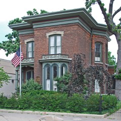 | Isaac Brown House | under 500 feet | 1983 |
| Upjohn Company Office Building | 0.1 miles | 2022 | |
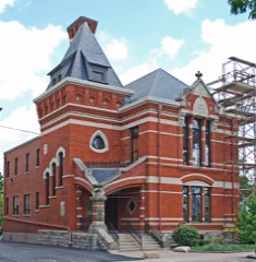 | Ladies Library Association Building | 0.2 miles | 1970 |
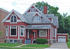 | Henry Gilbert House | 0.2 miles | 1983 |
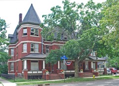 | William L. Welsh Terrace | 0.2 miles | 1983 |
 | Haymarket Historic District (Boundary Increase II) | 0.2 miles | 2011 |
| National Archives record | The nomination case file for reference 83004623 in Record Group 79. |
| Wikipedia article | Community-written account of this property, licensed CC BY-SA. |
| Kalamazoo County | All 60 listed properties in this county. |