Block
From the record
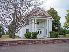
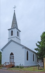
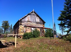
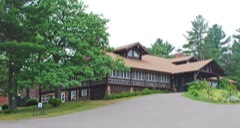
31 National Register listings published here.
Sources: the National Register database, National Park Service
78 topographic sheets cover 28 settlements here, and 31 properties are on the National Register of Historic Places.
31 National Register listings published here.
Sources: the National Register database, National Park Service
Every property in this county listed on the National Register of Historic Places, with the year it was listed and the federal nomination document.
Every wildfire the federal occurrence database records inside this county: 57 of them, burning about 336 acres. 29 started naturally and 3 were recorded as arson. Each settlement page carries the fires within five miles of it.
| Reported cause | Fires |
|---|---|
| Natural | 29 |
| Recreation and ceremony | 13 |
| Missing data/not specified/undetermined | 4 |
| Equipment and vehicle use | 4 |
| Arson/incendiarism | 3 |
| Debris and open burning | 2 |
| Power generation/transmission/distribution | 1 |
| Smoking | 1 |
The five largest, by the area the report gives. None of them was recorded as arson.
| Date | Cause | Size | Reported by | Name on the report |
|---|---|---|---|---|
| 7 July 2006 | Missing data/not specified/undetermined | 119 acres | Michigan Department of Natural Resources | not named |
| 3 August 2006 | Natural | 106 acres | Michigan Department of Natural Resources | KEYSTONE |
| 30 October 2008 | Recreation and ceremony | 32 acres | Michigan Department of Natural Resources | NONAME |
| 1 August 2005 | Natural | 11 acres | Michigan Department of Natural Resources | not named |
| 18 May 2010 | Debris and open burning | 8.0 acres | Michigan Department of Natural Resources | HERMIT COVE #2 |
| 12 August 2001 | Natural | 7.6 acres | Isle Royale National Park | LAKEJOHN |
| 3 June 2002 | Natural | 7.0 acres | Michigan Department of Natural Resources | not named |
| 23 May 2015 | Natural | 5.7 acres | Michigan Department of Natural Resources | MADISON GAP |
Every settlement page carries the fires within five miles of it - see the settlement index below.
The NOAA Storm Events Database holds 41 reports for this county, causing no deaths, no injuries and about $1,212,500 in recorded property damage. Each settlement page carries the reports that name it.
| Kind of event | Reports |
|---|---|
| Thunderstorm Wind | 23 |
| Hail | 7 |
| Heavy Rain | 5 |
| Flood | 3 |
| Tornado | 2 |
| Flash Flood | 1 |
The most serious of them, by death, then injury, then recorded damage. The accounts are quoted exactly as the forecast office filed them.
| When | Event | Place named | Harm | What the report says |
|---|---|---|---|---|
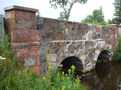
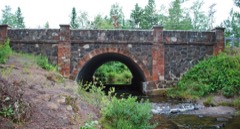
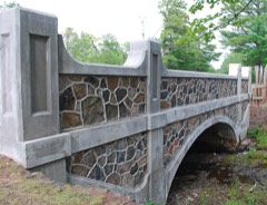
| April 2023 | Flood | Delaware | $1,000,000 | Local media reported Highway M-26 was closed on the evening of the 22nd due to the collapse of a retaining wall at the Silver River Bridge in Keweenaw County. The bridge's already compromised stone retaining wall eroded due to the heavy runoff from spring snow melt forcing the closure of Highway M-26. Traffic has been rerouted along US Highway 41. While MDOT was already planning on a $2.9 million project to remove and replace the bridge this summer, the snowmelt runoff contributed to the bridge failure closing the road sooner than anticipated. |
| April 2013 | Flood | Gay | $72,000 | Rapid melting of significant late season snow pack caused minor to moerate flooding of Highway M-26 between Eagle River and Copper Harbor and along the Gay-Lac La Belle Road from the 28th into the 30th. Minor flooding continued into early May. Some flooding of basements was also reported. Governor Rick Snyder declared a state of disaster in Keweenaw County where over $ 72,000 of property damage occurred due to the flooding mainly to roadway infrastructure. |
| May 2006 | Flood | (P59)Copper Harbor | $60,000 | no account filed |
| June 2006 | Thunderstorm Wind | Phoenix | $40,000 | 40 to 50 large trees were snapped off or uprooted along Gratiot Lake Road within a mile of the northwest shoreline of Gratiot Lake. |
| August 2018 | Thunderstorm Wind | Lac La Belle | $5,000 | The Keweenaw County Road Commission reported multiple trees down across Keweenaw County. The trees ranged from 4 to 12 inches in diameter. |
| June 1994 | Hail | Copper Harbor | $5,000 | Hail damage reported to vehicle windshields and a metal roof of a store. Winds blew down trees and power lines between Eagle River and Copper Harbor. |
| June 1994 | Thunderstorm Wind | Copper Harbor | $5,000 | Hail damage reported to vehicle windshields and a metal roof of a store. Winds blew down trees and power lines between Eagle River and Copper Harbor. |
| July 2012 | Thunderstorm Wind | Delaware | $4,000 | The 911 dispatcher said they received numerous reports from across the county about downed trees blocking the road. Most of the trees were approximately 6 inches to 1 foot in diameter. |
| July 2011 | Thunderstorm Wind | (P59)Copper Harbor | $4,000 | The Keweenaw County Sheriff reported a 150-yard stretch of approximately 40 trees uprooted or snapped just west of Copper Harbor. The trees ranged from 6 to 18 inches in diameter and fell in the same general direction. Several of the trees fell across Highway M-26 closing the highway. |
| July 2006 | Thunderstorm Wind | (P59)Copper Harbor | $4,000 | A dozen six to eight-inch diameter trees down between Copper Harbor and Delaware. |
| September 2023 | Thunderstorm Wind | Windigo | $3,000 | Park rangers in Isle Royale National Park reported a tree down, an 80-pound aluminum canoe taken off its rack, and a portion of the floating dock torn at and around Windigo. |
| July 2019 | Thunderstorm Wind | Mandan | $3,000 | The Keweenaw County emergency manager reported numerous trees down on the road to Lac La Belle causing the road to become impassable. The time of the report was estimated from the radar. |
| July 2007 | Thunderstorm Wind | Copper Harbor | $3,000 | Many trees and branches downed along the highway. |
| July 1987 | Tornado (F0) | not stated | $2,500 | no account filed |
| July 2012 | Thunderstorm Wind | (P59)Copper Harbor | $1,000 | The 911 dispatcher received a report of trees blocking the road. |
| June 2007 | Thunderstorm Wind | Phoenix | $1,000 | Tree blown down across Cliff Drive. |
| June 2021 | Thunderstorm Wind | Mott Island | - | The Ojibway RAWS station on Isle Royale measured a peak gust of 59 mph from a severe thunderstorm moving over the area. |
| May 2017 | Heavy Rain | Ft Wilkins | - | Observers in the Copper Harbor area measured over two inches of rainfall in 24 hours. |
| August 2017 | Hail | Mott Island | - | A delayed report from the park ranger at Isle Royale National Park reported gusty winds and hail the size of quarters. |
| September 2014 | Heavy Rain | Mohawk | - | Rainfall totals between 1.5 and 2.5 inches were reported in approximately 16 hours across Keweenaw County...heaviest near the Houghton County line. |
| June 2012 | Heavy Rain | (P59)Copper Harbor | - | The Copper Harbor ASOS measured 2.01 inches of storm total rainfall. |
| July 2012 | Heavy Rain | Bumbletown | - | The observer four miles northeast of Calumet measured 1.25 inches of rainfall during the event. |
| July 2012 | Heavy Rain | Fulton | - | Observers measured 2 to 3 inches of rain across Keweenaw County. |
| June 2007 | Hail | Phoenix | - | Penny-sized hail also reported five miles west of Phoenix at the same time. |
| July 2006 | Hail | Isle Royal Nat Park | - | Nickel-sized hail reported at Rock Harbor Lodge on Isle Royale. Hail lasted approximately ten minutes. |
| June 2005 | Flash Flood | Isle Royal Nat Park | - | Trail damage was reported in the back country of the park, including washouts and other property damage. There was evidence of high flows on the local streams. |
| August 2003 | Tornado (F0) | Copper Harbor | - | A waterspout over Lake Superior moved onshore at Silver Island just off the shore from Eagle Harbor. The tornado knocked down a tree on the island before it dissipated. |
| July 2003 | Thunderstorm Wind | Windigo | - | A seven inch diameter tree was blown down. |
| June 2003 | Thunderstorm Wind | Copper Harbor | - | Three trees were blown down. |
| August 2002 | Thunderstorm Wind | Eagle Harbor | - | Trees were downed at Eagle Harbor, Lac La Belle, Copper Harbor, Gay and Eagle River. |
| July 1999 | Thunderstorm Wind | Isle Royal Nat Park | - | Gust report from the Passage Island C-MAN station on the north end of Isle Royale. |
| July 1997 | Thunderstorm Wind | Eagle River | - | 8 to 10 inch diameter trees downed |
| July 1995 | Thunderstorm Wind | Bumbletown | - | Gust to 67 mph. |
| July 1995 | Thunderstorm Wind | Bumbletown | - | Winds gust to 63 mph. |
| June 2011 | Hail | Mohawk | - | no account filed |
| June 2004 | Hail | Windigo | - | no account filed |
| July 1992 | Thunderstorm Wind | not stated | - | no account filed |
| June 1991 | Thunderstorm Wind | not stated | - | no account filed |
| August 1984 | Thunderstorm Wind | not stated | - | no account filed |
| August 1983 | Thunderstorm Wind | not stated | - | no account filed |
| June 1955 | Hail | not stated | - | no account filed |
The Survey's mineral resources record lists 157 workings inside this county. 12 still produce and 145 are closed or unrecorded. Each settlement page carries the workings within five miles of it.
| Commodity | Workings |
|---|---|
| Copper | 144 |
| Silver | 6 |
| Sand and Gravel, Construction | 5 |
| Copper, Silver | 3 |
| Silver, Copper | 2 |
| Nickel, Copper | 1 |
| Arsenic | 1 |
| Manganese | 1 |
| Copper, Arsenic | 1 |
The least common of them first, because a county's hundredth gravel pit says nothing its first ten did not.
| Where | Site | Commodity | Status | Recorded |
|---|---|---|---|---|
| Clark Manganese Deposit | Manganese | Past Producer | 1881 | |
| Michigan Nickel Deposits | Nickel, Copper | Prospect | Sulfides | |
| Mohawk | Copper, Arsenic | Past Producer | 1898, 1902 | |
| Mohawkite Fissure | Copper, Arsenic | Past Producer | 1900, 1901 | |
| Cliff | Silver, Copper | Past Producer | 1844, 1847 | |
| Gratiot Copper Mine | Silver, Copper | Past Producer | Copper | |
| Iroquois | Copper, Silver | Past Producer | 1942, 1956 | |
| Phoenix Ashbed | Copper, Silver | Past Producer | 1855 | |
| Phoenix Fissure | Copper, Silver | Past Producer | 1863 | |
| Keweenaw County Pit Number 21 | Sand and Gravel, Construction | Producer | ||
| Keweenaw County Road Comm. Pit | Sand and Gravel, Construction | Producer | ||
| Keweenaw County Road Comm. Pit | Sand and Gravel, Construction | Producer | ||
| Keweenaw County Road Comm. Pit | Sand and Gravel, Construction | Producer | ||
| Keweenaw County Road Comm. Pit | Sand and Gravel, Construction | Producer | ||
| Central Cu Mine | Copper, Silver | Past Producer | ||
| Cliff Copper Mine | Copper, Silver | Past Producer | ||
| Gratiot Copper Mine | Copper, Silver | Past Producer | ||
| Mohawk Mine | Copper, Silver | Past Producer | 1900, 1931 | |
| Phoenix Cu Mine | Copper, Silver | Producer | ||
| Phoenix Fissure Mine | Copper, Silver | Past Producer | 1844, 1931 | |
| 543-S | Copper | Producer | 1975 | |
| 543-S Deposit | Copper | Producer | 1996 | |
| 813 - Mt. Bohemia West | Copper | Prospect | Chalcocite | |
| Aetna Copper Mine | Copper | Past Producer | ||
| Aetna Exploration Copper Mine | Copper | Past Producer | 1864, 1867 | |
| Agate Harbor Mine | Copper | Past Producer | 1846, 1854 | |
| Ahmeek Copper Mine | Copper | Past Producer | 1904, 1922 | |
| Ahmeek Copper Mine | Copper | Past Producer | ||
| Allouez | Copper | Past Producer | 1858, 1869 | |
| Allouez Mine | Copper | Past Producer | 1869, 1923 | |
| Amygdaloid Cu Mine | Copper | Past Producer | ||
| Arnold Copper Mine | Copper | Past Producer | 1860, 1900 | |
| Arnold Cu Mine | Copper | Past Producer | ||
| Babbitt Fissure | Copper | Producer | 1880 | |
| Bluff Wyoming Mine | Copper | Past Producer | 1865 | |
| Bohemian Range Exploration | Copper | Prospect | Copper | |
| Cape Mine | Copper | Past Producer | 1854 | |
| Central Exploration | Copper | Past Producer | 1930, 1934, 1945 | |
| Central Mine | Copper | Past Producer | 1854, 1898 | |
| Childs Fissure Mine | Copper | Past Producer | 1852, 1860 | |
| Clark | Copper | Past Producer | 1872, 1879 | |
| Cliff Fissure | Copper | Past Producer | 1845, 1887 | |
| Cliff Mining Co. | Copper | Past Producer | ||
| Connecticut Fissure | Copper | Past Producer | Copper | |
| Copper Falls | Copper | Past Producer | 1862, 1877 | |
| Copper Falls Copper Mine | Copper | Past Producer | ||
| Dana Mine | Copper | Past Producer | 1851, 1857 | |
| Datolite Mine | Copper | Past Producer | 1846, 1848 | |
| Delaware Copper Mine | Copper | Past Producer | ||
| Delaware Mine | Copper | Past Producer | 1847, 1886 | |
| Drexel Fissure | Copper | Producer | Copper | |
| Eagle Harbor Mines | Copper | Past Producer | 1864, 1866 | |
| Eagle River Mine | Copper | Past Producer | 1853, 1867 | |
| Empire Copper Mine | Copper | Past Producer | ||
| Epidote Mine | Copper | Past Producer | 1846, 1848 | |
| Fulton Fissure | Copper | Past Producer | 1853 | |
| G-12 | Copper | Prospect | Chalcocite | |
| G-13 | Copper | Prospect | Chalcocite | |
| G-2 | Copper | Prospect | Chalcocite | |
| Garden City Mine | Copper | Past Producer | 1859, 1868 | |
| Girard Exploration | Copper | Prospect | 1864, 1865 | |
| Gratiot Lake Project | Copper | Prospect | 1853 | |
| Hanover Mine | Copper | Past Producer | 1852 | |
| Hays Mine (Pittsburgh & Boston) | Copper | Past Producer | Fissure Copper Veins | |
| Haytown Mine | Copper | Producer | Copper | |
| Hill Fissure Mine | Copper | Past Producer | 1852, 1860 | |
| Houghton Conglomerate | Copper | Past Producer | 1943, 1968 | |
| Houghton No.2 | Copper | Past Producer | 1841 | |
| Humboldt Mine | Copper | Past Producer | 1853 | |
| Iroquois Amygdaloid | Copper | Past Producer | 1942, 1968 | |
| Iroquois No. 1 | Copper | Past Producer | 1942, 1956 | |
| Iroquois No. 2 | Copper | Past Producer | 1942, 1956 | |
| Island Mine | Copper | Past Producer | 1872, 1877 | |
| Kingston | Copper | Past Producer | 1962, 1963 | |
| Kingston Conglomerate | Copper | Past Producer | 1962, 1968 | |
| Lac La Belle | Copper | Prospect | 1846, 1866 | |
| Lac La Belle Exploration | Copper | Past Producer | 1850 | |
| Lizzardo | Copper | Prospect | Chalcocite | |
| Madison Fissure | Copper | Past Producer | 1856, 1881 | |
| Manhattan Exploration | Copper | Prospect | Copper | |
| Manitou Cu Mine | Copper | Past Producer | ||
| Mass Fissure | Copper | Past Producer | 1909, 1925 | |
| Meadow Mine | Copper | Past Producer | 1853, 1900 | |
| Medora Mine | Copper | Past Producer | 1851, 1909 | |
| Mendota Mine | Copper | Past Producer | 1850, 1866 | |
| Michigan Native Copper | Copper | Unknown | ||
| Minong Mine | Copper | Past Producer | 1871, 1875, 1883 | |
| Minor Conglomerates No. 1 | Copper | Past Producer | ||
| Minor Conglomerates No. 2 | Copper | Past Producer | ||
| Miskwabic Exploration | Copper | Prospect | 1903, 1905 | |
| Natick Gap Exploration | Copper | Prospect | Fissure Copper Veins | |
| New York and Michigan Exploration | Copper | Past Producer | 1846, 1853 | |
| North American Mine | Copper | Past Producer | 1846, 1863 | |
| North Cliff | Copper | Past Producer | 1859, 1864 | |
| Northwestern Fissure | Copper | Past Producer | 1845, 1880 | |
| Ojibway | Copper | Past Producer | 1907, 1911 | |
| Ojibway Mine | Copper | Past Producer | 1907, 1911, 1944 | |
| Old Copper Falls Mine | Copper | Past Producer | 1845, 1850 | |
| Old Mendota Cu Mine | Copper | Past Producer | ||
| Owl Creek Fissure Mine | Copper | Past Producer | 1854, 1882 | |
| Pennsylvania Copper Mine | Copper | Past Producer | ||
| Petherick Mine | Copper | Past Producer | 1861, 1884 | |
| Ransom Mine | Copper | Past Producer | Copper | |
| Reliance Prospect | Copper | Prospect | Fissure Copper Veins | |
| Resolute Mine | Copper | Past Producer | 1864, 1901 | |
| Saginaw Mine | Copper | Past Producer | 1875, 1879 | |
| Seneca | Copper | Past Producer | 1874, 1887 | |
| Seneca No. 1 Mine | Copper | Past Producer | 1872, 1925 | |
| Seneca No. 2 Mine | Copper | Past Producer | 1872, 1967 | |
| Siskowit Mine | Copper | Past Producer | 1847, 1855 | |
| St. Clair Fissure | Copper | Past Producer | 1865, 1885 | |
| Star Mine | Copper | Past Producer | 1851, 1887 | |
| Suffolk Exploration | Copper | Past Producer | 1847 | |
| Unnamed Copper Deposit | Copper | Past Producer | ||
| Unnamed Copper Deposit | Copper | Past Producer | ||
| Unnamed Copper Deposit | Copper | Past Producer | ||
| Unnamed Copper Deposit | Copper | Past Producer | ||
| Unnamed Copper Deposit | Copper | Past Producer | ||
| Unnamed Copper Deposit | Copper | Occurrence | ||
| Unnamed Copper Deposit | Copper | Past Producer | ||
| Unnamed Copper Deposit | Copper | Past Producer | ||
| Unnamed Copper Deposit | Copper | Past Producer | ||
| Unnamed Copper Deposit | Copper | Past Producer | ||
| Unnamed Copper Deposit | Copper | Past Producer | ||
| Unnamed Copper Deposit | Copper | Past Producer | ||
| Unnamed Copper Deposit | Copper | Past Producer | ||
| Unnamed Copper Deposit | Copper | Past Producer | ||
| Unnamed Copper Deposit | Copper | Past Producer | ||
| Unnamed Copper Deposit | Copper | Past Producer | ||
| Unnamed Copper Deposit | Copper | Past Producer | ||
| Unnamed Copper Prospect | Copper | Prospect | ||
| Unnamed Copper Prospect | Copper | Prospect | ||
| Unnamed Copper Prospect | Copper | Prospect | ||
| Unnamed Copper Prospect | Copper | Occurrence | ||
| Unnamed Copper Prospect | Copper | Prospect | ||
| Unnamed Copper Prospect | Copper | Prospect | ||
| Unnamed Copper Prospect | Copper | Prospect | ||
| Unnamed Copper Prospect | Copper | Occurrence | ||
| Unnamed Copper Prospect | Copper | Prospect | ||
| Unnamed Copper Prospect | Copper | Occurrence | ||
| Unnamed Copper Prospect | Copper | Occurrence | ||
| Unnamed Copper Prospect | Copper | Prospect | ||
| Unnamed Copper Prospect | Copper | Prospect | ||
| Unnamed Copper Prospect | Copper | Prospect | ||
| Unnamed Copper Prospect | Copper | Prospect | ||
| Unnamed Copper Prospect | Copper | Prospect | ||
| Unnamed Copper Prospect | Copper | Prospect | ||
| Unnamed Copper Prospect | Copper | Prospect | ||
| Unnamed Copper Prospect | Copper | Prospect | ||
| Unnamed Copper Prospect | Copper | Prospect | ||
| Unnamed Copper Prospect | Copper | Prospect | ||
| Vaughnsville Exploration | Copper | Prospect | Fissure Copper Veins | |
| Vulcan Exploration Copper Mine | Copper | Past Producer | 1864 | |
| Vulcan Exploration Copper Mine | Copper | Past Producer | ||
| Washington Mine | Copper | Prospect | 1854, 1901 | |
| Wendigo Mines | Copper | Producer | Copper | |
| Winthrop Mine | Copper | Past Producer | 1863, 1865 |
Named settlements recorded in the Geographic Names Information System, each with the topographic sheets covering it. Villages, hamlets and abandoned places alike. Each is shown with the nearest named watercourse or landform and the survey quadrangle it falls on.
Grant township · 49950 · Near Mount Houghton · Lake Medora quadrangle
12 sheets, 1940 to 1985
Houghton township · 49950 · On Buffalo Creek · Eagle Harbor quadrangle
14 sheets, 1940 to 1985
Eagle Harbor township · 49950 · On Owl Creek · Eagle Harbor quadrangle
14 sheets, 1940 to 1985
Grant township · 49918 · On Garden Brook · Lake Medora quadrangle
12 sheets, 1940 to 1985
Eagle Harbor township · 49950 · On Eliza Creek · Eagle Harbor quadrangle
14 sheets, 1940 to 1985
Houghton township · 49950 · On Garden City Creek · Phoenix quadrangle
13 sheets, 1946 to 1985
Eagle Harbor township · 49950 · Near Montreal Meadows · Eagle Harbor quadrangle
14 sheets, 1940 to 1985
Houghton township · 49950 · On East Branch Eagle River · Phoenix quadrangle
13 sheets, 1946 to 1985
Houghton township · Near Park Place Island · Rock Harbor Lodge quadrangle
10 sheets, 1895 to 1985
Houghton township · 49950 · On East Branch Eagle River · Phoenix quadrangle
13 sheets, 1946 to 1985