 Block
From the record
14 National Register listings published here.
Sources: the National Register database, National Park Service
95 topographic sheets cover 32 settlements here, and 14 properties are on the National Register of Historic Places.
14 National Register listings published here.
Sources: the National Register database, National Park Service
Every property in this county listed on the National Register of Historic Places, with the year it was listed and the federal nomination document.
| Photograph | Property | Type | Listed | Reference |
|---|---|---|---|---|
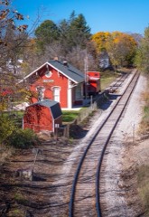 | Ann Arbor Railway Station | building | 1971 | 71000405 |
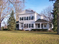 | Bingham House | building | 1972 | 72000635 |
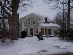 | Jacob Fishbeck Farmstead | building | 2003 | 03000178 |
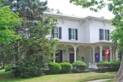 | John H. and Martha Durfee Galloway House | building | 2006 | 06001030 |
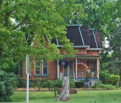 | Frank J. Hecox House | building | 1994 | 94000745 |
 | Howell Downtown Historic District | district | 1987 | 86003363 |
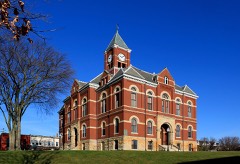 | Livingston County Courthouse | building | 1976 | 76001031 |
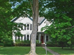 | George Louk Farm | building | 1995 | 95000285 |
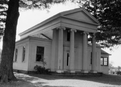 | Alonzo W. Olds House | building | 1972 | 72000636 |
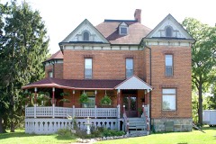 | William K. and Nellie Sexton House | building | 2013 | 13000797 |
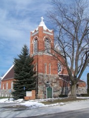 | St. Augustine Catholic Church and Cemetery | district | 1996 | 96000802 |
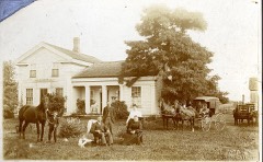 | Timothy and Lucretia Jones Warner Homestead | building | 2011 | 11000635 |
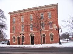 | Western House | building | 1986 | 86000806 |
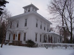 | August Westphal Farmstead | building | 1985 | 85002151 |
Every wildfire the federal occurrence database records inside this county: 156 of them, burning about 699 acres. 9 started naturally and 2 were recorded as arson. Each settlement page carries the fires within five miles of it.
| Reported cause | Fires |
|---|---|
| Equipment and vehicle use | 81 |
| Missing data/not specified/undetermined | 42 |
| Natural | 9 |
| Recreation and ceremony | 7 |
| Debris and open burning | 7 |
| Smoking | 5 |
| Power generation/transmission/distribution | 2 |
| Arson/incendiarism | 2 |
| Misuse of fire by a minor | 1 |
The five largest, by the area the report gives. None of them was recorded as arson.
| Date | Cause | Size | Reported by | Name on the report |
|---|---|---|---|---|
| 4 November 2020 | Missing data/not specified/undetermined | 143 acres | Michigan Department of Natural Resources | LIVINGSTON 01 |
| 27 February 2018 | Equipment and vehicle use | 100 acres | Michigan Department of Natural Resources | HOWELL AREA FD 0000199 - 2018 |
| 8 March 2017 | Power generation/transmission/distribution | 51 acres | Michigan Department of Natural Resources | LIVINGSTON 02 - GREGORY - ALLEN RD |
| 24 March 2015 | Equipment and vehicle use | 50 acres | Michigan Department of Natural Resources | LIVINGSTON 01 - LIVINGSTON COUNTY #2 |
| 27 March 2019 | Equipment and vehicle use | 45 acres | Michigan Department of Natural Resources | FOWLERVILLE FD 0000190 - 2019 |
| 9 April 1994 | Recreation and ceremony | 38 acres | Michigan Department of Natural Resources | not named |
| 18 April 2006 | Equipment and vehicle use | 25 acres | Michigan Department of Natural Resources | not named |
| 10 April 2005 | Missing data/not specified/undetermined | 24 acres | Michigan Department of Natural Resources | not named |
Every settlement page carries the fires within five miles of it - see the settlement index below.
The NOAA Storm Events Database holds 456 reports for this county, causing 3 deaths, 34 injuries and about $23,267,250 in recorded property damage. Each settlement page carries the reports that name it.
| Kind of event | Reports |
|---|---|
| Thunderstorm Wind | 317 |
| Hail | 88 |
| Tornado | 29 |
| Lightning | 13 |
| Flood | 7 |
| Flash Flood | 2 |
The most serious of them, by death, then injury, then recorded damage. The accounts are quoted exactly as the forecast office filed them.
| When | Event | Place named | Harm | What the report says |
|---|---|---|---|---|
| August 1988 | Thunderstorm Wind | not stated | 2 killed | no account filed |
| May 1974 | Tornado (F3) | not stated | 1 killed, $250,000 | no account filed |
| June 1953 | Tornado (F3) | not stated | 7 hurt, $2,500,000 | no account filed |
| May 1956 | Tornado (F2) | not stated | 5 hurt, $250,000 | no account filed |
| May 1956 | Tornado (F2) | not stated | 5 hurt, $250,000 | no account filed |
| July 1957 | Tornado (F4) | not stated | 4 hurt, $250,000 | no account filed |
| July 2021 | Lightning | Anderson | 4 hurt | Four men were injured by a lightning strike as they worked in a field in Iosco Township. |The lightning struck a field along Weller Road in Gregory around 9 am EDT. One of local workers were transported to local hospital, while the other three workers declined medical treatment. |
| May 2001 | Tornado (F2) | Hartland | 3 hurt, $3,000,000 | A tornado developed near Hartland High School and Lake Walden, and moved north parallel to US-23, eventually crossing that busy highway between Clyde and Faussett Roads. There was a brief break in the damage path south of Center Road, but the tornado reformed again north of Center Road, this time back on the west side of US-23. The tornado continued north into Genesee County.Most of the damage to trees and structures was consistent with a weak tornado. However, near and north of the Majestic Golf Course, damage was considerably more intense, justifying an F2 rating. Seventy vehicles in the golf course parking lot were damaged (rolled, tossed, or struck by debris), with twelve of them totaled. Thirty five golf carts were destroyed, and a pontoon boat used to transport golfers was flipped. A large piece of a wooden footbridge was tossed through the enclosed back porch of the clubhouse. An amputee organization was having a golf outing that afternoon. Thankfully, the golf carts were equipped with G.P.S. units, and the course sent a message out on those units that a tornado was approaching. Only one person on the course suffered a minor injury (exact injury undisclosed). Three homes were destroyed near Clyde Road and US-23, as were a party store and a towing company that shared a building. A man at the party store suffered a minor hand injury, and two vehicles at the towing company were totaled. Several hundred trees were downed in this general area.Further north, several cars and semis were flipped when the tornado crossed US-23. One driver of a semi suffered a head injury when his truck overturned, though he was not seriously hurt. The TRW plant on Center Road lost a small part of its roof. Several cars in the parking of Tyrone Hills Golf Course had windows blown out. As the tornado moved across agricultural land, three cows were killed. |
| June 1982 | Tornado (F2) | not stated | 2 hurt, $25,000 | no account filed |
| April 1977 | Tornado (F2) | not stated | 1 hurt, $250,000 | no account filed |
| July 1995 | Thunderstorm Wind | Howell to | 1 hurt, $15,000 | no account filed |
| July 2007 | Thunderstorm Wind | Fowlerville | 1 hurt, $8,000 | Fowlerville fire officials reported at least 10 trees down in the area, with one landing on a car at the intersection of Elliott and Mason Roads. The driver of the vehicle was taken to an area hospital with minor injuries. National Weather Service Meteorologists surveyed the damage and estimated straight line wind gusts up to 65 MPH. |
| October 2001 | Lightning | Green Oak | 1 hurt | A 42 year old man was struck by lightning while standing near his front door. The man sustained only minor injuries. |
| August 2007 | Tornado (EF2) | Fowlerville | $7,000,000 | This tornado first touched down approximately 4 miles northeast of Fowlerville at 1630EST between Owosso and Fleming Roads approximately three-fourths of a mile north of Chase Lake Road in Cohoctah Township, Livingston County. Tornado damage was observed from the ground continuously for 14 miles in Livingston County through Cohoctah Township, Deerfield Township and northwest Tyrone Township where the tornado entered Genesee County and the City of Fenton. The tornado damaged 71 homes/buildings and leveled hundreds of trees in Livingston County. Eight homes were destroyed in Cohoctah and Deerfield Townships. The damage along the path was predominately consistent with EF1 scale damage (associated with approximately 100 MPH winds). However, there were 2 sections in Livingston County consistent with EF2 scale damage (and associated with approximately 130 mph winds). The first section of EF2 damage occurred along Schrepfer Road in Cohoctah Township, where a single family dwelling was destroyed. The second section of EF2 damage occurred near the intersection of Center and Mack Roads in Deerfield Township, where substantial structural and tree damage was observed. A third and final section of EF2 damage occurred in Genesee County through the City of Fenton. The average path width in Livingston County was 200 yards. The tornado exited Livingston County across Bennett Lake Road approximately a half mile west of U.S. 23 at 1649EST. It then continued for 4 miles across southeastern Genesee County and for another 5.5 miles in western Oakland County. |
| August 1988 | Tornado (F2) | not stated | $2,500,000 | no account filed |
| August 1998 | Lightning | Brighton | $1,500,000 | no account filed |
| June 2023 | Hail | Pinckney | $1,000,000 | no account filed |
| August 2023 | Thunderstorm Wind | Oak Grove | $800,000 | Trees reported down throughout the county. Over 400 homes and mobile homes were affected, with 4 homes suffering major damage. |
| June 2023 | Hail | Chilson | $500,000 | no account filed |
| March 2009 | Flood | Pettysville | $500,000 | no account filed |
| June 2007 | Flood | Gregory | $400,000 | Local newspaper reports confirmed a couple dozen homes sustained flood damage. Five and a half inches of rain in only a few hours caused about a dozen basements to flood around the Gregory area on the evening of June 3rd. Additional basement flooding occurred later in the week around Lake Patterson, which finally peaked on Thursday June 7th. Flood waters finally began to recede that night. Total property damages were estimated at roughly $400K. |
| September 2008 | Flood | Gregory | $250,000 | no account filed |
| August 1988 | Tornado (F1) | not stated | $250,000 | no account filed |
| May 1951 | Tornado (F2) | not stated | $250,000 | no account filed |
| July 1997 | Tornado (F1) | Fowlerville | $200,000 | no account filed |
| September 2008 | Flood | Lakeland | $150,000 | The Huron River at Hamburg crested at 7.6 feet during the morning of September 18th. |
| October 2006 | Lightning | Fowlerville | $150,000 | A local newspaper included a picture of a home that caught fire after being struck by lightning. The blaze resulted in extensive damages, destroying two second-story rooms and the roof. Property damages were estimated at $150K. No one was injured. |
| August 2023 | Tornado (EF1) | Fowlerville | $70,000 | The strong tornado over northeast Ingham county weakened and moved into Livingston county south of North Cedar Road and close to the West Branch Red Cedar River by Wallace Road. Trees and tree limbs were uprooted and blown down with estimated winds up to 90 mph as the tornado tracked east. The tornado weakened further and dissipated along Van Buren Road and west of North Nicholson Road. |
| July 2023 | Tornado (EF0) | Williamsville | $50,000 | A weak tornado with maximum winds of 70 mph tracked east-northeast from northeast Jackson County and briefly crossed into Livingston County before dissipating just northeast of Leeke Road and north of Bowdish Road. One business along the path sustained some minor structural damage that included roof damage and siding damage to an outbuilding. |
| October 2006 | Lightning | Hartland | $50,000 | A local newspaper included a picture of a condominium that caught fire after being struck by lightning. The blaze caused extensive damage to the condo, including the entire interior. Other condos attached to this one were not damaged. Damages were roughly estimated at $50K. No one was injured. |
| June 2005 | Thunderstorm Wind | Brighton | $50,000 | Thunderstorm winds brought down dozens of trees and power lines. Damage from the storm appeared to be confined mostly to the area of Brighton from the railroad tracks west to the high school. A couple of homes sustained damage from large trees which fell on them. |
| April 2003 | Lightning | Brighton | $50,000 | Lightning struck an electrical pole at the rear of a house and set a portion of the garage on fire. |
| August 2023 | Thunderstorm Wind | Howell | $40,000 | Trees and power lines reported down throughout Livingston county. |
| June 2008 | Thunderstorm Wind | Oak Grove | $40,000 | Trees reported down. |
| October 2001 | Thunderstorm Wind | Howell | $40,000 | A large tree was blown down onto a house and a barn was blown over. |
| June 2010 | Lightning | Fowlerville | $30,000 | A vacant home caught fire after a lightning strike. The fire was contained in the attic, but the roof was destroyed. |
| May 2002 | Lightning | Fowlerville | $30,000 | no account filed |
| May 2010 | Thunderstorm Wind | Gregory | $25,000 | Numerous trees and power lines were brought down from thunderstorm wind gusts. |
| May 2010 | Thunderstorm Wind | Gregory | $25,000 | Numerous trees and power lines were brought down from thunderstorm wind gusts. |
| July 2008 | Thunderstorm Wind | Pinckney | $25,000 | Large trees and powerlines reported down. |
| July 2007 | Thunderstorm Wind | Hamburg | $25,000 | A local Television station reported dozens of trees down. One tree fell through the roof of the Livingston County Wildlife and Conservation Club. No one was injured. Total property damages were estimated at roughly $25K. |
| April 2003 | Thunderstorm Wind | Brighton | $25,000 | The newspaper reported that thunderstorm winds blew a mobile home off of its foundation. |
| October 2001 | Thunderstorm Wind | Howell | $25,000 | A 16 inch diameter tree fell onto a boat and trailer. Several large trees also fell onto a home. |
| August 1972 | Tornado (F2) | not stated | $25,000 | no account filed |
| July 1971 | Tornado (F2) | not stated | $25,000 | no account filed |
| August 1968 | Tornado (F2) | not stated | $25,000 | no account filed |
| May 2007 | Thunderstorm Wind | Brighton | $20,000 | A National Weather Service employee reported trees down. One tree, a 50-foot pine, fell onto a house in Green Oak Township. Total property damage was estimated at roughly $20K. |
| May 2011 | Thunderstorm Wind | Hartland | $15,000 | Estimated 50 to 70 trees blown down across Tyrone Township. |
| May 2011 | Thunderstorm Wind | Parkers Corners | $15,000 | Trees were blown down and a barn was destroyed. |
| May 2011 | Thunderstorm Wind | Parkers Corners | $15,000 | Trees were blown down and a barn roof damaged. |
| May 2011 | Thunderstorm Wind | Parkers Corners | $15,000 | Trees were blown down and an old barn destroyed. |
| April 2002 | Lightning | Brighton | $15,000 | A bolt of lightning struck a detached garage setting it ablaze. The garage suffered some sizable damage. |
| August 2023 | Thunderstorm Wind | Parkers Corners | $10,000 | Trees snapped and uprooted due to straight line winds from Wallace road to Cedar road, along and north of West Van Orgen Road. |
| November 2016 | Thunderstorm Wind | Brighton | $10,000 | Numerous reports of trees down between Brighton and Howell. |
| August 2014 | Thunderstorm Wind | Howell | $10,000 | Multiple trees and power lines reported down. |
| August 2013 | Tornado (EF0) | Chilson | $10,000 | Numerous hardwood and softwood trees were uprooted and snapped. Minor siding damage was also observed with this EF0 tornado with maximum winds of 80 mph. The tornado touched down near the Brighton Road and Timberline Lane intersection, tracking southeast and lifting just past the Welle Road and Hamell Road intersection. |
| July 2011 | Thunderstorm Wind | Brighton | $10,000 | Numerous trees and power lines reported down. |
| October 2001 | Thunderstorm Wind | Howell | $10,000 | A 40 X 60 foot outbuilding was destroyed by a wind gust. |
| June 1998 | Lightning | Hartland | $10,000 | no account filed |
| July 2006 | Thunderstorm Wind | Howell | $8,000 | A local newspaper reported several trees blown down in Howell and included a picture of a work van pinned beneath the trunk of a large tree on Barnard Street. Total damage to the vehicle was roughly estimated at $8K. |
The Survey's mineral resources record lists 36 workings inside this county. 35 still produce and 1 is closed or unrecorded. Each settlement page carries the workings within five miles of it.
| Commodity | Workings |
|---|---|
| Sand and Gravel, Construction | 35 |
| Clay | 1 |
The least common of them first, because a county's hundredth gravel pit says nothing its first ten did not.
| Where | Site | Commodity | Status | Recorded |
|---|---|---|---|---|
| Coal Shale Clay Pit | Clay | Past Producer | ||
| Albert Sand and Gravel | Sand and Gravel, Construction | Producer | ||
| American Aggregates Corp Pit | Sand and Gravel, Construction | Producer | ||
| Bennett No 12 Pit | Sand and Gravel, Construction | Producer | ||
| Bentley Pit | Sand and Gravel, Construction | Producer | ||
| Brighton Pit and Plant | Sand and Gravel, Construction | Producer | ||
| D and J Sand and Gravel | Sand and Gravel, Construction | Producer | ||
| Denton Plant & Mill | Sand and Gravel, Construction | Producer | ||
| Fenton Gravel Co., Inc. Pit | Sand and Gravel, Construction | Producer | ||
| Fenton Gravel Co., Inc. Pit | Sand and Gravel, Construction | Producer | ||
| Green Oak Pit and Mill | Sand and Gravel, Construction | Producer | ||
| Green Oaks Pit | Sand and Gravel, Construction | Producer | ||
| Holloway Sand and Gravel Pit | Sand and Gravel, Construction | Producer | ||
| Kensington Pit | Sand and Gravel, Construction | Producer | ||
| Livingston Aggregates Pit | Sand and Gravel, Construction | Producer | ||
| Livingston County Road Comm. Pit | Sand and Gravel, Construction | Producer | ||
| Livingston County Road Comm. Pit | Sand and Gravel, Construction | Producer | ||
| Livingston County Road Comm. Pit | Sand and Gravel, Construction | Producer | ||
| Livingston County Road Comm. Pit | Sand and Gravel, Construction | Producer | ||
| Livingston County Road Comm. Pit | Sand and Gravel, Construction | Producer | ||
| Livingston County Road Comm. Pit | Sand and Gravel, Construction | Producer | ||
| Livingston County Road Comm. Pit | Sand and Gravel, Construction | Producer | ||
| Livingston County Road Comm. Pit | Sand and Gravel, Construction | Producer | ||
| Livingston County Road Comm. Pit | Sand and Gravel, Construction | Producer | ||
| Livingston County Road Comm. Pit | Sand and Gravel, Construction | Producer | ||
| Livingston County Road Comm. Pit | Sand and Gravel, Construction | Producer | ||
| Livingston County Road Comm. Pit | Sand and Gravel, Construction | Producer | ||
| Livingston County Road Comm. Pit | Sand and Gravel, Construction | Producer | ||
| Livingston County Road Comm. Pit | Sand and Gravel, Construction | Producer | ||
| Livingston County Road Comm. Pit | Sand and Gravel, Construction | Producer | ||
| Livingston County Road Comm. Pit | Sand and Gravel, Construction | Producer | ||
| Livingston County Road Commission | Sand and Gravel, Construction | Producer | ||
| Milford Plant | Sand and Gravel, Construction | Producer | ||
| Muir Road Pit | Sand and Gravel, Construction | Producer | ||
| Reyhl Pit | Sand and Gravel, Construction | Producer | ||
| Yarnell Livingston County Pit | Sand and Gravel, Construction | Producer |
Named settlements recorded in the Geographic Names Information System, each with the topographic sheets covering it. Villages, hamlets and abandoned places alike. Each is shown with the nearest named watercourse or landform and the survey quadrangle it falls on.
Putnam township · 48169 · On Portage Creek · Gregory quadrangle
16 sheets, 1919 to 1996
Deerfield township · 48855 · On Cranberry Creek · Byron quadrangle
14 sheets, 1922 to 1985
Handy township · 48836 · On Middle Branch Red Cedar River · Fowlerville quadrangle
11 sheets, 1908 to 1983
Green Oak township · 48116 · On Woodruff Creek · South Lyon quadrangle
19 sheets, 1902 to 1989
Unadilla township · 48137 · On Portage Creek · Gregory quadrangle
16 sheets, 1919 to 1996
Hamburg township · 48169 · On Chilson Creek · Hamburg quadrangle
19 sheets, 1902 to 1996
Unadilla township · 48137 · On Unadilla Stockbridge Drain · Gregory quadrangle
16 sheets, 1919 to 1996