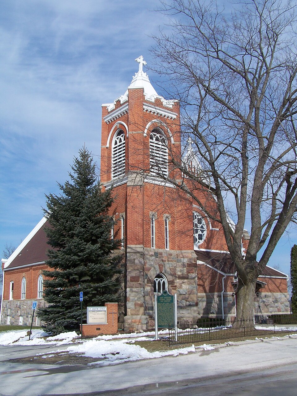
Listed on the National Register of Historic Places in 1996.
From the record
“Augustine Catholic Church and Cemetery is a historic site in Hartland, Michigan. Patrick O'Kelly, a missionary priest who was active in Southeastern Michigan.”
Wikipedia article St. Augustine Catholic Church and Cemetery (Hartland, Michigan), CC BY-SA 4.0.
One of 14 National Register listings published here for Livingston County · listed in 1996 · category: District.
National Register reference number.96000802- the number the National Park Service assigned this property when it was listed, and the key its nomination file is catalogued under at the National Archives.
Fires near this property
14 since 2006
Regional context, not property-specific
evidence. The
federal wildfire occurrence database
lists 14 fires within 5 miles of St. Augustine Catholic Church and Cemetery
between 2006 and 2019, burning about 39 acres in total. None started naturally. None was recorded as arson.
Distance is straight-line from the map coordinates, so a fire counted
here may appear on a neighbouring settlement's page as well.
Reported cause
Fires
Missing data/not specified/undetermined
7
Equipment and vehicle use
6
Smoking
1
The most recent of
them, most recent first, with the day each was reported and the service
that recorded it.
Regional context, not property-specific
evidence. The federal mineral resources record lists
3 workings within 5 miles of St. Augustine Catholic Church and Cemetery: 3 producers.
All of them still produce. What was taken out: Sand and Gravel, Construction. Distance is straight-line from the
map coordinates, so a quarry counted here may appear on a neighbouring
settlement's page as well.
Regional context, not property-specific
evidence. The National Weather Service names
Hartland, the town this property stands in, in 37 storm reports between 1994 and 2025: 26 thunderstorm wind, 6 hail, 3 tornado, 2 lightning.
The reports record 3 injuries. Each account below is quoted exactly as the forecast office
filed it, from the NOAA Storm Events Database, and each date
opens the federal record of that event.
A tornado developed near Hartland High School and Lake Walden, and moved north parallel to US-23, eventually crossing that busy highway between Clyde and Faussett Roads. There was a brief break in the damage path south of Center Road, but the tornado reformed again north of Center Road, this time back on the west side of US-23. The tornado continued north into Genesee County.Most of the damage to trees and structures was consistent with a weak tornado. However, near and north of the Majestic Golf Course, damage was considerably more intense, justifying an F2 rating. Seventy vehicles in the golf course parking lot were damaged (rolled, tossed, or struck by debris), with twelve of them totaled. Thirty five golf carts were destroyed, and a pontoon boat used to transport golfers was flipped. A large piece of a wooden footbridge was tossed through the enclosed back porch of the clubhouse. An amputee organization was having a golf outing that afternoon. Thankfully, the golf carts were equipped with G.P.S. units, and the course sent a message out on those units that a tornado was approaching. Only one person on the course suffered a minor injury (exact injury undisclosed). Three homes were destroyed near Clyde Road and US-23, as were a party store and a towing company that shared a building. A man at the party store suffered a minor hand injury, and two vehicles at the towing company were totaled. Several hundred trees were downed in this general area.Further north, several cars and semis were flipped when the tornado crossed US-23. One driver of a semi suffered a head injury when his truck overturned, though he was not seriously hurt. The TRW plant on Center Road lost a small part of its roof. Several cars in the parking of Tyrone Hills Golf Course had windows blown out. As the tornado moved across agricultural land, three cows were killed.
A local newspaper included a picture of a condominium that caught fire after being struck by lightning. The blaze caused extensive damage to the condo, including the entire interior. Other condos attached to this one were not damaged. Damages were roughly estimated at $50K. No one was injured.
A tornado touched down west of Hartland and moved east-northeast to the Oakland county line. Along the path of the tornado, only extensive tree damage was observed. Once the tornado reached the Oakland county line, it continued into Oakland County.
No historic map-sheet match is published
for this property yet. That does not mean no map exists. This record needs
a coordinate-quality review before it can be joined to a sheet boundary.
Browse the county's mapped places while that work is
pending.
Listing record. National Park Service National Register of Historic Places, listed-properties dataset, current to 2026-05-22.
Map join. Address geocoded through the United States Census geocoder, then tested against the published boundary of every sheet in the USGS Historical Topographic Map Collection.
How this page is made. Listing fields come from federal records; map-sheet coverage is a labelled coordinate-to-boundary calculation, not a source-field claim.
Wildfire. Short, Karen C. 2022. Spatial wildfire occurrence data for the United States, 1992-2020 [FPA_FOD_20221014]. 6th Edition. Fort Collins, CO: Forest Service Research Data Archive. https://doi.org/10.2737/RDS-2013-0009.6 Collected with United States Government funding and usable without additional permissions or fees.
Mines and quarries. USGS Mineral Resources Data System (MRDS) https://mrdata.usgs.gov/mrds/ A work of the United States government, no copyright under 17 U.S.C. 105.
Storms. NOAA National Centers for Environmental Information, Storm Events Database https://www.ncei.noaa.gov/stormevents/ A work of the United States government, no copyright under 17 U.S.C. 105. Narratives are quoted verbatim from the National Weather Service report and are not edited or summarised.
 Block