 Block
From the record
15 National Register listings published here, 1 of them a National Historic Landmark.
Sources: the National Register database, National Park Service
126 topographic sheets cover 42 settlements here, and 15 properties are on the National Register of Historic Places.
15 National Register listings published here, 1 of them a National Historic Landmark.
Sources: the National Register database, National Park Service
Every property in this county listed on the National Register of Historic Places, with the year it was listed and the federal nomination document.
| Photograph | Property | Type | Listed | Reference |
|---|---|---|---|---|
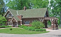 | Clinton Grove Cemetery | district | 1996 | 96000807 |
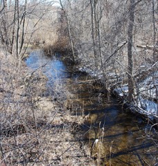 | Clinton-Kalamazoo Canal | structure | 1972 | 72000638 |
 | Erin-Warren Fractional District No. 2 Schoolhouse | building | 2001 | 01000412 |
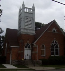 | First Congregational Church | building | 1975 | 75000954 |
 | Edsel and Eleanor Ford House | building | 1979 | 79001164 |
 | General Motors Technical Center | district | 2000 | 00000224 |
 | Grand Trunk Western Railroad, Mount Clemens Station | building | 1981 | 81000311 |
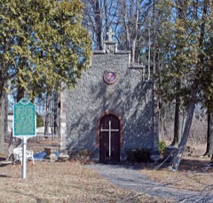 | Kolping Park and Chapel | district | 1996 | 96001417 |
| Mount Clemens Public Library | building | 2021 | 100007210 | |
 | Packard Proving Grounds Gateway Complex | district | 2007 | 06001322 |
 | Romeo Historic District | district | 1970 | 70000281 |
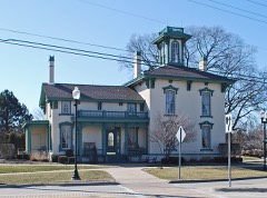 | William Upton House | building | 1986 | 86002113 |
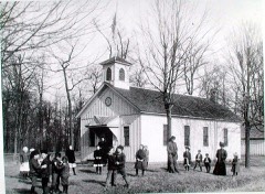 | Warren Township District No. 4 School | building | 2012 | 12000308 |
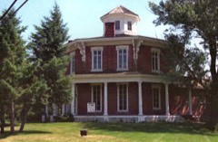 | Washington Octagon House | building | 1971 | 71000413 |
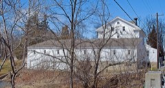 | Wolcott Mill | building | 2009 | 09001063 |
Every wildfire the federal occurrence database records inside this county: 224 of them, burning about 284 acres. 19 started naturally and none was recorded as arson. Each settlement page carries the fires within five miles of it.
| Reported cause | Fires |
|---|---|
| Equipment and vehicle use | 111 |
| Missing data/not specified/undetermined | 71 |
| Natural | 19 |
| Debris and open burning | 14 |
| Recreation and ceremony | 6 |
| Smoking | 3 |
The five largest, by the area the report gives. None of them was recorded as arson.
| Date | Cause | Size | Reported by | Name on the report |
|---|---|---|---|---|
| 28 June 2019 | Missing data/not specified/undetermined | 49 acres | Michigan Department of Natural Resources | SHELBY TOWNSHIP FD 0000226 - 2019 |
| 24 March 2018 | Equipment and vehicle use | 6.0 acres | Michigan Department of Natural Resources | ARMADA TOWNSHIP FD 214 - 2018 |
| 26 March 2018 | Equipment and vehicle use | 6.0 acres | Michigan Department of Natural Resources | ARMADA TOWNSHIP FD 218 - 2018 |
| 22 April 2018 | Missing data/not specified/undetermined | 3.0 acres | Michigan Department of Natural Resources | CLINTON TOWNSHIP FIRE/RESCUE 0004101 - 2018 |
| 23 February 2020 | Equipment and vehicle use | 3.0 acres | Michigan Department of Natural Resources | ARMADA TOWNSHIP FD 127 - 2020 |
| 10 July 2018 | Equipment and vehicle use | 1.0 acres | Michigan Department of Natural Resources | WARREN FD 10000 - 2018 |
| 17 November 2019 | Missing data/not specified/undetermined | 1.0 acres | Michigan Department of Natural Resources | GROSSE POINTE SHORES DPS 0000039 - 2019 |
| 5 May 2019 | Natural | 1.0 acres | Michigan Department of Natural Resources | WARREN FD 0006580 - 2019 |
Every settlement page carries the fires within five miles of it - see the settlement index below.
The NOAA Storm Events Database holds 709 reports for this county, causing 12 deaths, 250 injuries and about $389,682,280 in recorded property damage. Each settlement page carries the reports that name it.
| Kind of event | Reports |
|---|---|
| Thunderstorm Wind | 432 |
| Hail | 186 |
| Flash Flood | 25 |
| Lightning | 25 |
| Tornado | 22 |
| Flood | 18 |
| Wildfire | 1 |
The most serious of them, by death, then injury, then recorded damage. The accounts are quoted exactly as the forecast office filed them.
| When | Event | Place named | Harm | What the report says |
|---|---|---|---|---|
| May 1964 | Tornado (F4) | not stated | 11 killed, 224 hurt, $2,500,000 | no account filed |
| March 1976 | Tornado (F3) | not stated | 1 killed, 3 hurt, $250,000 | no account filed |
| July 1997 | Tornado (F0) | Romeo | 6 hurt, $30,000,000 | no account filed |
| April 1985 | Tornado (F1) | not stated | 6 hurt, $250,000 | no account filed |
| November 2005 | Lightning | Disco | 2 hurt, $225,000 | Lightning struck a home located in the 55000 block of Ashbrooke Drive in the Northwest corner of Shelby Township. The strike blew up the mantle in the living room. The flying debris caused minor injuries to two school aged children. A fire broke out and spread from the living room to the basement. The Fire Department estimated damages between 200K and 250K. |
| July 1996 | Thunderstorm Wind | Sterling Heights | 1 hurt, $3,000,000 | no account filed |
| July 1998 | Thunderstorm Wind | Mt Clemens | 1 hurt, $1,400,000 | no account filed |
| July 1976 | Tornado (F1) | not stated | 1 hurt, $25,000 | no account filed |
| April 2002 | Lightning | New Baltimore | 1 hurt, $5,000 | A man was struck while making household repairs in his attic. It is thought that lightning traveled through the metal heating ducts. The man was hospitalized for a couple of days. |
| August 2003 | Lightning | Roseville | 1 hurt | A woman was struck by lightning while loading groceries into her car. The woman was treated and released from the hospital. |
| July 2002 | Lightning | Mt Clemens | 1 hurt | A newspaper reported that a 21-year old male was struck by lightning while working on runway lights at Selfridge Air National Guard Base. |
| July 2002 | Lightning | New Baltimore | 1 hurt | A newspaper reported that an 11-year old girl was struck by lightning while riding her bicycle. |
| September 2000 | Lightning | Warren | 1 hurt | Lightning struck the ground at an athletic field as kids were rushing to leave soccer practice. One boy close to the strike was thrown to the ground. He was not seriously hurt, though he stayed overnight at a local hospital for precautionary reasons. |
| August 1987 | Thunderstorm Wind | not stated | 1 hurt | no account filed |
| August 2014 | Flash Flood | St Clair Shrs | $300,000,000 | no account filed |
| May 1983 | Tornado (F3) | not stated | $25,000,000 | no account filed |
| July 1998 | Thunderstorm Wind | Warren | $5,800,000 | no account filed |
| July 2021 | Tornado (EF1) | Armada | $4,500,000 | A tornado touched down just southwest of the city of Armada, around the intersection of 34 mile and Armada Ridge Rd. Initial damage consisted of plentiful tree damage and sporadic roofing damage mainly to shingles. Initial damage was consistent with an EF0 tornado. Tornado then increased in strength to an EF1 tornado on Main St on the west side of Armada. Peak winds were estimated at 105 mph. Damage in the city consisted of massive tree damage with uprooted and sheared trees. Several residential homes observed shingle damage, with a couple of houses exhibiting more severe damage to the roofing structure as roofing material was removed from the home. One house lost all roofing, with the upper walls then collapsing. The tornado then tracked northeast towards the school complexes in town, dropping in intensity down to EF0. Damage observed at this point included several uprooted trees and large limbs snapped. The tornado then continued north-northeast towards Omo and Florence Rd, re-strengthening to an EF1, where a residential home lost a large section of roofing. The tornado briefly continued up Omo Rd before lifting. |
| August 2023 | Thunderstorm Wind | Mt Clemens | $3,100,000 | Trees and power lines reported down across the county, especially in and around Clinton Township. Around 450 homes were affected, with 43 homes and businesses seeing major damage. Schools in Anchor Bay also reported flooding on the first floor, which caused damage to the flooring that needed to be replaced, along with the debris removal. |
| November 2019 | Flood | Roseville | $3,000,000 | no account filed |
| June 2021 | Flash Flood | Pleasant Ridge | $1,000,000 | Roads and basements became flooding across southern Macomb county as 3 to 4 inches of rain was reported. |
| July 2005 | Lightning | Macomb | $1,000,000 | Lightning struck a home which started a fire. The subsequent fire burned the house down.Additional lightning strikes in Macomb Township lead to five house fires in the area of 22 Mile and 23 Mile Roads. |
| July 2000 | Lightning | Romeo | $1,000,000 | A lightning strike started a fire that destroyed an automall. |
| July 1997 | Thunderstorm Wind | Sterling Hgts | $1,000,000 | no account filed |
| July 2019 | Flash Flood | Pleasant Ridge | $895,000 | Numerous roads were closed due to flooding, including portions of I-696 and I-94. |
| September 2008 | Flood | Romeo | $750,000 | no account filed |
| August 2010 | Tornado (EF1) | Utica Arpt | $500,000 | A tornado touched down near the intersection of 22 Mile and Hayes Road at 729 pm, tracking south-southeast before lifting at 735 pm just east of Hayes Road on M-59. Maximum winds were estimated to be up to 90 mph. Damage included multiple homes with roof damage, along with downed trees and power lines. |
| September 2016 | Flash Flood | Sterling Hgts | $500,000 | no account filed |
| May 1998 | Thunderstorm Wind | Armada | $405,000 | no account filed |
| August 2010 | Tornado (EF0) | Mt Clemens | $300,000 | A tornado touched down on Dorchestour Court at 740 pm, just east of Romeo Plank and north of Canal Road. The tornado tracked southeast before lifting at 748 pm just west of the intersection of 14 Mile Road and Harper Avenue. Maximum winds were estimated up to 85 mph. A few homes sustained window, garage, and shingle damage. Wooden fences were blown over. Numerous trees were blown down. |
| August 1998 | Flash Flood | Mt Clemens | $300,000 | no account filed |
| July 1998 | Lightning | Sterling Hgts | $275,000 | Separate lightning strikes started fires that destroyed a house and an apartment building. Sixteen people were left homeless. |
| March 2007 | Flash Flood | Chesterfield | $250,000 | An extreme amount of rain fell in a short period of time, 4 inches in only one hour, during a thunderstorm that became stationary over Clinton Township. Rain fell so fast that sewers were unable to handle the water flow and flash flooding ensued. Water was three to four feet deep in some spots, flooding multiple homes and swamping cars up to their windows. It was estimated that 100 homes suffered some type of water damage, with at least 30 homes flooded by at least 2 feet of water. Multiple roads became impassable from the flooding and had to be closed off. Lifelong residents reported the flooding to be by far the worst they had ever witnessed. This was also not considered a flood plain, thus nearly all residents were without flood insurance. Total monetary damages attributed to the flooding were estimated at roughly $300K. |
| May 2006 | Lightning | Warren | $250,000 | Lightning caused major damage to a house on Arden Street in Warren. The bolt hit the house and a tree next to it, starting the house on fire and collapsing the roof. Total damages were estimated at $250K. |
| June 2008 | Thunderstorm Wind | (Mtc)Mt Clemens/Self | $225,000 | Large tree limbs and power poles reported down. |
| June 2009 | Thunderstorm Wind | Sterling Hgts | $150,000 | Extensive thunderstorm wind damage across Sterling Heights, with over 50 trees reported down. A few of those trees fell onto houses and cars, with hundreds of downed wires. |
| July 2000 | Flash Flood | Utica | $125,000 | no account filed |
| August 2021 | Flash Flood | Cady | $100,000 | Flooded roadways were reported, especially around 13 Mile Road and Groesbeck Highway. Cars were stranded due to the flood waters. |
| July 2005 | Flash Flood | Countywide | $100,000 | Heavy rainfall from thunderstorms caused flash flooding with dozens of roads and side streets overflowing with water. At least two cars stalled and had to be pushed out along Tilch Road near 21 Mile Road. An elderly couple was rescued by Macomb township firefighters from a sport utility vehicle. The vehicle was driven into a ditch on 24 Mile Road west of Romeo Plank Road. The ditch held 4 feet of water, but was hidden due to water over the road. Basements, yards, and streets were also reported flooded along 24 Mile and Hayes Roads. Several homes in Richmond flooded. |
| July 1999 | Thunderstorm Wind | St Clair Shrs | $70,000 | no account filed |
| June 2009 | Thunderstorm Wind | Washington | $60,000 | Large trees and power poles reported down. |
| August 2010 | Thunderstorm Wind | Mt Vernon | $50,000 | Numerous trees reported down in Stony Creek Metropark, along with boats blown over. |
| August 2010 | Thunderstorm Wind | Mt Clemens | $50,000 | Large tree fell onto a house, causing significant damage. |
| June 2008 | Thunderstorm Wind | Mt Vernon | $50,000 | Trees and power poles reported down. |
| September 2008 | Flood | Warren | $50,000 | The Clinton River in Clinton Township crested at 18.32 feet during the evening of September 14th, while the Clinton River near Mount Clemens crested at 16.16 feet during the morning hours of September 16th. |
| July 2002 | Lightning | Armada | $50,000 | A newspaper reported that a home in Armada Township was struck by lightning and caught on fire. |
| May 1998 | Thunderstorm Wind | Memphis | $50,000 | no account filed |
| December 1998 | Thunderstorm Wind | Utica | $50,000 | no account filed |
| June 1995 | Thunderstorm Wind | Clinton Township | $50,000 | no account filed |
| August 1996 | Thunderstorm Wind | New Baltimore | $40,000 | no account filed |
| April 2023 | Thunderstorm Wind | Utica | $30,000 | Sterling Estates, a mobile home park, suffered thunderstorm wind damage. Most of the damage was roof/shingle damage, but a few trees and sheds were also reported blown down. One home had the roof/awning completely ripped off. |
| September 1999 | Flash Flood | Utica | $30,000 | no account filed |
| June 2009 | Thunderstorm Wind | Mt Clemens | $25,000 | Trees and power lines were reported down. |
| June 2008 | Thunderstorm Wind | Chesterfield | $25,000 | Trees and wires reported down. |
| July 2005 | Thunderstorm Wind | St Clair Shrs | $25,000 | Numerous trees and large tree limbs were blown down. One parked car in the Eagle Pointe neighborhood was heavily damaged due to fallen tree branches. |
| July 2002 | Lightning | Sterling Hgts | $25,000 | A newspaper reported that lightning struck a home in Shelby Township and started a small fire. |
| June 2000 | Thunderstorm Wind | Sterling Hgts | $25,000 | no account filed |
| July 2000 | Flash Flood | Countywide | $25,000 | no account filed |
| June 1990 | Tornado (F1) | not stated | $25,000 | no account filed |
| May 1983 | Tornado (F2) | not stated | $25,000 | no account filed |
The Survey's mineral resources record lists 16 workings inside this county. 11 still produce and 5 are closed or unrecorded. Each settlement page carries the workings within five miles of it.
| Commodity | Workings |
|---|---|
| Sand and Gravel, Construction | 10 |
| Fire Clay (Refractory) | 4 |
| Tantalum | 1 |
| Iron | 1 |
The least common of them first, because a county's hundredth gravel pit says nothing its first ten did not.
| Where | Site | Commodity | Status | Recorded |
|---|---|---|---|---|
| General Electric Co--Warren, Mich. | Tantalum | Past Producer | ||
| Jones & Laughlin--Warren, Mich. | Iron | Producer | ||
| Alliance Brick Co Clay Pit | Fire Clay (Refractory) | Past Producer | ||
| East Gass'sS Clay Pit | Fire Clay (Refractory) | Past Producer | ||
| Fries Tile Works' Clay Pit | Fire Clay (Refractory) | Past Producer | ||
| Warren Brick Co Clay Pit | Fire Clay (Refractory) | Past Producer | ||
| Boss Pit and Mill | Sand and Gravel, Construction | Producer | ||
| Compton Pit | Sand and Gravel, Construction | Producer | ||
| Katz Pit | Sand and Gravel, Construction | Producer | ||
| Macomb Pit | Sand and Gravel, Construction | Producer | ||
| Marsack Pit and Mill | Sand and Gravel, Construction | Producer | ||
| Morgan Number 1 Pit and Mill | Sand and Gravel, Construction | Producer | ||
| Natural Pit and Mill | Sand and Gravel, Construction | Producer | ||
| Romeo Pit and Mill | Sand and Gravel, Construction | Producer | ||
| Sees Sand and Gravel | Sand and Gravel, Construction | Producer | ||
| Vergote Pit and Mill | Sand and Gravel, Construction | Producer |
Named settlements recorded in the Geographic Names Information System, each with the topographic sheets covering it. Villages, hamlets and abandoned places alike. Each is shown with the nearest named watercourse or landform and the survey quadrangle it falls on.
Chesterfield township · 48047 · On Auvase Creek · New Haven quadrangle
17 sheets, 1912 to 1981
Chesterfield township · 48047 · On Meldrum Drain · New Haven quadrangle
17 sheets, 1912 to 1981
Chesterfield township · 48047 · On Tucker Jones Drain · New Haven quadrangle
17 sheets, 1912 to 1981
Clinton Charter Township · 48035 · Mount Clemens West quadrangle
18 sheets, 1912 to 1981
Clinton Charter Township · 48035 · On Faulman Drain · Mount Clemens West quadrangle
18 sheets, 1912 to 1981
Chesterfield township · 48051 · On Pitts Drain · New Haven quadrangle
17 sheets, 1912 to 1981
Chesterfield township · 48047 · On Crapaud Creek · New Haven quadrangle
17 sheets, 1912 to 1981
Clinton Charter Township · 48036 · On Kukuk Drain · Mount Clemens West quadrangle
18 sheets, 1912 to 1981
Fraser city · 48026 · On Sweeney Drain · Mount Clemens West quadrangle
18 sheets, 1912 to 1981
Harrison Charter Township · 48045 · On Peltier Drain · Mount Clemens East quadrangle
18 sheets, 1912 to 1981
Chesterfield township · 48047 · On Fish Creek · New Haven quadrangle
17 sheets, 1912 to 1981
Macomb township · 48042 · On East Branch Coon Creek · New Haven quadrangle
17 sheets, 1912 to 1981
Chesterfield township · 48051 · On Crandall Drain · New Haven quadrangle
17 sheets, 1912 to 1981
Mount Clemens city · 48043 · On Harrington Drain · Mount Clemens West quadrangle
18 sheets, 1912 to 1981
Washington Charter Township · 48094 · On Mount Vernon Drain · Utica quadrangle
18 sheets, 1908 to 1985
New Baltimore city · 48047 · On Crapaud Creek · New Baltimore quadrangle
12 sheets, 1914 to 1981
Chesterfield township · 48047 · On Peltier Drain · New Haven quadrangle
17 sheets, 1912 to 1981
Shelby Charter Township · 48315 · On Yates Drain · Waldenburg quadrangle
17 sheets, 1912 to 1981
Washington Charter Township · 48094 · On King Drain · Utica quadrangle
18 sheets, 1908 to 1985
Harrison Charter Township · 48045 · Near Grass Island · Mount Clemens East quadrangle
18 sheets, 1912 to 1981
Chesterfield township · 48047 · On Harms Drain · New Haven quadrangle
17 sheets, 1912 to 1981
Sterling Heights city · 48312 · On Moore Drain · Warren quadrangle
18 sheets, 1908 to 1985
Washington Charter Township · 48094 · On King Drain · Utica quadrangle
18 sheets, 1908 to 1985