Block
From the record
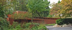
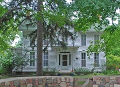
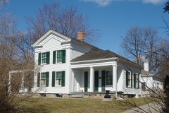
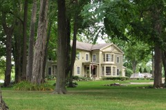
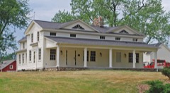
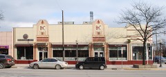
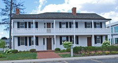
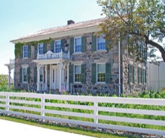
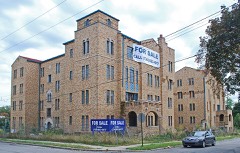
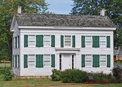
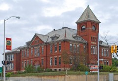
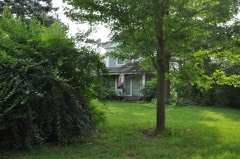
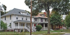
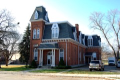
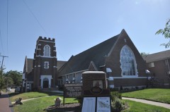
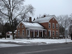
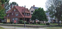
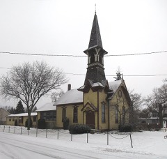
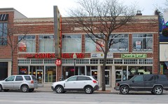
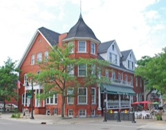
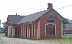
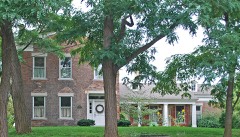
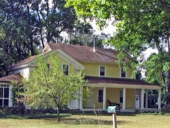
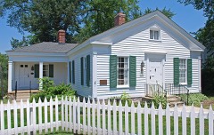
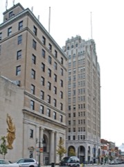
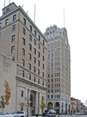
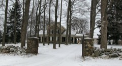
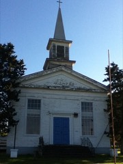
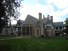
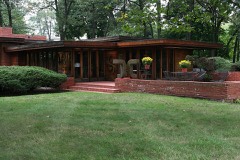
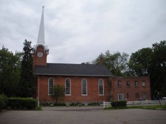
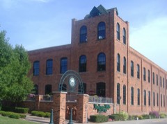
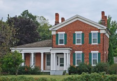
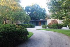
87 National Register listings published here, 2 of them National Historic Landmarks.
Sources: the National Register database, National Park Service
221 topographic sheets cover 92 settlements here, and 87 properties are on the National Register of Historic Places.
87 National Register listings published here, 2 of them National Historic Landmarks.
Sources: the National Register database, National Park Service
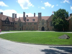
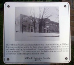
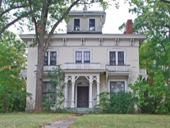
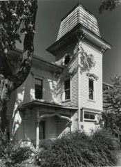
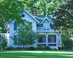
Every property in this county listed on the National Register of Historic Places, with the year it was listed and the federal nomination document.
Every wildfire the federal occurrence database records inside this county: 221 of them, burning about 359 acres. 21 started naturally and 1 was recorded as arson. Each settlement page carries the fires within five miles of it.
| Reported cause | Fires |
|---|---|
| Equipment and vehicle use | 87 |
| Missing data/not specified/undetermined | 80 |
| Natural | 21 |
| Debris and open burning | 13 |
| Recreation and ceremony | 11 |
| Smoking | 7 |
| Misuse of fire by a minor | 1 |
| Arson/incendiarism | 1 |
The five largest, by the area the report gives. One of them was set deliberately.
| Date | Cause | Size | Reported by | Name on the report |
|---|---|---|---|---|
| 17 March 2020 | Debris and open burning | 50 acres | Michigan Department of Natural Resources | HIGHLAND TOWNSHIP FD 20298 - 2020 |
| 10 April 2014 | Recreation and ceremony | 30 acres | Michigan Department of Natural Resources | OAKLAND 0001 |
| 10 April 1996 | Misuse of fire by a minor | 30 acres | Michigan Department of Natural Resources | not named |
| 12 April 1992 | Arson/incendiarism | 22 acres | Michigan Department of Natural Resources | not named |
| 11 April 1996 | Debris and open burning | 6.0 acres | Michigan Department of Natural Resources | not named |
| 5 May 2019 | Equipment and vehicle use | 4.0 acres | Michigan Department of Natural Resources | NORTH OAKLAND COUNTY FIRE AUTH 326 - 2019 |
| 1 May 2018 | Natural | 4.0 acres | Michigan Department of Natural Resources | HOLLY FD 0000242 - 2018 |
| 26 April 2003 | Smoking | 3.7 acres | Michigan Department of Natural Resources | not named |
Every settlement page carries the fires within five miles of it - see the settlement index below.
The NOAA Storm Events Database holds 1,064 reports for this county, causing 7 deaths, 101 injuries and about $508,143,030 in recorded property damage. Each settlement page carries the reports that name it.
| Kind of event | Reports |
|---|---|
| Thunderstorm Wind | 716 |
| Hail | 238 |
| Lightning | 40 |
| Tornado | 36 |
| Flash Flood | 24 |
| Flood | 8 |
| Heavy Rain | 2 |
The most serious of them, by death, then injury, then recorded damage. The accounts are quoted exactly as the forecast office filed them.
| When | Event | Place named | Harm | What the report says |
|---|---|---|---|---|
| March 1976 | Tornado (F4) | not stated | 1 killed, 55 hurt, $25,000,000 | no account filed |
| June 1987 | Tornado (F2) | not stated | 1 killed, 6 hurt, $2,500,000 | no account filed |
| September 1990 | Thunderstorm Wind | not stated | 1 killed, 4 hurt | no account filed |
| July 1997 | Tornado (F1) | Holly | 1 killed, $2,000,000 | no account filed |
| June 1996 | Flash Flood | Countywide | 1 killed, $500,000 | no account filed |
| July 1996 | Lightning | Milford Twp | 1 killed | no account filed |
| June 1992 | Thunderstorm Wind | not stated | 1 killed | no account filed |
| May 1987 | Tornado (F1) | not stated | 8 hurt, $250,000 | no account filed |
| June 1953 | Tornado (F3) | not stated | 4 hurt, $2,500,000 | no account filed |
| June 1995 | Hail | Milford | 3 hurt | A severe thunderstorm brought nickle-size hail and frequent cloud to ground lightning to the Milford area in southwest Oakland County. Lightning resulted in three minor injuries. |
| April 1975 | Tornado (F1) | not stated | 2 hurt, $250,000 | no account filed |
| July 1957 | Tornado (F4) | not stated | 2 hurt, $250,000 | no account filed |
| December 1998 | Thunderstorm Wind | Farmington | 2 hurt, $60,000 | no account filed |
| May 1998 | Thunderstorm Wind | Holly | 2 hurt, $40,000 | no account filed |
| June 2024 | Thunderstorm Wind | East Highland | 2 hurt | A tree landed onto two trucks located on South Duck Lake Road. Two men were injured and take to the hospital. |
| May 1991 | Thunderstorm Wind | not stated | 2 hurt | no account filed |
| May 1964 | Tornado (F2) | not stated | 1 hurt, $25,000 | no account filed |
| June 2006 | Lightning | Troy | 1 hurt, $15,000 | One family member suffered minor injuries related directly to a lightning strike that created flying glass when the fireplace door exploded. There was no fire but the chimney was destroyed and the family room and kitchen were also damaged. Property damage was roughly estimated at $15K. |
| July 2019 | Thunderstorm Wind | Trot Big Beaver Arpt | 1 hurt | A tree fell onto the top of a truck, resulting in a minor injury to the driver. |
| June 2005 | Lightning | Royal Oak | 1 hurt | Lightning struck a Royal Oak man when he tried to remove a fallen tree branch from a neighbor's car. The strike happened outside an apartment building at 1703 Gardenia Avenue. The victim was taken to a hospital and released the next day. |
| August 2003 | Lightning | Troy | 1 hurt | An 11 year old boy was struck by lightning on Garry Road. CPR was performed on the boy, who later recovered. |
| April 1997 | Lightning | Commerce | 1 hurt | A 34-year-old woman was struck by lightning outside of her home in Commerce Township at 4:45 pm EST. She was taken to the University of Michigan Medical Center where she was listed in serious condition. |
| July 1998 | Lightning | Waterford | 1 hurt | no account filed |
| October 1990 | Thunderstorm Wind | not stated | 1 hurt | no account filed |
| June 1987 | Thunderstorm Wind | not stated | 1 hurt | no account filed |
| August 2014 | Flash Flood | Ferndale | $400,000,000 | no account filed |
| July 2021 | Tornado (EF1) | White Lake | $8,500,000 | A tornado touched down 1 mile NNE of White Lake just west of the intersection of Teggerdine Rd and Pontiac Lake Rd. The tornado began as an EF-0 in which several healthy trees were uprooted and snapped. The tornado then tracked southeast toward a neighborhood at the intersection of Pontiac Lake Rd and Howland Blvd where it produced EF-1 damage, including shingle and roof damage, garage damage with one garage door completely blown off, and numerous healthy trees uprooted and snapped. Peak winds were estimated at 100 mph. A house was damaged when multiple pine trees fell onto it, resulting in one minor injury. The tornado then tracked to the northeast and crossed Pontiac Lake Rd before tracking across Pontiac Lake as an EF-0, in which it produced shingle damage and uprooted numerous trees in neighborhoods located on the peninsula north of Pontiac Lake Rd along Buckingham St and a second peninsula off of Gale Rd near Tackles Dr. The tornado then tracked northeast of the peninsulas and lifted while over the water on Pontiac Lake prior to reaching Gale Rd. |
| August 2023 | Thunderstorm Wind | South Lyon | $7,000,000 | Widespread trees reported blown down. The South Lyon DPW main building was severely damaged (roof torn off, all overhead doors blown in, walls bowing out). One South Lyon PD patrol vehicle was severely damaged on a flooded road responding to a stranded vehicle requiring rescue. Homes were also affected, with several having major damage or even destroyed. The City of South Lyon offices had no power for two days. |
| July 2014 | Hail | East Highland | $6,000,000 | no account filed |
| August 2007 | Tornado (EF1) | Holly | $4,000,000 | This is the same tornado that began in Livingston County's Cohoctah Township and eventually tore a path through the City of Fenton in southwestern Genesee County. The tornado exited Genesee County and moved into Oakland County via Grange Hall Road at 1700EST. Of the 30 homes/buildings damaged in Oakland County, two were destroyed. The most significant damage in Oakland County occurred on Holly's north-side along the Grange Hall Road corridor and was rated as EF1 with wind speeds estimated at approximately 100 MPH. The average path width in Oakland County was 150 yards. The tornado ended in Oakland County approximately 3 miles northeast of Holly at 1707EST. |
| October 2021 | Flash Flood | Oxford | $3,400,000 | no account filed |
| July 2014 | Hail | Oxbow | $3,000,000 | no account filed |
| July 2014 | Hail | Clyde | $3,000,000 | no account filed |
| July 2014 | Hail | Highland | $3,000,000 | no account filed |
| July 2014 | Hail | Oxbow | $3,000,000 | no account filed |
| July 2014 | Hail | Oxbow | $3,000,000 | no account filed |
| September 1990 | Tornado (F3) | not stated | $2,500,000 | no account filed |
| September 1990 | Tornado (F1) | not stated | $2,500,000 | no account filed |
| August 1972 | Tornado (F3) | not stated | $2,500,000 | no account filed |
| June 2021 | Flash Flood | Oakwood | $2,000,000 | Roads and basements became flooding across southern Oakland county as 3 to 4 inches of rain was reported. |
| July 2014 | Hail | Clyde | $2,000,000 | A mobile home park was damaged, with 80 percent of the homes suffering broken windows. |
| July 2014 | Hail | White Lake | $2,000,000 | no account filed |
| July 2021 | Thunderstorm Wind | Farmington | $1,500,000 | Multiple trees blown down, blocking roadways. Trees blown down with property damage across parts of Farmington. The City of Farmington estimates property damage close to 1.5 million. |
| June 2008 | Thunderstorm Wind | Cresent Lake Estates | $1,200,000 | Widespread trees and power lines down. Garage doors blown in. Some trees fell on vehicles and houses. |
| October 2001 | Tornado (F1) | Clyde | $750,000 | The Livingston County tornado moved into Oakland County near Clyde Rd in Highland Township. The tornado moved northeast and hit the small community of Davisburg in Springfield Township. Extensive damage occurred to the eastern portion of the Davisburg Elementary School. Four classrooms were completely destroyed and eight others were heavily damaged. The tornado struck the school after hours and while no after school extra curricular activities were going on. Therefore, the only people in the school at the time the tornado hit were two custodians, who were uninjured. Outside of the elementary school, some of the brick work on the outside of the Davisburg Candle Factory building was damaged, several homes sustained damage to their siding and shingles, and a tractor and horse trailer were overturned at a ranch just outside of town. Outside of the Davisburg area, broken and uprooted trees were the only other damage witnessed along the path of the tornado. |
| September 2000 | Heavy Rain | White Lake | $750,000 | no account filed |
| July 1997 | Lightning | Farmington | $750,000 | no account filed |
| June 2008 | Thunderstorm Wind | Commerce | $600,000 | Widespread trees and wires down. Union Lake Golf Course was particularly hurt hard, losing 20 trees. |
| April 2026 | Flood | Ortonville | $500,000 | The Village of Holly issued a local state of emergency after flooding damaged pumps at its Waste Water Treatment Plant and impacted hundreds of homes. Water levels rose high enough to enter backyards and sheds. In some neighborhoods, residents reported water reaching the floorboards of their homes. The Road Commission for Oakland County (RCOC) was forced to close North Holly Road (just north of Quick Road near Holly Middle School) on the evening of April 4. The closure remained in place for several days due to standing water and road instability. |
| July 2021 | Thunderstorm Wind | Windiate Park | $500,000 | Several trees blown down over Maceday Lake road. A large tree also fell onto a home. |
| July 2021 | Thunderstorm Wind | Walled Lake | $500,000 | Large oak trees reported down on residential homes. |
| July 2021 | Thunderstorm Wind | Novi | $500,000 | Wires reported down across both directions of I-275 near Grand River, some wires on cars as well. |
| June 2005 | Lightning | Walled Lake | $500,000 | Lightning struck a condominium complex in West Bloomfield near Maple and Haggerty roads. All four units were deemed uninhabitable due to smoke and fire damage. |
| September 2016 | Flash Flood | Wixom Spencer Arpt | $500,000 | no account filed |
| September 2008 | Flood | South Lyon | $500,000 | no account filed |
| August 1998 | Flash Flood | Novi | $500,000 | no account filed |
| September 2014 | Tornado (EF1) | Goodison | $400,000 | The tornado started near Lambeth Park and New Kent Road and tracked east-northeast, ending near West Ridge Drive and Spring Creek Road. The tornado is rated EF-1 with maximum winds of 90 mph. Maximum path width was 150 yards and path length was 1 1/4 miles. Strongest damage was along Grandview and Fairlane Drives with partial roof torn off of house. Several homes had minor roof and siding damage. Numerous trees were downed along the path. |
| June 2008 | Thunderstorm Wind | Orchard Lake Vlg | $400,000 | Local media reported widespread trees and wires down. Residents reported some property damage. |
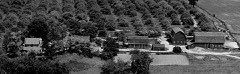
| June 2008 | Thunderstorm Wind | Highland | $400,000 | Trees were reported down. |The Haven Hill estate sheep barn in the Highland Recreation Area sustained severe storm damage. |
| June 2008 | Thunderstorm Wind | Oakwood | $325,000 | Power lines and trees reported down, with at least one landing on a house. |
The Survey's mineral resources record lists 48 workings inside this county. 44 still produce and 4 are closed or unrecorded. Each settlement page carries the workings within five miles of it.
| Commodity | Workings |
|---|---|
| Sand and Gravel, Construction | 44 |
| Fire Clay (Refractory) | 2 |
| Silica | 1 |
| Tungsten | 1 |
The least common of them first, because a county's hundredth gravel pit says nothing its first ten did not.
| Where | Site | Commodity | Status | Recorded |
|---|---|---|---|---|
| Carmet Co--Madison Hgts, Mich. | Tungsten | Producer | ||
| Plant No 31 Pit | Silica | Producer | ||
| Bigelow Clay Prod Co Clay Pit | Fire Clay (Refractory) | Past Producer | ||
| Daniels Clay Pit | Fire Clay (Refractory) | Past Producer | ||
| Addison Township Pit | Sand and Gravel, Construction | Producer | ||
| Ajax Pit & Mill | Sand and Gravel, Construction | Producer | ||
| American Aggregate Pit | Sand and Gravel, Construction | Producer | ||
| Andersonville Road Plant | Sand and Gravel, Construction | Producer | ||
| Bald Mt Plant No. 3 | Sand and Gravel, Construction | Producer | ||
| Buffalo Pit | Sand and Gravel, Construction | Producer | ||
| Buffalo Pit No 2 | Sand and Gravel, Construction | Producer | ||
| Buffalo Pit No. 1 | Sand and Gravel, Construction | Producer | ||
| Fyke Pit | Sand and Gravel, Construction | Producer | ||
| Gale Road Plant No. 4 | Sand and Gravel, Construction | Producer | ||
| Grand River Pit | Sand and Gravel, Construction | Producer | ||
| Granger Road Plant | Sand and Gravel, Construction | Producer | ||
| Great Lakes Pit | Sand and Gravel, Construction | Producer | ||
| Haas Road Pit | Sand and Gravel, Construction | Producer | ||
| Holloway Oakland County Pit | Sand and Gravel, Construction | Producer | ||
| Holly Sand and Gravel Pit | Sand and Gravel, Construction | Producer | ||
| Kent Lake Pit | Sand and Gravel, Construction | Producer | ||
| Koenig Fuel and Supply Co. Pit | Sand and Gravel, Construction | Producer | ||
| Kurtz Pit | Sand and Gravel, Construction | Producer | ||
| Lake Shore Pit | Sand and Gravel, Construction | Producer | ||
| Levy Pit | Sand and Gravel, Construction | Producer | ||
| Maceday Lake Pit | Sand and Gravel, Construction | Producer | ||
| Middleton Pit | Sand and Gravel, Construction | Producer | ||
| Milford No 315 Pit | Sand and Gravel, Construction | Past Producer | ||
| Molesworth Oakland County Pit | Sand and Gravel, Construction | Producer | ||
| Nay and Gladstone Pits | Sand and Gravel, Construction | Producer | ||
| Oxford Pit | Sand and Gravel, Construction | Producer | ||
| Oxford Pit | Sand and Gravel, Construction | Producer | ||
| Oxford Pit No. 311 | Sand and Gravel, Construction | Producer | ||
| Plant No 30 | Sand and Gravel, Construction | Producer | ||
| Plant No 30 Pit & Mill | Sand and Gravel, Construction | Producer | ||
| Portable Aggregates Pit | Sand and Gravel, Construction | Producer | ||
| Rose Pit | Sand and Gravel, Construction | Producer | ||
| Salem Pit | Sand and Gravel, Construction | Producer | ||
| Sleeth Rd Pit | Sand and Gravel, Construction | Producer | ||
| South Flint Gravel Pit | Sand and Gravel, Construction | Producer | ||
| Standard Gravel Co., Inc. Pit | Sand and Gravel, Construction | Producer | ||
| Tri-City Aggregates Inc Pit | Sand and Gravel, Construction | Producer | ||
| Underwood Pit | Sand and Gravel, Construction | Producer | ||
| Waterford Sanitary Landfill Pit | Sand and Gravel, Construction | Producer | ||
| Webers Sand and Gravel Pit | Sand and Gravel, Construction | Past Producer | ||
| Webers Sand and Gravel Pit | Sand and Gravel, Construction | Producer | ||
| Webers Sand and Gravel Pit | Sand and Gravel, Construction | Producer | ||
| Western Materials Co. Pit | Sand and Gravel, Construction | Producer |
Named settlements recorded in the Geographic Names Information System, each with the topographic sheets covering it. Villages, hamlets and abandoned places alike. Each is shown with the nearest named watercourse or landform and the survey quadrangle it falls on.
Southfield township · 48025 · On Sunken Bridge Drain · Birmingham quadrangle
17 sheets, 1908 to 1985
Southfield township · 48025 · On Franklin Branch · Pontiac South quadrangle
21 sheets, 1907 to 1997
Birmingham city · 48009 · On Sunken Bridge Drain · Birmingham quadrangle
17 sheets, 1908 to 1985
Birmingham city · 48009 · On Sunken Bridge Drain · Birmingham quadrangle
17 sheets, 1908 to 1985
Bloomfield Hills city · 48304 · On Amy Drain · Birmingham quadrangle
17 sheets, 1908 to 1985
Brandon Charter Township · 48462 · Near Eagle Island · Ortonville quadrangle
13 sheets, 1943 to 1991
Oakland Charter Township · 48363 · On Krohn Drain · Lake Orion quadrangle
13 sheets, 1943 to 1996
Bloomfield Charter Township · 48304 · On Amy Drain · Birmingham quadrangle
17 sheets, 1908 to 1985
Waterford Charter Township · 48329 · Near Bird Island · Pontiac North quadrangle
21 sheets, 1907 to 1997
Commerce Charter Township · 48382 · On Hayes Creek · Walled Lake quadrangle
22 sheets, 1907 to 1985
Waterford Charter Township · 48329 · Near Bird Island · Clarkston quadrangle
21 sheets, 1907 to 1985
Highland Charter Township · 48356 · Near Hubbels Island · Highland quadrangle
18 sheets, 1909 to 1985
Farmington Hills city · 48334 · On Seeley Drain · Northville quadrangle
20 sheets, 1905 to 1989
Orion Charter Township · 48359 · Near Mount Judah · Pontiac North quadrangle
21 sheets, 1907 to 1997
Groveland township · 48442 · Near Devil Island · Davisburg quadrangle
17 sheets, 1920 to 1985
Lake Angelus city · 48326 · Near Mount Judah · Pontiac North quadrangle
21 sheets, 1907 to 1997
Orion Charter Township · 48362 · Near Park Island · Lake Orion quadrangle
13 sheets, 1943 to 1996
Orion Charter Township · 48362 · Near Bellevue Island · Oxford quadrangle
14 sheets, 1943 to 1991
Milford Charter Township · 48381 · On Pettibone Creek · Milford quadrangle
19 sheets, 1909 to 1985
West Bloomfield Charter Township · 48322 · Walled Lake quadrangle
22 sheets, 1907 to 1985
Orchard Lake Village city · 48324 · Near Apple Island · Pontiac South quadrangle
21 sheets, 1907 to 1997
Brandon Charter Township · 48462 · On Duck Creek · Ortonville quadrangle
13 sheets, 1943 to 1991
White Lake Charter Township · 48386 · On Cedar Creek · Clarkston quadrangle
21 sheets, 1907 to 1985
Farmington Hills city · 48331 · On Seeley Drain · Northville quadrangle
20 sheets, 1905 to 1989
Orion Charter Township · 48362 · Near Park Island · Lake Orion quadrangle
13 sheets, 1943 to 1996
Highland Charter Township · 48356 · Near Dawsons Island · Highland quadrangle
18 sheets, 1909 to 1985
Rochester Hills city · 48307 · On Stony Creek · Utica quadrangle
18 sheets, 1908 to 1985
West Bloomfield Charter Township · 48320 · Pontiac South quadrangle
21 sheets, 1907 to 1997
Waterford Charter Township · 48329 · On Waterford Hill · Clarkston quadrangle
21 sheets, 1907 to 1985
White Lake Charter Township · 48383 · Near Dawsons Island · Highland quadrangle
18 sheets, 1909 to 1985