 Block
From the record
13 National Register listings published here.
Sources: the National Register database, National Park Service
34 topographic sheets cover 34 settlements here, and 13 properties are on the National Register of Historic Places.
13 National Register listings published here.
Sources: the National Register database, National Park Service
Every property in this county listed on the National Register of Historic Places, with the year it was listed and the federal nomination document.
| Photograph | Property | Type | Listed | Reference |
|---|---|---|---|---|
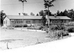 | Camp Black Lake | district | 2021 | 100006365 |
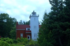 | Forty Mile Point Light Station | building | 1984 | 84001830 |
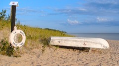 | P.H. Hoeft State Park | district | 2009 | 09001065 |
 | KYLE SPANGLER (schooner) Shipwreck Site | site | 2016 | 14001098 |
 | NORMAN (shipwreck) | site | 2016 | 16000819 |
| Ocqueoc Falls Highway-Ocqueoc River Bridge | structure | 1999 | 99001536 | |
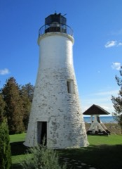 | Old Presque Isle Lighthouse | building | 1973 | 73000957 |
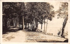 | Onaway State Park | district | 2009 | 09001066 |
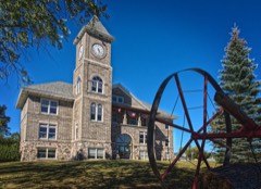 | Presque Isle County Courthouse | building | 1980 | 80001889 |
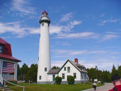 | Presque Isle Light Station | building | 1983 | 83000890 |
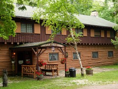 | Presque Isle Lodge | building | 2008 | 07001490 |
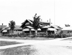 | Radka-Bradley House | building | 1991 | 91001019 |
| Rogers Theater | building | 2024 | 100010780 |
Every wildfire the federal occurrence database records inside this county: 147 of them, burning about 651 acres. 9 started naturally and 6 were recorded as arson. Each settlement page carries the fires within five miles of it.
| Reported cause | Fires |
|---|---|
| Debris and open burning | 46 |
| Missing data/not specified/undetermined | 33 |
| Equipment and vehicle use | 22 |
| Recreation and ceremony | 13 |
| Natural | 9 |
| Power generation/transmission/distribution | 8 |
| Arson/incendiarism | 6 |
| Railroad operations and maintenance | 3 |
| Misuse of fire by a minor | 3 |
| Other causes | 2 |
| Smoking | 2 |
The five largest, by the area the report gives. None of them was recorded as arson.
| Date | Cause | Size | Reported by | Name on the report |
|---|---|---|---|---|
| 29 April 2006 | Recreation and ceremony | 108 acres | Michigan Department of Natural Resources | not named |
| 28 April 2003 | Debris and open burning | 54 acres | Michigan Department of Natural Resources | not named |
| 19 July 2018 | Power generation/transmission/distribution | 34 acres | Michigan Department of Natural Resources | PRESQUE ISLE 05 |
| 16 April 2005 | Equipment and vehicle use | 25 acres | Michigan Department of Natural Resources | not named |
| 28 March 1995 | Misuse of fire by a minor | 23 acres | Michigan Department of Natural Resources | not named |
| 15 April 2009 | Debris and open burning | 23 acres | Michigan Department of Natural Resources | PRESQUE ISLE 03 |
| 2 April 2020 | Debris and open burning | 21 acres | Michigan Department of Natural Resources | PRESQUE ISLE 01 - EARLY FIRE |
| 24 May 2002 | Debris and open burning | 19 acres | Michigan Department of Natural Resources | not named |
Every settlement page carries the fires within five miles of it - see the settlement index below.
The NOAA Storm Events Database holds 96 reports for this county, causing 1 death, 3 injuries and about $3,995,500 in recorded property damage. Each settlement page carries the reports that name it.
| Kind of event | Reports |
|---|---|
| Thunderstorm Wind | 50 |
| Hail | 36 |
| Tornado | 7 |
| Lightning | 3 |
The most serious of them, by death, then injury, then recorded damage. The accounts are quoted exactly as the forecast office filed them.
| When | Event | Place named | Harm | What the report says |
|---|---|---|---|---|
| August 2016 | Lightning | Erand Lake | 1 killed | A 21 year old woman from Grand Rapids was struck by lightning while working as a life guard. She passed away two days later. |
| July 2004 | Hail | Posen | 1 hurt, $3,500,000 | A devastating hailstorm caused extensive damage in the small town of Posen. The hail was driven at times by wind gusts around 60 mph. Most buildings and vehicles in the community suffered some sort of damage. Holes were punched in roofs and siding; cars were dented, and windows broken. Buildings that had siding damage were damaged almost exclusively on their south side. The storm spawned hundreds of insurance claims. A local church had to patch 300 holes in its roof. Damage to a school roof was estimated at nearly $200,000, and a local greenhouse lost over a thousand two-foot by two-foot window panes. One individual suffered a badly bruised back as he tried to move his vehicle to shelter. Substantial damage was done to crops (largely potatoes, with some beans, tomatoes and corn in the mix) in nearby fields. |
| July 2020 | Thunderstorm Wind | Black Lake Bluffs | 1 hurt, $95,000 | Areas of wind damage, mainly downed trees, occurred just east and southeast of Black Lake. A number of trees were downed at Onaway State Park, damaging multiple camping trailers. One occupant of a trailer suffered two broken ribs when his trailer was struck by a falling tree. |
| July 1964 | Tornado (F1) | not stated | 1 hurt, $25,000 | no account filed |
| May 1964 | Tornado (F2) | not stated | $250,000 | no account filed |
| July 1957 | Tornado (F2) | not stated | $25,000 | no account filed |
| August 2015 | Thunderstorm Wind | Ocqueoc | $12,000 | A number of trees and power lines were downed in and west of Rogers City. A boater at harbor in Rogers City measured a 66 mph gust. |
| August 2008 | Thunderstorm Wind | Onaway | $12,000 | A weighted picnic table was blown into the side of a house. Part of the table penetrated the siding and sheeting of the home, and entered some cabinetry. |
| August 2015 | Thunderstorm Wind | Onaway | $8,000 | Multiple trees and power lines were downed in western Presque Isle County. |
| May 2011 | Thunderstorm Wind | Onaway | $8,000 | Numerous trees downed. |
| June 2017 | Thunderstorm Wind | Onaway | $7,000 | Several trees were downed, across power lines in some areas. A road near Millersburg was briefly blocked. |
| May 2013 | Thunderstorm Wind | Big Cut | $6,000 | Multiple trees downed on County Road 638 between Millersburg and Hawks. |
| September 2005 | Thunderstorm Wind | Onaway | $6,000 | Numerous trees and power lines downed. |
| August 1993 | Hail | Alpena | $5,000 | Hail, 0.75-inch in diameter was reported in extreme southeast Presque Isle County near Birch Highway on the east side of Long Lake. Several cars were dented by the large hail. |
| June 2011 | Thunderstorm Wind | Erand Lake | $4,000 | Numerous trees were downed. |
| June 2007 | Thunderstorm Wind | Onaway | $4,000 | Several large trees were downed. |
| July 2006 | Thunderstorm Wind | Ocqueoc | $4,000 | Several large trees downed. |
| July 2006 | Thunderstorm Wind | Ocqueoc | $4,000 | Trees downed. |
| July 2005 | Thunderstorm Wind | Posen | $4,000 | Several large trees were downed in the Grand Lake area. Presque Isle Lighthouse measured a wind gust of 54 knots. |
| August 2003 | Lightning | Onaway | $4,000 | Lightning struck a tree outside a home. The charge moved through the ground and entered the house, splintering joists in the crawl space and starting a small electrical fire. |
| August 1986 | Tornado (F1) | not stated | $2,500 | no account filed |
| September 2021 | Thunderstorm Wind | Millersburg | $2,000 | Tree broken and heavy metal swing blown down. |
| September 2019 | Thunderstorm Wind | Rogers City | $2,000 | A single, large tree was downed. |
| June 2011 | Thunderstorm Wind | Posen | $2,000 | Two trees and one power pole were downed. |
| May 2006 | Thunderstorm Wind | Onaway | $2,000 | Trees downed. |
| August 2006 | Thunderstorm Wind | Ocqueoc | $2,000 | Trees downed. |
| May 2022 | Hail | Onaway | - | Facebook photo of 1.5 inch hail at Tomahawk Creek Flooding. Time estimated on radar. |
| May 2022 | Hail | Hawks | - | Two inch hail report. Time estimated by radar. |
| May 2022 | Hail | Posen | - | Baseball sized hail was reported in Posen. |
| May 2022 | Hail | Erand Lake | - | Three inch hail was reported near Presque Isle. |
| May 2022 | Hail | Erand Lake | - | Report of hen egg sized hail in Black Bass Bay. Time estimated by radar. |
| September 2012 | Hail | Ocqueoc | - | Golfball-sized hail fell along M-68 between Rogers City and Millersburg. |
| June 2011 | Hail | Millersburg | - | Hail covered the ground. |
| June 2008 | Hail | Black Lake Bluffs | - | Penny sized hail fell at Onaway State Park. |
| July 2006 | Hail | Polaski | - | Tennis ball sized hail along north shore of Long Lake. |
| July 2006 | Hail | Ocqueoc | - | Nickel sized hail at Huron Beach. |
| July 2005 | Hail | Ocqueoc | - | A small cluster of severe thunderstorms developed early in the afternoon in northeast Lower Michigan. Quarter sized hail fell at Huron Beach. |
| July 2004 | Thunderstorm Wind | Posen | - | Trees were downed. |
| July 2002 | Thunderstorm Wind | Rogers City | - | Numerous trees down. |
| August 2002 | Tornado (F0) | Black Lake Bluffs | - | Tornado developed over Black Lake and moved onshore near Black Lake Bluffs. Many trees downed and at least three pontoon boats flipped. |
| August 2002 | Thunderstorm Wind | Onaway | - | Several trees down. |
| June 2001 | Lightning | Rogers City | - | Large tree struck by lightning and downed across road. |
| June 2001 | Tornado (F0) | Posen | - | Brief touchdown lifted truck off ground, blew off barn doors and downed a few large trees. |
| September 2001 | Thunderstorm Wind | Posen | - | Numerous trees down. Most damage was to Apple and Poplar trees. Some trees fell on homes and power lines. |
| June 1999 | Thunderstorm Wind | Rogers City | - | Trees down on South Rogers Rd |
| July 1999 | Thunderstorm Wind | Hammond | - | Trees down. |
| September 1998 | Thunderstorm Wind | Posen | - | Trees snapped off and/or uprooted across the area. Some powerlines also down. |
| September 1998 | Thunderstorm Wind | Rogers City | - | Gust of 60 mph reported at the 40 mile Point Lighthouse. |
| July 1995 | Thunderstorm Wind | Rogers City | - | Spotter reported trees downed by thunderstorm winds. |
| July 1995 | Thunderstorm Wind | Hawks | - | Spotter reported trees downed by thunderstorm winds, as well as south of Hawks near the countyline between Alpena County and Presque Isle County. |
| May 1995 | Hail | Apn | - | Three-quarters inch hail reported in Rogers City by Rogers City Police. |
| August 1993 | Thunderstorm Wind | Alpena | - | Several trees were uprooted at the north end of Grand Lake in eastern Presque Isle County near McCreery Highway area. |
| August 1993 | Thunderstorm Wind | Hawks | - | Several trees were uprooted by thunderstorm wind. |
| May 2013 | Hail | Rogers City | - | no account filed |
| May 2013 | Hail | Onaway | - | no account filed |
| June 2011 | Hail | Rogers City | - | no account filed |
| May 2011 | Hail | Grace | - | no account filed |
| May 2011 | Hail | Erand Lake | - | no account filed |
| August 2009 | Hail | Posen | - | no account filed |
| June 2008 | Hail | Polaski | - | no account filed |
The Survey's mineral resources record lists 19 workings inside this county. 13 still produce and 6 are closed or unrecorded. Each settlement page carries the workings within five miles of it.
| Commodity | Workings |
|---|---|
| Sand and Gravel, Construction | 8 |
| Limestone, General | 4 |
| Stone, Crushed/Broken | 2 |
| Clay | 2 |
| Fire Clay (Refractory) | 1 |
| Limestone, Dimension | 1 |
| Limestone, High Calcium | 1 |
The least common of them first, because a county's hundredth gravel pit says nothing its first ten did not.
| Where | Site | Commodity | Status | Recorded |
|---|---|---|---|---|
| Calcite Plant | Limestone, High Calcium | Producer | 1912 | |
| Indian Creek Clay Pit | Fire Clay (Refractory) | Prospect | ||
| Onaway Quarry | Limestone, Dimension | Producer | ||
| Bell Clay Shale Pit | Clay | Prospect | ||
| Calcite Plant | Stone, Crushed/Broken | Producer | ||
| N.Hackett Lake Clay Pit | Clay | Prospect | ||
| Stoneport | Stone, Crushed/Broken | Producer | ||
| Calcite Mill/Glawe Inc | Limestone, General | Past Producer | ||
| East Branch Limestone Exposure | Limestone, General | Prospect | ||
| Ocqueoc Limestone Exposure | Limestone, General | Prospect | ||
| Stoneport Quarry | Limestone, General | Producer | 1954 | |
| Presque Isle Co Pit No 1 & Mill 27 | Sand and Gravel, Construction | Producer | ||
| Presque Isle County Road Comm. Pit | Sand and Gravel, Construction | Producer | ||
| Presque Isle County Road Comm. Pit | Sand and Gravel, Construction | Producer | ||
| State of Michigan Pit | Sand and Gravel, Construction | Producer | ||
| State of Michigan Pit | Sand and Gravel, Construction | Producer | ||
| State of Michigan Pit | Sand and Gravel, Construction | Producer | ||
| State of Michigan Pit | Sand and Gravel, Construction | Producer | ||
| Straits Aggregate and Equipment Co. | Sand and Gravel, Construction | Producer |
Named settlements recorded in the Geographic Names Information System, each with the topographic sheets covering it. Villages, hamlets and abandoned places alike. Each is shown with the nearest named watercourse or landform and the survey quadrangle it falls on.
Presque Isle township · 49777 · On Bell River · Long Lake East quadrangle
7 sheets, 1954 to 1984
Ocqueoc township · 49759 · On Ocqueoc River · Ocqueoc quadrangle
11 sheets, 1955 to 1986
Bearinger township · 49765 · On Cold Creek · Black Lake Bluffs quadrangle
11 sheets, 1955 to 1986
North Allis township · 49765 · On Rainy River · Black Lake Bluffs quadrangle
11 sheets, 1955 to 1986
Ocqueoc township · 49759 · On Ocqueoc River · Ocqueoc quadrangle
11 sheets, 1955 to 1986
Presque Isle township · 49777 · Near Crescent Island · Presque Isle quadrangle
8 sheets, 1954 to 1984
Rogers City city · 49779 · On Trout River · Rogers City quadrangle
7 sheets, 1954 to 1984
North Allis township · 49765 · On Cold Creek · Black Lake Bluffs quadrangle
11 sheets, 1955 to 1986
Rogers City city · 49779 · On Trout River · Rogers City quadrangle
7 sheets, 1954 to 1984