 Block
Rogers City, Michigan
7 topographic sheets cover this place, the earliest surveyed in 1954 and the latest in 1984. It stands in Rogers City City. It lies in ZIP code area 49779. It stands on Trout River. The Survey maps it on the Rogers City quadrangle. 2,850 people lived here at the 2020 count. It stands 597 feet above sea level.
Research this city
On record in Rogers City
Buildings and businesses the archive holds for this place. Each opens its own page, with the source record it came from.
On the National Register 2 records
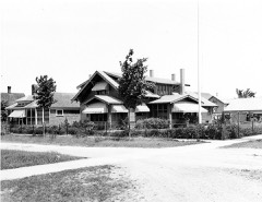 Radka-Bradley Houselisted 1991
- Rogers Theaterlisted 2024
Population over time
2 figuresRogers City grew from 2,827 to 2,850 between 2010 and 2020. These are the recorded population figures Wikidata holds for this place, reached through the Geographic Names Information System number this page is keyed on rather than by name, so they belong to this place and not to another of the same name. Most are census counts, but not all are: an early figure may be a founding or settlement estimate, and an estimate published within five years of a census is left out. The change column is computed, and is left blank where more than 20 years separate a figure from the one before it, because a gap that long is not a change between two counts.
| Year | People | Change |
|---|---|---|
| 2010 | 2,827 | |
| 2020 | 2,850 | +23 (+1%) |
Topographic sheets covering this place
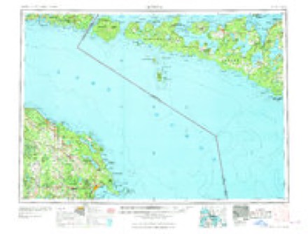
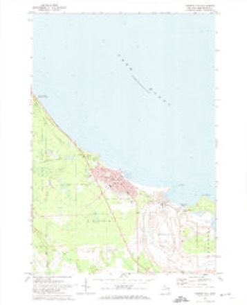
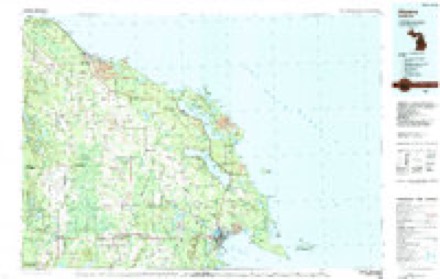
6 surveys from 7 printed sheetsMatched by testing this settlement's coordinate against the published boundary of every sheet in the United States Geological Survey's historical collection. Each opens the scanned sheet at the Survey.
- 1954 USGS Alpena quadrangle1:250000, 2 printings
- 1957 USGS Alpena quadrangle1:250000
- 1958 USGS Alpena quadrangle1:250000
- 1969 USGS Alpena quadrangle1:250000
- 1971 USGS Rogers City quadrangle1:24000
- 1984 USGS Alpena quadrangle1:100000
Fires near this place
9 since 1994Regional context, not property-specific evidence. The federal wildfire occurrence database lists 9 fires within 5 miles of Rogers City between 1994 and 2020, burning about 53 acres in total. None started naturally. None was recorded as arson. Distance is straight-line from the map coordinates, so a fire counted here may appear on a neighbouring settlement's page as well.
| Reported cause | Fires |
|---|---|
| Debris and open burning | 6 |
| Recreation and ceremony | 1 |
| Equipment and vehicle use | 1 |
| Smoking | 1 |
The most recent of them, most recent first, with the day each was reported and the service that recorded it.
| Date | Cause | Size | Reported by | Name on the report |
|---|---|---|---|---|
| 4 July 2018 | Recreation and ceremony | 1.0 acres | Michigan Department of Natural Resources | ROGERS CITY FD 2018F20 - 2018 |
| 25 June 2020 | Smoking | 1.0 acres | Michigan Department of Natural Resources | ROGERS CITY FD 2020F21 - 2020 |
| 8 May 2005 | Debris and open burning | 7.9 acres | Michigan Department of Natural Resources | not named |
| 24 May 2002 | Debris and open burning | 19 acres | Michigan Department of Natural Resources | not named |
| 20 May 2001 | Debris and open burning | 16 acres | Michigan Department of Natural Resources | not named |
| 13 May 2003 | Equipment and vehicle use | 2.0 acres | Michigan Department of Natural Resources | not named |
| 9 April 1994 | Debris and open burning | 1.3 acres | Michigan Department of Natural Resources | not named |
| 24 April 2012 | Debris and open burning | under an acre | Michigan Department of Natural Resources | PRESQUE ISLE 04 |
Settlements close enough to share some of these fires:
Mines and quarries near this place
3 within 5 milesRegional context, not property-specific evidence. The federal mineral resources record lists 3 workings within 5 miles of Rogers City: 2 producers, 1 past producer. 2 still produce. What was taken out: Limestone, High Calcium, Stone, Crushed/Broken, Limestone, General. Distance is straight-line from the map coordinates, so a quarry counted here may appear on a neighbouring settlement's page as well.
| Where | Site | Commodity | Status | Recorded |
|---|---|---|---|---|
| Calcite Mill/Glawe Inc | Limestone, General | Past Producer | ||
| Calcite Plant | Limestone, High Calcium | Producer | 1912 | |
| Calcite Plant | Stone, Crushed/Broken | Producer |
Storms near this place
12 since 1995Regional context, not property-specific evidence. The National Weather Service names Rogers City in 12 storm reports between 1995 and 2019: 6 thunderstorm wind, 5 hail, 1 lightning. No death or injury is recorded in these reports. Each account below is quoted exactly as the forecast office filed it, from the NOAA Storm Events Database, and each date opens the federal record of that event.
| When | Event | Place named | Harm | What the report says |
|---|---|---|---|---|
| September 2019 | Thunderstorm Wind | Rogers City | $2,000 | A single, large tree was downed. |
| July 2002 | Thunderstorm Wind | Rogers City | - | Numerous trees down. |
| June 2001 | Lightning | Rogers City | - | Large tree struck by lightning and downed across road. |
| June 1999 | Thunderstorm Wind | Rogers City | - | Trees down on South Rogers Rd |
| September 1998 | Thunderstorm Wind | Rogers City | - | Gust of 60 mph reported at the 40 mile Point Lighthouse. |
| July 1995 | Thunderstorm Wind | Rogers City | - | Spotter reported trees downed by thunderstorm winds. |
| May 2013 | Hail | Rogers City | - | no account filed |
| June 2011 | Hail | Rogers City | - | no account filed |
| June 2005 | Hail | Rogers City | - | no account filed |
| July 2004 | Hail | Rogers City | - | no account filed |
| July 1999 | Thunderstorm Wind | Rogers City | - | no account filed |
| July 1996 | Hail | Rogers City | - | no account filed |
Nearest settlements
The eight closest, with where each one stands in the county. Distances are straight-line, computed from the Geographic Names Information System coordinates.
| Map | Place | Distance | Sheets |
|---|---|---|---|
| Presque Isle Estates | 1.0 miles | 7 | |
| Calcite | 1.9 miles | 7 | |
| Bruningville | 2.5 miles | 7 | |
| Moltke | 6.0 miles | 7 | |
| Belknap | 6.3 miles | 7 | |
| Hagensville | 6.4 miles | 7 | |
| Liske | 7.3 miles | 7 | |
| Manitou Beach | 7.7 miles | 7 |
Elsewhere
Matched on this settlement's Geographic Names Information System number rather than its name, so it cannot be a different place of the same name in another state.
| Wikipedia article on Rogers City | An encyclopaedic summary. Its text is share-alike, so it is linked here rather than copied. |
| Wikidata item Q1876616 | The structured record the population and elevation above come from. Public domain (CC0). |
Provenance
This settlement is recorded in the Geographic Names Information System as feature 636115. The sheet list is computed by point-in-boundary test against the United States Geological Survey's historical topographic inventory. Both are works of the United States government and carry no copyright under 17 U.S.C. 105.
Wildfire. Short, Karen C. 2022. Spatial wildfire occurrence data for the United States, 1992-2020 [FPA_FOD_20221014]. 6th Edition. Fort Collins, CO: Forest Service Research Data Archive. https://doi.org/10.2737/RDS-2013-0009.6 Collected with United States Government funding and usable without additional permissions or fees.
Mines and quarries. USGS Mineral Resources Data System (MRDS) https://mrdata.usgs.gov/mrds/ A work of the United States government, no copyright under 17 U.S.C. 105.
Storms. NOAA National Centers for Environmental Information, Storm Events Database https://www.ncei.noaa.gov/stormevents/ A work of the United States government, no copyright under 17 U.S.C. 105. Narratives are quoted verbatim from the National Weather Service report and are not edited or summarised.