Block
From the record
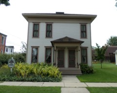
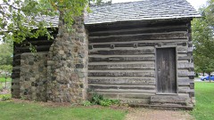
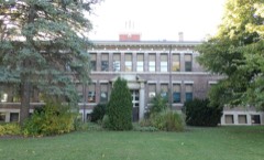
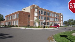
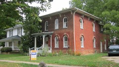
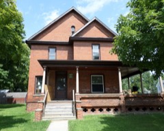
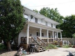
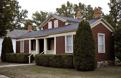
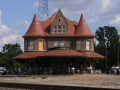
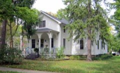
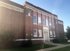
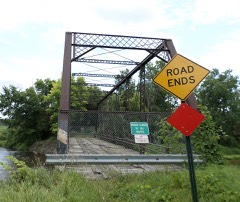
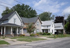
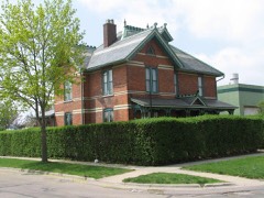
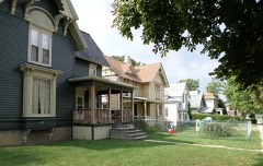
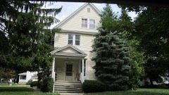
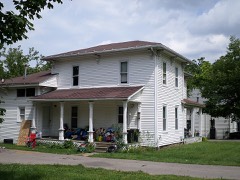
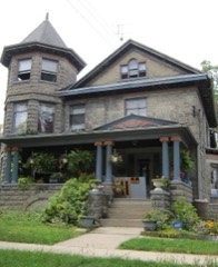
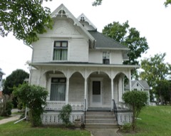
45 National Register listings published here.
Sources: the National Register database, National Park Service
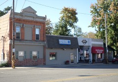
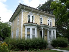
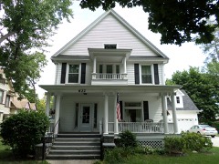
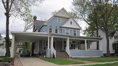
77 topographic sheets cover 33 settlements here, and 45 properties are on the National Register of Historic Places.
45 National Register listings published here.
Sources: the National Register database, National Park Service
Every property in this county listed on the National Register of Historic Places, with the year it was listed and the federal nomination document.
Every wildfire the federal occurrence database records inside this county: 62 of them, burning about 221 acres. 4 started naturally and none was recorded as arson. Each settlement page carries the fires within five miles of it.
| Reported cause | Fires |
|---|---|
| Missing data/not specified/undetermined | 33 |
| Equipment and vehicle use | 21 |
| Natural | 4 |
| Debris and open burning | 3 |
| Recreation and ceremony | 1 |
The five largest, by the area the report gives. None of them was recorded as arson.
| Date | Cause | Size | Reported by | Name on the report |
|---|---|---|---|---|
| 11 April 1996 | Debris and open burning | 80 acres | Michigan Department of Natural Resources | not named |
| 2 April 1994 | Debris and open burning | 60 acres | Michigan Department of Natural Resources | not named |
| 20 November 2015 | Debris and open burning | 17 acres | Michigan Department of Natural Resources | SHIAWASSEE 01 |
| 26 March 2018 | Missing data/not specified/undetermined | 3.0 acres | Michigan Department of Natural Resources | LSW EMERGENCY SERVICES FIRE DIVISION 0000149 - 201 |
| 1 August 2019 | Equipment and vehicle use | 3.0 acres | Michigan Department of Natural Resources | OVID-MIDDLEBURY FD 0000086 - 2019 |
| 26 March 2019 | Equipment and vehicle use | 2.0 acres | Michigan Department of Natural Resources | SHIAWASSEE TOWNSHIP FD 0000026 - 2019 |
| 26 March 2018 | Equipment and vehicle use | 2.0 acres | Michigan Department of Natural Resources | OWOSSO TOWNSHIP FD 0000035 - 2018 |
| 7 May 2018 | Missing data/not specified/undetermined | 1.0 acres | Michigan Department of Natural Resources | LSW EMERGENCY SERVICES FIRE DIVISION 0000223 - 201 |
Every settlement page carries the fires within five miles of it - see the settlement index below.
The NOAA Storm Events Database holds 305 reports for this county, causing no deaths, 17 injuries and about $23,732,280 in recorded property damage. Each settlement page carries the reports that name it.
| Kind of event | Reports |
|---|---|
| Thunderstorm Wind | 201 |
| Hail | 55 |
| Tornado | 35 |
| Lightning | 7 |
| Flood | 4 |
| Flash Flood | 3 |
The most serious of them, by death, then injury, then recorded damage. The accounts are quoted exactly as the forecast office filed them.
| When | Event | Place named | Harm | What the report says |
|---|---|---|---|---|
| August 1978 | Tornado (F2) | not stated | 8 hurt, $250,000 | no account filed |
| June 1971 | Tornado (F1) | not stated | 3 hurt, $250,000 | no account filed |
| April 1976 | Tornado (F2) | not stated | 1 hurt, $2,500,000 | no account filed |
| October 2007 | Tornado (EF1) | Perry | 1 hurt, $400,000 | This tornado developed in Ingham County, just northeast of Mason, and tracked northeastward through the town of Williamston before crossing into Shiawassee County at 2153EST at a point 3.3 miles south-southeast of Perry (see Storm Data for Michigan, Southwest, for more information on the beginning portion of this tornado). In Shiawassee County, the tornado was on the ground for 2 miles and the most significant damage, rated EF1, was concentrated on Lovejoy, Locke, and Braden roads where 4 barns and 3 houses received damage. One house had windows blown out, one farm house had a section of roof taken off, and a modular home had the entire roof taken off. A man in the modular home received a bump on the head, otherwise, no injuries were reported. Total property damages to structures, vehicles, and other property were estimated at $400K. Average path width for the Shiawassee County portion was 100 yards. |
| April 1967 | Tornado (F2) | not stated | 1 hurt, $250,000 | no account filed |
| May 1956 | Tornado (F1) | not stated | 1 hurt, $250,000 | no account filed |
| April 1977 | Tornado (F1) | not stated | 1 hurt, $25,000 | no account filed |
| September 2001 | Lightning | Perry | 1 hurt | A 15-year old Perry Middle School student was hit by lightning while playing soccer on a school field. The boy was rushed to an area hospital for treatment. It is unknown at the time of this publication the condition of the boy. |
| March 2019 | Tornado (EF2) | Perry | $9,750,000 | The tornado touched down around the intersection of Britton Rd and I-69 and produced EF-0 damage up to Bancroft Rd and Newburg Rd with large tree limbs downed and trees snapped. Shoreline Lake Condos had over 10 trailers and mobile homes damaged from falling trees. The tornado continued northeast from Bancroft Rd/Newburg Rd to M-71 just ESE of Vernon producing EF-2 damage. One roof was completely taken off, a second story wall collapsed, and numerous homes with wall damage. The tornado weakened back down to EF-1 as two more home damaged near Bennington Rd Reed Rd. The tornado finally lifted near Riniel Rd just south of Lytle Rd. |
| July 2007 | Hail | Durand | $2,800,000 | Large hail hammered areas in a 3 mile radius around Durand for 50 minutes. The hail, at times, was as big as golf balls. A local newspaper reported $1.8M in hail damages to homes alone. Hundreds of vehicles also took a beating. Local experts estimated damages at an average of $4K per vehicle. This information was used to estimate $1M in total damages to vehicles. Many crops in the area were also destroyed. One farmer estimated $400K in losses to soybeans alone. Total crop damages were estimated at a conservative $2M, bringing the total cost of this hailstorm to nearly $5M. |
| April 1986 | Tornado (F2) | not stated | $2,500,000 | no account filed |
| May 2012 | Flash Flood | West Five Pts | $1,100,000 | Several roads were closed due to flooding as well as bridges being reported washed out. |
| August 2023 | Tornado (EF1) | Perry | $1,000,000 | The tornado touched down three miles west of Perry around Beardslee Rd, just south of W. Britton Rd, and initially traveled through Ruess Rd and Boulder Ln, where downed trees and fallen large tree limbs were observed. The tornado then intensified as it entered into the city of Perry. Damage located around the intersection of Polly St and Lamb St and southeast into the intersection of 2nd St and Washington St consisted of large uprooted trees, sheared large tree limbs, major roofing damage to several outbuildings, and shingle/siding damaging to some residential homes. These locations observed a peak wind around 95 mph with a tornado width around 430 yards. The tornado then weakened while entering the vicinity of Washington and 2nd St |where downed large tree limbs were observed, before lifting just east of this location. |
| May 1998 | Thunderstorm Wind | Henderson | $630,000 | no account filed |
| April 1965 | Tornado (F4) | not stated | $250,000 | no account filed |
| July 1995 | Thunderstorm Wind | Countywide | $200,000 | no account filed |
| May 1998 | Thunderstorm Wind | Laingsburg | $120,000 | no account filed |
| May 2013 | Tornado (EF1) | Bancroft | $100,000 | This tornado formed 4 miles south-southeast of Bancroft and tracked east-northeastward for about 5.5 miles before exiting Shiawaseee County about 3 miles north-northeast of Byron at 2019EST. The tornado continued in Genesee County for another 4 miles, before dissipating at 2024EST. The tornado was rated EF1 with maximum winds to 100 mph. Path width was 550 yards. The tornado started just south of the intersection of Britton and Grand River Roads. The tornado moved northeast near the city of Byron, before exiting Shiawassee County. Many trees were uprooted and snapped. 50 percent of a roof and siding were torn off a home. An old barn was destroyed and another whole roof was torn off. |
| May 1998 | Thunderstorm Wind | Laingsburg | $100,000 | no account filed |
| September 2002 | Lightning | Morrice | $75,000 | Ligthning struck a barn and set it on fire. The barn was heavily damaged. |
| August 1998 | Lightning | Corunna | $75,000 | no account filed |
| May 1998 | Thunderstorm Wind | New Lothrop | $60,000 | no account filed |
| May 1998 | Thunderstorm Wind | Corunna | $60,000 | no account filed |
| April 2026 | Tornado (EF0) | Vernon | $50,000 | The tornado touched down near Newburg Rd just west of Lansing Rd before moving|east across Lansing Rd. EF-0 damage occurred along the path with downed pine|trees and large tree limbs. Some structural damage was seen with siding off|of a home, outbuilding roof panels blown off and collapsed barn doors near|Newburg Rd and Vernon Rd. Peak winds estimated at 80 mph. The tornado lifted just to the southeast of Newburg Rd and S Reed Rd where there were both downed hardwood and pine trees, along with large tree limbs. |
| March 2019 | Tornado (EF0) | Pittsburg | $50,000 | The tornado touched down close to the intersection of Bennington Greens Drive and Innsbrook Drive, snapping pine trees. The tornado continued northeast, crossing M-52 near West Grand River Road. Hardwood trees were observed snapped with large limbs down. The tornado then hit a Farm along South Morrice Road, just south of W Garrison Road. Trees were uprooted and a well built farm outbuilding lost its roof. The tornado snapped additional trees near Vandecarr and Bennington Roads before lifting near the Maple River. |
| July 2019 | Thunderstorm Wind | New Lothrop | $50,000 | Trees blown down throughout town, siding torn off downtown buildings and a window blown out of a building. |
| August 2019 | Tornado (EF0) | New Lothrop | $50,000 | A weak tornado touched down near Allan and New Lothrup roads and tracked off to the northeast, lifting close to North Byron Road between Easton and Johnston roads. Maple trees were observed uprooted along the path. A small garage and pole barn were destroyed. At least 1 home suffered structural damage, with 2 homes suffering mostly shingle damage. A propane tank was also moved by the wind. The maximum peak winds was 85 mph. |
| May 2013 | Tornado (EF0) | Morrice | $50,000 | The tornado was rated EF0 with maximum winds to 75 mph. Path width was 100 yards and path length 1/2 mile. The tornado started at Bethemy Cemetary and moved northeast, ending at West Britton and Hidden Ridge Roads. Trees were uprooted and many tree limbs were downed. |
| July 2012 | Thunderstorm Wind | Corunna | $50,000 | Trees and power lines reported down across the county. |
| August 2007 | Tornado (EF0) | Juddville | $50,000 | Damage from this brief tornado was consistent with EF0 scale damage with maximum winds near 75 mph. There was substantial damage to a barn with a portion of its metal roof peeled off and the trusses damaged. Another barn had its shingles peeled off. There were also numerous large tree branches down along the short path of the tornado. |
| November 2005 | Lightning | Vernon | $50,000 | Lightning struck a home on M71, surging through the entire house. The interior was a total loss because of smoke damage, but the house was still standing. |
| September 2002 | Thunderstorm Wind | Morrice | $50,000 | A newspaper reported that several large trees and tree limbs were blown down in thunderstorm winds, some of which fell onto homes. |
| September 2008 | Flood | Shaftsburg | $50,000 | no account filed |
| July 2024 | Lightning | Burton | $35,000 | Lightning struck a power pole, with the attached electrical wire leading to a house causing a fire. |
| May 2013 | Tornado (EF0) | Shaftsburg | $30,000 | The Tornado was rated EF0 with maximum winds to 75 mph. Path width was 60 yards and path length 3/4 mile. The tornado started at Lansing and Warner roads, and followed lansing road and then crossed I-69. The tornado ended at the entrance ramp of the highway rest area. Many trees were uprooted and shingles were torn off a church. |
| May 1998 | Thunderstorm Wind | Bancroft | $30,000 | no account filed |
| May 2011 | Tornado (EF1) | Shaftsburg | $25,000 | A tornado which originated in Ingham county crossed into Shiawassee county near LoveJoy and Locke Roads at 528 PM, tracking northeast for around three miles, ending at Beard and Ruppert Roads at 532 pm. The damage path was about 100 yards wide. Damage was mostly soft and hard wood trees uprooted and snapped, with estimated max wind speed of 90 mph, making this Tornado an EF1. |
| July 2010 | Thunderstorm Wind | New Lothrop | $25,000 | Numerous trees were reported blown down, with a few landing on houses. |
| May 2007 | Thunderstorm Wind | Byron | $25,000 | TV media reported trees down, with at least one falling through a home. |
| March 2007 | Lightning | Bancroft | $25,000 | no account filed |
| November 1989 | Tornado (F1) | not stated | $25,000 | no account filed |
| April 1976 | Tornado (F1) | not stated | $25,000 | no account filed |
| August 1975 | Tornado (F2) | not stated | $25,000 | no account filed |
| August 2023 | Thunderstorm Wind | West Five Pts | $20,000 | A large tree was reported to have fallen on a house with power outages also reported around Owosso. |
| July 2010 | Thunderstorm Wind | Bancroft | $20,000 | Trees were blown down and minor shingle damage reported. |
| May 2007 | Thunderstorm Wind | Vernon | $15,000 | Law enforcement reported that thunderstorm winds lifted a van and flipped it into the median. |
| September 2002 | Thunderstorm Wind | Laingsburg | $15,000 | Trained spotters and broadcast media reported several large trees blown down, some of which blocked roadways. One tree limb landed on a house, while another house lost its chimney. |
| June 2015 | Tornado (EF0) | Durand | $10,000 | Media reports indicated damage to a barn and a few trees near Prior and Byron Roads in Vernon Township in eastern Shiawassee County. It was determined the damage resulted from a weak EF-0 tornado with maximum winds estimated at 65 mph. The tornado was on the ground for a minute or less as it traveled eastward. |
| April 2014 | Thunderstorm Wind | Byron | $10,000 | Roof peeled of gymnasium. |
| May 2011 | Thunderstorm Wind | Perry | $10,000 | Numerous trees and tree limbs were blown down. |
| June 2011 | Thunderstorm Wind | Morrice | $10,000 | Two large maple trees were blown down, along with vinyl siding off a home and large shed flipped over. |
| May 1999 | Thunderstorm Wind | Owosso | $10,000 | no account filed |
| July 1998 | Thunderstorm Wind | Carland | $9,000 | no account filed |
| July 1999 | Thunderstorm Wind | Owosso | $8,000 | no account filed |
| November 1998 | Thunderstorm Wind | Perry | $8,000 | no account filed |
| April 2001 | Thunderstorm Wind | Owosso | $6,000 | Trees and power lines were downed. |
| June 2000 | Thunderstorm Wind | Durand | $6,000 | no account filed |
| August 2000 | Thunderstorm Wind | Owosso | $5,000 | Power lines were blown down, resulting in an electrical fire. |
| July 2000 | Thunderstorm Wind | Bancroft | $5,000 | no account filed |
| November 1998 | Thunderstorm Wind | Owosso | $5,000 | no account filed |
The Survey's mineral resources record lists 19 workings inside this county. 15 still produce and 4 are closed or unrecorded. Each settlement page carries the workings within five miles of it.
| Commodity | Workings |
|---|---|
| Sand and Gravel, Construction | 16 |
| Fire Clay (Refractory) | 2 |
| Clay | 1 |
The least common of them first, because a county's hundredth gravel pit says nothing its first ten did not.
| Where | Site | Commodity | Status | Recorded |
|---|---|---|---|---|
| Michigan Brick Pit and Mill | Clay | Producer | ||
| New Corunna Brick Co Clay Shale Pit | Fire Clay (Refractory) | Past Producer | ||
| New Egy.And Aetna Port.Clay Pit | Fire Clay (Refractory) | Past Producer | ||
| Blinja & Hammond Pit & Mill | Sand and Gravel, Construction | Producer | ||
| Fisher Gravel Pit | Sand and Gravel, Construction | Producer | ||
| Fred Fitzgerald Gravel Co. Pit | Sand and Gravel, Construction | Producer | ||
| Fred Fitzgerald Gravel Co. Pit | Sand and Gravel, Construction | Producer | ||
| Fred Fitzgerald Sand and Gravel Pit | Sand and Gravel, Construction | Producer | ||
| Fuoss Gravel Co. Pit | Sand and Gravel, Construction | Producer | ||
| Fuoss Gravel Co. Pit | Sand and Gravel, Construction | Producer | ||
| Fuoss Gravel Co. Pit | Sand and Gravel, Construction | Producer | ||
| Grand River Gravel Co. Pit | Sand and Gravel, Construction | Past Producer | ||
| Grand River Gravel Co. Pit | Sand and Gravel, Construction | Past Producer | ||
| Grand River Pit | Sand and Gravel, Construction | Producer | ||
| Lennon Sand and Gravel Pit and Mill | Sand and Gravel, Construction | Producer | ||
| Orlando Pit and Mill | Sand and Gravel, Construction | Producer | ||
| Owosso Sand and Gravel Pit | Sand and Gravel, Construction | Producer | ||
| Polhamus Sand and Gravel Pit & Mill | Sand and Gravel, Construction | Producer | ||
| Shiawassee County Road Comm. Pit | Sand and Gravel, Construction | Producer |
Named settlements recorded in the Geographic Names Information System, each with the topographic sheets covering it. Villages, hamlets and abandoned places alike. Each is shown with the nearest named watercourse or landform and the survey quadrangle it falls on.
Burns township · 48418 · On South Branch Shiawassee River · Byron quadrangle
14 sheets, 1922 to 1985
New Haven township · 48867 · On Sixmile Creek · Owosso North quadrangle
15 sheets, 1917 to 1985
Hazelton township · 48817 · On Rush Creek · New Lothrop quadrangle
14 sheets, 1919 to 1990
Laingsburg city · 48848 · On Vermilion Creek · Laingsburg quadrangle
13 sheets, 1928 to 1983
New Haven township · 48867 · On Sixmile Creek · Owosso North quadrangle
15 sheets, 1917 to 1985
Hazelton township · 48460 · On Porter Creek · New Lothrop quadrangle
14 sheets, 1919 to 1990