 Block
Ann Arbor, Michigan
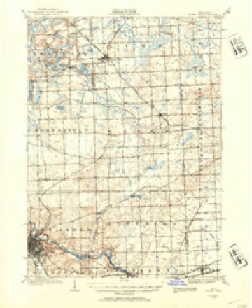
22 topographic sheets cover this place, the earliest surveyed in 1902 and the latest in 1989. It stands in Ann Arbor City. It lies in ZIP code area 48104. The Survey maps it on the Ann Arbor East quadrangle. 123,851 people lived here at the 2020 count. It stands 840 feet above sea level.
Research this city
On record in Ann Arbor
Buildings and businesses the archive holds for this place. Each opens its own page, with the source record it came from.
On the National Register 12 of 38 shown
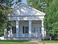 William Anderson Houselisted 1982
 Ann Arbor Central Fire Stationlisted 1972
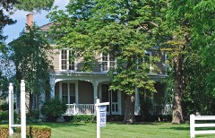 Bell-Spalding Houselisted 1990
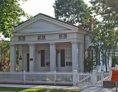 Henry Bennett Houselisted 1973
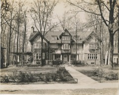 Delta Upsilon Fraternity Houselisted 1995
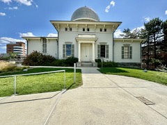 Detroit Observatorylisted 1973
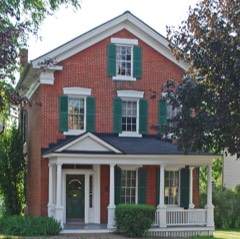 Thomas Earl Houselisted 1992
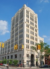 First National Bank Buildinglisted 1982
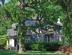 Henry S. Frieze Houselisted 1972
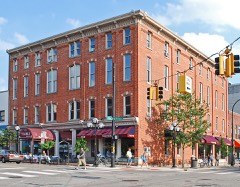 Germania Building Complexlisted 1983
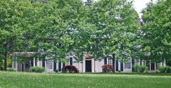 Arnold and Gertrude Goss Houselisted 2006
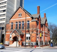 Harris Halllisted 1982
Population over time
8 figuresAnn Arbor grew from 5,097 to 123,851 between 1860 and 2020. These are the recorded population figures Wikidata holds for this place, reached through the Geographic Names Information System number this page is keyed on rather than by name, so they belong to this place and not to another of the same name. Most are census counts, but not all are: an early figure may be a founding or settlement estimate, and an estimate published within five years of a census is left out. The change column is computed, and is left blank where more than 20 years separate a figure from the one before it, because a gap that long is not a change between two counts.
| Year | People | Change |
|---|---|---|
| 1860 | 5,097 | |
| 1870 | 7,363 | +2,266 (+44%) |
| 1880 | 8,061 | +698 (+9%) |
| 1890 | 9,431 | +1,370 (+17%) |
| 1900 | 14,509 | +5,078 (+54%) |
| 1910 | 14,817 | +308 (+2%) |
| 2010 | 113,934 | |
| 2020 | 123,851 | +9,917 (+9%) |
Topographic sheets covering this place
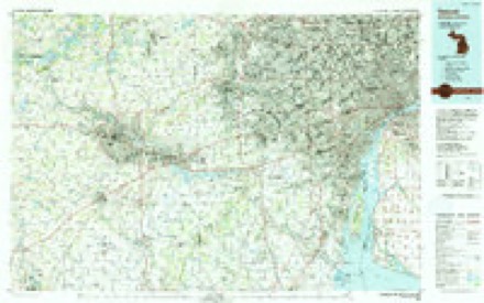
10 surveys from 22 printed sheetsMatched by testing this settlement's coordinate against the published boundary of every sheet in the United States Geological Survey's historical collection. Each opens the scanned sheet at the Survey.
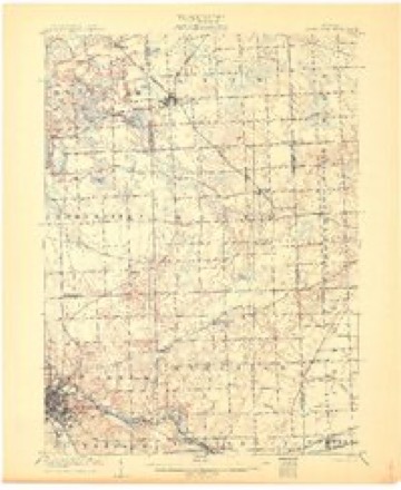
- 1902 USGS South Lyon quadrangle1:62500
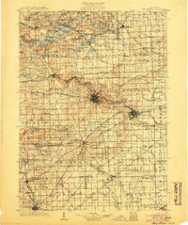
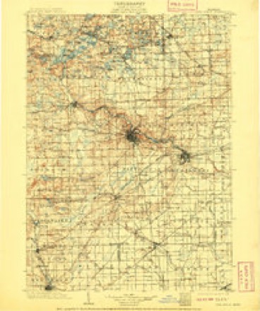
- 1904 USGS Ann Arbor quadrangle1:125000, 2 printings
- 1906 USGS South Lyon quadrangle1:62500, 5 printings
- 1908 USGS Ann Arbor quadrangle1:125000
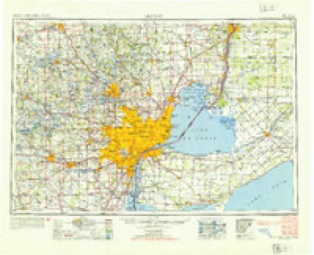
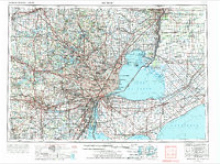
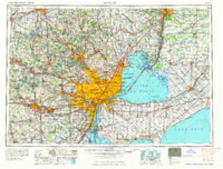
- 1954 USGS Detroit quadrangle1:250000
- 1961 USGS Detroit quadrangle1:250000, 2 printings
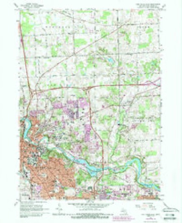
- 1965 USGS Ann Arbor East quadrangle1:24000, 7 printings
- 1965 USGS Detroit quadrangle1:250000
- 1985 USGS Detroit quadrangle1:100000
- 1989 USGS Detroit quadrangle1:100000
Fires near this place
33 since 2018Regional context, not property-specific evidence. The federal wildfire occurrence database lists 33 fires within 5 miles of Ann Arbor between 2018 and 2020, burning about 34 acres in total. 3 started naturally. None was recorded as arson. Distance is straight-line from the map coordinates, so a fire counted here may appear on a neighbouring settlement's page as well.
| Reported cause | Fires |
|---|---|
| Equipment and vehicle use | 14 |
| Missing data/not specified/undetermined | 13 |
| Natural | 3 |
| Smoking | 2 |
| Recreation and ceremony | 1 |
The most recent of them, most recent first, with the day each was reported and the service that recorded it.
| Date | Cause | Size | Reported by | Name on the report |
|---|---|---|---|---|
| 6 September 2019 | Missing data/not specified/undetermined | 1.0 acres | Michigan Department of Natural Resources | ANN ARBOR FD 751468 - 2019 |
| 4 August 2018 | Missing data/not specified/undetermined | 1.0 acres | Michigan Department of Natural Resources | PITTSFIELD TOWNSHIP DPS 0821304 - 2018 |
| 29 August 2018 | Missing data/not specified/undetermined | 1.0 acres | Michigan Department of Natural Resources | ANN ARBOR FD 0823638 - 2018 |
| 9 July 2018 | Missing data/not specified/undetermined | 1.0 acres | Michigan Department of Natural Resources | ANN ARBOR FD 0818772 - 2018 |
| 5 July 2018 | Equipment and vehicle use | 1.0 acres | Michigan Department of Natural Resources | ANN ARBOR FD 0818413 - 2018 |
| 26 July 2018 | Equipment and vehicle use | 1.0 acres | Michigan Department of Natural Resources | PITTSFIELD TOWNSHIP DPS 0820465 - 2018 |
| 25 July 2018 | Equipment and vehicle use | 1.0 acres | Michigan Department of Natural Resources | ANN ARBOR FD 0820309 - 2018 |
| 19 July 2018 | Equipment and vehicle use | 1.0 acres | Michigan Department of Natural Resources | ANN ARBOR FD 0819685 - 2018 |
Settlements close enough to share some of these fires:
Mines and quarries near this place
8 within 5 milesRegional context, not property-specific evidence. The federal mineral resources record lists 8 workings within 5 miles of Ann Arbor: 5 producers, 3 past producers. 5 still produce. What was taken out: Sand and Gravel, Construction, Emery. Distance is straight-line from the map coordinates, so a quarry counted here may appear on a neighbouring settlement's page as well.
| Where | Site | Commodity | Status | Recorded |
|---|---|---|---|---|
| Ervin Indus Inc--Ann Arbor, Mich. | Emery | Producer | ||
| Killins Pit | Sand and Gravel, Construction | Producer | ||
| Kruse Gravel Pit | Sand and Gravel, Construction | Producer | ||
| Liberty Pit and Mill | Sand and Gravel, Construction | Producer | ||
| Maple Pit | Sand and Gravel, Construction | Producer | ||
| O E Gooding & Co. Pit | Sand and Gravel, Construction | Past Producer | ||
| O E Gooding & Co. Pit | Sand and Gravel, Construction | Past Producer | ||
| O E Gooding & Co. Pit | Sand and Gravel, Construction | Past Producer |
Storms near this place
60 of 108 shownRegional context, not property-specific evidence. The National Weather Service names Ann Arbor in 108 storm reports between 1994 and 2026: 57 thunderstorm wind, 39 hail, 5 lightning, 4 flash flood. The reports record 1 death and 5 injuries. Each account below is quoted exactly as the forecast office filed it, from the NOAA Storm Events Database, and each date opens the federal record of that event.
| When | Event | Place named | Harm | What the report says |
|---|---|---|---|---|
| September 2002 | Lightning | Ann Arbor | 1 killed, 2 hurt | Three men were installing a roof at an apartment complex under construction when they were struck by lightning. Two of the men were injured, while the third was later pronounced dead. |
| April 2000 | Lightning | Ann Arbor | 2 hurt | Two 18 year old men were struck by lightning and briefly hospitalized. |
| July 2019 | Thunderstorm Wind | Ann Arbor | 1 hurt | Tents were blown down at the Ann Arbor Art Fair which resulted in one injury. |
| July 1998 | Thunderstorm Wind | Ann Arbor | $4,500,000 | no account filed |
| December 2000 | Lightning | Ann Arbor | $1,100,000 | A lightning strike ignited a large home just northwest of Ann Arbor. The home was destroyed by fire. |
| August 1998 | Flash Flood | Ann Arbor | $800,000 | no account filed |
| April 2026 | Tornado (EF1) | Ann Arbor | $500,000 | The tornado started in the area of Jackson Ave near Interstate 94. It|moved southeast across the interstate and then over Veterans Memorial|Park where it produced EF-1 damage. This damage included numerous|uprooted and snapped trees, along with snapped stadium light poles.|The greatest concentration of EF-1 damage occurred from Jackson Ave though|Veterans Memorial Park and into the nearby neighborhoods. Peak winds estimated at 110 mph. The tornado continued through residential areas where there were numerous trees snapped and large downed tree limbs. The damage became more sporadic as is continued to the southeast through Virginia Park. A building north of Bach Elementary lost a portion of its roof, before the tornado lifted near W William St and 4th St. Once the tornado had lifted, there was additional damage that occurred from straight line winds at the Yost Ice Arena where the metal roof panels had been pulled from the building. |
| June 2006 | Lightning | Ann Arbor | $200,000 | A lightning strike tore a large hole in the roof of an upscale home, causing extensive damage. Much of the upstairs portion of the home was destroyed. Total Property damage was estimated at $200K based on pictures included in the newspaper. |
| December 1998 | Thunderstorm Wind | Ann Arbor | $175,000 | no account filed |
| May 2014 | Thunderstorm Wind | Ann Arbor | $100,000 | Widespread trees down, some of which fell onto homes which caused structural damage. |
| September 2000 | Flash Flood | Ann Arbor | $40,000 | Water levels in Ford Lake, and its inflowing streams, resulted in erosion of the roadway along Ford Lake Dam. In addition, street flooding in the city of Ypsilanti was widespread. Ann Arbor had numerous stalled cars and flooded intersections, including a foot of water over Huron Street and Washtenaw Avenue. The heavy rain indirectly contributed to a fatality, when a female pedestrian was struck and killed by a University of Michigan bus during a blinding downpour. |
| July 1999 | Thunderstorm Wind | Ann Arbor | $35,000 | no account filed |
| May 2000 | Thunderstorm Wind | Ann Arbor | $30,000 | no account filed |
| June 2006 | Thunderstorm Wind | Ann Arbor | $12,000 | Law Enforcement reported 6 utility poles blown down. |
| April 2001 | Thunderstorm Wind | Ann Arbor | $10,000 | A tree and several large limbs were downed onto State Street, landing on two cars. |
| May 2014 | Thunderstorm Wind | Ann Arbor | $5,000 | A large tree was uprooted and fell onto detached garage. |
| April 2013 | Thunderstorm Wind | Ann Arbor | $5,000 | Shingles blown off roofs. |
| June 2006 | Thunderstorm Wind | Ann Arbor | $4,000 | Law Enforcement reported a tree blown down on car. |
| March 2025 | Thunderstorm Wind | Ann Arbor | $1,000 | Power lines downed and a large tree on fire. |
| April 2026 | Thunderstorm Wind | Ann Arbor | - | Trees and power lines were reported down across parts of the county, especially in the Ann Arbor and Ypsilanti areas. |
| April 2026 | Thunderstorm Wind | Ann Arbor | - | Measured at the University of Michigan Staduim. |
| March 2025 | Thunderstorm Wind | Ann Arbor | - | Pea to half inch size hail also reported. |
| August 2024 | Thunderstorm Wind | Ann Arbor | - | Trees and power lines reported down across many parts of Washtenaw County, but especially over Scio Township and the Ann Arbor area. A few trees landed on houses and cars. |
| June 2024 | Thunderstorm Wind | Ann Arbor | - | Tree reported down on the road. |
| July 2023 | Thunderstorm Wind | Ann Arbor | - | A large tree limb fell on the roof of a house. |
| July 2023 | Thunderstorm Wind | Ann Arbor | - | A large tree was reported blown down. |
| August 2023 | Thunderstorm Wind | Ann Arbor | - | Large trees reported blown down on cars and streets. |
| August 2021 | Thunderstorm Wind | Ann Arbor | - | Numerous small trees and branches reported down in the Ann Arbor area. |
| June 2020 | Thunderstorm Wind | Ann Arbor | - | Large tree reported down on the road. |
| June 2020 | Thunderstorm Wind | Ann Arbor | - | A large tree limb was reported down. |
| June 2020 | Thunderstorm Wind | Ann Arbor | - | A tree was reported down. |
| September 2019 | Thunderstorm Wind | Ann Arbor | - | A tree was reported blown down. |
| June 2015 | Thunderstorm Wind | Ann Arbor | - | Several uprooted trees and large limbs down. |
| August 2014 | Thunderstorm Wind | Ann Arbor | - | A spotter estimated a 60 mph thunderstorm wind gust. |
| May 2014 | Thunderstorm Wind | Ann Arbor | - | Numerous large tree limbs down on the University of Michigan golf course. |
| July 2014 | Thunderstorm Wind | Ann Arbor | - | Fourteen inch diameter tree limb reported down. |
| July 2013 | Thunderstorm Wind | Ann Arbor | - | Six inch diameter tree limbs reported down. |
| September 2011 | Thunderstorm Wind | Ann Arbor | - | A 4 inch diameter tree limb was reported down. |
| January 2008 | Thunderstorm Wind | Ann Arbor | - | A trained spotter reported large tree limbs down. |
| May 2007 | Thunderstorm Wind | Ann Arbor | - | Official National Weather Service observing equipment measured a 66 MPH wind gust. |
| August 2007 | Thunderstorm Wind | Ann Arbor | - | A trained spotter reported a tree down and estimated the wind gusts at 60 MPH. |
| March 2006 | Thunderstorm Wind | Ann Arbor | - | A 12 inch diameter tree fell at the Elks Club in Ann Arbor. |
| June 2006 | Thunderstorm Wind | Ann Arbor | - | National Weather Service surface observing equipment measured a wind gust of 65 MPH. |
| May 2006 | Thunderstorm Wind | Ann Arbor | - | Thunderstorm winds downed several trees near Ann Arbor. |
| September 2006 | Tornado (F0) | Ann Arbor | - | Washtenaw County Emergency Manager, trained spotters, and Michigan State Police all reported a weak tornado at the I94 and US23 interchange. The Tornado/cold air funnel was very brief and just kicked up some dirt with wind speeds estimated between 40 and 50 MPH. There were no injuries and no damages. |
| May 2005 | Thunderstorm Wind | Ann Arbor | - | A trained weather spotter reported a 12 inch diameter tree and large tree limbs blown down. |
| June 2005 | Thunderstorm Wind | Ann Arbor | - | Tree limbs were reported blown down on the University of Michigan campus. |
| September 2005 | Thunderstorm Wind | Ann Arbor | - | ASOS measured a gust of 59 MPH. |
| May 2004 | Thunderstorm Wind | Ann Arbor | - | A trained weather spotter reported numerous trees blown down. |
| May 2004 | Thunderstorm Wind | Ann Arbor | - | Ten utility poles were toppled along Wagner Road between Scio Church and Ellsworth Roads in Lodi Township. |
| May 2004 | Flash Flood | Ann Arbor | - | Three roads were closed due to flooding in Ann Arbor. |
| May 2004 | Thunderstorm Wind | Ann Arbor | - | A large tree toppled and blocked the eastbound lane of Dexter Avenue at the North Maple Road intersection. |
| May 2004 | Thunderstorm Wind | Ann Arbor | - | A trained spotter estimated a 60 mph thunderstorm wind gust. |
| May 2004 | Thunderstorm Wind | Ann Arbor | - | A trained spotter estimated a 80 mph thunderstorm wind gust. |
| August 2003 | Thunderstorm Wind | Ann Arbor | - | A trained weather spotter reported a 1 foot diameter tree down. |
| August 2003 | Thunderstorm Wind | Ann Arbor | - | Local law enforcement reported numerous power lines down. |
| August 2003 | Thunderstorm Wind | Ann Arbor | - | Central dispatch reported trees down. |
| July 2003 | Thunderstorm Wind | Ann Arbor | - | A trained spotter reported trees blown down. |
| October 2002 | Thunderstorm Wind | Ann Arbor | - | Trained spotters reported several trees and power lines blown down in thunderstorm winds. |
| August 2000 | Flash Flood | Ann Arbor | - | Heavy downpours resulted in substantial street flooding in the Ann Arbor-Ypsilanti area. Up to two inches of rain fell between 9 and 10 pm EDT. |
Nearest settlements
The eight closest, with where each one stands in the county. Distances are straight-line, computed from the Geographic Names Information System coordinates.
| Map | Place | Distance | Sheets |
|---|---|---|---|
| Geddes | 3.1 miles | 22 | |
| Foster | 4.2 miles | 17 | |
| Pittsfield | 4.2 miles | 17 | |
| Barton Hills | 4.2 miles | 17 | |
| Dixboro | 4.7 miles | 22 | |
| Superior | 4.7 miles | 22 | |
| Northfield | 5.0 miles | 22 | |
| Delhi Mills | 6.1 miles | 17 |
Elsewhere
Matched on this settlement's Geographic Names Information System number rather than its name, so it cannot be a different place of the same name in another state.
| Wikipedia article on Ann Arbor | An encyclopaedic summary. Its text is share-alike, so it is linked here rather than copied. |
| Wikidata item Q485172 | The structured record the population and elevation above come from. Public domain (CC0). |
Provenance
This settlement is recorded in the Geographic Names Information System as feature 620133. The sheet list is computed by point-in-boundary test against the United States Geological Survey's historical topographic inventory. Both are works of the United States government and carry no copyright under 17 U.S.C. 105.
Wildfire. Short, Karen C. 2022. Spatial wildfire occurrence data for the United States, 1992-2020 [FPA_FOD_20221014]. 6th Edition. Fort Collins, CO: Forest Service Research Data Archive. https://doi.org/10.2737/RDS-2013-0009.6 Collected with United States Government funding and usable without additional permissions or fees.
Mines and quarries. USGS Mineral Resources Data System (MRDS) https://mrdata.usgs.gov/mrds/ A work of the United States government, no copyright under 17 U.S.C. 105.
Storms. NOAA National Centers for Environmental Information, Storm Events Database https://www.ncei.noaa.gov/stormevents/ A work of the United States government, no copyright under 17 U.S.C. 105. Narratives are quoted verbatim from the National Weather Service report and are not edited or summarised.