 Block
Burnips, Michigan
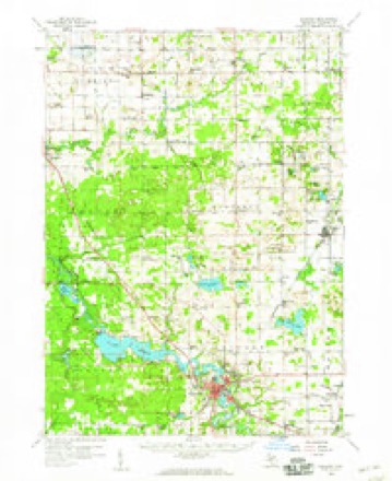
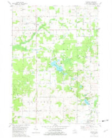
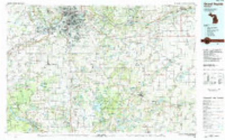
9 topographic sheets cover this place, the earliest surveyed in 1958 and the latest in 1984. It stands in Salem Township. It lies in ZIP code area 49323. The Survey maps it on the Burnips quadrangle. It stands 659 feet above sea level.
Topographic sheets covering this place
6 surveys from 9 printed sheetsMatched by testing this settlement's coordinate against the published boundary of every sheet in the United States Geological Survey's historical collection. Each opens the scanned sheet at the Survey.
- 1958 USGS Allegan quadrangle1:62500, 2 printings
- 1958 USGS Grand Rapids quadrangle1:250000, 2 printings
- 1961 USGS Grand Rapids quadrangle1:250000
- 1962 USGS Grand Rapids quadrangle1:250000, 2 printings
- 1981 USGS Burnips quadrangle1:24000
- 1984 USGS Grand Rapids quadrangle1:100000
What happened here
An account from the chapter on Salem township. The inset identifies its exact source book and publication year.
A River Calamity
On the 25th of July, 1841, John Billings, with his wife and six children, the wife of McLaughlin the ship-builder, with her child, R. A. McDonald, and an Irishman (name unknown) were passing up the river in a small boat, when the craft accidentally capsized, and five of the twelve persons on board were drowned, viz.
In the county-history sources
32,001 words on this townshipHistory of Allegan and Barry Counties, Michigan, published 1880 has no passage naming this settlement, which was common for smaller places. Its township is covered in full.
The chapter on Salem Township covers the township.
Read the chapter on Salem Township - 32,001 words.
Fires near this place
8 since 1995Regional context, not property-specific evidence. The federal wildfire occurrence database lists 8 fires within 5 miles of Burnips between 1995 and 2020, burning about 7 acres in total. 1 started naturally. None was recorded as arson. Distance is straight-line from the map coordinates, so a fire counted here may appear on a neighbouring settlement's page as well.
| Reported cause | Fires |
|---|---|
| Equipment and vehicle use | 3 |
| Missing data/not specified/undetermined | 3 |
| Natural | 1 |
| Debris and open burning | 1 |
The most recent of them, most recent first, with the day each was reported and the service that recorded it.
| Date | Cause | Size | Reported by | Name on the report |
|---|---|---|---|---|
| 13 September 1995 | Debris and open burning | under an acre | Michigan Department of Natural Resources | not named |
| 15 August 2020 | Equipment and vehicle use | 1.0 acres | Michigan Department of Natural Resources | OVERISEL FD 2000087 - 2020 |
| 9 July 2018 | Natural | 1.0 acres | Michigan Department of Natural Resources | SALEM TOWNSHIP FD 0000061 - 2018 |
| 5 May 2018 | Missing data/not specified/undetermined | 1.0 acres | Michigan Department of Natural Resources | DORR TOWNSHIP FD 0000067 - 2018 |
| 3 April 2019 | Missing data/not specified/undetermined | 1.0 acres | Michigan Department of Natural Resources | SALEM TOWNSHIP FD 0000022 - 2019 |
| 26 April 2018 | Missing data/not specified/undetermined | 1.0 acres | Michigan Department of Natural Resources | SALEM TOWNSHIP FD 0000037 - 2018 |
| 26 March 2019 | Equipment and vehicle use | 1.0 acres | Michigan Department of Natural Resources | SALEM TOWNSHIP FD 0000021 - 2019 |
| 15 March 2020 | Equipment and vehicle use | 1.0 acres | Michigan Department of Natural Resources | SALEM TOWNSHIP FD 0000014 - 2020 |
Settlements close enough to share some of these fires:
Mines and quarries near this place
3 within 5 milesRegional context, not property-specific evidence. The federal mineral resources record lists 3 workings within 5 miles of Burnips: 3 past producers. None of them still produces. What was taken out: Sand and Gravel, Construction, Calcium. Distance is straight-line from the map coordinates, so a quarry counted here may appear on a neighbouring settlement's page as well.
| Where | Site | Commodity | Status | Recorded |
|---|---|---|---|---|
| Gerald Arnsman Marl Pit | Calcium | Past Producer | ||
| Flemming Gravel Co. Pit | Sand and Gravel, Construction | Past Producer | ||
| Pickett and Schreur, Inc. Pit | Sand and Gravel, Construction | Past Producer |
Storms near this place
8 since 1999Regional context, not property-specific evidence. The National Weather Service names Burnips in 8 storm reports between 1999 and 2025: 4 thunderstorm wind, 3 tornado, 1 hail. No death or injury is recorded in these reports. Each account below is quoted exactly as the forecast office filed it, from the NOAA Storm Events Database, and each date opens the federal record of that event.
| When | Event | Place named | Harm | What the report says |
|---|---|---|---|---|
| April 2011 | Tornado (EF0) | Burnips | $1,000,000 | The tornado touchdown at a landscaping company where it tore a small section of roof of a warehouse building, knocked over several trailers, and blew the windows out of several cars. The tornado then struck a row of 100 yard long turkey pole barns. An approximately 100 ft section of one barn was uplifted and the collapsed. The roof was torn off about a 50 ft section of another barn. Further northeast, several small outbuildings were destroyed and trees were uprooted. Several houses in the path received minor roof and soffit damage with two garage doors damaged. The tornado lifted after partially destroying a 75 year-old 40 ft by 90 ft barn. |
| August 2021 | Tornado (EF0) | Burnips | $300,000 | An NWS storm survey determined that one outbuilding was destroyed near 26th street with metal roofing debris scattered along the path. A large irrigation structure was knocked over and damaged east of 26th street. Tornadic damage to trees was noted throughout the path. Intermittent roofing damage was also observed. |
| May 1999 | Thunderstorm Wind | Burnips | $10,000 | Strong winds downed power lines over a house... resulting in a small fire. |
| November 2005 | Hail | Burnips | $5,000 | Three quarters inch diameter hail was reported in Burnips. |
| September 2001 | Thunderstorm Wind | Burnips | $2,000 | no account filed |
| May 2025 | Tornado (EF1) | Burnips | - | The tornado developed near Sandy Pines campground and became more intense|near the intersection of 138th Avenue and 24th Street. Primary|damage consisted of numerous trees uprooted and snapped. Some of |the more significant damage and most intense winds occurred |around Hilltop View Drive and 21st Street. |
| July 2022 | Thunderstorm Wind | Burnips | - | A peak wind gust to 64 mph recorded by a mesonet station was reported by the public in New Salem. |
| July 2009 | Thunderstorm Wind | Burnips | - | The National Weather Service in Grand Rapids conducted a survey of the storms that moved across portions of Allegan County. As a result of the survey, it was determined that straight line winds of up to 60 mph produced widespread tree damage. The damage began between 5:57 am EDT and 6:05 am EDT. Strong to severe winds lasted up to 15 minutes at some locations, according to eyewitness reports. This is consistent with straight-line wind damage.||Most of the damage was confined to the Sandy Pines Resort southeast of Burnips. Numerous tree limbs were scattered throughout this location. The hardest hit area was Phase III of Sandy Pines where a few uprooted trees and numerous broken tree limbs had fallen. A large tree fell on an unoccupied camping trailer, resulting in substantial damage to the trailer. No injuries were reported from these thunderstorm winds. |
Nearest settlements
The eight closest, with where each one stands in the county. Distances are straight-line, computed from the Geographic Names Information System coordinates.
| Map | Place | Distance | Sheets |
|---|---|---|---|
| New Salem | 2.5 miles | 9 | |
| Sandy Pines | 3.4 miles | 9 | |
| Oakland | 4.3 miles | 10 | |
| Bentheim | 4.5 miles | 10 | |
| Diamond Springs | 4.7 miles | 10 | |
| Dorr | 6.2 miles | 9 | |
| Monterey Center | 6.5 miles | 9 | |
| Hilliards | 7.1 miles | 9 |
Elsewhere
Matched on this settlement's Geographic Names Information System number rather than its name, so it cannot be a different place of the same name in another state.
| Wikidata item Q122555152 | The structured record the population and elevation above come from. Public domain (CC0). |
Provenance
This settlement is recorded in the Geographic Names Information System as feature 622293. The sheet list is computed by point-in-boundary test against the United States Geological Survey's historical topographic inventory. Both are works of the United States government and carry no copyright under 17 U.S.C. 105.
Wildfire. Short, Karen C. 2022. Spatial wildfire occurrence data for the United States, 1992-2020 [FPA_FOD_20221014]. 6th Edition. Fort Collins, CO: Forest Service Research Data Archive. https://doi.org/10.2737/RDS-2013-0009.6 Collected with United States Government funding and usable without additional permissions or fees.
Mines and quarries. USGS Mineral Resources Data System (MRDS) https://mrdata.usgs.gov/mrds/ A work of the United States government, no copyright under 17 U.S.C. 105.
Storms. NOAA National Centers for Environmental Information, Storm Events Database https://www.ncei.noaa.gov/stormevents/ A work of the United States government, no copyright under 17 U.S.C. 105. Narratives are quoted verbatim from the National Weather Service report and are not edited or summarised.