 Block
Chassell, Michigan
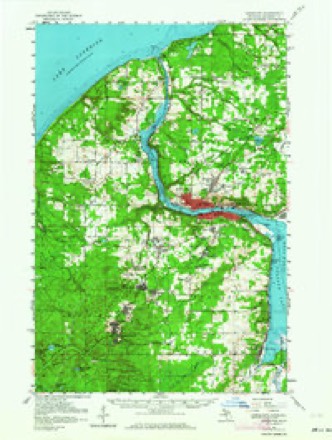
19 topographic sheets cover this place, the earliest surveyed in 1915 and the latest in 1985. It stands in Chassell Township. It lies in ZIP code area 49916. It stands on Pike River. The Survey maps it on the Chassell quadrangle.
On record in Chassell
Buildings and businesses the archive holds for this place. Each opens its own page, with the source record it came from.
On the National Register 2 records
 Chassell School Complexlisted 2009
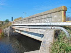 County Road C11-Pike River Bridgelisted 1999
Topographic sheets covering this place
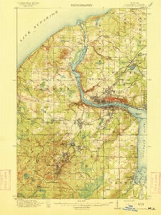
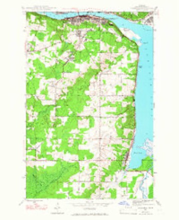
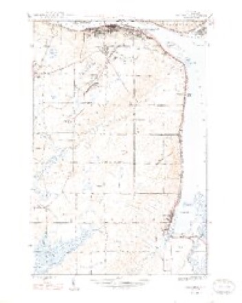
10 surveys from 19 printed sheetsMatched by testing this settlement's coordinate against the published boundary of every sheet in the United States Geological Survey's historical collection. Each opens the scanned sheet at the Survey.
- 1915 USGS Houghton quadrangle1:62500, 4 printings
- 1946 USGS Chassell quadrangle1:24000, 2 printings
- 1948 USGS Chassell quadrangle1:24000, 2 printings
- 1954 USGS Houghton quadrangle1:62500, 2 printings
- 1958 USGS Hancock quadrangle1:250000, 2 printings
- 1960 USGS Hancock quadrangle1:250000
- 1961 USGS Hancock quadrangle1:250000
- 1966 USGS Hancock quadrangle1:250000
- 1978 USGS Chassell quadrangle1:24000
- 1985 USGS Hancock quadrangle1:100000, 3 printings
Fires near this place
3 since 2000Regional context, not property-specific evidence. The federal wildfire occurrence database lists 3 fires within 5 miles of Chassell between 2000 and 2019, burning about 402 acres in total. 2 started naturally. None was recorded as arson. Distance is straight-line from the map coordinates, so a fire counted here may appear on a neighbouring settlement's page as well.
| Reported cause | Fires |
|---|---|
| Natural | 2 |
| Missing data/not specified/undetermined | 1 |
The most recent of them, most recent first, with the day each was reported and the service that recorded it.
| Date | Cause | Size | Reported by | Name on the report |
|---|---|---|---|---|
| 6 June 2000 | Missing data/not specified/undetermined | 400 acres | Michigan Department of Natural Resources | RICE LAKE |
| 21 May 2018 | Natural | 1.0 acres | Michigan Department of Natural Resources | CHASSELL FD 1800010 - 2018 |
| 28 April 2019 | Natural | 1.0 acres | Michigan Department of Natural Resources | CHASSELL FD 1900006 - 2019 |
Settlements close enough to share some of these fires:
Mines and quarries near this place
7 within 5 milesRegional context, not property-specific evidence. The federal mineral resources record lists 7 workings within 5 miles of Chassell: 3 past producers, 2 producers, 1 unknown, 1 prospect. 2 still produce. What was taken out: Copper, Sand and Gravel, Construction, Copper, Silver, Stone, Crushed/Broken. Distance is straight-line from the map coordinates, so a quarry counted here may appear on a neighbouring settlement's page as well.
| Where | Site | Commodity | Status | Recorded |
|---|---|---|---|---|
| Houghton Co Road Commission Quarry | Stone, Crushed/Broken | Producer | ||
| Moilanen Pit | Sand and Gravel, Construction | Producer | ||
| Superior | Copper, Silver | Past Producer | 1904, 1908 | |
| Houghton Exploration | Copper | Prospect | Lode | |
| Michigan Native Copper | Copper | Unknown | ||
| Superior Cu Mine | Copper | Past Producer | ||
| Superior Mine | Copper | Past Producer | Lode |
Storms near this place
16 since 1999Regional context, not property-specific evidence. The National Weather Service names Chassell in 16 storm reports between 1999 and 2025: 5 hail, 5 flood, 3 thunderstorm wind, 2 flash flood. No death or injury is recorded in these reports. Each account below is quoted exactly as the forecast office filed it, from the NOAA Storm Events Database, and each date opens the federal record of that event.
| When | Event | Place named | Harm | What the report says |
|---|---|---|---|---|
| July 2025 | Flash Flood | Chassell | $5,500,000 | Flash flooding resulted in several washouts in the Chassell area, including Massie Road, Chassell-Painesdale Road, and Bootjack Road. Some of these areas experienced flooding in the recent past, including June 2025. Floodwaters impacted a few residences on Lakeshore Drive as well. US-41 had one foot of flowing water over the roadway near Chassell, resulting in a closure of one lane. |
| May 2023 | Flood | Chassell | $500,000 | Heavy water equivalent precipitation of 2 to nearly 4 inches during the late-season snowstorm of May 1-2 caused minor snowmelt flooding of rivers and small streams over portions of northern Houghton County through the 12th. The most extensive flooding impacts were along the Sturgeon River basin. |
| June 2025 | Flash Flood | Chassell | $200,000 | Emergency Management, Law Enforcement, Broadcast Media, State Department of Transportation, and the Public reported flash flooding on the morning of the 21st. In Chassell, 4,000 yards of material on Massie Rd was washed out and Sadjak Rd was closed due to water over the road. In Houghton, standing water was observed on many roads, at least 2 road washouts occurred, and surface damage including sidewalk damage was observed at Agate St and MacInnes Dr. The City Council approved $150,000 for repairs. In Hubbell, debris was deposited on roads. In Calumet, sewer systems were overwhelmed and backing up into residences. Damage as also observed in Silver Creek. |
| July 2011 | Thunderstorm Wind | Chassell | $5,000 | The 911 call center reported trees and power lines downed. |
| April 2022 | Flood | Chassell | - | Snowmelt combined with periods of heavy rain resulted in minor flooding along the Sturgeon River near Chassell in late April. |
| April 2022 | Flood | Chassell | - | Minor flooding occurred near Chassell along the Sturgeon River in mid-April. |
| June 2021 | Hail | Chassell | - | One inch diameter hail was reported a few miles south-southwest of Chassell. |
| June 2021 | Hail | Chassell | - | Hail was observed on two different occasions in Chassell Township late afternoon on the 10th. This report is the first observation where nickel-sized hail was observed. A double rainbow was observed after each hail occurrence. |
| April 2019 | Flood | Chassell | - | Abundant and anomalously wet snow pack along with periods of moderate to heavy rain contributed to widespread minor flooding along the Sturgeon River from the 18th through the end of the month. ||The Houghton County emergency manager reported that several houses and barns near the Sturgeon River at Chassell had rising water around them but no structures were inundated. Sturgeon River Road was reported to be under 6-8 inches of water and Rajala Road was under 8-10 inches of water. Multiple sections of Halonen Road near Pelkie and adjacent fields were reported to be under water the morning of 04/23 as the Sturgeon River crested. Rain and snow melt runoff along with some clogged culverts led to Highway M-26 being closed south of Hubbell on the night of the 22nd due to water over the road. |
| August 2018 | Hail | Chassell | - | A photo of one inch diameter hail at Chassell was posted on social media. |
| August 2018 | Hail | Chassell | - | There was a video received via social media of dime to quarter sized hail near Chassell. |
| May 2011 | Heavy Rain | Chassell | - | A spotter southeast of Chassel measured 2.45 inches of rain in a two and a half hour period with greater than one-inch per hour rainfall rates. Several inches of water covered Highway 41 near Chassel and Calumet during the heavy rain event. Water was also reported over several secondary roads near and just north of Chassel. In addition to the heavy rain, a lightning strike in northern Wisconsin around 3:30 AM CDT knocked out the main electrical transmission lines to the western half of Upper Michigan. Power was knocked out to nearly 75,000 residents for many hours throughout the western half of Upper Michigan. The power outage resulted in numerous school and business closures. For more information on the actual location of the lightning strike refer to the Storm Data entries for northern Wisconsin. |
| April 2008 | Hail | Chassell | - | Hail covered the ground in Chassell. |
| April 2008 | Flood | Chassell | - | The Sturgeon River went above flood stage near Chassell on the 20th, and remained above flood stage into the afternoon of the 26th. Flooding was observed on Sturgeon River, Aho, and Rajala Roads during this time although no property damage was reported. |
| June 2005 | Thunderstorm Wind | Chassell | - | Numerous small trees down. |
| July 1999 | Thunderstorm Wind | Chassell | - | Many small trees down. |
Nearest settlements
The eight closest, with where each one stands in the county. Distances are straight-line, computed from the Geographic Names Information System coordinates.
| Map | Place | Distance | Sheets |
|---|---|---|---|
| Sunshine Beach | 4.2 miles | 19 | |
| Klingville | 4.9 miles | 12 | |
| Pilgrim | 4.9 miles | 19 | |
| Superior | 5.0 miles | 19 | |
| Dodgeville | 5.4 miles | 19 | |
| Point Mills | 5.4 miles | 12 | |
| Portage Entry | 5.5 miles | 12 | |
| White City | 6.2 miles | 12 |
Provenance
This settlement is recorded in the Geographic Names Information System as feature 1617970. The sheet list is computed by point-in-boundary test against the United States Geological Survey's historical topographic inventory. Both are works of the United States government and carry no copyright under 17 U.S.C. 105.
Wildfire. Short, Karen C. 2022. Spatial wildfire occurrence data for the United States, 1992-2020 [FPA_FOD_20221014]. 6th Edition. Fort Collins, CO: Forest Service Research Data Archive. https://doi.org/10.2737/RDS-2013-0009.6 Collected with United States Government funding and usable without additional permissions or fees.
Mines and quarries. USGS Mineral Resources Data System (MRDS) https://mrdata.usgs.gov/mrds/ A work of the United States government, no copyright under 17 U.S.C. 105.
Storms. NOAA National Centers for Environmental Information, Storm Events Database https://www.ncei.noaa.gov/stormevents/ A work of the United States government, no copyright under 17 U.S.C. 105. Narratives are quoted verbatim from the National Weather Service report and are not edited or summarised.