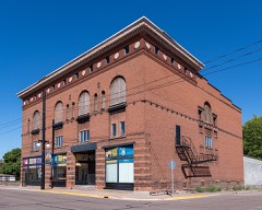
Block
From the record
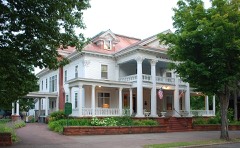
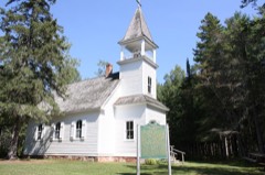
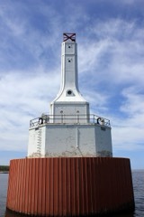
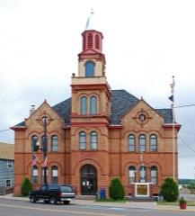
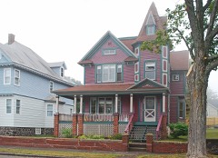
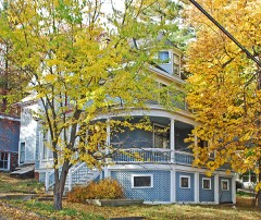
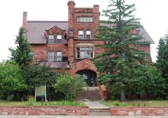
41 National Register listings published here, 1 of them a National Historic Landmark.
Sources: the National Register database, National Park Service
104 topographic sheets cover 75 settlements here, and 41 properties are on the National Register of Historic Places.
41 National Register listings published here, 1 of them a National Historic Landmark.
Sources: the National Register database, National Park Service
Every property in this county listed on the National Register of Historic Places, with the year it was listed and the federal nomination document.
Every wildfire the federal occurrence database records inside this county: 92 of them, burning about 910 acres. 13 started naturally and 7 were recorded as arson. Each settlement page carries the fires within five miles of it.
| Reported cause | Fires |
|---|---|
| Missing data/not specified/undetermined | 25 |
| Recreation and ceremony | 14 |
| Natural | 13 |
| Debris and open burning | 12 |
| Misuse of fire by a minor | 7 |
| Arson/incendiarism | 7 |
| Equipment and vehicle use | 4 |
| Railroad operations and maintenance | 3 |
| Power generation/transmission/distribution | 3 |
| Smoking | 3 |
| Other causes | 1 |
The five largest, by the area the report gives. One of them was set deliberately.
| Date | Cause | Size | Reported by | Name on the report |
|---|---|---|---|---|
| 6 June 2000 | Missing data/not specified/undetermined | 400 acres | Michigan Department of Natural Resources | RICE LAKE |
| 8 August 2005 | Arson/incendiarism | 388 acres | Michigan Department of Natural Resources | RICE LAKE 2 |
| 10 May 2004 | Debris and open burning | 15 acres | Michigan Department of Natural Resources | not named |
| 8 May 1994 | Debris and open burning | 7.3 acres | Michigan Department of Natural Resources | not named |
| 12 October 2000 | Recreation and ceremony | 7.0 acres | Ottawa National Forest | LITTLE ASPEN FIRE |
| 20 May 1994 | Equipment and vehicle use | 6.4 acres | Michigan Department of Natural Resources | not named |
| 4 May 2003 | Missing data/not specified/undetermined | 5.5 acres | Michigan Department of Natural Resources | not named |
| 10 May 2016 | Power generation/transmission/distribution | 4.5 acres | Michigan Department of Natural Resources | not named |
Every settlement page carries the fires within five miles of it - see the settlement index below.
The NOAA Storm Events Database holds 242 reports for this county, causing 1 death, no injuries and about $128,627,000 in recorded property damage. Each settlement page carries the reports that name it.
| Kind of event | Reports |
|---|---|
| Thunderstorm Wind | 118 |
| Hail | 78 |
| Heavy Rain | 18 |
| Flood | 15 |
| Flash Flood | 9 |
| Lightning | 2 |
| Tornado | 1 |
| Funnel Cloud | 1 |
The most serious of them, by death, then injury, then recorded damage. The accounts are quoted exactly as the forecast office filed them.
| When | Event | Place named | Harm | What the report says |
|---|---|---|---|---|
| June 2018 | Flash Flood | Alcone | 1 killed, $100,000,000 | Three to nearly seven inches of rainfall in the early morning hours of the 17th caused widespread and catastrophic flash flooding across much of Houghton County from Chassell through Houghton/Hancock to Dollar Bay, Hubbell and Lake Linden. The NOAA Precipitation Frequency Atlas indicated a 1000-year recurrence interval for rainfall amounts of the magnitude which occurred during this event. The Houghton County emergency manager reported that nearly all roads were impassable in central and southern Houghton County. Many homes and businesses were flooded throughout the area, particularly in Houghton/Hancock where one fatality occurred when a basement collapsed at a home on Canal Road. The Administration Building at Michigan Tech University also sustained flood damage. Governor Rick Snyder declared a state of disaster for Houghton County a day after the flooding occurred and damage estimates from flooding are currently over $100 million. Recovery efforts will be ongoing over Houghton County for the next several months. |
| April 2023 | Flood | Osceola | $18,000,000 | A flash flood impacted the Lake Linden, MI area early on April 12th after a culvert under railroad tracks failed and released a flood wave resulting in an estimated $150,000 in|damages. The flooding prompted a state of emergency declaration for Houghton County by Governor Whitmer. The culvert was recently installed as part of repairs following the Fathers Day flooding in 2018. There was also prolonged snowmelt flooding along the Sturgeon River which lasted through the 24th. |
| July 2025 | Flash Flood | Chassell | $5,500,000 | Flash flooding resulted in several washouts in the Chassell area, including Massie Road, Chassell-Painesdale Road, and Bootjack Road. Some of these areas experienced flooding in the recent past, including June 2025. Floodwaters impacted a few residences on Lakeshore Drive as well. US-41 had one foot of flowing water over the roadway near Chassell, resulting in a closure of one lane. |
| April 2013 | Flood | Sidnaw Grooms Arpt | $2,900,000 | Rapid melting of significant late season snow pack caused moderate flooding of roads across portions of Houghton County, especially along the Sturgeon River from Alston to Chassell, from the 28th into the 30th. Minor flooding continued into early May. Some flooding of basements was also reported. Governor Rick Snyder declared a state of disaster in Houghton County where nearly 2.9 million dollars in property damage occurred due to the flooding mainly to roadway infrastructure. |
| July 2018 | Flash Flood | Redridge | $1,000,000 | Three to four inches of rain in approximately six hours caused another episode of flooding in Houghton and surrounding areas within the span of month. The Houghton County Sheriff reported several roads washed out in the Houghton/Hancock area. This second flood episode during the recovery period of the more severe Father's Day flood event prompted Governor Rick Snyder to declare a second state of disaster for Houghton County. |
| May 2023 | Flood | Chassell | $500,000 | Heavy water equivalent precipitation of 2 to nearly 4 inches during the late-season snowstorm of May 1-2 caused minor snowmelt flooding of rivers and small streams over portions of northern Houghton County through the 12th. The most extensive flooding impacts were along the Sturgeon River basin. |
| June 2025 | Flash Flood | Chassell | $200,000 | Emergency Management, Law Enforcement, Broadcast Media, State Department of Transportation, and the Public reported flash flooding on the morning of the 21st. In Chassell, 4,000 yards of material on Massie Rd was washed out and Sadjak Rd was closed due to water over the road. In Houghton, standing water was observed on many roads, at least 2 road washouts occurred, and surface damage including sidewalk damage was observed at Agate St and MacInnes Dr. The City Council approved $150,000 for repairs. In Hubbell, debris was deposited on roads. In Calumet, sewer systems were overwhelmed and backing up into residences. Damage as also observed in Silver Creek. |
| July 2016 | Thunderstorm Wind | Lake Roland | $80,000 | The NWS storm survey confirmed extensive tree damage at Emily Lake Campground with over half an acre of trees blown down due to straight line winds estimated to be up to 90 mph. Local reports indicated that the strong winds lasted at least five minutes. Damage included trees down on two campers and one vehicle, but no injuries were reported. The time of the report was estimated from radar. |
| June 2024 | Flash Flood | White | $50,000 | Nearly four inches of rain from late evening on the 18th into the early morning of the 19th caused flooding on south Laird Road in southern Houghton County where a 4-foot culvert washed out and farther down the road a second culvert was sticking out of ground. Road was not passable after flooding. |
| July 2020 | Thunderstorm Wind | Hisula | $50,000 | There was a public report of a barn collapsed onto vehicles along with trees and power lines down in Nisula. The time of the report was estimated from radar. |
| July 2011 | Thunderstorm Wind | Laurium | $50,000 | A damage path stretched from Mine Street through the intersection of US-41 and Church Street in North Calumet. The damage path was oriented from southwest to northeast and estimated to be one-quarter mile wide. Metal building housing a travel trailer destroyed. Several trees estimated to be between 18 to 24 inches in diameter were uprooted. A drill shop roof near the elementary school sustained significant damage. |
| August 2018 | Thunderstorm Wind | Oskar | $40,000 | There was a delayed public report of nearly 200 downed trees near Liminga from thunderstorm winds. |
| July 2016 | Thunderstorm Wind | Jacobsville | $30,000 | There was a delayed report via social media of multiple large trees down or snapped on either side of the Portage Canal near Jacobsville. Some trees were down on vehicles and structures. |
| July 2025 | Flash Flood | Freda | $25,000 | Old Rink Road was washed out near the South Branch of the Elm River. |
| May 2011 | Lightning | Calumet | $20,000 | Lightning struck and damaged the steeple tower of the Keweenaw Heritage Center at St. Anne's located in Calumet Township on the early morning of the 11th. |
| July 2020 | Thunderstorm Wind | Alston | $12,000 | There was a social media video taken just northeast of Nisula of at least twenty healthy trees snapped off about a quarter of the way from the ground with numerous other trees uprooted. The time of the delayed report was estimated from radar. |
| July 2023 | Thunderstorm Wind | Baltic | $10,000 | Social media report of pea-sized hail and a photo of damage to the roof of a building. The report also indicated downed tree branches in the area. Time of the delayed report was estimated from radar. |
| August 2020 | Flash Flood | Lake Roland | $10,000 | There were multiple shoulder washouts along Pike Lake Road. There were also some docks on local lakes underwater. The time of the report was estimated from radar. |
| July 2007 | Hail | Twin Lakes | $10,000 | Trees stripped of leaves with some vehicle damage. |
| May 2016 | Thunderstorm Wind | Sidnaw | $8,000 | A spotter south of Sidnaw reported numerous large trees snapped or uprooted. |
| May 2021 | Thunderstorm Wind | Pilgram | $5,000 | The Houghton County Sheriff reported trees down blocking Highway US-41 near the Portage Lake Golf Course. Additional trees were reported down in the Houghton area. Time of the report estimated from radar. |
| July 2020 | Thunderstorm Wind | Dodgeville | $5,000 | Widespread power outages were reported across Houghton County by UPPCO, especially from Houghton to Calumet. |
| August 2020 | Flash Flood | Freda | $5,000 | There was a report and video received on social media of water flowing over the roads near the intersection of Massie Road and US-Highway 41 in Chassell. There was also a video received of a business in Chassell surrounded by about a foot of standing water. Three to four inches of rainfall over a couple hours time caused the localized flooding over the area. |
| July 2016 | Thunderstorm Wind | Toivola | $5,000 | A spotter reported widespread tree damage from Toivola and Donken to Twin Lakes. Highway M-26 was blocked by fallen trees. |
| September 2013 | Lightning | Laurium | $5,000 | A lightning strike blew holes in the steeple of the Keweenaw Heritage Center at St. Anne's Church in Calumet. The roofing and underlying wood were shattered. |
| July 2013 | Thunderstorm Wind | Alcone | $5,000 | Wind gusts estimated over 60 mph near Kearsarge. There were reports on 800 MHz radio of trees and power lines down across the Keweenaw Peninsula. |
| July 2011 | Thunderstorm Wind | Chassell | $5,000 | The 911 call center reported trees and power lines downed. |
| July 2011 | Thunderstorm Wind | Calumet | $5,000 | The 911 call center reported trees and power lines downed. |
| June 2006 | Thunderstorm Wind | Alston | $5,000 | Numerous trees and power lines were reported down along a two-mile swath near Prickett Dam Road and along Silver Mountain Road. |
| July 2006 | Thunderstorm Wind | Kenton | $5,000 | Many large trees down, one on hood of truck. |
| July 2006 | Thunderstorm Wind | Kenton | $5,000 | Many large trees down |
| July 2006 | Thunderstorm Wind | Hancock | $5,000 | Numerous trees down across Salo Road, Bear Lake Road and along Highway M-203 south of McLain State Park. |
| June 2017 | Thunderstorm Wind | Boston | $4,000 | Trees were reported down on power lines and across Highway M-203. Time of the report was estimated from radar. |
| June 2016 | Thunderstorm Wind | Osceola | $4,000 | The Houghton County Sheriff reported multiple trees down in the high terrain in northern Houghton County near Laurium. Time of the report was estimated from radar. |
| July 2011 | Thunderstorm Wind | Osceola | $4,000 | The Calumet Golf Club sustained tree damage. Several oak trees approximately one-foot in diameter were snapped. Several pine tree branches six inches in diameter were broken off. A one-foot diameter pine tree was also uprooted. Trees all fell to the northeast. |
| July 2023 | Thunderstorm Wind | Sidnaw Grooms Arpt | $3,000 | Three large maple trees were observed down in Sidnaw. |
| July 2020 | Thunderstorm Wind | Alston | $3,000 | Social media photos revealed extensive tree damage on a property in Alston, including a few large healthy trees completely uprooted. The time of the delayed report was estimated from radar. |
| September 2020 | Thunderstorm Wind | Ripley | $3,000 | Severe thunderstorms produced power outages across portions of Houghton County on the evening of the 25th. |
| August 2018 | Thunderstorm Wind | Houghton | $3,000 | There were reports over the police scanner of trees down in Houghton. |
| June 2013 | Thunderstorm Wind | Jacobsville | $3,000 | Trees down across Kuusisto Road and Hidden Acres Road. The Houghton County Emergency Manager also reported trees down and power outages across the county. |
| September 2007 | Thunderstorm Wind | Twin Lakes | $3,000 | Several 100-foot tall trees knocked down. |
| July 1987 | Tornado (F0) | not stated | $2,500 | no account filed |
| July 2020 | Thunderstorm Wind | Alston | $2,000 | There were social media photos of power poles snapped near the intersection of Cadeau Road and Alston Road in Alston. Time of the delayed report was estimated from radar. |
| August 2018 | Thunderstorm Wind | Lake Linden | $2,000 | The observer in Lake Linden reported a loss of power with trees fallen on power lines. |
| August 2018 | Thunderstorm Wind | (Cmx)Houghton-Hancoc | $2,000 | There was a social media post of a mature tree that fell down on a homeowner's deck in Hancock. |
| June 2017 | Thunderstorm Wind | Laurium | $2,000 | Power lines were reported down in Calumet. Time of the report was estimated from radar. |
| October 2017 | Flood | Tamarack | $2,000 | A spotter along the Trap Rock River reported flooding on Woodbush Road in Calumet and farther south on Cemetary Road. The flooding resulted from two to three inches of rainfall over a 24-hour period. |
| June 2016 | Thunderstorm Wind | Hubbell | $2,000 | The Houghton County Sheriff reported a tree down on power lines near Hubbell Township. |
| August 2016 | Heavy Rain | (Cmx)Houghton-Hancoc | $2,000 | A section of Canal Road west of Houghton had a small section washout from heavy rainfall. Two and a half to nearly three inches of heavy rain fell in and around the Houghton area over a two hour period. |
| July 2016 | Thunderstorm Wind | Hisula | $2,000 | A metal framed RV storage shelter was flattened near Nisula. This was a delayed report relayed via social media. |
| July 2012 | Thunderstorm Wind | Ripley | $2,000 | The 911 dispatcher said they received numerous reports of downed trees on a power line near Lake Linden. There was an additional report of trees down on US-41 north of Hancock. |
| September 2007 | Thunderstorm Wind | Twin Lakes | $2,000 | Fallen tree limbs knocked down power lines. |
| July 2011 | Thunderstorm Wind | Laurium | $1,500 | Home on Mine Street sustained damage. Windows were partially broken and garage door was bowing inward. Rollers were blown off the garage door. Garage was shifted one inch off of foundation. Garage door and damaged windows were on the windward side of house facing the southwest. |
| June 2025 | Thunderstorm Wind | Houghton | $1,000 | Multiple downed trees have been observed by law enforcement in the City of Houghton. The public has been observed cleaning up the debris. |
| June 2024 | Thunderstorm Wind | (Cmx)Houghton-Hancoc | $1,000 | There was a public report of a tree down on Atlantic Street west of Birch Street in Hancock. The report was relayed by a local broadcasting partner. |
| June 2024 | Thunderstorm Wind | (Cmx)Houghton-Hancoc | $1,000 | Media reported a whole tree down in West Hancock that fell partially onto Minnesota Street. Report relayed by WLUCTV6. |
| August 2022 | Thunderstorm Wind | Kenton | $1,000 | Michigan DOT reported eastbound and westbound lanes of Highway M-28 were closed in Kenton due to a downed tree on the highway. The report was relayed via social media. |
| May 2021 | Thunderstorm Wind | Kearsarge | $1,000 | A caller near Kearsarge reported a roadside stand strapped to the ground was blown over by a strong thunderstorm wind gust. |
| August 2020 | Thunderstorm Wind | Sidnaw | $1,000 | There was a picture posted on social media from one of the local TV stations of a large portion of a tree downed on power lines south of Sidnaw. |
| August 2019 | Thunderstorm Wind | Lake Linden | $1,000 | Law enforcement dispatch reported a power line down at the intersection of 9th Street and Calumet Street in Lake Linden. |
The Survey's mineral resources record lists 154 workings inside this county. 14 still produce and 140 are closed or unrecorded. Each settlement page carries the workings within five miles of it.
| Commodity | Workings |
|---|---|
| Copper | 127 |
| Stone, Crushed/Broken | 11 |
| Silver | 9 |
| Sand and Gravel, Construction | 9 |
| Copper, Silver | 6 |
| Nickel | 1 |
| Fire Clay (Refractory) | 1 |
The least common of them first, because a county's hundredth gravel pit says nothing its first ten did not.
| Where | Site | Commodity | Status | Recorded |
|---|---|---|---|---|
| Michigan Nickel Deposits | Nickel, Copper | Prospect | ||
| Sturgeon Clay Pit | Fire Clay (Refractory) | Past Producer | ||
| Centennial No.2 | Copper, Silver | Past Producer | 1863, 1904 | |
| Isle Royale | Copper, Silver | Past Producer | 1852, 1853 | |
| Quincy | Copper, Silver | Past Producer | 1856 | |
| Quincy Mine | Copper, Silver | Past Producer | 1856, 1925 | |
| Superior | Copper, Silver | Past Producer | 1904, 1908 | |
| Wolverine | Copper, Silver | Past Producer | 1882, 1898 | |
| Allouez Conglomerate No 1 & 2 | Copper, Silver | Past Producer | 1830 | |
| Centennial Mine | Copper, Silver | Past Producer | 1869, 1920 | |
| G and S Sand and Gravel Pit | Sand and Gravel, Construction | Producer | ||
| Gedvillas Pit | Sand and Gravel, Construction | Producer | ||
| George Hocking Constr Co Pit | Sand and Gravel, Construction | Producer | ||
| Hager Lake Pit | Sand and Gravel, Construction | Producer | ||
| Haltunen Sand & Gravel | Sand and Gravel, Construction | Producer | ||
| Houghton Co Road Commission Pit | Sand and Gravel, Construction | Producer | ||
| Isle Royale Amygdaloid | Copper, Silver | Past Producer | 1852, 1968 | |
| Isle Royale Mine | Copper, Silver | Past Producer | 1853, 1885 | |
| Kearsarge Amygdaloid | Copper, Silver | Past Producer | 1887 | |
| Kearsarge Mine | Copper, Silver | Past Producer | Lode | |
| La Salle Mine | Copper, Silver | Past Producer | 1910, 1920 | |
| Mayflower Old Colony Mine | Copper, Silver | Past Producer | Lode | |
| Moilanen Pit | Sand and Gravel, Construction | Producer | ||
| Pewabic Amygdaloid | Copper, Silver | Past Producer | 1857, 1931 | |
| Superior Sand and Gravel Pit | Sand and Gravel, Construction | Producer | ||
| Wash Plant | Sand and Gravel, Construction | Producer | ||
| Baltic Pit | Stone, Crushed/Broken | Producer | ||
| Dodgeville Pit and Mill | Stone, Crushed/Broken | Past Producer | ||
| George Hocking Constr Co Pit | Stone, Crushed/Broken | Past Producer | ||
| Houghton Co Road Commission Pit | Stone, Crushed/Broken | Producer | ||
| Houghton Co Road Commission Pit | Stone, Crushed/Broken | Producer | ||
| Houghton Co Road Commission Quarry | Stone, Crushed/Broken | Producer | ||
| Houghton Crushed Stone Pit | Stone, Crushed/Broken | Producer | ||
| Mica Schist Drill Sample | Stone, Crushed/Broken | Prospect | ||
| Mich Tech University Exper | Stone, Crushed/Broken | Past Producer | ||
| Tamarack Mine Dump | Stone, Crushed/Broken | Past Producer | ||
| Winona Pit | Stone, Crushed/Broken | Past Producer | ||
| Arcadian Mine | Copper | Past Producer | 1863, 1898, 1902 | |
| Arcadian Copper Mine | Copper | Past Producer | ||
| Arcadian Copper Mine South | Copper | Past Producer | ||
| Arcadian Cu Mine North | Copper | Past Producer | ||
| Atlantic | Copper | Past Producer | 1865, 1866 | |
| Atlantic Amygdaloid | Copper | Past Producer | 1855, 1917 | |
| Atlantic Mine | Copper | Past Producer | 1866, 1910 | |
| Atlantic Section 16 Exploration | Copper | Prospect | 1907 | |
| Baltic | Copper | Past Producer | 1882, 1898 | |
| Baltic Amygdaloid | Copper | Past Producer | 1898 | |
| Baltic Amygdaloid | Copper | Past Producer | Underground | |
| Baltic Mine | Copper | Past Producer | 1898, 1968 | |
| Calumet No 2 | Copper | Past Producer | 1864, 1865 | |
| Calumet No.1 | Copper | Past Producer | 1864, 1865 | |
| Calumet and Hecla Conglomerate Lode | Copper | Past Producer | 1864, 1865, 1968 | |
| Centennial No. 3-6 | Copper | Past Producer | 1864, 1869 | |
| Challenge Copper Mine | Copper | Past Producer | ||
| Champion | Copper | Past Producer | 1894, 1902 | |
| Champion Mine | Copper | Past Producer | 1902, 1925 | |
| Concord & Douglas Copper Mine | Copper | Past Producer | ||
| Douglass Houghton Exploration | Copper | Prospect | 1845, 1847 | |
| Eagle Exploration | Copper | Prospect | 1853, 1866 | |
| Elm River Mine | Copper | Past Producer | 1899, 1906 | |
| Erie-Ontario Mine | Copper | Prospect | 1854, 1907 | |
| Franklin | Copper | Past Producer | ||
| Franklin Junior Copper Mines | Copper | Past Producer | ||
| Franklin Junior Mine | Copper | Past Producer | 1862, 1911 | |
| Globe Copper Mine | Copper | Past Producer | ||
| Globe Mine | Copper | Past Producer | 1907 | |
| Hancock Copper Mines | Copper | Past Producer | ||
| Hancock Mine | Copper | Past Producer | 1861, 1918 | |
| Houghton Exploration | Copper | Prospect | Lode | |
| Houghton No.1 | Copper | Past Producer | 1841 | |
| Huron Mine | Copper | Past Producer | 1855, 1893 | |
| Iroquois Mine | Copper | Past Producer | 1942, 1968 | |
| Kearsarge Amygdaloid No.1 | Copper | Past Producer | 1874, 1887 | |
| Kearsarge Amygdaloid No.2 | Copper | Past Producer | 1874, 1887 | |
| King Philip Cu Mine | Copper | Past Producer | ||
| King Philip Mine | Copper | Past Producer | Secondary Enrichment | |
| Kingston No.1 | Copper | Past Producer | 1962, 1965 | |
| Kingston No.2 | Copper | Past Producer | 1962, 1965 | |
| La Salle Cu Mine | Copper | Past Producer | ||
| Laurium Mine | Copper | Past Producer | Lode | |
| Mabbs Mine | Copper | Past Producer | 1880, 1882 | |
| Mayflower-Old Colony | Copper | Prospect | 1850 | |
| Mesnard Cu Mine | Copper | Past Producer | ||
| Mesnard Mine | Copper | Past Producer | 1859, 1877 | |
| Miscellaneous Amygdaloids No. 1 | Copper | Past Producer | ||
| Miscellaneous Amygdaloids No. 2 | Copper | Past Producer | ||
| Miscellaneous Fissures No. 1 | Copper | Past Producer | ||
| Miscellaneous Fissures No. 2 | Copper | Past Producer | ||
| Montezuma Prospect | Copper | Prospect | 1853 | |
| Naumkeag Mine | Copper | Past Producer | 1870, 1921 | |
| New Arcadian Exploration | Copper | Prospect | Lode | |
| New Baltic Copper Company | Copper | Past Producer | ||
| New Baltic Exploration | Copper | Prospect | Lode | |
| North Kearsarge | Copper | Past Producer | 1871, 1897 | |
| North Kearsarge Mine | Copper | Past Producer | Lode | |
| North's Copper Pit | Copper | Prospect | ||
| Old Colony Exploration | Copper | Prospect | Lode | |
| Oneco Exploration | Copper | Prospect | 1862, 1928 | |
| Osceola | Copper | Past Producer | 1874, 1879 | |
| Osceola Amygdaloid | Copper | Past Producer | 1879, 1968 | |
| Osceola Mine | Copper | Past Producer | Lode | |
| Osceola No. 2 | Copper | Past Producer | 1874, 1879 | |
| Osceola No.1 | Copper | Past Producer | 1874, 1879 | |
| Pacific Exploration | Copper | Prospect | 1899, 1900 | |
| Pewabic No.1 | Copper | Past Producer | Underground | |
| Pewabic No.2 | Copper | Past Producer | Underground | |
| Pontiac Exploration | Copper | Prospect | Secondary Enrichment | |
| Quincy Cu Mine | Copper | Past Producer | ||
| Rhode Island Exploration | Copper | Prospect | Lode | |
| Rhode Island Cu Mine | Copper | Past Producer | ||
| Ripley Exploration | Copper | Prospect | 1863 | |
| Saint Mary's Mine | Copper | Prospect | 1863, 1899 | |
| Shawmut Mine | Copper | Past Producer | Secondary Enrichment | |
| South Kearsarge | Copper | Past Producer | 1887, 1900 | |
| South Kearsarge Mine | Copper | Past Producer | 1900, 1920 | |
| South Side Mine | Copper | Past Producer | 1860 | |
| St. Louis Exploration | Copper | Prospect | 1909 | |
| Superior Cu Mine | Copper | Past Producer | ||
| Superior Mine | Copper | Past Producer | Lode | |
| Tamarack Junior Mine | Copper | Past Producer | 1892, 1896 | |
| Tamarack Mine | Copper | Past Producer | 1882 | |
| Trimountain | Copper | Past Producer | 1898, 1902 | |
| Trimountain Cu Mine | Copper | Past Producer | ||
| Trimountain Cu Mine North | Copper | Past Producer | ||
| Trimountain Cu Mine South | Copper | Past Producer | ||
| Trimountain Mine | Copper | Past Producer | 1902, 1925 | |
| Unnamed Copper Mine | Copper | Past Producer | ||
| Unnamed Copper Mine | Copper | Past Producer | ||
| Unnamed Copper Mine | Copper | Past Producer | ||
| Unnamed Copper Mine | Copper | Past Producer | ||
| Unnamed Copper Mine | Copper | Past Producer | ||
| Unnamed Copper Prospect | Copper | Prospect | ||
| Unnamed Copper Prospect | Copper | Prospect | ||
| Unnamed Copper Prospect | Copper | Prospect | ||
| Unnamed Copper Prospect | Copper | Prospect | ||
| Unnamed Copper Prospect | Copper | Prospect | ||
| Unnamed Copper Prospect | Copper | Prospect | ||
| Unnamed Copper Prospect | Copper | Prospect | ||
| Unnamed Copper Prospect | Copper | Prospect | ||
| Unnamed Copper Prospect | Copper | Prospect | ||
| Unnamed Copper Prospect | Copper | Prospect | ||
| Unnamed Copper Prospect | Copper | Prospect | ||
| Unnamed Copper Prospect | Copper | Prospect | ||
| Unnamed Copper Prospect | Copper | Prospect | ||
| Unnamed Copper Prospect | Copper | Prospect | ||
| Unnamed Copper Prospect | Copper | Prospect | ||
| Webster Prospect | Copper | Prospect | 1853 | |
| Wheal Kate Prospect | Copper | Prospect | 1851 | |
| Winona | Copper | Past Producer | 1864, 1902 | |
| Winona Copper Mine | Copper | Past Producer | ||
| Winona Mine | Copper | Past Producer | Secondary Enrichment | |
| Wolverine Mine | Copper | Past Producer | 1882, 1925 | |
| Wyandot Mine | Copper | Past Producer | Secondary Enrichment | |
| Wyandotte Cu Mine | Copper | Past Producer |
Named settlements recorded in the Geographic Names Information System, each with the topographic sheets covering it. Villages, hamlets and abandoned places alike. Each is shown with the nearest named watercourse or landform and the survey quadrangle it falls on.
Portage Charter Township · 49958 · On Otter River · Otter Lake quadrangle
12 sheets, 1954 to 1991
Adams township · 49955 · Near Tolonen Hill · South Range quadrangle
19 sheets, 1915 to 1985
Calumet Charter Township · 49917 · On Slaughterhouse Creek · Ahmeek quadrangle
14 sheets, 1941 to 1985
Franklin township · 49922 · On Pilgrim River · Chassell quadrangle
19 sheets, 1915 to 1985
Torch Lake township · 49945 · On Dubuque Creek · Point Mills quadrangle
12 sheets, 1954 to 1985
Schoolcraft township · 49945 · On Sawmill Creek · Laurium quadrangle
13 sheets, 1946 to 1985
Calumet Charter Township · 49913 · On Slaughterhouse Creek · Ahmeek quadrangle
14 sheets, 1941 to 1985
Schoolcraft township · 49945 · On Trap Rock River · Laurium quadrangle
13 sheets, 1946 to 1985
Adams township · 49955 · Near Tolonen Hill · South Range quadrangle
19 sheets, 1915 to 1985
Calumet Charter Township · 49913 · On Slaughterhouse Creek · Ahmeek quadrangle
14 sheets, 1941 to 1985
Portage Charter Township · 49931 · On Pilgrim River · Chassell quadrangle
19 sheets, 1915 to 1985
Torch Lake township · 49930 · On Lovell Creek · Point Mills quadrangle
12 sheets, 1954 to 1985
Chassell township · 49916 · On Jarvi Creek · Portage Entry quadrangle
12 sheets, 1954 to 1991
Torch Lake township · 49945 · On Lahti Creek · Traverse Island quadrangle
11 sheets, 1954 to 1985
Stanton township · 49905 · On Salmon Trout River · Beacon Hill quadrangle
12 sheets, 1954 to 1985
Stanton township · 49905 · On Obenhoff Creek · South Range quadrangle
19 sheets, 1915 to 1985
Stanton township · 49931 · Near Harrington Island · Oskar quadrangle
17 sheets, 1915 to 1985
Torch Lake township · 49930 · On Lovell Creek · Point Mills quadrangle
12 sheets, 1954 to 1985
Portage Charter Township · 49931 · On Pilgrim River · Chassell quadrangle
19 sheets, 1915 to 1985
Torch Lake township · 49945 · On Jarvi Creek · Portage Entry quadrangle
12 sheets, 1954 to 1991
Calumet Charter Township · 49942 · On Slaughterhouse Creek · Ahmeek quadrangle
14 sheets, 1941 to 1985
Elm River township · 49965 · On Ahola Creek · Winona North quadrangle
12 sheets, 1954 to 1991