 Block
Flint, Michigan
16 topographic sheets cover this place, the earliest surveyed in 1920 and the latest in 1990. It stands in Flint City. It lies in ZIP code area 48502. It stands on Thread Creek. The Survey maps it on the Flint North quadrangle. 81,252 people lived here at the 2020 count. It stands 751 feet above sea level.
Research this city
On record in Flint
Buildings and businesses the archive holds for this place. Each opens its own page, with the source record it came from.
On the National Register 12 of 31 shown
 Durant-Dort Carriage Company OfficeNational Historic Landmark · listed 1975
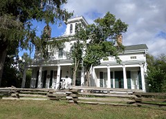 Robert Aitkan Farm Houselisted 1982
 Applewoodlisted 1979
 Beach-Garland Street-Flint River Bridgelisted 1999
 Berridge Hotellisted 2008
 Capitol Theatre Buildinglisted 1985
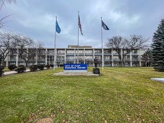 City of Flint Municipal Centerlisted 2019
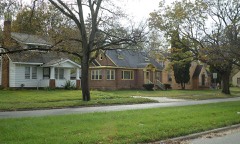 Civic Park Historic Districtlisted 1979
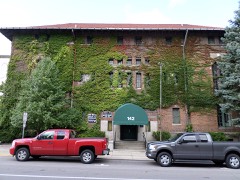 Elks Lodge Buildinglisted 1978
 First National Bank and Trust Company Buildinglisted 2007
 Flint Brewing Companylisted 1980
 Flint Journal Buildinglisted 2013
Population over time
2 figuresFlint fell from 102,434 to 81,252 between 2010 and 2020. These are the recorded population figures Wikidata holds for this place, reached through the Geographic Names Information System number this page is keyed on rather than by name, so they belong to this place and not to another of the same name. Most are census counts, but not all are: an early figure may be a founding or settlement estimate, and an estimate published within five years of a census is left out. The change column is computed, and is left blank where more than 20 years separate a figure from the one before it, because a gap that long is not a change between two counts.
| Year | People | Change |
|---|---|---|
| 2010 | 102,434 | |
| 2020 | 81,252 | -21,182 (-21%) |
Topographic sheets covering this place
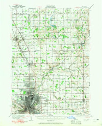
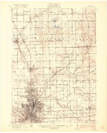
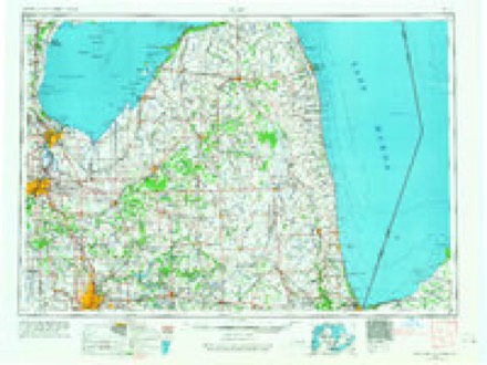
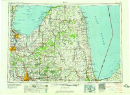
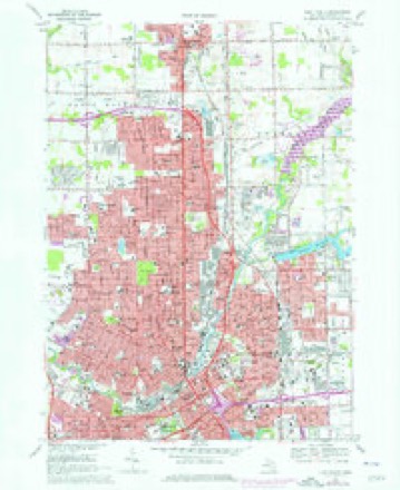
8 surveys from 16 printed sheetsMatched by testing this settlement's coordinate against the published boundary of every sheet in the United States Geological Survey's historical collection. Each opens the scanned sheet at the Survey.
- 1920 USGS Flint quadrangle1:62500, 2 printings
- 1922 USGS Flint quadrangle1:62500, 3 printings
- 1943 USGS Flint quadrangle1:62500
- 1954 USGS Flint quadrangle1:250000, 4 printings
- 1958 USGS Flint quadrangle1:250000, 2 printings
- 1969 USGS Flint North quadrangle1:24000, 2 printings
- 1984 USGS Flint quadrangle1:100000
- 1990 USGS Flint quadrangle1:100000
Fires near this place
50 since 2018Regional context, not property-specific evidence. The federal wildfire occurrence database lists 50 fires within 5 miles of Flint between 2018 and 2020, burning about 51 acres in total. 8 started naturally. None was recorded as arson. Distance is straight-line from the map coordinates, so a fire counted here may appear on a neighbouring settlement's page as well.
| Reported cause | Fires |
|---|---|
| Equipment and vehicle use | 21 |
| Missing data/not specified/undetermined | 14 |
| Natural | 8 |
| Recreation and ceremony | 4 |
| Debris and open burning | 2 |
| Smoking | 1 |
The most recent of them, most recent first, with the day each was reported and the service that recorded it.
| Date | Cause | Size | Reported by | Name on the report |
|---|---|---|---|---|
| 9 September 2018 | Equipment and vehicle use | 1.0 acres | Michigan Department of Natural Resources | MUNDY TOWNSHIP FD 2018254 - 2018 |
| 7 September 2019 | Natural | 1.0 acres | Michigan Department of Natural Resources | CITY OF FLINT FD 0016180 - 2019 |
| 4 September 2019 | Equipment and vehicle use | 1.0 acres | Michigan Department of Natural Resources | CITY OF FLINT FD 0015960 - 2019 |
| 31 August 2019 | Natural | 1.0 acres | Michigan Department of Natural Resources | CITY OF FLINT FD 0015716 - 2019 |
| 3 August 2019 | Missing data/not specified/undetermined | 1.0 acres | Michigan Department of Natural Resources | BURTON CITY FIRE/RESCUE 0000266 - 2019 |
| 3 August 2019 | Missing data/not specified/undetermined | 2.0 acres | Michigan Department of Natural Resources | BURTON CITY FIRE/RESCUE 0000265 - 2019 |
| 16 August 2018 | Equipment and vehicle use | 1.0 acres | Michigan Department of Natural Resources | CITY OF FLINT FD 0003256 - 2018 |
| 14 August 2018 | Equipment and vehicle use | 1.0 acres | Michigan Department of Natural Resources | FLINT TOWNSHIP FD 1800497 - 2018 |
Settlements close enough to share some of these fires:
Storms near this place
60 of 81 shownRegional context, not property-specific evidence. The National Weather Service names Flint in 81 storm reports between 1994 and 2025: 55 thunderstorm wind, 19 hail, 3 flash flood, 3 lightning. The reports record 3 injuries. Each account below is quoted exactly as the forecast office filed it, from the NOAA Storm Events Database, and each date opens the federal record of that event.
| When | Event | Place named | Harm | What the report says |
|---|---|---|---|---|
| September 2000 | Thunderstorm Wind | Flint | 1 hurt, $12,000 | A tree was downed onto a car on Russell Avenue near Summit Street. A woman at scene suffered a cut to her arm, necessitating a trip to the hospital. |
| May 2004 | Thunderstorm Wind | Flint | 1 hurt | A ten year old was blown off his feet and suffered cuts to the head, requiring 5 stitches. |
| June 1999 | Lightning | Flint | 1 hurt | Lightning struck a man as he was unloading groceries from his car. He was briefly hospitalized, but was not seriously hurt. |
| June 1994 | Thunderstorm Wind | Flint | $5,000,000 | A severe thunderstorm moved from west to east across Genesee County on the evening of the 28th. Spotters estimated wind gusts to 60 mph about one mile south of Lennon around 1832 EST, in the extreme western portion of the county. The storm then produced a series of funnel clouds and three separate damage swaths across the central part of the county from strong thunderstorm downburst winds, estimated as high as 100 mph in a post-storm damage survey. The first area of significant damage, which began around 1845 EST, was on the west side of Flint where the strong winds blew large trees down onto homes and porches, power lines, and vehicles. Several home television antennas were also blown down. There was also damage to fences, and windows were blown out of homes and a few businesses. Structural damage occurred at a plant in Flint where a portion of the east-facing wall was peeled off, and to an IGA store, and a video equipment service company where the roofs were peeled off of the structures. Substantial water damage occurred at another building where a portion of the roof was torn off. The second area of major damage, that began around 1855 EST, was on the southeast side of Flint where numerous trees were uprooted and blown down onto houses, mobile homes, and power lines. Power poles were also blown down at an intersection. The third area of major damage, that began around 1907 EST, was just east of Davison in the eastern portion of the county, where numerous trees were uprooted and blown down. In southeast Genesee County, around 1907 EST, the Atlas Township Fire Department reported a funnel cloud over M-15 (State Road), about one-half mile north of Goodrich. |
| May 2007 | Lightning | Flint | $75,000 | A local newspaper article reported that a house suffered heavy damage after a lightning strike ignited a fire. Total damages were roughly estimated at $75K. |
| June 2011 | Thunderstorm Wind | Flint | $50,000 | Trees and powerlines reported down across Flint and Genesse county. |
| November 2005 | Lightning | Flint | $50,000 | Lightning struck a home on Seymour Rd, between Bristol and Miller Roads in Vernon Township, causing a fire. |
| June 2006 | Flash Flood | Flint | $35,000 | Monday evening, June 26th, thunderstorms over the Flint area produced heavy rainfall with up to 2.8 inches falling in about an hour over a relatively small area of Flint around the Cherokee Avenue and Atherton Road areas. Flooding of homes and streets were reported with several people needing rescuing by boat. No deaths or injuries were reported. Flooding has occurred in this area several times in the past and is partly due to a poor drainage system in place. A rough estimate of $35K accounts for contents lost in homes as well as vehicle damage. |
| July 2000 | Flash Flood | Flint | $35,000 | no account filed |
| August 2001 | Thunderstorm Wind | Flint | $25,000 | Several large trees and tree limbs were blown down. A flag pole was bent over and a pop-up camper parked in a driveway was blown over and destroyed. |
| May 1998 | Thunderstorm Wind | Flint | $25,000 | no account filed |
| July 2007 | Thunderstorm Wind | Flint | $20,000 | Law enforcement reported 4 trees down and 7 utility poles snapped. Wind gusts were estimated at 70 MPH. |
| April 2006 | Thunderstorm Wind | Flint | $20,000 | Downburst winds brought down several large trees just northeast of Interstate 475 and Davison Rd in Flint. Two homes were struck by large trees and sustained serious roof damage. One home was located on Mabel Street and the other on Cook Street. Power lines and poles were also downed in the area. An NWS employee surveyed the damage and estimated that the wind speeds were between 65 and 70 MPH. No injuries were reported. |
| November 2016 | Thunderstorm Wind | Flint | $15,000 | Trees and power lines reported throughout the city. |
| July 1995 | Thunderstorm Wind | Flint | $10,000 | no account filed |
| August 2015 | Thunderstorm Wind | Flint | $5,000 | A large tree was blown down onto a house. |
| July 2008 | Thunderstorm Wind | Flint | $5,000 | Trees and power lines reported down. |
| September 2016 | Thunderstorm Wind | Flint | $3,000 | Several trees and wires reported down. |
| July 1998 | Thunderstorm Wind | Flint | $3,000 | no account filed |
| July 2007 | Thunderstorm Wind | Flint | $1,500 | Trained spotters and central dispatchers reported tree branches 6 to 7 inches in diameter down, a tree down, and shingles blown off a house. |
| March 2025 | Thunderstorm Wind | Flint | - | Damaged fencing and snapped power poles reported. |
| August 2024 | Thunderstorm Wind | Flint | - | Gust measured at Flint Bishop Airport. |
| August 2021 | Thunderstorm Wind | Flint | - | An 8 inch diameter tree limb reported down. |
| April 2020 | Thunderstorm Wind | Flint | - | Strong winds blew down trees and powerlines. |
| October 2020 | Thunderstorm Wind | Flint | - | Multiple reports of trees and wires down. |
| July 2019 | Thunderstorm Wind | Flint | - | A tree was reported down. |
| July 2019 | Thunderstorm Wind | Flint | - | Large tree limbs reported down. |
| August 2015 | Thunderstorm Wind | Flint | - | Power lines reported down. |
| August 2015 | Thunderstorm Wind | Flint | - | Multiple 6 to 8 inch diameter tree limbs reported down. |
| May 2013 | Thunderstorm Wind | Flint | - | Large tree limbs were blown down. |
| May 2012 | Thunderstorm Wind | Flint | - | Trees were blown down. |
| May 2012 | Thunderstorm Wind | Flint | - | Two to three foot trees were reported snapped. |
| May 2011 | Thunderstorm Wind | Flint | - | A trained spotter estimated 70 mph thunderstorm wind gust. |
| June 2010 | Thunderstorm Wind | Flint | - | Eight inch diameter tree limbs reported blown down. |
| May 2007 | Thunderstorm Wind | Flint | - | A trained spotter reported a tree down. |
| July 2007 | Thunderstorm Wind | Flint | - | Law enforcement reported two trees down on the northwest side of Flint. |
| July 2007 | Thunderstorm Wind | Flint | - | A trained spotter reported a large tree down. |
| September 2007 | Thunderstorm Wind | Flint | - | A trained spotter reported several trees down. |
| August 2007 | Thunderstorm Wind | Flint | - | Law enforcement reported numerous power lines down. |
| May 2006 | Hail | Flint | - | An amateur radio operator reported hail the size of quarters covering the ground at the corner of I75 and I69. |
| July 2006 | Thunderstorm Wind | Flint | - | Local firefighter reported a telephone pole blown down. |
| July 2005 | Thunderstorm Wind | Flint | - | A trained spotter estimated a 60 mph thunderstorm wind gust. |
| July 2005 | Thunderstorm Wind | Flint | - | Several large tree limbs were reported blown down. |
| June 2005 | Thunderstorm Wind | Flint | - | A trained spotter estimated a 60 mph thunderstorm wind gust between Linden and Corunna Roads. |
| June 2004 | Hail | Flint | - | A trained weather spotter also estimated a 62 mph thunderstorm wind gust. |
| June 2004 | Thunderstorm Wind | Flint | - | A trained weather spotter estimated a 60 mph thunderstorm wind gust. |
| May 2004 | Thunderstorm Wind | Flint | - | Local law enforcement reported trees blown down. |
| August 2004 | Thunderstorm Wind | Flint | - | Numerous trees were reported blown down. |
| August 2003 | Thunderstorm Wind | Flint | - | A trained weather spotter reported a shed blown over. |
| April 2001 | Thunderstorm Wind | Flint | - | A spotter measured a 61 mph wind gust at Atherton and Fenton. |
| March 2025 | Hail | Flint | - | no account filed |
| September 2015 | Thunderstorm Wind | Flint | - | no account filed |
| July 2012 | Thunderstorm Wind | Flint | - | no account filed |
| June 2011 | Thunderstorm Wind | Flint | - | no account filed |
| June 2011 | Hail | Flint | - | no account filed |
| July 2007 | Hail | Flint | - | no account filed |
| July 2007 | Hail | Flint | - | no account filed |
| July 2007 | Hail | Flint | - | no account filed |
| July 2007 | Hail | Flint | - | no account filed |
| July 2007 | Hail | Flint | - | no account filed |
Nearest settlements
The eight closest, with where each one stands in the county. Distances are straight-line, computed from the Geographic Names Information System coordinates.
| Map | Place | Distance | Sheets |
|---|---|---|---|
| Burton | 3.9 miles | 13 | |
| McGrew Junction | 4.0 miles | 16 | |
| Lapeer Heights | 4.9 miles | 16 | |
| Belsay | 5.0 miles | 16 | |
| Whigville | 5.1 miles | 14 | |
| Beecher | 5.4 miles | 16 | |
| Grand Blanc | 6.6 miles | 14 | |
| Mount Morris | 7.3 miles | 16 |
Elsewhere
Matched on this settlement's Geographic Names Information System number rather than its name, so it cannot be a different place of the same name in another state.
| Wikipedia article on Flint | An encyclopaedic summary. Its text is share-alike, so it is linked here rather than copied. |
| Wikidata item Q490584 | The structured record the population and elevation above come from. Public domain (CC0). |
Provenance
This settlement is recorded in the Geographic Names Information System as feature 626170. The sheet list is computed by point-in-boundary test against the United States Geological Survey's historical topographic inventory. Both are works of the United States government and carry no copyright under 17 U.S.C. 105.
Wildfire. Short, Karen C. 2022. Spatial wildfire occurrence data for the United States, 1992-2020 [FPA_FOD_20221014]. 6th Edition. Fort Collins, CO: Forest Service Research Data Archive. https://doi.org/10.2737/RDS-2013-0009.6 Collected with United States Government funding and usable without additional permissions or fees.
Storms. NOAA National Centers for Environmental Information, Storm Events Database https://www.ncei.noaa.gov/stormevents/ A work of the United States government, no copyright under 17 U.S.C. 105. Narratives are quoted verbatim from the National Weather Service report and are not edited or summarised.