Block
From the record
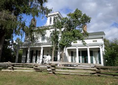
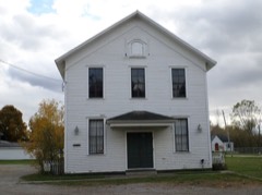
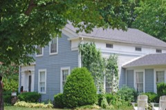
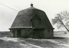
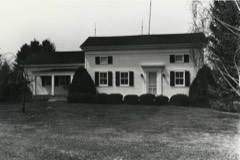
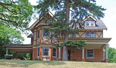
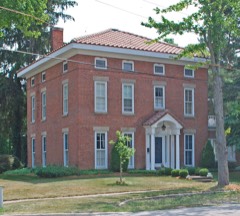
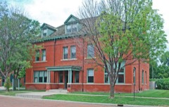
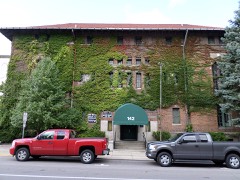
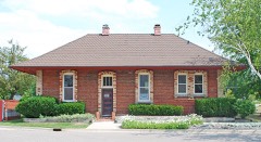
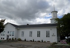
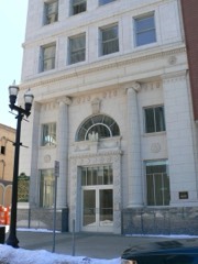
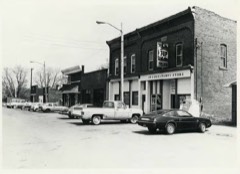
73 National Register listings published here, 1 of them a National Historic Landmark.
Sources: the National Register database, National Park Service
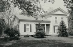
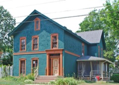
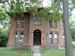
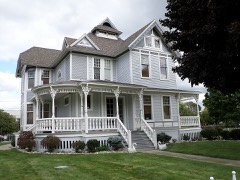
66 topographic sheets cover 34 settlements here, and 73 properties are on the National Register of Historic Places.
73 National Register listings published here, 1 of them a National Historic Landmark.
Sources: the National Register database, National Park Service
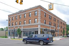
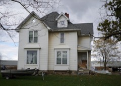
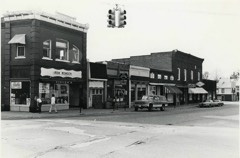
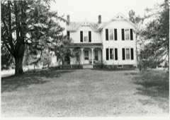
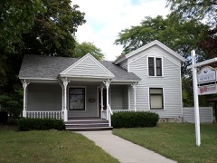
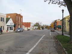
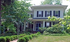
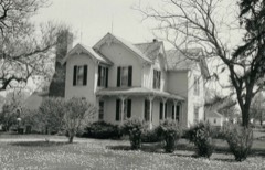
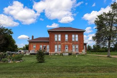
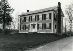
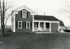
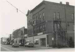
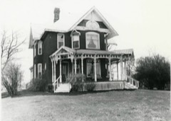
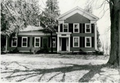
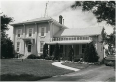
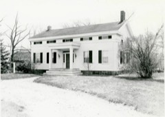
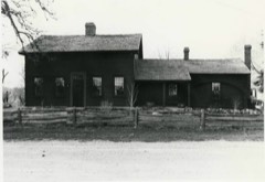
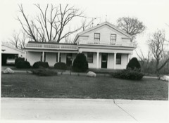
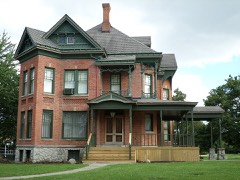
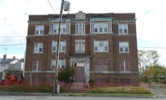
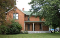
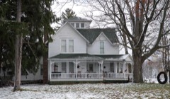
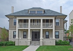
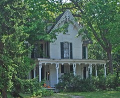
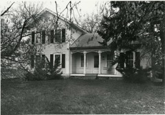
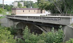
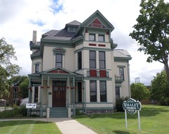
Every property in this county listed on the National Register of Historic Places, with the year it was listed and the federal nomination document.
Every wildfire the federal occurrence database records inside this county: 188 of them, burning about 244 acres. 25 started naturally and none was recorded as arson. Each settlement page carries the fires within five miles of it.
| Reported cause | Fires |
|---|---|
| Equipment and vehicle use | 89 |
| Missing data/not specified/undetermined | 53 |
| Natural | 25 |
| Recreation and ceremony | 10 |
| Debris and open burning | 9 |
| Smoking | 2 |
The five largest, by the area the report gives. None of them was recorded as arson.
| Date | Cause | Size | Reported by | Name on the report |
|---|---|---|---|---|
| 22 March 2018 | Missing data/not specified/undetermined | 30 acres | Michigan Department of Natural Resources | GAINES TOWNSHIP FD 0000066 - 2018 |
| 1 May 2018 | Equipment and vehicle use | 15 acres | Michigan Department of Natural Resources | FLUSHING FD 0000073 - 2018 |
| 25 April 2019 | Equipment and vehicle use | 8.0 acres | Michigan Department of Natural Resources | CLIO AREA FD 0000067 - 2019 |
| 22 April 2018 | Equipment and vehicle use | 4.0 acres | Michigan Department of Natural Resources | DAVISON-RICHFIELD AREA FD 18148 - 2018 |
| 1 May 2018 | Recreation and ceremony | 4.0 acres | Michigan Department of Natural Resources | GENESEE TWP FIRE STATION #1 0000066 - 2018 |
| 3 August 2019 | Missing data/not specified/undetermined | 2.0 acres | Michigan Department of Natural Resources | BURTON CITY FIRE/RESCUE 0000265 - 2019 |
| 21 October 2019 | Equipment and vehicle use | 1.0 acres | Michigan Department of Natural Resources | FENTON CITY FD 0000403 - 2019 |
| 21 June 2018 | Equipment and vehicle use | 1.0 acres | Michigan Department of Natural Resources | FENTON CITY FD 0000240 - 2018 |
Every settlement page carries the fires within five miles of it - see the settlement index below.
The NOAA Storm Events Database holds 756 reports for this county, causing 121 deaths, 925 injuries and about $116,246,250 in recorded property damage. Each settlement page carries the reports that name it.
| Kind of event | Reports |
|---|---|
| Thunderstorm Wind | 455 |
| Hail | 215 |
| Tornado | 50 |
| Flash Flood | 16 |
| Lightning | 15 |
| Flood | 5 |
The most serious of them, by death, then injury, then recorded damage. The accounts are quoted exactly as the forecast office filed them.
| When | Event | Place named | Harm | What the report says |
|---|---|---|---|---|
| June 1953 | Tornado (F5) | not stated | 116 killed, 785 hurt, $25,000,000 | no account filed |
| May 1956 | Tornado (F4) | not stated | 3 killed, 116 hurt, $2,500,000 | no account filed |
| July 1997 | Tornado (F3) | Clio | 1 killed, 1 hurt, $3,800,000 | no account filed |
| July 1999 | Lightning | Fenton | 1 killed, 1 hurt | A thunderstorm quickly rolled into Silver Lake Park near Fenton. Beachgoers at the park quickly gathered up their things and raced to their cars, but the last group off the beach was not quite quick enough. Lightning struck an adult female and an eight year old girl, about five feet away from their car. Rescue workers were briefly able to resuscitate the adult, but she died soon after arriving at a local hospital. The girl was treated for her injuries at the hospital, and was released the following day. |
| June 1997 | Lightning | Otisville | 8 hurt | no account filed |
| April 1954 | Tornado (F2) | not stated | 2 hurt, $25,000 | no account filed |
| August 2007 | Tornado (EF2) | Fenton | 1 hurt, $13,000,000 | This is the same tornado that began in Livingston County's Cohoctah Township. The tornado crossed into Genesee County approximately 3 miles west southwest of Fenton at 1649EST. The City of Fenton sustained the greatest amount of damage where the tornado path widened to approximately one-quarter mile, including the snapping and uprooting of hundreds of trees, de-roofing of both residential and municipal structures, and the partial collapse of a large retail structure near the intersection of Owen Road and U.S. 23. Of the approximately 250 homes/buildings damaged in Fenton, two were destroyed and five sustained major damage. The tornado was rated as EF2 in Fenton with wind speeds estimated at approximately 130 MPH. The average path width in Genesee County was 350 yards. One person in Fenton received minor injuries after being struck by flying glass. The tornado exited Genesee County one mile east of Fenton at 1700EST and then continued in Oakland County for another 5.5 miles. |
| October 1990 | Tornado (F2) | not stated | 1 hurt, $2,500,000 | no account filed |
| July 1977 | Tornado (F1) | not stated | 1 hurt, $250,000 | no account filed |
| September 1977 | Tornado (F2) | not stated | 1 hurt, $250,000 | no account filed |
| August 1971 | Tornado (F2) | not stated | 1 hurt, $250,000 | no account filed |
| July 1986 | Tornado (F1) | not stated | 1 hurt, $25,000 | no account filed |
| September 2000 | Thunderstorm Wind | Flint | 1 hurt, $12,000 | A tree was downed onto a car on Russell Avenue near Summit Street. A woman at scene suffered a cut to her arm, necessitating a trip to the hospital. |
| June 1973 | Tornado (F0) | not stated | 1 hurt, $2,500 | no account filed |
| September 2010 | Thunderstorm Wind | Clio | 1 hurt | A large tree was blown down which struck a man on a motorcyle. |
| May 2004 | Thunderstorm Wind | Flint | 1 hurt | A ten year old was blown off his feet and suffered cuts to the head, requiring 5 stitches. |
| June 1999 | Lightning | Flint | 1 hurt | Lightning struck a man as he was unloading groceries from his car. He was briefly hospitalized, but was not seriously hurt. |
| May 1996 | Lightning | Richfield Twp | 1 hurt | no account filed |
| June 1953 | Tornado (F5) | not stated | $25,000,000 | no account filed |
| July 2023 | Hail | Davison | $20,000,000 | Reports of widespread hail damage across Davison, which included car and house damage. |
| May 2012 | Flash Flood | Lennon | $7,100,000 | Four to seven inches of rain falling in less than 12 hours lead to extensive flooding. |Flint Bishop Airport reported 5.62 inches. Dozens of homes flooded with numerous roads shut down, including sections of I-75 and I-69. Especially hard hit was Swartz Creek and Flint Township. Residents of Apple Creek Apartment in Swartz Creek had to evacuate. In Grand Blanc Township, Knollwood Apartments, located off of Hill Road, saw the worst of the damage. The far eastern side of the apartment complex saw the bulk of the damage, with water nearly submerging at least 30 cars, flooding basements, damaging first floors and knocking out the power. The total cost to Knollwood for the damage was more than $1.7 million. |
| June 1994 | Thunderstorm Wind | Flint | $5,000,000 | A severe thunderstorm moved from west to east across Genesee County on the evening of the 28th. Spotters estimated wind gusts to 60 mph about one mile south of Lennon around 1832 EST, in the extreme western portion of the county. The storm then produced a series of funnel clouds and three separate damage swaths across the central part of the county from strong thunderstorm downburst winds, estimated as high as 100 mph in a post-storm damage survey. The first area of significant damage, which began around 1845 EST, was on the west side of Flint where the strong winds blew large trees down onto homes and porches, power lines, and vehicles. Several home television antennas were also blown down. There was also damage to fences, and windows were blown out of homes and a few businesses. Structural damage occurred at a plant in Flint where a portion of the east-facing wall was peeled off, and to an IGA store, and a video equipment service company where the roofs were peeled off of the structures. Substantial water damage occurred at another building where a portion of the roof was torn off. The second area of major damage, that began around 1855 EST, was on the southeast side of Flint where numerous trees were uprooted and blown down onto houses, mobile homes, and power lines. Power poles were also blown down at an intersection. The third area of major damage, that began around 1907 EST, was just east of Davison in the eastern portion of the county, where numerous trees were uprooted and blown down. In southeast Genesee County, around 1907 EST, the Atlas Township Fire Department reported a funnel cloud over M-15 (State Road), about one-half mile north of Goodrich. |
| August 1984 | Tornado (F2) | not stated | $2,500,000 | no account filed |
| February 2024 | Tornado (EF2) | Grand Blanc | $1,000,000 | The tornado touched down in Creasey Bicentennial Park damaging the south pavilion and uprooting a pine tree. The tornado tracked east northeast across Westminster Cir where multiple trees were snapped, two garage doors were blown out, and a roof was partially stripped from one home. The tornado continued tracking east northeast across Porter Rd and Reid Rd where multiple limbs and trees were snapped. The peak of damage occurred at an industrial complex at the intersection of Reid and S Dort Hwy. Damage to the complex included blown out non load bearing walls and loss of the majority of the roof. Peak winds were estimated at 115 mph. Multiple transmission poles were also snapped along S Dort Hwy. Damaged continued into the Indian Hill neighborhood near downtown Grand Blanc where multiple large trees were downed with some of them falling onto homes along Old Bridge Rd to Stonybrook Dr. The tornado tracked east northeast across Genesee Road to Belsay Rd snapping hardwood limbs and uprooting pine trees before greater damage occurred along Moonstone Dr and Brookview Dr. Damage in these areas included more widespread tree damage and one home with a garage door blown out and a roof partially uplifted. The tornado weakened and lifted shortly after it crossed Perry Rd. |
| July 2021 | Tornado (EF1) | Flushing | $1,000,000 | The tornado path extended from just northeast of Calkins and North McKinley Rd, just west of Elms Rd between Corunna and Calkins Rd. The most significant damage, consistent with EF1 damage, was along Calkins Rd, west of Morrish Road; and along Morrish Road, south of Calkins Rd. Peak winds were estimated at 100 mph. Notable damage included three garages that were either partially or completely destroyed. Additional damage included minor structural damage to adjacent homes, including the loss of roofing materials and siding. There was sporadic tree and crop damage along the path. |
| June 2008 | Thunderstorm Wind | Bayport Park | $750,000 | Widespread trees and wires reported down. A few trees fell onto houses and vehicles. |
| June 2008 | Thunderstorm Wind | Burton | $600,000 | Trees and wired reported down, some on homes. |
| July 1997 | Tornado (F3) | Clio | $600,000 | no account filed |
| May 2013 | Tornado (EF2) | Grand Blanc | $350,000 | The tornado was rated EF2 with a maximum wind speed of 130 mph. The maximum path width was 300 yards with a total path length of 4.6 miles. The tornado started near the intersection of Vassar Road and Pointe North Drive and continued to State Road near Perry Road. The greatest damage occurred near the intersection of Hegel Gale Roads. A house was nearly destroyed, along with a garage and external storage facilities wrecked. |
| June 2003 | Tornado (F1) | Fenton | $300,000 | A tornado touched down in Camp Copneconic and produced extensive tree damage. The tornado then traveled northeast into southern Grand Blanc Township. The tornado hit Spring Oak subdivision on the north side of Baldwin Road approximately one mile east of Fenton road. The tornado completely destroyed the garage and front porches of three homes. Several homes had their garage walls destroyed. Several other homes had shingle and siding damage. The tornado continued through Aspen subdivision, where two homes sustained roof and garage damage. Several other homes in the subdivision lost shingles and siding. The tornado continued to the intersection of McWain and Pollock roads. Several homes sustained damage due to falling trees. The Michigan room on one home was destroyed. The tornado lifted just northeast of McWain road. An official storm survey conducted by the National Weather Service estimated winds between 100 and 110 mph. |
| June 2008 | Thunderstorm Wind | Argentine | $250,000 | Trees and power lines reported down, damage to 7 homes. Barn roof blown off. |
| September 2005 | Flash Flood | Countywide | $250,000 | Three to four inches of rainfall led to widespread flooding across the county. Numerous reports of 3 feet of water on area roads including: I-75, I-475, Lieth, North, Miller, Beecher, Bradley, Sunset.Water was also reported in homes and businesses. Basement flooding was observed in Goodrich.The Flint Public library roof leaked, causing water damage to books and carpeting. A woman at Mott Community College was stranded atop her car for more than an hour due to rising flood waters, and had to be rescued. |
| September 1986 | Tornado (F2) | not stated | $250,000 | no account filed |
| August 1984 | Tornado (F0) | not stated | $250,000 | no account filed |
| August 1984 | Tornado (F3) | not stated | $250,000 | no account filed |
| June 1983 | Tornado (F1) | not stated | $250,000 | no account filed |
| July 1974 | Tornado (F3) | not stated | $250,000 | no account filed |
| June 1971 | Tornado (F1) | not stated | $250,000 | no account filed |
| May 2013 | Tornado (EF2) | Lake Fenton | $225,000 | The tornado was rated EF2 with maximum wind speeds of 115 mph. The maximum path width was 500 yards with a total path length of 5.1 miles. The tornado started along Odell Road south of Linden Road and continued to Fenton Road north of Baldwin Road. The greatest damage occurred along Thompson Road between Fairbanks and Jennings Roads. There was significant damage to homes, including removal of roofs, along with substantial tree damage. |
| June 2009 | Flood | Gaines Arpt | $200,000 | no account filed |
| July 1999 | Thunderstorm Wind | Goodrich | $140,000 | no account filed |
| March 2019 | Tornado (EF0) | Genesee Duford Arpt | $100,000 | A tornado touched down near the intersection of Stanley and Bray Roads and quickly tracked off to the northeast. The storm lifted near the M-57 and Irish Road intersection. The tornado was strongest when it hit the Camelot Villas off of Genesee Road. A mobile home was flipped onto its side, with another mobile home partially blown off the foundation. Roof and siding damage was prevalent within the mobile park. Clusters of trees were snapped and tree tops sheared along the tornado path, with a couple other small trailers flipped. |
| May 2014 | Flash Flood | Brent Creek | $100,000 | Multiple streets were flooded, including I-75. Vehicles were stranded due to the high water. Although rainfall totals where only around 1 inch, heavy rainfall of 3 to 5 inches from the previous day set the stage for the Flash Flooding which occurred. |
| May 2013 | Tornado (EF1) | Beecher | $100,000 | The tornado was rated an EF1 with maximum wind speeds of 105 mph. The maximum path width was 400 yards with a total path length of 2.3 miles. The tornado started at the southern end of Hasselbring Park and continued northeast to around the intersection of Harry Street and Humprey Avenue. The greatest damage occurred along Saginaw Street in between Holtslander and Downey Avenues. There was significant tree damage as well as damage to older commercial buildings of small to medium size. |
| May 2011 | Flash Flood | Duffield | $100,000 | Estimated rainfall of at least 2 to 4 inches caused water over roads and flooded properties. |
| October 2007 | Tornado (EF0) | Thetford Center | $100,000 | This tornado developed at 0006EST in Thetford Township about 5 miles east of Clio. It started near Center and Vienna roads, tracked northeastward for 2.5 miles, and ended in Buell Lake Park. The tornado was rated as EF0 with winds estimated around 80 mph. Most of the damage was to large trees with many snapped or uprooted. One home had shingle damage and a barn had a portion of its metal roof peeled off. Damage to these two structures was estimated at $100K. The average path width was 50 yards. | |
| May 2002 | Thunderstorm Wind | Flushing | $100,000 | A National Weather Service storm survey determined that a downburst (strait line thunderstorm winds) hit portions of northeastern Flushing Township and northwestern Mt Morris Township. Damage included numerous downed trees and limbs, some of which fell onto homes and cars. The downburst was aproximately 4 miles long and 2 to 3 miles wide. |
| March 2019 | Tornado (EF0) | Lennon | $75,000 | The tornado touched down on Nichols Rd just south of Corunna Rd before traveling east/northeast to Calkins Rd just east of Morrish Rd. Damage included downed and snapped trees, large limbs, and a collapsed pole barn. The tornado lifted near Jennings Rd just north of Pasadena Ave. |
| May 2007 | Lightning | Flint | $75,000 | A local newspaper article reported that a house suffered heavy damage after a lightning strike ignited a fire. Total damages were roughly estimated at $75K. |
| June 2006 | Lightning | Davison | $55,000 | A very intense lightning bolt struck a home, causing severe damage. The strike left a hole in the side of one wall and had electrical outlets smoking. Damages were estimated at $15K to the property and $40K to contents. Residents were home but no one was injured. |
| June 2011 | Thunderstorm Wind | Flint | $50,000 | Trees and powerlines reported down across Flint and Genesse county. |
| May 2007 | Thunderstorm Wind | Grand Blanc | $50,000 | A local newspaper article reported that a 60-foot-tall tree fell and struck a chimney, sending the chimney and roof crashing through two stories of a home. The family of four were home at the time and all avoided injury. The insurance company estimated that the total property damage was at least $50K. |
| November 2005 | Lightning | Flint | $50,000 | Lightning struck a home on Seymour Rd, between Bristol and Miller Roads in Vernon Township, causing a fire. |
| July 2000 | Thunderstorm Wind | Gaines | $40,000 | no account filed |
| July 2022 | Tornado (EF0) | Bayport Park | $35,000 | An NWS storm survey confirmed a weak tornado developed over or along the shoreline of eastern Lake Fenton during the late evening of July 11th. The tornado tracked east-southeast for 7.5 miles before lifting 3 miles east-southeast of Holly/just west of I-75 in northern Oakland County. The first indication of damage occurred on Pine Street near Lake Fenton where large limbs fell on a home, which took out a second-story dormer and a portion of the roof. Tree damage was sparse and sporadic along the path, mainly consisting of tree limbs and leaves down. The weak tornado crossed into northwest Oakland County just southwest of Oyster Lake, and continued tracking southeast for an additional 6.1 miles. The peak damage was observed in the backyard of a home on Addis Road in Holly. About a dozen trees suffered significant damage. The home also lost a few vinyl siding panels and a pergola was damaged. A barn farther down the road lost some metal roofing. |
| June 2006 | Flash Flood | Flint | $35,000 | Monday evening, June 26th, thunderstorms over the Flint area produced heavy rainfall with up to 2.8 inches falling in about an hour over a relatively small area of Flint around the Cherokee Avenue and Atherton Road areas. Flooding of homes and streets were reported with several people needing rescuing by boat. No deaths or injuries were reported. Flooding has occurred in this area several times in the past and is partly due to a poor drainage system in place. A rough estimate of $35K accounts for contents lost in homes as well as vehicle damage. |
| July 2000 | Flash Flood | Flint | $35,000 | no account filed |
| June 2008 | Thunderstorm Wind | Linden | $30,000 | Trees and wires reported down. |
| June 1999 | Thunderstorm Wind | Atlas | $30,000 | no account filed |
| September 2014 | Thunderstorm Wind | Goodrich | $25,000 | Numerous large trees down, some on homes and vehicles. |
The Survey's mineral resources record lists 17 workings inside this county. 8 still produce and 9 are closed or unrecorded. Each settlement page carries the workings within five miles of it.
| Commodity | Workings |
|---|---|
| Sand and Gravel, Construction | 14 |
| Clay | 3 |
The least common of them first, because a county's hundredth gravel pit says nothing its first ten did not.
| Where | Site | Commodity | Status | Recorded |
|---|---|---|---|---|
| Frank Sharp Clay Pit | Clay | Past Producer | ||
| Fred Mccann Clay Pit | Clay | Past Producer | ||
| Saginaw Clay Products Co Shale Pit | Clay | Past Producer | ||
| Ferguson Excavating Co Pit | Sand and Gravel, Construction | Past Producer | ||
| Genesee County Pit & Mill | Sand and Gravel, Construction | Producer | ||
| Holloway Sand & Gravel Co., Inc Pit | Sand and Gravel, Construction | Past Producer | ||
| Kish Pit & Mill | Sand and Gravel, Construction | Producer | ||
| Kurtz Gravel Co. Pit | Sand and Gravel, Construction | Past Producer | ||
| Kurtz Gravel Co. Pit | Sand and Gravel, Construction | Past Producer | ||
| Kurtz Gravel Co. Pit | Sand and Gravel, Construction | Past Producer | ||
| Kurtz Pit & Mill | Sand and Gravel, Construction | Producer | ||
| Mathews Sand & Gravel Pit | Sand and Gravel, Construction | Producer | ||
| Neuman Sand & Gravel Pit | Sand and Gravel, Construction | Producer | ||
| Otisville Pit & Mill | Sand and Gravel, Construction | Producer | ||
| Snelenberger Sand & Gravel Pit | Sand and Gravel, Construction | Producer | ||
| Stillman Pit & Mill | Sand and Gravel, Construction | Producer | ||
| Uno Talo Pit | Sand and Gravel, Construction | Past Producer |
Named settlements recorded in the Geographic Names Information System, each with the topographic sheets covering it. Villages, hamlets and abandoned places alike. Each is shown with the nearest named watercourse or landform and the survey quadrangle it falls on.
Argentine township · 48451 · Near Stage Island · Linden quadrangle
14 sheets, 1922 to 1985
Fenton Charter Township · 48430 · Near Case Island · Fenton quadrangle
14 sheets, 1920 to 1985
Flushing Charter Township · 48433 · On Brent Creek · New Lothrop quadrangle
14 sheets, 1919 to 1990
Vienna Charter Township · 48420 · On Benjamin Run · Clio quadrangle
16 sheets, 1920 to 1990
Genesee Charter Township · 48437 · On Butternut Creek · Davison quadrangle
16 sheets, 1920 to 1990
Grand Blanc city · 48439 · On Bush Creek · Flint South quadrangle
14 sheets, 1920 to 1985
Fenton Charter Township · 48430 · Near Case Island · Fenton quadrangle
14 sheets, 1920 to 1985
Fenton Charter Township · 48430 · Near Case Island · Fenton quadrangle
14 sheets, 1920 to 1985
Flint city · 48505 · On Kearsley Creek · Flint North quadrangle
16 sheets, 1920 to 1990
Vienna Charter Township · 48420 · On Benjamin Run · Clio quadrangle
16 sheets, 1920 to 1990
Richfield township · 48423 · On Riegle Drain · Davison quadrangle
16 sheets, 1920 to 1990
Richfield township · 48458 · On Butternut Creek · Davison quadrangle
16 sheets, 1920 to 1990
Richfield township · 48423 · On Zufelt Drain · Davison quadrangle
16 sheets, 1920 to 1990