 Block
Grand Rapids, Michigan
17 topographic sheets cover this place, the earliest surveyed in 1914 and the latest in 1996. It stands in Grand Rapids City. It lies in ZIP code area 49503. The Survey maps it on the Grand Rapids West quadrangle. 198,917 people lived here at the 2020 count. It stands 640 feet above sea level.
Research this city
On record in Grand Rapids
Buildings and businesses the archive holds for this place. Each opens its own page, with the source record it came from.
On the National Register 12 of 47 shown
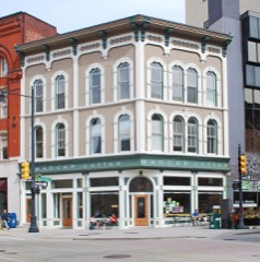 Aldrich Buildinglisted 1982
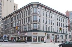 Aldrich, Godfrey, and White Blocklisted 1999
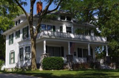 Mathias. Alten House and Studiolisted 2009
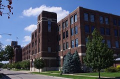 American Seating Company Factory Complexlisted 2003
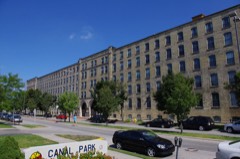 Berkey and Gay Furniture Company Factorylisted 2000
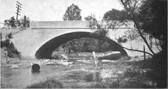 Division Avenue-Plaster Creek Bridgelisted 1999
 Eastern Avenue Schoollisted 2013
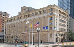 Fine Arts Buildinglisted 1982
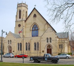 First (Park) Congregational Churchlisted 1982
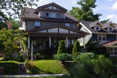 President Gerald R. Ford Jr. Boyhood Homelisted 1995
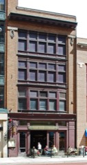 Goodspeed Brothers Buildinglisted 1980
 Grand Rapids Christian High Schoollisted 2018
Population over time
9 figuresGrand Rapids grew from 2,686 to 198,917 between 1850 and 2020. These are the recorded population figures Wikidata holds for this place, reached through the Geographic Names Information System number this page is keyed on rather than by name, so they belong to this place and not to another of the same name. Most are census counts, but not all are: an early figure may be a founding or settlement estimate, and an estimate published within five years of a census is left out. The change column is computed, and is left blank where more than 20 years separate a figure from the one before it, because a gap that long is not a change between two counts.
| Year | People | Change |
|---|---|---|
| 1850 | 2,686 | |
| 1860 | 8,085 | +5,399 (+201%) |
| 1870 | 16,507 | +8,422 (+104%) |
| 1880 | 32,016 | +15,509 (+94%) |
| 1890 | 60,278 | +28,262 (+88%) |
| 1900 | 87,565 | +27,287 (+45%) |
| 1910 | 112,571 | +25,006 (+29%) |
| 2010 | 188,040 | |
| 2020 | 198,917 | +10,877 (+6%) |
Topographic sheets covering this place
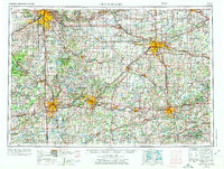
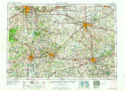
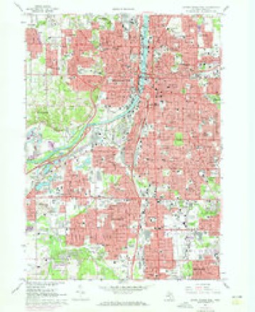
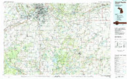
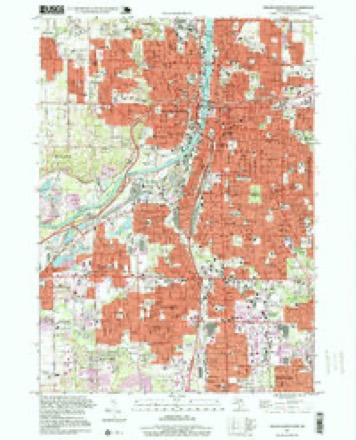
8 surveys from 17 printed sheetsMatched by testing this settlement's coordinate against the published boundary of every sheet in the United States Geological Survey's historical collection. Each opens the scanned sheet at the Survey.
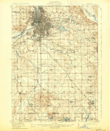
- 1914 USGS Grand Rapids quadrangle1:62500, 5 printings
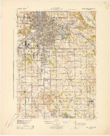
- 1943 USGS Grand Rapids quadrangle1:62500
- 1958 USGS Grand Rapids quadrangle1:250000, 2 printings
- 1961 USGS Grand Rapids quadrangle1:250000
- 1962 USGS Grand Rapids quadrangle1:250000, 2 printings
- 1967 USGS Grand Rapids West quadrangle1:24000, 4 printings
- 1984 USGS Grand Rapids quadrangle1:100000
- 1996 USGS Grand Rapids West quadrangle1:24000
Fires near this place
108 since 2012Regional context, not property-specific evidence. The federal wildfire occurrence database lists 108 fires within 5 miles of Grand Rapids between 2012 and 2020, burning about 116 acres in total. 11 started naturally. None was recorded as arson. Distance is straight-line from the map coordinates, so a fire counted here may appear on a neighbouring settlement's page as well.
| Reported cause | Fires |
|---|---|
| Equipment and vehicle use | 48 |
| Missing data/not specified/undetermined | 38 |
| Natural | 11 |
| Debris and open burning | 7 |
| Smoking | 3 |
| Recreation and ceremony | 1 |
The most recent of them, most recent first, with the day each was reported and the service that recorded it.
| Date | Cause | Size | Reported by | Name on the report |
|---|---|---|---|---|
| 8 September 2019 | Missing data/not specified/undetermined | 1.0 acres | Michigan Department of Natural Resources | WYOMING FD 194678 - 2019 |
| 4 September 2019 | Debris and open burning | 1.0 acres | Michigan Department of Natural Resources | GRAND RAPIDS FD 0016378 - 2019 |
| 29 September 2018 | Natural | 1.0 acres | Michigan Department of Natural Resources | GRAND RAPIDS FD 0016868 - 2018 |
| 25 September 2018 | Natural | 1.0 acres | Michigan Department of Natural Resources | GRAND RAPIDS FD 0016660 - 2018 |
| 20 September 2019 | Missing data/not specified/undetermined | 1.0 acres | Michigan Department of Natural Resources | WYOMING FD 194896 - 2019 |
| 16 September 2018 | Equipment and vehicle use | 1.0 acres | Michigan Department of Natural Resources | GRAND RAPIDS FD 0016112 - 2018 |
| 12 September 2019 | Missing data/not specified/undetermined | 1.0 acres | Michigan Department of Natural Resources | WYOMING FD 194763 - 2019 |
| 5 August 2018 | Missing data/not specified/undetermined | 1.0 acres | Michigan Department of Natural Resources | GRAND RAPIDS FD 0013282 - 2018 |
Settlements close enough to share some of these fires:
Mines and quarries near this place
10 of 12 shownRegional context, not property-specific evidence. The federal mineral resources record lists 12 workings within 5 miles of Grand Rapids: 7 producers, 4 past producers, 1 unknown. 7 still produce. What was taken out: Sand and Gravel, Construction, Gypsum-Anhydrite. Distance is straight-line from the map coordinates, so a quarry counted here may appear on a neighbouring settlement's page as well.
| Where | Site | Commodity | Status | Recorded |
|---|---|---|---|---|
| Grand Rapids Gypsum Mine #1 | Gypsum-Anhydrite | Past Producer | ||
| Grand Rapids Gypsum Mine #2 | Gypsum-Anhydrite | Past Producer | ||
| Grand Rapids Gypsum Mine #3 | Gypsum-Anhydrite | Past Producer | ||
| Grand Rapids Mine | Gypsum-Anhydrite | Producer | ||
| Bird Pit | Sand and Gravel, Construction | Producer | ||
| Butterworth Sand Pit | Sand and Gravel, Construction | Producer | ||
| Devries Pit | Sand and Gravel, Construction | Unknown | ||
| Gillisse Pit and Mill | Sand and Gravel, Construction | Producer | ||
| Grand Rapids Gravel Co. Plant No.20 | Sand and Gravel, Construction | Producer | ||
| Grand Rapids Plant No. 5 | Sand and Gravel, Construction | Producer |
Storms near this place
56 since 1993Regional context, not property-specific evidence. The National Weather Service names Grand Rapids in 56 storm reports between 1993 and 2026: 29 thunderstorm wind, 19 hail, 5 flash flood, 2 tornado. No death or injury is recorded in these reports. Each account below is quoted exactly as the forecast office filed it, from the NOAA Storm Events Database, and each date opens the federal record of that event.
| When | Event | Place named | Harm | What the report says |
|---|---|---|---|---|
| May 1998 | Thunderstorm Wind | Grand Rapids | $373,000 | Michigan State Police EMD's Damage and Injury Assessment Report indicated $373,000 in public damage costs, 25 homes damaged, and 5 businesses damaged within the City of Grand Rapids. Private damage cost estimates were not available. No injuries were reported in the city. Widespread power outages left much of the northern half of the city in the dark and traffic signals were out across the city. The City of Grand Rapids declared a local state of emergency and was covered under the Governor's disaster declaration for Kent County. On June 24th, President Clinton granted a Major Disaster Declaration for Kent County, making federal disaster assistance available for city and county residents. |
| August 2003 | Hail | East Grand Rapids | $100,000 | One and three quarters inch diameter hail was reported in Ada and also in Rockford, and three quarters inch diameter hail was reported one mile north of east Grand Rapids. |
| June 2014 | Thunderstorm Wind | Grand Rapids | $50,000 | Several trees were blown down across southern Kent county. |
| June 2005 | Hail | Grand Rapids | $50,000 | no account filed |
| August 2000 | Thunderstorm Wind | Grand Rapids | $50,000 | no account filed |
| May 2004 | Hail | Grand Rapids | $30,000 | Three quarters inch diameter hail and wind gusts to around 60 m.p.h. were reported in the city of Grand Rapids and about two miles west of Ada. |
| August 2016 | Tornado (EF0) | Grand Rapids | $25,000 | A brief EF-0 tornado touched down in Kent County near Perkins Avenue NE between Leonard Street NE and Knapp Street NE. Tree damage and some property damage from fallen trees occurred as the result of this brief tornado. |
| August 2015 | Thunderstorm Wind | Grand Rapids | $25,000 | The broadcast media in Grand Rapids reported isolated trees down across portions of Kent county. A tree was blown down onto a house at Fountain street and Mack avenue. |
| June 2009 | Flash Flood | Grand Rapids | $25,000 | During the evening hours, four cars stalled in high water at 28th street east of Division. Flooding of the terminal building at the Grand Rapids Airport was also reported. High water was reported over Thornapple Road in Cascade Township. Cars also stalled in flood waters on 52nd street near Brenton. Flooding was also reported at 44th and Kenowa in Grandville. |
| June 2007 | Thunderstorm Wind | Grand Rapids | $25,000 | A measured 63 mph wind gust was recorded at the Grand Rapids ASOS. There were numerous reports of downed trees and power lines in Lowell. |
| June 2006 | Hail | Grand Rapids | $25,000 | Quarter sized hail was reported in Grand Rapids. |
| May 2003 | Hail | Grand Rapids | $25,000 | Hail up to one inch in diameter was reported in Grand Rapids. |
| May 2003 | Hail | Grand Rapids | $25,000 | Another report of one inch diameter hail was received in the city of Grand Rapids. |
| June 2005 | Hail | Grand Rapids | $25,000 | no account filed |
| August 2007 | Thunderstorm Wind | East Grand Rapids | $20,000 | Several large trees were blown down in East Grand Rapids and Ada. |
| April 1997 | Thunderstorm Wind | East Grand Rapids | $15,000 | no account filed |
| May 2012 | Thunderstorm Wind | East Grand Rapids | $10,000 | Widespread tree damage for several blocks along Lake and Elmwood drives in eastern Grand Rapids. One large tree was uprooted and fell on the second story of a house. Roof damage on at least four houses. |
| June 2006 | Hail | Grand Rapids | $10,000 | Three quarters inch hail was reported just north of Grand Rapids and wind damage was reported near Ada. |
| June 2005 | Hail | Grand Rapids | $10,000 | Three quarters inch diameter hail was reported in Grand Rapids. |
| July 1995 | Thunderstorm Wind | Grand Rapids | $10,000 | Trees and power lines down. One tree fell onto a home. |
| August 2002 | Thunderstorm Wind | Grand Rapids | $10,000 | no account filed |
| May 1996 | Flash Flood | Grand Rapids | $10,000 | no account filed |
| June 2012 | Thunderstorm Wind | East Grand Rapids | $5,000 | The broadcast media reported an isolated tree was blown down in East Grand Rapids, briefly pinning a person in a car at Cascade Road and Cherry Drive. |
| October 2002 | Thunderstorm Wind | Grand Rapids | $5,000 | Law enforcement in Kent county reported that several trees were blown down ten miles northeast of the city of Grand Rapids. |
| August 1993 | Thunderstorm Wind | Grand Rapids | $5,000 | A large tree was blown over onto a house and car at 2300 Clyde Park Avenue. |
| June 2005 | Hail | Grand Rapids | $5,000 | no account filed |
| June 1998 | Thunderstorm Wind | Grand Rapids | $2,500 | Amateur radio operators reported power lines downed near the intersection of Plainfield Ave and 4 Mile Road in NE Grand Rapids. A trained spotter reported one tree was uprooted at a funeral home at the corner of Fuller St. and 3 Mile Road in NE Grand Rapids. No structural damage was reported. |
| August 2001 | Thunderstorm Wind | Grand Rapids | $1,000 | no account filed |
| April 2026 | Thunderstorm Wind | East Grand Rapids | - | Estimated wind gust. |
| May 2025 | Thunderstorm Wind | Grand Rapids | - | Uprooted tree fell on a vehicle. |
| July 2022 | Thunderstorm Wind | Grand Rapids | - | Wind gust to around 60 mph were reported in and near Grand Rapids. |
| September 2019 | Tornado (EF0) | Grand Rapids | - | Apartment building on Fairview Ave NE just east of Division Street had roofed peeled off. Roof landed on homes immediately to the east of the apartment building. |
| March 2012 | Hail | Grand Rapids | - | The public reported three quarters inch diameter hail with a strong thunderstorm just northeast of downtown Grand Rapids. |
| July 2011 | Flash Flood | Grand Rapids | - | Dispatch reported numerous incidents of cars stuck in water and rapidly flowing water flooding streets. Sections of Diamond and Turner Avenue were impassible. |
| September 2011 | Thunderstorm Wind | Grand Rapids | - | A few trees and scattered power lines were blown down across portions of the southern half of Kent county, where a trained spotter measured a peak wind gust of 55 mph four miles north northwest of Lowell. A measured gust of 52 mph was recorded at the Gerald Ford airport in Grand Rapids. |
| July 2008 | Hail | Grand Rapids | - | An amateur radio operator in Grand Rapids reported seven eighths inch diameter hail. |
| July 2008 | Hail | Grand Rapids | - | A trained spotter in Grand Rapids reported three quarters inch diameter hail and a wind gust estimated at 60 mph. |
| July 2008 | Thunderstorm Wind | Grand Rapids | - | A 56 knot wind gust was measured at Wood Tv 8 in Grand Rapids. |
| December 2007 | Thunderstorm Wind | Grand Rapids | - | A 56 knot wind gust was recorded at the Gerald R. Ford Interational Airport in Grand Rapids. |
| September 2007 | Thunderstorm Wind | Grand Rapids | - | A 58 mph measured wind gust was recorded at the Grand Rapids ASOS site. |
| June 2007 | Thunderstorm Wind | Grand Rapids | - | A measured 68 mph wind gust was recorded in downtown Grand Rapids. |
| February 1999 | Thunderstorm Wind | Grand Rapids | - | A 63 mile per hour wind gust was reported in Grand Rapids. |
| October 1998 | Flood | Grand Rapids | - | Rainfall of 1 inch in under 15 minutes caused urban flooding. |
| May 1997 | Hail | Grand Rapids | - | Golfball sized hail reported by NWS spotter at the John Ball Park Public Zoo. |
| September 1997 | Flash Flood | Grand Rapids | - | Urban flooding in the northeast quadrant of Grand Rapids left standing water at the intersection of Plainfield Road and 4-Mile Road. Three vehicles were stranded while trying to cross the flooded intersection. |
| July 1995 | Thunderstorm Wind | Grand Rapids | - | Spotters reported large tree limbs down and street flooding in southeast Grand Rapids. |
| July 1994 | Thunderstorm Wind | Grand Rapids | - | Several trees and power lines were blown down in the northwest part of the city. |
| July 1994 | Thunderstorm Wind | Grand Rapids | - | Several trees and power lines were blown down on the northeast side of the city. |
| July 1994 | Thunderstorm Wind | Grand Rapids | - | Five large pine trees were uprooted by strong thunderstorm winds. The trees were two feet or more in diameter. |
| August 1993 | Thunderstorm Wind | Grand Rapids | - | A thunderstorm wind gust of 63 mph was reported at Four Mile Road and the East Beltline in northeast Grand Rapids. |
| March 2026 | Hail | Grand Rapids | - | no account filed |
| March 2026 | Hail | East Grand Rapids | - | no account filed |
| March 2026 | Hail | East Grand Rapids | - | no account filed |
| February 1997 | Flash Flood | Grand Rapids | - | no account filed |
| September 1994 | Hail | Grand Rapids | - | no account filed |
| August 1993 | Hail | Grand Rapids | - | no account filed |
Nearest settlements
The eight closest, with where each one stands in the county. Distances are straight-line, computed from the Geographic Names Information System coordinates.
| Map | Place | Distance | Sheets |
|---|---|---|---|
| East Grand Rapids | 3.4 miles | 16 | |
| Wyoming | 4.0 miles | 17 | |
| Comstock Park | 5.2 miles | 16 | |
| Wilder Center | 5.7 miles | 16 | |
| Standale | 5.8 miles | 11 | |
| Walker | 5.9 miles | 14 | |
| Eastmont | 6.0 miles | 16 | |
| Grandville | 6.2 miles | 11 |
Elsewhere
Matched on this settlement's Geographic Names Information System number rather than its name, so it cannot be a different place of the same name in another state.
| Wikipedia article on Grand Rapids | An encyclopaedic summary. Its text is share-alike, so it is linked here rather than copied. |
| Wikidata item Q184587 | The structured record the population and elevation above come from. Public domain (CC0). |
Provenance
This settlement is recorded in the Geographic Names Information System as feature 627105. The sheet list is computed by point-in-boundary test against the United States Geological Survey's historical topographic inventory. Both are works of the United States government and carry no copyright under 17 U.S.C. 105.
Wildfire. Short, Karen C. 2022. Spatial wildfire occurrence data for the United States, 1992-2020 [FPA_FOD_20221014]. 6th Edition. Fort Collins, CO: Forest Service Research Data Archive. https://doi.org/10.2737/RDS-2013-0009.6 Collected with United States Government funding and usable without additional permissions or fees.
Mines and quarries. USGS Mineral Resources Data System (MRDS) https://mrdata.usgs.gov/mrds/ A work of the United States government, no copyright under 17 U.S.C. 105.
Storms. NOAA National Centers for Environmental Information, Storm Events Database https://www.ncei.noaa.gov/stormevents/ A work of the United States government, no copyright under 17 U.S.C. 105. Narratives are quoted verbatim from the National Weather Service report and are not edited or summarised.