Block
From the record
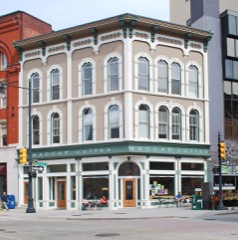
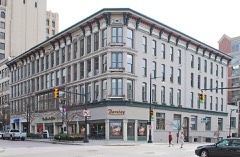
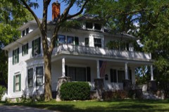
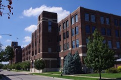
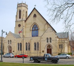
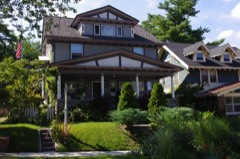
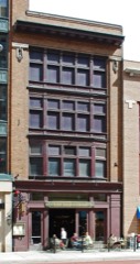
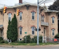
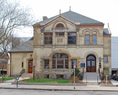
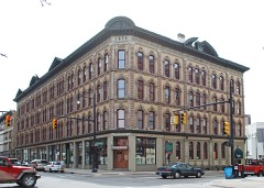
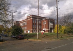
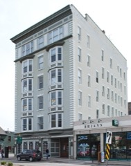
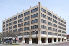
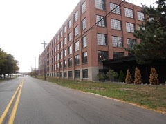
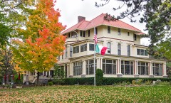
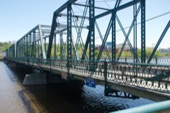
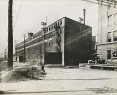
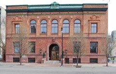
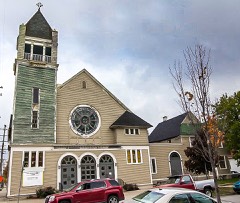
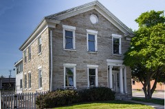
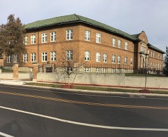
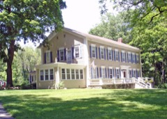
57 National Register listings published here.
Sources: the National Register database, National Park Service
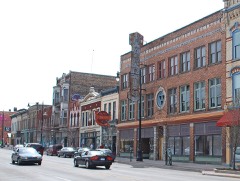
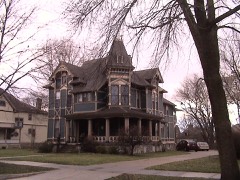
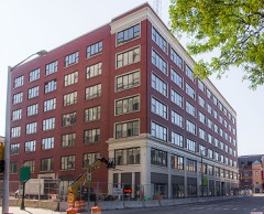
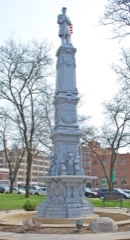
79 topographic sheets cover 60 settlements here, and 57 properties are on the National Register of Historic Places.
57 National Register listings published here.
Sources: the National Register database, National Park Service
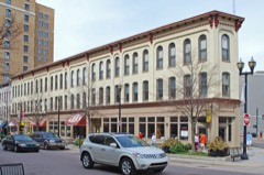
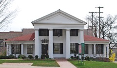
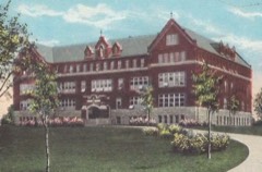
Every property in this county listed on the National Register of Historic Places, with the year it was listed and the federal nomination document.
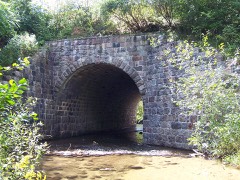
Kent County has 2 covered bridges on the National Register. Each is a listed structure with a federal nomination on file.
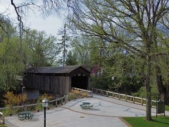 | Ada Covered Bridge | Listed 1970 |
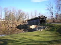 | Fallasburg Covered Bridge | Listed 1972 |
Every wildfire the federal occurrence database records inside this county: 487 of them, burning about 657 acres. 43 started naturally and 5 were recorded as arson. Each settlement page carries the fires within five miles of it.
| Reported cause | Fires |
|---|---|
| Equipment and vehicle use | 238 |
| Missing data/not specified/undetermined | 154 |
| Natural | 43 |
| Recreation and ceremony | 18 |
| Debris and open burning | 16 |
| Smoking | 12 |
| Arson/incendiarism | 5 |
| Fireworks | 1 |
The five largest, by the area the report gives. One of them was set deliberately.
| Date | Cause | Size | Reported by | Name on the report |
|---|---|---|---|---|
| 19 July 2016 | Equipment and vehicle use | 40 acres | Michigan Department of Natural Resources | not named |
| 9 May 1993 | Recreation and ceremony | 18 acres | Michigan Department of Natural Resources | not named |
| 16 April 2009 | Missing data/not specified/undetermined | 17 acres | Michigan Department of Natural Resources | KENT #1 |
| 3 May 2015 | Missing data/not specified/undetermined | 16 acres | Michigan Department of Natural Resources | KENT 03 |
| 9 April 1994 | Debris and open burning | 10 acres | Michigan Department of Natural Resources | not named |
| 16 April 2003 | Debris and open burning | 9.5 acres | Michigan Department of Natural Resources | not named |
| 18 April 2015 | Arson/incendiarism | 8.9 acres | Michigan Department of Natural Resources | KENT 02 |
| 17 July 2012 | Missing data/not specified/undetermined | 8.3 acres | Michigan Department of Natural Resources | KENT 02 |
Every settlement page carries the fires within five miles of it - see the settlement index below.
The NOAA Storm Events Database holds 497 reports for this county, causing 16 deaths, 376 injuries and about $145,460,500 in recorded property damage. Each settlement page carries the reports that name it.
| Kind of event | Reports |
|---|---|
| Thunderstorm Wind | 287 |
| Hail | 140 |
| Tornado | 44 |
| Flash Flood | 14 |
| Flood | 8 |
| Lightning | 3 |
| Funnel Cloud | 1 |
The most serious of them, by death, then injury, then recorded damage. The accounts are quoted exactly as the forecast office filed them.
| When | Event | Place named | Harm | What the report says |
|---|---|---|---|---|
| April 1965 | Tornado (F4) | not stated | 5 killed, 142 hurt, $2,500,000 | no account filed |
| April 1956 | Tornado (F5) | not stated | 4 killed, 130 hurt, $25,000 | no account filed |
| August 2023 | Thunderstorm Wind | Sand Lake | 3 killed, $10,000,000 | Numerous trees, tree limbs and power lines were blown down. A woman and two girls were also killed near Cedar Springs when the vehicle they were traveling in lost control in a heavy downpour and hydroplaning accident. |
| July 2011 | Thunderstorm Wind | Byron Center | 1 killed, 1 hurt, $5,000,000 | Radar data indicates the northern end of a strong bow echo moved east into southwestern Kent county at 10:45 a.m. and raced east northeast producing significant wind damage and exited far east central Kent county near Lowell at around 11:10 a.m. Numerous trees and power lines were blown down and uprooted in and near towns including Cutlerville, Wyoming and Kentwood.||A 38 year old man was killed inside his garage along 68th street SE in Cutlerville when wind gusts of up to 80 mph ripped a large tree and its roots out of the ground and toppling it onto the garage, splitting it in half. In addition, a woman suffered minor injuries when a tree fell on her home in Cutlerville. |
| May 1999 | Thunderstorm Wind | Wyoming | 1 killed, 1 hurt, $50,000 | Gusty thunderstorm winds flattened a house under construction in Wyoming in Kent County, causing one fatality and injuring another person. A 70 mile per hour wind gust was recorded in Grandville. Numerous trees were downed across the county. A 75 mile per hour wind gust was recorded in Grand Rapids. |
| July 2000 | Thunderstorm Wind | Cascade | 1 killed, 1 hurt, $20,000 | no account filed |
| July 2022 | Thunderstorm Wind | Eagle Mills | 1 killed, $500,000 | Numerous large trees were snapped off or uprooted and there were numerous power outages, mostly in a more concentrated damage path just northwest to north and northeast of downtown Grand Rapids from Walker Avenue east to Fish Ladder Park and Lookout Park. One fatality occurred just north of downtown Grand Rapids due to wind blowing down a large hinged steel door on a shipping container onto the man. |
| May 1998 | Thunderstorm Wind | Sand Lake | 53 hurt, $49,340,000 | Michigan State Police EMD's Damage and Injury Assessment Report indicated $4,336,751 in public damage costs, 53 injuries, 63 homes destroyed, 1196 homes damaged, 15 businesses destroyed, and 173 businesses damaged in Kent County, excluding the City of Grand Rapids (see separate Grand Rapids report). Private damage costs were estimated to be approximately $45.0 Million in the city of Walker alone. No other private damage costs were available from across the county. The storm damage was most severe in the cities of Rockford and Walker. Most city streets within the city limits of Rockford and Walker were left impassable. The city of Walker was closed to the public. Michigan State Police troopers assisted the city of Walker with security and a dawn to dusk curfew was enforced. A team from the Michigan National Guard was sent to the city of Walker to assist in debris removal and cleanup operations. Most of Walker was left without power as the power line infrastructure was destroyed. Damaged and destroyed businesses left 8,403 people unemployed. The Kent County fruitbelt, covering much of the northwest part of the county, received an estimated $20.0 Million in damages due to snapped and uprooted trees. Most damage was done to apple trees, but cherry and peach orchards were also damaged. Kent County declared a local state of emergency (as did the city of Walker) and was granted a Governor's disaster declaration to activate state assistance for the county. On June 24th, President Clinton granted a Major Disaster Declaration for Kent County, making available federal disaster assistance. |
| April 1967 | Tornado (F3) | not stated | 32 hurt, $25,000,000 | no account filed |
| July 2014 | Tornado (EF1) | Grand Rapids South K | 6 hurt, $4,500,000 | An NWS storm survey determined that an EF1 tornado developed rapidly near 64th Street and Burlingame Avenue in Byron Center and tracked northeast for 6.25 miles through Wyoming and Kentwood. The tornado, on the ground for about 10 minutes, produced significant damage with estimated wind speeds up to at least 110 mph. Numerous trees, structures, and power lines were downed or damaged along a damage path 300-400 yards wide across southern Kent County. There were six injuries and no fatalities. Sunday night's tornado was the first EF-1 in Kent County since May 21, 2001. |
| June 2011 | Thunderstorm Wind | (Grr)Kent Co Arpt Gr | 4 hurt | Thunderstorm wind gusts caused two civilian hangars to become damaged and collapse at the Gerald R. Ford International Airport, causing four injuries. Three of the four were treated on the scene and released but one person who incurred more significant injuries and a head laceration was taken to the hospital. The damage occurred at the north end of the airport and affected a row of general aviation hangers. The injuries occurred due to debris from the two hangars that collapsed. |
| July 1987 | Tornado (F1) | not stated | 2 hurt, $2,500 | no account filed |
| July 1976 | Tornado (F1) | not stated | 1 hurt, $250,000 | no account filed |
| May 1975 | Tornado (F2) | not stated | 1 hurt, $250,000 | no account filed |
| September 1989 | Tornado (F1) | not stated | 1 hurt, $25,000 | no account filed |
| September 1968 | Tornado (F2) | not stated | 1 hurt, $25,000 | no account filed |
| April 2011 | Hail | North Dorr | $12,000,000 | Hail up to 1.5 inches in diameter fell in a one mile wide swath from Jamestown in extreme northeast Ottawa County through Kentwood and East Grand Rapids. The swath continued northeast towards Belding in northwest Ionia County. The swath was estimated based on the correlation of multiple spotter reports with maximum estimated hail size, NSSL hail swath track algorithm, and 0.5 degree reflectivity products form WFO-GRR WSR88D. |
| August 2023 | Tornado (EF1) | Westgate | $10,000,000 | A tornado began east of Peach Ridge Avenue and north of 6 Mile Road and moved east northeast for almost 9 miles, ending just west of Rockford High School. Hundreds of trees were snapped or uprooted. Structural damage was done to buildings in the 5600 block of Alpine Avenue and to homes in a subdivision just north of the intersection of 7 Mile Road and Pine Island Drive. Peak wind speeds in this area were estimated to be 110 mph making this an upper end EF-1 tornado. |
| August 2023 | Thunderstorm Wind | Alpine | $10,000,000 | There were numerous reports of damage to homes as a result of fallen trees and tree limbs. Many power lines were also downed. |
| April 2011 | Hail | Herps | $2,000,000 | Hail up to 1.5 inches in diameter fell in a half mile wide swath beginning southwest of Cutlerville and continuing northeast through Ada. Some of the largest hail was observed at the Grand Rapids Weather Forecast Office. The swath was estimated based on the correlation of multiple spotter reports with maximum estimated hail size, NSSL hail swath track algorithm, and 0.5 degree reflectivity products form WFO-GRR WSR88D. |
| September 2019 | Thunderstorm Wind | Leonard Hgts | $1,000,000 | NWS storm surveys confirmed that a quasi linear convective system produced significant wind damage in and just east of Grand Rapids. The survey team estimated that microbursts containing winds of up to 100 mph caused the damage. Damage included significant roof damage to the Belknap apartment complex and significant damage in a subdivision a mile and a half east of Belknap apartments. Some building damage also occurred due to falling trees and many roads were blocked due to downed trees and power lines. |
| April 2014 | Thunderstorm Wind | Sand Lake | $1,000,000 | A trailer and log cabin lost their roofs and a barn suffered heavy damage near Sand Lake where power lines and several trees were blown down. A car dealership suffered severe roof damage in Kent City. Numerous trees and power lines were blown down by straight line wind gusts of up to 75 to 85 mph across northern Kent county. |
| June 2024 | Thunderstorm Wind | Westgate | $500,000 | Wind gusts to 70 mph blew down numerous trees and tree limbs and power lines. |
| June 2024 | Thunderstorm Wind | Cutlerville | $500,000 | Widespread trees and tree limbs and power lines were blown down across portions of Kent county as severe storm winds gusted to around 70 mph. |
| September 2019 | Thunderstorm Wind | Cascade | $500,000 | NWS storm surveys in eastern Kent county found that hundreds of trees were either snapped or uprooted across three distinct swaths near Ada and Forest Hills. Some building damage occurred as a result of falling trees and many roads were blocked by downed trees and power lines. |
| August 2016 | Tornado (EF0) | Grandville Arpt | $500,000 | The fourth tornado of the day was an EF-0 in southwestern Kent county. Along the path, hundreds of trees were damaged or knocked over resulting in tens of thousands of power outages. Many homes and a number of vehicles were damaged from fallen trees.||A couple notable locations the tornado moved through include the Wyoming Middle School football field where a set of football field goal posts were bent by soccer goals, and Battjes Park and Prairie Park where a number of trees were damaged or uprooted. |
| September 2010 | Lightning | Eastmont | $500,000 | Local fire departments reported that around a dozen house fires were produced by lightning from Ada south to Caledonia. |
| August 2009 | Thunderstorm Wind | Sparta Schaefer Arpt | $500,000 | Numerous trees were blown down between Kent City and Sparta. Numerous utility wires were downed by falling trees. Scattered trees were blown down south of Cedar Springs.|Significant damage to apple orchards occurred between 12 mile and 15 mile roads west of Sparta. |
| July 1998 | Lightning | Kentwood | $500,000 | The Grand Rapids Press reported that a lightning strike at a Kentwood apartment building caused a fire that heavily damaged the building. Fire Chief Jim Carr said that the blaze was started by a lightning strike and caused more than $500,000 in structural damage to the complex. Six apartments, on the top floor of a building at Wingate Apartments on Schafer Avenue SE, were destroyed when the roof caved in and at least 10 more apartments were damaged. No injuries were reported. The thunderstorm knocked out electricity to about 15,000 homes in the Grand Rapids metropolitan area, mostly caused by lightning strikes. |
| July 1994 | Thunderstorm Wind | Byron Center | $500,000 | Strong thunderstorm winds twisted and overturned the aluminum bleachers at the high school football field. The bleachers were not anchored to the ground. |
| May 2001 | Flash Flood | Kentwood | $500,000 | no account filed |
| May 1998 | Thunderstorm Wind | Grand Rapids | $373,000 | Michigan State Police EMD's Damage and Injury Assessment Report indicated $373,000 in public damage costs, 25 homes damaged, and 5 businesses damaged within the City of Grand Rapids. Private damage cost estimates were not available. No injuries were reported in the city. Widespread power outages left much of the northern half of the city in the dark and traffic signals were out across the city. The City of Grand Rapids declared a local state of emergency and was covered under the Governor's disaster declaration for Kent County. On June 24th, President Clinton granted a Major Disaster Declaration for Kent County, making federal disaster assistance available for city and county residents. |
| June 2010 | Flood | Kentwood | $350,000 | Significant flooding occurred across portions of Kent county. |
| May 2000 | Flash Flood | Countywide | $300,000 | no account filed |
| August 2016 | Thunderstorm Wind | North Byron | $250,000 | National Weather Service damage surveys identified areas of straight line wind damage in Kent County from August 20th storms with estimated winds of around 100mph. A small area of wind damage caused by estimated 100 mph winds was|found near M6 between Ivanrest Ave SW and Kenowa Avenue SW.||Ironwood Golf Course saw the worst of the damage losing a significant number of large trees. North of M6 just west of Wilson Ave SW along 64th Street, a number of very large trees were uprooted causing significant damage to one home. |
| August 1968 | Tornado (F2) | not stated | $250,000 | no account filed |
| June 2024 | Hail | Rockford | $200,000 | Downed trees and limbs and power lines as well as hail up to an inch and a half in diameter was reported. |
| May 2020 | Flood | Alpine | $200,000 | Flooding of the Grand River in the Comstock Park area affected 108 homes. One of the homes incurred major damage and the flooding caused two hundred thousand dollars worth of damage. |
| April 2017 | Tornado (EF1) | Browne Center | $200,000 | An NWS storm survey confirmed that an EF1 tornado occurred with peak winds of 90 mph and a path width of 220 yards. Dozens of large trees were blown down and there was significant damage to several outbuildings. |
| May 2010 | Flash Flood | Plainfield Hgts | $200,000 | Law enforcement reported that flash flooding submerged a car at Plainfield Avenue south of Four Mile Road. Extensive flooding of basements was reported in Belmont with water up to 3 feet in places. Eight inches of debris, logs and sand blocked a road near Plainfield and Breckenridge closing that intersection. A retaining wall was washed out and numerous homes experienced flooding one mile south of Rockford.||Plainfield Township officials indicated that the flash flooding started around 3:30 p.m. Based on resident and Plainfield Township officials observations, the rain intensity peaked at about 3 p.m. and the peak flows in streams in the most intense areas (such as Scott Creek) peaked at approximately 3:30 p.m. Minor flooding occurred along the Rogue River near Rockford.||A portion of House Road was washed out, requiring an emergency repair. Several other driveway culverts were severely damaged or washed out, and many homes experienced some level of flooding. The newspaper reported that one home had 8 feet of standing water in its basement. The water in the basement was from overland flow that broke out a basement window and filled the recently finished basement (at a cost of $18,000). The heavy rainfall also washed out the White Pine Trail between Roguewood Driver NE and House Court NE in Rockford. At 4:00 p.m. a tv meteorologist reported 4.95 inches of rain which flooded streets in Comstock Park. |
| May 2001 | Tornado (F1) | Comstock Park | $200,000 | A tornado touched down near the intersection of I-96 and Leonard streets. It was classified as a F1 tornado, producing maximum estimated wind speeds of 80 m.p.h. It had a path length of only a quarter of a mile, with a width of 50 yards. Roof damage was incurred to an apartment complex, and there was also some tree damage. |
| July 2010 | Thunderstorm Wind | Fisher | $150,000 | An NWS storm survey team concluded that a series of wet microbursts across southwestern Kent county produced wind gusts ranging from 60 up to 80 mph, which brought down several trees and power lines in the Wyoming and Cutlerville areas and also flipped over and destroyed 8 wood and metal sheds at a store near Cutlerville. |
| August 2024 | Thunderstorm Wind | Englishville | $100,000 | Several trees and limbs were blown down and a report of hail up to an inch in diameter was also received. |
| August 2022 | Thunderstorm Wind | Balmont | $100,000 | Several trees and power lines were blown down across Kent county. |
| August 2021 | Thunderstorm Wind | Holy Corners | $100,000 | Wind gusts to around 60 mph brought down several trees and tree limbs and power lines. |
| November 2020 | Thunderstorm Wind | Ballard | $100,000 | Numerous trees and power lines were blown down across portions of Kent county. |
| June 2020 | Thunderstorm Wind | Grandville Arpt | $100,000 | There were numerous reports of downed trees, power lines and power outages and a wind gust to 75 mph was recorded. |
| July 2017 | Thunderstorm Wind | Grandville Arpt | $100,000 | Numerous trees and power lines were blown down across southern Kent county. |
| July 2011 | Thunderstorm Wind | Jennison | $100,000 | Severe thunderstorm wind gusts of around 60 mph blew a large tree onto a house that did significant damage to the roof and second floor five miles east northeast of Hudsonville. Trees also fell onto a trailer in Kent City. |
| June 2008 | Thunderstorm Wind | Cascade | $100,000 | A building under construction located near the entrance to the Watermark Country Club collapsed due to high winds. About two dozen trees were blown down from Cascade Road extending north and ending in the graveyard just north of Fulton St and just west of the Amway Headquarters. |
| September 2006 | Tornado (F0) | Caledonia | $100,000 | An F0 tornado touched down about two miles north of Caledonia. It had a damage path of a half a mile in length and 200 feet in width. Top winds were estimated at 70 m.p.h. |
| August 2003 | Hail | East Grand Rapids | $100,000 | One and three quarters inch diameter hail was reported in Ada and also in Rockford, and three quarters inch diameter hail was reported one mile north of east Grand Rapids. |
| June 2003 | Hail | Kentwood | $100,000 | Three quarters to one inch diameter hail was reported in Kentwood. The same storm produced a report of one and one quarters inch hail in Cascade and three quarters inch hail in Ada as it moved east across southern Kent county. |
| May 2001 | Tornado (F0) | Grandville | $100,000 | A F0 tornado touched down just south of Carlton Park Drive and moved north, ending just north of Chicago Drive. The tornado produced some tree damage and siding was peeled back on one home. The tornado produced maximum estimated wind speeds to 70 m.p.h., with a 0.6 mile path length and path width of 50 yards. |
| July 1999 | Hail | Byron Center | $100,000 | Numerous reports of severe weather included the following: 7/8" diameter hail observed in Byron Center; Storm gutters that were blown off of a few homes in Kentwood; large limbs and a few trees were blown down across southern Kent county; several reports of 3/4" to 1.25" hail in Wyoming and Kentwood; and several windows that were blown out of cars in Wyoming. |
| June 2001 | Thunderstorm Wind | Cutlerville | $100,000 | no account filed |
| April 2021 | Tornado (EF0) | Corinth | $75,000 | A very small, brief, and weak tornado touched down in the Preservation Lakes subdivision in southern Kent county just south of Cutlerville and east of Byron Center in Gaines Township, causing damage to 6 to 12 homes. The NWS in Grand Rapids surveyed the damage. The most notable damage was a small portion of a roof torn off one home, some siding stripped off two homes, and a partially pushed in garage door. Security camera/doorbell video revealed that objects were lofted and carried through the air. At least two vehicles sustained damage from being struck by flying debris such as lawn chairs. |
| May 2001 | Tornado (F0) | Alpine | $75,000 | A F0 tornado touched down very briefly between Alpine avenue and 4 mile road. The tornado was 50 yards wide and had a path length of only a tenth of a mile. Maximum estimated wind speeds of 65 m.p.h. caused some tree damage, and also roof damage to an apartment complex and a supermarket. |
| May 2024 | Thunderstorm Wind | Byron Center | $50,000 | There were several reports of downed trees, limbs and power lines. |
| May 2024 | Thunderstorm Wind | Cascade | $50,000 | There were several reports of downed power lines and trees and tree limbs. |
The Survey's mineral resources record lists 45 workings inside this county. 32 still produce and 13 are closed or unrecorded. Each settlement page carries the workings within five miles of it.
| Commodity | Workings |
|---|---|
| Sand and Gravel, Construction | 33 |
| Gypsum-Anhydrite | 7 |
| Fire Clay (Refractory) | 3 |
| Copper | 1 |
| Clay | 1 |
The least common of them first, because a county's hundredth gravel pit says nothing its first ten did not.
| Where | Site | Commodity | Status | Recorded |
|---|---|---|---|---|
| Grand Rapids Clay Shale Pit | Clay | Past Producer | ||
| Unnamed Copper Mine | Copper | Past Producer | ||
| Clay Manufacturing Co Clay Pit | Fire Clay (Refractory) | Past Producer | ||
| Grand Rap Clay Prod Co Clay Pit | Fire Clay (Refractory) | Past Producer | ||
| Ponce De Leon Water Co Clay Pit | Fire Clay (Refractory) | Past Producer | ||
| Grand Rapids Gypsum Mine | Gypsum-Anhydrite | Past Producer | 1849 | |
| Grand Rapids Gypsum Mine #1 | Gypsum-Anhydrite | Past Producer | ||
| Grand Rapids Gypsum Mine #2 | Gypsum-Anhydrite | Past Producer | ||
| Grand Rapids Gypsum Mine #3 | Gypsum-Anhydrite | Past Producer | ||
| Grand Rapids Mine | Gypsum-Anhydrite | Producer | ||
| Kentwood Mine | Gypsum-Anhydrite | Producer | ||
| Kentwood Mine | Gypsum-Anhydrite | Past Producer | 1999 | |
| Bird Pit | Sand and Gravel, Construction | Producer | ||
| Butterworth Pit | Sand and Gravel, Construction | Producer | ||
| Butterworth Sand Pit | Sand and Gravel, Construction | Producer | ||
| Byron Sand | Sand and Gravel, Construction | Producer | Sedimentary | |
| Chadwick Pit and Mill | Sand and Gravel, Construction | Producer | ||
| Coit Avenue Gravel & Aggregate Pit | Sand and Gravel, Construction | Producer | ||
| Contractors Sand & Gravel Pit | Sand and Gravel, Construction | Producer | ||
| Devries Pit | Sand and Gravel, Construction | Unknown | ||
| Dredge Operations | Sand and Gravel, Construction | Producer | ||
| Gillisse Pit and Mill | Sand and Gravel, Construction | Producer | ||
| Grand Rapids Gravel Co. Plant No.20 | Sand and Gravel, Construction | Producer | ||
| Grand Rapids Gravel Company | Sand and Gravel, Construction | Producer | ||
| Grand Rapids Plant No. 5 | Sand and Gravel, Construction | Producer | ||
| Great Lakes Pit | Sand and Gravel, Construction | Producer | ||
| Katz Pit | Sand and Gravel, Construction | Producer | ||
| Mathews Pit & Mill | Sand and Gravel, Construction | Producer | ||
| Maynard Pit and Plant No. 8 | Sand and Gravel, Construction | Producer | ||
| Norman Pit | Sand and Gravel, Construction | Producer | ||
| Northeast Sand & Gravel Pit | Sand and Gravel, Construction | Past Producer | ||
| Petersen Gravel & Excavating Pit | Sand and Gravel, Construction | Producer | ||
| Petersen Pit | Sand and Gravel, Construction | Producer | ||
| Pickett and Schreur Inc Pit | Sand and Gravel, Construction | Producer | ||
| Pickett and Schreur Inc. Pit | Sand and Gravel, Construction | Producer | ||
| Pickett and Schreur Inc. Pit | Sand and Gravel, Construction | Producer | ||
| Pickett and Schreur Inc. Pit | Sand and Gravel, Construction | Producer | ||
| Pickett and Schreur Inc. Pit | Sand and Gravel, Construction | Producer | ||
| Pickett and Schreur Inc. Pit | Sand and Gravel, Construction | Producer | ||
| Pickett and Schreur Inc. Pit | Sand and Gravel, Construction | Producer | ||
| Pickett and Schreur Inc. Pit | Sand and Gravel, Construction | Producer | ||
| Pickett and Shreur Inc. Pit | Sand and Gravel, Construction | Producer | ||
| Riverside Sand and Gravel Pit | Sand and Gravel, Construction | Producer | ||
| Rocks Realty Company Pit | Sand and Gravel, Construction | Past Producer | ||
| Wiggins Kent County Pit | Sand and Gravel, Construction | Producer |
Named settlements recorded in the Geographic Names Information System, each with the topographic sheets covering it. Villages, hamlets and abandoned places alike. Each is shown with the nearest named watercourse or landform and the survey quadrangle it falls on.
Plainfield Charter Township · 49306 · On Scott Creek · Rockford quadrangle
16 sheets, 1918 to 1986
Plainfield Charter Township · 49341 · On Barkley Creek · Rockford quadrangle
16 sheets, 1918 to 1986
Plainfield Charter Township · 49321 · On Strawberry Creek · Cedar Springs SW quadrangle
16 sheets, 1918 to 1986
Byron township · 49548 · On Sharps Creek · Cutlerville quadrangle
15 sheets, 1914 to 1984
East Grand Rapids city · 49506 · Grand Rapids East quadrangle
16 sheets, 1914 to 1984
Kentwood city · 49512 · On Whisky Creek · Grand Rapids East quadrangle
16 sheets, 1914 to 1984
Grand Rapids Charter Township · 49546 · Grand Rapids East quadrangle
16 sheets, 1914 to 1984
Algoma township · 49341 · Near Porter Hollow · Cedar Springs quadrangle
15 sheets, 1918 to 1986
Plainfield Charter Township · 49525 · On Rogue River · Rockford quadrangle
16 sheets, 1918 to 1986
Solon township · 49319 · On Frost Creek · Cedar Springs quadrangle
15 sheets, 1918 to 1986
Cascade Charter Township · 49301 · On McCords Creek · Alto quadrangle
12 sheets, 1918 to 1984