 Block
Hadley, Michigan
11 topographic sheets cover this place, the earliest surveyed in 1945 and the latest in 1991. It stands in Hadley Township. It lies in ZIP code area 48455. It stands on Mill Creek. The Survey maps it on the Hadley quadrangle.
On record in Hadley
Buildings and businesses the archive holds for this place. Each opens its own page, with the source record it came from.
On the National Register within a mile 1 record
The National Register names another town for these. They stand within one mile of this settlement's coordinate.
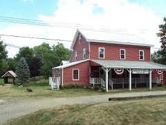 Hadley Flour and Feed Milllisted 1986 · 0.3 miles away
Topographic sheets covering this place
7 surveys from 11 printed sheetsMatched by testing this settlement's coordinate against the published boundary of every sheet in the United States Geological Survey's historical collection. Each opens the scanned sheet at the Survey.
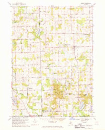
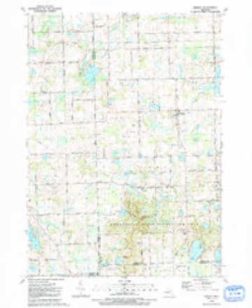
- 1945 USGS Hadley quadrangle1:24000, 2 printings
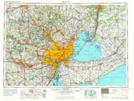
- 1954 USGS Detroit quadrangle1:250000
- 1961 USGS Detroit quadrangle1:250000, 2 printings
- 1965 USGS Detroit quadrangle1:250000
- 1968 USGS Hadley quadrangle1:24000, 2 printings
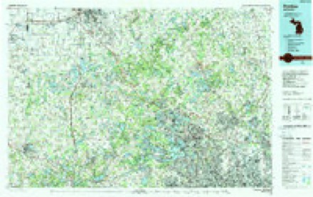
- 1985 USGS Pontiac quadrangle1:100000, 2 printings
- 1991 USGS Hadley quadrangle1:24000
Fires near this place
9 since 2018Regional context, not property-specific evidence. The federal wildfire occurrence database lists 9 fires within 5 miles of Hadley between 2018 and 2020, burning about 14 acres in total. None started naturally. None was recorded as arson. Distance is straight-line from the map coordinates, so a fire counted here may appear on a neighbouring settlement's page as well.
| Reported cause | Fires |
|---|---|
| Equipment and vehicle use | 6 |
| Missing data/not specified/undetermined | 3 |
The most recent of them, most recent first, with the day each was reported and the service that recorded it.
| Date | Cause | Size | Reported by | Name on the report |
|---|---|---|---|---|
| 31 August 2019 | Equipment and vehicle use | 1.0 acres | Michigan Department of Natural Resources | LAPEER CITY FIRE/RESCUE 0119246 - 2019 |
| 23 August 2019 | Equipment and vehicle use | 1.0 acres | Michigan Department of Natural Resources | ELBA TOWNSHIP FD 0000075 - 2019 |
| 17 August 2019 | Equipment and vehicle use | 1.0 acres | Michigan Department of Natural Resources | METAMORA TOWNSHIP FIRE/RESCUE 0000218 - 2019 |
| 8 May 2018 | Missing data/not specified/undetermined | 1.0 acres | Michigan Department of Natural Resources | ATLAS TOWNSHIP FD 0000053 - 2018 |
| 3 May 2020 | Equipment and vehicle use | 1.0 acres | Michigan Department of Natural Resources | ATLAS TOWNSHIP FD 0000068 - 2020 |
| 14 May 2018 | Missing data/not specified/undetermined | 5.5 acres | Michigan Department of Natural Resources | LAPEER 01 - ORTONVILLE HILLS |
| 7 April 2019 | Missing data/not specified/undetermined | 1.0 acres | Michigan Department of Natural Resources | HADLEY TOWNSHIP FD 0719066 - 2019 |
| 2 April 2019 | Equipment and vehicle use | 1.0 acres | Michigan Department of Natural Resources | ELBA TOWNSHIP FD 0000031 - 2019 |
Settlements close enough to share some of these fires:
Storms near this place
18 since 1994Regional context, not property-specific evidence. The National Weather Service names Hadley in 18 storm reports between 1994 and 2025: 12 thunderstorm wind, 2 tornado, 2 hail, 1 flood. No death or injury is recorded in these reports. Each account below is quoted exactly as the forecast office filed it, from the NOAA Storm Events Database, and each date opens the federal record of that event.
| When | Event | Place named | Harm | What the report says |
|---|---|---|---|---|
| August 2007 | Tornado (EF1) | Hadley | $1,000,000 | This tornado tracked for several miles through Hadley Township, narrowly missing the town of Hadley. The initial tornado damage was observed one-half mile southwest of the Gregory and Brigham road intersection in Hadley Township. Significant damage to homes, outbuildings, and garages was observed at the intersection of Gregory and Brigham roads, and farther east along Brigham road. Damage to homes in this area was consistent with EF1 scale damage and maximum winds of roughly 110 mph. In addition, hundreds of trees were uprooted and/or snapped along Gregory Road and along Brigham road to near Hadley road. Lighter tree damage consistent with EF0 scale damage and winds around 70 mph occurred from the Hadley and Brigham road intersection northeastward to Pratt road (just west of Herd road). The average path width was 150 yards. |
| May 2001 | Tornado (F0) | Hadley | $135,000 | Though the tornado originated in Genesee County, it did most of its damage in Lapeer County. It moved northeast from near Hegal and Washburn Roads, finally dissipating near Lippincott Road, southwest of the city of Lapeer. Two barns were destroyed by the tornado, one of which was 150 years old. A house and garage were moved off their foundations. A camper-trailer was tipped over, and a storage silo was tossed. Shingles were lost off of one home. |
| September 2008 | Flood | Hadley | $125,000 | no account filed |
| August 2000 | Thunderstorm Wind | Hadley | $25,000 | The public estimated 60 mph gusts near Lapeer, while a spotter reported 70 mph winds in Hadley. Large branches were downed near Lapeer and Hadley. The worst damage was 3 miles west of Metamora, where many trees and limbs were downed, and a pole barn was destroyed. |
| July 2012 | Thunderstorm Wind | Hadley | $10,000 | Trees and power lines down throughout Hadley Area. |
| June 2025 | Thunderstorm Wind | Hadley | $5,000 | Approximately 50 trees downed and some wires. |
| April 2003 | Thunderstorm Wind | Hadley | $1,000 | Lapeer County Central Dispatch reported numerous trees and power lines blown down in thunderstorm winds. |
| August 2024 | Thunderstorm Wind | Hadley | - | Four trees reported down. |
| July 2020 | Thunderstorm Wind | Hadley | - | Numerous trees reported down. |
| July 2017 | Thunderstorm Wind | Hadley | - | Trees reported down in Hadley. |
| July 2017 | Flash Flood | Hadley | - | Many back roads were closed throughout the county due to flooding. Flooding in the farm fields, with local streams over their banks. |
| September 2014 | Thunderstorm Wind | Hadley | - | Tree fell onto a car. |
| July 2007 | Thunderstorm Wind | Hadley | - | A trained spotter reported a large tree down and estimated the wind gusts at 60 MPH. |
| June 2005 | Thunderstorm Wind | Hadley | - | The emergency manager reported large tree limbs blown down. |
| April 2002 | Thunderstorm Wind | Hadley | - | Law Enforcement reported several small trees blown down. |
| July 1994 | Thunderstorm Wind | Hadley | - | Power lines were blown down by strong thunderstorm winds. |
| July 2011 | Hail | Hadley | - | no account filed |
| July 2003 | Hail | Hadley | - | no account filed |
Nearest settlements
The eight closest, with where each one stands in the county. Distances are straight-line, computed from the Geographic Names Information System coordinates.
| Map | Place | Distance | Sheets |
|---|---|---|---|
| Farmers Creek | 3.4 miles | 12 | |
| Kerr Hill | 4.0 miles | 11 | |
| Elba | 6.0 miles | 10 | |
| Metamora | 6.1 miles | 12 | |
| Hunters Creek | 6.2 miles | 12 | |
| Lapeer | 8.0 miles | 10 | |
| Thornville | 9.5 miles | 11 | |
| Attica | 13.6 miles | 10 |
Provenance
This settlement is recorded in the Geographic Names Information System as feature 627582. The sheet list is computed by point-in-boundary test against the United States Geological Survey's historical topographic inventory. Both are works of the United States government and carry no copyright under 17 U.S.C. 105.
Wildfire. Short, Karen C. 2022. Spatial wildfire occurrence data for the United States, 1992-2020 [FPA_FOD_20221014]. 6th Edition. Fort Collins, CO: Forest Service Research Data Archive. https://doi.org/10.2737/RDS-2013-0009.6 Collected with United States Government funding and usable without additional permissions or fees.
Storms. NOAA National Centers for Environmental Information, Storm Events Database https://www.ncei.noaa.gov/stormevents/ A work of the United States government, no copyright under 17 U.S.C. 105. Narratives are quoted verbatim from the National Weather Service report and are not edited or summarised.