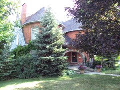
Block
From the record
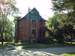
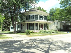
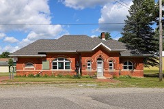
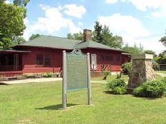
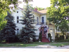
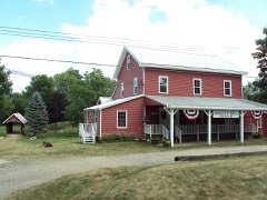
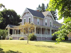
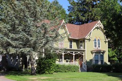
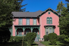
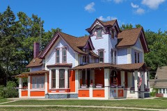
23 National Register listings published here.
Sources: the National Register database, National Park Service
52 topographic sheets cover 23 settlements here, and 23 properties are on the National Register of Historic Places.
23 National Register listings published here.
Sources: the National Register database, National Park Service
Every property in this county listed on the National Register of Historic Places, with the year it was listed and the federal nomination document.
Every wildfire the federal occurrence database records inside this county: 91 of them, burning about 295 acres. 5 started naturally and 1 was recorded as arson. Each settlement page carries the fires within five miles of it.
| Reported cause | Fires |
|---|---|
| Equipment and vehicle use | 39 |
| Missing data/not specified/undetermined | 37 |
| Debris and open burning | 5 |
| Natural | 5 |
| Smoking | 1 |
| Misuse of fire by a minor | 1 |
| Recreation and ceremony | 1 |
| Arson/incendiarism | 1 |
| Power generation/transmission/distribution | 1 |
The five largest, by the area the report gives. One of them was set deliberately.
| Date | Cause | Size | Reported by | Name on the report |
|---|---|---|---|---|
| 12 November 2012 | Smoking | 64 acres | Michigan Department of Natural Resources | LAPEER 01 - CEDAR LAKE |
| 9 November 2020 | Missing data/not specified/undetermined | 37 acres | Michigan Department of Natural Resources | LAPEER 01 |
| 29 April 2008 | Missing data/not specified/undetermined | 22 acres | Michigan Department of Natural Resources | LAPEER 01 |
| 15 April 2003 | Equipment and vehicle use | 21 acres | Michigan Department of Natural Resources | not named |
| 15 April 2003 | Equipment and vehicle use | 15 acres | Michigan Department of Natural Resources | not named |
| 19 April 2004 | Debris and open burning | 12 acres | Michigan Department of Natural Resources | not named |
| 26 March 2018 | Equipment and vehicle use | 10 acres | Michigan Department of Natural Resources | ALMONT FD 40 - 2018 |
| 20 March 2006 | Arson/incendiarism | 9.3 acres | Michigan Department of Natural Resources | not named |
Every settlement page carries the fires within five miles of it - see the settlement index below.
The NOAA Storm Events Database holds 390 reports for this county, causing 1 death, 66 injuries and about $41,072,280 in recorded property damage. Each settlement page carries the reports that name it.
| Kind of event | Reports |
|---|---|
| Thunderstorm Wind | 261 |
| Hail | 84 |
| Tornado | 20 |
| Lightning | 10 |
| Flash Flood | 8 |
| Flood | 7 |
The most serious of them, by death, then injury, then recorded damage. The accounts are quoted exactly as the forecast office filed them.
| When | Event | Place named | Harm | What the report says |
|---|---|---|---|---|
| August 2022 | Thunderstorm Wind | Attica | 1 killed | A tree fell onto a Dodge Ram truck traveling on the road. The tree went through the trucks windshield and entered the passenger compartment, killing a 36 year old woman passenger. |
| June 1953 | Tornado (F5) | not stated | 59 hurt, $25,000,000 | no account filed |
| July 2002 | Lightning | Lapeer | 3 hurt | A newspaper reported that three people were struck by lightning while walking toward a dumpster in the parking lot of an apartment complex. Witnesses claim that lightning ricocheted off the dumpster and hit the three people (2 men and one woman). They were all taken to the hospital with minor injuries. |
| May 2007 | Thunderstorm Wind | Almont | 1 hurt, $10,000 | A trained spotter reported trees down across a major highway. One of the trees fell on a vehicle. An occupant of the vehicle suffered minor injuries. |
| August 2006 | Lightning | North Branch | 1 hurt | A 27 year old male was struck by lightning while inside his home. The lightning struck just as he was closing an aluminum storm door that was blown open by the wind. It first hit his backyard and traveled up the porch, to the storm door, and through his body. He was barefoot at the time and the lightning knocked him to the floor in pain. He was unable to talk for awhile but refused to be transported to the hospital. His arm was swollen the following day and his joints remained stiff. |
| March 1991 | Thunderstorm Wind | not stated | 1 hurt | no account filed |
| July 1991 | Thunderstorm Wind | not stated | 1 hurt | no account filed |
| June 1996 | Flash Flood | Nrn 1/2 Of Co. | $5,800,000 | no account filed |
| August 2009 | Flood | Holloway Res | $3,000,000 | Numerous roads were flooded and closed. The most significant road damage was M-53 south of Imlay City which was washed out and had to be closed for about 10 days. Over two dozen homes were also damaged due to the flooding. A local state of emergency was declared. |
| August 2007 | Tornado (EF1) | Hadley | $1,000,000 | This tornado tracked for several miles through Hadley Township, narrowly missing the town of Hadley. The initial tornado damage was observed one-half mile southwest of the Gregory and Brigham road intersection in Hadley Township. Significant damage to homes, outbuildings, and garages was observed at the intersection of Gregory and Brigham roads, and farther east along Brigham road. Damage to homes in this area was consistent with EF1 scale damage and maximum winds of roughly 110 mph. In addition, hundreds of trees were uprooted and/or snapped along Gregory Road and along Brigham road to near Hadley road. Lighter tree damage consistent with EF0 scale damage and winds around 70 mph occurred from the Hadley and Brigham road intersection northeastward to Pratt road (just west of Herd road). The average path width was 150 yards. |
| July 2000 | Lightning | Dryden | $650,000 | Lightning struck a staircase manufacturing company. The building was destroyed in the resulting fire, and a neighboring flooring company was damaged. |
| March 2012 | Tornado (EF2) | Columbiaville | $500,000 | A National Weather Service Storm Damage Survey confirmed the occurrence of a tornado in western Lapeer County, approximately 3 miles south of Columbiaville or 5 miles northwest of Lapeer. The tornado produced damage consistent with a rating of EF2, with maximum wind speeds of around 125 mph. The tornado damage path was roughly 4.6 miles long with a maximum width of 400 yards. The damage extended from near the intersection of Mt. Morris Road and German Road with a touchdown of approximately 649 PM EDT to near the intersection of Flint River Road and Millville Road by approximately 704 PM EDT. Damage along much of the path was primarily uprooted trees and minor structural damage. The most intense damage occurred along Carpentar Road, roughly one quarter mile south of Stanley Road, at 700 PM EDT. A house was shifted off the foundation and an attached garage was destroyed at this location. |
| July 1994 | Thunderstorm Wind | Metamora | $500,000 | Very strong straight line winds, estimated at 80 to 100 mph, in a post-storm damage survey, caused a damage path of about one-quarter mile wide and two miles long that ran from west to east off Lake Metamora. A garage was destroyed and several houses sustained damage. A lawn chair was driven into the side of a house. A chimney was partially destroyed along with part of a roof on one house. Another house suffered damage as the back porch, including its roof, was blown away. The roof of the porch landed on a vehicle parked in a driveway next door. A pontoon boat was overturned and numerous large limbs, some more than three to four inches in diameter, were ripped from numerous trees along a drive. The damage was estimated well in excess of $100,000. |
| June 1994 | Thunderstorm Wind | Lapeer | $500,000 | A severe thunderstorm moved into western Lapeer County from eastern Genesee County around 1915 EST on the evening of the 28th, producing several funnel cloud sightings along with powerful wind gusts that resulted in major damage about one and a half miles northwest of Lapeer in southern Oregon Township. Extensive tree damage occurred at a golf course near Potter Lake. Numerous trees were also uprooted or blown over. An entire roof was lifted off of the second floor of a house, and a couple of barns and outbuildings were damaged. A post-storm survey indicated that the damage was the result of tremendous downburst winds, estimated at near 100 mph. |
| August 2006 | Lightning | Burnside | $400,000 | A local newspaper reported that lightning set a barn on fire, causing extensive damage. The barn was 60 by 170 feet located at the Muxlow Dairy Farm on Wilcoz Rd. Officials on the scene estimated total damages at $400K, including the barn, two tractors, a skid steer, and 2,500 bales of hay and straw. No people or livestock were injured. |
| August 2006 | Flash Flood | Columbiaville | $300,000 | Thunderstorms with very heavy rain repeatedly occurred across the same areas and dumped rain at a rate of nearly 2 inches per hour. Doppler radar estimated that 6 inches of rain, with locally higher amounts, fell in a west to east swath across north central Lapeer County. The most intense rain fell from about 2000 EST on the 2nd to about 0100 EST on the 3rd. Flash flooding began around 2245 EST. The rain caused mass flooding to area roads. Nearly a dozen roads, between M-90 and Clear Lake Rd, were washed out and had to be closed. Crops were also severely punished. Farmers in the North Branch area reported losing over a million dollars in vegetable and sod crops. One farmer lost 120 acres of sod, estimated at $540K. Another farmer lost 35 acres of onions, estimated at around $200K. Total losses in crops due to the floods were estimated at $1M. Several homes were heavily damaged by flooding on the east side of burnside township. Total property damages, including rebuilding roads, were estimated at $300K. No injuries were reported. |
| July 2005 | Thunderstorm Wind | Otter Lake | $250,000 | Trees were reported blown down, some of which fell onto houses.Boats on Otter Lake were also flipped over. |
| June 1983 | Tornado (F1) | not stated | $250,000 | no account filed |
| July 1977 | Tornado (F1) | not stated | $250,000 | no account filed |
| June 1953 | Tornado (F4) | not stated | $250,000 | no account filed |
| July 1997 | Tornado (F1) | Columbiaville | $200,000 | no account filed |
| August 2007 | Lightning | Lum | $175,000 | The local newspaper reported a home destroyed by fire after being struck by lightning during a violent thunderstorm. Total property damages were estimated at roughly $175K. |
| July 2023 | Thunderstorm Wind | Lapeer | $150,000 | Large trees and wires down reported from just south of Columbiaville through all of Mayfield Township and into the city of Lapeer. Trees fell onto at least two homes and a car. |
| May 2001 | Tornado (F0) | Hadley | $135,000 | Though the tornado originated in Genesee County, it did most of its damage in Lapeer County. It moved northeast from near Hegal and Washburn Roads, finally dissipating near Lippincott Road, southwest of the city of Lapeer. Two barns were destroyed by the tornado, one of which was 150 years old. A house and garage were moved off their foundations. A camper-trailer was tipped over, and a storage silo was tossed. Shingles were lost off of one home. |
| September 2000 | Flash Flood | Metamora | $125,000 | Gravel roads were washed out in Almont and Dryden Townships. Roads were also flooded to the west, in Deerfield and Metamora Townships. Some culverts were displaced where the gravel had washed out. Annrook Park in the city of Lapeer was flooded by the Flint River. Fields were flooded and driveways washed out in Imlay City. |
| September 2008 | Flood | Hadley | $125,000 | no account filed |
| August 2009 | Thunderstorm Wind | Imlay City | $100,000 | Numerous trees and tree limbs were blown down, some of which brought down power lines and fell onto homes. Power lines were also reported being snapped. |
| October 2001 | Thunderstorm Wind | Lum | $100,000 | A large barn and a garage were destroyed as winds lifted the roofs off the structures, a pickup truck in the garage was moved downwind about 20 to 40 feet, some homes in the area suffered significant roof damage, and several large trees were blown down. It was determined from the debris field and radar that most of the damage was the result of microburst winds. The damage path was about one mile wide in length and one half mile in width. Some of the damage may have been enhanced by small circulations within the edges of the microburst - commonly called "gustnadoes". |
| April 2013 | Flood | Otter Lake | $100,000 | no account filed |
| June 2009 | Flood | Holloway Res | $100,000 | no account filed |
| July 1999 | Thunderstorm Wind | Lapeer | $95,000 | no account filed |
| August 2010 | Thunderstorm Wind | Metamora | $75,000 | Dozens of trees down, along with large signs. A metal light post was also blown down. |
| May 2006 | Lightning | Millville | $75,000 | A two story home in Lapeer county was zapped by lightning, sparking a fire. The home and its contents have smoke and water damage. Total damages were roughly estimated at $75K. |
| May 1998 | Thunderstorm Wind | Attica | $75,000 | no account filed |
| May 2011 | Thunderstorm Wind | Lapeer | $50,000 | House moved off foundation and apartments damaged. Numerous trees blown down. |
| August 2010 | Thunderstorm Wind | Elba | $50,000 | A roof was blown off a boat shop, along with boats flipped over. |
| August 2000 | Thunderstorm Wind | Dryden | $50,000 | A three story, historic barn (dating from the 1920s) was destroyed in Dryden Township. Six sheep inside were killed. |
| July 2000 | Flash Flood | Metamora | $50,000 | no account filed |
| May 1999 | Tornado (F1) | Imlay City | $45,000 | no account filed |
| May 2017 | Lightning | Kerr Hill | $40,000 | no account filed |
| April 2009 | Thunderstorm Wind | Almont | $30,000 | Two barns were reported blown down. |
| November 2015 | Thunderstorm Wind | Lapeer | $25,000 | Trees and power lines reported down in and around Lapeer and across eastern part of the county. Signs were also blown down. |
| July 2002 | Lightning | Imlay City | $25,000 | A newspaper reported that a house was struck by lightning and caught fire. The damage was reportedly confined to one bedroom and its contents. |
| August 2000 | Thunderstorm Wind | Hadley | $25,000 | The public estimated 60 mph gusts near Lapeer, while a spotter reported 70 mph winds in Hadley. Large branches were downed near Lapeer and Hadley. The worst damage was 3 miles west of Metamora, where many trees and limbs were downed, and a pole barn was destroyed. |
| May 1998 | Thunderstorm Wind | Lapeer | $25,000 | no account filed |
| August 1968 | Tornado (F1) | not stated | $25,000 | no account filed |
| August 1951 | Tornado (F1) | not stated | $25,000 | no account filed |
| November 2016 | Thunderstorm Wind | Lapeer | $20,000 | Roof blown off Vic Bond Sales. |
| June 2008 | Thunderstorm Wind | Almont | $20,000 | Numerous trees and limbs reported down. |
| July 2008 | Flash Flood | Elba | $20,000 | Heavy rain caused flash flooding, with roads covered in water, along with flooding reported at the Lapeer Courthouse. |
| May 2006 | Thunderstorm Wind | Lapeer | $17,500 | Central Dispatch reported that several trees and powerlines were blown down near Lapeer by thunderstorm winds. The local newspaper showed a picture of a large tree on top of a house. Property damage was roughly estimated at $15K. |
| August 2009 | Thunderstorm Wind | Imlay City | $15,000 | An old barn was blown over and wires were also reported down. |
| June 2013 | Thunderstorm Wind | Elba | $10,000 | Trees were snapped and uprooted, as well as damage to roofs. |
| November 2013 | Thunderstorm Wind | North Lake | $10,000 | A tree fell onto a house. |
| July 2012 | Thunderstorm Wind | Hadley | $10,000 | Trees and power lines down throughout Hadley Area. |
| July 2011 | Thunderstorm Wind | Attica | $10,000 | Trees blown down. |
| July 2011 | Thunderstorm Wind | Five Lakes | $10,000 | Trees and wires reported down. |
| June 2011 | Thunderstorm Wind | Hunters Creek | $10,000 | A barn roof was blown off, along with numerous trees blown down. |
| September 2010 | Thunderstorm Wind | Lapeer | $10,000 | Numerous trees and power lines were reported down. |
| July 1999 | Thunderstorm Wind | Lapeer | $10,000 | no account filed |
The Survey's mineral resources record lists 19 workings inside this county. 18 still produce and 1 is closed or unrecorded. Each settlement page carries the workings within five miles of it.
| Commodity | Workings |
|---|---|
| Sand and Gravel, Construction | 17 |
| Clay | 1 |
| Magnesite | 1 |
The least common of them first, because a county's hundredth gravel pit says nothing its first ten did not.
| Where | Site | Commodity | Status | Recorded |
|---|---|---|---|---|
| Farley's Clay Pit | Clay | Past Producer | ||
| Wilkinson Chemical | Magnesite | Producer | ||
| Almont Gravel Company Pit | Sand and Gravel, Construction | Producer | ||
| Attica Aggregates Pit | Sand and Gravel, Construction | Producer | ||
| Baritt Pit | Sand and Gravel, Construction | Producer | ||
| Corey and Hartwig Sand & Gravel Pit | Sand and Gravel, Construction | Producer | ||
| Elba Gravel Company | Sand and Gravel, Construction | Producer | ||
| Lapeer County Road Comm. Pit | Sand and Gravel, Construction | Producer | ||
| Lapeer County Road Comm. Pit | Sand and Gravel, Construction | Producer | ||
| Metamora Pit and Mil | Sand and Gravel, Construction | Producer | ||
| Molesworth Lapeer Co. Pit | Sand and Gravel, Construction | Producer | ||
| Nolan Pit | Sand and Gravel, Construction | Producer | ||
| Parrish Pit & Mill | Sand and Gravel, Construction | Producer | ||
| Paton Pit | Sand and Gravel, Construction | Producer | ||
| Peake Pit & Mill | Sand and Gravel, Construction | Producer | ||
| St Clair County Road Comm. Pit | Sand and Gravel, Construction | Producer | ||
| St Clair County Road Comm. Pit | Sand and Gravel, Construction | Producer | ||
| St Clair County Road Comm. Pit | Sand and Gravel, Construction | Producer | ||
| Vannini Pit | Sand and Gravel, Construction | Producer |
Named settlements recorded in the Geographic Names Information System, each with the topographic sheets covering it. Villages, hamlets and abandoned places alike. Each is shown with the nearest named watercourse or landform and the survey quadrangle it falls on.
Marathon township · 48421 · On Hemmingway and Whipple Drain · Columbiaville quadrangle
10 sheets, 1954 to 1990
Hadley township · 48455 · On South Branch Farmers Creek · Metamora quadrangle
12 sheets, 1943 to 1991
Goodland township · 48444 · On Elk Lake Creek · Imlay City quadrangle
10 sheets, 1954 to 1990
Deerfield township · 48421 · On Crystal Creek · Barnes Lake quadrangle
10 sheets, 1954 to 1990
North Branch township · 48461 · On Gravel Creek · North Branch quadrangle
10 sheets, 1954 to 1990
Dryden township · 48455 · On Whigville Creek · Thornville quadrangle
11 sheets, 1945 to 1991