 Block
Holland, Michigan
11 topographic sheets cover this place, the earliest surveyed in 1929 and the latest in 1982. It stands in Holland City. It lies in ZIP code area 49423. It stands on Macatawa River. The Survey maps it on the Holland East quadrangle. 34,378 people lived here at the 2020 count. It stands 663 feet above sea level.
On record in Holland
Buildings and businesses the archive holds for this place. Each opens its own page, with the source record it came from.
On the National Register 12 of 13 shown
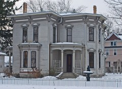 Isaac Cappon Houselisted 1984
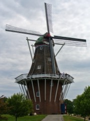 De Zwaan Windmilllisted 2018
 Egbert H. Gold Estatelisted 1984
 Holland Downtown Historic Districtlisted 1990
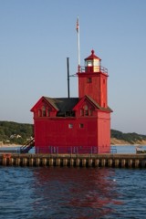 Holland Harbor Lighthouselisted 1978
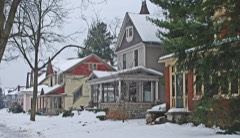 Holland Historic Districtlisted 1983
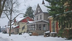 Holland Historic District (Boundary Increase)listed 1990
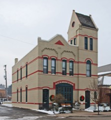 Holland Old City Hall and Fire Stationlisted 1985
 Holland Reformed Protestant Dutch Churchlisted 1990
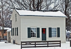 Thomas and Anna Morrissey Houselisted 1999
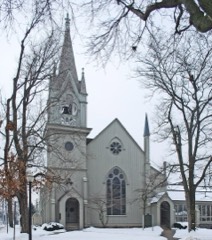 Third Reformed Church of Hollandlisted 1971
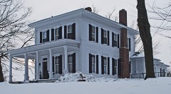 Benjamin Van Raalte Houselisted 1989
Topographic sheets covering this place
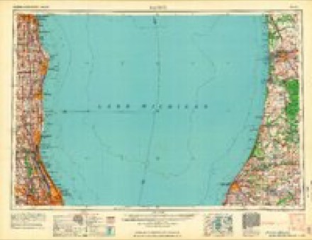
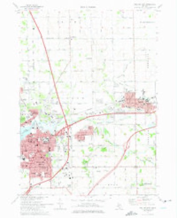
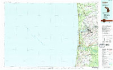
6 surveys from 11 printed sheetsMatched by testing this settlement's coordinate against the published boundary of every sheet in the United States Geological Survey's historical collection. Each opens the scanned sheet at the Survey.
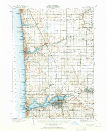
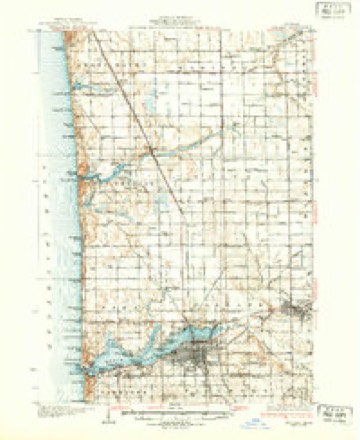
- 1929 USGS Holland quadrangle1:62500, 2 printings
- 1932 USGS Holland quadrangle1:62500, 2 printings
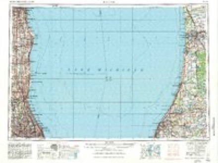
- 1958 USGS Racine quadrangle1:250000, 3 printings
- 1962 USGS Racine quadrangle1:250000
- 1972 USGS Holland East quadrangle1:24000, 2 printings
- 1982 USGS Holland quadrangle1:100000
Fires near this place
26 since 2005Regional context, not property-specific evidence. The federal wildfire occurrence database lists 26 fires within 5 miles of Holland between 2005 and 2020, burning about 31 acres in total. 4 started naturally. None was recorded as arson. Distance is straight-line from the map coordinates, so a fire counted here may appear on a neighbouring settlement's page as well.
| Reported cause | Fires |
|---|---|
| Missing data/not specified/undetermined | 15 |
| Equipment and vehicle use | 5 |
| Natural | 4 |
| Debris and open burning | 2 |
The most recent of them, most recent first, with the day each was reported and the service that recorded it.
| Date | Cause | Size | Reported by | Name on the report |
|---|---|---|---|---|
| 9 September 2019 | Missing data/not specified/undetermined | 1.0 acres | Michigan Department of Natural Resources | HOLLAND TOWNSHIP FD 19636 - 2019 |
| 8 September 2018 | Equipment and vehicle use | 1.0 acres | Michigan Department of Natural Resources | GRAAFSCHAP FD 2018470 - 2018 |
| 21 September 2005 | Debris and open burning | 7.0 acres | Michigan Department of Natural Resources | not named |
| 2 August 2019 | Missing data/not specified/undetermined | 1.0 acres | Michigan Department of Natural Resources | HOLLAND TOWNSHIP FD 19543 - 2019 |
| 16 August 2019 | Natural | 1.0 acres | Michigan Department of Natural Resources | GRAAFSCHAP FD 2019424 - 2019 |
| 10 August 2020 | Equipment and vehicle use | under an acre | Michigan Department of Natural Resources | HOLLAND TOWNSHIP FD 20528 - 2020 |
| 9 July 2018 | Missing data/not specified/undetermined | 1.0 acres | Michigan Department of Natural Resources | HOLLAND FD 0002036 - 2018 |
| 6 July 2018 | Equipment and vehicle use | 1.0 acres | Michigan Department of Natural Resources | HOLLAND FD 0002003 - 2018 |
Settlements close enough to share some of these fires:
Mines and quarries near this place
1 within 5 milesRegional context, not property-specific evidence. The federal mineral resources record lists 1 working within 5 miles of Holland: 1 past producer. None of them still produces. What was taken out: Fire Clay (Refractory). Distance is straight-line from the map coordinates, so a quarry counted here may appear on a neighbouring settlement's page as well.
| Where | Site | Commodity | Status | Recorded |
|---|---|---|---|---|
| Zeeland Brick Co.Clay Pit | Fire Clay (Refractory) | Past Producer |
Storms near this place
28 since 1993Regional context, not property-specific evidence. The National Weather Service names Holland in 28 storm reports between 1993 and 2022: 13 thunderstorm wind, 11 hail, 4 flash flood. The reports record 1 death. Each account below is quoted exactly as the forecast office filed it, from the NOAA Storm Events Database, and each date opens the federal record of that event.
| When | Event | Place named | Harm | What the report says |
|---|---|---|---|---|
| June 2008 | Flash Flood | Holland | 1 killed, $1,000,000 | A 76 year old farmer drowned while trying to remove boards from the Worley Drain Dam that regulates waters from Bass Creek. A significant number of roads were washed out in the city of Holland and water levels on roads in some low lying locations reached the roof tops of cars. ||A presidential disaster declaration was issued for Ottawa county due to all the flooding. |
| June 1996 | Flash Flood | Holland | $100,000 | no account filed |
| July 2005 | Thunderstorm Wind | Holland | $75,000 | no account filed |
| July 2001 | Flash Flood | Holland | $50,000 | no account filed |
| June 1997 | Thunderstorm Wind | Holland | $25,000 | Severe thunderstorm winds downed power lines and transformers across the city of Holland. The highest measured wind gust with this line of storms was 42 mph, at 1 mile east of Holland State Park at 8:10 PM EDT. Marble-sized hail was also reported in Holland at 7:40 PM EDT. |
| October 2001 | Flash Flood | Holland | $25,000 | no account filed |
| May 1999 | Thunderstorm Wind | Holland | $20,000 | Strong winds downed numerous trees and power lines in Holland. |
| October 2001 | Thunderstorm Wind | Holland | $15,000 | no account filed |
| July 2003 | Thunderstorm Wind | Holland | $10,000 | The ASOS weather observing system at the Tulip City airport in Holland measured a 59 m.p.h. wind gust. |
| June 1999 | Thunderstorm Wind | Holland | $10,000 | Numerous trees and power lines were downed by gusty thunderstorm winds in Holland. |
| September 1997 | Thunderstorm Wind | Holland | $10,000 | Ottawa County Central Dispatch reported trees and power lines downed in the city of Holland around 14th Street. Consumers Energy reported 3,200 customers lost power across southern Ottawa County during the storm. In northern Ottawa County, a lightning strike at a communications tower in Grand Haven stopped emergency radio communications across the entire county. Ottawa County Central Dispatch was forced to use backup towers at emergency operations centers in Allendale and Holland. |
| August 2001 | Hail | Holland | $10,000 | no account filed |
| October 2001 | Hail | Holland | $10,000 | no account filed |
| November 2005 | Hail | Holland | $5,000 | Three quarters inch diameter hail was reported one mile west of Holland. |
| August 2004 | Thunderstorm Wind | Holland | $5,000 | A wind gust of around 70 m.p.h. was measured by wind equipment in Holland. |
| July 1994 | Thunderstorm Wind | Holland | $5,000 | A large tree was uprooted, and the wall of a building under construction was blown down. |
| October 2002 | Thunderstorm Wind | Holland | $3,000 | Law enforcement reported one tree blown down in Spring Lake. |
| June 2002 | Hail | Holland | $2,000 | Three quarters inch hail was also reported by the public near Holland just north of the Allegan and Ottawa county line. |
| August 2022 | Thunderstorm Wind | Holland | - | A peak wind gust to 59 mph was measured at Spyglass condos in Holland. |
| June 2011 | Thunderstorm Wind | Holland | - | As storms came upon shore, a wind gust of 66 miles per hour was observed at the Holland State Park. Further inland, a measured wind gust of 47 miles per hour was recorded on the campus of Grand Valley State University in Allendale. |
| April 2010 | Hail | Holland | - | A trained spotter in Holland reported one inch diameter hail. |
| October 2007 | Hail | Holland | - | Three quarters inch diameter hail was reportd at the intersection of Chicago Drive and Waverly Roads. |
| August 1993 | Thunderstorm Wind | Holland | - | Thunderstorm winds gusted to 60 mph 3 miles north of Holland. |
| October 2007 | Hail | Holland | - | no account filed |
| April 1998 | Hail | Holland | - | no account filed |
| April 1997 | Hail | Holland | - | no account filed |
| April 1996 | Hail | Holland | - | no account filed |
| April 1994 | Hail | Holland | - | no account filed |
Nearest settlements
The eight closest, with where each one stands in the county. Distances are straight-line, computed from the Geographic Names Information System coordinates.
| Map | Place | Distance | Sheets |
|---|---|---|---|
| Beechwood | 1.1 miles | 10 | |
| Oaklawn Beechwood | 1.2 miles | 11 | |
| Waverly | 1.5 miles | 11 | |
| Tasmas Corners | 2.8 miles | 10 | |
| Pine Creek | 3.2 miles | 10 | |
| Virginia Park | 3.7 miles | 10 | |
| Noordeloos | 4.6 miles | 11 | |
| New Holland | 5.0 miles | 11 |
Elsewhere
Matched on this settlement's Geographic Names Information System number rather than its name, so it cannot be a different place of the same name in another state.
| Wikipedia article on Holland | An encyclopaedic summary. Its text is share-alike, so it is linked here rather than copied. |
| Wikidata item Q1001742 | The structured record the population and elevation above come from. Public domain (CC0). |
Provenance
This settlement is recorded in the Geographic Names Information System as feature 628421. The sheet list is computed by point-in-boundary test against the United States Geological Survey's historical topographic inventory. Both are works of the United States government and carry no copyright under 17 U.S.C. 105.
Wildfire. Short, Karen C. 2022. Spatial wildfire occurrence data for the United States, 1992-2020 [FPA_FOD_20221014]. 6th Edition. Fort Collins, CO: Forest Service Research Data Archive. https://doi.org/10.2737/RDS-2013-0009.6 Collected with United States Government funding and usable without additional permissions or fees.
Mines and quarries. USGS Mineral Resources Data System (MRDS) https://mrdata.usgs.gov/mrds/ A work of the United States government, no copyright under 17 U.S.C. 105.
Storms. NOAA National Centers for Environmental Information, Storm Events Database https://www.ncei.noaa.gov/stormevents/ A work of the United States government, no copyright under 17 U.S.C. 105. Narratives are quoted verbatim from the National Weather Service report and are not edited or summarised.