Block
From the record
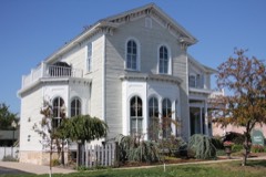
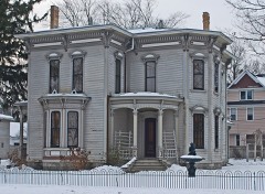
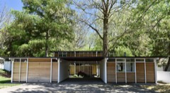
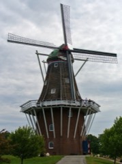
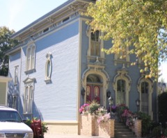
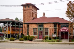
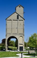
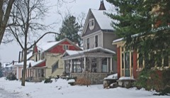
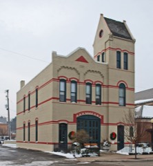
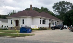
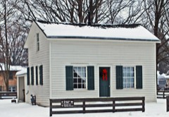
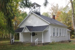
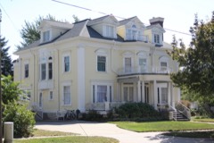
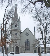
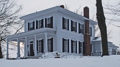
29 National Register listings published here.
Sources: the National Register database, National Park Service
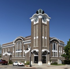
61 topographic sheets cover 55 settlements here, and 29 properties are on the National Register of Historic Places.
29 National Register listings published here.
Sources: the National Register database, National Park Service
Every property in this county listed on the National Register of Historic Places, with the year it was listed and the federal nomination document.
Every wildfire the federal occurrence database records inside this county: 185 of them, burning about 310 acres. 6 started naturally and 9 were recorded as arson. Each settlement page carries the fires within five miles of it.
| Reported cause | Fires |
|---|---|
| Missing data/not specified/undetermined | 81 |
| Equipment and vehicle use | 45 |
| Debris and open burning | 26 |
| Arson/incendiarism | 9 |
| Recreation and ceremony | 7 |
| Natural | 6 |
| Misuse of fire by a minor | 6 |
| Smoking | 3 |
| Railroad operations and maintenance | 2 |
The five largest, by the area the report gives. None of them was recorded as arson.
| Date | Cause | Size | Reported by | Name on the report |
|---|---|---|---|---|
| 17 March 2018 | Equipment and vehicle use | 25 acres | Michigan Department of Natural Resources | CHESTER TOWNSHIP FD 0000029 - 2018 |
| 19 June 1995 | Recreation and ceremony | 12 acres | Michigan Department of Natural Resources | not named |
| 2 September 2005 | Misuse of fire by a minor | 9.9 acres | Michigan Department of Natural Resources | not named |
| 7 May 2006 | Debris and open burning | 8.3 acres | Michigan Department of Natural Resources | not named |
| 23 August 2012 | Debris and open burning | 8.2 acres | Michigan Department of Natural Resources | OTTAWA 02 |
| 10 June 1992 | Misuse of fire by a minor | 8.0 acres | Michigan Department of Natural Resources | not named |
| 21 September 2005 | Debris and open burning | 7.0 acres | Michigan Department of Natural Resources | not named |
| 6 August 2005 | Missing data/not specified/undetermined | 6.9 acres | Michigan Department of Natural Resources | not named |
Every settlement page carries the fires within five miles of it - see the settlement index below.
The NOAA Storm Events Database holds 340 reports for this county, causing 21 deaths, 228 injuries and about $96,035,530 in recorded property damage. Each settlement page carries the reports that name it.
| Kind of event | Reports |
|---|---|
| Thunderstorm Wind | 184 |
| Hail | 108 |
| Tornado | 25 |
| Flash Flood | 13 |
| Flood | 6 |
| Lightning | 3 |
| Funnel Cloud | 1 |
The most serious of them, by death, then injury, then recorded damage. The accounts are quoted exactly as the forecast office filed them.
| When | Event | Place named | Harm | What the report says |
|---|---|---|---|---|
| April 1956 | Tornado (F5) | not stated | 14 killed, 200 hurt, $250,000 | no account filed |
| May 1998 | Thunderstorm Wind | Grand Haven | 1 killed, 20 hurt, $34,630,000 | Michigan State Police EMD's Damage and Injury Assessment Report indicated $4,195,604 in public damage costs, 17 homes destroyed, 827 homes damaged, 8 businesses destroyed, and 129 businesses damaged. Total private damage costs were estimated at $25.0 Million in the city of Grand Haven and Grand Haven Township, $5.1 Million in the village of Spring Lake, $130,000 in Park Township, $182,900 in the city of Zeeland, and approximately $20,000 in Holland. Damage and losses were concentrated in the city of Grand Haven, the village of Spring Lake, and the townships of Grand Haven (northern portion), Spring Lake, Crockery, Polkton, Wright, Park, Holland Charter, Zeeland, and Jamestown. Private damage costs were not available from other cities and townships within the county. The Mill Point Condominiums along the Grand River in Spring Lake sustained major damage and approximately 50% of the units were destroyed. Numerous campers, trailers, and RV's were overturned at Grand Haven State Park along the Lake Michigan shoreline. One fatality was reported. A male utility worker (age not reported) was killed while attempting to repair storm-damaged electrical lines. Twenty injuries occurred. Crop damage was estimated at around $10.0 Million in the fruit belt (to apple, cherry, and peach trees) in the northern part of the county. Severe tree damage occurred in Grand Haven State Park. Ottawa County declared a local state of emergency and was granted a Governor's disaster declaration to activate state assistance for the county. A Michigan National Guard team was deployed to the village of Spring Lake to assist the local jurisdiction with debris removal and cleanup operations.On June 24th, President Clinton granted a Major Disaster Declaration for Ottawa County, making federal disaster assistance available. |
| June 2008 | Thunderstorm Wind | Spring Lake | 1 killed, 1 hurt | A two foot diameter tree fell on a car in motion in Spring Lake. As a result the driver was killed and the passenger incurred minor injuries. |
| June 2008 | Flash Flood | Holland | 1 killed, $1,000,000 | A 76 year old farmer drowned while trying to remove boards from the Worley Drain Dam that regulates waters from Bass Creek. A significant number of roads were washed out in the city of Holland and water levels on roads in some low lying locations reached the roof tops of cars. ||A presidential disaster declaration was issued for Ottawa county due to all the flooding. |
| July 2017 | Thunderstorm Wind | Grand Haven | 1 killed, $250,000 | A large tree fell on a home in Grand Haven and killed a 72 year old man. An 88 mph measured wind gust was recorded at Grand Valley State University in Allendale. Numerous trees and power lines were blown down across Ottawa county. |
| June 2008 | Flood | Robinson | 1 killed, $5,000 | Law enforcement near Rusk in Ottawa county determined that a man drowned while apparently tending to a drainage ditch with rising waters near a driveway. This occurred at Lake Michigan Drive and 112th Avenue in Robinson township. |
| August 2009 | Thunderstorm Wind | Grand Haven | 1 killed | Scattered trees were snapped and uprooted across the extreme northern part of Ottawa county. MLive reported heavy damage to an apple orchard just northwest of Conklin. |
| June 2008 | Thunderstorm Wind | Harrisburg | 1 killed | Law enforcement near Ravenna reported that a woman was killed when a tree fell on her as she was walking in Chester township. |
| June 1997 | Flash Flood | County-Wide | 2 hurt, $1,350,000 | Slow-moving thunderstorms developed over Lake Michigan and moved east across Ottawa County throughout the day of Friday, June 20th. With the soil already saturated from 2 to 4 inches of rainfall from this training effect of thunderstorm activity during the day, a line of severe thunderstorms developed early Friday evening and moved across the county, depositing another 1-5 inches of rainfall within a 2 hour period, causing widespread flash flooding. Southern Ottawa County bore the brunt of the flash flooding,including the cities of Holland and Zeeland, Zeeland Township, Jamestown Township, Holland Township, Wright Township, and Chester Township. Notable rainfall totals for the 24 hour period ending at midnight included 5.47 inches in the city of Holland, 9.16 inches at Holland State Park, and an unofficial report of 13 inches of rainfall in Zeeland. Extensive damage was done to roads, bridges, and homes. Approximately 44 roads were flooded including parts of U.S. Highway 31. Of this number, 40 roads were deemed impassable due to washouts. During the peak of the flash flooding, many motorists were stranded for several hours until emergency personnel could free them. Shortly after midnight, a U.S. Coast Guard helicopter rescued four occupants off the top of their overturned car stranded in deep water at 80th Avenue and Adams Street in Zeeland Township. The Coast Guard rescued a total of 12 people from stranded vehicles Friday evening. In addition to the road washouts, 6 bridges were damaged. Zeeland officials reported 15-20 percent of the city's streets were flooded during the peak of the storm. In addition, 2 sewage lift stations were disabled, causing sewage backups at many residences. Ottawa County officials reported approximately 150 homes and 11 businesses damaged. Most of the damage was from flooded basements. No injuries were reported Friday evening. However, 2 boys, aged 12 and 11, received minor injuries Saturday afternoon when their raft overturned in the swollen north branch of the Black River in Holland. On Monday, June 23rd, Ottawa County declared a local State of Emergency. On Friday, June 27th, Governor John Engler issued a state disaster declaration for Ottawa County as a result of the widespread flooding damage. |
| March 1976 | Tornado (F1) | not stated | 1 hurt, $250,000 | no account filed |
| May 1996 | Flash Flood | Southern | 1 hurt, $100,000 | no account filed |
| September 1961 | Tornado (F2) | not stated | 1 hurt, $25,000 | no account filed |
| May 1998 | Lightning | Jamestown | 1 hurt | The Muskegon Chronicle reported Collin Zackrison, a 34 year-old male, was critically injured when he was struck by lightning at Spring Grove Park near Jamestown, in southeastern Ottawa County. The Ottawa County Parks and Recreation Department employee suffered severe leg and chest injuries. |
| August 1990 | Thunderstorm Wind | not stated | 1 hurt | no account filed |
| June 2009 | Flash Flood | Vriesland | $34,000,000 | Numerous reports of damage to homes and streets across the warned area occurred. Over 2000 homes sustained some type of damage during the flooding. In terms of roads impacted by water, there were four road closures, twenty five road washouts and forty roads were covered by water.||A Local State of Emergency was declared. |
| May 2020 | Flood | Grand Haven Arpt | $5,000,000 | Ottawa county emergency management reported that 372 homes were affected by flooding of the Grand River. Ten homes incurred major damage and 3 sustained minor damage. Several building complexes incurred significant flood damage, particularly in Grand Haven, Spring Lake and Ferrysburg. Several roads were also closed due to flooding. |
| April 2013 | Flood | Ferrysburg | $5,000,000 | Significant flooding occurred on rivers and streams across Ottawa county due to heavy rainfall from early to mid April. |
| December 2008 | Flood | Crisp | $3,600,000 | Flooding across portions of Ottawa county was a result of the combination of heavy rain and melting of a significant snowpack across the area. There were up to 80 road closures and significant flooding of numerous intersections. At one time a section of US-31 was closed. Water up to four feet deep across some roads floated several cars. ||The road shoulder and pavement was washed out on several roads in Jamestown, Hudsonville and Conklin. Roads in several subdivisions across Ottawa county were submerged under two to three feet of water and there were reports of first floors of some homes being flooded. ||Severe flooding also occurred in the village of Spring Lake, city of Grand Haven and across Spring Lake and Robinson Townships as the result of back water from an ice jam on the Grand River in Grand Haven. ||A damage assessment conducted by Ottawa county revealed that a total of $270,500 worth of damage occurred to public infrastructure, with a total of $3,292,400 worth of damage to private property. As a result of the widespread flooding, a local state of emergency was declared in Ottawa county. |
| April 1956 | Tornado (F3) | not stated | $2,500,000 | no account filed |
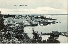
| July 2011 | Thunderstorm Wind | Ottawa Beach | $2,000,000 | Radar data corroborated with ground truth reports indicates that a significant bow echo came onshore in Holland at 10:25 a.m. A storm chaser estimated that it produced wind gusts of up to 80 mph. Numerous reports of trees and power lines were received from in and near Holland and radar data indicates additional wind damage was likely east northeast to Zeeland and Jenison. The storm blew through Jenison at 10:45 a.m. |
| June 2011 | Flash Flood | Vriesland | $1,500,000 | Three to five inches fell in just one to three hours across portions of central and eastern Ottawa county. This caused extensive flooding of the Grand Valley State University Allendale campus, where over a million dollars worth of damage due to flooding was reported. A coop observer in Allendale measured 4.43 inches of rainfall with this event and a CoCoRaHs observer near Tallmadge measured 3.74 inches of rainfall. |
| August 2016 | Tornado (EF1) | Gitchel | $500,000 | The day's third tornado, also rated EF-1, began 2 miles northwest of Burnips and tracked to 2 miles southeast of Jamestown in extreme southeast Ottawa County, causing heavy tree damage. |
| May 2000 | Flash Flood | Countywide | $300,000 | no account filed |
| August 1979 | Tornado (F1) | not stated | $250,000 | no account filed |
| June 1976 | Tornado (F1) | not stated | $250,000 | no account filed |
| July 2021 | Thunderstorm Wind | Port Sheldon | $200,000 | Numerous trees and power lines were blown down across portions of Ottawa county. |
| June 2010 | Thunderstorm Wind | Eastmanville | $200,000 | A swath of wind damage occurred from just west of Lamont, MI to near Alpine, MI. The strongest winds occurred along Johnson Street between 48th and 32 Avenues where a barn was damaged, five houses suffered loss of shingles (less than 5%), and numerous trees were uprooted or snapped. Large broken limbs and uprooted trees were observed as far west as Lenard Street and 76 Avenue. Similar damage occurred to the east-northeast through Marne, MI and then into Alpine Township in Kent County.||The wind damage was associated with the transition of an HP Supercell into a bowing thunderstorm line segment. |
| June 2010 | Tornado (EF0) | Vriesland | $200,000 | Tornado occurred just east of Zeeland, MI. It touched down near the intersection of 80th Avenue and Quincy snapping tree limbs and knocking a telephone pole about 30 degrees out of vertical. It then crossed mostly open field where a couple of isolated trees were uprooted before it crossed 72 Avenue just north of Chicago Drive. Here, it knocked down numerous trees significantly damaging the roof of one residence and causing minor damage to two other houses. The tornado then crossed Chicago Drive knocking down more trees before damaging several corn bins and ripping about 10% of the shingles off a residence located just north of the 64th Avenue and Riley Street intersection. ||The tornado was associated with two intersecting bowing thunderstorm line segments and was a spin-up tornado. |
| June 2024 | Thunderstorm Wind | Spring Lake | $100,000 | Several trees were blown down in the Spring Lake and Grand Haven areas. |
| June 2021 | Tornado (EF0) | Olive Center | $100,000 | NWS storm damage survey revealed a broken path of small to medium limbs down and several locations of small groups of trees uprooted indicating winds of 55 to 70 mph. The worst damage was found near Fillmore St between 108th and 104th Ave indicating winds of 75 to 85 mph. One outbuilding had a garage door blown in which caused a small section of roof to lift off. Trees on and near the property were uprooted and outdoor furniture was thrown toward the north across the property. There was some evidence of lofting as some debris was stuck in trees. A camper trailer was flipped over northeast of that location but a nearby turkey barn did not appear to be damaged. A few trees were down just south of Ottawa Area Center school near the end of |the path. |
| June 2020 | Thunderstorm Wind | Vriesland | $100,000 | The public reported wind damage with downed trees, power lines, and a barn roof was damaged near Vriesland. |
| August 2000 | Thunderstorm Wind | Spring Lake | $100,000 | no account filed |
| June 1996 | Flash Flood | Holland | $100,000 | no account filed |
| July 2005 | Thunderstorm Wind | Holland | $75,000 | no account filed |
| April 1998 | Lightning | Nunica | $60,000 | The Muskegon Chronicle reported that lightning struck the roof of a brick house at 10048 State St. in Nunica at 4:45 pm EDT. No one was injured in the blaze that ensued. Damage to the home was estimated at $45,000 and the fire destroyed about $15,000 worth of the family's belongings. |
| June 2024 | Thunderstorm Wind | Olive Center | $50,000 | Several trees and power lines were blown down and a street light was also blown down. |
| July 2022 | Thunderstorm Wind | Coopersville Arpt | $50,000 | The public reported that multiple trees were uprooted or snapped. One tree damaged the roof of a house and power outages were reported in the area. |
| November 2020 | Thunderstorm Wind | Grand Haven Arpt | $50,000 | Several trees were blown down across portions of Ottawa county. |
| July 2019 | Thunderstorm Wind | Hudsonville | $50,000 | A peak wind gust of 70 mph was reported. |
| August 2018 | Thunderstorm Wind | Spring Lake Lake | $50,000 | Numerous trees and power lines were blown down mainly across the northern half of Ottawa county. |
| May 2004 | Hail | Zeeland | $50,000 | One and three quarters inch diameter hail was reported by the public one mile east of Zeeland. |
| July 2003 | Hail | Jenison | $50,000 | A report of one and three quarters inch diameter hail was received from Hudsonville. Three quarters inch diameter hail was reported in Jenison. |
| July 2003 | Hail | Hudsonville | $50,000 | Two inch diameter hail was reported in Hudsonville. This was the largest hail report received across our area for this event. |
| May 2001 | Tornado (F0) | Marne | $50,000 | A F0 tornado produced maximum estimated wind speeds to 65 m.p.h. It's path length was only a tenth of a mile long, with a width of 50 yards. The tornado touched down between 8th avenue and 6 mile road, and produced some tree damage and tore the shingles off one home. |
| July 1999 | Hail | Allendale | $50,000 | 1.5" to 2" diameter hail was observed in Allendale. Wind damage included large limbs that were downed, and screens that were ripped off some homes. |
| May 1999 | Thunderstorm Wind | Countywide | $50,000 | Wind gusts downed numerous trees and power lines. A metal roof was blown off a home in Hudsonville. |
| May 2001 | Flash Flood | Countywide | $50,000 | no account filed |
| July 2001 | Flash Flood | Holland | $50,000 | no account filed |
| May 2000 | Hail | Grand Haven | $50,000 | no account filed |
| October 1996 | Thunderstorm Wind | Borculo | $50,000 | no account filed |
| May 2000 | Hail | Jamestown | $40,000 | no account filed |
| July 2016 | Thunderstorm Wind | Hudsonville | $25,000 | A tree was blown down onto a house near Hudsonville. |
| July 2015 | Thunderstorm Wind | Oaklawn Park | $25,000 | The Ottawa county road commission reported that several trees were blown down across portions of southern Ottawa county, particularly in the Park and Jamestown township areas. |
| July 2013 | Thunderstorm Wind | Jamestown | $25,000 | Law enforcement reported several trees were blown down across portions of Ottawa county. |
| September 2010 | Thunderstorm Wind | Lakewood | $25,000 | Several trees were blown down around Lakewood Boulevard and 168th Avenue. A 65 mph measured wind gust was recorded by a mesonet station five miles west of Holland. A tree was also reported down on a house two miles northwest of Holland and several trees were blown down around Port Sheldon. |
| September 2010 | Thunderstorm Wind | Hudsonville | $25,000 | Power lines were blown down on Chicago Drive in Hudsonville. |
| August 2007 | Thunderstorm Wind | Hudsonville | $25,000 | Numerous trees were blown down in the city of Hudsonville and in Georgetown townships. |
| July 2006 | Hail | Coopersville | $25,000 | One and three quarters to two inch hail was reported near Coopersville and in Marne. |
| May 1998 | Thunderstorm Wind | Spring Lake | $25,000 | Several large trees and power lines downed in the cities of Ferrysburg, Spring Lake, and Spring Lake Township. |
| May 1998 | Thunderstorm Wind | Grand Haven | $25,000 | Numerous trees, utility poles, and power lines downed in the city of Grand Haven and Grand Haven Township. |
The Survey's mineral resources record lists 34 workings inside this county. 28 still produce and 6 are closed or unrecorded. Each settlement page carries the workings within five miles of it.
| Commodity | Workings |
|---|---|
| Sand and Gravel, Construction | 27 |
| Silica | 5 |
| Fire Clay (Refractory) | 1 |
| Clay | 1 |
The least common of them first, because a county's hundredth gravel pit says nothing its first ten did not.
| Where | Site | Commodity | Status | Recorded |
|---|---|---|---|---|
| Construction Aggregates Corp Pit | Clay | Past Producer | ||
| Zeeland Brick Co.Clay Pit | Fire Clay (Refractory) | Past Producer | ||
| Ferrysburg Site | Silica | Producer | Sedimentary | |
| Holiday Hills Site | Silica | Past Producer | Sedimentary | |
| North Sag Site | Silica | Past Producer | Sedimentary | |
| Rosy Mound | Silica | Producer | Sedimentary | |
| Rycenga Site | Silica | Producer | Sedimentary | |
| Bass River Pit & Mill | Sand and Gravel, Construction | Producer | ||
| C&L Pit & Mill | Sand and Gravel, Construction | Producer | ||
| Cheyne Pit & Mill | Sand and Gravel, Construction | Producer | ||
| Construction Aggregates Corp Pit | Sand and Gravel, Construction | Producer | ||
| Construction Aggregates Corp Pit | Sand and Gravel, Construction | Producer | ||
| Construction Aggregates Corp Pit | Sand and Gravel, Construction | Producer | ||
| De Went Gravel Pit | Sand and Gravel, Construction | Producer | ||
| Grand Valley Gravel | Sand and Gravel, Construction | Producer | ||
| Grand Valley Gravel Co. Pit | Sand and Gravel, Construction | Producer | ||
| Huizenga Gravel Co., Inc. | Sand and Gravel, Construction | Producer | ||
| J V Burkett Construction Co. Pit | Sand and Gravel, Construction | Past Producer | ||
| J V Burkett Construction Co. Pit | Sand and Gravel, Construction | Past Producer | ||
| Muskegon Gravel Pit | Sand and Gravel, Construction | Producer | ||
| Ottawa County Pit | Sand and Gravel, Construction | Producer | ||
| Ottawa County Road Commission Pit | Sand and Gravel, Construction | Producer | ||
| Ottawa County Road Commission Pit | Sand and Gravel, Construction | Producer | ||
| Ottawa County Road Commission Pit | Sand and Gravel, Construction | Producer | ||
| Ottawa County Road Commission Pit | Sand and Gravel, Construction | Producer | ||
| Ottawa County Road Commission Pit | Sand and Gravel, Construction | Producer | ||
| Ottawa County Road Commission Pit | Sand and Gravel, Construction | Producer | ||
| Ottowa County Pit | Sand and Gravel, Construction | Producer | ||
| Rieth-Riley Constr. Aggregate Pit | Sand and Gravel, Construction | Producer | ||
| Riverview Pit | Sand and Gravel, Construction | Producer | ||
| Standard Sand Co. Pit | Sand and Gravel, Construction | Producer | ||
| West Shore Construction Co. Pit | Sand and Gravel, Construction | Producer | ||
| West Shore Construction Co. Pit | Sand and Gravel, Construction | Producer | ||
| Winans Pit | Sand and Gravel, Construction | Producer |
Named settlements recorded in the Geographic Names Information System, each with the topographic sheets covering it. Villages, hamlets and abandoned places alike. Each is shown with the nearest named watercourse or landform and the survey quadrangle it falls on.
Holland Charter Township · 49424 · On Macatawa River · Holland West quadrangle
10 sheets, 1929 to 1982
Robinson township · 49417 · On Robinson Bayou · Grand Haven quadrangle
12 sheets, 1930 to 1982
Coopersville city · 49404 · On Beaver Creek · Coopersville quadrangle
13 sheets, 1945 to 1986
Polkton Charter Township · 49404 · On Deer Creek · Coopersville quadrangle
13 sheets, 1945 to 1986
Ferrysburg city · 49456 · Near Harbor Island · Grand Haven quadrangle
12 sheets, 1930 to 1982
Jamestown Charter Township · 49426 · Hudsonville East quadrangle
9 sheets, 1958 to 1984
Jamestown Charter Township · 49426 · Hudsonville West quadrangle
9 sheets, 1958 to 1984
Grand Haven city · 49417 · Near Harbor Island · Grand Haven quadrangle
12 sheets, 1930 to 1982
Tallmadge Charter Township · 49435 · On Ottawa Creek · Grandville quadrangle
11 sheets, 1958 to 1984
Georgetown Charter Township · 49428 · On Rush Creek · Grandville quadrangle
11 sheets, 1958 to 1984
Tallmadge Charter Township · 49404 · On Little Deer Creek · Coopersville quadrangle
13 sheets, 1945 to 1986
Holland Charter Township · 49424 · Near Windmill Island · Holland East quadrangle
11 sheets, 1929 to 1982
Crockery township · 49404 · Near Fishermans Island · Nunica quadrangle
10 sheets, 1930 to 1982
Port Sheldon township · 49460 · On Pigeon River · Port Sheldon quadrangle
11 sheets, 1929 to 1982
Allendale Charter Township · 49401 · On Little Bass Creek · Borculo quadrangle
11 sheets, 1929 to 1982
Grand Haven Charter Township · 49417 · Near Poel Island · Grand Haven quadrangle
12 sheets, 1930 to 1982
Spring Lake township · 49456 · Near Eastmans Island · Grand Haven quadrangle
12 sheets, 1930 to 1982
Park township · 49424 · On Pine Creek · Holland West quadrangle
10 sheets, 1929 to 1982
Holland Charter Township · 49424 · Near Windmill Island · Holland East quadrangle
11 sheets, 1929 to 1982