 Block
Pinconning, Michigan
9 topographic sheets cover this place, the earliest surveyed in 1954 and the latest in 1984. It stands in Pinconning Township. It lies in ZIP code area 48650. It stands on Walk Drain. The Survey maps it on the Pinconning quadrangle. 1,204 people lived here at the 2020 count. It stands 600 feet above sea level.
Population over time
2 figuresPinconning fell from 1,307 to 1,204 between 2010 and 2020. These are the recorded population figures Wikidata holds for this place, reached through the Geographic Names Information System number this page is keyed on rather than by name, so they belong to this place and not to another of the same name. Most are census counts, but not all are: an early figure may be a founding or settlement estimate, and an estimate published within five years of a census is left out. The change column is computed, and is left blank where more than 20 years separate a figure from the one before it, because a gap that long is not a change between two counts.
| Year | People | Change |
|---|---|---|
| 2010 | 1,307 | |
| 2020 | 1,204 | -103 (-8%) |
Topographic sheets covering this place
4 surveys from 9 printed sheetsMatched by testing this settlement's coordinate against the published boundary of every sheet in the United States Geological Survey's historical collection. Each opens the scanned sheet at the Survey.
- 1954 USGS Flint quadrangle1:250000, 4 printings
- 1958 USGS Flint quadrangle1:250000, 2 printings
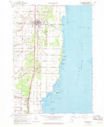
- 1967 USGS Pinconning quadrangle1:24000, 2 printings
- 1984 USGS Bay City quadrangle1:100000
In the county-history sources
12,822 words on this townshipHistory of Bay County, Michigan with Illustrations and Biographical Sketches of Some of Its Prominent Men and Pioneers, published 1883 names this settlement in its chapter on Pinconning Township. These are the passages that mention it, exactly as the scans read.
At the mouth of the Pinconning River was an Indian settlement. In 1869 Mr. F. G. Stark was fishing at the mouth of the river, and at that time there was the old log mission church at the Indian settlement. Mr. Stark now has a blacksmith shop in Pinconning village, and a farm in the township.
Passage source: History of Bay County, Michigan with Illustrations and Biographical Sketches of Some of Its Prominent Men and Pioneers, published 1883.
This company was organized in January, 1883. The officers are as follows: President, Wilham Mercer; Vice President, E. A. Cooley; Secretary and Treasurer, C. V. Plummer. This company is practically successor of the original founders of Pinconning. Two saw mills were built at different times, both of which burned. Geo. Campbell & Co. built a planing mill, and in 1877 that firm was succeeded by J. H. Plummer, who turned the saw mill into a saw and shingle mill, and operated them until the present company was organized, in which Mr. Plummer is interested. In the Winter of 1883 the company built a planing mill, which is now in operation. They manufacture about 6,000,000 feet of lumber, and about 4,000,000 shingles a season, and employ about fifty men. The affairs of the company are in the hands of enterprising men who are infusing new life into the growth of the village.
Passage source: History of Bay County, Michigan with Illustrations and Biographical Sketches of Some of Its Prominent Men and Pioneers, published 1883.
William Mercer, President of the company, has been identified with the interests of Bay County since 1863. He was born in Scotland in 1833, and emigrated to Canada in 1849. In 186 3 he located in Bay City, where he still resides. He was city surveyor of Bay City for some time, and most of the early improvements were made under his direction. He was also engaged in lumbering. He first came to Pinconning to lay out the work of the first mill built in 1872. In 1877 he had charge of the rebuilding of the railroad, and was Superintendent of the road until 1879. From that time until the Fall of 1882 he was chief engineer of the Quincy, Vandalia & Eastern Eailway in Illinois. In the Winter of 1883 the organization of the present company was effected, as before stated. Mr. Mercer has a wife and eight children, and his residenC^e is still in Bay City. He is a man of great energy and enterprise, and is doing much to build up the village of Pinconning^
Passage source: History of Bay County, Michigan with Illustrations and Biographical Sketches of Some of Its Prominent Men and Pioneers, published 1883.
Machine-read from a century-old scan, so expect the errors a machine makes: misspelled names, dropped words, stray characters.
Read the whole chapter on Pinconning Township - it names this place 17 more 17 times.
Fires near this place
21 since 1992Regional context, not property-specific evidence. The federal wildfire occurrence database lists 21 fires within 5 miles of Pinconning between 1992 and 2020, burning about 91 acres in total. 3 started naturally. 2 were recorded as arson. Distance is straight-line from the map coordinates, so a fire counted here may appear on a neighbouring settlement's page as well.
| Reported cause | Fires |
|---|---|
| Missing data/not specified/undetermined | 6 |
| Equipment and vehicle use | 5 |
| Debris and open burning | 4 |
| Natural | 3 |
| Arson/incendiarism | 2 |
| Misuse of fire by a minor | 1 |
The most recent of them, most recent first, with the day each was reported and the service that recorded it.
| Date | Cause | Size | Reported by | Name on the report |
|---|---|---|---|---|
| 31 July 2019 | Missing data/not specified/undetermined | 1.0 acres | Michigan Department of Natural Resources | MT FOREST TOWNSHIP FD 0000096 - 2019 |
| 28 July 2019 | Missing data/not specified/undetermined | 1.0 acres | Michigan Department of Natural Resources | GARFIELD TOWNSHIP VFD 0190077 - 2019 |
| 26 July 2019 | Equipment and vehicle use | 1.0 acres | Michigan Department of Natural Resources | PINCONNING-FRASER FD 0000184 - 2019 |
| 12 July 2019 | Equipment and vehicle use | 1.0 acres | Michigan Department of Natural Resources | PINCONNING-FRASER FD 0000180 - 2019 |
| 5 May 2019 | Natural | 1.0 acres | Michigan Department of Natural Resources | PINCONNING-FRASER FD 0000162 - 2019 |
| 25 May 2019 | Equipment and vehicle use | 1.0 acres | Michigan Department of Natural Resources | PINCONNING-FRASER FD 0000167 - 2019 |
| 15 May 2013 | Missing data/not specified/undetermined | 4.0 acres | Michigan Department of Natural Resources | BAY 03 |
| 15 May 2013 | Missing data/not specified/undetermined | 9.0 acres | Michigan Department of Natural Resources | BAY 02 |
Settlements close enough to share some of these fires:
Storms near this place
24 since 1993Regional context, not property-specific evidence. The National Weather Service names Pinconning in 24 storm reports between 1993 and 2025: 13 thunderstorm wind, 10 hail, 1 tornado. No death or injury is recorded in these reports. Each account below is quoted exactly as the forecast office filed it, from the NOAA Storm Events Database, and each date opens the federal record of that event.
| When | Event | Place named | Harm | What the report says |
|---|---|---|---|---|
| August 1993 | Thunderstorm Wind | Pinconning | $50,000 | Power lines were knocked down by strong thunderstorm wind gusts. |
| July 2014 | Hail | Pinconning | $50,000 | no account filed |
| July 2016 | Tornado (EF0) | Pinconning | $10,000 | Tornado began near the northern end of Elevator Road. The tornado uprooted pines and downed large tree limbs as it paralleled Lapan Road. At the end of Lapan Road, small trees were snapped, a roof was peeled off, and a house sustained broken windows, likely from being struck by roofing material. Estimated peak winds of 70 mph. Based on storm spotter pictures, the tornado likely continued into Saginaw Bay as a waterspout. |
| November 2013 | Thunderstorm Wind | Pinconning | $10,000 | An outbuilding was reported destroyed. |
| June 2001 | Thunderstorm Wind | Pinconning | $2,000 | A large tree was downed. |
| July 2025 | Thunderstorm Wind | Pinconning | - | Large tree uprooted and two large tree limbs reported down. |
| August 2024 | Thunderstorm Wind | Pinconning | - | One large reported down, as well as large limbs. |
| August 2021 | Thunderstorm Wind | Pinconning | - | A large tree was blown down. |
| June 2020 | Thunderstorm Wind | Pinconning | - | Trees reported down on the road. |
| August 2018 | Thunderstorm Wind | Pinconning | - | Multiple trees and power lines reported down. |
| December 2015 | Thunderstorm Wind | Pinconning | - | Power lines were reported down. |
| December 2015 | Thunderstorm Wind | Pinconning | - | A pine tree was reported blown down. |
| September 2015 | Thunderstorm Wind | Pinconning | - | Tree reported down. |
| September 2017 | Hail | Pinconning | - | no account filed |
| September 2017 | Hail | Pinconning | - | no account filed |
| July 2016 | Hail | Pinconning | - | no account filed |
| July 2016 | Hail | Pinconning | - | no account filed |
| July 2016 | Hail | Pinconning | - | no account filed |
| July 2016 | Thunderstorm Wind | Pinconning | - | no account filed |
| April 2011 | Hail | Pinconning | - | no account filed |
| June 2008 | Hail | Pinconning | - | no account filed |
| August 2000 | Hail | Pinconning | - | no account filed |
| June 1998 | Hail | Pinconning | - | no account filed |
| August 1996 | Thunderstorm Wind | Pinconning | - | no account filed |
Nearest settlements
The eight closest, with where each one stands in the county. Distances are straight-line, computed from the Geographic Names Information System coordinates.
| Map | Place | Distance | Sheets |
|---|---|---|---|
| Woodville | 3.3 miles | 11 | |
| Almeda Beach | 3.3 miles | 9 | |
| Meyers Beach | 3.8 miles | 9 | |
| Nine Mile | 5.5 miles | 11 | |
| Linwood | 7.9 miles | 14 | |
| Mount Forest | 8.2 miles | 11 | |
| Linwood Beach | 9.0 miles | 14 | |
| Crump | 9.5 miles | 11 |
Elsewhere
Matched on this settlement's Geographic Names Information System number rather than its name, so it cannot be a different place of the same name in another state.
| Wikipedia article on Pinconning | An encyclopaedic summary. Its text is share-alike, so it is linked here rather than copied. |
| Wikidata item Q2988028 | The structured record the population and elevation above come from. Public domain (CC0). |
Provenance
This settlement is recorded in the Geographic Names Information System as feature 634899. The sheet list is computed by point-in-boundary test against the United States Geological Survey's historical topographic inventory. Both are works of the United States government and carry no copyright under 17 U.S.C. 105.
Wildfire. Short, Karen C. 2022. Spatial wildfire occurrence data for the United States, 1992-2020 [FPA_FOD_20221014]. 6th Edition. Fort Collins, CO: Forest Service Research Data Archive. https://doi.org/10.2737/RDS-2013-0009.6 Collected with United States Government funding and usable without additional permissions or fees.
Storms. NOAA National Centers for Environmental Information, Storm Events Database https://www.ncei.noaa.gov/stormevents/ A work of the United States government, no copyright under 17 U.S.C. 105. Narratives are quoted verbatim from the National Weather Service report and are not edited or summarised.