“in those days was a primitive affair, and the transportation of the mails was attended with more hardship and fewer complications. Bernard Cunningham used to go to Saginaw in a canoe or on foot and bring the entire mail for this office in his coat pocket. Miller, still a resident of Bay*City, used to start on horse¬ back for Saginaw, when the ice was not strong enough to bear him in safety, and after going a short distance to a squatter's cabin, would be obliged to leave his pony and proceed on foot, wading sometimes to his knees in the half frozen marsh.”
The Postal Service - History of Bay County Michigan (1883). Machine-read text.
16 National Register listings published here · the county-history sources tell 4 stories and name 11 people · people the book names include A. Rust & Bros (Essexville City, 1883) (machine-read).
Michigan within the United StatesBay County within Michigan
What the record shows
397 topographic sheet readings cover the county's settlements.
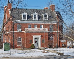
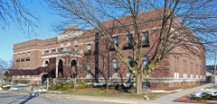
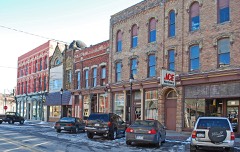
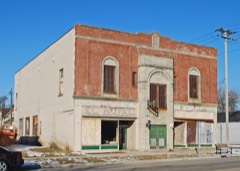
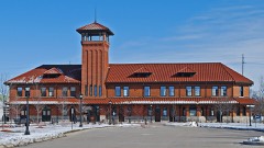
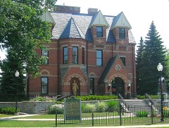
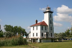
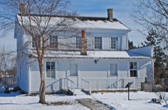
16 properties here are on the National Register of Historic Places: 10 buildings, 4 districts, 1 structure and 1 site.
3 of the 16 listings were added during the 1970s.
The Geographic Names Information System records 33 populated places in this county; 33 are covered by at least one topographic sheet.
3 public-domain county histories, 1883 and 1905, supply 137,261 words of narrative reproduced here.
What happened here
4 accounts
Among them: Biographical; Bio Graphic Al; Sydney S. Campbell. These passages come from the
identified county-history source books. Each inset names its own source
and opens the exact section it comes from.
Worthy Perry was born in Ashtabula County, Ohio, 1838. Remained at birth-place until 1862, when he enhsted in the Union army. Company I, 105th Ohio Infantry, and served to the close of the war. Was in various engagements with the enemy, including the battle of Perry ville, Ky., in which he received 'a gun-shot wound, which disabled him for about two months in hospital; then returned to his regiment, and, unlike many others, has never applied for a pension, to help swell the milhons for the people to pay.
Worthy Perry was born in Ashtabula County, Ohio, 1838. Remained at birth-place until 1862, when he enlisted in the Union army, Company I, 105th Ohio Infantry, and served to the close of the war. Was in various engagements with the enemy, including the battle of Perryville, Ky., in which he received 'a gun-shot wound, which disabled him for about two months in hospital; then returned to his regiment, and, unlike many others, has never ap¬ plied for a pension, to help swell the millions for the people to pay.
or Judge Campbell, as he is generally called, was unquestionably the first to locate in Lower Saginaw and effect a permanent settle¬ ment, after the town was projected. He was born at Paris, Oneida and the following day killed a large buck on the opposite side of the river, the last one that he saw for five years.
in those days was a primitive affair, and the transportation of the mails was attended with more hardship and fewer complications. Bernard Cunningham used to go to Saginaw in a canoe or on foot and bring the entire mail for this office in his coat pocket. Mr* Jesse M. Miller, still a resident of Bay*City, used to start on horse¬ back for Saginaw, when the ice was not strong enough to bear him in safety, and after going a short distance to a squatter's cabin, would be obliged to leave his pony and proceed on foot, wading sometimes to his knees in the half frozen marsh.
Every wildfire the federal occurrence
database records inside this county: 114 of them, burning
about 306 acres. 24 started naturally and 3 were recorded as arson. Each settlement page carries the fires within
five miles of it.
Reported cause
Fires
Missing data/not specified/undetermined
44
Equipment and vehicle use
31
Natural
24
Debris and open burning
10
Arson/incendiarism
3
Power generation/transmission/distribution
1
Misuse of fire by a minor
1
The five largest, by the area the report
gives. One of them was set deliberately.
Date
Cause
Size
Reported by
Name on the report
8 June 2006
Missing data/not specified/undetermined
61 acres
Michigan Department of Natural Resources
not named
23 April 2003
Debris and open burning
27 acres
Michigan Department of Natural Resources
not named
1 May 2001
Arson/incendiarism
26 acres
Michigan Department of Natural Resources
not named
15 May 2013
Missing data/not specified/undetermined
19 acres
Michigan Department of Natural Resources
BAY 01
27 October 2010
Power generation/transmission/distribution
18 acres
Michigan Department of Natural Resources
BAY 06
15 May 2013
Missing data/not specified/undetermined
9.0 acres
Michigan Department of Natural Resources
BAY 02
16 March 2010
Debris and open burning
8.0 acres
Michigan Department of Natural Resources
BAY 01
31 May 2010
Natural
5.0 acres
Michigan Department of Natural Resources
BAY 04
Every settlement page carries the fires within five
miles of it - see the settlement index below.
Storms,
1957 to 2025
60 of 290 shown
The
NOAA Storm Events Database holds
290 reports for this county, causing 2 deaths, 11 injuries and about $35,662,250 in recorded property damage.
Each settlement page carries the reports that name it.
Kind of event
Reports
Thunderstorm Wind
161
Hail
97
Tornado
14
Flash Flood
6
Lightning
5
Flood
5
Dust Devil
1
Heavy Rain
1
The most serious of them, by death, then
injury, then recorded damage. The accounts are quoted exactly as the
forecast office filed them.
A local newspaper reported that a coal stacker at the Karn-Weadock power plant was destroyed after being toppled by thunderstorm winds. A plant spokesman estimated wind gusts at 80 MPH. Total damages were estimated at roughly $1.5M.
The tornado was rated EF1 with maximum winds to 95 mph. The path width was 200 yards with a path length of 8.4 miles. The tornado started near Parish road and 11 mile road just west of the community of Beaver. The tornado then moved through Beaver, crossed Interstate 75, and finally across the south part of Linwood before moving out to Saginaw Bay at 737 pm. A barn was destroyed and homes were damaged near Beaver, mostly to garages and roofing material. Numerous trees were uprooted with snapped large limbs.
A tornado touched down 3.5 miles east of the town of Munger. The tornado struck a farmstead on Briggs Road. Property damage from the tornado included, complete destruction of a small barn and garage, a grain silo being lifted off its foundation, and minor damage to the siding and front porch of the main house. The tornado then moved northeast into Tuscola County.
Bay County Central Dispatch reported numerous wires and trees down throughout the county. Just under 20 percent of the consumers energy customers lost power in Bay county.
Heavy rain of 4 to 5 inches during the afternoon hours caused flash flooding across Bay City. The Bay-Arenac ISD Service Center and Career Center was closed due to flooding. At least a foot of standing water accumulated on Wilder Road. Several residents across Bay City also reported flooded basements.
County police reported trees and power lines down all over Bay city. A large tree branch also landed on a car on the south side of the city. Siding was blown off houses across the north side of the city, along with fences blown down.
Tornado began near the northern end of Elevator Road. The tornado uprooted pines and downed large tree limbs as it paralleled Lapan Road. At the end of Lapan Road, small trees were snapped, a roof was peeled off, and a house sustained broken windows, likely from being struck by roofing material. Estimated peak winds of 70 mph. Based on storm spotter pictures, the tornado likely continued into Saginaw Bay as a waterspout.
Lightning struck a tree, channeled through a dog run, and into a house on Wilder Rd in Bangor Township. The lightning strike damaged the window casing that the dog run was attached to and destroyed most of the electrical equipment in the home. Total damage was estimated at $10K.
Strong thunderstorms dumped very heavy rain across Williams Township in the western part of Bay County. The Williams Township Supervisor reported that 3.7 inches of rain fell in parts of the township during the storm and much of that occurred in the first hour or so. A number of farm fields, even tiled ones, were overwhelmed by the large amount of rain. At least one farmer reported crop damage when his field washed out. Also, a number of homes in the Garfield Subdivision ended up with water in the basement. This event was very localized and no roads or bridges were washed out in the area. Damages to crops were roughly estimated at $25K. Additional property damage was roughly estimated at $10K.
A weak tornado touched down near 11 mile and Salzburg Road, tracking east-northeast. The tornado lifted near 8 mile. Trees and power lines were blown down. A camper was also overturned.
Law enforcement reported large tree branches down at Lincoln ave and 5th Street. There were also reports of numerous wires down and a couple of blown transformers across the Bay City area.
Law enforcement reported that part of a barn roof with wires on it was blown onto Anderson Road between Mackinaw and Fraser Roads. They also reported that a couple of trees had been blown down in the same area.
Very large tree branches blown down, damaging a home.
Mines and
quarries
7 recorded
The Survey's mineral resources record
lists 7 workings inside this county. 1 still produces and 6 are closed or unrecorded. Each
settlement page carries the workings within five miles of it.
Commodity
Workings
Clay
5
Clay, Fire Clay (Refractory)
1
Stone
1
The least common of them first, because a
county's hundredth gravel pit says nothing its first ten did not.
History of Bay County, Michigan, and Representative Citizens; devotes a chapter to each township:
its boundaries and streams, who settled it and when, the mills, the
schools and the churches. All 7 are reproduced here in full. Each row
shows the township's own shape and where it lies in the county, drawn from
the Census Bureau's boundary. Which settlements belong to which township
is computed from that same boundary, not taken from the book.
2 books written about this county, cut here
where the book itself is cut, at its printed chapters: 17 chapters in all.
Every chapter is public domain, machine-read from the scan and
reproduced complete. A chapter already given under one of the county's
towns is not repeated in this list.
History of Bay County, Michigan with Illustrations and Biographical Sketches of Some of Its Prominent Men and Pioneers (1883)
Everyone History of Bay County, Michigan, and Representative Citizens; stops to write about, with
the section that describes them. Among them are the men who founded the
place and governed the Territory. Each name opens the passage itself, in
the words of 1905.
Named settlements recorded in the Geographic Names
Information System, each with the topographic sheets covering it. Villages,
hamlets and abandoned places alike. Each is shown with the nearest named
watercourse or landform and the survey quadrangle it falls on.
Topographic sheets. USGS Historical Topographic Map Collection, county index, measured from the bulk metadata.
Fire insurance maps. Library of Congress Sanborn collection, faceted to this county.
Photographs. Each place queried individually against the Library of Congress Prints and Photographs search.
Wildfire. Short, Karen C. 2022. Spatial wildfire occurrence data for the United States, 1992-2020 [FPA_FOD_20221014]. 6th Edition. Fort Collins, CO: Forest Service Research Data Archive. https://doi.org/10.2737/RDS-2013-0009.6 Collected with United States Government funding and usable without additional permissions or fees.
Mines and quarries. USGS Mineral Resources Data System (MRDS) https://mrdata.usgs.gov/mrds/ A work of the United States government, no copyright under 17 U.S.C. 105.
Storms. NOAA National Centers for Environmental Information, Storm Events Database https://www.ncei.noaa.gov/stormevents/ A work of the United States government, no copyright under 17 U.S.C. 105. Narratives are quoted verbatim from the National Weather Service report and are not edited or summarised.
 Block