 Block
Plainwell, Michigan
17 topographic sheets cover this place, the earliest surveyed in 1916 and the latest in 1982. It stands in Plainwell City. It lies in ZIP code area 49080. The Survey maps it on the Otsego quadrangle. 3,788 people lived here at the 2020 count. It stands 728 feet above sea level.
On record in Plainwell
Buildings and businesses the archive holds for this place. Each opens its own page, with the source record it came from.
On the National Register 6 records
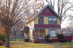 Cherry DeLefebvre Houselisted 1991
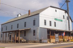 J. F. Eesley Milling Co. Flour Mill-Elevatorlisted 1991
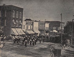 Island Historic Districtlisted 1991
 Michigan Paper Company Mill Historic Districtlisted 2011
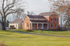 James Noble Sherwood Houselisted 1984
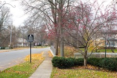 West Bridge Street Historic Districtlisted 1991
Population over time
2 figuresPlainwell fell from 3,804 to 3,788 between 2010 and 2020. These are the recorded population figures Wikidata holds for this place, reached through the Geographic Names Information System number this page is keyed on rather than by name, so they belong to this place and not to another of the same name. Most are census counts, but not all are: an early figure may be a founding or settlement estimate, and an estimate published within five years of a census is left out. The change column is computed, and is left blank where more than 20 years separate a figure from the one before it, because a gap that long is not a change between two counts.
| Year | People | Change |
|---|---|---|
| 2010 | 3,804 | |
| 2020 | 3,788 | -16 (-0%) |
Topographic sheets covering this place
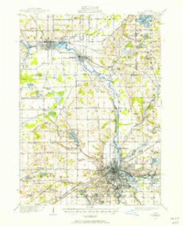
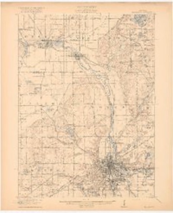
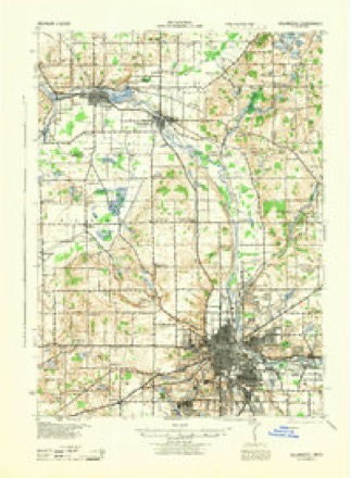
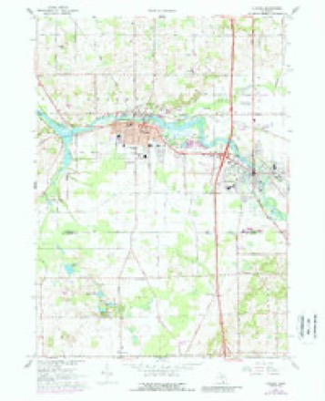
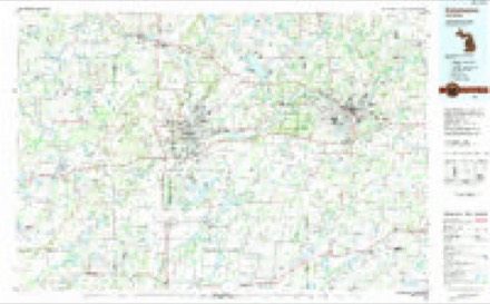
8 surveys from 17 printed sheetsMatched by testing this settlement's coordinate against the published boundary of every sheet in the United States Geological Survey's historical collection. Each opens the scanned sheet at the Survey.
- 1916 USGS Kalamazoo quadrangle1:62500, 3 printings
- 1918 USGS Kalamazoo quadrangle1:62500, 4 printings
- 1943 USGS Kalamazoo quadrangle1:62500
- 1958 USGS Grand Rapids quadrangle1:250000, 2 printings
- 1961 USGS Grand Rapids quadrangle1:250000
- 1962 USGS Grand Rapids quadrangle1:250000, 2 printings
- 1967 USGS Otsego quadrangle1:24000, 3 printings
- 1982 USGS Kalamazoo quadrangle1:100000
In the county-history sources
1,188 words on this townshipHistory of Allegan and Barry Counties Michigan 1880, published 1880 names this settlement in its chapter on Plainwell City. These are the passages that mention it, exactly as the scans read.
The village of Plainwell, an incorporated municipality of about 1650 inhabitants, is pleasantly situated on both banks of the Kalamazoo River. It is also a station of importance on the lines of the Grand Rapids and Indiana and the Kalamazoo division of the Lake-Shore and Michigan Southern Railroads, which roads here cross each other. By rail it is distant 12 miles from Kalamazoo, 36 miles from Grand Rapids, and 13 miles from Allegan, the countyseat.
Passage source: History of Allegan and Barry Counties Michigan 1880, published 1880.
Plainwell is a village of comparatively recent origin and growth, yet, lying in the midst of a district rich in agricultural resources, the seat of busy mills and manufactories, and the home of a thrifty, energetic people, it is deserving of more than mere mention in the history of Allegan County. Among the original owners of the lands within or near its present corporate limits were Norman Davis, Thomas J. Warner, Sylvester Sibley,t Lebbeus Sherwood, Thomas M. Warrant, Lucius Lindsley, Samuel Foster, Joseph D. Beers, Samuel Sherwood, Hull Sherwood, James Hanmer, and Sarah R. Hoskins,
Passage source: History of Allegan and Barry Counties Michigan 1880, published 1880.
John H. Lasher, the first shoemaker to settle here,.came in July, 1855. His recollections of people and matters at that time are as follows: William H. Woodhams was residing near the bridge. On the northeast corner of Bridge and Main Streets was Alfred S. Pierson's grocery-store, he residing in the same building. Hart Dunham's dwelling stood near the present post-office building, and hard by was the blacksmith-shop. Orson D. Dunham was postmaster and proprietor of the Plainwell House, and in the old log house, previously mentioned, lived Harry Munn, an Englishman. The old school-house stood near Corporation standing near the school-house. Abel Dunham's house was where Frederick Woodhams now resides, and a considerable distance west, on Allegan Street, was Hiram W. Anderson's log dwelling. The Lovelock. family also lived near the blacksmith-shop. Nathaniel Seeley was on the extreme west side, and in the vicinity of the village, on the northeast side of the river, were John Anderson, William Still, and Calvin Dunham. Lasher's first dwelling, which stands on the north side of Allegan Street, west of the race, was built in the fall of 1855.
Passage source: History of Allegan and Barry Counties Michigan 1880, published 1880.
Machine-read from a century-old scan, so expect the errors a machine makes: misspelled names, dropped words, stray characters.
Read the whole chapter on Plainwell City - it names this place 4 more 4 times.
Fires near this place
27 since 1993Regional context, not property-specific evidence. The federal wildfire occurrence database lists 27 fires within 5 miles of Plainwell between 1993 and 2020, burning about 42 acres in total. 2 started naturally. None was recorded as arson. Distance is straight-line from the map coordinates, so a fire counted here may appear on a neighbouring settlement's page as well.
| Reported cause | Fires |
|---|---|
| Equipment and vehicle use | 11 |
| Missing data/not specified/undetermined | 10 |
| Debris and open burning | 4 |
| Natural | 2 |
The most recent of them, most recent first, with the day each was reported and the service that recorded it.
| Date | Cause | Size | Reported by | Name on the report |
|---|---|---|---|---|
| 19 September 2018 | Missing data/not specified/undetermined | 1.0 acres | Michigan Department of Natural Resources | PLAINWELL DPS 0002076 - 2018 |
| 29 July 1996 | Debris and open burning | under an acre | Michigan Department of Natural Resources | not named |
| 2 July 2020 | Equipment and vehicle use | 1.0 acres | Michigan Department of Natural Resources | OTSEGO FD 0443 - 2020 |
| 25 June 2003 | Equipment and vehicle use | 5.4 acres | Michigan Department of Natural Resources | not named |
| 7 May 2020 | Missing data/not specified/undetermined | 1.0 acres | Michigan Department of Natural Resources | OSHTEMO TOWNSHIP FD 930 - 2020 |
| 23 May 2020 | Missing data/not specified/undetermined | 1.0 acres | Michigan Department of Natural Resources | GUN PLAIN CHARTER TWP FD 0000072 - 2020 |
| 2 May 2018 | Missing data/not specified/undetermined | 1.0 acres | Michigan Department of Natural Resources | GUN PLAIN CHARTER TWP FD 0000049 - 2018 |
| 9 April 2019 | Equipment and vehicle use | 1.0 acres | Michigan Department of Natural Resources | OTSEGO FD 243 - 2019 |
Settlements close enough to share some of these fires:
Mines and quarries near this place
3 within 5 milesRegional context, not property-specific evidence. The federal mineral resources record lists 3 workings within 5 miles of Plainwell: 2 past producers, 1 producer. 1 still produces. What was taken out: Sand and Gravel, Construction, Clay. Distance is straight-line from the map coordinates, so a quarry counted here may appear on a neighbouring settlement's page as well.
| Where | Site | Commodity | Status | Recorded |
|---|---|---|---|---|
| Cushman Bros Clay Pit | Clay | Past Producer | ||
| Allegan Co Pit | Sand and Gravel, Construction | Producer | ||
| Smith Pit | Sand and Gravel, Construction | Past Producer |
Storms near this place
21 since 1996Regional context, not property-specific evidence. The National Weather Service names Plainwell in 21 storm reports between 1996 and 2026: 12 thunderstorm wind, 7 hail, 1 flash flood, 1 tornado. No death or injury is recorded in these reports. Each account below is quoted exactly as the forecast office filed it, from the NOAA Storm Events Database, and each date opens the federal record of that event.
| When | Event | Place named | Harm | What the report says |
|---|---|---|---|---|
| April 2020 | Hail | Plainwell | $500,000 | Very large hail to two inches in diameter was reported near Plainwell. |
| April 2008 | Tornado (EF1) | Plainwell | $150,000 | A National Weather Service storm survey determined that damage in the vicinity of 388 3rd Street in the southeast corner of Allegan county was caused by a tornado. The tornado was rated an EF-1 on the Enhanced Fujita Damage Scale. The tornado touched down just southwest of the above address in Allegan county.||The tornado was on the ground for nearly five miles, and traveled to the northeast. It did significant damage to a horse barn, lifted a trailer adjacent to the barn, damaged gravel yard equipment, lofted a tank, and uprooted numerous large trees. Some trees were snapped off.||No one was injured. The damage was concentrated about four miles east of Plainwell and extended from the 300 block of 102nd Avenue to the northeast, crossing 106th Avenue in the 100 to 200 block section. |
| May 2000 | Hail | Plainwell | $40,000 | no account filed |
| July 2014 | Hail | Plainwell | $10,000 | A trained spotter measured golf ball sized hail near Allegan street in Cooper township. |
| May 1998 | Thunderstorm Wind | Plainwell | $10,000 | Trees and power lines downed in Plainwell. Trees fell across the road on 11th Street and along 10th Street near the intersections with 107th and 112th Streets. |
| June 2006 | Thunderstorm Wind | Plainwell | $5,000 | Two trees were blown down in Plainwell. |
| July 2002 | Thunderstorm Wind | Plainwell | $5,000 | Several large maple trees had limbs of up to one foot in diameter blown down by thunderstorm wind gusts. |
| June 1998 | Thunderstorm Wind | Plainwell | $2,500 | Trees and power lines downed in Doster, 5 miles northeast of Plainwell, near the Allegan-Barry County border. |
| June 1998 | Thunderstorm Wind | Plainwell | $2,500 | Trees and power lines downed in the city of Plainwell. |
| August 2020 | Thunderstorm Wind | Plainwell | $2,000 | There was isolated tree damage near Plainwell. |
| August 2001 | Thunderstorm Wind | Plainwell | $1,000 | no account filed |
| April 2026 | Thunderstorm Wind | Plainwell | - | Several uprooted trees. |
| July 2014 | Hail | Plainwell | - | A trained spotter reported one inch diameter hail near Plainwell. |
| June 2010 | Thunderstorm Wind | Plainwell | - | Law enforcement reported that a tree and many power lines were blown down one mile north northeast of Plainwell. |
| July 2008 | Hail | Plainwell | - | A trained spotter reported seven eighths inch diameter hail. |
| September 2007 | Hail | Plainwell | - | A trained spotter reported dime to penny size hail . |
| June 1998 | Thunderstorm Wind | Plainwell | - | Amateur radio operators estimated wind gusts to 60 mph 3 miles west of Plainwell, in Otsego Township, at 12:40 am EDT, Friday, June 26th. |
| July 1998 | Flash Flood | Plainwell | - | A trained spotter reported street flooding in the city of Plainwell, where 2.71 inches of rain had fallen in less than 2 hours. No injuries or property damage was reported. |
| July 1998 | Thunderstorm Wind | Plainwell | - | A trained spotter reported numerous trees downed near the U.S. Highway 131 and Michigan Highway 89 interchange. A damage estimate was not available. |
| October 2007 | Hail | Plainwell | - | no account filed |
| January 1996 | Thunderstorm Wind | Plainwell | - | no account filed |
Nearest settlements
The eight closest, with where each one stands in the county. Distances are straight-line, computed from the Geographic Names Information System coordinates.
| Map | Place | Distance | Sheets |
|---|---|---|---|
| Otsego | 2.9 miles | 17 | |
| Monteith Station | 5.7 miles | 9 | |
| Neeley | 6.5 miles | 9 | |
| Hooper | 6.7 miles | 9 | |
| Martin | 6.7 miles | 9 | |
| Watson | 7.3 miles | 9 | |
| East Martin | 8.3 miles | 9 | |
| Shelbyville | 10.7 miles | 9 |
Elsewhere
Matched on this settlement's Geographic Names Information System number rather than its name, so it cannot be a different place of the same name in another state.
| Wikipedia article on Plainwell | An encyclopaedic summary. Its text is share-alike, so it is linked here rather than copied. |
| Wikidata item Q2273620 | The structured record the population and elevation above come from. Public domain (CC0). |
Provenance
This settlement is recorded in the Geographic Names Information System as feature 635077. The sheet list is computed by point-in-boundary test against the United States Geological Survey's historical topographic inventory. Both are works of the United States government and carry no copyright under 17 U.S.C. 105.
Wildfire. Short, Karen C. 2022. Spatial wildfire occurrence data for the United States, 1992-2020 [FPA_FOD_20221014]. 6th Edition. Fort Collins, CO: Forest Service Research Data Archive. https://doi.org/10.2737/RDS-2013-0009.6 Collected with United States Government funding and usable without additional permissions or fees.
Mines and quarries. USGS Mineral Resources Data System (MRDS) https://mrdata.usgs.gov/mrds/ A work of the United States government, no copyright under 17 U.S.C. 105.
Storms. NOAA National Centers for Environmental Information, Storm Events Database https://www.ncei.noaa.gov/stormevents/ A work of the United States government, no copyright under 17 U.S.C. 105. Narratives are quoted verbatim from the National Weather Service report and are not edited or summarised.