 Block
Three Rivers, Michigan
15 topographic sheets cover this place, the earliest surveyed in 1914 and the latest in 1985. It stands in Three Rivers City. It lies in ZIP code area 49093. It stands on Portage River. The Survey maps it on the Three Rivers West quadrangle. 7,973 people lived here at the 2020 count. It stands 804 feet above sea level.
Research this city
On record in Three Rivers
Buildings and businesses the archive holds for this place. Each opens its own page, with the source record it came from.
On the National Register 2 records
 Downtown Three Rivers Commercial Historic Districtlisted 1982
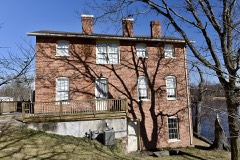 Arthur Silliman Houselisted 1979
Population over time
2 figuresThree Rivers grew from 7,811 to 7,973 between 2010 and 2020. These are the recorded population figures Wikidata holds for this place, reached through the Geographic Names Information System number this page is keyed on rather than by name, so they belong to this place and not to another of the same name. Most are census counts, but not all are: an early figure may be a founding or settlement estimate, and an estimate published within five years of a census is left out. The change column is computed, and is left blank where more than 20 years separate a figure from the one before it, because a gap that long is not a change between two counts.
| Year | People | Change |
|---|---|---|
| 2010 | 7,811 | |
| 2020 | 7,973 | +162 (+2%) |
Topographic sheets covering this place
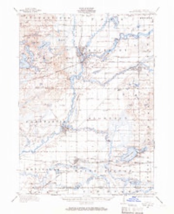
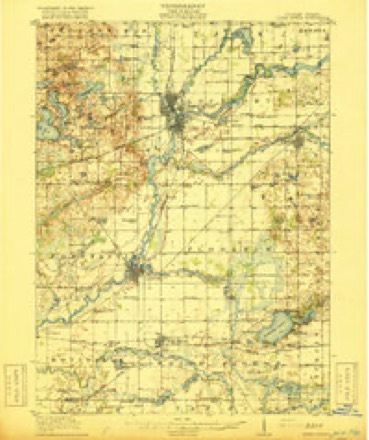
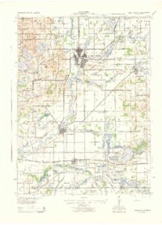
7 surveys from 15 printed sheetsMatched by testing this settlement's coordinate against the published boundary of every sheet in the United States Geological Survey's historical collection. Each opens the scanned sheet at the Survey.
- 1914 USGS Three Rivers quadrangle1:62500
- 1916 USGS Three Rivers quadrangle1:62500, 3 printings
- 1943 USGS Three Rivers quadrangle1:62500
- 1953 USGS Fort Wayne quadrangle1:250000, 4 printings
- 1956 USGS Fort Wayne quadrangle1:250000, 2 printings
- 1972 USGS Three Rivers West quadrangle1:24000, 2 printings
- 1985 USGS Elkhart quadrangle1:100000, 2 printings
Fires near this place
8 since 2019Regional context, not property-specific evidence. The federal wildfire occurrence database lists 8 fires within 5 miles of Three Rivers between 2019 and 2020, burning about 8 acres in total. None started naturally. None was recorded as arson. Distance is straight-line from the map coordinates, so a fire counted here may appear on a neighbouring settlement's page as well.
| Reported cause | Fires |
|---|---|
| Missing data/not specified/undetermined | 5 |
| Equipment and vehicle use | 3 |
The most recent of them, most recent first, with the day each was reported and the service that recorded it.
| Date | Cause | Size | Reported by | Name on the report |
|---|---|---|---|---|
| 21 August 2020 | Missing data/not specified/undetermined | 1.0 acres | Michigan Department of Natural Resources | FABIUS PARK FD 141 - 2020 |
| 4 July 2020 | Missing data/not specified/undetermined | 1.0 acres | Michigan Department of Natural Resources | FABIUS PARK FD 114 - 2020 |
| 30 July 2019 | Equipment and vehicle use | 1.0 acres | Michigan Department of Natural Resources | CONSTANTINE FD 202 - 2019 |
| 13 June 2020 | Missing data/not specified/undetermined | 1.0 acres | Michigan Department of Natural Resources | CONSTANTINE FD 132 - 2020 |
| 6 April 2019 | Missing data/not specified/undetermined | 1.0 acres | Michigan Department of Natural Resources | ALAMO TOWNSHIP FD 19150 - 2019 |
| 19 April 2020 | Equipment and vehicle use | 1.0 acres | Michigan Department of Natural Resources | FABIUS PARK FD 69 - 2020 |
| 11 April 2020 | Equipment and vehicle use | 1.0 acres | Michigan Department of Natural Resources | FABIUS PARK FD 67 - 2020 |
| 13 March 2020 | Missing data/not specified/undetermined | 1.0 acres | Michigan Department of Natural Resources | THREE RIVERS FD 20958 - 2020 |
Settlements close enough to share some of these fires:
Mines and quarries near this place
4 within 5 milesRegional context, not property-specific evidence. The federal mineral resources record lists 4 workings within 5 miles of Three Rivers: 3 producers, 1 past producer. 3 still produce. What was taken out: Sand and Gravel, Construction, Peat, Limestone, General. Distance is straight-line from the map coordinates, so a quarry counted here may appear on a neighbouring settlement's page as well.
| Where | Site | Commodity | Status | Recorded |
|---|---|---|---|---|
| Kerr Pit | Peat, Limestone, General | Producer | ||
| Cole Brothers Contractors Pit | Sand and Gravel, Construction | Past Producer | ||
| Hoffman Road Pit and Wash Plant | Sand and Gravel, Construction | Producer | ||
| St. Joseph County Pit | Sand and Gravel, Construction | Producer |
Storms near this place
60 of 67 shownRegional context, not property-specific evidence. The National Weather Service names Three Rivers in 67 storm reports between 1996 and 2026: 51 thunderstorm wind, 12 hail, 2 lightning, 1 flash flood. The reports record 12 injuries. Each account below is quoted exactly as the forecast office filed it, from the NOAA Storm Events Database, and each date opens the federal record of that event.
| When | Event | Place named | Harm | What the report says |
|---|---|---|---|---|
| March 2026 | Tornado (EF2) | Three Rivers | 10 hurt | Another tornado from the same supercell that produced the|Edwardsburg tornado touched down near Roberts Rd and M60 just|southwest of Three Rivers on Friday afternoon. The tornado|quickly intensified and produced EF-2 damage with estimated wind|speeds of 120-130 mph. Here, the tornado hit a Menards, removing|the roof on the southwest and northwest portions of the building,|along with an exterior wall collapse. One section of an nearby|Uhaul facility was also completely destroyed. The tornado|continued through the heart of Three Rivers, producing EF-1 and|isolated pockets of EF-2 damage to residences and businesses|(including the hospital). The tornado crossed the St. Joseph|River, producing extensive damage to a lumber yard before|uprooting many trees in a local cemetery. The tornado produced|another pocket of EF-2 damage to a double-wide mobile home and a|brand new school transportation facility. Multiple school|trailers were tossed either across the street or inside the|transportation facility itself which had its roof removed. As the|tornado became cut off from the main supercell, it began to jog|more eastward. It produced more damage north of Centreville|including a large barn and additional trees snapped. |
| June 2024 | Thunderstorm Wind | Three Rivers | 2 hurt, $20,000 | St. Joseph County dispatch reported numerous trees and powerlines down in Three Rivers. Power is out. Two injuries reported as a car collided with a downed tree in the road. |
| March 2025 | Thunderstorm Wind | Three Rivers | $50,000 | Photos received of numerous, large glass panes blown out of a tire shop. Semi trailer blown over in the parking lot. Roof damage possible. |
| August 2022 | Thunderstorm Wind | Three Rivers | $20,000 | Trees are down in and around the city. |
| August 2007 | Thunderstorm Wind | Three Rivers | $15,000 | Numerous trees, branches and power lines were blown down. A 2 foot diameter tree was uprooted, with a branch being blown onto a house. |
| May 2024 | Hail | Three Rivers | $12,000 | no account filed |
| July 2012 | Lightning | Three Rivers | $10,000 | Local fire officials and media reported a lightning strike caused an attic fire in the Westchase Apartments complex. Smoke was reported from one of the complexes and the fire was quickly located in the attic. Only one apartment suffered moderate damage when fire crews had to pull the ceiling down to access the area of the fire in the attic. The remaining fire and smoke damage was confined to the attic. No damage estimates were provided, but will be set at $10,000. |
| July 2005 | Thunderstorm Wind | Three Rivers | $10,000 | Several trees blown down on power lines and a large tree blown down on house. |
| August 1997 | Thunderstorm Wind | Three Rivers | $10,000 | The Three Rivers Police Department and weather spotters reported several large tree limbs downed in the city. American Electric Power reported 12 transformer losses and a broken utility pole, which resulted in approximately 1,500 power outages. |
| July 2024 | Thunderstorm Wind | Three Rivers | $5,000 | Multiple trees down at Meyer Broadway County Park. |
| July 2024 | Thunderstorm Wind | Three Rivers | $5,000 | A few trees down near South Main Street. |
| June 2006 | Thunderstorm Wind | Three Rivers | $5,000 | Trees and power lines were blown down. |
| August 1997 | Thunderstorm Wind | Three Rivers | $5,000 | Trees downed across the Three Rivers area. |
| August 1996 | Thunderstorm Wind | Three Rivers | $5,000 | no account filed |
| October 1996 | Thunderstorm Wind | Three Rivers | $3,000 | no account filed |
| July 1997 | Thunderstorm Wind | Three Rivers | $2,500 | Trees downed in the Three Rivers area. |
| May 1997 | Thunderstorm Wind | Three Rivers | $2,500 | Several trees and power lines downed in Three Rivers. |
| August 1997 | Thunderstorm Wind | Three Rivers | $2,500 | Scattered reports of trees downed across Three Rivers area. |
| April 1997 | Thunderstorm Wind | Three Rivers | $2,500 | no account filed |
| June 2007 | Thunderstorm Wind | Three Rivers | $2,000 | A tree was blown down west of Three Rivers. |
| July 2024 | Thunderstorm Wind | Three Rivers | $1,000 | Large tree down on south Lincoln Ave. |
| June 2003 | Thunderstorm Wind | Three Rivers | $750 | Law enforcement reported railroad crossing arms broken by thunderstorm winds in Three Rivers. |
| June 2022 | Thunderstorm Wind | Three Rivers | - | The ASOS at the Three Rivers Airport recorded a 66 mph wind gust. |
| June 2022 | Thunderstorm Wind | Three Rivers | - | The public reported two small trees down. |
| June 2022 | Thunderstorm Wind | Three Rivers | - | The public reported a large tree down across US 131, south of Three Rivers. |
| June 2022 | Thunderstorm Wind | Three Rivers | - | A trained spotter recorded a 73 mph wind gust. |
| August 2020 | Thunderstorm Wind | Three Rivers | - | The local fire department reported large trees blown down in the Three Rivers area. |
| July 2019 | Thunderstorm Wind | Three Rivers | - | Fire officials reported multiple trees and power lines down. |
| June 2017 | Thunderstorm Wind | Three Rivers | - | Amateur radio operators reported a tree fell onto a car as well as power lines. |
| June 2016 | Thunderstorm Wind | Three Rivers | - | Trained spotters reported multiple trees down along Hoffman St. Additional trees, tree limbs and power lines were also down across the area. . |
| June 2014 | Lightning | Three Rivers | - | Local media reported a lightning strike caused a fire at an apartment complex in Three Rivers. The fire was mainly confined to the attic area, but extensive smoke and water damage occurred. A fire fighter suffered minor injuries while in the building when the ceiling collapsed. No damage estimate was available. |
| July 2014 | Thunderstorm Wind | Three Rivers | - | The public reported a tree down onto a residence. No injuries were noted. |
| June 2013 | Thunderstorm Wind | Three Rivers | - | Amateur radio operators reported a six inch diameter tree down on River Drive, near 6th Avenue. |
| September 2013 | Thunderstorm Wind | Three Rivers | - | Local fire officials reported trees and power lines down. |
| June 2013 | Thunderstorm Wind | Three Rivers | - | A trained spotter reported power lines down at South Hooker and Buck Street in Three Rivers. |
| August 2011 | Hail | Three Rivers | - | A trained spotter reported hail covering the ground ranging in size from peas to quarters. |
| August 2011 | Thunderstorm Wind | Three Rivers | - | A trained spotter recorded a 71 mph wind gust just to the northwest of Three Rivers. |
| July 2011 | Thunderstorm Wind | Three Rivers | - | Local fire officials reported numerous trees and power lines down in and around Three Rivers. |
| April 2010 | Thunderstorm Wind | Three Rivers | - | Trained spotters reported several trees down in the Three Rivers area. One of these fell onto a house. No damage estimate was available. |
| April 2008 | Thunderstorm Wind | Three Rivers | - | Local law enforcement reproted a tree was blown down on a road in Three Rivers. |
| August 2007 | Thunderstorm Wind | Three Rivers | - | Several large limbs and power lines were blown down. |
| August 2006 | Thunderstorm Wind | Three Rivers | - | Trees blown down. |
| May 2004 | Thunderstorm Wind | Three Rivers | - | Broadcast media weather station at Three Rivers High School recorded a wind gust to 78 MPH. |
| June 2004 | Thunderstorm Wind | Three Rivers | - | Law enforcement reported trees and power lines down in and east of Three Rivers. |
| August 2003 | Thunderstorm Wind | Three Rivers | - | Trees were reported down. |
| March 2003 | Hail | Three Rivers | - | Golf ball size hail was reported in Three Rivers, with reports of quarter size hail in Sturgis. |
| June 2003 | Thunderstorm Wind | Three Rivers | - | Law enforcement reported trees and power lines down northwest of Three Rivers. |
| July 2003 | Thunderstorm Wind | Three Rivers | - | Law enforcement reported trees and power lines down in Three Rivers. |
| August 2003 | Thunderstorm Wind | Three Rivers | - | Trees reported down near Centerville. |
| August 2002 | Thunderstorm Wind | Three Rivers | - | General public reported trees down in Three Rivers. |
| August 2002 | Thunderstorm Wind | Three Rivers | - | Law enforcement reported trees and power lines down in Three Rivers. |
| June 2001 | Thunderstorm Wind | Three Rivers | - | Trees down in Three Rivers |
| September 2001 | Thunderstorm Wind | Three Rivers | - | Approximately a dozen trees blown down. |
| September 2001 | Thunderstorm Wind | Three Rivers | - | Numerous trees and power lines blown down. |
| June 2000 | Thunderstorm Wind | Three Rivers | - | Power lines and pole down. Trees down and some uprooted. |
| April 2017 | Hail | Three Rivers | - | no account filed |
| April 2017 | Hail | Three Rivers | - | no account filed |
| June 2013 | Hail | Three Rivers | - | no account filed |
| March 2012 | Hail | Three Rivers | - | no account filed |
| April 2010 | Hail | Three Rivers | - | no account filed |
Nearest settlements
The eight closest, with where each one stands in the county. Distances are straight-line, computed from the Geographic Names Information System coordinates.
| Map | Place | Distance | Sheets |
|---|---|---|---|
| Moore Park | 4.8 miles | 15 | |
| Golden Pond Estates | 4.9 miles | 15 | |
| Fabius | 5.3 miles | 15 | |
| Centreville | 5.7 miles | 15 | |
| Pine Ridge | 6.3 miles | 15 | |
| Parkville | 6.7 miles | 15 | |
| Howardsville | 7.2 miles | 15 | |
| Constantine | 7.3 miles | 14 |
Elsewhere
Matched on this settlement's Geographic Names Information System number rather than its name, so it cannot be a different place of the same name in another state.
| Wikipedia article on Three Rivers | An encyclopaedic summary. Its text is share-alike, so it is linked here rather than copied. |
| Wikidata item Q2471911 | The structured record the population and elevation above come from. Public domain (CC0). |
Provenance
This settlement is recorded in the Geographic Names Information System as feature 1624987. The sheet list is computed by point-in-boundary test against the United States Geological Survey's historical topographic inventory. Both are works of the United States government and carry no copyright under 17 U.S.C. 105.
Wildfire. Short, Karen C. 2022. Spatial wildfire occurrence data for the United States, 1992-2020 [FPA_FOD_20221014]. 6th Edition. Fort Collins, CO: Forest Service Research Data Archive. https://doi.org/10.2737/RDS-2013-0009.6 Collected with United States Government funding and usable without additional permissions or fees.
Mines and quarries. USGS Mineral Resources Data System (MRDS) https://mrdata.usgs.gov/mrds/ A work of the United States government, no copyright under 17 U.S.C. 105.
Storms. NOAA National Centers for Environmental Information, Storm Events Database https://www.ncei.noaa.gov/stormevents/ A work of the United States government, no copyright under 17 U.S.C. 105. Narratives are quoted verbatim from the National Weather Service report and are not edited or summarised.