 Block
From the record
17 National Register listings published here.
Sources: the National Register database, National Park Service
65 topographic sheets cover 29 settlements here, and 17 properties are on the National Register of Historic Places.
17 National Register listings published here.
Sources: the National Register database, National Park Service
Every property in this county listed on the National Register of Historic Places, with the year it was listed and the federal nomination document.
| Photograph | Property | Type | Listed | Reference |
|---|---|---|---|---|
 | Art Gallery Building | building | 1980 | 80004070 |
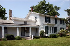 | Gov. John S. Barry House | building | 1972 | 72001308 |
 | Clapp, Leverett A. and Amanda (Hampson), House | building | 2009 | 09000476 |
 | Constantine Historic Commercial District | district | 1985 | 85002444 |
 | Downtown Three Rivers Commercial Historic District | district | 1982 | 82004472 |
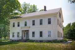 | Farrand Hall | building | 1972 | 72001307 |
 | M-86-Prarie River Bridge | structure | 2000 | 00000044 |
 | Marantette Bridge | structure | 2001 | 01000708 |
 | Marantette House | building | 1973 | 73001947 |
 | Morse-Scoville House | building | 1996 | 96000801 |
| Nettleton-Cond House | building | 2021 | 100006782 | |
 | Nottawa Stone School | building | 1972 | 72001309 |
 | Arthur Silliman House | building | 1979 | 79002662 |
 | St. Joseph County Courthouse | building | 1993 | 93000984 |
 | US 12 St. Joseph River Bridge | structure | 1991 | 91000388 |
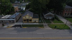 | US Government Land Office Building, Old | building | 1989 | 88003234 |
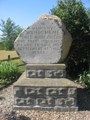 | Wahbememe Burial Site and Monument | site | 1995 | 95000867 |
Every wildfire the federal occurrence database records inside this county: 71 of them, burning about 107 acres. 10 started naturally and 1 was recorded as arson. Each settlement page carries the fires within five miles of it.
| Reported cause | Fires |
|---|---|
| Missing data/not specified/undetermined | 28 |
| Equipment and vehicle use | 27 |
| Natural | 10 |
| Recreation and ceremony | 4 |
| Arson/incendiarism | 1 |
| Debris and open burning | 1 |
The five largest, by the area the report gives. One of them was set deliberately.
| Date | Cause | Size | Reported by | Name on the report |
|---|---|---|---|---|
| 22 March 2018 | Equipment and vehicle use | 15 acres | Michigan Department of Natural Resources | CONSTANTINE FD 0000090 - 2018 |
| 26 June 2017 | Arson/incendiarism | 13 acres | Michigan Department of Natural Resources | ST JOSEPH 01 MICHIANA MULCH |
| 13 April 2009 | Missing data/not specified/undetermined | 3.0 acres | Michigan Department of Natural Resources | ST.JOSEPH 01 |
| 6 November 2020 | Equipment and vehicle use | 3.0 acres | Michigan Department of Natural Resources | WHITE PIGEON TWP FD 159 - 2020 |
| 15 April 2019 | Equipment and vehicle use | 3.0 acres | Michigan Department of Natural Resources | COLON FIRE/RESCUE 098 - 2019 |
| 19 March 2018 | Equipment and vehicle use | 3.0 acres | Michigan Department of Natural Resources | MARCELLUS FD 0000023 - 2018 |
| 9 November 2019 | Missing data/not specified/undetermined | 2.0 acres | Michigan Department of Natural Resources | TRI-TOWNSHIP FD 000363 - 2019 |
| 25 April 2018 | Equipment and vehicle use | 2.0 acres | Michigan Department of Natural Resources | CONSTANTINE FD 0000124 - 2018 |
Every settlement page carries the fires within five miles of it - see the settlement index below.
The NOAA Storm Events Database holds 364 reports for this county, causing 5 deaths, 16 injuries and about $3,217,250 in recorded property damage. Each settlement page carries the reports that name it.
| Kind of event | Reports |
|---|---|
| Thunderstorm Wind | 264 |
| Hail | 72 |
| Tornado | 18 |
| Lightning | 6 |
| Flood | 3 |
| Flash Flood | 1 |
The most serious of them, by death, then injury, then recorded damage. The accounts are quoted exactly as the forecast office filed them.
| When | Event | Place named | Harm | What the report says |
|---|---|---|---|---|
| May 2004 | Thunderstorm Wind | Sturgis | 1 killed, $10,000 | Emergency management reported a 36 year old female was driving in Sturgis when a large tree fell on her vehicle and crushed it. The driver was killed instantly. |
| May 2004 | Thunderstorm Wind | Colon | 1 killed, $10,000 | A 71 year old male was killed when a large tree fell on his vehicle and crushed it as he was driving north of Colon. The driver was killed instantly. |
| June 2006 | Lightning | Constantine | 1 killed | A 45 year old man leaning against a tree was seriously injured when the tree was struck by lightning. He later died of his injuries. |
| March 1991 | Thunderstorm Wind | not stated | 1 killed | no account filed |
| August 1989 | Thunderstorm Wind | not stated | 1 killed | no account filed |
| March 2026 | Tornado (EF2) | Three Rivers | 10 hurt | Another tornado from the same supercell that produced the|Edwardsburg tornado touched down near Roberts Rd and M60 just|southwest of Three Rivers on Friday afternoon. The tornado|quickly intensified and produced EF-2 damage with estimated wind|speeds of 120-130 mph. Here, the tornado hit a Menards, removing|the roof on the southwest and northwest portions of the building,|along with an exterior wall collapse. One section of an nearby|Uhaul facility was also completely destroyed. The tornado|continued through the heart of Three Rivers, producing EF-1 and|isolated pockets of EF-2 damage to residences and businesses|(including the hospital). The tornado crossed the St. Joseph|River, producing extensive damage to a lumber yard before|uprooting many trees in a local cemetery. The tornado produced|another pocket of EF-2 damage to a double-wide mobile home and a|brand new school transportation facility. Multiple school|trailers were tossed either across the street or inside the|transportation facility itself which had its roof removed. As the|tornado became cut off from the main supercell, it began to jog|more eastward. It produced more damage north of Centreville|including a large barn and additional trees snapped. |
| June 2024 | Thunderstorm Wind | Three Rivers | 2 hurt, $20,000 | St. Joseph County dispatch reported numerous trees and powerlines down in Three Rivers. Power is out. Two injuries reported as a car collided with a downed tree in the road. |
| October 2001 | Tornado (F1) | White Pigeon | 1 hurt, $322,200 | Tornado touched down north of the Elkhart/St Joseph Michigan county line southwest of White Pigeon and skipped northeast before lifting north of White pigeon. F1 damage near SR 131 and SR 12 to buildings and high tension wires. |
| May 2024 | Tornado (EF2) | Centreville | 1 hurt | A tornado touched down in St. Joseph county on the south side of Centreville and then tracked northeast, passing north of Colon and into Branch county near Havens and Goodrich Lake. The tornado finally weakened and lifted south of Union Lake. Extensive damage occurred to trees and center pivot irrigation systems along the track with the most significant damage occurring from north of Colon to north of Sherwood, when video evidence indicated the tornado became multi-vortex. Several homes suffered loss of roof and walls, resulting in the area of highest damage being consistent with an EF2 tornado and winds of up to 130 mph. An 84 year old man suffered minor injuries in a residence north of Colon. |
| August 2011 | Lightning | Colon | 1 hurt | A fire official reported that a 17 year old female was struck by lightning at a campground while taking a shower. No specific details were given as to the extent of injuries, which are assumed minor. |
| July 1997 | Lightning | Constantine | 1 hurt | An adult woman in Constantine was struck by lightning at 2:22 PM EDT at 10884 Harder Road. Michigan State Police reported she sought medical treatment at Three Rivers Area Hospital, where she was treated and released for minor injuries. |
| February 2018 | Flood | Factoryville | $680,000 | Flooding occurred due to high water levels in many creeks, streams and rivers in the county. Several roads were closed for a period of time until flood waters receded. Over 60 structures were impacted by the flood waters as well as minor road damage. Damage of around 680,000 dollars was estimated. |
| September 2008 | Flood | Howardsville | $500,000 | The rainfall from the remnants of Lowell and Ike continued to drop heavy rainfall into the early morning hours of the 15th. When the rain finally stopped, total rainfall amounts of eight to ten inches was reported across the southern part of the county, including the Three Rivers area. Numerous roads remained closed with some culverts and bridges suffering damage. No injuries were reported. No exact figures are available for the damage to the area from the flooding. |
| June 2010 | Tornado (EF2) | Constantine | $300,000 | A survey of damage across southern St. Joseph County was performed by NWS Personnel. The damage found indicates that a circulation touched down over an open field north of Miller Road and west of Blue School Road. The tornado initially struck two barns, destroying them and sending the debris several miles downwind. The tornado then picked up a trailer at a local Port-A-Jon business. It appears that a combination of the strong winds and the trailer striking one of the guy wires, resulted in a 350 foot cell tower being blown down into an adjacent tower, causing the failure of both (DI: FST DOD:2). The tornado then continued across mainly open fields, scouring a 200 yard wide area of corn, just to the east-southeast of the cell towers and several trees along its track. The final damage occurred at a residence where minor roof damage was done to a barn, as well as more focused tree damage and a center pivot irrigation system being flipped. The tornado reached a maximum of roughly 200 yards in width and was on the ground for over 10 miles. Maximum winds are estimated at around 125 mph. |
| November 1998 | Thunderstorm Wind | Colon | $150,000 | SEVERAL HOMES WERE HEAVILY DAMAGED BY FALLEN TREES. |
| October 2001 | Tornado (F0) | Howardsville | $100,000 | This tornado crossed into Berrien county Michigan from St Joseph county Indiana south of Niles (see Storm Data for Indiana, Northeast for more information on the beginning portion of this tornado in Indiana). The tornado tracked northeast across extreme southeast Berrien county, then across Cass county and the northeast corner of St Joseph county Michigan. F1 damage was reported south of Niles, near Edwardsburg, and in Cassopolis. The tornado was skipping as it caused general F0 to F1 damage across northeast Cass county and northwest St Joseph county. |
| October 2001 | Tornado (F1) | Colon | $100,000 | Tornado skipped along a 5 mile path. F1 damage included a well constructed barn destroyed with debris thrown about one half mile. |
| August 1998 | Thunderstorm Wind | Constantine | $100,000 | EXTENSIVE TREES AND POWER LINES DOWN ACROSS THE COUNTY. |
| November 1998 | Thunderstorm Wind | Countywide | $75,000 | NUMEROUS TREES AND POWER LINES WERE BLOWN DOWN ACROSS THE COUNTY. THE TOWN OF STURGIS WAS ESPECIALLY HARD HIT WHERE TREES...LIMBS...FENCES AND TV ANTENNAS WERE BLOWN DOWN. ONE HOME OWNERS CAR WAS COMPLETELY CRUSHED BY A VERY LARGE TREE. |
| August 2021 | Thunderstorm Wind | Centreville | $62,000 | Emergency manager reports 6 to 8 power poles were snapped. |
| March 2025 | Tornado (EF0) | Oakwood | $60,000 | Ground and aerial surveys confirm a weak tornado began near the intersection of Olnhausen and Shimmel Rd where over a dozen pine trees were snapped and several others were uprooted. The tornado proceeded quickly northeast removing an empty grain bin and a portion of a pole barn roof west of the intersection of Fawn River and Stubey roads. The grain bin was thrown into power lines along Fawn River Road, possibly aiding in the damage to several snapped power poles. Spans of a center pivot were rolled once. The tornado then continued across open fields to west of Balk Rd and US 12 where trees were blown down onto power lines. A piece of metal from the barn roof was wrapped around a pole several feet off the ground. Another center pivot was damaged northeast of this intersection. The tornado then dissipated shortly thereafter. |
| March 2025 | Thunderstorm Wind | Three Rivers | $50,000 | Photos received of numerous, large glass panes blown out of a tire shop. Semi trailer blown over in the parking lot. Roof damage possible. |
| May 2007 | Thunderstorm Wind | Three Rivers Arpt | $50,000 | A storm survey was performed by NWS personnel of the area between Three Rivers and Mendon, including Fishers Lake. Damage was observed at the Three Rivers Muncipal Airport and at an adjacent residence to the airport. A hangar door was blown open at the airport, with 2 large tree trunks falling onto parked vehicles at a private residence. One of the vehicles had pulled into the driveway due to poor visbility, and before the driver could exit, the tree trunk fell onto the roof of the car, causing minor head injury to the driver. The Three Rivers AWOS (KHAI) recorded a 68 mph wind gust at 548 pm EDT. As the survey progressed along M-60 to some of the back roads, more extensive damage began to be encountered. A barn was found destroyed by a combination of the strong winds and a small shed being picked up and thrown into the barn. An adjacent barn also suffered moderate damage from the wind. Numerous trees limbs were snapped in the yard, as well as the chimney of the 2 story residence being blown over to roof level. Just to the north of this residence a large grove of various hardwood trees suffered extensive damage with many trees being uprooted or snapped. The sandy soil in the area reduced the resistance of the roots somewhat. A residence as well as a barn suffered only minor damage despite the estimated 90 to 95 mph winds. KIWX 88D Base velocity data showed a couplet with 82 kt (94 mph) outbound winds in this general area. Damage continued northeast towards Mendon where trees continued to be damaged as well as 2 barns. |With the strength of the winds, it is possible that a few gust front tornadoes (gustnadoes) may have developed and helped locally focus some of the damage, but by far the strength of the straight line winds was more significant then the potential winds of any gustnadoes. |
| May 2024 | Hail | Leonidas | $40,000 | Photo on Twitter, X, of 4 inch hail. |
| May 2024 | Hail | Leonidas | $30,000 | Pictures of tennis ball size hail. |
| July 2023 | Tornado (EF1) | Colon | $25,000 | A tornado quickly developed almost directly over a storage facility on the east side of Colon in St. Joseph county. Garage doors were blown in and then a significant loss of roof decking and metal covering occurred. This wood and metal debris was lofted, twisted, and deposited both to the east and north up to 200 yards away in nearby fields. The tornado crossed into Branch county with sporadic tree damage noted on Ambs Road, South Culver Road, and Jackson Road, where large branches were down, trees uprooted, or trees were snapped several feet off the ground. The tornado topped a number of trees within a tree grove east of Jackson Road, but south of Wattles |Road before dissipating. The tornado was on the ground for 0.9 miles in St Joseph county and 2.0 miles in Branch county for a total of 2.9 miles in length. |
| July 2022 | Thunderstorm Wind | Parkville | $25,000 | Dispatch received several reports of trees and power lines down between Three Rivers and Mendon. |
| March 1976 | Tornado (F2) | not stated | $25,000 | no account filed |
| July 1966 | Tornado (F2) | not stated | $25,000 | no account filed |
| March 2025 | Thunderstorm Wind | Three Rivers Arpt | $20,000 | No power at the Three River Airport. Multiple trees down in the area. |
| March 2025 | Thunderstorm Wind | Sturgis | $20,000 | Several reports of trees and branches down in and around Sturgis. |
| August 2022 | Thunderstorm Wind | Three Rivers | $20,000 | Trees are down in and around the city. |
| June 2010 | Lightning | White Pigeon | $20,000 | A trained spotter reported that a house on Dickinson Road was struck by lightning and on fire. |
| July 1997 | Thunderstorm Wind | White Pigeon | $20,000 | St. Joseph County Central Dispatch reported downed trees and power lines across White Pigeon Township. One tree landed on a vehicle at 309 S. Washington Street in White Pigeon. Intermittent power outages occurred at the height of the storm. |
| March 2025 | Thunderstorm Wind | Burr Oak | $15,000 | Huge tree down on power lines. |
| August 2021 | Thunderstorm Wind | Colon | $15,000 | Two foot diameter healthy tree snapped in half, and thrown into a house causing roof and gutter damage. |
| August 2021 | Thunderstorm Wind | Findley | $15,000 | Healthy 1 to 3 ft diameter tree uprooted and downed on a garage. A tree with partial rotting was snapped at the base and the top limbs damaged a house. Several smaller 3 to 6 inch limbs down around porperty. Powerlines bent or down as well. |
| August 2007 | Thunderstorm Wind | Three Rivers | $15,000 | Numerous trees, branches and power lines were blown down. A 2 foot diameter tree was uprooted, with a branch being blown onto a house. |
| July 2006 | Thunderstorm Wind | Countywide | $15,000 | Estimated 70 mph winds blew down several trees and power lines in Centreville, Three Rivers and Constantine. At least one tree fell onto a home, causing mainly roof damage. Damage for the county is estimated at around $15,000. |
| June 2005 | Thunderstorm Wind | Sturgis | $15,000 | Trees and power lines were blown down across the county, with the majority of the reports being received from the southeastern half of the county. |
| April 1995 | Thunderstorm Wind | White Pigeon | $15,000 | A tree was blown over, crushing a car and part of a house. |
| May 2024 | Hail | Fairfax | $15,000 | no account filed |
| May 2024 | Hail | Three Rivers | $12,000 | no account filed |
| August 2022 | Thunderstorm Wind | Factoryville | $10,000 | A large tree is down. |
| July 2012 | Lightning | Three Rivers | $10,000 | Local fire officials and media reported a lightning strike caused an attic fire in the Westchase Apartments complex. Smoke was reported from one of the complexes and the fire was quickly located in the attic. Only one apartment suffered moderate damage when fire crews had to pull the ceiling down to access the area of the fire in the attic. The remaining fire and smoke damage was confined to the attic. No damage estimates were provided, but will be set at $10,000. |
| June 2008 | Thunderstorm Wind | Centreville | $10,000 | Trained spotters reported trees uprooted as well as power lines down in the area. |
| May 2007 | Thunderstorm Wind | Centreville | $10,000 | Several trees and power lines were reported down. |
| October 2007 | Thunderstorm Wind | Sturgis | $10,000 | Several trees and power lines down in and around Sturgis. |
| July 2005 | Thunderstorm Wind | Three Rivers | $10,000 | Several trees blown down on power lines and a large tree blown down on house. |
| August 1997 | Thunderstorm Wind | Three Rivers | $10,000 | The Three Rivers Police Department and weather spotters reported several large tree limbs downed in the city. American Electric Power reported 12 transformer losses and a broken utility pole, which resulted in approximately 1,500 power outages. |
| October 1996 | Thunderstorm Wind | Leonidas | $10,000 | no account filed |
| March 2025 | Thunderstorm Wind | Pine Ridge | $5,000 | Numerous trees or limbs down in the areas of US 131 and SR 216. |
| June 2025 | Thunderstorm Wind | Burr Oak | $5,000 | Several trees down in Burr Oak. |
| July 2024 | Thunderstorm Wind | Three Rivers | $5,000 | Multiple trees down at Meyer Broadway County Park. |
| July 2024 | Thunderstorm Wind | Three Rivers | $5,000 | A few trees down near South Main Street. |
| July 2023 | Thunderstorm Wind | Sturgis | $5,000 | Multiple trees down along Highway 66. |
| July 2023 | Thunderstorm Wind | Colon | $5,000 | Spotter estimated 70 mph wind gusts. Trees are down and crops have been blown over. |
| July 2023 | Thunderstorm Wind | Burr Oak | $5,000 | Numerous trees were snapped or uprooted in Burr Oak. Photos on Twitter. |
| March 2023 | Hail | Sturgis | $5,000 | Ping pong ball size hail was reported by a trained spotter. |
| June 2006 | Thunderstorm Wind | Three Rivers | $5,000 | Trees and power lines were blown down. |
The Survey's mineral resources record lists 14 workings inside this county. 5 still produce and 9 are closed or unrecorded. Each settlement page carries the workings within five miles of it.
| Commodity | Workings |
|---|---|
| Sand and Gravel, Construction | 12 |
| Limestone, General | 2 |
| Peat | 1 |
The least common of them first, because a county's hundredth gravel pit says nothing its first ten did not.
| Where | Site | Commodity | Status | Recorded |
|---|---|---|---|---|
| Kerr Pit | Peat, Limestone, General | Producer | ||
| Drake Marl Pit | Limestone, General | Producer | ||
| Api Dredge and Mill | Sand and Gravel, Construction | Producer | ||
| Cole Brothers Contractors Pit | Sand and Gravel, Construction | Past Producer | ||
| Cole Brothers Contractors Pit | Sand and Gravel, Construction | Past Producer | ||
| Cole Brothers Contractors Pit | Sand and Gravel, Construction | Past Producer | ||
| Cole Brothers Contractors Pit | Sand and Gravel, Construction | Past Producer | ||
| Cole Brothers Contractors Pit | Sand and Gravel, Construction | Past Producer | ||
| Cole Brothers Contractors Pit | Sand and Gravel, Construction | Past Producer | ||
| Cole Brothers Contractors Pit | Sand and Gravel, Construction | Past Producer | ||
| Cole Brothers Contractors Pit | Sand and Gravel, Construction | Past Producer | ||
| Cole Brothers Contractors Pit | Sand and Gravel, Construction | Past Producer | ||
| Hoffman Road Pit and Wash Plant | Sand and Gravel, Construction | Producer | ||
| St. Joseph County Pit | Sand and Gravel, Construction | Producer |
Named settlements recorded in the Geographic Names Information System, each with the topographic sheets covering it. Villages, hamlets and abandoned places alike. Each is shown with the nearest named watercourse or landform and the survey quadrangle it falls on.
White Pigeon township · 49099 · On Sherman Mill Creek · Klinger Lake quadrangle
15 sheets, 1914 to 1985
Nottawa township · 49032 · On Spring Creek · Three Rivers East quadrangle
15 sheets, 1914 to 1985
Constantine township · 49042 · On Fawn River · Constantine quadrangle
14 sheets, 1914 to 1985
Flowerfield township · 49067 · On Four County Drain · Schoolcraft quadrangle
15 sheets, 1922 to 1982
Mendon township · 49072 · On Little Portage Creek · Mendon quadrangle
14 sheets, 1918 to 1982
Three Rivers city · 49093 · On Portage River · Three Rivers West quadrangle
15 sheets, 1914 to 1985