 Block
From the record
One of 41 National Register listings published here for Houghton County · listed in 2005 · category: District.
Sources: the case file at the National Archives · the National Register database, National Park Service
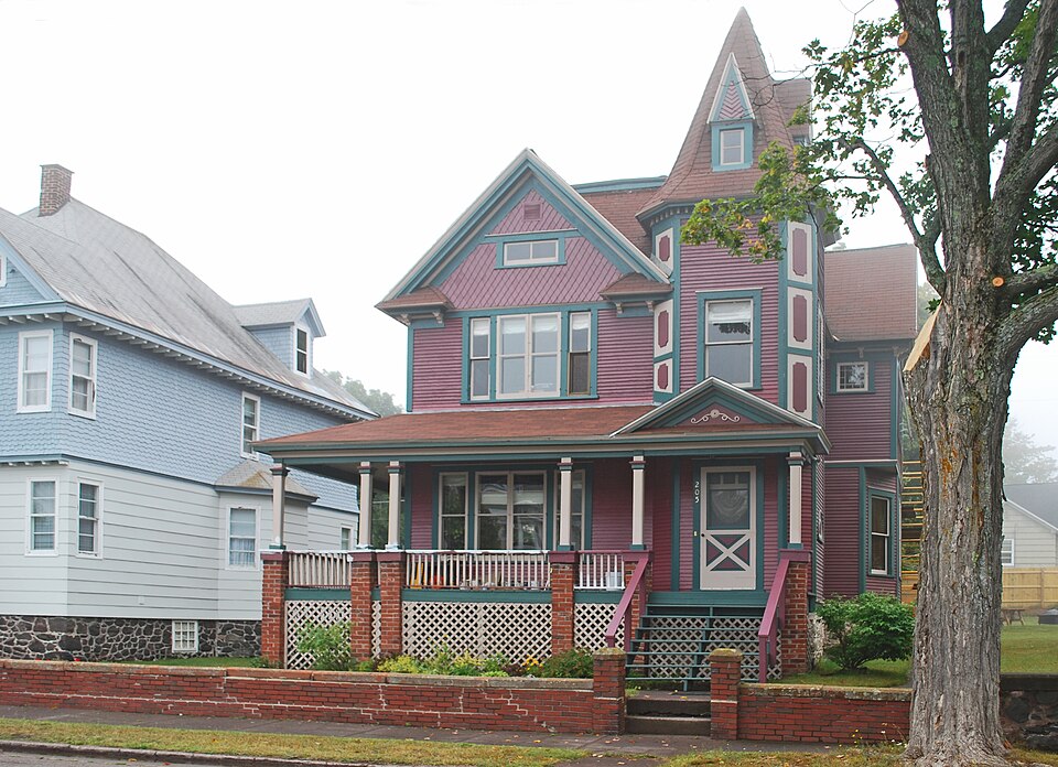
Listed on the National Register of Historic Places in 2005.
One of 41 National Register listings published here for Houghton County · listed in 2005 · category: District.
Sources: the case file at the National Archives · the National Register database, National Park Service
Regional context, not property-specific evidence. The federal wildfire occurrence database lists 20 fires within 5 miles of Laurium Historic District between 1992 and 2020, burning about 23 acres in total. 3 started naturally. 4 were recorded as arson. Distance is straight-line from the map coordinates, so a fire counted here may appear on a neighbouring settlement's page as well.
| Reported cause | Fires |
|---|---|
| Missing data/not specified/undetermined | 5 |
| Arson/incendiarism | 4 |
| Misuse of fire by a minor | 3 |
| Natural | 3 |
| Recreation and ceremony | 2 |
| Equipment and vehicle use | 2 |
| Smoking | 1 |
The most recent of them, most recent first, with the day each was reported and the service that recorded it.
| Date | Cause | Size | Reported by | Name on the report |
|---|---|---|---|---|
| 10 September 2019 | Natural | 1.0 acres | Michigan Department of Natural Resources | LAKE LINDEN FD 2019019 - 2019 |
| 7 August 1994 | Arson/incendiarism | under an acre | Michigan Department of Natural Resources | not named |
| 21 August 2019 | Missing data/not specified/undetermined | 1.0 acres | Michigan Department of Natural Resources | CALUMET VILLAGE FD 0081219 - 2019 |
| 26 July 2005 | Recreation and ceremony | under an acre | Michigan Department of Natural Resources | not named |
| 24 July 2019 | Missing data/not specified/undetermined | 1.0 acres | Michigan Department of Natural Resources | HUBBELL VFD 0724191 - 2019 |
| 2 July 2006 | Misuse of fire by a minor | under an acre | Michigan Department of Natural Resources | not named |
| 5 June 2009 | Arson/incendiarism | under an acre | Michigan Department of Natural Resources | SLASHER |
| 5 June 1993 | Smoking | 1.6 acres | Michigan Department of Natural Resources | not named |
Regional context, not property-specific evidence. The federal mineral resources record lists 61 workings within 5 miles of Laurium Historic District: 50 past producers, 10 prospects, 1 producer. 1 still produces. What was taken out: Copper, Silver, Copper, Silver, Nickel, Copper. Distance is straight-line from the map coordinates, so a quarry counted here may appear on a neighbouring settlement's page as well.
| Where | Site | Commodity | Status | Recorded |
|---|---|---|---|---|
| Haltunen Sand & Gravel | Sand and Gravel, Construction | Producer | ||
| Michigan Nickel Deposits | Nickel, Copper | Prospect | Sulfides | |
| Michigan Nickel Deposits | Nickel, Copper | Prospect | ||
| Centennial No.2 | Copper, Silver | Past Producer | 1863, 1904 | |
| Wolverine | Copper, Silver | Past Producer | 1882, 1898 | |
| Allouez Conglomerate No 1 & 2 | Copper, Silver | Past Producer | 1830 | |
| Centennial Mine | Copper, Silver | Past Producer | 1869, 1920 | |
| Kearsarge Amygdaloid | Copper, Silver | Past Producer | 1887 | |
| Kearsarge Mine | Copper, Silver | Past Producer | Lode | |
| La Salle Mine | Copper, Silver | Past Producer | 1910, 1920 |
Regional context, not property-specific evidence. The National Weather Service names Laurium, the town this property stands in, in 12 storm reports between 2006 and 2019: 7 thunderstorm wind, 2 hail, 2 heavy rain, 1 lightning. No death or injury is recorded in these reports. Each account below is quoted exactly as the forecast office filed it, from the NOAA Storm Events Database, and each date opens the federal record of that event.
| When | Event | Place named | Harm | What the report says |
|---|---|---|---|---|
| July 2011 | Thunderstorm Wind | Laurium | $50,000 | A damage path stretched from Mine Street through the intersection of US-41 and Church Street in North Calumet. The damage path was oriented from southwest to northeast and estimated to be one-quarter mile wide. Metal building housing a travel trailer destroyed. Several trees estimated to be between 18 to 24 inches in diameter were uprooted. A drill shop roof near the elementary school sustained significant damage. |
| September 2013 | Lightning | Laurium | $5,000 | A lightning strike blew holes in the steeple of the Keweenaw Heritage Center at St. Anne's Church in Calumet. The roofing and underlying wood were shattered. |
| June 2017 | Thunderstorm Wind | Laurium | $2,000 | Power lines were reported down in Calumet. Time of the report was estimated from radar. |
| July 2011 | Thunderstorm Wind | Laurium | $1,500 | Home on Mine Street sustained damage. Windows were partially broken and garage door was bowing inward. Rollers were blown off the garage door. Garage was shifted one inch off of foundation. Garage door and damaged windows were on the windward side of house facing the southwest. |
| July 2011 | Thunderstorm Wind | Laurium | $1,000 | Multiple locations along Caledonia Street had tree damage. One house had a tree branch 1.5 feet in diameter fall onto a deck. Other locations had 6 to 12-inch diameter branches down. All of the branches were broken off in a north to northeast direction. |
| August 2019 | Thunderstorm Wind | Laurium | $500 | There was a report via social media of large branches of tall maple trees down in the front yard of a home in Calumet. The time of the report was estimated from radar. |
| September 2017 | Hail | Laurium | - | A trained spotter in Laurium reported hail up to the size of quarters. |
| July 2012 | Heavy Rain | Laurium | - | The observer near Calumet measured 1.53 inches of rain in one hour. |
| July 2011 | Thunderstorm Wind | Laurium | - | A small wooden shed rolled once over a fence at Calumet Elementary School. The shed was about 8 feet high and 12 feet wide. Some playground equipment at the school was also tipped over. |
| April 2009 | Thunderstorm Wind | Laurium | - | Power lines were down in Laurium with no power in the city. |
| July 2006 | Heavy Rain | Laurium | - | 3.67 inches of rain fell mainly between 3 and 5 am EST. |
| July 2006 | Hail | Laurium | - | no account filed |
No historic map-sheet match is published for this property yet. That does not mean no map exists. This record needs a coordinate-quality review before it can be joined to a sheet boundary. Browse the county's mapped places while that work is pending.
Other National Register properties close enough to walk or drive between, ordered by distance from this one. Both positions come from the same geocoding pass that matched these properties to their map sheets.
| Photograph | Property | Distance | Listed |
|---|---|---|---|
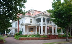 | Thomas H. Hoatson House | 0.1 miles | 1994 |
 | Vivian, Jr., J., and Company Building | 0.2 miles | 2003 |
 | Calumet and Hecla Industrial District | 0.7 miles | 1974 |
 | Calumet Downtown Historic District | 1.1 miles | 1974 |
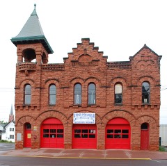 | Calumet Fire Station | 1.1 miles | 1974 |
 | Calumet Theatre | 1.1 miles | 1971 |
| National Archives record | The nomination case file for reference 04001578 in Record Group 79. |
| Houghton County | All 41 listed properties in this county. |