BlockBefore
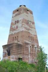
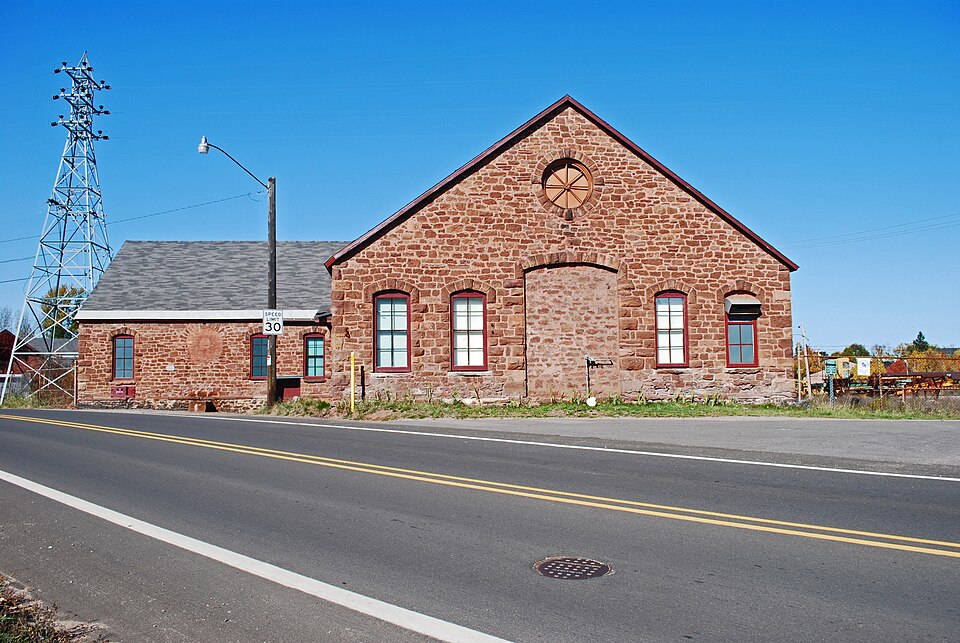
Photograph of Cleveland Mine Engine House Number 3
Photograph by Andrew Jameson, CC BY-SA 3.0. Via Wikimedia Commons.

Cleveland Mine Engine House Number 3

Listed on the National Register of Historic Places in 2007.

From the record

“The Cleveland Mine Engine House Number 3, also known as the Brownstone Engine House, is a building located at 601 Division Street in Ishpeming, Michigan. It was built to house engines hoisting ore from various Cleveland Mine locales, and was listed on the National Register of Historic Places in 2007.”

Wikipedia article Cleveland Mine Engine House Number 3, CC BY-SA 4.0.

One of 40 National Register listings published here for Marquette County · listed in 2007 · category: Building.

Sources: the Wikipedia article · the case file at the National Archives · the National Register database, National Park Service
The listing

  • What is counted as historic. The nomination lists 1 building as contributing to the listing.
  • Address. 601 Division St., Ishpeming, 49849
  • When was it listed? May 2007
  • Category. building
  • City. Ishpeming city
  • National Register reference number. 07000386 - the number the National Park Service assigned this property when it was listed, and the key its nomination file is catalogued under at the National Archives.

Fires near this property

40 since 1994

Regional context, not property-specific evidence. The federal wildfire occurrence database lists 40 fires within 5 miles of Cleveland Mine Engine House Number 3 between 1994 and 2020, burning about 48 acres in total. 4 started naturally. None was recorded as arson. Distance is straight-line from the map coordinates, so a fire counted here may appear on a neighbouring settlement's page as well.

Reported cause Fires
Missing data/not specified/undetermined13
Recreation and ceremony6
Debris and open burning5
Natural4
Misuse of fire by a minor4
Equipment and vehicle use4
Power generation/transmission/distribution2
Railroad operations and maintenance2

The most recent of them, most recent first, with the day each was reported and the service that recorded it.

DateCause SizeReported by Name on the report
4 September 2001Debris and open burning2.0 acresMichigan Department of Natural Resourcesnot named
9 August 2005Naturalunder an acreMichigan Department of Natural Resourcesnot named
3 August 2011Missing data/not specified/undeterminedunder an acreMichigan Department of Natural ResourcesCARP BRIDGE
2 August 2007Missing data/not specified/undetermined5.1 acresMichigan Department of Natural Resourcesnot named
11 August 2010Recreation and ceremonyunder an acreMichigan Department of Natural ResourcesHARD ROCK FIRE
30 July 2004Naturalunder an acreMichigan Department of Natural Resourcesnot named
27 July 2005Missing data/not specified/undeterminedunder an acreMichigan Department of Natural Resourcesnot named
20 July 2006Missing data/not specified/undeterminedunder an acreMichigan Department of Natural Resourcesnot named

Every fire recorded in Marquette County

Mines and quarries near this property

10 of 169 shown

Regional context, not property-specific evidence. The federal mineral resources record lists 169 workings within 5 miles of Cleveland Mine Engine House Number 3: 111 past producers, 25 prospects, 16 occurrences, 11 producers. 17 still produce. What was taken out: Iron, Gold, Copper, Gold, Silver. Distance is straight-line from the map coordinates, so a quarry counted here may appear on a neighbouring settlement's page as well.

Where SiteCommodity StatusRecorded
Gold&Copper&Tungsten&Zinc ProspectCopper, Gold, Tungsten, ZincOccurrence
Mi.Verde Antique Co.Dolomite QuarryMarble, DimensionPast Producer
RopesGold, SilverPlant1880, 1882
Unnamed Copper and Zinc ProspectCopper, ZincOccurrence
Unnamed Copper&Lead&Zinc ProspectCopper, Lead, ZincOccurrence
Unnamed Molybdenum ProspectMolybdenumOccurrence
Ropes MineGold, SilverProducer1880, 1882, 1989
Superior Gold & Silver ExplorationGold, SilverProspect1889
Unnamed Gold and Copper ProspectCopper, GoldOccurrence

Every working recorded in Marquette County

Storms near this property

32 since 1998

Regional context, not property-specific evidence. The National Weather Service names Ishpeming, the town this property stands in, in 32 storm reports between 1998 and 2020: 14 hail, 11 thunderstorm wind, 4 flash flood, 1 wildfire. No death or injury is recorded in these reports. Each account below is quoted exactly as the forecast office filed it, from the NOAA Storm Events Database, and each date opens the federal record of that event.

WhenEvent Place namedHarm What the report says
April 2017Thunderstorm WindIshpeming$1,000,000Law enforcement reported multiple large trees and power lines down in the city of Ishpeming.
August 2013Thunderstorm WindWest Ishpeming$10,000A few trees uprooted or snapped and branches broken off in the South Angeline/Salisbury/Terrace Street area south of Ishpeming. One large branch fell on a car breaking the back window and doing additional body damage.
July 2014Thunderstorm WindIshpeming$5,000There was a public report of a tree down over a vehicle in Ishpeming.
April 2017Thunderstorm WindIshpeming$3,000Law enforcement reported a natural gas leak caused by damage from a large uprooted tree along East Johnson Street in the city of Ishpeming.
May 2012LightningIshpeming$2,000Lightning and high wind from thunderstorms caused more than 200 customers to lose power in Ishpeming.
August 2020Thunderstorm WindWest Ishpeming$1,000There was a report of half a tree down and a power outage near Ishpeming from thunderstorm winds. Time of the report was estimated from radar.
May 2013Thunderstorm WindIshpeming$1,000Trees were reported down in Ishpeming. Time was estimated based on radar.
May 2018HailIshpeming-Nickel sized hail was observed just to the south of Al Quall Recreational Area in Ishpeming.
June 2018HailWest Ishpeming-Penny-sized hail was reported just west of Ishpeming.
June 2016HailIshpeming-There were public reports of dime-sized hail on Business M-28 between Ishpeming and Negaunee.
July 2016Funnel CloudIshpeming-A spotter near Ishpeming observed a funnel cloud over Bell Hospital. The funnel cloud went back up into the cloud when penny sized hail and a heavy rain were observed.
May 2015HailWest Ishpeming-There were delayed public reports via social media of nickel-sized hail in West Ishpeming.
July 2002Thunderstorm WindIshpeming-One to two foot diameter trees were blown down.
April 2001Thunderstorm WindIshpeming-Tree fell on automoble.
June 2001Thunderstorm WindIshpeming-Two 8 inch diameter trees uprooted. Other trees down.
June 2001HailIshpeming-One inch hail.
July 1998Thunderstorm WindIshpeming-Several trees down along US 41 west of Ishpeming.
August 1998Thunderstorm WindIshpeming-Large tree down over County Road 581.
May 2007HailIshpeming-no account filed
July 2006HailIshpeming-no account filed
May 2005HailIshpeming-no account filed
May 2003Flash FloodIshpeming-no account filed
August 2000HailIshpeming-no account filed
May 1999WildfireIshpeming-no account filed
May 1998HailIshpeming-no account filed
May 1998HailWest Ishpeming-no account filed

Every storm recorded in Marquette County

Map coverage status

No historic map-sheet match is published for this property yet. That does not mean no map exists. This record needs a coordinate-quality review before it can be joined to a sheet boundary. Browse the county's mapped places while that work is pending.

Listed places nearby

6 within 8 miles

Other National Register properties close enough to walk or drive between, ordered by distance from this one. Both positions come from the same geocoding pass that matched these properties to their map sheets.

Photograph PropertyDistance Listed
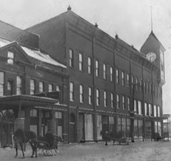
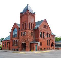
Braastad-Gossard Building0.4 miles2015
Ishpeming Municipal Building0.4 miles1981
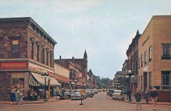
Ishpeming Main Street Historic District0.5 miles2021
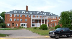
Mather Inn0.5 miles1978
Cliffs Shaft Mine0.8 miles1992
Jackson Mine1.8 miles1971

Sources for this property

National Archives recordThe nomination case file for reference 07000386 in Record Group 79.
Wikipedia articleCommunity-written account of this property, licensed CC BY-SA.
Marquette CountyAll 40 listed properties in this county.

Provenance

  • Listing record. National Park Service National Register of Historic Places, listed-properties dataset, current to 2026-05-22.
  • Map join. Address geocoded through the United States Census geocoder, then tested against the published boundary of every sheet in the USGS Historical Topographic Map Collection.
  • How this page is made. Listing fields come from federal records; map-sheet coverage is a labelled coordinate-to-boundary calculation, not a source-field claim.
  • Wildfire. Short, Karen C. 2022. Spatial wildfire occurrence data for the United States, 1992-2020 [FPA_FOD_20221014]. 6th Edition. Fort Collins, CO: Forest Service Research Data Archive. https://doi.org/10.2737/RDS-2013-0009.6 Collected with United States Government funding and usable without additional permissions or fees.
  • Mines and quarries. USGS Mineral Resources Data System (MRDS) https://mrdata.usgs.gov/mrds/ A work of the United States government, no copyright under 17 U.S.C. 105.
  • Storms. NOAA National Centers for Environmental Information, Storm Events Database https://www.ncei.noaa.gov/stormevents/ A work of the United States government, no copyright under 17 U.S.C. 105. Narratives are quoted verbatim from the National Weather Service report and are not edited or summarised.