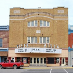
Block
From the record
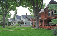
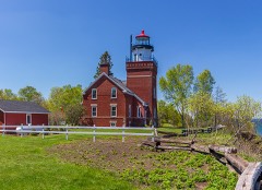
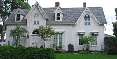
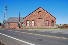
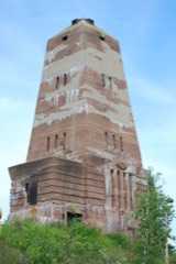
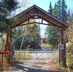
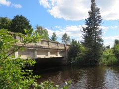
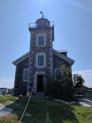
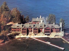
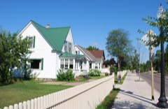
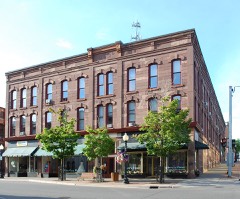
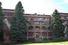
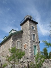
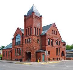
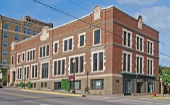
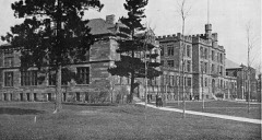
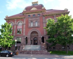
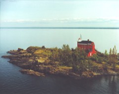
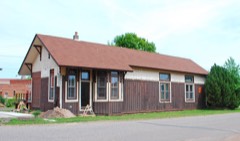
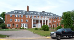
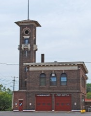
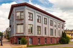
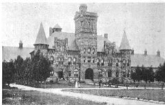
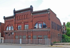
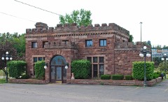
40 National Register listings published here.
Sources: the National Register database, National Park Service
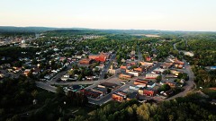
135 topographic sheets cover 82 settlements here, and 40 properties are on the National Register of Historic Places.
40 National Register listings published here.
Sources: the National Register database, National Park Service
Every property in this county listed on the National Register of Historic Places, with the year it was listed and the federal nomination document.
Every wildfire the federal occurrence database records inside this county: 507 of them, burning about 8,164 acres. 96 started naturally and 15 were recorded as arson. Each settlement page carries the fires within five miles of it.
| Reported cause | Fires |
|---|---|
| Missing data/not specified/undetermined | 128 |
| Natural | 96 |
| Debris and open burning | 80 |
| Recreation and ceremony | 68 |
| Equipment and vehicle use | 52 |
| Power generation/transmission/distribution | 23 |
| Misuse of fire by a minor | 20 |
| Arson/incendiarism | 15 |
| Smoking | 10 |
| Railroad operations and maintenance | 9 |
| Other causes | 4 |
| Fireworks | 2 |
The five largest, by the area the report gives. One of them was set deliberately.
| Date | Cause | Size | Reported by | Name on the report |
|---|---|---|---|---|
| 30 April 1999 | Missing data/not specified/undetermined | 5,625 acres | Michigan Department of Natural Resources | MARQUETTE9 |
| 20 May 2009 | Power generation/transmission/distribution | 806 acres | Michigan Department of Natural Resources | BLACK RIVER FALLS |
| 18 May 1996 | Railroad operations and maintenance | 155 acres | Michigan Department of Natural Resources | not named |
| 23 April 1994 | Arson/incendiarism | 103 acres | Michigan Department of Natural Resources | not named |
| 30 July 2015 | Equipment and vehicle use | 80 acres | Michigan Department of Natural Resources | CO RD 601 |
| 1 May 2012 | Equipment and vehicle use | 62 acres | Michigan Department of Natural Resources | FLATROCK |
| 29 April 2007 | Missing data/not specified/undetermined | 60 acres | Michigan Department of Natural Resources | not named |
| 29 July 2011 | Power generation/transmission/distribution | 59 acres | Michigan Department of Natural Resources | GRAPEVINE |
Every settlement page carries the fires within five miles of it - see the settlement index below.
The NOAA Storm Events Database holds 536 reports for this county, causing 1 death, 4 injuries and about $80,087,500 in recorded property damage. Each settlement page carries the reports that name it.
| Kind of event | Reports |
|---|---|
| Thunderstorm Wind | 239 |
| Hail | 218 |
| Heavy Rain | 20 |
| Flash Flood | 17 |
| Flood | 15 |
| Tornado | 11 |
| Lightning | 10 |
| Wildfire | 4 |
| Funnel Cloud | 2 |
The most serious of them, by death, then injury, then recorded damage. The accounts are quoted exactly as the forecast office filed them.
| When | Event | Place named | Harm | What the report says |
|---|---|---|---|---|
| August 1988 | Thunderstorm Wind | not stated | 1 killed | no account filed |
| May 1999 | Wildfire | Republic | 4 hurt, $960,000 | no account filed |
| June 2007 | Hail | Marquette | $10,000,000 | Golfball-sized hail covering the ground. |
| June 2007 | Hail | Marquette | $10,000,000 | Ping pong hail covering the ground two inches deep. |
| June 2007 | Hail | Marquette | $10,000,000 | Hail damage to automobiles. |
| June 2007 | Hail | Marquette | $8,000,000 | Shredded leaves clogged storm drains resulting in street flooding from melting hail. |
| April 2023 | Flood | Witch Lake | $7,000,000 | Fairly widespread flooding was observed across a large portion of Marquette County with flooding observed along the Chocolay, Escanaba and Michigamme Rivers. Some of the most severe and longest-duration flooding was along the Michigamme River near Republic and Witch Lake. On April 24th Marquette County officials described extensive and significant flooding damage to 25+ roads and 7+ crossings with damage estimates exceeding $7 million. Marquette County was added to the state of emergency declaration on 4/21 by Governor Whitmer to aid in flood recovery efforts. |
| June 2007 | Hail | Harvey | $6,000,000 | Several trucks damaged or totaled. |
| June 2007 | Hail | Marquette | $4,000,000 | Hail covering the ground two inches deep. |
| June 2007 | Hail | Harvey | $4,000,000 | no account filed |
| June 2007 | Hail | Marquette | $4,000,000 | no account filed |
| May 2022 | Flash Flood | North Lake | $3,000,000 | Heavy rainfall of three to four inches from thunderstorms over an approximate three-hour time period caused flooding from downtown Ishpeming across County Road 510 at the Noquemanon 510 Trailhead to County Road 550 near Wetmore Landing and Harlow Lake. The flooding in Ishpeming caused multiple cars to get stranded in nearly 2 feet of water near the U.S. National Ski Hall of Fame and water over the road on Hill Street. Flooding also closed portions of County Road 510 near the Noquemanon 510 Trailhead and portions of County Road 550 were closed near Wetmore Landing and Harlow Lake. In July, Governor Whitmer declared a state of emergency for the flood damage in western Marquette County on 5/12. |
| June 2007 | Hail | Marquette | $2,000,000 | Hail covering the ground at the mall. |
| June 2007 | Hail | Marquette | $2,000,000 | Hail covering the ground. |
| June 2007 | Hail | Marquette | $2,000,000 | Hailed for five minutes. |
| June 2007 | Hail | Harvey | $2,000,000 | no account filed |
| April 2017 | Thunderstorm Wind | Ishpeming | $1,000,000 | Law enforcement reported multiple large trees and power lines down in the city of Ishpeming. |
| April 2026 | Flood | Sugar Loaf | $638,000 | Emergency management reported multiple rivers and low lying areas were inundated by the combination of rain and snowmelt. In Gwinn, multiple roadways were inaccessible due to flooding on the Escanaba River by the 18th. Division Street in Negaunee was closed daily from the 13th onwards. Harlow Lake Rd (County Road HD) was closed at County Road 550 on the 17th. Flooding at Pelissier Lake in Sands Township resulted in 1 evacuation with well water being unsafe due to the high water table making septic systems inoperable. Ely, Humboldt, Champion, and Republic townships experienced water over multiple roadways, including the road at Steel Bridge Rd (Ely Township, County Road CG) on the 18th. The Chocolay River Fishing pier was underwater by the 19th. The Iron Ore Heritage Trail west of Wawanowin Rd to the city of Republic had flowing water on the trail by the 21st. 10 properties along the Michigamme River were inaccessible on the 23rd. Jasper Street in Ishpeming had a sinkhole that was filled on the 23rd. Due to the severity of the flooding, a Disaster Declaration Request was approved by the president on June 30th. |
| April 2013 | Flood | Harvey | $625,000 | Rapid melting of significant late season snow pack caused minor to moderate flooding of some secondary roads across portions of Marquette County from the 28th into the 30th. Minor flooding continued into early May. Some flooding of basements was also reported. Governor Rick Snyder declared a state of disaster in Marquette County where nearly $ 625,000 of property damage occurred due to the flooding mainly to roadway infrastructure. |
| May 2023 | Flood | Huron Mtn | $500,000 | Up to four inches of water equivalent precipitation from the historic May 1-2 snowstorm caused a secondary episode of widespread minor flooding across portions of Marquette County for early May, particularly along rivers and small streams. Reported impacts from flooding included roads along the Michigamme River, CR550 just north of Marquette, and a portion of the road in the Feather Ridge Subdivision near the Crossroads where flood waters backed up from nearby Pelissier Lake. |
| June 2012 | Hail | Sugar Loaf | $500,000 | Golf ball sized hail busted out windows and damaged roofs in homes on the north side of Marquette. The hail also dented vehicles. |
| April 2017 | Thunderstorm Wind | Winthrop Jct | $200,000 | Thunderstorm winds peeled a metal roof was peeled off a commercial building in downtown Ishpeming. Numerous commercial signs and billboards were also torn down or damaged. Time was estimated from radar. |
| April 2017 | Thunderstorm Wind | North Lake | $200,000 | The Marquette County Dispatch Center reported multiple high-tension transmission lines downed resulting in widespread power outages and the closure of US Highway 41 west of Ishpeming. Time of the report was estimated from radar. |
| July 2013 | Thunderstorm Wind | South Republic | $150,000 | Thunderstorm straight-line winds caused significant damage along the south end of Helen Lake near Republic. The damage path associated with this storm was about one half mile long and roughly 200 yards wide. The winds were estimated to be around 80 mph, causing over 100 trees to be snapped or uprooted. Some of these trees actually landed on camps as well as other structures causing significant damage. |
| April 2017 | Thunderstorm Wind | Greenwood | $100,000 | The regional central dispatch center reported large power poles down near the intersection of Highway US-41 and County Road 496 in West Ishpeming. |
| July 2012 | Hail | South Republic | $100,000 | Golf ball to baseball sized hail caused extensive damage to siding on houses along and north of Evergreen Street between Pine and Willow Streets in South Republic. A car and carport were also damaged at a house on Pine Street. Two hours after the storm, quarter sized hail was piled up next to a house at the corner of Willow and Evergreen Streets. |
| May 2006 | Flood | Big Bay | $100,000 | no account filed |
| October 2024 | Lightning | Marquette | $50,000 | An attic fire reported by the Marquette Fire Department was likely started by lightning as determined by on-the-scene reports and NLDN/GLD lightning data sets. No injuries were reported from the fire which occurred at a home on 310 Harrison Street in Marquette. The City of Marquette Fire Department was assisted at the scene by the Marquette Township Fire Department, Chocolay Township Fire Department, the Marquette Police Department, UPHS EMS, SEMCO and the Maquette BLP. |
| April 2017 | Thunderstorm Wind | South Republic | $50,000 | A trained spotter reported numerous trees and a few power poles downed around South Republic. At least one tree fell on the roof of a house. The strong wind also tipped over a pull behind camper trailer and bent over a street sign. Hail of unknown size was also reported. |
| May 2016 | Tornado (EF1) | Clarksburg | $50,000 | The survey team observed numerous large trees snapped or uprooted along the path of the tornado. There were also trees knocked down on a cabin along with damage to a chimney. A trampoline and lawn furniture were also damaged at another residence. |
| July 1999 | Thunderstorm Wind | Marquette | $50,000 | Many trees down. Several houses and vehicles were damaged by falling trees. |
| April 2017 | Thunderstorm Wind | (Mqt)Marquette Co Ar | $35,000 | There was a public report of a garage moved off its foundation and windows broken in a house in Negaunee Township along Cedar Lane and Airport Circle. |
| April 2025 | Flood | Lake Michigamme | $33,500 | Spring snowmelt and flooding have forced the DNR to the temporary emergency closure of Arfelin Lake boating access site in Marquette County until road repairs can be made. Culvert and the dirt access road have failed and water is moving swiftly. A pickup truck became stuck when a portion of the road collapsed. |
| December 2017 | Flood | Harvey | $30,000 | Strong northwest winds blowing across Lake Superior pushed ice into the mouth of the Chocolay River producing an ice jam. Water backed up behind the ice jam causing flooding in the basements of eight homes along the Chocolay River near Lake Superior. |
| May 2015 | Heavy Rain | Skandia | $30,000 | Heavy rain may have contributed to a fatal head-on accident which occurred in Skandia on the morning of the 27th. The Marquette County Sheriff's Department reported the accident which occurred just before 7 am EST on the 27th near the north intersection of Kreiger Road with US Highway 41 in Skandia. A SUV driven by 24-year old Gwinn man crossed the center line of US Highway 41 and collided with an oncoming semi truck. The Gwinn man was transported to UP Health System in Marquette and was later pronounced dead. The driver of the semi truck was not injured in the crash. |
| May 2015 | Heavy Rain | Gordon | $30,000 | Over one-inch per hour rainfall rates and fog from a series of thunderstorms contributed to two multi-vehicle accidents on Highway M-28 in Chocolay Township in Marquette County on the afternoon of the 29th. ||The Chocolay Township Police said the first accident was a head-on collision which occurred at 330 pm EST on Highway M-28 about a mile east of Kawbawgam Road. Both vehicles were totaled and the drivers and one passenger were treated for non-life threatening injuries at the UP Health System in Marquette. The second accident occurred approximately 45 minutes later, not far from the site of the first accident, and involved one vehicle rear ending another vehicle. One person from the second accident was taken to Marquette General Hospital with a head injury. |
| October 2012 | Hail | (Mqt)Marquette Co Ar | $30,000 | An auto dealership just northeast of Negaunee reported significant damage to four cars from hail. Hail size was estimated using other reports from the area. |
| August 1996 | Thunderstorm Wind | Marquette | $30,000 | no account filed |
| June 2022 | Thunderstorm Wind | Harvey | $20,000 | Extensive tree and power line damage was reported along and across Highway US-41 south of M-28 from Veda Street south to Magnum Road. |
| August 2021 | Thunderstorm Wind | Witch Lake | $20,000 | UPPCO outage map showed hundreds of customers without power in the area between Witch Lake and the Iron County line. Delayed report with the time estimated by radar. |
| August 2021 | Thunderstorm Wind | Austin | $20,000 | UPPCO outage map showed more than a thousand customers without power in the area west of Gwinn with most power outages concentrated around Shag Lake. This is a delayed report with time estimated from radar. |
| July 2018 | Lightning | Trowbridge Park | $20,000 | The Marquette Fire Department responded to a fire on Grant Street in Marquette on the morning of the 12th. It was determined that a lightning strike caused the fire and engulfed a small shed in flames. The structure was a total loss. Also, the Marquette Board of Light and Power was contacted as the electrical supply for an adjacent home was damaged by the radiant heat from the fire. Marquette Police blocked off Lincoln Street between Ridge and Jefferson streets during containment of the fire. |
| August 2018 | Thunderstorm Wind | Swanzy | $20,000 | There was a report via social media of a large pine tree felled onto a house near K.I Sawyer. Numerous other trees were reported down in the area. Time of the report was estimated from radar. |
| August 2013 | Thunderstorm Wind | Greenwood | $20,000 | Forty-three trees were uprooted or snapped at Wawonowin Golf Course. Some trees were up to two feet in diameter and all fell in the same direction. |
| July 2008 | Lightning | Negaunee | $20,000 | Lightning struck a power pole outside a residence in Negaunee. The lightning bolt traveled into the residence igniting a fire. |
| August 2013 | Thunderstorm Wind | Greenwood | $18,000 | Two trees roughly a foot in diameter fell near the intersection of CR 478 and Highway M-28 west of Ishpeming. One tree clipped the corner of a mobile home and another fell on a camper trailer and truck. |
| June 2025 | Lightning | (Mqt)Marquette Co Ar | $15,000 | Broadcast media reported a house along Sparks Drive in the Dead River basin took a lightning strike, disrupting power, uprooting flowers and tree roots, damaging a concrete slab, damaging the power line, and minor damage within the house. Time estimated from radar. |
| September 2015 | Lightning | Beacon | $15,000 | A fallen tree caused damage to a boat, a pickup truck and a camper awning in Van Riper State Park after it was struck by lightning. No injuries were reported. |
| July 2010 | Lightning | Harvey | $15,000 | Lightning from storms moving through the area caused a house fire in the Chocolay Township. |
| August 2021 | Thunderstorm Wind | Lake Michigamme | $10,000 | WE Energies map showed an outage affecting 69 customers east of Lake Michigamme. State Police Dispatch also reported a tree down in the area. |
| September 2018 | Flood | Harvey | $10,000 | By early afternoon on the 5th, the Marquette County Sheriff and Skandia/West Branch Fire Department reported that the Chocolay River had risen as high as the concrete girders on the Highway US-41 bridge just north of Yalmer Road in Skandia Township. The runoff from four to five inches of rain which fell across the Chocolay River Basin early on the 5th caused the river to rise nearly a foot above flood stage at the gauge in Harvey by early morning on the 6th. There were reports of basement flooding at several residences along the river in Harvey. |
| June 2018 | Flash Flood | Clowry | $10,000 | Rainfall amounts between two and three inches over approximately five hours caused flooding of several roads from Marquette and Harvey to Negaunee. The Marquette County Road Commission reported the washout and closure of a portion of County Road 601 in Humboldt Township due to the heavy rains. A NWS employee reported the closure of Lakeshore Boulevard in Marquette due to mud and debris flowing over the street. Several other streets were reported closed in Marquette due to water over the roads. Rescue personnel from the Chocolay Fire and Sheriff departments were evacuating residences along Green Garden Road at the Chocolay River Bridge southeast of Harvey. There was also a picture via social media of water under the bridge in Negaunee, and several residences in Negaunee reported water in the basements due to the heavy rain. |
| May 2016 | Tornado (EF1) | Michigamme | $10,000 | The survey team observed several snapped or uprooted white pine trees over a foot in diameter just west-northwest of Republic. |
| July 2016 | Thunderstorm Wind | North Lake | $10,000 | The Ishpeming Township Fire Department reported several trees down on Cooper Lake Road south of the Deer Lake Road intersection. Some of the downed hardwood trees were estimated to measure between 12 and 18 inches in diameter and a few were snapped off toward the tops. The power company was on the scene to help with cleanup, and one car had a tree lying down on it. This was a delayed report. |
| August 2013 | Thunderstorm Wind | West Ishpeming | $10,000 | A few trees uprooted or snapped and branches broken off in the South Angeline/Salisbury/Terrace Street area south of Ishpeming. One large branch fell on a car breaking the back window and doing additional body damage. |
| July 2013 | Thunderstorm Wind | New Swanzy | $10,000 | The Michigan DNR reported numerous large trees were uprooted or snapped. |
| July 2013 | Thunderstorm Wind | Palmer | $10,000 | The Michigan DNR reported numerous large trees were uprooted or snapped. |
| June 2012 | Tornado (EF1) | Huron Mtn | $10,000 | The tornado snapped or uprooted numerous large trees causing some backroads in rural western Marquette County to become impassable. The tornado was classified as an EF-1 with max winds estimated at 95 mph. |
| June 2006 | Thunderstorm Wind | Marquette | $10,000 | Many trees blown down or uprooted along Eagles Nest and Buck Roe Roads. Several trees ranging between 8 and 10 inches in diameter were snapped off half way up the tree. One tree was uprooted near County Highway 550. |
| July 2023 | Thunderstorm Wind | Marquette | $7,000 | Marquette County Central Dispatch reported a downed tree on a vehicle on Altamont Street in Marquette. |
The Survey's mineral resources record lists 381 workings inside this county. 36 still produce and 345 are closed or unrecorded. Each settlement page carries the workings within five miles of it.
| Commodity | Workings |
|---|---|
| Iron | 248 |
| Gold | 49 |
| Copper | 24 |
| Sand and Gravel, Construction | 10 |
| Molybdenum | 5 |
| Copper, Lead, Zinc | 5 |
| Granite | 4 |
| Gold, Silver | 3 |
| Copper, Zinc | 3 |
| Copper, Gold | 3 |
| Silver | 3 |
| Zinc | 2 |
| Lead | 2 |
| Copper, Molybdenum | 2 |
The least common of them first, because a county's hundredth gravel pit says nothing its first ten did not.
| Where | Site | Commodity | Status | Recorded |
|---|---|---|---|---|
| Cascade | Iron, Water, Free | Prospect | 1845 | |
| Chippewa Exploration | Iron, Vanadium | Prospect | Bedded, Chemical Sediment | |
| Coon Gold Exploration | Gold, Copper | Occurrence | 1886 | |
| Daniel Sec 30 Gold Prospect | Silver, Gold, Copper | Occurrence | 1891, 1903 | |
| Eagle Project | Copper, Nickel, Platinum, Gold, Palladium, Cobalt | Prospect | 2002 | |
| Fire Center Prospect | Gold, Zinc, Copper | Prospect | 1891, 1936 | |
| Gold&Copper&Tungsten&Zinc Prospect | Copper, Gold, Tungsten, Zinc | Occurrence | ||
| Holyoke Silver Mine | Silver, Gold, Cadmium | Prospect | 1864, 1868 | |
| Mi.Verde Antique Co.Dolomite Quarry | Marble, Dimension | Past Producer | ||
| Republic Feldspar Quarry | Feldspar | Past Producer | ||
| Unnamed Gold&Lead&Copper Prospect | Gold, Lead, Copper | Occurrence | ||
| Unnamed Copper and Lead Prospect | Copper, Lead | Occurrence | ||
| Unnamed Copper and Tungsten Prospec | Copper, Tungsten | Occurrence | ||
| Unnamed Copper&Lead&Zinc Prospect | Lead, Zinc, Copper | Occurrence | ||
| Unnamed Copper&Nickel&Lead Prospect | Copper, Lead, Nickel | Occurrence | ||
| Unnamed Gold&Copper&Silver Prospect | Copper, Gold, Silver | Occurrence | ||
| Unnamed Mineral Prospect | Molybdenum, Gold, Copper, Bismuth, Tungsten | Occurrence | ||
| Unnamed Silver and Copper Prospect | Copper, Silver | Occurrence | ||
| Unnamed Silver and Lead Prospect | Lead, Silver | Occurrence | ||
| Unnamed Uranium Prospect | Uranium | Occurrence | ||
| Arvon Slate Quarry | Stone, Crushed/Broken | Past Producer | ||
| Lindberg Quarries | Stone, Crushed/Broken | Producer | ||
| Unnamed Copper&Molybdenum Prospect | Copper, Molybdenum | Occurrence | ||
| Unnamed Copper&Molybdenum Prospect | Copper, Molybdenum | Occurrence | ||
| Unnamed Lead Prospect | Lead | Occurrence | ||
| Unnamed Lead Prospect | Lead | Occurrence | ||
| Unnamed Lead and Zinc Prospect | Lead, Zinc | Occurrence | ||
| Unnamed Lead&Zinc Prospect | Lead, Zinc | Occurrence | ||
| Unnamed Zinc Prospect | Zinc | Occurrence | ||
| Unnamed Zinc Prospect | Zinc | Occurrence | ||
| Marquette Silver Prospect | Silver | Prospect | 1864 | |
| Ropes | Gold, Silver | Plant | 1880, 1882 | |
| Ropes Mine | Gold, Silver | Producer | 1880, 1882, 1989 | |
| Superior Gold & Silver Exploration | Gold, Silver | Prospect | 1889 | |
| Unnamed Copper and Zinc Deposit | Copper, Zinc | Occurrence | ||
| Unnamed Copper and Zinc Prospect | Copper, Zinc | Occurrence | ||
| Unnamed Copper and Zinc Prospect | Copper, Zinc | Occurrence | ||
| Unnamed Gold and Copper Prospect | Copper, Gold | Occurrence | ||
| Unnamed Gold and Copper Prospect | Copper, Gold | Occurrence | ||
| Unnamed Gold and Copper Prospect | Copper, Gold | Occurrence | ||
| Unnamed Gold and Silver Prospect | Gold, Silver | Occurrence | ||
| Clear Creek Slate Quarry | Granite | Past Producer | ||
| Clinton Slate & Iron Co.Quarry | Granite | Past Producer | ||
| Huron Bay Slate Quarry | Granite | Past Producer | ||
| N.West Branch Slate Quarry | Granite | Past Producer | ||
| Copper&Lead&Zinc Prospect | Copper, Lead, Zinc | Occurrence | ||
| Unnamed Copper&Lead&Zinc Prospect | Copper, Lead, Zinc | Occurrence | ||
| Unnamed Copper&Lead&Zinc Prospect | Copper, Lead, Zinc | Occurrence | ||
| Unnamed Copper&Lead&Zinc Prospect | Copper, Lead, Zinc | Occurrence | ||
| Unnamed Copper&Lead&Zinc Prospect | Copper, Lead, Zinc | Occurrence | ||
| Unnamed Molybdenum Prospect | Molybdenum | Occurrence | ||
| Unnamed Molybdenum Prospect | Molybdenum | Occurrence | ||
| Unnamed Molybdenum Prospect | Molybdenum | Occurrence | ||
| Unnamed Molybdenum Prospect | Molybdenum | Occurrence | ||
| Unnamed Molybdenum Prospect | Molybdenum | Occurrence | ||
| 480 Pit & Mill | Sand and Gravel, Construction | Producer | ||
| City of Marquette Pit | Sand and Gravel, Construction | Producer | ||
| City of Marquette Pit | Sand and Gravel, Construction | Producer | ||
| Dishneau Pit | Sand and Gravel, Construction | Producer | ||
| Felber Pit | Sand and Gravel, Construction | Producer | ||
| Herman Gunlach Company | Sand and Gravel, Construction | Producer | ||
| Hocking Construction Co. Pit | Sand and Gravel, Construction | Producer | ||
| Krygorski Const Co | Sand and Gravel, Construction | Producer | ||
| Lawson Pit & Mill | Sand and Gravel, Construction | Producer | ||
| Morgan Meadows Pit | Sand and Gravel, Construction | Producer | ||
| Kona Dolomite | Copper | Producer | Chalcocite, Pyrite, Malachite, Chalcopyrite, Bornite | |
| Kona Sulfides | Copper | Past Producer | 1888 | |
| Unnamed Copper Deposit | Copper | Occurrence | ||
| Unnamed Copper Deposit | Copper | Occurrence | ||
| Unnamed Copper Prospect | Copper | Occurrence | ||
| Unnamed Copper Prospect | Copper | Occurrence | ||
| Unnamed Copper Prospect | Copper | Occurrence | ||
| Unnamed Copper Prospect | Copper | Occurrence | ||
| Unnamed Copper Prospect | Copper | Occurrence | ||
| Unnamed Copper Prospect | Copper | Occurrence | ||
| Unnamed Copper Prospect | Copper | Occurrence | ||
| Unnamed Copper Prospect | Copper | Occurrence | ||
| Unnamed Copper Prospect | Copper | Occurrence | ||
| Unnamed Copper Prospect | Copper | Occurrence | ||
| Unnamed Copper Prospect | Copper | Occurrence | ||
| Unnamed Copper Prospect | Copper | Occurrence | ||
| Unnamed Copper Prospect | Copper | Occurrence | ||
| Unnamed Copper Prospect | Copper | Occurrence | ||
| Unnamed Copper Prospect | Copper | Occurrence | ||
| Unnamed Copper Prospect | Copper | Occurrence | ||
| Unnamed Copper Prospect | Copper | Occurrence | ||
| Unnamed Copper Prospect | Copper | Occurrence | ||
| Unnamed Copper Prospect | Copper | Occurrence | ||
| Unnamed Copper Prospect | Copper | Occurrence | ||
| Alger Gold Prospect | Gold | Prospect | 1844, 1883, 1885 | |
| B & M Gold Exploration | Gold | Prospect | 1898 | |
| Berringer & Thurber Gold Exploration | Gold | Prospect | 1884 | |
| Bjork & Ludin Gold Prospect | Gold | Prospect | 1880 | |
| Boulson Exploration | Gold | Prospect | 1891 | |
| Breitung Gold Exploration | Gold | Prospect | 1885, 1889 | |
| Brown Gold Prospect | Gold | Prospect | 1888 | |
| Calumet Gold Exploration | Gold | Prospect | 1883 | |
| Crescent Gold Exploration | Gold | Occurrence | 1891 | |
| Daniel Sec 5 Gold Prospect | Gold | Prospect | 1898 | |
| Dead River Gold Mine | Gold | Prospect | 1889 | |
| Detroit Gold & Silver Prospect | Gold | Prospect | 1890 | |
| Foley & Adams Gold Prospect | Gold | Prospect | 1884 | |
| Gold Bluff Prospect | Gold | Prospect | Gold | |
| Gordon Gold Exploration | Gold | Occurrence | 1885 | |
| Grand Rapids & Ishpeming Gold Prospect | Gold | Prospect | 1889 | |
| Grayling Gold Prospect | Gold | Prospect | 1888 | |
| Grummett Gold Prospect | Gold | Prospect | 1886, 1889 | |
| High Point Gold Prospect | Gold | Prospect | Gold | |
| Krieg Mine | Gold | Past Producer | 1899, 1901 | |
| Lake Superior / Detroit Exploration | Gold | Prospect | 1888 | |
| Lake Superior Gold Exploration | Gold | Prospect | Gold | |
| Madden & Hogan Exploration | Gold | Prospect | 1883 | |
| Michigan Gold Mine | Gold | Past Producer | ||
| Michigan Gold Mine | Gold | Producer | 1887, 1930 | |
| Mockler Gold Exploration | Gold | Prospect | 1888 | |
| Morgan Gold Prospect | Gold | Prospect | 1885 | |
| Peninsula Gold Prospect | Gold | Prospect | 1888, 1905 | |
| Phillips Gold Exploration | Gold | Prospect | 1884 | |
| Ruppe Prospect | Gold | Prospect | 1884 | |
| Silver Creek West | Gold | Prospect | 1988 | |
| Unnamed Copper Deposit | Gold | Occurrence | ||
| Unnamed Copper Deposit | Gold | Occurrence | ||
| Unnamed Copper Prospect | Gold | Occurrence | ||
| Unnamed Gold Prospect | Gold | Occurrence | ||
| Unnamed Gold Prospect | Gold | Occurrence | ||
| Unnamed Gold Prospect | Gold | Occurrence | ||
| Unnamed Gold Prospect | Gold | Occurrence | ||
| Unnamed Gold Prospect | Gold | Occurrence | ||
| Unnamed Gold Prospect | Gold | Occurrence | ||
| Unnamed Gold Prospect | Gold | Occurrence | ||
| Unnamed Gold Prospect | Gold | Occurrence | ||
| Unnamed Gold Prospect | Gold | Occurrence | ||
| Unnamed Gold Prospect | Gold | Occurrence | ||
| Unnamed Gold Prospect | Gold | Occurrence | ||
| Unnamed Lead Deposit | Gold | Occurrence | ||
| Adams Mine | Iron | Past Producer | 1844, 1913, 1924 | |
| Adams Mine | Iron | Past Producer | 1913 | |
| Albion Mine | Iron | Prospect | 1844, 1872, 1879 | |
| Albion Mine | Iron | Past Producer | 1872 | |
| American Mine | Iron | Past Producer | 1844, 1880, 1922 | |
| American Mine | Iron | Past Producer | 1880 | |
| Archibald Mine | Iron | Past Producer | 1844, 1907, 1942 | |
| Archibald Mine | Iron | Past Producer | 1907, 1911 | |
| Athens Iron Mine | Iron | Past Producer | ||
| Athens Mine | Iron | Past Producer | 1844, 1918 | |
| Athens Mine | Iron | Past Producer | 1918 | |
| Austin Mine | Iron | Past Producer | 1844, 1905, 1929 | |
| Austin Mines Numbers 1 and 2 | Iron | Past Producer | 1903, 1905 | |
| Barasa Mine | Iron | Past Producer | 1844, 1903 | |
| Barasa Mine | Iron | Past Producer | 1903 | |
| Barnes-Hecker Mine | Iron | Past Producer | 1844, 1923, 1927 | |
| Barnes-Hecker Mine | Iron | Past Producer | 1918, 1923 | |
| Barnum Iron Mine | Iron | Past Producer | ||
| Bessie Mine | Iron | Producer | 1844, 1891, 1906 | |
| Bessie Mine | Iron | Past Producer | 1891 | |
| Blueberry Mine | Iron | Past Producer | 1844, 1929 | |
| Blueberry Mine | Iron | Past Producer | 1926, 1929 | |
| Breitung Iron Mine | Iron | Past Producer | ||
| Breitung-Hematite Mine | Iron | Past Producer | 1844, 1903, 1937 | |
| Bunker Hill Mine | Iron | Past Producer | 1844 | |
| Bunker Hill Mine | Iron | Occurrence | 1950, 1952 | |
| Cambria-Jackson Mine | Iron | Past Producer | 1844, 1875 | |
| Cambria-Jackson Mine | Iron | Past Producer | 1874, 1875 | |
| Carr Mine | Iron | Past Producer | 1844, 1873, 1874 | |
| Cascade Iron #1 | Iron | Prospect | ||
| Cascade Iron #2 | Iron | Prospect | ||
| Cascade Iron #3 | Iron | Prospect | ||
| Champion Mine | Iron | Past Producer | 1844, 1868 | |
| Champion Mine | Iron | Past Producer | 1868 | |
| Chase Mine | Iron | Past Producer | 1844, 1910, 1916 | |
| Chase Mine | Iron | Past Producer | 1883 | |
| Chicago Mine | Iron | Past Producer | 1879 | |
| Chicago Prospect | Iron | Prospect | 1844, 1879, 1883 | |
| Chippewa Iron Mine | Iron | Past Producer | ||
| Cleveland Cliffs Iron Mine | Iron | Past Producer | ||
| Cleveland Lake Group | Iron | Past Producer | 1844, 1849, 1950 | |
| Cleveland Lake Mine | Iron | Past Producer | 1854 | |
| Cleveland Mine | Iron | Past Producer | 1844, 1849, 1898 | |
| Cleveland-Cliffs Humboldt Plnt | Iron | Past Producer | ||
| Cleveland-Cliffs Ore Improve. Plnt | Iron | Past Producer | ||
| Cleveland-Cliffs Pioneer Pel. Plnt | Iron | Past Producer | ||
| Cliffs Arctic | Iron | Occurrence | ||
| Cliffs Arctic Reserve | Iron | Prospect | 1844 | |
| Cliffs Shaft Mine | Iron | Past Producer | 1844, 1887 | |
| Cliffs Shaft Mine Includes | Iron | Past Producer | 1881, 1887 | |
| Columbia Mine | Iron | Past Producer | 1844, 1873, 1883 | |
| Columbia Mine | Iron | Past Producer | 1873 | |
| Detroit Mine | Iron | Past Producer | 1844, 1882, 1890 | |
| Detroit Mine | Iron | Past Producer | 1882 | |
| Dexter Iron Mine | Iron | Past Producer | ||
| Diamond Drill Dept | Iron | Producer | ||
| East Champion | Iron | Past Producer | 1844, 1872, 1889 | |
| East Champion Mine | Iron | Past Producer | 1873 | |
| East New York Iron Mine | Iron | Past Producer | ||
| Empire | Iron | Producer | 1887, 1907 | |
| Empire I Pellet Plant | Iron | Plant | ||
| Empire II Pellet Plant | Iron | Plant | ||
| Empire III Pellet Plant | Iron | Plant | ||
| Empire IV Pellet Plant | Iron | Plant | ||
| Empire Mine | Iron | Producer | 1907 | |
| Empire Mining Co--Palmer, Mich. | Iron | Producer | ||
| Erie Mine | Iron | Past Producer | 1876, 1883 | |
| Erie Mine | Iron | Past Producer | 1876 | |
| Excelsior Mine | Iron | Past Producer | 1872 | |
| Excelsior Prospect | Iron | Past Producer | 1844, 1872, 1895 | |
| Fitch Mine | Iron | Past Producer | 1844, 1890, 1895 | |
| Fitch Mine | Iron | Past Producer | 1890 | |
| Forest City | Iron | Past Producer | ||
| Forest City Prospect | Iron | Prospect | 1844 | |
| Foster | Iron | Past Producer | 1868 | |
| Foster Mine | Iron | Past Producer | 1844, 1868, 1903 | |
| Foxdale Mine | Iron | Past Producer | 1901 | |
| Foxdale Reserve | Iron | Past Producer | 1844, 1901, 1905 | |
| Francis | Iron | Past Producer | 1893 | |
| Francis Mine | Iron | Past Producer | 1844, 1893, 1939 | |
| Gardner-Mackinaw | Iron | Past Producer | 1911, 1919 | |
| Gardner-Mackinaw Mine | Iron | Past Producer | 1844, 1919, 1941 | |
| Gertrude Mine | Iron | Past Producer | Bedded, Chemical Sediment | |
| Gibson | Iron | Past Producer | 1885 | |
| Gibson Prospect | Iron | Past Producer | 1844, 1885, 1888 | |
| Gilmore Prospect | Iron | Prospect | ||
| Goodrich | Iron | Past Producer | 1873 | |
| Goodrich Prospect | Iron | Prospect | 1844, 1873, 1882 | |
| Grant Iron Mine | Iron | Past Producer | ||
| Grant, U.S. Mine | Iron | Occurrence | 1891, 1892 | |
| Greenwood | Iron | Past Producer | 1932 | |
| Greenwood Mine | Iron | Past Producer | 1844, 1932 | |
| Hard Ore Mine | Iron | Past Producer | ||
| Hematite Iron Mine | Iron | Past Producer | ||
| Himrod Iron Mine | Iron | Past Producer | ||
| Himrod Prospect | Iron | Past Producer | 1844, 1873 | |
| Hortense | Iron | Past Producer | 1887 | |
| Hortense Mine | Iron | Past Producer | 1844, 1887, 1890 | |
| Howell-Hoppock | Iron | Past Producer | 1873 | |
| Howell-Hoppock Prospect | Iron | Past Producer | 1844, 1873, 1874 | |
| Humboldt (Old) Mine | Iron | Past Producer | 1844, 1865, 1920 | |
| Humboldt Mine (Cci) | Iron | Past Producer | 1954, 1972 | |
| Hungerford Mine | Iron | Occurrence | Bedded, Chemical Sediment | |
| Includes Old New York Hematite | Iron | Past Producer | 1903 | |
| Interstate Iron Mine | Iron | Past Producer | ||
| Isabella Mine | Iron | Past Producer | 1844, 1916, 1934 | |
| Isabella Mine | Iron | Past Producer | 1912, 1916 | |
| Jackson Fe Mine | Iron | Past Producer | ||
| Jones and Laughlin Iron Mine | Iron | Past Producer | ||
| Lackawanna | Iron | Past Producer | 1886 | |
| Lackawanna Mine | Iron | Past Producer | 1844, 1886, 1888 | |
| Lake Angeline Mine | Iron | Past Producer | 1844, 1864, 1922 | |
| Lake Angeline Mine | Iron | Past Producer | 1864 | |
| Lake Sally Mine | Iron | Past Producer | 1865 | |
| Lake Sally Reserve | Iron | Prospect | 1844, 1865, 1916 | |
| Lake Superior Group | Iron | Past Producer | 1844, 1858, 1945 | |
| Lake Superior Group | Iron | Past Producer | 1858 | |
| Lillie Iron Mine | Iron | Past Producer | ||
| Lloyd Mine | Iron | Past Producer | 1844, 1911 | |
| Lloyd Mine | Iron | Past Producer | 1911 | |
| Lowthian Mine | Iron | Past Producer | 1882 | |
| Lowthian Mine | Iron | Past Producer | 1882 | |
| Lucky Star Mine | Iron | Past Producer | 1926 | |
| Lucky Star Reserve | Iron | Prospect | 1844, 1926, 1949 | |
| Lucy Mine | Iron | Past Producer | 1844, 1870, 1913 | |
| Lucy Mine | Iron | Past Producer | 1870 | |
| Maas Mine | Iron | Past Producer | 1844, 1907 | |
| Maas Mine | Iron | Past Producer | 1901, 1907 | |
| Mackinaw-Gardner Iron Mine | Iron | Past Producer | ||
| Magnetic Mine | Iron | Past Producer | 1906 | |
| Magnetic Mine | Iron | Past Producer | 1906 | |
| Maitland Iron Mine | Iron | Past Producer | ||
| Manganese Mine | Iron | Past Producer | 1883 | |
| Manganese Mine | Iron | Past Producer | 1883, 1895 | |
| Marine Fe Mine | Iron | Past Producer | ||
| Marquette Iron District | Iron | Producer | 1844, 1848 | |
| Marquette Iron District | Iron | Producer | 1844 | |
| Marquette Iron Mining-Republic Plnt | Iron | Producer | ||
| Marquette Mine | Iron | Past Producer | 1860 | |
| Marquette Prospect | Iron | Prospect | 1844, 1860, 1892 | |
| Mary Charlotte Mine | Iron | Past Producer | 1844, 1903, 1948 | |
| Mary Charlotte Mine - Includes A | Iron | Past Producer | 1903 | |
| Mather B Mine | Iron | Past Producer | 1844, 1880 | |
| Mather Mine | Iron | Past Producer | 1941, 1979 | |
| Mexican Mine | Iron | Past Producer | 1873 | |
| Michigamme | Iron | Past Producer | 1872 | |
| Michigamme Mine | Iron | Past Producer | 1872, 1905 | |
| Michigan Mine | Iron | Past Producer | 1872 | |
| Michigan Prospect | Iron | Prospect | 1844, 1872, 1873 | |
| Miller | Iron | Past Producer | ||
| Miller Prospect | Iron | Prospect | 1844, 1902 | |
| Milwaukee-Davis Mine | Iron | Past Producer | 1844, 1879, 1915 | |
| Milwaukee-Davis Mine | Iron | Past Producer | 1884 | |
| Mitchell Mine | Iron | Past Producer | 1844, 1872, 1913 | |
| Mitchell Mine | Iron | Past Producer | 1872 | |
| Moore | Iron | Past Producer | 1873 | |
| Moore Mine | Iron | Past Producer | 1844, 1873, 1904 | |
| Moro Mine | Iron | Past Producer | 1844, 1890, 1918 | |
| Morris Mine | Iron | Past Producer | 1844, 1912 | |
| Morris Mine | Iron | Past Producer | 1909, 1912 | |
| National Mine | Iron | Past Producer | 1844, 1878, 1884 | |
| National Mine | Iron | Past Producer | 1878 | |
| Negaunee Iron Mine | Iron | Past Producer | ||
| Negaunee Mine | Iron | Past Producer | 1844, 1887, 1949 | |
| Negaunee Mine | Iron | Past Producer | 1887 | |
| New Burt | Iron | Prospect | 1879 | |
| New England Mine | Iron | Past Producer | 1844, 1866, 1873 | |
| New England Mine | Iron | Past Producer | 1866 | |
| New Humboldt Mine | Iron | Past Producer | 1955 | |
| New Richmond Open Pit | Iron | Past Producer | 1927 | |
| New Volunteer Mine-Includes Maitl | Iron | Past Producer | 1926 | |
| New York Mine | Iron | Past Producer | 1864 | |
| New York Mine | Iron | Past Producer | 1844, 1864, 1919 | |
| Non Pareil Mine | Iron | Past Producer | 1844, 1882, 1887 | |
| Nonpariel | Iron | Past Producer | 1882 | |
| North Phenix Iron Mine | Iron | Past Producer | ||
| North Republic | Iron | Prospect | 1888 | |
| North Republic Mine | Iron | Past Producer | Secondary Enrichment | |
| Northampton Iron Mine | Iron | Past Producer | ||
| Northhamption Exploration | Iron | Prospect | Bedded, Chemical Sediment | |
| Ogden | Iron | Past Producer | 1897 | |
| Ogden Mine | Iron | Past Producer | 1844, 1897, 1928 | |
| Old Richmond Open Pit | Iron | Past Producer | 1896 | |
| Old Volunteer Mine-Includes Palme | Iron | Past Producer | 1871 | |
| Pascoe Mine | Iron | Past Producer | 1844, 1882, 1886 | |
| Pascoe Mine | Iron | Past Producer | 1882 | |
| Phoenix | Iron | Past Producer | 1880, 1881 | |
| Phoenix Mine | Iron | Past Producer | 1844, 1863, 1887 | |
| Pioneer | Iron | Past Producer | 1886 | |
| Pioneer Mine | Iron | Past Producer | 1844, 1886, 1888 | |
| Pioneer Pellet Plant | Iron | Plant | ||
| Platt | Iron | Past Producer | 1891, 1892 | |
| Platt Mine | Iron | Past Producer | 1844, 1892, 1896 | |
| Pontiac | Iron | Prospect | 1902 | |
| Pontiac Prospect | Iron | Producer | 1844 | |
| Primrose | Iron | Prospect | 1896 | |
| Princeton Mine | Iron | Past Producer | 1844, 1872, 1947 | |
| Princeton Mine- Includes No.1, No | Iron | Past Producer | 1872 | |
| Queen Group- Now Includes Buffalo | Iron | Past Producer | 1886 | |
| Regent Group | Iron | Past Producer | 1886, 1917 | |
| Regent Group- Includes: Prince Of | Iron | Past Producer | 1886 | |
| Republic Iron Mine | Iron | Past Producer | ||
| Republic Mine | Iron | Past Producer | 1844, 1872 | |
| Republic Mine | Iron | Producer | 1846, 1872 | |
| Republic Pellet Plant | Iron | Plant | ||
| Richards | Iron | Prospect | 1887 | |
| Richards Prospect | Iron | Prospect | 1844, 1887, 1897 | |
| Richmond Iron Mine | Iron | Past Producer | ||
| Richmond Mine (New) | Iron | Past Producer | 1844, 1927 | |
| Richmond Mine (Old) | Iron | Past Producer | 1844, 1896, 1927 | |
| Riverside | Iron | Past Producer | 1887, 1888 | |
| Riverside Mine | Iron | Past Producer | 1888, 1893 | |
| Rolling Mill Iron Mine | Iron | Past Producer | ||
| Rolling Mill Mine | Iron | Past Producer | 1844, 1871, 1935 | |
| Rolling Mill Mine and Kruse Open | Iron | Past Producer | 1871 | |
| Rowland | Iron | Prospect | 1902 | |
| Rowland Prospect | Iron | Prospect | 1844, 1902 | |
| Saginaw Mine | Iron | Past Producer | 1844, 1872, 1891 | |
| Saginaw Mine | Iron | Past Producer | 1871, 1872 | |
| Salisbury Mine | Iron | Past Producer | 1844, 1872, 1924 | |
| Salisbury Mine | Iron | Past Producer | 1872 | |
| Sampson Mine | Iron | Past Producer | 1844, 1866, 1892 | |
| Section 12 | Iron | Past Producer | 1879 | |
| Section 12 Mine | Iron | Prospect | 1844, 1879, 1882 | |
| Section 16 Mine | Iron | Past Producer | ||
| Section 21 Iron Mine | Iron | Past Producer | ||
| St Lawrence Iron Mine | Iron | Past Producer | ||
| Standard Iron Mine | Iron | Past Producer | ||
| Star West | Iron | Past Producer | 1873 | |
| Star West Mine | Iron | Past Producer | 1873, 1911 | |
| Stegmiller Mine | Iron | Past Producer | 1909 | |
| Stephenson Mine | Iron | Past Producer | 1844, 1907, 1941 | |
| Stephenson Mine | Iron | Past Producer | 1904, 1907 | |
| Tilden I Pellet Plant | Iron | Plant | ||
| Tilden Ii Pellet Plant | Iron | Plant | ||
| Tilden Mine | Iron | Producer | 1929 | |
| Tilden Mine | Iron | Producer | 1845, 1866 | |
| Tracy Mine | Iron | Past Producer | 1870, 1971 | |
| Tracy Mine | Iron | Past Producer | 1954 | |
| Volunteer (New) Mine | Iron | Producer | 1844, 1926 | |
| Volunteer (Old) Mine | Iron | Past Producer | 1844, 1871, 1916 | |
| West Republic Mine | Iron | Past Producer | ||
| Wicks | Iron | Prospect | 1882 | |
| Wicks Prospect | Iron | Prospect | 1844, 1882 | |
| Winthrop | Iron | Past Producer | 1869, 1870 | |
| Winthrop Mine | Iron | Past Producer | 1844, 1869, 1903 |
Named settlements recorded in the Geographic Names Information System, each with the topographic sheets covering it. Villages, hamlets and abandoned places alike. Each is shown with the nearest named watercourse or landform and the survey quadrangle it falls on.
Forsyth township · 49841 · On East Branch Escanaba River · Gwinn quadrangle
18 sheets, 1932 to 1983
Chocolay Charter Township · 49855 · On Cedar Creek · Harvey quadrangle
14 sheets, 1932 to 1985
Marquette Charter Township · 49855 · On Little Garlic River · Buckroe quadrangle
12 sheets, 1954 to 1985
Powell township · 49808 · On West Branch Salmon Trout River · Ives Hill quadrangle
13 sheets, 1954 to 1985
Marquette Charter Township · 49855 · On Reany Creek · Marquette quadrangle
18 sheets, 1907 to 1985
Marquette Charter Township · 49855 · Near Sugarloaf Mountain · Marquette quadrangle
18 sheets, 1907 to 1985
Powell township · 49808 · On Salmon Trout River · Ives Hill quadrangle
13 sheets, 1954 to 1985
Chocolay Charter Township · 49855 · On Dorow Creek · Skandia quadrangle
11 sheets, 1950 to 1985
Chocolay Charter Township · 49855 · On Foster Creek · Harvey quadrangle
14 sheets, 1932 to 1985
Forsyth township · 49841 · On East Branch Escanaba River · Gwinn quadrangle
18 sheets, 1932 to 1983
Chocolay Charter Township · 49855 · On Chocolay River · Harvey quadrangle
14 sheets, 1932 to 1985
Humboldt township · 49814 · On Halfway Creek · Republic quadrangle
12 sheets, 1955 to 1983
Powell township · 49808 · On Pine River · Huron Mountain quadrangle
12 sheets, 1954 to 1985
Ishpeming city · 49849 · Near Pilot Knob · Ishpeming quadrangle
15 sheets, 1952 to 1983
Chocolay Charter Township · 49855 · On Chocolay River · Harvey quadrangle
14 sheets, 1932 to 1985
Chocolay Charter Township · 49855 · On Two Sisters Creek · Harvey quadrangle
14 sheets, 1932 to 1985
Marquette city · 49855 · On Whetstone Brook · Marquette quadrangle
18 sheets, 1907 to 1985
Champion township · 49814 · On Peshekee River · Champion quadrangle
15 sheets, 1955 to 1985
Michigamme township · 49861 · Near Sundstrum Island · Michigamme quadrangle
15 sheets, 1956 to 1991
Marquette city · 49855 · On Westren Brook · Marquette quadrangle
18 sheets, 1907 to 1985
Chocolay Charter Township · 49855 · On Chocolay River · Harvey quadrangle
14 sheets, 1932 to 1985
Skandia township · 49885 · On West Branch Nelson Creek · Skandia quadrangle
11 sheets, 1950 to 1985
Ely township · 49814 · On Larson Creek · Greenwood quadrangle
13 sheets, 1955 to 1983
Marquette Charter Township · 49855 · Near Sugarloaf Mountain · Marquette quadrangle
18 sheets, 1907 to 1985
Ishpeming township · 49849 · Near Pilot Knob · Ishpeming quadrangle
15 sheets, 1952 to 1983
Marquette Charter Township · 49855 · Near Sugarloaf Mountain · Marquette quadrangle
18 sheets, 1907 to 1985
Ishpeming city · 49849 · Near Pilot Knob · Ishpeming quadrangle
15 sheets, 1952 to 1983