BlockBefore

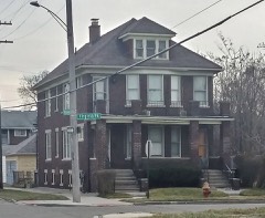
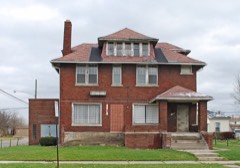
Orsel and Minnie McGhee House

Listed on the National Register of Historic Places in 2022.

From the record

“The Orsel and Minnie McGhee House is a single family home located at 4626 Seebaldt Street in Detroit. The house played a role in the landmark Shelley v.”

Wikipedia article Orsel and Minnie McGhee House, CC BY-SA 4.0.

One of 396 National Register listings published here for Wayne County · listed in 2022 · category: Building.

Sources: the Wikipedia article · the National Register database, National Park Service
The listing

  • What is counted as historic. The nomination lists 1 building as contributing to the listing.
  • Still standing. The Park Service records this property as extant.
  • Listed as. McGhee, Orsel and Minnie, House - the National Register files a house under its owner's surname.
  • Address. 4626 Seebaldt St, Detroit, 48204
  • When was it listed? August 2022
  • Category. building
  • Also known as. The Civil Rights Movement and the African American Experience in 20th Century Detroit MPS
  • City. Detroit city
  • National Register reference number. 100008009 - assigned by the National Park Service when the property was listed.

Fires near this property

149 since 2018

Regional context, not property-specific evidence. The federal wildfire occurrence database lists 149 fires within 5 miles of Orsel and Minnie McGhee House between 2018 and 2020, burning about 150 acres in total. 15 started naturally. None was recorded as arson. Distance is straight-line from the map coordinates, so a fire counted here may appear on a neighbouring settlement's page as well.

Reported cause Fires
Debris and open burning69
Equipment and vehicle use46
Natural15
Missing data/not specified/undetermined12
Recreation and ceremony5
Smoking2

The most recent of them, most recent first, with the day each was reported and the service that recorded it.

DateCause SizeReported by Name on the report
9 September 2018Natural1.0 acresMichigan Department of Natural ResourcesDETROIT FD 0033175 - 2018
7 September 2018Equipment and vehicle use1.0 acresMichigan Department of Natural ResourcesDETROIT FD 0033020 - 2018
6 September 2018Debris and open burning1.0 acresMichigan Department of Natural ResourcesDETROIT FD 0032843 - 2018
3 September 2019Debris and open burning1.0 acresMichigan Department of Natural ResourcesDETROIT FD 0031432 - 2019
28 September 2018Natural1.0 acresMichigan Department of Natural ResourcesDETROIT FD 0035675 - 2018
23 September 2019Natural1.0 acresMichigan Department of Natural ResourcesDETROIT FD 0034275 - 2019
19 September 2019Equipment and vehicle use1.0 acresMichigan Department of Natural ResourcesDETROIT FD 0033618 - 2019
19 September 2018Natural1.0 acresMichigan Department of Natural ResourcesDETROIT FD 0034403 - 2018

Every fire recorded in Wayne County

Mines and quarries near this property

7 within 5 miles

Regional context, not property-specific evidence. The federal mineral resources record lists 7 workings within 5 miles of Orsel and Minnie McGhee House: 5 producers, 2 past producers. 5 still produce. What was taken out: Calcium, Vermiculite, Clay, Iron. Distance is straight-line from the map coordinates, so a quarry counted here may appear on a neighbouring settlement's page as well.

Where SiteCommodity StatusRecorded
Clippert Brick and Tile Co. PitClayPast Producer
Cummings-Moore GraphiteGraphiteProducer
Mclouth Steel Gibralter Roll'G MillIronProducer
Stroble Primary Aluminum PlantAluminumPast Producer
Wr Grace Zonolite DivVermiculiteProducer
Detroit Lime Co Calcining PlantCalciumProducer
River Rouge LimekilnCalciumProducer

Every working recorded in Wayne County

Storms near this property

54 since 1993

Regional context, not property-specific evidence. The National Weather Service names Detroit, the town this property stands in, in 54 storm reports between 1993 and 2023: 27 thunderstorm wind, 20 hail, 4 flash flood, 2 lightning. The reports record 2 deaths. Each account below is quoted exactly as the forecast office filed it, from the NOAA Storm Events Database, and each date opens the federal record of that event.

WhenEvent Place namedHarm What the report says
June 2007LightningDetroit1 killedA golfer was struck and killed by lightning after seeking refuge under a tree at the Rogell Golf Course near 7 Mile and Lahser Roads.
June 1998LightningDetroit1 killedno account filed
July 1998Thunderstorm WindDetroit$200,000no account filed
July 2000Flash FloodDetroit$150,000no account filed
March 1998Thunderstorm WindDetroit$50,000no account filed
July 2000Flash FloodDetroit$15,000no account filed
June 2002Thunderstorm WindDetroit$10,000Broadcast media reported some trees blown down and a roof partially blown off due to thunderstorm winds.
June 1995Thunderstorm WindDetroit$10,000Strong thunderstorm winds uprooted several trees on the east side of the city. Damage occurred when three of the trees fell onto some parked cars.
June 2000Thunderstorm WindDetroit$5,000no account filed
May 2006Thunderstorm WindDetroit$2,500Trained spotter reported several trees and large limbs were blown down in the southwest side of Detroit.
May 2000Thunderstorm WindDetroit$2,000no account filed
May 2011Thunderstorm WindDetroit$500A large tree was reported blown down.
August 2023Thunderstorm WindDetroit-Trained spotter reported wind gust.
June 2022Thunderstorm WindDetroit-A section of metal roofing on the 150 West Jefferson Building in downtown Detroit was blown off.
June 2021Thunderstorm WindDetroit-A tree was reported blown down on the road.
June 2008Thunderstorm WindDetroit-A trained spotter estimated a 65 mph thunderstorm wind gust.
July 2007Thunderstorm WindDetroit-Local television stations reported large trees down on the northwest side of Detroit.
June 2007Thunderstorm WindDetroit-The local television stations reported trees and power lines down in northwest Detroit.
September 2006Flash FloodDetroit-Thunderstorms produced heavy rains with rates approaching 2 inches per hour over the downtown area. Broadcast Media reported on flooding along I-75 from 5 Mile to 7 Mile Rd. Trained spotters also reported street flooding in Westland and in Canton Township.
June 2005Thunderstorm WindDetroit-Local media reported trees down on the north side of Detroit.
June 2005Thunderstorm WindDetroit-Broadcast media reported trees down along 7 mile and Wyoming Roads.
June 2005Thunderstorm WindDetroit-Trees were reported down on the northwest side of Detroit.
May 2004Thunderstorm WindDetroit-One large tree and numerous tree limbs were blown down.
April 2003Thunderstorm WindDetroit-Detroit Edison reported numerous tree branches blown down onto wires on the Detroit/Redford border.
July 2003Thunderstorm WindDetroit-A trained spotter reported large tree limbs down.
July 2003Thunderstorm WindDetroit-A local television meteorologist reported a large tree blown down.
June 2003Thunderstorm WindDetroit-Local media reported trees blown down.
May 2001HailDetroit-Dime sized hail interrupted the next-to-last set of the Detroit Electronic Music Festival, cancelling the rest of the performances.
July 2001Thunderstorm WindDetroit-Large tree limbs blown down.
July 2001Thunderstorm WindDetroit-Power lines blown down.
July 1995HailDetroit-A ham radio operater reported golf ball-size hail.
September 1993Tornado (F0)Detroit-A cold air funnel was reported by a number of citizens as well as a retired police officer. This cold air funnel briefly touched down as a weak tornado as reported by an on-duty state trooper at the scene. Fortunately, there was no damage from this tornado.
August 2015HailDetroit-no account filed
June 2008HailDetroit-no account filed
May 2007HailDetroit-no account filed
June 2006HailDetroit-no account filed
September 2006HailDetroit-no account filed
September 2006Flash FloodDetroit-no account filed
April 2004HailDetroit-no account filed
May 2004HailDetroit-no account filed
May 2004Thunderstorm WindDetroit-no account filed
July 2003Thunderstorm WindDetroit-no account filed
May 2000HailDetroit-no account filed
October 1999HailDetroit-no account filed
September 1997Thunderstorm WindDetroit-no account filed

Every storm recorded in Wayne County

Map coverage status

No historic map-sheet match is published for this property yet. That does not mean no map exists. This record needs a coordinate-quality review before it can be joined to a sheet boundary. Browse the county's mapped places while that work is pending.

Listed places nearby

6 within 8 miles

Other National Register properties close enough to walk or drive between, ordered by distance from this one. Both positions come from the same geocoding pass that matched these properties to their map sheets.

Photograph PropertyDistance Listed
Nacirema Club0.4 miles2011
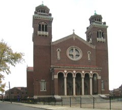
St. Theresa of Avila Roman Catholic Parish Complex0.6 miles1989
Parks, Rosa L. (McCauley) and Raymond, Flat0.8 miles2021
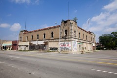
Grande Ballroom0.8 miles2018
Grand Riviera Theater0.9 miles1982
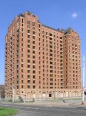
Lee Plaza Hotel1.0 miles1981

Sources for this property

National Archives recordThe nomination case file for reference 100008009 in Record Group 79.
Wikipedia articleCommunity-written account of this property, licensed CC BY-SA.
Wayne CountyAll 396 listed properties in this county.

Provenance

  • Listing record. National Park Service National Register of Historic Places, listed-properties dataset, current to 2026-05-22.
  • Map join. Address geocoded through the United States Census geocoder, then tested against the published boundary of every sheet in the USGS Historical Topographic Map Collection.
  • How this page is made. Listing fields come from federal records; map-sheet coverage is a labelled coordinate-to-boundary calculation, not a source-field claim.
  • Wildfire. Short, Karen C. 2022. Spatial wildfire occurrence data for the United States, 1992-2020 [FPA_FOD_20221014]. 6th Edition. Fort Collins, CO: Forest Service Research Data Archive. https://doi.org/10.2737/RDS-2013-0009.6 Collected with United States Government funding and usable without additional permissions or fees.
  • Mines and quarries. USGS Mineral Resources Data System (MRDS) https://mrdata.usgs.gov/mrds/ A work of the United States government, no copyright under 17 U.S.C. 105.
  • Storms. NOAA National Centers for Environmental Information, Storm Events Database https://www.ncei.noaa.gov/stormevents/ A work of the United States government, no copyright under 17 U.S.C. 105. Narratives are quoted verbatim from the National Weather Service report and are not edited or summarised.