 Block
From the record
One of 32 National Register listings published here for Berrien County · listed in 2023 · category: District.
Sources: the National Register database, National Park Service
Listed on the National Register of Historic Places in 2023.
One of 32 National Register listings published here for Berrien County · listed in 2023 · category: District.
Sources: the National Register database, National Park Service
Regional context, not property-specific evidence. The federal wildfire occurrence database lists 24 fires within 5 miles of Clark Equipment Company Administrative Complex between 2018 and 2020, burning about 29 acres in total. None started naturally. None was recorded as arson. Distance is straight-line from the map coordinates, so a fire counted here may appear on a neighbouring settlement's page as well.
| Reported cause | Fires |
|---|---|
| Missing data/not specified/undetermined | 15 |
| Equipment and vehicle use | 8 |
| Debris and open burning | 1 |
The most recent of them, most recent first, with the day each was reported and the service that recorded it.
| Date | Cause | Size | Reported by | Name on the report |
|---|---|---|---|---|
| 5 September 2019 | Equipment and vehicle use | 1.0 acres | Michigan Department of Natural Resources | NILES TOWNSHIP FD 2019309 - 2019 |
| 27 September 2020 | Equipment and vehicle use | 1.0 acres | Michigan Department of Natural Resources | BUCHANAN TOWNSHIP FD 68 - 2020 |
| 23 May 2018 | Missing data/not specified/undetermined | 1.0 acres | Michigan Department of Natural Resources | BUCHANAN FD 1800049 - 2018 |
| 13 May 2020 | Missing data/not specified/undetermined | 1.0 acres | Michigan Department of Natural Resources | BERTRAND TOWNSHIP FD 2020027 - 2020 |
| 30 April 2018 | Missing data/not specified/undetermined | 1.0 acres | Michigan Department of Natural Resources | BUCHANAN TOWNSHIP FD 29 - 2018 |
| 30 April 2018 | Missing data/not specified/undetermined | 1.0 acres | Michigan Department of Natural Resources | NILES TOWNSHIP FD 2018128 - 2018 |
| 3 April 2019 | Equipment and vehicle use | 1.0 acres | Michigan Department of Natural Resources | NILES FD 2190291 - 2019 |
| 25 April 2018 | Missing data/not specified/undetermined | 3.0 acres | Michigan Department of Natural Resources | BUCHANAN TOWNSHIP FD 28 - 2018 |
Regional context, not property-specific evidence. The federal mineral resources record lists 3 workings within 5 miles of Clark Equipment Company Administrative Complex: 3 past producers. None of them still produces. What was taken out: Sand and Gravel, Construction. Distance is straight-line from the map coordinates, so a quarry counted here may appear on a neighbouring settlement's page as well.
| Where | Site | Commodity | Status | Recorded |
|---|---|---|---|---|
| Harroff Sand & Gravel Pit | Sand and Gravel, Construction | Past Producer | ||
| Trautman Pit | Sand and Gravel, Construction | Past Producer | ||
| Yerington Pit | Sand and Gravel, Construction | Past Producer |
Regional context, not property-specific evidence. The National Weather Service names Buchanan, the town this property stands in, in 23 storm reports between 1997 and 2025: 19 thunderstorm wind, 4 hail. No death or injury is recorded in these reports. Each account below is quoted exactly as the forecast office filed it, from the NOAA Storm Events Database, and each date opens the federal record of that event.
| When | Event | Place named | Harm | What the report says |
|---|---|---|---|---|
| July 1997 | Thunderstorm Wind | Buchanan | $30,000 | Several trees and power lines were downed in Buchanan Township. Major tree damage was reported from 2 area golf courses, Orchard Hills and Brookwood. Orchard Hill was hit hardest and was closed through Tuesday, July 15, 1997, for clean up. The greens superintendent reported 25 trees downed by the winds. Brookwood Golf Course did not report as much damage, but had a significant number of trees downed, approximately 100, which ranged from 10 inches to 4 feet in diameter. No injuries were reported. |
| March 2025 | Thunderstorm Wind | Buchanan | $25,000 | Large pine tree fell on a garage and crushed it. The garage at the house looks like it was moved off its foundation. Siding, shingles, fascia and soffit gone off the house. |
| March 2025 | Thunderstorm Wind | Buchanan | $20,000 | Several large trees down in and around Buchanan. Power is out. |
| June 2008 | Thunderstorm Wind | Buchanan | $15,000 | County officials reported several trees and power lines down in and around the Buchanan area. |
| May 2007 | Thunderstorm Wind | Buchanan | $15,000 | Several trees and power lines were blown down across the southeast part of the county. |
| August 2007 | Thunderstorm Wind | Buchanan | $10,000 | A tree broke off at the 30 feet level and fell onto a camper, trapping some people for a while. There were no injuries. Damage is estimated at $10,000. |
| June 2023 | Thunderstorm Wind | Buchanan | $1,000 | A tree was down on Dayton Road. |
| May 2025 | Thunderstorm Wind | Buchanan | - | Local media reported several large trees down. |
| October 2021 | Thunderstorm Wind | Buchanan | - | Emergency management officials reported several trees down in the Buchanan area. |
| June 2016 | Hail | Buchanan | - | The public reported hail up to one inch in diameter. |
| July 2015 | Thunderstorm Wind | Buchanan | - | Large tree down onto local road. |
| July 2015 | Thunderstorm Wind | Buchanan | - | Small branches down in Buchanan, with reports of trees down two miles south of Buchanan. |
| June 2014 | Thunderstorm Wind | Buchanan | - | A trained spotter measured a 58 mph wind gust. |
| June 2014 | Thunderstorm Wind | Buchanan | - | Trained spotters reported several six inch diameter tree limbs down. |
| May 2013 | Thunderstorm Wind | Buchanan | - | A trained spotter reported numerous large tree limbs down, up to a foot in diameter, on Gardner Rd. |
| June 2013 | Thunderstorm Wind | Buchanan | - | Trees reported down at a nearby lake. |
| April 2011 | Hail | Buchanan | - | A trained spotter reported hail up to the size of quarters covering the ground. |
| June 2010 | Thunderstorm Wind | Buchanan | - | Tree limbs down. |
| June 2010 | Thunderstorm Wind | Buchanan | - | Trees down. |
| July 2007 | Thunderstorm Wind | Buchanan | - | Numerous trees were reported down in the southeast part of the county. |
| April 2020 | Hail | Buchanan | - | no account filed |
| June 2020 | Thunderstorm Wind | Buchanan | - | no account filed |
| April 2011 | Hail | Buchanan | - | no account filed |
No historic map-sheet match is published for this property yet. That does not mean no map exists. This record needs a coordinate-quality review before it can be joined to a sheet boundary. Browse the county's mapped places while that work is pending.
Other National Register properties close enough to walk or drive between, ordered by distance from this one. Both positions come from the same geocoding pass that matched these properties to their map sheets.
| Photograph | Property | Distance | Listed |
|---|---|---|---|
 | Union Block | 0.2 miles | 2007 |
 | Buchanan Downtown Historic District | 0.2 miles | 2009 |
 | Zinc Collar Pad Company Building | 0.4 miles | 2009 |
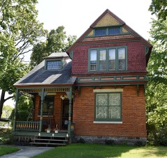 | Buchanan North and West Neighborhoods Historic District | 0.4 miles | 2011 |
| Oak Ridge Cemetery | 1.2 miles | 2024 | |
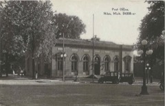 | Old US Post Office | 4.6 miles | 1985 |
| National Archives record | The nomination case file for reference 100008725 in Record Group 79. |
| Berrien County | All 32 listed properties in this county. |