Block
From the record
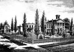
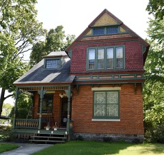
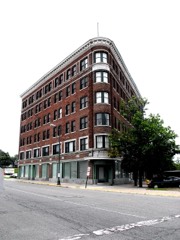
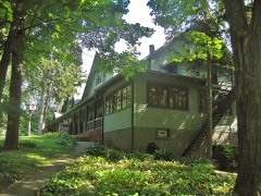
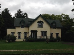
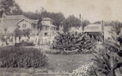
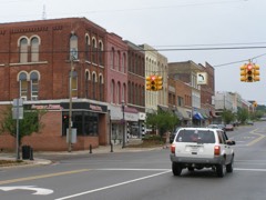
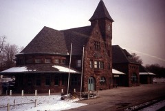
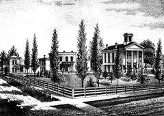
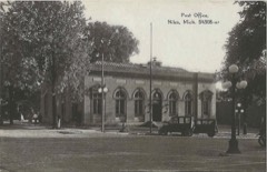
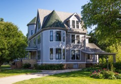
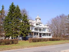
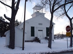
32 National Register listings published here.
Sources: the National Register database, National Park Service
53 topographic sheets cover 79 settlements here, and 32 properties are on the National Register of Historic Places.
32 National Register listings published here.
Sources: the National Register database, National Park Service
Every property in this county listed on the National Register of Historic Places, with the year it was listed and the federal nomination document.
Every wildfire the federal occurrence database records inside this county: 217 of them, burning about 240 acres. 54 started naturally and none was recorded as arson. Each settlement page carries the fires within five miles of it.
| Reported cause | Fires |
|---|---|
| Equipment and vehicle use | 89 |
| Missing data/not specified/undetermined | 61 |
| Natural | 54 |
| Recreation and ceremony | 7 |
| Debris and open burning | 4 |
| Smoking | 2 |
The five largest, by the area the report gives. None of them was recorded as arson.
| Date | Cause | Size | Reported by | Name on the report |
|---|---|---|---|---|
| 23 April 2018 | Equipment and vehicle use | 8.0 acres | Michigan Department of Natural Resources | BENTON CHARTER TWP FD 0000160 - 2018 |
| 10 September 2005 | Natural | 4.0 acres | Michigan Department of Natural Resources | not named |
| 19 March 2018 | Equipment and vehicle use | 4.0 acres | Michigan Department of Natural Resources | BENTON CHARTER TWP FD 0000110 - 2018 |
| 2 April 2019 | Equipment and vehicle use | 3.0 acres | Michigan Department of Natural Resources | BERTRAND TOWNSHIP FD 2019028 - 2019 |
| 26 March 2019 | Equipment and vehicle use | 3.0 acres | Michigan Department of Natural Resources | BUCHANAN TOWNSHIP FD 23 - 2019 |
| 25 April 2018 | Missing data/not specified/undetermined | 3.0 acres | Michigan Department of Natural Resources | BUCHANAN TOWNSHIP FD 28 - 2018 |
| 8 November 2019 | Equipment and vehicle use | 2.0 acres | Michigan Department of Natural Resources | WEESAW TOWNSHIP FD 19-0041 - 2019 |
| 19 June 2020 | Missing data/not specified/undetermined | 2.0 acres | Michigan Department of Natural Resources | WEESAW TOWNSHIP FD 20-0023 - 2020 |
Every settlement page carries the fires within five miles of it - see the settlement index below.
The NOAA Storm Events Database holds 505 reports for this county, causing 5 deaths, 31 injuries and about $22,399,280 in recorded property damage. Each settlement page carries the reports that name it.
| Kind of event | Reports |
|---|---|
| Thunderstorm Wind | 330 |
| Hail | 105 |
| Tornado | 32 |
| Flash Flood | 18 |
| Flood | 11 |
| Lightning | 3 |
| Rip Current | 3 |
| Heavy Rain | 2 |
| Waterspout | 1 |
The most serious of them, by death, then injury, then recorded damage. The accounts are quoted exactly as the forecast office filed them.
| When | Event | Place named | Harm | What the report says |
|---|---|---|---|---|
| July 1988 | Thunderstorm Wind | not stated | 1 killed, 4 hurt | no account filed |
| May 2004 | Thunderstorm Wind | Coloma | 1 killed, $10,000 | Emergency management reported a 4 foot diameter oak tree fell onto a vehicle as it was passing. The car was crushed and the 50 year old female driver was killed instantly. |
| August 2005 | Rip Current | Sawyer | 1 killed | Coast Guard officials received a report of a 20 year old male caught in a rip current 100 yards off shore from Warren Dunes State Park, near Sawyer. The person was removed from the water and was taken to a local hospital where he was pronounced dead a short time later. Coast Guard and park officials had warned of strong rip current activity through the day. |
| July 2001 | Rip Current | Bridgman | 1 killed | 13 year old girl drowned at Warren Dunes State Park. Police and park rangers believe girlwas caught in rip current near shore. |
| August 2001 | Rip Current | Bridgman | 1 killed | A 17-year old male drowned while swimming in Lake Michigan at Warren Dunes State Park. Officials at the scene said that wave heights were up to six feet. A rip current apparently pulled him underwater. |
| March 1976 | Tornado (F2) | not stated | 9 hurt, $250,000 | no account filed |
| May 2004 | Thunderstorm Wind | Berrien Spgs | 7 hurt, $50,000 | Law enforcement reported trees and power lines down in Berrien Springs and countywide. 7 injuries reported. Damage to the roofs of 6 buildings. |
| April 1979 | Tornado (F2) | not stated | 6 hurt, $250,000 | no account filed |
| April 1988 | Thunderstorm Wind | not stated | 2 hurt | no account filed |
| October 2021 | Thunderstorm Wind | Baroda | 1 hurt | Emergency management officials reported a tree was blown over onto the road and moving car. At least 1 minor injury was reported, but no specific details were available. |
| July 2010 | Thunderstorm Wind | St Joseph | 1 hurt | A trained spotter measured an 80 mph wind gust. Several tents at the Venetian festival were blown over. One of the tents hit and destroyed a CSX railroad crossing signal, struck a man in the head knocking him over and eventually struck two mini vans. The man was treated at the scene for minor injuries. |
| July 2006 | Lightning | St Joseph | 1 hurt | A 10 year old girl was injured when lightning struck a tree along a sidewalk as her and her grandmother were heading for their vehicle as a storm approached. She was knocked over and was found unconcious and not breathing. She was revived enroute to the hospital and is expected to recover fully. The grandmother was knocked over but suffered no other injuries. |
| February 2018 | Flood | Michiana Shrs | $8,400,000 | Extensive flooding occurred across the county with over 300 structures suffering varying degrees of damage from the flood waters. Several roads were closed across the area with some suffering partial washouts as rivers rose to record or near record levels. Initial damage estimates are at least 8 million dollars. |
| May 1996 | Flash Flood | South Half | $5,400,000 | no account filed |
| August 2021 | Flash Flood | Livingston | $1,340,000 | A survey of flood damage from emergency management officials reported in severe damage to a electrical substation that resulted in widespread power outages for several days. In addition a total of 108 structures suffered varying degrees of flood damage, mainly from water as high as four feet into basements. 5 homes suffered major damage and were uninhabitable due to extensive water damage or in one case a collapse of a basement wall. Five to locally as much as eight inches of rain fell in this area. Estimated damage to property was 1.343 million dollars. |
| August 1998 | Tornado (F1) | Niles | $1,100,000 | EXTENSIVE DAMAGE TO TREES ACROSS THE CITY WHICH BLOCKED 15 SEPARATE STREETS AT ONE TIME. 60 HOMES DAMAGED SUSTAINED MINOR TO SEVERE STRUCTURAL DAMAGE. MANY VEHICLES WERE DAMAGED OR DESTROYED BY FALLEN TREES AND LIMBS. SEVERAL POWER POLES AND LINES TAKEN OUT. THE FRENCH PAPER COMPANY LOST ROOFS ON THREE DIFFERENT BUILDINGS AS DID THE D&D TIRE COMPANY WHICH HAD ITS WAREHOUSE ROOF RIPPED OFF. DEMOND GROCERY STORE LOST 20K DOLLARS WORTH OF PERISHABLE FOOD ITEMS DUE TO THE EXTENDED EXTENSIVE POWER OUTAGE THAT AFFECTED 41,500 PEOPLE AT ONE POINT. ONE MAN LOST 21 LARGE TREES IN HIS YARD ALONE. THE MICHIGAN STATE GOVERNOR DECLARED THE CITY OF NILES A DISASTER AREA. AN OFF DUTY MICHIGAN STATE POLICE OFFICER TRAGICALLY LOST HIS LIFE WHEN HE WAS ELECTROCUTED BY A DOWNED POWER LINE. |
| June 2001 | Lightning | Benton Center | $800,000 | Lightning struck the Briarwood apartments in Benton township. 35 residents evacuated. Roof ofbuilding and two apartments destroyed, with some damage to other apartments. |
| September 2008 | Flood | Jerry Tyler Meml Arp | $750,000 | The rainfall from the remnants of Lowell and Ike continued to drop heavy rainfall into the early morning hours of the 15th. When the rain finally stopped, total rainfall amounts of over 12 inches was reported in the Buchanan and Niles area. Numerous roads remained closed with some culverts and bridges suffering damage. The Pucker Street Dam in Niles suffered a partial breech on an earthen part of the dam. Roughly a eight foot section was washed away, forcing the evacuation of residents downstream of the dam. No injuries were reported. No exact figures are available for the damage to the area from the flooding. |
| October 2001 | Tornado (F1) | Niles | $750,000 | no account filed |
| September 2008 | Flash Flood | Sawyer | $500,000 | Emergency management officials reported numerous roads in the southern part of the county being flooded, some with water as deep as one foot flowing over the road. This resulted in the closure of some roads, especially in the Niles area. Rainfall reports of up to 5 inches were noted across the area. Areal flooding continued into the 15th as additional rainfall occurred. Damage values are estimated. |
| July 1997 | Thunderstorm Wind | Berrien Spgs | $300,000 | Numerous 2 to 3 foot diameter trees were uprooted and several large trees were downed, damaging several Berrien Springs area homes, from straight-line winds in a severe thunderstorm. Wind gusts during the thunderstorm were estimated at 70 mph. A maple tree fell on a home at 10594 Old U.S. 31 at approximately 7:20 AM EDT. Another large tree came down on a house on Harrison Street, damaging the front and a ramp for the handicapped on the south side of the residence. A home on Rose Hill Street was damaged as 2 large trees destroyed a front porch, damaged the roof, and crushed 3 cars parked in the driveway. Other homes were damaged in the Bridlewood subdivision just south of Berrien Springs off Long Lake Road. A large tree fell through the roof of one home in this neighborhood, shattering a sun roof and sending a shower of glass through the cathedral ceiling onto the living-dining area of the two-level house. Numerous television antennas across the area were destroyed. One of the trees downed was a 300-year-old white oak along West Ferry Street, which was believed to be the oldest tree in the Berrien Springs area. It fell on a narrow lot, barely missing 2 homes. Trees blocked several area roads for hours and local flooding was reported. No injuries were reported. |
| July 1988 | Tornado (F0) | not stated | $250,000 | no account filed |
| June 1981 | Tornado (F2) | not stated | $250,000 | no account filed |
| April 1967 | Tornado (F2) | not stated | $250,000 | no account filed |
| March 1961 | Tornado (F2) | not stated | $250,000 | no account filed |
| June 2010 | Tornado (EF2) | Baroda | $150,000 | A survey of the area between Baroda and Stevensville indicated damage consistent with a tornado. The damage started on Marrs Road, just west of Stevensville-Baroda Road and continued east-northeast. The damage started with a travel trailer being thrown and destroyed as well as some tree damage. The circulation tracked mainly over open fields until reaching an area of homes on Lincoln Ave where the entire roof was ripped off a home (DI: FR12, DOD: 6) and another home suffered slightly less roof damage. The circulation continued northeast, crossing Hollywood Road, north of Linco Road. Several one year old 24 inch diameter power poles were snapped (DI: ETL; DOD 4). In addition, a harrow and trailer were thrown from a barn roughly 150 to 200 yards into a field. The circulation appears to dissipate north of Linco Road on Scottdale Road. The tornado was roughly 200 yards wide at its peak. Maximum winds are estimated at around 125 mph. |
| June 2010 | Tornado (EF1) | Arden | $100,000 | Just to the southeast of the first tornado of the evening a separate storm produced another tornado about a mile southeast of the first one, on Linco Road. The circulation continued along the road where it struck a garage near the intersection of Linco and Garr Roads. The east side of the garage was blown outwards. The tornado then turned somewhat southeast ending on Michigan 139, where a pole barn was destroyed. The tornado reached a maximum width of around 100 yards with top winds estimated at around 100 mph. |
| June 2004 | Flash Flood | Stevensville | $75,000 | Emergency management reported roads flooded and water flowing into the first floor of some homes in Stevensville subdivisions. |
| June 2005 | Thunderstorm Wind | Watervliet | $70,000 | Trees and power lines were reported down in Watervliet. A home as well as 2 cars suffered damage in Coloma as high winds brought down a large tree. Damage amount estimated. |
| August 2024 | Thunderstorm Wind | Three Oaks | $50,000 | Facebook photo shows a tree down onto a home in Three Oaks. |
| July 2022 | Thunderstorm Wind | Edgewater | $50,000 | Numerous trees and powerlines were down in Benton Harbor and surrounding areas. Some damage to homes from downed trees, and at least one car was damaged. |
| July 1997 | Thunderstorm Wind | Niles | $50,000 | Numerous trees were downed in the Niles area during the severe thunderstorm which produced estimated 70 mph winds across much of southeastern Berrien County. Falling trees downed power, phone, and cable lines. Minor damage was reported at several residences, including reports of patio furniture being swept away and a trampoline destroyed. Nearly 2 3/4 inches of rain fell in one hour at a Niles residence, with minor street flooding reported in the storm's aftermath. |
| June 1996 | Flash Flood | New Buffalo | $50,000 | no account filed |
| June 2005 | Lightning | Niles | $40,000 | Residents reported hearing a loud boom and a flash of light from their electrical meter box. A fire rapidly started as a result, destroying at least half the house. The damage to the house was estimated as a total determination of the damage was not available. No one was injured. |
| June 2010 | Thunderstorm Wind | Arden | $30,000 | A microburst, which likely assisted in the demise of the second tornado in Berrien County, raced east-southeast ward, causing extensive damage to trees for roughly 8 miles in the eastern part of the county, as well as the destruction of a shed and severe damage to a car. An orchard near the intersection of Hipps Hollow Road and Hochberger Road suffered extensive wind damage as well. The damage continued and crossed into Cass County near County Line Road and Frost Street. |
| July 1997 | Thunderstorm Wind | Buchanan | $30,000 | Several trees and power lines were downed in Buchanan Township. Major tree damage was reported from 2 area golf courses, Orchard Hills and Brookwood. Orchard Hill was hit hardest and was closed through Tuesday, July 15, 1997, for clean up. The greens superintendent reported 25 trees downed by the winds. Brookwood Golf Course did not report as much damage, but had a significant number of trees downed, approximately 100, which ranged from 10 inches to 4 feet in diameter. No injuries were reported. |
| March 2025 | Thunderstorm Wind | Buchanan | $25,000 | Large pine tree fell on a garage and crushed it. The garage at the house looks like it was moved off its foundation. Siding, shingles, fascia and soffit gone off the house. |
| July 2007 | Flash Flood | Niles | $25,000 | A report of 3.61 inches of rain was received in the Niles area, with several roads having signs of partial damage from flowing water over them. Damage is estimated at $25,000. |
| November 1998 | Thunderstorm Wind | Niles | $25,000 | SEVERAL TREES...TREE LIMBS...POWER LINES AND POWER POLES WERE EITHER SNAPPED OR BLOWN DOWN IN TOWN. |
| July 1997 | Thunderstorm Wind | Eau Claire | $25,000 | Numerous trees and power lines were downed across the Eau Claire area. Several homes received minor damage from falling trees and limbs. |
| June 1980 | Tornado (F1) | not stated | $25,000 | no account filed |
| October 1979 | Tornado (F0) | not stated | $25,000 | no account filed |
| June 1978 | Tornado (F1) | not stated | $25,000 | no account filed |
| March 1976 | Tornado (F2) | not stated | $25,000 | no account filed |
| May 1975 | Tornado (F1) | not stated | $25,000 | no account filed |
| June 1974 | Tornado (F2) | not stated | $25,000 | no account filed |
| September 1974 | Tornado (F0) | not stated | $25,000 | no account filed |
| September 1974 | Tornado (F1) | not stated | $25,000 | no account filed |
| May 1958 | Tornado (F0) | not stated | $25,000 | no account filed |
| June 1957 | Tornado (F1) | not stated | $25,000 | no account filed |
| March 2025 | Thunderstorm Wind | New Troy | $20,000 | Several large trees down in and around New Troy. Power is out. |
| March 2025 | Thunderstorm Wind | Buchanan | $20,000 | Several large trees down in and around Buchanan. Power is out. |
| April 2023 | Flood | Scottdale | $20,000 | Public reported flooding at the intersection of Lauren Lane and Solak Court in Royalton, MI. Two cars were stuck in floodwaters. |
| May 1999 | Thunderstorm Wind | Berrien Center | $20,000 | Several trees were blown down and one barn was damaged. |
| July 2022 | Thunderstorm Wind | St Joseph | $15,000 | The media reported that large trees were downed and uprooted. |
| July 2011 | Thunderstorm Wind | Edgewater | $15,000 | A trained spotter reported two trees down, as well as roof damage to a commercial building. Damage is estimated at $15,000. |
| June 2008 | Thunderstorm Wind | Buchanan | $15,000 | County officials reported several trees and power lines down in and around the Buchanan area. |
| August 2008 | Thunderstorm Wind | St Joseph | $15,000 | Law enforcement officials reported trees and power lines down in St Joseph. |
| May 2007 | Thunderstorm Wind | Buchanan | $15,000 | Several trees and power lines were blown down across the southeast part of the county. |
| June 2005 | Thunderstorm Wind | Berrien Spgs | $15,000 | A tree was reported to have been blown down onto two cars at a Snow Road residence in the city. |
The Survey's mineral resources record lists 23 workings inside this county. 8 still produce and 15 are closed or unrecorded. Each settlement page carries the workings within five miles of it.
| Commodity | Workings |
|---|---|
| Sand and Gravel, Construction | 13 |
| Silica | 6 |
| Limestone, General | 2 |
| Zinc | 1 |
| Clay | 1 |
The least common of them first, because a county's hundredth gravel pit says nothing its first ten did not.
| Where | Site | Commodity | Status | Recorded |
|---|---|---|---|---|
| Mich Std Alloys--Benton Harbor, Mi. | Zinc | Past Producer | ||
| Unnamed Clay Prospect | Clay | Prospect | ||
| Crosby Marl Pit | Limestone, General | Past Producer | ||
| Saint Joseph Terminal Mill | Limestone, General | Past Producer | ||
| Bridgman Pit & Mill/Martin-Marietta | Silica | Producer | ||
| Garage Site | Silica | Past Producer | Sedimentary | |
| Gulliver-Peters Site | Silica | Producer | Sedimentary | |
| Nadeau Pit | Silica | Producer | Sedimentary | |
| North Bridgman Pit | Silica | Past Producer | Sedimentary | |
| South Bridgman Site | Silica | Past Producer | Sedimentary | |
| Barrien County Pit | Sand and Gravel, Construction | Producer | ||
| Berrien Sand Quarry | Sand and Gravel, Construction | Past Producer | ||
| Bridgman Pit & Mill Manley Bros | Sand and Gravel, Construction | Producer | ||
| Dunaetz Pit | Sand and Gravel, Construction | Producer | ||
| Haof No 1 Pit | Sand and Gravel, Construction | Past Producer | ||
| Harroff Sand & Gravel Pit | Sand and Gravel, Construction | Past Producer | ||
| Kiell Pit & Mill | Sand and Gravel, Construction | Past Producer | ||
| Kiell Sand & Gravel | Sand and Gravel, Construction | Producer | ||
| Naoff No 2 Pit | Sand and Gravel, Construction | Past Producer | ||
| Trautman Pit | Sand and Gravel, Construction | Past Producer | ||
| White Pit | Sand and Gravel, Construction | Producer | ||
| Yerington Pit | Sand and Gravel, Construction | Past Producer | ||
| Yerington Pit | Sand and Gravel, Construction | Past Producer |
Named settlements recorded in the Geographic Names Information System, each with the topographic sheets covering it. Villages, hamlets and abandoned places alike. Each is shown with the nearest named watercourse or landform and the survey quadrangle it falls on.
Baroda township · 49101 · On North Branch Hickory Creek · Baroda quadrangle
15 sheets, 1927 to 1983
Baroda township · 49101 · On North Branch Hickory Creek · Baroda quadrangle
15 sheets, 1927 to 1983
Benton Charter Township · 49022 · On Yellow Creek · Benton Harbor quadrangle
11 sheets, 1927 to 1970
Benton Harbor city · 49022 · On Ox Creek · Benton Harbor quadrangle
11 sheets, 1927 to 1970
Benton Charter Township · 49022 · On Blue Creek · Benton Heights quadrangle
10 sheets, 1927 to 1970
Oronoko Charter Township · 49103 · Near Pardee Island · Berrien Springs quadrangle
16 sheets, 1927 to 1983
Chikaming township · 49125 · Near Mount Fuller · Bridgman quadrangle
14 sheets, 1930 to 1983
Benton Charter Township · 49022 · On Hickory Creek · Benton Harbor quadrangle
11 sheets, 1927 to 1970
New Buffalo township · 49129 · On South Branch Galien River · New Buffalo East quadrangle
13 sheets, 1930 to 1983
New Buffalo township · 49117 · On White Ditch · New Buffalo West quadrangle
10 sheets, 1953 to 1983
Benton Charter Township · 49022 · On Ox Creek · Benton Heights quadrangle
10 sheets, 1927 to 1970
Weesaw township · 49107 · On Judy Lake Drain · Baroda quadrangle
15 sheets, 1927 to 1983
New Buffalo township · 49129 · On South Branch Galien River · New Buffalo East quadrangle
13 sheets, 1930 to 1983
Sodus township · 49126 · On Pipestone Creek · Benton Harbor quadrangle
11 sheets, 1927 to 1970
Chikaming township · 49129 · On South Branch Galien River · New Buffalo East quadrangle
13 sheets, 1930 to 1983
New Buffalo township · 49117 · On White Ditch · New Buffalo West quadrangle
10 sheets, 1953 to 1983
Benton Charter Township · 49022 · On Yellow Creek · Sodus quadrangle
10 sheets, 1927 to 1970
New Buffalo city · 49117 · On Galien River · New Buffalo East quadrangle
13 sheets, 1930 to 1983
Weesaw township · 49119 · On East Branch Galien River · Bridgman quadrangle
14 sheets, 1930 to 1983
Niles township · 49120 · On Dowagiac River · Niles East quadrangle
14 sheets, 1945 to 1983
Benton Charter Township · 49022 · Benton Harbor quadrangle
11 sheets, 1927 to 1970
Berrien township · 49103 · Near Pardee Island · Berrien Springs quadrangle
16 sheets, 1927 to 1983
Oronoko Charter Township · 49103 · On Painter Creek · Berrien Springs quadrangle
16 sheets, 1927 to 1983
Hagar township · 49022 · On Granger Drain · Benton Heights quadrangle
10 sheets, 1927 to 1970
St. Joseph city · 49085 · On Paw Paw River · Benton Harbor quadrangle
11 sheets, 1927 to 1970
Chikaming township · 49125 · Near Mount Fuller · Bridgman quadrangle
14 sheets, 1930 to 1983
Lincoln Charter Township · 49127 · On Keelo Creek · Stevensville quadrangle
6 sheets, 1958 to 1970
Lake Charter Township · 49125 · Near Mount Fuller · Bridgman quadrangle
14 sheets, 1930 to 1983
Benton Charter Township · 49022 · On Granger Drain · Benton Heights quadrangle
10 sheets, 1927 to 1970
New Buffalo township · 49129 · On South Branch Galien River · New Buffalo East quadrangle
13 sheets, 1930 to 1983