 Block
From the record
One of 9 National Register listings published here for Van Buren County · listed in 2025 · category: Building.
Sources: the National Register database, National Park Service
Listed on the National Register of Historic Places in 2025.
One of 9 National Register listings published here for Van Buren County · listed in 2025 · category: Building.
Sources: the National Register database, National Park Service
Regional context, not property-specific evidence. The federal wildfire occurrence database lists 10 fires within 5 miles of Nichols Hotel between 2018 and 2019, burning about 11 acres in total. 1 started naturally. None was recorded as arson. Distance is straight-line from the map coordinates, so a fire counted here may appear on a neighbouring settlement's page as well.
| Reported cause | Fires |
|---|---|
| Equipment and vehicle use | 8 |
| Natural | 1 |
| Missing data/not specified/undetermined | 1 |
The most recent of them, most recent first, with the day each was reported and the service that recorded it.
| Date | Cause | Size | Reported by | Name on the report |
|---|---|---|---|---|
| 5 May 2018 | Equipment and vehicle use | 1.0 acres | Michigan Department of Natural Resources | SOUTH HAVEN AREA ESA 0000668 - 2018 |
| 7 April 2018 | Equipment and vehicle use | 1.0 acres | Michigan Department of Natural Resources | SOUTH HAVEN AREA ESA 0000497 - 2018 |
| 3 April 2019 | Equipment and vehicle use | 1.0 acres | Michigan Department of Natural Resources | SOUTH HAVEN AREA ESA 0000506 - 2019 |
| 28 April 2018 | Equipment and vehicle use | 1.0 acres | Michigan Department of Natural Resources | SOUTH HAVEN AREA ESA 0000609 - 2018 |
| 2 April 2019 | Missing data/not specified/undetermined | 1.0 acres | Michigan Department of Natural Resources | CLYDE TOWNSHIP FD 0000032 - 2019 |
| 13 April 2019 | Equipment and vehicle use | 1.0 acres | Michigan Department of Natural Resources | SOUTH HAVEN AREA ESA 0000557 - 2019 |
| 28 March 2019 | Equipment and vehicle use | 1.0 acres | Michigan Department of Natural Resources | SOUTH HAVEN AREA ESA 0000476 - 2019 |
| 27 March 2019 | Equipment and vehicle use | 2.0 acres | Michigan Department of Natural Resources | SOUTH HAVEN AREA ESA 0000464 - 2019 |
Regional context, not property-specific evidence. The National Weather Service names South Haven, the town this property stands in, in 18 storm reports between 1996 and 2025: 10 thunderstorm wind, 2 hail, 2 funnel cloud, 1 flash flood. No death or injury is recorded in these reports. Each account below is quoted exactly as the forecast office filed it, from the NOAA Storm Events Database, and each date opens the federal record of that event.
| When | Event | Place named | Harm | What the report says |
|---|---|---|---|---|
| April 2013 | Flood | South Haven | $3,000,000 | Significant flooding occurred on rivers and streams across Van Buren county due to heavy rainfall from early to mid April. |
| September 1997 | Lightning | South Haven | $200,000 | South Haven Community Hospital received a direct lightning strike on the northwest corner of the building. The radio tower for the HERN radio, which is the communications link with area ambulances, sustained the strike, which then grounded through the building directly through the telephone communications center on the basement level. The entire telephone system was disabled beyond repair. |
| March 2007 | Thunderstorm Wind | South Haven | $40,000 | Law enforcement reported that numerous trees were blown down by severe thunderstorm wind gusts in South Haven and Bangor. |
| August 2014 | Thunderstorm Wind | South Haven | $25,000 | A Van Buren county official reported that numerous trees were blown down in South Haven with several other reports of downed trees from the western half of Van Buren county inluding in Grand Junction. |
| July 2003 | Thunderstorm Wind | South Haven | $25,000 | Severe thunderstorm wind gusts blew down large trees, branches and numerous power lines in South Haven and Hartford. |
| August 2007 | Thunderstorm Wind | South Haven | $15,000 | An emergency manager reported that numerous trees were blown down throughout the county. |
| June 1996 | Flash Flood | South Haven | $8,000 | no account filed |
| April 2008 | Hail | South Haven | $5,000 | no account filed |
| October 1996 | Thunderstorm Wind | South Haven | $3,000 | no account filed |
| August 2024 | Hail | South Haven | - | There was an isolated report of three quarters inch hail near South Haven. |
| May 2019 | Thunderstorm Wind | South Haven | - | A 56 knot peak wind gust was measured at the South Haven GLERL site. |
| June 2016 | Thunderstorm Wind | South Haven | - | A trained spotter in South Haven reported wind gusts to 60 mph and one inch diameter hail. |
| August 2014 | Thunderstorm Wind | South Haven | - | A measured peak wind gust of 64 mph occurred at the South Haven GLERL coastal observation site. |
| September 2012 | Funnel Cloud | South Haven | - | Law enforcement near South Haven passed along numerous reports of funnel clouds during the mid morning between 8:55 and 9:05 a.m. |
| September 2012 | Funnel Cloud | South Haven | - | The Van Buren 911 center passed along a report that a funnel cloud was spotted near the Blue Star Highway in South Haven. |
| September 2010 | Thunderstorm Wind | South Haven | - | A 63 mph wind gust was measured at the South Haven GLERL site. |
| June 1998 | Waterspout | South Haven | - | Michigan State Police Post in South Haven reported a waterspout just offshore South Haven over Lake Michigan. The waterspout was short-lived as it moved south and dissipated before moving onshore. No injuries or damage was reported. |
| March 2025 | Thunderstorm Wind | South Haven | - | no account filed |
No historic map-sheet match is published for this property yet. That does not mean no map exists. This record needs a coordinate-quality review before it can be joined to a sheet boundary. Browse the county's mapped places while that work is pending.
Other National Register properties close enough to walk or drive between, ordered by distance from this one. Both positions come from the same geocoding pass that matched these properties to their map sheets.
| Photograph | Property | Distance | Listed |
|---|---|---|---|
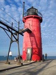 | Navigation Structures at South Haven Harbor, Michigan | 0.4 miles | 1995 |
| Navigation Structures at South Haven Harbor, Michigan | 0.8 miles | 1995 |
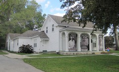 | Liberty Hyde Bailey Birthplace | 1.0 miles | 1983 |
| National Archives record | The nomination case file for reference 100011633 in Record Group 79. |
| Van Buren County | All 9 listed properties in this county. |