BlockBefore

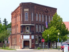
Alpena Central Historic District

Listed on the National Register of Historic Places in 2025.

From the record

“The Alpena Central Historic District is a primarily commercial historic district located in Alpena, Michigan. The district stretches along River and Water Streets from Fifth to Thunder Bay and along Second Avenue from Washington to Clark, with additional structures around Washington and Third and along the Bay and the River.”

Wikipedia article Alpena Central Historic District, CC BY-SA 4.0.

One of 12 National Register listings published here for Alpena County · listed in 2025 · category: District.

Sources: the Wikipedia article · the National Register database, National Park Service
The listing

Fires near this property

61 since 1992

Regional context, not property-specific evidence. The federal wildfire occurrence database lists 61 fires within 5 miles of Alpena Central Historic District between 1992 and 2020, burning about 37 acres in total. 2 started naturally. 3 were recorded as arson. Distance is straight-line from the map coordinates, so a fire counted here may appear on a neighbouring settlement's page as well.

Reported cause Fires
Debris and open burning17
Missing data/not specified/undetermined14
Railroad operations and maintenance10
Equipment and vehicle use7
Misuse of fire by a minor5
Arson/incendiarism3
Natural2
Recreation and ceremony1
Power generation/transmission/distribution1
Smoking1

The most recent of them, most recent first, with the day each was reported and the service that recorded it.

DateCause SizeReported by Name on the report
21 September 1995Debris and open burningunder an acreMichigan Department of Natural Resourcesnot named
2 September 2018Missing data/not specified/undetermined1.0 acresMichigan Department of Natural ResourcesALPENA TOWNSHIP FD 18N1075 - 2018
3 July 2020Equipment and vehicle use1.0 acresMichigan Department of Natural ResourcesALPENA FIRE DEPARTMENT 0704 - 2020
21 July 2002Naturalunder an acreMichigan Department of Natural Resourcesnot named
2 July 2018Missing data/not specified/undetermined1.0 acresMichigan Department of Natural ResourcesALPENA FIRE DEPARTMENT 0000686 - 2018
18 July 2018Missing data/not specified/undetermined1.0 acresMichigan Department of Natural ResourcesALPENA FIRE DEPARTMENT 0000759 - 2018
30 June 2018Missing data/not specified/undetermined1.0 acresMichigan Department of Natural ResourcesALPENA TOWNSHIP FD 018N745 - 2018
21 June 1995Misuse of fire by a minorunder an acreMichigan Department of Natural Resourcesnot named

Every fire recorded in Alpena County

Mines and quarries near this property

5 within 5 miles

Regional context, not property-specific evidence. The federal mineral resources record lists 5 workings within 5 miles of Alpena Central Historic District: 3 producers, 1 plant, 1 past producer. 4 still produce. What was taken out: Sand and Gravel, Construction, Stone, Stone, Crushed/Broken, Cement Rock. Distance is straight-line from the map coordinates, so a quarry counted here may appear on a neighbouring settlement's page as well.

Where SiteCommodity StatusRecorded
Alpena PlantStone, Crushed/BrokenPlant
Alpena QuarryCement RockProducer1908
Limestone Quarry-National GypsumStoneProducer
Alpena Co Pit Re Glancy IncSand and Gravel, ConstructionProducer
Klein Pit & MillSand and Gravel, ConstructionPast Producer

Every working recorded in Alpena County

Storms near this property

25 since 1993

Regional context, not property-specific evidence. The National Weather Service names Alpena, the town this property stands in, in 25 storm reports between 1993 and 2025: 14 thunderstorm wind, 10 hail, 1 lightning. The reports record 1 injury. Each account below is quoted exactly as the forecast office filed it, from the NOAA Storm Events Database, and each date opens the federal record of that event.

WhenEvent Place namedHarm What the report says
July 2005LightningAlpena1 hurtA nearby lightning strike at a campground shocked a man who was taking down an awning. He was taken to a local hospital for observation.
August 1993Thunderstorm WindAlpena$50,000A barn was blown over on Hubbard Lake road.
August 1993Thunderstorm WindAlpena$50,000A garage roof was blown over onto a car by thunderstorm wind.
July 2016Thunderstorm WindAlpena$10,000Several trees were downed.
April 1993Thunderstorm WindAlpena$5,000Strong thunderstorm winds uprooted several large trees near Highway M-32.
July 2021Thunderstorm WindAlpena$3,000Several trees down in Washington Avenue Park. Social media pictures included uprooted trees and a blown over portable toilet.
June 2007Thunderstorm WindAlpena$3,000A tree and a few large tree limbs were downed on 2nd Avenue and on Sable Street, near the northern city limits of Alpena.
August 1993Thunderstorm WindAlpena$500A 12-inch-diameter tree was blown over on Long Rapids Road within two blocks northwest of the city limits in Alpena. A wind gust was estimated at 50 mph.
August 1993Thunderstorm WindAlpena$500A 12-inch-diameter tree was uprooted on fair street in the city of Alpena.
August 1993Thunderstorm WindAlpena$500A 15-inch-diameter tree was uprooted on Dow Road in the city of Alpena as reported by a student volunteer.
August 1993Thunderstorm WindAlpena$500Several large trees were uprooted by thunderstorm wind.
August 2025HailAlpena-Multiple reports of hailstones up to 2 inches in diameter near El Cajon and Misery Bays on the Lake Huron coast east of Alpena.
July 2024Thunderstorm WindAlpena-Report from social media of a tree snapped at its base, downing wires and a power pole. Rainfall report from the Alpena area of 2.41 inches of rain with thunderstorms with standing water in yard.
July 2016HailAlpena-Some damage done to area crops, including wheat and soybeans.
July 2003Thunderstorm WindAlpena-Numerous trees and utility lines were downed.
May 1998Thunderstorm WindAlpena-Strong thunderstorm winds downed numerous trees and powerlines countywide.
August 1993HailAlpena-A spotter reported dime-size hail on Franklin Street in the city of Alpena.
June 2008HailAlpena-no account filed
July 2007HailAlpena-no account filed
July 2006HailAlpena-no account filed
June 2001HailAlpena-no account filed
May 2000HailAlpena-no account filed
May 1998HailAlpena-no account filed
July 1996HailAlpena-no account filed
July 1996Thunderstorm WindAlpena-no account filed

Every storm recorded in Alpena County

Map coverage status

No historic map-sheet match is published for this property yet. That does not mean no map exists. This record needs a coordinate-quality review before it can be joined to a sheet boundary. Browse the county's mapped places while that work is pending.

Listed places nearby

6 within 8 miles

Other National Register properties close enough to walk or drive between, ordered by distance from this one. Both positions come from the same geocoding pass that matched these properties to their map sheets.

Photograph PropertyDistance Listed
IOOF Centennial Building0.1 miles2015
Besser, Herman and Hattie (Ely), House0.4 miles2023
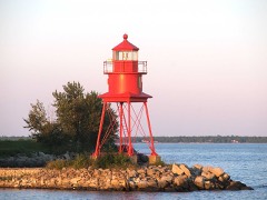
Alpena Light0.4 miles2006
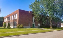
Bingham School0.5 miles2020
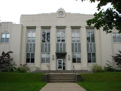
Alpena County Courthouse0.7 miles1983
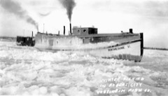
Fishing Tug Katherine V1.6 miles2003

Sources for this property

National Archives recordThe nomination case file for reference 100012172 in Record Group 79.
Wikipedia articleCommunity-written account of this property, licensed CC BY-SA.
Alpena CountyAll 12 listed properties in this county.

Provenance

  • Listing record. National Park Service National Register of Historic Places, listed-properties dataset, current to 2026-05-22.
  • Map join. Address geocoded through the United States Census geocoder, then tested against the published boundary of every sheet in the USGS Historical Topographic Map Collection.
  • How this page is made. Listing fields come from federal records; map-sheet coverage is a labelled coordinate-to-boundary calculation, not a source-field claim.
  • Wildfire. Short, Karen C. 2022. Spatial wildfire occurrence data for the United States, 1992-2020 [FPA_FOD_20221014]. 6th Edition. Fort Collins, CO: Forest Service Research Data Archive. https://doi.org/10.2737/RDS-2013-0009.6 Collected with United States Government funding and usable without additional permissions or fees.
  • Mines and quarries. USGS Mineral Resources Data System (MRDS) https://mrdata.usgs.gov/mrds/ A work of the United States government, no copyright under 17 U.S.C. 105.
  • Storms. NOAA National Centers for Environmental Information, Storm Events Database https://www.ncei.noaa.gov/stormevents/ A work of the United States government, no copyright under 17 U.S.C. 105. Narratives are quoted verbatim from the National Weather Service report and are not edited or summarised.