 Block
From the record
One of 29 National Register listings published here for Ottawa County · listed in 2026 · category: District.
Sources: the National Register database, National Park Service
Listed on the National Register of Historic Places in 2026.
One of 29 National Register listings published here for Ottawa County · listed in 2026 · category: District.
Sources: the National Register database, National Park Service
Regional context, not property-specific evidence. The federal wildfire occurrence database lists 28 fires within 5 miles of Washington Square Historic District between 2005 and 2020, burning about 33 acres in total. 3 started naturally. None was recorded as arson. Distance is straight-line from the map coordinates, so a fire counted here may appear on a neighbouring settlement's page as well.
| Reported cause | Fires |
|---|---|
| Missing data/not specified/undetermined | 17 |
| Equipment and vehicle use | 6 |
| Natural | 3 |
| Debris and open burning | 2 |
The most recent of them, most recent first, with the day each was reported and the service that recorded it.
| Date | Cause | Size | Reported by | Name on the report |
|---|---|---|---|---|
| 9 September 2019 | Missing data/not specified/undetermined | 1.0 acres | Michigan Department of Natural Resources | HOLLAND TOWNSHIP FD 19636 - 2019 |
| 8 September 2018 | Equipment and vehicle use | 1.0 acres | Michigan Department of Natural Resources | GRAAFSCHAP FD 2018470 - 2018 |
| 21 September 2005 | Debris and open burning | 7.0 acres | Michigan Department of Natural Resources | not named |
| 2 August 2019 | Missing data/not specified/undetermined | 1.0 acres | Michigan Department of Natural Resources | HOLLAND TOWNSHIP FD 19543 - 2019 |
| 16 August 2019 | Natural | 1.0 acres | Michigan Department of Natural Resources | GRAAFSCHAP FD 2019424 - 2019 |
| 10 August 2020 | Equipment and vehicle use | under an acre | Michigan Department of Natural Resources | HOLLAND TOWNSHIP FD 20528 - 2020 |
| 9 July 2018 | Missing data/not specified/undetermined | 1.0 acres | Michigan Department of Natural Resources | HOLLAND FD 0002036 - 2018 |
| 6 July 2018 | Equipment and vehicle use | 1.0 acres | Michigan Department of Natural Resources | HOLLAND FD 0002003 - 2018 |
Regional context, not property-specific evidence. The federal mineral resources record lists 1 working within 5 miles of Washington Square Historic District: 1 past producer. None of them still produces. What was taken out: Fire Clay (Refractory). Distance is straight-line from the map coordinates, so a quarry counted here may appear on a neighbouring settlement's page as well.
| Where | Site | Commodity | Status | Recorded |
|---|---|---|---|---|
| Zeeland Brick Co.Clay Pit | Fire Clay (Refractory) | Past Producer |
Regional context, not property-specific evidence. The National Weather Service names Holland, the town this property stands in, in 28 storm reports between 1993 and 2022: 13 thunderstorm wind, 11 hail, 4 flash flood. The reports record 1 death. Each account below is quoted exactly as the forecast office filed it, from the NOAA Storm Events Database, and each date opens the federal record of that event.
| When | Event | Place named | Harm | What the report says |
|---|---|---|---|---|
| June 2008 | Flash Flood | Holland | 1 killed, $1,000,000 | A 76 year old farmer drowned while trying to remove boards from the Worley Drain Dam that regulates waters from Bass Creek. A significant number of roads were washed out in the city of Holland and water levels on roads in some low lying locations reached the roof tops of cars. ||A presidential disaster declaration was issued for Ottawa county due to all the flooding. |
| June 1996 | Flash Flood | Holland | $100,000 | no account filed |
| July 2005 | Thunderstorm Wind | Holland | $75,000 | no account filed |
| July 2001 | Flash Flood | Holland | $50,000 | no account filed |
| June 1997 | Thunderstorm Wind | Holland | $25,000 | Severe thunderstorm winds downed power lines and transformers across the city of Holland. The highest measured wind gust with this line of storms was 42 mph, at 1 mile east of Holland State Park at 8:10 PM EDT. Marble-sized hail was also reported in Holland at 7:40 PM EDT. |
| October 2001 | Flash Flood | Holland | $25,000 | no account filed |
| May 1999 | Thunderstorm Wind | Holland | $20,000 | Strong winds downed numerous trees and power lines in Holland. |
| October 2001 | Thunderstorm Wind | Holland | $15,000 | no account filed |
| July 2003 | Thunderstorm Wind | Holland | $10,000 | The ASOS weather observing system at the Tulip City airport in Holland measured a 59 m.p.h. wind gust. |
| June 1999 | Thunderstorm Wind | Holland | $10,000 | Numerous trees and power lines were downed by gusty thunderstorm winds in Holland. |
| September 1997 | Thunderstorm Wind | Holland | $10,000 | Ottawa County Central Dispatch reported trees and power lines downed in the city of Holland around 14th Street. Consumers Energy reported 3,200 customers lost power across southern Ottawa County during the storm. In northern Ottawa County, a lightning strike at a communications tower in Grand Haven stopped emergency radio communications across the entire county. Ottawa County Central Dispatch was forced to use backup towers at emergency operations centers in Allendale and Holland. |
| August 2001 | Hail | Holland | $10,000 | no account filed |
| October 2001 | Hail | Holland | $10,000 | no account filed |
| November 2005 | Hail | Holland | $5,000 | Three quarters inch diameter hail was reported one mile west of Holland. |
| August 2004 | Thunderstorm Wind | Holland | $5,000 | A wind gust of around 70 m.p.h. was measured by wind equipment in Holland. |
| July 1994 | Thunderstorm Wind | Holland | $5,000 | A large tree was uprooted, and the wall of a building under construction was blown down. |
| October 2002 | Thunderstorm Wind | Holland | $3,000 | Law enforcement reported one tree blown down in Spring Lake. |
| June 2002 | Hail | Holland | $2,000 | Three quarters inch hail was also reported by the public near Holland just north of the Allegan and Ottawa county line. |
| August 2022 | Thunderstorm Wind | Holland | - | A peak wind gust to 59 mph was measured at Spyglass condos in Holland. |
| June 2011 | Thunderstorm Wind | Holland | - | As storms came upon shore, a wind gust of 66 miles per hour was observed at the Holland State Park. Further inland, a measured wind gust of 47 miles per hour was recorded on the campus of Grand Valley State University in Allendale. |
| April 2010 | Hail | Holland | - | A trained spotter in Holland reported one inch diameter hail. |
| October 2007 | Hail | Holland | - | Three quarters inch diameter hail was reportd at the intersection of Chicago Drive and Waverly Roads. |
| August 1993 | Thunderstorm Wind | Holland | - | Thunderstorm winds gusted to 60 mph 3 miles north of Holland. |
| October 2007 | Hail | Holland | - | no account filed |
| April 1998 | Hail | Holland | - | no account filed |
| April 1997 | Hail | Holland | - | no account filed |
| April 1996 | Hail | Holland | - | no account filed |
| April 1994 | Hail | Holland | - | no account filed |
No historic map-sheet match is published for this property yet. That does not mean no map exists. This record needs a coordinate-quality review before it can be joined to a sheet boundary. Browse the county's mapped places while that work is pending.
Other National Register properties close enough to walk or drive between, ordered by distance from this one. Both positions come from the same geocoding pass that matched these properties to their map sheets.
| Photograph | Property | Distance | Listed |
|---|---|---|---|
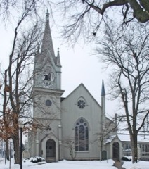 | Third Reformed Church of Holland | 0.4 miles | 1971 |
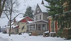 | Holland Historic District | 0.4 miles | 1983 |
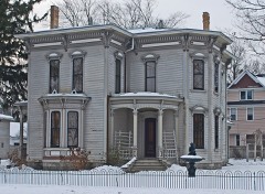 | Isaac Cappon House | 0.6 miles | 1984 |
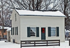 | Thomas and Anna Morrissey House | 0.6 miles | 1999 |
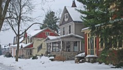 | Holland Historic District (Boundary Increase) | 0.6 miles | 1990 |
 | Holland Reformed Protestant Dutch Church | 0.8 miles | 1990 |
| National Archives record | The nomination case file for reference 100012619 in Record Group 79. |
| Ottawa County | All 29 listed properties in this county. |