 Block
From the record
One of 50 National Register listings published here for Calhoun County · listed in 2012 · category: District.
Sources: the case file at the National Archives · the National Register database, National Park Service
Listed on the National Register of Historic Places in 2012.
One of 50 National Register listings published here for Calhoun County · listed in 2012 · category: District.
Sources: the case file at the National Archives · the National Register database, National Park Service
Regional context, not property-specific evidence. The federal wildfire occurrence database lists 77 fires within 5 miles of Battle Creek Sanitarium (Boundary Increase) between 2018 and 2020, burning about 80 acres in total. 13 started naturally. None was recorded as arson. Distance is straight-line from the map coordinates, so a fire counted here may appear on a neighbouring settlement's page as well.
| Reported cause | Fires |
|---|---|
| Equipment and vehicle use | 36 |
| Missing data/not specified/undetermined | 19 |
| Natural | 13 |
| Smoking | 4 |
| Debris and open burning | 3 |
| Recreation and ceremony | 2 |
The most recent of them, most recent first, with the day each was reported and the service that recorded it.
| Date | Cause | Size | Reported by | Name on the report |
|---|---|---|---|---|
| 23 September 2019 | Missing data/not specified/undetermined | 1.0 acres | Michigan Department of Natural Resources | EMMETT TOWNSHIP DPS 01205 - 2019 |
| 22 September 2020 | Natural | 1.0 acres | Michigan Department of Natural Resources | EMMETT TOWNSHIP DPS 00971 - 2020 |
| 21 September 2018 | Equipment and vehicle use | 1.0 acres | Michigan Department of Natural Resources | BATTLE CREEK FD 05331 - 2018 |
| 13 September 2018 | Equipment and vehicle use | 1.0 acres | Michigan Department of Natural Resources | BATTLE CREEK FD 05179 - 2018 |
| 8 August 2019 | Smoking | 1.0 acres | Michigan Department of Natural Resources | EMMETT TOWNSHIP DPS 00986 - 2019 |
| 21 August 2019 | Missing data/not specified/undetermined | 1.0 acres | Michigan Department of Natural Resources | BATTLE CREEK FD 05036 - 2019 |
| 8 July 2018 | Equipment and vehicle use | 1.0 acres | Michigan Department of Natural Resources | BATTLE CREEK FD 03805 - 2018 |
| 6 July 2018 | Missing data/not specified/undetermined | 1.0 acres | Michigan Department of Natural Resources | BATTLE CREEK FD 03770 - 2018 |
Regional context, not property-specific evidence. The federal mineral resources record lists 7 workings within 5 miles of Battle Creek Sanitarium (Boundary Increase): 5 producers, 2 past producers. 5 still produce. What was taken out: Sand and Gravel, Construction. Distance is straight-line from the map coordinates, so a quarry counted here may appear on a neighbouring settlement's page as well.
| Where | Site | Commodity | Status | Recorded |
|---|---|---|---|---|
| Calhoun Co Pit Bill Smith S&G | Sand and Gravel, Construction | Producer | ||
| Calhoun County Pit | Sand and Gravel, Construction | Producer | ||
| Dickman Road Pit & Mill | Sand and Gravel, Construction | Past Producer | ||
| Dickman Road Plant | Sand and Gravel, Construction | Producer | ||
| Hoffman Brothers Sand & Gravel Pit | Sand and Gravel, Construction | Past Producer | ||
| Huntington Dredge & Mill | Sand and Gravel, Construction | Producer | ||
| Rays Aggregates Company | Sand and Gravel, Construction | Producer |
Regional context, not property-specific evidence. The National Weather Service names Battle Creek, the town this property stands in, in 45 storm reports between 1994 and 2025: 32 thunderstorm wind, 11 hail, 1 lightning, 1 tornado. No death or injury is recorded in these reports. Each account below is quoted exactly as the forecast office filed it, from the NOAA Storm Events Database, and each date opens the federal record of that event.
| When | Event | Place named | Harm | What the report says |
|---|---|---|---|---|
| July 2003 | Tornado (F1) | Battle Creek | $1,000,000 | A F1 tornado struck Calhoun county. |
| June 2024 | Thunderstorm Wind | Battle Creek | $200,000 | There were numerous reports of trees and power lines. |
| June 2019 | Hail | Battle Creek | $100,000 | Hail up to almost three inches in diameter was reported. |
| August 2000 | Thunderstorm Wind | Battle Creek | $75,000 | no account filed |
| May 2004 | Hail | Battle Creek | $50,000 | A trained spotter four miles north of Battle Creek reported one and three quarters inch diameter hail. |
| May 2004 | Hail | Battle Creek | $50,000 | The public reported one and three quarters inch diameter hail on I-94 just over the Calhoun county line. |
| May 2004 | Thunderstorm Wind | Battle Creek | $50,000 | Several trees were blown down in Battle Creek. |
| May 2004 | Thunderstorm Wind | Battle Creek | $50,000 | The public four miles south southwest of Battle Creek reported that one and a half inch diameter hail and wind gusts to 65 m.p.h. occurred with a severe thunderstorm in that area. |
| July 2001 | Thunderstorm Wind | Battle Creek | $50,000 | Several trees and power lines were blown down in Battle Creek and across Emmit township. One tree fell on power lines and a parked car. |
| July 2003 | Thunderstorm Wind | Battle Creek | $30,000 | Numerous trees and power lines were blown down three miles south of Battle Creek. |
| July 2005 | Thunderstorm Wind | Battle Creek | $25,000 | Several trees were blown down five miles southeast of Battle Creek and also around 6 Mile and B Drive. Numerous trees were blown down in Lakeview and several trees were blown down in Bedford. |
| May 2004 | Hail | Battle Creek | $25,000 | An emergency manager reported seven eighths inch hail in Battle Creek. |
| June 2004 | Thunderstorm Wind | Battle Creek | $25,000 | Law enforcement reported that 1.5 foot diameter trees were blown down and some were uprooted. |
| August 2003 | Thunderstorm Wind | Battle Creek | $25,000 | Numerous trees were blown down by severe thunderstorm wind gusts in the city of Battle Creek. |
| July 2001 | Thunderstorm Wind | Battle Creek | $25,000 | A large tree was blown down and blocked the intersection of Kirby and Waubascon roads. Several tree limbs that were two to three inches in diameter were also blown down. |
| July 1997 | Thunderstorm Wind | Battle Creek | $25,000 | Trees and power lines were downed in a few locations across the city of Battle Creek. Power was knocked out for 2,600 Consumers Energy customers in the city. Lightweight patio furniture was blown around on the grounds of the Team U.S. National Hot-Air Balloon Championship and Air Show at Kellogg Regional Airport during 40 mph wind gusts. |
| June 2001 | Thunderstorm Wind | Battle Creek | $25,000 | no account filed |
| June 2006 | Hail | Battle Creek | $20,000 | Trained spotters reported hail as large as one and a quarter inches in diameter two miles south of Marshall. |
| June 2005 | Thunderstorm Wind | Battle Creek | $20,000 | no account filed |
| August 2001 | Thunderstorm Wind | Battle Creek | $20,000 | no account filed |
| March 2006 | Hail | Battle Creek | $15,000 | Trained spotters and an emergency manager reported one inch diameter hail from east of Battle Creek to near Marshall. |
| August 2003 | Thunderstorm Wind | Battle Creek | $15,000 | A 60 m.p.h. wind gust was reported in Battle Creek. |
| August 2003 | Thunderstorm Wind | Battle Creek | $15,000 | Several trees were blown down in the city of Battle Creek. |
| May 1998 | Lightning | Battle Creek | $11,000 | The Battle Creek Enquirer reported a lightning strike caused $8,000 in damage to a married couple's rented home at 17 N. 20th Street in Battle Creek. The fire started in the basement and smoke filled the home, damaging $3,000 worth of contents according to Battle Creek fire-fighters. No one was injured. |
| May 2006 | Thunderstorm Wind | Battle Creek | $10,000 | Several trees were blown down in the city of Battle Creek. |
| August 2004 | Thunderstorm Wind | Battle Creek | $10,000 | An emergency manager reported that power lines were blown down in and just south of downtown Battle Creek. |
| May 1998 | Thunderstorm Wind | Battle Creek | $10,000 | Several trees and power lines downed in the City of Battle Creek. No injuries or property damage was reported. |
| May 1998 | Thunderstorm Wind | Battle Creek | $10,000 | Several large limbs and a few power lines downed in the city of Battle Creek. Reports were scattered across the city, rather than from one distinct location. |
| August 2002 | Thunderstorm Wind | Battle Creek | $10,000 | no account filed |
| June 2001 | Hail | Battle Creek | $10,000 | no account filed |
| September 2001 | Thunderstorm Wind | Battle Creek | $10,000 | no account filed |
| May 2005 | Hail | Battle Creek | $5,000 | A severe thunderstorm produced three quarters inch diameter hail one mile south of Battle Creek. |
| August 1996 | Thunderstorm Wind | Battle Creek | $3,000 | no account filed |
| December 2007 | Thunderstorm Wind | Battle Creek | $2,000 | A tree was blown down across a road. |
| March 2025 | Thunderstorm Wind | Battle Creek | - | Steeple toppled from a church. Several large trees had damage. |
| June 2014 | Hail | Battle Creek | - | Trained spotters reported hail ranging anywhere from around an inch to up to one and three quarters inches in diameter. |
| August 2011 | Hail | Battle Creek | - | A trained spotter reported seven eighths inch diameter hail in downtown Battle Creek. |
| July 2010 | Thunderstorm Wind | Battle Creek | - | A severe thunderstorm produced a measured wind gust of 62 mph at the Battle Creek airport. A county official in Battle Creek reported that the top portion of a 35 inch in diameter oak tree was knocked over. |
| July 1998 | Thunderstorm Wind | Battle Creek | - | Trees and power lines were downed in Leroy Township near the intersection of Michigan Highway 66 and E Drive South and near 4-Mile Road and F Drive South. Power outages were reported in the Battle Creek area, where approximately 1,180 residential and business customers were affected. Most power loss was blamed on lightning strikes. Calhoun County Central Dispatch also reported several trees were downed in the eastern half of Calhoun County. No damage estimate was available. |
| July 1998 | Thunderstorm Wind | Battle Creek | - | Tree down on house, unknown property damage. |
| June 1998 | Hail | Battle Creek | - | Amateur radio operators reported 1-inch diameter hail in downtown Battle Creek at 1:18 am EDT. |
| June 1998 | Thunderstorm Wind | Battle Creek | - | City of Battle Creek Emergency Management reported trees and power lines were downed across Battle Creek, Pennfield, and Emmett Townships and within the city limits of Battle Creek between 1:30 and 1:40 am EDT. Wind gust estimates ranged from 60 to 100 mph, mainly over the southwest section of the City of Battle Creek in Battle Creek Township, where most of the damage was reported. Several uprooted trees and at least one damaged vehicle were reported on Hamilton Lane off Capital Avenue SW in the village of Lakeview, just southwest of downtown Battle Creek. Other scattered reports of trees and power lines having been felled came from Pennfield and Emmett Townships. Approximately 4,000 residents lost power in and around the city. No injuries were reported and damage estimates were not available. |
| June 1994 | Thunderstorm Wind | Battle Creek | - | Numerous trees and power lines downed. Reported by Battle Creek Emergency Services. Additional tree and power line damage was reported across northern Calhoun county over next 30 minutes. |
| June 1994 | Thunderstorm Wind | Battle Creek | - | Reported at Kellogg International Airport. |
| January 1996 | Thunderstorm Wind | Battle Creek | - | no account filed |
No historic map-sheet match is published for this property yet. That does not mean no map exists. This record needs a coordinate-quality review before it can be joined to a sheet boundary. Browse the county's mapped places while that work is pending.
Other National Register properties close enough to walk or drive between, ordered by distance from this one. Both positions come from the same geocoding pass that matched these properties to their map sheets.
| Photograph | Property | Distance | Listed |
|---|---|---|---|
 | Federal Center | 0.1 miles | 1974 |
 | W.K. Kellogg House | 0.3 miles | 1985 |
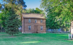 | Advent Historic District | 0.4 miles | 1994 |
| Milk Producers Company Barn | 0.5 miles | 2002 | |
 | Record Printing and Box Company Building | 0.5 miles | 2019 |
 | Central National Tower | 0.6 miles | 2008 |
| National Archives record | The nomination case file for reference 11001060 in Record Group 79. |
| Calhoun County | All 50 listed properties in this county. |