Block
From the record
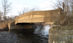
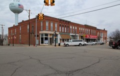
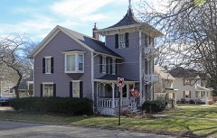
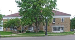
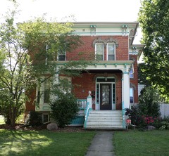
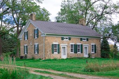
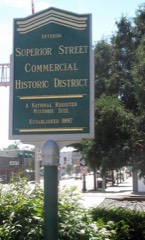
50 National Register listings published here, 1 of them a National Historic Landmark.
Sources: the National Register database, National Park Service
84 topographic sheets cover 47 settlements here, and 50 properties are on the National Register of Historic Places.
50 National Register listings published here, 1 of them a National Historic Landmark.
Sources: the National Register database, National Park Service
Every property in this county listed on the National Register of Historic Places, with the year it was listed and the federal nomination document.
Every wildfire the federal occurrence database records inside this county: 225 of them, burning about 456 acres. 30 started naturally and none was recorded as arson. Each settlement page carries the fires within five miles of it.
| Reported cause | Fires |
|---|---|
| Equipment and vehicle use | 88 |
| Missing data/not specified/undetermined | 86 |
| Natural | 30 |
| Smoking | 10 |
| Debris and open burning | 7 |
| Recreation and ceremony | 4 |
The five largest, by the area the report gives. None of them was recorded as arson.
| Date | Cause | Size | Reported by | Name on the report |
|---|---|---|---|---|
| 22 April 2018 | Natural | 105 acres | Michigan Department of Natural Resources | MARSHALL TOWNSHIP FD 0000131 - 2018 |
| 28 March 2019 | Equipment and vehicle use | 30 acres | Michigan Department of Natural Resources | MARENGO TOWNSHIP FD 0000040 - 2019 |
| 25 March 2019 | Equipment and vehicle use | 25 acres | Michigan Department of Natural Resources | TEKONSHA FD 2019072 - 2019 |
| 4 May 2018 | Equipment and vehicle use | 21 acres | Michigan Department of Natural Resources | BATTLE CREEK FD 02475 - 2018 |
| 1 July 2018 | Equipment and vehicle use | 14 acres | Michigan Department of Natural Resources | SHERIDAN TOWNSHIP FD 2018074 - 2018 |
| 17 March 2018 | Equipment and vehicle use | 12 acres | Michigan Department of Natural Resources | MARENGO TOWNSHIP FD 0000048 - 2018 |
| 8 April 2019 | Missing data/not specified/undetermined | 5.0 acres | Michigan Department of Natural Resources | HOMER FD 70 - 2019 |
| 18 April 2004 | Debris and open burning | 5.0 acres | Michigan Department of Natural Resources | not named |
Every settlement page carries the fires within five miles of it - see the settlement index below.
The NOAA Storm Events Database holds 390 reports for this county, causing 1 death, 31 injuries and about $49,571,750 in recorded property damage. Each settlement page carries the reports that name it.
| Kind of event | Reports |
|---|---|
| Thunderstorm Wind | 284 |
| Hail | 77 |
| Tornado | 18 |
| Flash Flood | 7 |
| Flood | 2 |
| Lightning | 1 |
| Funnel Cloud | 1 |
The most serious of them, by death, then injury, then recorded damage. The accounts are quoted exactly as the forecast office filed them.
| When | Event | Place named | Harm | What the report says |
|---|---|---|---|---|
| June 1998 | Thunderstorm Wind | Pennfield | 1 killed, 2 hurt, $500,000 | The same supercell thunderstorm which produced the F1 tornado in northwest Calhoun County produced a wet microburst as it moved across Pennfield Township. The downburst caused one fatality and 2 injuries approximately 1/2 mile south of Pennfield High School, just east of the Battle Creek River in the vicinity of Pony Street and Clarence Blvd. Approximately 12 homes sustained varying degrees of damage in this location. Two modular homes on adjacent properties along Clarence Blvd. were blown off their foundations and destroyed. A 75 year old man in the northernmost structure was killed, while a teenage girl who occupied the neighboring home was critically injured and her mother sustained minor injuries. A 20 foot camping trailer was hurled in a grove of small trees over 100 feet away and was demolished. In addition, several vehicles were damaged. A damage survey conducted by the National Weather Service Office in Grand Rapids revealed a unidirectional damage pattern associated with straight-line winds. It appeared a powerful wet microburst occurred in Pennfield Township as the severe thunderstorm mesocyclone weakened. Wind speeds were estimated to have reached 120 mph at the damage site. |
| March 1991 | Tornado (F3) | not stated | 18 hurt, $250,000 | no account filed |
| October 2001 | Thunderstorm Wind | Tekonsha | 6 hurt, $1,000,000 | no account filed |
| August 1964 | Tornado (F1) | not stated | 3 hurt, $250,000 | no account filed |
| May 2011 | Thunderstorm Wind | West Leroy | 2 hurt, $25,000,000 | The bowing segment of a line echo wave pattern caused extensive damage to homes, businesses, and utilities on the south side of Battle Creek along E Columbia Ave. Approximately 600 homes were damaged with 76 of those homes having been destroyed. Also, 21 businesses were damaged of which 4 were destroyed. To the north and east of the Battle Creek area, two dozen rural properties also sustained damage. Throughout the county, over 40,000 customers were without power and thousands of trees were either uprooted or snapped. The damage path was 33 miles long and ranged from 0.5 mile up to 2 miles in width. |
| August 2023 | Thunderstorm Wind | Marengo | $5,000,000 | There were multiple reports of downed trees and limbs and power lines. |
| April 2013 | Flood | Bedford | $5,000,000 | Significant flooding occurred on rivers and streams across Calhoun county due to heavy rainfall and antecedent high river levels and saturated grounds. |
| July 2014 | Thunderstorm Wind | (Btl)Kellog Arpt Btl | $2,000,000 | An NWS storm survey indicated that winds reached up to 80 to 90 mph near to northeast of Albion in Calhoun county, where numerous trees and power lines were blown down with extensive power outages. One roof was also blown off a home. A 74 mph wind gust was measured at Brooks field. |
| June 2010 | Tornado (EF1) | Springfield Place | $2,000,000 | The tornado touched down near the intersection of Capitol Avenue and East Stafford Avenue just east of Goguac Lake and moved east just missing Riverside Elementary School and then moving along Chapel Hill Drive where it reached its peak intensity. The tornado then weakened as it moved across Interstate 194 before finally dissipating as it crossed 6 1/2 mile road. Three houses and Chapel Hill Methodist Church suffered partial loss of their roofs which along with approximately 100 snapped and uprooted trees resulted in a rating of EF1 along Chapel Hill Drive. The remainder of the track was rated EF0 where clusters of trees were uprooted or snapped with only minor damage occurring to houses in the path. |
| February 2024 | Tornado (EF1) | Marshall | $1,000,000 | A tornado touched down near sixteen and a quarter mile road and moved east northeast and uprooted or snapped hundreds of trees along its path. The tornado heavily damaged a few outbuildings and caused roof damage to a number of homes with shingles ripped off and tore away siding. The tornado ended southwest of twenty one and a half mile road and L drive north. No injuries or fatalities were reported. |
| July 2003 | Tornado (F1) | Battle Creek | $1,000,000 | A F1 tornado struck Calhoun county. |
| February 2024 | Hail | Renton | $500,000 | A supercell thunderstorm produced numerous reports of large hail ranging from an inch up to two and a half inches in diameter from near to just south of Battle Creek east northeast to Marshall. |
| June 2024 | Thunderstorm Wind | Albion Midway Arpt | $500,000 | Wind gusts to near 70 mph brought down scattered power lines and trees countywide. |
| September 2013 | Thunderstorm Wind | Albion | $500,000 | A severe thunderstorm produced wind gusts of up to 70 to 80 mph that brought down numerous trees and power lines in and near Albion, resulting in numerous power outages and a closure of Albion college for several days due to all the wind damage and loss of power. |
| August 1989 | Tornado (F1) | not stated | $250,000 | no account filed |
| July 1986 | Tornado (F2) | not stated | $250,000 | no account filed |
| June 2024 | Thunderstorm Wind | Battle Creek | $200,000 | There were numerous reports of trees and power lines. |
| June 2021 | Thunderstorm Wind | East Leroy | $200,000 | An NWS storm survey determined that there was an 8.5 mile long path of tree damage. Thunderstorm winds likely originated from a surging rear-flank downdraft associated with a mesocyclone embedded within a multicell storm line. Tree damage in the form of uproots and a mix of healthy and unhealthy snaps were common along the path. Most of the path length had EF-0 type of damage. In small sections of the path, damage was more in line with EF-1 estimated wind speeds in the form of several dozen trees snapped or uprooted. The worst damage was along M Drive S and K Drive S, near 10 Mile Road. Damage to property was relatively minor and ground surveys and tours of homes and farms with the property owners revealed no sign of debris deposited down the path into fields. |
| June 2023 | Thunderstorm Wind | Level Park | $150,000 | Numerous trees and power lines were blown down across the county. |
| August 2022 | Thunderstorm Wind | Springfield | $150,000 | A peak wind gust to 58 mph was measured at Battle Creek airport and numerous trees and power lines were blown down. |
| July 2002 | Tornado (F1) | Ft Custer | $150,000 | no account filed |
| May 2024 | Thunderstorm Wind | Tekonsha | $100,000 | Numerous trees and power lines were blown down in and near Tekonsha. |
| April 2020 | Hail | Beadle Lake | $100,000 | Hail up to an inch and a half in diameter was reported. |
| June 2019 | Hail | Battle Creek | $100,000 | Hail up to almost three inches in diameter was reported. |
| July 2011 | Thunderstorm Wind | Renton | $100,000 | A bow echo raced east across Calhoun county during the late morning hours, weakening as it did so, but still bringing down several trees and tree limbs. |
| June 2010 | Flash Flood | (Btl)Kellog Arpt Btl | $100,000 | Calhoun county emergency management reported cars stalled in floodwaters in downtown Battle Creek. The road commission closed several roads due to washouts and flooding. |
| August 2007 | Thunderstorm Wind | Albion | $100,000 | Numerous large trees were blown down in Albion. Trees and power lines were also blown down throughout city of Battle Creek. |
| May 1999 | Thunderstorm Wind | Countywide | $100,000 | Numerous trees and power lines were downed across the county by strong winds. A 115 mile per hour wind gust was recorded in northwest Newton. Numerous trees were also blown down in Homer, Marshall, and Albion, in some cases causing damage to homes. |
| February 2001 | Flash Flood | Countywide | $100,000 | no account filed |
| May 2000 | Thunderstorm Wind | Countywide | $100,000 | no account filed |
| May 2000 | Flash Flood | Countywide | $100,000 | no account filed |
| August 2000 | Thunderstorm Wind | Battle Creek | $75,000 | no account filed |
| June 2024 | Thunderstorm Wind | Pine Creek | $50,000 | Several trees were blown down. |
| August 2024 | Thunderstorm Wind | Oak Park | $50,000 | Several trees and limbs were blown down. |
| September 2021 | Thunderstorm Wind | Springfield | $50,000 | A 66 mph peak wind gust was reported at the Battle Creek airport ASOS and there were several reports of downed trees and power lines. |
| September 2014 | Thunderstorm Wind | Lakeview | $50,000 | The public reported that several trees were blown down across portions of Calhoun county. |
| July 2013 | Thunderstorm Wind | Morgan Corners | $50,000 | Numerous trees and power lines were blown down in Leroy Township. |
| June 2010 | Thunderstorm Wind | Sunrise Hgts | $50,000 | Thunderstorm wind gusts downed branches and uprooted several large partially rotten trees scattered throughout a several block area of the east side of Battle Creek. The storm was the same storm that produced a tornado in the same time frame about 1 mile south of the area. |
| July 2010 | Flash Flood | Marshall | $50,000 | A Calhoun county official reported that several roads were flooded particularly near Marshall where water approached some area homes before receding. A co-op observer reported total rainfall of 3.5 inches on old route 27 between Marshall and Tekonsha. |
| July 2010 | Thunderstorm Wind | Brownlee Park | $50,000 | Numerous trees and power lines were blown down three miles east of Battle Creek by what a trained spotter estimated to be peak wind gusts up to 60 mph. A Calhoun county official reported that a tree and power lines were blown down onto a house three miles east northeast of Battle Creek. Several trees and power lines were also blown down further east of downtown Battle Creek. |
| May 2004 | Hail | Battle Creek | $50,000 | A trained spotter four miles north of Battle Creek reported one and three quarters inch diameter hail. |
| May 2004 | Hail | Battle Creek | $50,000 | The public reported one and three quarters inch diameter hail on I-94 just over the Calhoun county line. |
| May 2004 | Thunderstorm Wind | Battle Creek | $50,000 | Several trees were blown down in Battle Creek. |
| May 2004 | Thunderstorm Wind | Battle Creek | $50,000 | The public four miles south southwest of Battle Creek reported that one and a half inch diameter hail and wind gusts to 65 m.p.h. occurred with a severe thunderstorm in that area. |
| July 2001 | Thunderstorm Wind | Battle Creek | $50,000 | Several trees and power lines were blown down in Battle Creek and across Emmit township. One tree fell on power lines and a parked car. |
| June 1998 | Tornado (F1) | Bedford | $50,000 | Damage surveys conducted by the National Weather Service with the assistance of the Civil Air Patrol and Calhoun County Emergency Management confirmed a brief tornado touchdown occurred in Bedford Township of northwest Calhoun County at 4:34 pm EDT on Friday, June 12th. The tornado touched down in a low wooded area near Kirby Lake, 2 miles southwest of the village of Bedford. The tornado crossed Collier Road and travelled along Halbert Road and caused extensive damage to trees from Wanbascon Creek to about 3/4 of a mile east of Michigan Highway 37. The storm path length was approximately 2.5 statute miles long and up to 600 feet (or 200 yards) wide. It appeared that most of the tornadic winds remained aloft, clipping the upper half of trees like a large weed wacker. Scattered homes in the area received minor damage consisting of broken windows, TV antennas bent over roof tops, and damage to shingles and siding. A few homes sustained roof damage as the result of trees and large limbs being blown down on the dwellings. Based on the estimates from the damage survey in Bedford Township, this particular tornado was rated F1 (73-112mph) on the Fujita Scale. The tornado lifted approximately 4 minutes after touching down as the storm continued to move east-southeast into Pennfield Township. No injuries or fatalities were reported as a direct result of this tornado touchdown. Parts of Michigan Highway 37 were closed for a time after the storm to clear away downed trees and power lines. |
| May 2001 | Flash Flood | Countywide | $50,000 | no account filed |
| September 2001 | Thunderstorm Wind | Countywide | $50,000 | no account filed |
| July 2001 | Thunderstorm Wind | Countywide | $50,000 | no account filed |
| May 2000 | Thunderstorm Wind | Albion | $50,000 | no account filed |
| May 2000 | Thunderstorm Wind | Albion | $50,000 | no account filed |
| April 1997 | Thunderstorm Wind | Marshall | $50,000 | no account filed |
| May 2004 | Thunderstorm Wind | East Leroy | $40,000 | Law enforcement reported that many trees were blown down in Leroy and Emmett townships. |
| July 2003 | Hail | Marshall | $40,000 | One and one half inch diameter hail was reported five miles north of Marshall. |
| July 2003 | Thunderstorm Wind | Battle Creek | $30,000 | Numerous trees and power lines were blown down three miles south of Battle Creek. |
| June 2024 | Thunderstorm Wind | Pennfield | $25,000 | Several limbs and power lines were blown down near Pennfield. |
| June 2014 | Thunderstorm Wind | Pine Creek | $25,000 | Calhoun county emergency management reported that a 3 foot diameter tree was blown down onto a house on M Drive between M66 and Two Mile Rd. in Battle Creek. |
| July 2013 | Thunderstorm Wind | Morgan Corners | $25,000 | Several trees and power lines were blown down across portions of Calhoun county. |
| July 2010 | Thunderstorm Wind | Bedford | $25,000 | A storm survey discovered several old trees that were blown down in Urbandale just to the northwest of Battle Creek. A Calhoun county emergency manager reported that numerous trees and power lines were blown down in Bedford. However the storm survey indicated no evidence of a tornado touchdown in Calhoun county. |
| December 2007 | Thunderstorm Wind | Lakeview | $25,000 | Numerous power lines were blown down. |
The Survey's mineral resources record lists 22 workings inside this county. 8 still produce and 14 are closed or unrecorded. Each settlement page carries the workings within five miles of it.
| Commodity | Workings |
|---|---|
| Sand and Gravel, Construction | 19 |
| Limestone, General | 1 |
| Clay | 1 |
| Calcium | 1 |
The least common of them first, because a county's hundredth gravel pit says nothing its first ten did not.
| Where | Site | Commodity | Status | Recorded |
|---|---|---|---|---|
| Alpha Prtlnd Cmnt Co Clay Pit | Clay | Past Producer | ||
| David Allwood Pit | Limestone, General | Past Producer | ||
| William Case Marl Pit | Calcium | Past Producer | ||
| Calhoun Co Pit Bill Smith S&G | Sand and Gravel, Construction | Producer | ||
| Calhoun Co Pit Cole Bros | Sand and Gravel, Construction | Producer | ||
| Cat Pit & Mill | Sand and Gravel, Construction | Past Producer | ||
| Cole Bros Contractors, Inc Pit | Sand and Gravel, Construction | Past Producer | ||
| Cole Bros Contractors, Inc Pit | Sand and Gravel, Construction | Past Producer | ||
| Dickman Road Pit & Mill | Sand and Gravel, Construction | Past Producer | ||
| Dickman Road Plant | Sand and Gravel, Construction | Producer | ||
| Emil Combs Sand & Gravel | Sand and Gravel, Construction | Producer | ||
| George Miller & Sons Inc | Sand and Gravel, Construction | Past Producer | ||
| George Miller & Sons Inc Pit | Sand and Gravel, Construction | Past Producer | ||
| Hoffman Brothers Sand & Gravel Pit | Sand and Gravel, Construction | Past Producer | ||
| Huntington Dredge & Mill | Sand and Gravel, Construction | Producer | ||
| Pit No. 3 and Mill | Sand and Gravel, Construction | Past Producer | ||
| Rays Aggregates Company | Sand and Gravel, Construction | Producer | ||
| Schaeffer Pit & Mill | Sand and Gravel, Construction | Producer | ||
| Tekonsha Pit | Sand and Gravel, Construction | Producer | ||
| Turtle Lake Pit | Sand and Gravel, Construction | Past Producer | ||
| Yerington Pit | Sand and Gravel, Construction | Past Producer | ||
| Yerington Pit | Sand and Gravel, Construction | Past Producer |
Named settlements recorded in the Geographic Names Information System, each with the topographic sheets covering it. Villages, hamlets and abandoned places alike. Each is shown with the nearest named watercourse or landform and the survey quadrangle it falls on.
Albion city · 49224 · On South Branch Kalamazoo River · Southwest Albion quadrangle
12 sheets, 1948 to 1995
Battle Creek city · 49017 · On Battle Creek · Battle Creek quadrangle
18 sheets, 1918 to 1982
Emmett Charter Township · 49014 · On Barnum Creek · Battle Creek quadrangle
18 sheets, 1918 to 1982
Emmett Charter Township · 49014 · On Willow Creek · Battle Creek quadrangle
18 sheets, 1918 to 1982
Pennfield Charter Township · 49014 · Battle Creek quadrangle
18 sheets, 1918 to 1982
Battle Creek city · 49015 · Near Ward Island · Battle Creek quadrangle
18 sheets, 1918 to 1982
Battle Creek city · 49015 · On Brickyard Creek · Battle Creek quadrangle
18 sheets, 1918 to 1982
Battle Creek city · 49037 · On Battle Creek · Battle Creek quadrangle
18 sheets, 1918 to 1982
Battle Creek city · 49015 · Near Ward Island · Battle Creek quadrangle
18 sheets, 1918 to 1982
Emmett Charter Township · 49014 · On Minges Brook · Battle Creek quadrangle
18 sheets, 1918 to 1982
Tekonsha township · 49092 · On Tamarack Creek · Tekonsha quadrangle
11 sheets, 1948 to 1983
Emmett Charter Township · 49014 · On Dickinson Creek · Ceresco quadrangle
18 sheets, 1918 to 1982