 Block
From the record
One of 73 National Register listings published here for Genesee County · listed in 1980 · category: District.
Sources: the case file at the National Archives · the National Register database, National Park Service
Listed on the National Register of Historic Places in 1980.
One of 73 National Register listings published here for Genesee County · listed in 1980 · category: District.
Sources: the case file at the National Archives · the National Register database, National Park Service
Regional context, not property-specific evidence. The federal wildfire occurrence database lists 23 fires within 5 miles of Vermont House and Fenton Grain Elevator between 2010 and 2020, burning about 24 acres in total. 2 started naturally. None was recorded as arson. Distance is straight-line from the map coordinates, so a fire counted here may appear on a neighbouring settlement's page as well.
| Reported cause | Fires |
|---|---|
| Equipment and vehicle use | 14 |
| Missing data/not specified/undetermined | 4 |
| Debris and open burning | 2 |
| Natural | 2 |
| Smoking | 1 |
The most recent of them, most recent first, with the day each was reported and the service that recorded it.
| Date | Cause | Size | Reported by | Name on the report |
|---|---|---|---|---|
| 7 September 2019 | Smoking | 1.0 acres | Michigan Department of Natural Resources | HARTLAND AREA FD 0000655 - 2019 |
| 8 August 2019 | Equipment and vehicle use | 1.0 acres | Michigan Department of Natural Resources | FENTON CITY FD 0000288 - 2019 |
| 24 August 2019 | Equipment and vehicle use | 1.0 acres | Michigan Department of Natural Resources | FENTON CITY FD 0000320 - 2019 |
| 20 August 2018 | Debris and open burning | 1.0 acres | Michigan Department of Natural Resources | NORTH OAKLAND COUNTY FIRE AUTH 662 - 2018 |
| 16 August 2019 | Missing data/not specified/undetermined | 1.0 acres | Michigan Department of Natural Resources | FENTON CITY FD 0000305 - 2019 |
| 20 July 2019 | Natural | 1.0 acres | Michigan Department of Natural Resources | NORTH OAKLAND COUNTY FIRE AUTH 573 - 2019 |
| 10 July 2019 | Equipment and vehicle use | 1.0 acres | Michigan Department of Natural Resources | FENTON CITY FD 0000228 - 2019 |
| 7 June 2019 | Missing data/not specified/undetermined | 1.0 acres | Michigan Department of Natural Resources | NORTH OAKLAND COUNTY FIRE AUTH 437 - 2019 |
Regional context, not property-specific evidence. The federal mineral resources record lists 4 workings within 5 miles of Vermont House and Fenton Grain Elevator: 4 producers. All of them still produce. What was taken out: Sand and Gravel, Construction. Distance is straight-line from the map coordinates, so a quarry counted here may appear on a neighbouring settlement's page as well.
| Where | Site | Commodity | Status | Recorded |
|---|---|---|---|---|
| Bentley Pit | Sand and Gravel, Construction | Producer | ||
| Denton Plant & Mill | Sand and Gravel, Construction | Producer | ||
| Fenton Gravel Co., Inc. Pit | Sand and Gravel, Construction | Producer | ||
| Livingston County Road Comm. Pit | Sand and Gravel, Construction | Producer |
Regional context, not property-specific evidence. The National Weather Service names Fenton, the town this property stands in, in 31 storm reports between 1994 and 2023: 17 thunderstorm wind, 8 hail, 3 lightning, 3 tornado. The reports record 1 death and 2 injuries. Each account below is quoted exactly as the forecast office filed it, from the NOAA Storm Events Database, and each date opens the federal record of that event.
| When | Event | Place named | Harm | What the report says |
|---|---|---|---|---|
| July 1999 | Lightning | Fenton | 1 killed, 1 hurt | A thunderstorm quickly rolled into Silver Lake Park near Fenton. Beachgoers at the park quickly gathered up their things and raced to their cars, but the last group off the beach was not quite quick enough. Lightning struck an adult female and an eight year old girl, about five feet away from their car. Rescue workers were briefly able to resuscitate the adult, but she died soon after arriving at a local hospital. The girl was treated for her injuries at the hospital, and was released the following day. |
| August 2007 | Tornado (EF2) | Fenton | 1 hurt, $13,000,000 | This is the same tornado that began in Livingston County's Cohoctah Township. The tornado crossed into Genesee County approximately 3 miles west southwest of Fenton at 1649EST. The City of Fenton sustained the greatest amount of damage where the tornado path widened to approximately one-quarter mile, including the snapping and uprooting of hundreds of trees, de-roofing of both residential and municipal structures, and the partial collapse of a large retail structure near the intersection of Owen Road and U.S. 23. Of the approximately 250 homes/buildings damaged in Fenton, two were destroyed and five sustained major damage. The tornado was rated as EF2 in Fenton with wind speeds estimated at approximately 130 MPH. The average path width in Genesee County was 350 yards. One person in Fenton received minor injuries after being struck by flying glass. The tornado exited Genesee County one mile east of Fenton at 1700EST and then continued in Oakland County for another 5.5 miles. |
| June 2003 | Tornado (F1) | Fenton | $300,000 | A tornado touched down in Camp Copneconic and produced extensive tree damage. The tornado then traveled northeast into southern Grand Blanc Township. The tornado hit Spring Oak subdivision on the north side of Baldwin Road approximately one mile east of Fenton road. The tornado completely destroyed the garage and front porches of three homes. Several homes had their garage walls destroyed. Several other homes had shingle and siding damage. The tornado continued through Aspen subdivision, where two homes sustained roof and garage damage. Several other homes in the subdivision lost shingles and siding. The tornado continued to the intersection of McWain and Pollock roads. Several homes sustained damage due to falling trees. The Michigan room on one home was destroyed. The tornado lifted just northeast of McWain road. An official storm survey conducted by the National Weather Service estimated winds between 100 and 110 mph. |
| May 2001 | Tornado (F0) | Fenton | $10,000 | The tornado moved north from Livingston County, soon dissipating in far southern Genesee County. Tree damage was spotty along the path in Genesee County, consistent with a weak tornado. |
| June 2000 | Thunderstorm Wind | Fenton | $6,000 | no account filed |
| July 2011 | Lightning | Fenton | $5,000 | Lightning struck a house which caused a fire. |
| June 2008 | Thunderstorm Wind | Fenton | $5,000 | A large tree |was reported blown down near South Holly and South Leroy Roads. |
| July 1999 | Thunderstorm Wind | Fenton | $3,000 | no account filed |
| June 2010 | Thunderstorm Wind | Fenton | $1,000 | A 12 inch diameter tree was blown down, as well as a few 6 inch diameter tree limbs. |
| August 2023 | Thunderstorm Wind | Fenton | - | Six inch tree limbs reported down. |
| August 2022 | Thunderstorm Wind | Fenton | - | Trees and large limbs reported down. |
| July 2019 | Thunderstorm Wind | Fenton | - | Multiple large tree limbs reported down. |
| October 2017 | Thunderstorm Wind | Fenton | - | Large tree reported blown down. |
| September 2014 | Thunderstorm Wind | Fenton | - | Six inch diameter trees reported down. |
| August 2007 | Thunderstorm Wind | Fenton | - | A trained spotter reported trees down at the intersection of Fenton and Thompson Roads. |
| July 2005 | Lightning | Fenton | - | A lightning strike hit the steeple at Fenton First Presbyterian Church,sending shingles and plywood to the ground. |
| June 2004 | Thunderstorm Wind | Fenton | - | A trained weather spotter reported 2 to 8 inch diameter tree limbs down. |
| June 2004 | Thunderstorm Wind | Fenton | - | An 18 inch and 2 foot diameter tree were blown down. |
| July 1995 | Thunderstorm Wind | Fenton | - | A large tree was blown over. |
| July 1994 | Thunderstorm Wind | Fenton | - | Numerous large tree limbs were knocked down at various locations in the community of Fenton. In Goodrich, numerous trees, power lines, phone lines, and cable lines were blown down. A large tree was blown onto a dog house at a residence, crushing it, and a large tree fell across M-15. At Shinanguag Lake, just south of Goodrich, numerous large trees were blown down. |
| July 2011 | Hail | Fenton | - | no account filed |
| May 2007 | Hail | Fenton | - | no account filed |
| June 2004 | Hail | Fenton | - | no account filed |
| June 2004 | Hail | Fenton | - | no account filed |
| May 2003 | Hail | Fenton | - | no account filed |
| April 2001 | Hail | Fenton | - | no account filed |
| July 2000 | Thunderstorm Wind | Fenton | - | no account filed |
| June 1999 | Hail | Fenton | - | no account filed |
| June 1999 | Thunderstorm Wind | Fenton | - | no account filed |
| April 1998 | Thunderstorm Wind | Fenton | - | no account filed |
| June 1998 | Hail | Fenton | - | no account filed |
No historic map-sheet match is published for this property yet. That does not mean no map exists. This record needs a coordinate-quality review before it can be joined to a sheet boundary. Browse the county's mapped places while that work is pending.
Other National Register properties close enough to walk or drive between, ordered by distance from this one. Both positions come from the same geocoding pass that matched these properties to their map sheets.
| Photograph | Property | Distance | Listed |
|---|---|---|---|
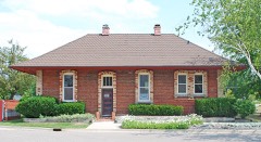 | Fenton Railroad Depot | 0.1 miles | 1983 |
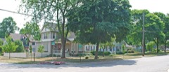 | Dibbleville-Fentonville Historic District | 0.4 miles | 1982 |
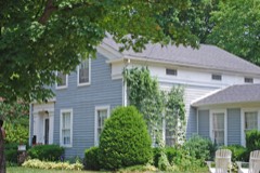 | Benjamin Bangs House | 0.6 miles | 1982 |
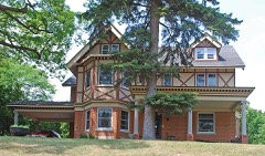 | Church, Volney-Carlos B. Shotwell House | 0.7 miles | 1982 |
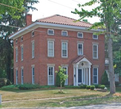 | David B. Colwell House | 0.7 miles | 1982 |
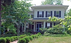 | Col. J. Hinckley House | 0.7 miles | 1982 |
| National Archives record | The nomination case file for reference 80001853 in Record Group 79. |
| Genesee County | All 73 listed properties in this county. |