BlockBefore
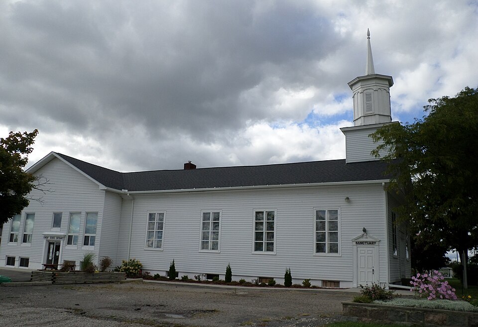
Photograph of First Baptist Church of Grand Blanc
Photograph by kennethaw88, CC BY 4.0. Via Wikimedia Commons.

First Baptist Church of Grand Blanc

Listed on the National Register of Historic Places in 1983.

From the record

“First Baptist Church of Grand Blanc is a historic church at 6106 S. Saginaw Street in Grand Blanc, Michigan.”

Wikipedia article First Baptist Church of Grand Blanc, CC BY-SA 4.0.

One of 73 National Register listings published here for Genesee County · listed in 1983 · category: Building.

Sources: the Wikipedia article · the case file at the National Archives · the National Register database, National Park Service

The listing

  • What is counted as historic. The nomination lists 1 building as contributing to the listing.
  • Address. 6101 S. Saginaw St., Grand Blanc, 48439
  • When was it listed? June 1983
  • Category. building
  • Also known as. Genesee County MRA
  • Charter township. Grand Blanc charter township
  • Architectural style. Greek Revival architecture
  • National Register reference number. 83000844 - the number the National Park Service assigned this property when it was listed, and the key its nomination file is catalogued under at the National Archives.

Fires near this property

41 since 2018

Regional context, not property-specific evidence. The federal wildfire occurrence database lists 41 fires within 5 miles of First Baptist Church of Grand Blanc between 2018 and 2020, burning about 42 acres in total. 9 started naturally. None was recorded as arson. Distance is straight-line from the map coordinates, so a fire counted here may appear on a neighbouring settlement's page as well.

Reported cause Fires
Equipment and vehicle use20
Missing data/not specified/undetermined9
Natural9
Debris and open burning2
Recreation and ceremony1

The most recent of them, most recent first, with the day each was reported and the service that recorded it.

DateCause SizeReported by Name on the report
9 September 2018Equipment and vehicle use1.0 acresMichigan Department of Natural ResourcesMUNDY TOWNSHIP FD 2018254 - 2018
7 September 2019Natural1.0 acresMichigan Department of Natural ResourcesCITY OF FLINT FD 0016180 - 2019
4 September 2019Equipment and vehicle use1.0 acresMichigan Department of Natural ResourcesCITY OF FLINT FD 0015960 - 2019
24 September 2019Missing data/not specified/undetermined1.0 acresMichigan Department of Natural ResourcesGRAND BLANC FD 12478 - 2019
3 August 2019Missing data/not specified/undetermined1.0 acresMichigan Department of Natural ResourcesBURTON CITY FIRE/RESCUE 0000266 - 2019
3 August 2019Missing data/not specified/undetermined2.0 acresMichigan Department of Natural ResourcesBURTON CITY FIRE/RESCUE 0000265 - 2019
25 August 2020Natural1.0 acresMichigan Department of Natural ResourcesGRAND BLANC FD 425 - 2020
10 August 2019Equipment and vehicle use1.0 acresMichigan Department of Natural ResourcesCITY OF FLINT FD 0014253 - 2019

Every fire recorded in Genesee County

Storms near this property

46 since 1994

Regional context, not property-specific evidence. The National Weather Service names Grand Blanc, the town this property stands in, in 46 storm reports between 1994 and 2025: 22 hail, 22 thunderstorm wind, 2 tornado. No death or injury is recorded in these reports. Each account below is quoted exactly as the forecast office filed it, from the NOAA Storm Events Database, and each date opens the federal record of that event.

WhenEvent Place namedHarm What the report says
February 2024Tornado (EF2)Grand Blanc$1,000,000The tornado touched down in Creasey Bicentennial Park damaging the south pavilion and uprooting a pine tree. The tornado tracked east northeast across Westminster Cir where multiple trees were snapped, two garage doors were blown out, and a roof was partially stripped from one home. The tornado continued tracking east northeast across Porter Rd and Reid Rd where multiple limbs and trees were snapped. The peak of damage occurred at an industrial complex at the intersection of Reid and S Dort Hwy. Damage to the complex included blown out non load bearing walls and loss of the majority of the roof. Peak winds were estimated at 115 mph. Multiple transmission poles were also snapped along S Dort Hwy. Damaged continued into the Indian Hill neighborhood near downtown Grand Blanc where multiple large trees were downed with some of them falling onto homes along Old Bridge Rd to Stonybrook Dr. The tornado tracked east northeast across Genesee Road to Belsay Rd snapping hardwood limbs and uprooting pine trees before greater damage occurred along Moonstone Dr and Brookview Dr. Damage in these areas included more widespread tree damage and one home with a garage door blown out and a roof partially uplifted. The tornado weakened and lifted shortly after it crossed Perry Rd.
May 2013Tornado (EF2)Grand Blanc$350,000The tornado was rated EF2 with a maximum wind speed of 130 mph. The maximum path width was 300 yards with a total path length of 4.6 miles. The tornado started near the intersection of Vassar Road and Pointe North Drive and continued to State Road near Perry Road. The greatest damage occurred near the intersection of Hegel Gale Roads. A house was nearly destroyed, along with a garage and external storage facilities wrecked.
May 2007Thunderstorm WindGrand Blanc$50,000A local newspaper article reported that a 60-foot-tall tree fell and struck a chimney, sending the chimney and roof crashing through two stories of a home. The family of four were home at the time and all avoided injury. The insurance company estimated that the total property damage was at least $50K.
May 1998Thunderstorm WindGrand Blanc$10,000no account filed
September 2014Thunderstorm WindGrand Blanc$5,000Grand Blanc Fire Department reported trees down and partial collapse of house on Crest Knoll Drive.
June 2014Thunderstorm WindGrand Blanc$5,000Multiple power lines reported down.
September 2016Thunderstorm WindGrand Blanc$3,000Several trees and wires reported down.
July 2007Thunderstorm WindGrand Blanc$3,000Law enforcement reported numerous small trees and 1 utility pole down.
March 2025Thunderstorm WindGrand Blanc-Numerous 8 to 10 inch diameter tree limbs down, along with power lines and a few smaller trees uprooted.
April 2022Thunderstorm WindGrand Blanc-Power lines were reported down.
June 2021Thunderstorm WindGrand Blanc-Numerous trees reported down across Grand Blanc.
July 2014Thunderstorm WindGrand Blanc-Two eight to ten inch tree limbs down, along with several three to four inch limbs.
September 2014Thunderstorm WindGrand Blanc-Four to six inch diameter tree branches and power poles reported down.
September 2014Thunderstorm WindGrand Blanc-Five inch diameter tree branch reported down.
June 2014Thunderstorm WindGrand Blanc-Large tree limb reported down.
September 2013Thunderstorm WindGrand Blanc-A couple of 12 inch diameter trees were reported down.
July 2012Thunderstorm WindGrand Blanc-A spotter estimated a 70 mph thunderstorm wind gust.
June 2009Thunderstorm WindGrand Blanc-A trained spotter measured a 69 mph thunderstorm wind gust.
May 2007Thunderstorm WindGrand Blanc-A trained spotter measured a 62 MPH wind gust.
August 2007Thunderstorm WindGrand Blanc-A trained spotter measured a 62 MPH wind gust.
March 2006HailGrand Blanc-Spotters reported hail accumulations 2 inches deep.
August 2006Thunderstorm WindGrand Blanc-A trained spotter measured a peak wind gust at 62 MPH.
May 2004Thunderstorm WindGrand Blanc-A trained weather spotter estimated a 80 mph thunderstorm wind gust.
August 2003Thunderstorm WindGrand Blanc-A trained weather spotter reported 5 inch tree limbs down.
May 2025HailGrand Blanc-no account filed
September 2013HailGrand Blanc-no account filed
July 2012HailGrand Blanc-no account filed
June 2009HailGrand Blanc-no account filed
June 2008HailGrand Blanc-no account filed
August 2008HailGrand Blanc-no account filed
July 2007HailGrand Blanc-no account filed
May 2006HailGrand Blanc-no account filed
August 2006HailGrand Blanc-no account filed
May 2003HailGrand Blanc-no account filed
May 2003Thunderstorm WindGrand Blanc-no account filed
August 2003HailGrand Blanc-no account filed
May 2001HailGrand Blanc-no account filed
July 2000HailGrand Blanc-no account filed
July 1999HailGrand Blanc-no account filed
June 1998HailGrand Blanc-no account filed
May 1997HailGrand Blanc-no account filed
September 1994HailGrand Blanc-no account filed

Every storm recorded in Genesee County

Map coverage status

No historic map-sheet match is published for this property yet. That does not mean no map exists. This record needs a coordinate-quality review before it can be joined to a sheet boundary. Browse the county's mapped places while that work is pending.

Listed places nearby

6 within 8 miles

Other National Register properties close enough to walk or drive between, ordered by distance from this one. Both positions come from the same geocoding pass that matched these properties to their map sheets.

Photograph PropertyDistance Listed
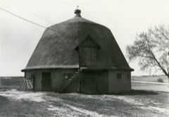
Flint Brewing Company4.5 miles1980
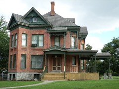
Morris A. Knight House5.1 miles1982
Atlas Grange Hall5.1 miles1982
Barn at 4277 Irish Road5.1 miles1982
Superintendent's Cottage5.2 miles1975
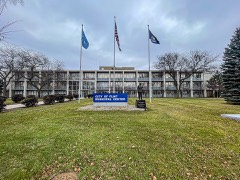
City of Flint Municipal Center5.2 miles2019

Sources for this property

National Archives recordThe nomination case file for reference 83000844 in Record Group 79.
Wikipedia articleCommunity-written account of this property, licensed CC BY-SA.
Genesee CountyAll 73 listed properties in this county.

Provenance

  • Listing record. National Park Service National Register of Historic Places, listed-properties dataset, current to 2026-05-22.
  • Map join. Address geocoded through the United States Census geocoder, then tested against the published boundary of every sheet in the USGS Historical Topographic Map Collection.
  • How this page is made. Listing fields come from federal records; map-sheet coverage is a labelled coordinate-to-boundary calculation, not a source-field claim.
  • Wildfire. Short, Karen C. 2022. Spatial wildfire occurrence data for the United States, 1992-2020 [FPA_FOD_20221014]. 6th Edition. Fort Collins, CO: Forest Service Research Data Archive. https://doi.org/10.2737/RDS-2013-0009.6 Collected with United States Government funding and usable without additional permissions or fees.
  • Storms. NOAA National Centers for Environmental Information, Storm Events Database https://www.ncei.noaa.gov/stormevents/ A work of the United States government, no copyright under 17 U.S.C. 105. Narratives are quoted verbatim from the National Weather Service report and are not edited or summarised.