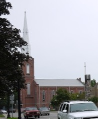
| May 2011 | Tornado (EF1) | Coldwater | $50,000 | A survey of damage was conducted in the Coldwater area. The damage found was consistent with a brief tornado touchdown within an area of wind damage around the touchdown location. The circulation touched down near U.S. 12 and Interstate 69, at 364 South Michigan Avenue. Major roof damage to a storage facility occurred, along with substantial tree damage. The garage door on the east side of a house was blown in just south of Woodward Drive. The tornado passed across Interstate 69 depositing debris on portions of the Interstate, causing brief lane closures. The damage was consistent with an EF1 with winds of around 90 mph. |
| June 2008 | Thunderstorm Wind | Coldwater | $25,000 | Emergency management officials reported numerous trees and power lines down across the county. |
| August 1998 | Thunderstorm Wind | Coldwater | $25,000 | TREES AND POWER LINES DOWN. |
| June 2008 | Thunderstorm Wind | Coldwater | $15,000 | Trees and power lines down were reported down in parts of the county, including the Coldwater area. |
| May 2024 | Hail | Coldwater | $15,000 | no account filed |
| August 2021 | Thunderstorm Wind | Coldwater | $10,000 | One to two foot diameter tree and several limbs down on a house causing gutter and siding damage. |
| May 2005 | Thunderstorm Wind | Coldwater | $10,000 | Semi truck blown over in Coldwater. Numerous trees and power lines down throughout the county as well. |
| May 1999 | Thunderstorm Wind | Coldwater | $10,000 | Utility poles and trees down in Coldwater. |
| July 1995 | Thunderstorm Wind | Coldwater | $10,000 | Trees blown down damaging vehicles and residential property. |
| August 1996 | Thunderstorm Wind | Coldwater | $10,000 | no account filed |
| August 2021 | Thunderstorm Wind | Coldwater | $5,000 | The public reports a large tree was downed onto a home. |
| June 2021 | Thunderstorm Wind | Coldwater | $5,000 | Large tree snapped and fell on house. |
| June 1994 | Thunderstorm Wind | Coldwater | $5,000 | Wind blew down trees across roadways, and caused a semi-tractor trailer to turn over in the ditch along Interstate 69 just south of Southern Road. |
| May 2004 | Thunderstorm Wind | Coldwater | $4,000 | Emergency management reported trees and power lines down in Coldwater. A barn was also blown over. |
| September 1997 | Thunderstorm Wind | Coldwater | $2,500 | A large tree was downed onto a home on Polk Street in Coldwater. |
| July 2005 | Thunderstorm Wind | Coldwater | $2,000 | Numerous trees and power lines were blown down in and around Coldwater. |
| October 2001 | Thunderstorm Wind | Coldwater | $2,000 | Law enforcement reported trees down and a barn destroyed near Coldwater. |
| May 1999 | Thunderstorm Wind | Coldwater | $2,000 | Trees reported blown down. |
| June 2022 | Thunderstorm Wind | Coldwater | - | A trained spotter reported five large trees down south of Coldwater. |
| June 2021 | Thunderstorm Wind | Coldwater | - | Tree limbs down along US-12. |
| August 2021 | Thunderstorm Wind | Coldwater | - | Trees downed on Union City Road and State Road. |
| June 2020 | Thunderstorm Wind | Coldwater | - | Trees and power lines down. Blocking Dorrance Road. |
| June 2020 | Thunderstorm Wind | Coldwater | - | Reported several trees and limbs down in an area from Coldwater to Quincy. |
| July 2019 | Thunderstorm Wind | Coldwater | - | Local dispatch officials reported trees across the road. Also, power lines were reported down on Mason Rd. |
| May 2019 | Thunderstorm Wind | Coldwater | - | Local media reported a one foot diameter tree was blown down onto a car. |
| May 2019 | Thunderstorm Wind | Coldwater | - | Local media reported trees uprooted and blown over with some power lines down. |
| May 2018 | Thunderstorm Wind | Coldwater | - | Emergency management officials reported a 14 inch diameter tree limb fell across a road. |
| May 2018 | Thunderstorm Wind | Coldwater | - | The Automated Weather Observation System at the Branch County Airport recorded a 73 mph wind gust. |
| April 2017 | Thunderstorm Wind | Coldwater | - | Trees were snapped or uprooted. |
| July 2016 | Thunderstorm Wind | Coldwater | - | The public reported several trees and tree limbs down onto power lines and some homes. |
| July 2015 | Thunderstorm Wind | Coldwater | - | Several trees down in and around the Coldwater area. Some trees and power lines onto vehicles or roadway. |
| July 2015 | Thunderstorm Wind | Coldwater | - | Tree downed across road. |
| July 2015 | Thunderstorm Wind | Coldwater | - | Tree downed across roadway. Power lines onto vehicle. |
| July 2014 | Thunderstorm Wind | Coldwater | - | Emergency management officials reported several trees down, blocking some roads. Several dead trees were also felled from the strong wind as well as tree limbs. |
| August 2011 | Thunderstorm Wind | Coldwater | - | Emergency management officials reported numerous trees down across the northern parts of the county. |
| September 2011 | Thunderstorm Wind | Coldwater | - | Emergency management officials reported a tree down onto a camper with two occupants. No injuries were reported. In addition, minor damage to cars and traliers in the area were reported from falling tree limbs. |
| September 2011 | Thunderstorm Wind | Coldwater | - | Emergency management officials estimated a 60 mph wind gust in Coldwater. |
| May 2011 | Thunderstorm Wind | Coldwater | - | Emergency management officials reported several trees down on US-12, just west of Coldwater. |
| May 2010 | Thunderstorm Wind | Coldwater | - | Emergency management officials reported numerous tree branches down. |
| June 2010 | Thunderstorm Wind | Coldwater | - | Emergency management officials reported numerous trees and tree limbs down in and around Coldwater. |
| June 2010 | Thunderstorm Wind | Coldwater | - | Widespread trees and power lines down in Coldwater, Sherwood, Girard and Bronson in Branch County. |
| July 2010 | Thunderstorm Wind | Coldwater | - | Law enforcement officials reported numerous trees and power lines down south of Coldwater. |
| July 2010 | Thunderstorm Wind | Coldwater | - | Emergency management officials reported numerous trees down across the northern part of Coldwater. |
| April 2008 | Hail | Coldwater | - | Amateur radio operators observed penny size hail at the Coldwater airport. |
| June 2006 | Thunderstorm Wind | Coldwater | - | Several trees blown down. |
| June 2006 | Thunderstorm Wind | Coldwater | - | 8 inch diameter tree broke off. |
| July 2006 | Thunderstorm Wind | Coldwater | - | A estimated wind gust to 60 mph was reported along with trees and tree limbs down. |
| June 2005 | Thunderstorm Wind | Coldwater | - | Tree limbs reported down. |
| June 2004 | Thunderstorm Wind | Coldwater | - | Emergency management reported trees down near Girard. |
| June 2004 | Thunderstorm Wind | Coldwater | - | Emergency management reported trees down near Kinderhook. |
| July 2004 | Thunderstorm Wind | Coldwater | - | Six trees reported blown down. Two power poles also blown down near US 12. |
| June 2004 | Thunderstorm Wind | Coldwater | - | Law enforcement reported numerous trees down in Coldwater. |
| July 2003 | Hail | Coldwater | - | Emergency management reported trees and power lines down in Litchfield. |
| July 2003 | Thunderstorm Wind | Coldwater | - | Law enforcement reported trees and power lines down in Coldwater. |
| July 2002 | Thunderstorm Wind | Coldwater | - | Law enforcement reported trees down in Coldwater. |
| June 2001 | Thunderstorm Wind | Coldwater | - | Trees down. |
| December 1998 | Thunderstorm Wind | Coldwater | - | SEVERAL TREES WERE BLOWN DOWN. |
| July 1998 | Thunderstorm Wind | Coldwater | - | WIND DAMAGE AND SEVERAL TREES DOWN IN TOWN. |
| July 1998 | Thunderstorm Wind | Coldwater | - | WIDESPREAD TREE AND POWER LINE DAMAGE COUNTYWIDE |
| June 1998 | Thunderstorm Wind | Coldwater | - | SEVERAL TREES BLOWN DOWN ACROSS COUNTY. |
 Block