 Block
From the record
17 National Register listings published here.
Sources: the National Register database, National Park Service
48 topographic sheets cover 29 settlements here, and 17 properties are on the National Register of Historic Places.
17 National Register listings published here.
Sources: the National Register database, National Park Service
Every property in this county listed on the National Register of Historic Places, with the year it was listed and the federal nomination document.
| Photograph | Property | Type | Listed | Reference |
|---|---|---|---|---|
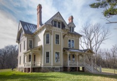 | Beardsley, Ezra E. and Florence (Holmes), House | building | 2015 | 15000157 |
| Capri Drive-In Theater | district | 2024 | 100010158 | |
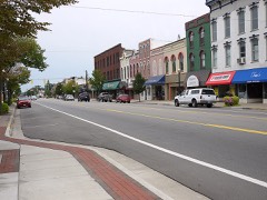 | Coldwater Downtown Historic District | district | 1990 | 90001124 |
 | Benedict Doll House | building | 1990 | 90001238 |
| East Chicago Street Historic District | district | 1975 | 75000937 | |
| East Chicago Street Historic District (Boundary Increase I) | district | 1990 | 90001129 | |
| East Chicago Street Historic District (Boundary Increase II) | district | 1990 | 90001130 | |
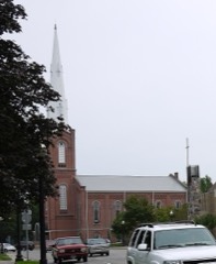 | First Presbyterian Church | building | 1986 | 86002111 |
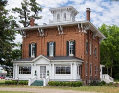 | Abram C. Fisk House | building | 1990 | 89002306 |
 | Lanphere-Pratt House | building | 1990 | 90001237 |
| Marshall Street Historic District | district | 1990 | 90001123 | |
 | South Monroe Street Historic District | district | 1990 | 90001121 |
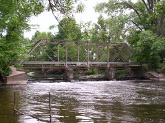 | Stancer-Road-North Coldwater River Bridge | structure | 1999 | 99001608 |
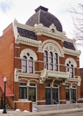 | Tibbits Opera House | building | 2019 | 100003577 |
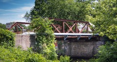 | US-12-Coldwater River Bridge | structure | 1999 | 99001609 |
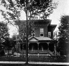 | West Pearl Street Historic District | district | 1990 | 90001122 |
 | Wing House | building | 1975 | 75000938 |
Every wildfire the federal occurrence database records inside this county: 76 of them, burning about 300 acres. 10 started naturally and none was recorded as arson. Each settlement page carries the fires within five miles of it.
| Reported cause | Fires |
|---|---|
| Equipment and vehicle use | 46 |
| Missing data/not specified/undetermined | 15 |
| Natural | 10 |
| Debris and open burning | 2 |
| Smoking | 2 |
| Recreation and ceremony | 1 |
The five largest, by the area the report gives. None of them was recorded as arson.
| Date | Cause | Size | Reported by | Name on the report |
|---|---|---|---|---|
| 21 April 2014 | Debris and open burning | 154 acres | Michigan Department of Natural Resources | BRANCH 0001 |
| 27 March 2019 | Equipment and vehicle use | 25 acres | Michigan Department of Natural Resources | QUINCY FD 38 - 2019 |
| 6 May 2019 | Natural | 22 acres | Michigan Department of Natural Resources | COLDWATER FD 487 - 2019 |
| 30 July 2019 | Missing data/not specified/undetermined | 12 acres | Michigan Department of Natural Resources | UNION CITY FD 0000039 - 2019 |
| 28 March 2019 | Equipment and vehicle use | 5.0 acres | Michigan Department of Natural Resources | BRONSON FD 0000097 - 2019 |
| 1 April 2019 | Equipment and vehicle use | 3.0 acres | Michigan Department of Natural Resources | BRONSON FD 0000103 - 2019 |
| 8 March 2020 | Equipment and vehicle use | 3.0 acres | Michigan Department of Natural Resources | QUINCY FD 32 - 2020 |
| 2 April 2019 | Equipment and vehicle use | 2.0 acres | Michigan Department of Natural Resources | BRONSON FD 0000106 - 2019 |
Every settlement page carries the fires within five miles of it - see the settlement index below.
The NOAA Storm Events Database holds 329 reports for this county, causing 22 deaths, 434 injuries and about $254,966,000 in recorded property damage. Each settlement page carries the reports that name it.
| Kind of event | Reports |
|---|---|
| Thunderstorm Wind | 233 |
| Hail | 72 |
| Tornado | 24 |
The most serious of them, by death, then injury, then recorded damage. The accounts are quoted exactly as the forecast office filed them.
| When | Event | Place named | Harm | What the report says |
|---|---|---|---|---|
| April 1965 | Tornado (F4) | not stated | 9 killed, 200 hurt, $250,000,000 | no account filed |
| April 1965 | Tornado (F4) | not stated | 9 killed, 200 hurt | no account filed |
| March 2026 | Tornado (EF3) | Sherwood | 3 killed, 12 hurt | The most intense and deadly tornado of the cyclic tornadic|supercell touched down in northwest Branch county, northwest of|Union Lake between Blossom Rd and Mendon Rd. This tornado was|well photographed from multiple angles, and it quickly turned|into a multi-vortex wedge. After destroying a pole barn and|damaging a residence, the tornado deposited a 500 gallon propane|tank in a field. Drone footage also showed ground scouring in the|same field. The tornado continued northeast and caused the most|widespread and intense damage along Prairie Rose Ln. Every|residence along this stretch was either heavily damaged or|completely destroyed. Tragically, three individuals lost their|lives here when their manufactured homes were lofted and tossed.|One of these trailers was well anchored and tossed approximately|100 yards, badly twisting the frame. Numerous vehicles were also|tossed in this area. The maximum peak intensity of 160 mph was|estimated to be at the corner of Tuttle Rd and Prairie Rose Ln.|This 2 story block home was completely destroyed. Construction|quality and older building codes of all homes in this area|contributed to their failure and precluded the survey team from|being able to rate higher than an EF-3. The tornado continued off|to the northeast into Union City producing EF-1 to EF2 damage|along the way before dissipating at the Branch/Calhoun county|line. Special thanks to the various subject matter experts on the|Quick Response Team that helped NWS Northern Indiana determine|this tornado's intensity. |
| April 1963 | Tornado (F1) | not stated | 1 killed, $25,000 | no account filed |
| March 1991 | Thunderstorm Wind | not stated | 18 hurt | no account filed |
| August 1995 | Thunderstorm Wind | Algansee Twp | 3 hurt, $5,000 | A tree blown over by thunderstorm winds struck a moving bus, entering the cab and front part of the vehicle and injuring the driver and two passengers. |
| May 1989 | Tornado (F1) | not stated | 1 hurt, $250,000 | no account filed |
| May 1986 | Tornado (F3) | not stated | $2,500,000 | no account filed |
| April 1996 | Hail | Bronson | $1,000,000 | no account filed |
| August 2024 | Thunderstorm Wind | Coldwater Arpt | $150,000 | Damage to a mobile home park. Healthy trees around 1 foot in diameter downed. Some trees fell onto cares and home causing structural damage. |
| August 2024 | Thunderstorm Wind | Coldwater Arpt | $150,000 | Widespread tree damage to a mobile home park southwest of Coldwater. |
| April 2025 | Tornado (EF1) | East Gilead | $100,000 | Damage survey from the National Weather Service along with Steuben County EMA found damage consistent with a tornado that touched down on the south side of Orland, IN. The tornado destroyed an old, small barn on the south side, before uprooting and snapping several trees and a communications pole in east Orland. The tornado damaged the roof of an apartment building, including ripping up the wood sheathing on the south end of the building. Non-conclusive, likely rear flank downdraft winds severely damaged a large barn at N 900 W and W State Rd 120 and a set of trees just off to the east. Across the street, a dozen or so trees were uprooted or snapped in a cemetery. Tree damage was also noted in the adjacent tree line. The tornado reached max width at the border of IN/MI where a large swath of significant tree damage occurred to a piece of property owned by the Indiana Toll Road. A semi-truck was reported to be blown over on the Toll Rd. The tornado crossed into Michigan with intermittent light structural and tree damage occurring near East Gilead and extending northeastward. The tornado reached maximum intensity of 105 mph (EF-1) when it struck a farm on E Pearl Road, tearing roofs off large silos, destroying a section of barn, driving 2x4 into the nearby home, and destroying another out building to the west. |
| April 2025 | Tornado (EF1) | East Gilead | $50,000 | Within the same parent cell as the Orland tornado, a NWS survey found a secondary tornado occurred in Branch County Michigan. Tree damage was first noted between W Southern Rd and Booth Rd. The tornado traveled northeast and then northerly, causing damage to multiple Amish buildings, many of which had already been repaired and debris cleaned up. Minor roof damage was noted to a barn on Cranson Rd. The tornado caused the most significant damage on W Pearl Rd west of Bethel where numerous large healthy trees were snapped or uprooted. Damage was also noted to a home, but repairs were completed prior to the survey. Maximum wind speeds were estimated at up to 100 mph based on the tree and limited structure damage that could be assessed. |
| May 2011 | Tornado (EF1) | Coldwater | $50,000 | A survey of damage was conducted in the Coldwater area. The damage found was consistent with a brief tornado touchdown within an area of wind damage around the touchdown location. The circulation touched down near U.S. 12 and Interstate 69, at 364 South Michigan Avenue. Major roof damage to a storage facility occurred, along with substantial tree damage. The garage door on the east side of a house was blown in just south of Woodward Drive. The tornado passed across Interstate 69 depositing debris on portions of the Interstate, causing brief lane closures. The damage was consistent with an EF1 with winds of around 90 mph. |
| August 2021 | Thunderstorm Wind | Quincy | $35,000 | A tree and large branches down with extensive damage to a fifth wheel trailer. |
| August 2022 | Thunderstorm Wind | Kinderhook | $30,000 | Large branches up to a foot in diameter were downed. Boat lifts were twisted and a boat dock was flipped over. |
| July 2023 | Tornado (EF1) | Sherwood | $25,000 | A tornado quickly developed almost directly over a storage facility on the east side of Colon in St. Joseph county. Garage doors were blown in and then a significant loss of roof decking and metal covering occurred. This wood and metal debris was lofted, twisted, and deposited both to the east and north up to 200 yards away in nearby fields. The tornado crossed into Branch county with sporadic tree damage noted on Ambs Road, South Culver Road, and Jackson Road, where large branches were down, trees uprooted, or trees were snapped several feet off the ground. The tornado topped a number of trees within a tree grove east of Jackson Road, but south of Wattles |Road before dissipating. The tornado was on the ground for 0.9 miles in St Joseph county and 2.0 miles in Branch county for a total of 2.9 miles in length. |
| June 2008 | Thunderstorm Wind | Coldwater | $25,000 | Emergency management officials reported numerous trees and power lines down across the county. |
| August 1998 | Thunderstorm Wind | Coldwater | $25,000 | TREES AND POWER LINES DOWN. |
| August 1998 | Thunderstorm Wind | Batavia | $25,000 | SEVERAL TREES AND POWER LINES DOWN IN TOWN. |
| August 1998 | Thunderstorm Wind | Kinderhook | $25,000 | LOTS OF TREES AND POWER LINES DOWN. |
| August 1997 | Thunderstorm Wind | East Long Lake | $25,000 | Thunderstorm winds stripped the tops off 3-4 mature maple trees and 5 cottages along East Long Lake received minor damage. |
| May 1986 | Tornado (F1) | not stated | $25,000 | no account filed |
| March 1983 | Tornado (F1) | not stated | $25,000 | no account filed |
| June 1983 | Tornado (F2) | not stated | $25,000 | no account filed |
| March 1976 | Tornado (F2) | not stated | $25,000 | no account filed |
| May 1975 | Tornado (F2) | not stated | $25,000 | no account filed |
| April 1974 | Tornado (F1) | not stated | $25,000 | no account filed |
| May 1954 | Tornado (F1) | not stated | $25,000 | no account filed |
| December 2007 | Thunderstorm Wind | Bronson Arpt | $20,000 | Numerous trees tree limbs and utility lines throughout the county. |
| November 2005 | Thunderstorm Wind | Quincy | $20,000 | Utility poles were blown down in the area. |
| June 2008 | Thunderstorm Wind | Coldwater | $15,000 | Trees and power lines down were reported down in parts of the county, including the Coldwater area. |
| May 2024 | Hail | Coldwater | $15,000 | no account filed |
| July 2023 | Thunderstorm Wind | Union City | $10,000 | Trees and powerlines down in Union City. Highway M60 is impassable in spots, closed by state police. |
| August 2021 | Thunderstorm Wind | Coldwater | $10,000 | One to two foot diameter tree and several limbs down on a house causing gutter and siding damage. |
| May 2010 | Thunderstorm Wind | Quincy | $10,000 | Emergency management officials reported a tree down in the Quincy area. In addition, a transformer and power lines were down as a result of a snapped utility pole. Damage is estimated at around $10,000. |
| June 2010 | Thunderstorm Wind | Bronson Arpt | $10,000 | Law enforcement reported widespread power outages and a tree that fell on a car. |
| July 2008 | Thunderstorm Wind | Bronson | $10,000 | Emergency management officials reported several trees and some power lines down in the Burr Oak area. |
| July 2008 | Thunderstorm Wind | Bronson Arpt | $10,000 | Emergency management officials reported trees and power lines down in the Bronson area. |
| June 2007 | Thunderstorm Wind | Girard | $10,000 | A large tree was blown down onto power lines 6 miles north of Coldwater. Dime size hail was also reported in the area. |
| May 2005 | Thunderstorm Wind | Coldwater | $10,000 | Semi truck blown over in Coldwater. Numerous trees and power lines down throughout the county as well. |
| October 2001 | Thunderstorm Wind | Sherwood | $10,000 | Law enforcement reported large power poles down with damage to roofs on a barn and an outbuilding. |
| May 1999 | Thunderstorm Wind | Coldwater | $10,000 | Utility poles and trees down in Coldwater. |
| June 1999 | Thunderstorm Wind | Kinderhook | $10,000 | SKYWARN spotter reported power lines downed on north side of Lake George. A three-foot diameter tree fell onto a garage. Parts of roofs also were damaged. |
| July 1997 | Thunderstorm Wind | County-Wide | $10,000 | Scattered reports of trees and power lines down across portions of western Branch County. |
| May 1997 | Thunderstorm Wind | Sherwood | $10,000 | Branch County Central Dispatch and Road Commission reported downed trees and power lines in Sherwood Township, in the northwest part of the county. A recreational trailer, parked on the side of the road on Division Street was torn open and the contents were strewn several yards. Some minor damage was done to mobile homes. Several trees and large limbs were downed along Sherwood Road. Extensive damage was done to a nature trail at Sherwood Elementary School. |
| July 1995 | Thunderstorm Wind | Coldwater | $10,000 | Trees blown down damaging vehicles and residential property. |
| August 1996 | Thunderstorm Wind | Union City | $10,000 | no account filed |
| August 1996 | Thunderstorm Wind | Hodunk | $10,000 | no account filed |
| August 1996 | Thunderstorm Wind | Coldwater | $10,000 | no account filed |
| June 2025 | Thunderstorm Wind | Bronson Arpt | $5,000 | A couple reports of large trees and branches down around Branch county. |
| August 2021 | Thunderstorm Wind | Coldwater | $5,000 | The public reports a large tree was downed onto a home. |
| June 2021 | Thunderstorm Wind | Coldwater | $5,000 | Large tree snapped and fell on house. |
| June 1994 | Thunderstorm Wind | Coldwater | $5,000 | Wind blew down trees across roadways, and caused a semi-tractor trailer to turn over in the ditch along Interstate 69 just south of Southern Road. |
| April 1993 | Thunderstorm Wind | Bronson | $5,000 | A thunderstorm wind gusts of nearly 60 mph caused damage to a house roof in Bronson. |
| October 1996 | Thunderstorm Wind | East Gilead | $5,000 | no account filed |
| May 2004 | Thunderstorm Wind | Coldwater | $4,000 | Emergency management reported trees and power lines down in Coldwater. A barn was also blown over. |
| August 1997 | Thunderstorm Wind | Kinderhook | $2,500 | A National Weather Service spotter reported several 4 to 5 inch diameter limbs downed 5 miles north of Kinderhook. |
| September 1997 | Thunderstorm Wind | Coldwater | $2,500 | A large tree was downed onto a home on Polk Street in Coldwater. |
| April 1991 | Tornado (F0) | not stated | $2,500 | no account filed |
The Survey's mineral resources record lists 11 workings inside this county. 4 still produce and 7 are closed or unrecorded. Each settlement page carries the workings within five miles of it.
| Commodity | Workings |
|---|---|
| Sand and Gravel, Construction | 7 |
| Clay | 2 |
| Molybdenum, Tungsten | 1 |
| Copper, Nickel | 1 |
| Limestone, General | 1 |
The least common of them first, because a county's hundredth gravel pit says nothing its first ten did not.
| Where | Site | Commodity | Status | Recorded |
|---|---|---|---|---|
| Amax Specialty Metals-Coldwater, Mi | Molybdenum, Tungsten, Copper, Nickel | Producer | ||
| Harmon Marl Quarry | Limestone, General | Past Producer | ||
| Peerless Prtlnd Cmnt Co Shale Pit | Clay | Past Producer | ||
| Wolverine Prtlnd Cmt Co Shale Pit | Clay | Past Producer | ||
| 47 Garfield Pit | Sand and Gravel, Construction | Producer | ||
| Baggley Pit | Sand and Gravel, Construction | Past Producer | ||
| Branch County Pit | Sand and Gravel, Construction | Producer | ||
| Certified Sand and Gravel | Sand and Gravel, Construction | Producer | ||
| Thompson Pit | Sand and Gravel, Construction | Unknown | ||
| Waterbury No 1 Pit & Mill | Sand and Gravel, Construction | Past Producer | ||
| Yerington Pit | Sand and Gravel, Construction | Past Producer |
Named settlements recorded in the Geographic Names Information System, each with the topographic sheets covering it. Villages, hamlets and abandoned places alike. Each is shown with the nearest named watercourse or landform and the survey quadrangle it falls on.
Kinderhook township · 49036 · Near Iyopawa Island · California quadrangle
10 sheets, 1953 to 1990
Algansee township · 49082 · On Fisher Creek · Coldwater East quadrangle
10 sheets, 1953 to 1990
Girard township · 49036 · On South Branch Hog Creek · Burlington quadrangle
14 sheets, 1918 to 1982
Ovid township · 49036 · Near Iyopawa Island · California quadrangle
10 sheets, 1953 to 1990
Ovid township · 49036 · Near Iyopawa Island · California quadrangle
10 sheets, 1953 to 1990
Sherwood township · 49089 · On Spencer Creek · Union City quadrangle
14 sheets, 1918 to 1982
Union township · 49094 · On Coldwater River · Union City quadrangle
14 sheets, 1918 to 1982