| May 1965 | Tornado (F4) | not stated | 3 killed, 175 hurt, $25,000,000 | no account filed |
| June 1951 | Tornado (F4) | not stated | 1 killed, 9 hurt, $2,500,000 | no account filed |
| June 1952 | Tornado (F2) | not stated | 9 hurt, $2,500,000 | no account filed |
| July 1983 | Tornado (F4) | not stated | 4 hurt, $25,000 | no account filed |
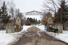
| July 2011 | Thunderstorm Wind | East Bethel | 3 hurt, $500,000 | A large area of eastern Anoka County received damage from severe straight line winds that moved from west to east across the area between 1850 to 1900 CST. Damage includes power lines, railroad crossing gates, personal property and trees. Three injuries occurred near Linwood at Camp Ajawah. A spotter measured 69 mph in the eastern part of East Bethel, or 2 miles north-northwest of Linwood. |
| July 1966 | Tornado (F1) | not stated | 3 hurt, $250,000 | no account filed |
| May 2008 | Tornado (EF1) | Coon Rapids | 2 hurt, $700,000 | Tornado touched down in the northeast corner of the intersection of Highway 10 and Main Street, and moved southeast. It lifted off in central Blaine, near the TPC Golf Club, just east of Highway 65 and north of 109th Avenue. Numerous trees were toppled or snapped, and some roof damage was also detected. One home was pushed off its foundation. A number of sheds and garages were destroyed. Two people in the parking lot at Kohl's in the Riverdale Village Shopping Center in Coon Rapids were picked up and blown over by the tornadic winds. In Blaine, one of the hardest hit areas was 118th Avenue, where extensive damage was incurred to several roofs, residential siding, and garages in the area. Several reports of damage were provided by the Coon Rapids Herald, the Blaine and Spring Lake Park Sun Focus, and other local newspapers. |
| July 1970 | Tornado (F1) | not stated | 2 hurt, $25,000 | no account filed |
| August 1996 | Thunderstorm Wind | Fridley | 2 hurt | no account filed |
| September 2005 | Tornado (F2) | Coon Rapids | 1 hurt, $5,000,000 | A damage survey determined that the tornado touched down in the east central portion of Coon Rapids, only a few blocks west of the border with Blaine. It traveled east-southeast causing mostly F0 to F1 damage at first, but strengthened to F2 status near the intersection of Jefferson Street and 104th Court. The tornado dissipated only 1/4 mile west of the National Sports Center complex. Ten homes were rendered uninhabitable, and thirty others were damaged to a lesser extent. A woman suffered minor injuries when she was blown from the upper story of her home into a tree. |
| July 2011 | Thunderstorm Wind | Nowthen | 1 hurt, $500,000 | A large area of western Anoka County received damage from severe straight line winds that moved from west to east across the area between 1830 to 1850 CST. Damage included power lines, railroad crossing gates, personal property and trees. One injury occurred as a parade and other activities were happening during the onset of the storm near Coon Rapids. The main damage occurred from near Nowthen, east and southeast to Oak Grove, Coon Rapids, Anoka, Fridley, and Spring Lake Park. |
| May 2014 | Lightning | Ham Lake | 1 hurt | A woman was struck by lightning while watching an outdoor baseball game. She was sent to the hospital and recovered from her injuries. |
| June 2005 | Lightning | East Bethel | 1 hurt | A 14-year-old boy was indirectly struck by lightning in the basement of a home near the intersection of 170th and Bender in Section 11 of Columbus Township. He was reaching for a glass on a table when he saw a blue flash by his feet and felt a sudden pain in his back. He was taken to a local hospital for evaluation. The time was estimated. |
| September 2005 | Thunderstorm Wind | Countywide | $85,000,000 | Two destructive storms swept across Anoka County, knocking over tens of thousands of trees, blowing roofs off houses, and producing large hail and two tornadoes. See separate reports for the hail and tornadoes. One storm moved across northwestern and central Anoka County, and the other tracked across southern Anoka County. The property damage report of $85 Million dollars covers all damage from wind and hail in Anoka County on 9-21-05. Many cities declared a state of emergency.The first storm knocked down three foot diameter trees in Ramsey and tipped over vehicles at an RV dealership. In Andover, several homes had roofs completely blown off, where the strongest downburst winds were estimated to have reached 85 knots. Numerous garages and sheds were blown apart. A portion of a gym roof was torn off at a school. About 10% of roads were blocked by fallen trees. The storm also moved across Coon Rapids, where 500 trees were felled at Bunker Hills Golf Course, the roof was blown off an office building, a fourplex had its roof partially blown off, and the Riverview neighborhood was "smothered" in downed trees. This storm was accompanied by two tornadoes, one in Andover and another tracking from Coon Rapids to Blaine (see separate tornado entries). The F0 tornado in Andover produced very little damage, but was accompanied by a very strong rear flank downdraft, which did the vast majority of the damage in Andover.The second storm tracked across southern Anoka County, affecting Fridley the most. This was the storm that produced significant damage over Hennepin County, and later on, Ramsey County. In Fridley, several thousands of trees were toppled, causing structural damage to about 400 homes. Many roads were blocked and about 90% of the city lost power. Three people were injured when clearing fallen trees. A damage survey revealed both inflow and downburst damage as the mesocyclone tracked over Fridley. Spring Lake Park and Columbia Heights also saw hundreds of downed trees, some on houses and across roads. |
| May 1965 | Tornado (F4) | not stated | $25,000,000 | no account filed |
| August 2006 | Hail | Anoka | $20,000,000 | Numerous car windows were smashed out, along with damaged building roofs. One State Farm claims adjuster said she processed "58 claims in 45 minutes". An Anoka County Sheriff said three city vehicles were put out of commission. As reported by the Pioneer Press newspaper. All vehicles parked on the top level of the government center ramp were damaged. There was one unofficial report of 3.0 inch hail at 1255 CST near Sunny Acres Park in Anoka. Damage total includes all storm reports from August 24 in Anoka County. |
| July 1986 | Tornado (F2) | not stated | $2,500,000 | no account filed |
| September 2016 | Flash Flood | Lexington | $1,000,000 | Flood waters caused numerous roads to become impassable on either side of University Avenue, between Highway 610 at Coon Rapids Blvd, and I-694. Water was several feet deep in far northern Fridley, with significant damage at the SpringBrook apartments, where flood waters entered seven of the nine buildings and adjacent garages, resulting in damage to many dozens of apartments. Other homes and buildings in the area also had flood waters inside their structures. |
| May 1998 | Tornado (F1) | Lino Lakes | $1,000,000 | See narrative for Ramsey County. |
| May 1998 | Hail | Coon Rapids | $1,000,000 | Scattered damage to houses from wind driven hail. |
| May 1998 | Hail | Fridley | $1,000,000 | Scattered damage from wind driven hail. |
| June 2017 | Hail | Circle Pines | $650,000 | Windows broken due to wind-driven hail. |
| May 1998 | Thunderstorm Wind | Spring Lake Park | $600,000 | Roof ripped off apartment building. |
| May 2011 | Tornado (EF1) | Fridley | $500,000 | An EF-1 tornado continued into Anoka County from the Camden Bridge along the Mississippi River, north-northeast to the east side of Fridley, to Spring Lake where it moved into Ramsey County. ||Damage was extensive along the path where it moved into a rail yard and a large industrial facility. A large metal building roof was ripped off in the industrial area, and eight train cars were tipped over where EF-1 damage was observed. Several warehouses sustained damaged along Miami Street where a roof was blown off. ||The tornado then moved across residential sections of Fridley, before it weakened as it continued northeast across the east side of Fridley, near Spring Lake. Damage was confined to trees blown down along the path, then moved into Ramsey County. |
| July 2011 | Flash Flood | Fridley | $500,000 | Several main highways, and secondary roads had significant flooding, with up to four feet of standing water in southern Anoka County. A train was derailed near Fridley due to the excessive rainfall that caused erosion along a culvert. |
| August 2011 | Flash Flood | Lexington | $500,000 | Due to excessive runoff from heavy rainfall, the intersection of Highway 65 and 81st Street in Spring Lake Park, Minnesota, was impassable. Also, significant flooding was reported along University Avenue between Osborne, and 73rd Street, and west of the Northtown Shopping Center. |
| June 2011 | Tornado (EF0) | Lexington | $500,000 | An EF-0 tornado touched down near the intersection of Highway 10 and Central Avenue in Blaine, then traveled approximately 6.1 miles northwest to one half mile northwest of the intersection of County Highway 14, and Hanson Boulevard in Coon Rapids. It had maximum wind speeds of 70 to 80 mph. Most of the damage was associated with trees and power lines blown down along the path length. Some damage occurred when trees fell on homes. |
| May 2008 | Tornado (EF3) | Centerville | $300,000 | The tornado touched down on the eastern side of Lino Lakes, at the eastern shore of Peltier Lake. The tornado felled trees and lifted boat docks, then tracked east and crossed Interstate 35E. As this occurred, a few barns, grain bins, and silos were damaged. The tornado then intensified as it moved into northwestern Washington County and a subdivision (Creekview Preserve), about two miles north of downtown Hugo. It was at this point (around 16:01), that the twister caused EF-3 damage. The tornado dissipated in the eastern portion of Hugo, just north of Irish Avenue and 140th Street. Seven hundred and ninety four homes, including mobile homes, were affected by the storm in some way. A total of 91 homes sustained minor structural damage, numerous broken windows, and damage to small sections of roof. Twenty seven homes were destroyed, totally collapsed, or not economically feasible to repair. A two year old boy in Washington County (see corresponding entry) died after being blown out of the first floor of his home in Creekview Preserve. A 62 year old woman in Washington County died an indirect death due to a heart attack during cleanup in Hugo a few days later. Some important information provided by the Pioneer Press, Star Tribune, and other local newspapers. |
| June 2013 | Thunderstorm Wind | Coon Rapids | $100,000 | Dozens of trees were downed, many across roads, on power lines, houses, and vehicles. Most of the damage was in Columbia Heights with some in Fridley, but extended as far north as Coon Rapids. |
| May 2011 | Tornado (EF0) | Anoka Co Blaine Arpt | $100,000 | An EF-0 continued into Anoka County, and dissipated on the south side of the Blaine-Anoka County Airport. Damage was confined to several hangers on the airport grounds, that had their exterior walls damaged. |
| May 2001 | Thunderstorm Wind | Andover | $100,000 | Large trees and sheds blown down along 1.5 mile path within Andover per NWS damage survey. Minor house damage. |
| July 1997 | Thunderstorm Wind | Coon Rapids | $100,000 | 200 trees blown down on Bunker Hills golf course. 20 corporate tents in preparation for upcoming senior PGA event destroyed. Roof damage also reported. |
| August 1995 | Thunderstorm Wind | Anoka | $60,000 | Multiple roofs damaged. Polebarn destroyed. |
| July 2019 | Thunderstorm Wind | Anoka | $50,000 | Several trees were blown down between Anoka, Coon Rapids, Andover and Blaine. In addition to the trees, several power lines and street signs were damaged. There were also reports of minor tree damage around Lino Lakes, Fridley, Oak Grove and Lexington. |
| May 2012 | Thunderstorm Wind | Lexington | $50,000 | There were numerous reports of downed trees and power lines throughout Blaine. In addition, a boat was overturned on an area lake, and a tree landed on a car. |
| May 2011 | Tornado (EF0) | Ham Lake | $50,000 | An EF-0 tornado briefly touched down near 155th Street Northeast, and County Highway 17 east of Ham Lake. Damage was confined to trees blown down and a few shingles ripped off homes. |
| September 2006 | Tornado (F0) | Ramsey | $50,000 | The tornado that tore through northern Hennepin County crossed into Anoka County, tracking for one mile in the city of Ramsey before dissipating. The tornado was rated F2 based on damage in Hennepin County, but in Anoka County, it was rated F0. The maximum width in Anoka County was 25 yards, but the maximum width of the tornado was 100 yards in Hennepin County. |
| June 2017 | Hail | Lino Lakes | $25,000 | The hail broke numerous windows around Blaine. |
| July 2016 | Lightning | Coon Rapids | $25,000 | A roof was struck by lightning, causing fire and smoke damage to a home in Coon Rapids, along Mississippi Blvd. |
| May 2012 | Thunderstorm Wind | Spring Lake Park | $25,000 | There were numerous reports of trees blown down from Fridley, to Spring Lake Park. In addition, two trees landed on a mobile home in Fridley. |
| July 2011 | Tornado (EF0) | East Bethel | $25,000 | A brief tornado touched down on Coon Lake, East of East Bethel. Damage occurred to a boat and the boat dock. |
| June 2010 | Thunderstorm Wind | Johnsville | $25,000 | At 242nd Street and Highway 65, several large trees, up to one foot in diameter were blown down near Blaine, Minnesota. |
| July 2010 | Thunderstorm Wind | Johnsville | $25,000 | A 20-24 inch diameter tree was blown down near the intersection of Highway 242 and Highway 65, northeast of Blaine, Minnesota. In addition, several 18-24 inch diameter trees were blown down at the Blaine City Hall on Radisson Road. |
| May 1965 | Tornado (F0) | not stated | $25,000 | no account filed |
| September 1965 | Tornado (F1) | not stated | $25,000 | no account filed |
| August 2009 | Thunderstorm Wind | Circle Pines | $20,000 | A storm survey determined that thunderstorm wind gusts of nearly 65 mph caused two dozen trees to be blown down in the City of Lexington, and also in extreme southeast Blaine, from the intersection of Restwood Road and Syndicate Avenue, to just west of 85th Avenue and Lexington Avenue. All trees were toppled from north to south. |
| September 2019 | Thunderstorm Wind | Coon Rapids | $15,000 | The local emergency manager indicated that the worst damage in the entire county was around Coon Rapids and Blaine. There were numerous trees blown down in the area, and reports of a few metal poles, and power lines that were blown down. |
| May 2014 | Lightning | Ham Lake | $15,000 | A house was struck by lightning during the afternoon of Saturday, May 31st. The house sustained some damage. |
| May 2018 | Thunderstorm Wind | Blaine | $10,000 | A severe down burst wind caused numerous large trees, up to 70 inches in diameter, to blow down near the intersection of 125th Ave NE, and Radisson Road NE. This is where the large tree fell on an outhouse at the Pioneer Park. Several power poles and lines were knock down, causing sporadic power outages across the northeast part of the metro area. |
| May 2018 | Thunderstorm Wind | Blaine | $10,000 | A severe down burst wind caused several large trees to blow down near the intersection of 128th Ave NE, and Harper Street. Several power poles and lines were knock down, causing sporadic power outages across the northeast part of the metro area. |
| August 2018 | Lightning | Linwood | $10,000 | A structure was struck by lightning, south of Linwood. |
| June 2013 | Thunderstorm Wind | Linwood | $10,000 | Several trees and power lines were blown down, some in the eastern part of East Bethel, but mostly in the northern part of the city of Columbus. |
| July 2010 | Thunderstorm Wind | Anoka | $10,000 | A railroad gate crossing was damaged on Main Street, east of Anoka, Minnesota. |
| September 2013 | Thunderstorm Wind | Andover | $5,000 | A metal stoplight was blown down at the intersection of Hanson Blvd, and Bunker Lake Blvd, in Andover. |
| June 2005 | Flash Flood | Countywide | $5,000 | Highway 10 was closed by flooding in Anoka. The city storm sewer system in Anoka was overwhelmed by heavy downpours and as a result water gushed out of manhole covers. Road flooding caused stalled vehicles in portions of the county. |
| August 1994 | Thunderstorm Wind | not stated | $5,000 | Several buildings were damaged by strong winds. |
| July 2012 | Thunderstorm Wind | St Francis | $3,000 | A tree was blown down and landed on a power line. |
| August 2021 | Thunderstorm Wind | Columbia Heights | $2,000 | A few minor tree limbs blew down near Blaine and Columbia Heights as strong gusty winds moved across the county. One of the tree limbs landed on a power line, and another caused a fire. |
| May 2012 | Thunderstorm Wind | East Bethel | $2,000 | Several power lines were blown down near East Bethel, Minnesota. |
| May 2022 | Thunderstorm Wind | Spring Lake Park | $500 | A street sign was damaged, and a large tree was blown down in a grocery store parking lot. |
 Block