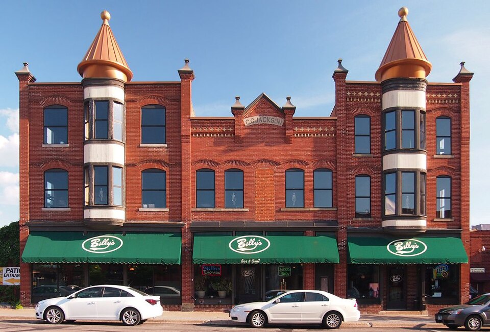
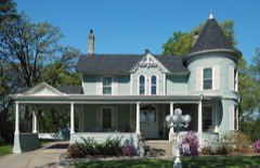
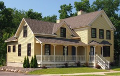
National Register reference number.78001525- the number the National Park Service assigned this property when it was listed, and the key its nomination file is catalogued under at the National Archives.
The ground it stands on
35,570 words
The chapter on Anoka City in With the Colors from Anoka County, published 1919 names Anoka. This is what it says, exactly as the scans read.
Captain Arthur L. Reed, Company "A" of Anoka, was directed to call his company for active duty and to get eight light trucks somewhere. He secured ten, had a local garage opened, filled up the machines with gas and oil, and, in an hour and a half was on the way to Moose Lake. The trip was indeed a strenuous one. The night was cold, the roads were rough and the air was so saturated with fog and smoke that cars were not visible ten or fifteen feet apart. The company traveled all night and well into the next morning, arriving at Moose Lake in time to be, by several hours, the first motor unit in the state to reach the scene of the disaster. Untiring press agents of other units have sought to claim the credit for having been first on the scene of disaster and have gained a great deal of publicity for their organizations. However, the above are the facts presented for the information of those who prefer the facts.
The generous people of Anoka could be depended upon not to overlook this opportunity to aid the suft'ering refugees. Mayor Berry requested George D. Hilliard to take up a collection. He did so and the money was sent to Governor Burnquist for relief work. Anoka was again the first on the job in this matter, and a Duluth paper found its way into the fire district and told the people there that Anoka had extended the hand of sympathy with more than a thousand dollars for them. If the givers of this money could have been at the little Village of Automba a few days after, where every sign of human habitation had been destroyed, and heard some of the refugees who had lost their all, thank an Anoka officer of the Home Guard for what they had just read about Anoka's generositj^ they would have felt well repaid for their kindly impulse.
Regional context, not property-specific
evidence. The
federal wildfire occurrence database
lists 51 fires within 5 miles of Jackson Hotel
between 1998 and 2019, burning about 840 acres in total. None started naturally. 15 were recorded as arson.
Distance is straight-line from the map coordinates, so a fire counted
here may appear on a neighbouring settlement's page as well.
Reported cause
Fires
Arson/incendiarism
15
Railroad operations and maintenance
13
Missing data/not specified/undetermined
8
Debris and open burning
6
Equipment and vehicle use
4
Recreation and ceremony
3
Fireworks
1
Smoking
1
The most recent of
them, most recent first, with the day each was reported and the service
that recorded it.
Regional context, not property-specific
evidence. The federal mineral resources record lists
2 workings within 5 miles of Jackson Hotel: 1 occurrence, 1 producer.
1 still produces. What was taken out: Limestone, General, Sand and Gravel, Construction. Distance is straight-line from the
map coordinates, so a quarry counted here may appear on a neighbouring
settlement's page as well.
Regional context, not property-specific
evidence. The National Weather Service names
Anoka, the town this property stands in, in 33 storm reports between 1995 and 2024: 18 hail, 14 thunderstorm wind, 1 heavy rain.
No death or injury is recorded in these reports. Each account below is quoted exactly as the forecast office
filed it, from the NOAA Storm Events Database, and each date
opens the federal record of that event.
Numerous car windows were smashed out, along with damaged building roofs. One State Farm claims adjuster said she processed "58 claims in 45 minutes". An Anoka County Sheriff said three city vehicles were put out of commission. As reported by the Pioneer Press newspaper. All vehicles parked on the top level of the government center ramp were damaged. There was one unofficial report of 3.0 inch hail at 1255 CST near Sunny Acres Park in Anoka. Damage total includes all storm reports from August 24 in Anoka County.
Several trees were blown down between Anoka, Coon Rapids, Andover and Blaine. In addition to the trees, several power lines and street signs were damaged. There were also reports of minor tree damage around Lino Lakes, Fridley, Oak Grove and Lexington.
A storm survey was performed and drone video from the Sheriff's Office was viewed to determine that this part of Anoka was hit by a downburst. Over 100 trees were broken or uprooted, some of which fell on houses, sheds, and vehicles.
No historic map-sheet match is published
for this property yet. That does not mean no map exists. This record needs
a coordinate-quality review before it can be joined to a sheet boundary.
Browse the county's mapped places while that work is
pending.
Listed places nearby
6 within 8 miles
Other National Register properties close
enough to walk or drive between, ordered by distance from this one. Both
positions come from the same geocoding pass that matched these properties
to their map sheets.
Listing record. National Park Service National Register of Historic Places, listed-properties dataset, current to 2026-05-22.
Map join. Address geocoded through the United States Census geocoder, then tested against the published boundary of every sheet in the USGS Historical Topographic Map Collection.
How this page is made. Listing fields come from federal records; map-sheet coverage is a labelled coordinate-to-boundary calculation, not a source-field claim.
Wildfire. Short, Karen C. 2022. Spatial wildfire occurrence data for the United States, 1992-2020 [FPA_FOD_20221014]. 6th Edition. Fort Collins, CO: Forest Service Research Data Archive. https://doi.org/10.2737/RDS-2013-0009.6 Collected with United States Government funding and usable without additional permissions or fees.
Mines and quarries. USGS Mineral Resources Data System (MRDS) https://mrdata.usgs.gov/mrds/ A work of the United States government, no copyright under 17 U.S.C. 105.
Storms. NOAA National Centers for Environmental Information, Storm Events Database https://www.ncei.noaa.gov/stormevents/ A work of the United States government, no copyright under 17 U.S.C. 105. Narratives are quoted verbatim from the National Weather Service report and are not edited or summarised.
 Block