Block
From the record
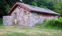
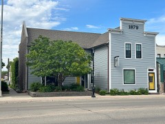
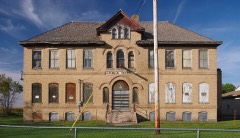
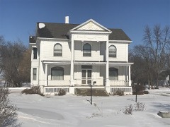
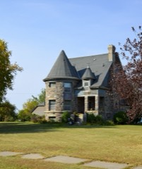
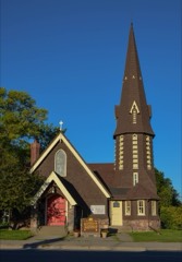
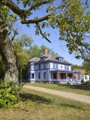
22 National Register listings published here.
Sources: the National Register database, National Park Service
66 topographic sheets cover 25 settlements here, and 22 properties are on the National Register of Historic Places.
22 National Register listings published here.
Sources: the National Register database, National Park Service
Every property in this county listed on the National Register of Historic Places, with the year it was listed and the federal nomination document.
Every wildfire the federal occurrence database records inside this county: 37 of them, burning about 5,818 acres. None started naturally and 8 were recorded as arson. Each settlement page carries the fires within five miles of it.
| Reported cause | Fires |
|---|---|
| Missing data/not specified/undetermined | 11 |
| Arson/incendiarism | 8 |
| Equipment and vehicle use | 5 |
| Debris and open burning | 5 |
| Recreation and ceremony | 3 |
| Smoking | 2 |
| Railroad operations and maintenance | 2 |
| Other causes | 1 |
The five largest, by the area the report gives. One of them was set deliberately.
| Date | Cause | Size | Reported by | Name on the report |
|---|---|---|---|---|
| 22 October 2015 | Equipment and vehicle use | 1,200 acres | Minnesota Department of Natural Resources | not named |
| 4 May 1996 | Arson/incendiarism | 1,155 acres | Minnesota Department of Natural Resources | not named |
| 7 October 2010 | Railroad operations and maintenance | 720 acres | Detroit Lakes Wetland Management District | BUFFALO RIVER |
| 7 October 2010 | Equipment and vehicle use | 402 acres | Minnesota Department of Natural Resources | not named |
| 8 May 2020 | Debris and open burning | 320 acres | Detroit Lakes Wetland Management District | MNDLR-FY20-WF-HOYKENS SOUTH |
| 13 April 2015 | Debris and open burning | 315 acres | Minnesota Department of Natural Resources | not named |
| 4 May 2015 | Missing data/not specified/undetermined | 254 acres | Minnesota Department of Natural Resources | not named |
| 30 April 2015 | Debris and open burning | 205 acres | Detroit Lakes Wetland Management District | DOWNER PRAIRIE NORTH |
Every settlement page carries the fires within five miles of it - see the settlement index below.
The NOAA Storm Events Database holds 504 reports for this county, causing no deaths, 5 injuries and about $19,806,960 in recorded property damage. Each settlement page carries the reports that name it.
| Kind of event | Reports |
|---|---|
| Hail | 214 |
| Thunderstorm Wind | 182 |
| Tornado | 42 |
| Flash Flood | 32 |
| Flood | 19 |
| Funnel Cloud | 11 |
| Lightning | 3 |
| Heavy Rain | 1 |
The most serious of them, by death, then injury, then recorded damage. The accounts are quoted exactly as the forecast office filed them.
| When | Event | Place named | Harm | What the report says |
|---|---|---|---|---|
| August 1958 | Tornado (F1) | not stated | 3 hurt, $25,000 | no account filed |
| May 1998 | Thunderstorm Wind | Moorhead | 2 hurt, $10,000 | The wind blew over a semi truck, injuring the two occupants inside. One had a broken collar bone. |
| September 2007 | Hail | Moorhead | $10,000,000 | The large hail left small 3 inch craters on lawns. Many vehicles and homes were damaged. |
| June 2000 | Flash Flood | Moorhead | $5,000,000 | Training thunderstorms dumped waves of rainfall across the Moorhead area. The official Moorhead NWS observer reported 7.31 inches of rain. This is believed to be a new 24 hour rainfall record for the Fargo-Moorhead area. The heavy rain halted traffic, inundated storm sewers, and knocked out electricity and phone service. One electrical substation in Moorhead failed when the water rose high enough to cause it to short out. |
| April 2006 | Flood | Countywide | $996,000 | The Red River at Fargo/Moorhead rose above flood stage around 1 AM CST on March 30th and remained above flood stage until around 7 PM CST on April 19th. The river peaked at roughly 37.18 feet around 2 AM CST on April 5th. Unofficially, 37.18 feet would be the fifth highest modern-day river stage recorded. Overland flooding also occurred in addition to the river flooding, with many roads around the county closed due to flooding. Problems were noted in the Sabin area, where farmhouses were surrounded by floodwater from the South Branch of the Buffalo River. The Buffalo River rose north of U.S. Highway 10 near Glyndon, and also surrounded several homes. In Moorhead, the 12th Avenue North Red River Bridge was closed. Other problems occurred north of Moorhead in Oakport Township. Temporary dikes were constructed, but several homes were flooded and most of the others were cut off. A vast area of water surrounded Kragness (also north of Moorhead). Several historic structures and most of the small town was inundated with water. Water also flowed over U.S. Highway 75, but it remained open. The Minnesota Governor authorized the National Guard to assist in the flood fight, working on dike patrols, security, and traffic control. After the spring flood of 1997, many communities along the Red River looked at ways to mitigate flood effects. For the Moorhead area, many homes were bought out in low-lying or flood-prone areas. Clay County received a Presidential Disaster Declaration for damages caused by spring flooding.In summary, the total public and private flood losses experienced within the Red River of the North basin through late March and April 2006 were likely in excess of $20 million. This includes the following amounts. For Minnesota state and local infrastructure (this total includes the damages listed for each county), $8.5 million. For North Dakota state and local infrastructure (this total includes the damages listed for each county), $8 million. For Federal agencies (USACE, USGS, and USCG), $1.5 million. For the transportation industry costs due to traffic diversions caused by prolonged road and bridge closures, $1.5 million. For personal property losses due to floodwaters surrounding more than 500 individual farmsteads and rural homesteads, $1.0 million. |
| June 2000 | Flash Flood | Dilworth | $500,000 | After 6 to 8 inches of rain fell across the Dilworth area, many basements filled with water. |
| July 2020 | Lightning | Barnesville | $250,000 | Lightning ignited a house fire, destroying the home. |
| July 2017 | Thunderstorm Wind | Ulen | $250,000 | Twelve to eighteen inch diameter trees were blown down. Powerlines were also blown down with localized street flooding in Ulen. Wind driven hail damaged fields and buildings. |
| May 2011 | Tornado (EF1) | Moorhead | $250,000 | This tornado tracked north-northeastward along the eastern edge of Moorhead and was likely enshrouded in downburst winds and heavy rain. A few wooden power poles were snapped and numerous trees were uprooted or snapped. Some mature trees were thrown more than 100 feet. Peak winds were estimated at 105 mph. |
| June 1996 | Tornado (F2) | Hitterdal | $250,000 | no account filed |
| June 1975 | Tornado (F4) | not stated | $250,000 | no account filed |
| August 1975 | Tornado (F1) | not stated | $250,000 | no account filed |
| June 1975 | Tornado (F3) | not stated | $250,000 | no account filed |
| June 1959 | Tornado (F2) | not stated | $250,000 | no account filed |
| June 1957 | Tornado (F5) | not stated | $250,000 | no account filed |
| July 2017 | Thunderstorm Wind | Hitterdal | $150,000 | Numerous large tree limbs and power lines were blown down. Wind driven hail damaged fields and buildings. |
| July 2004 | Tornado (F1) | Rollag | $100,000 | Several buildings were damaged at the Western Minnesota Steam Threshers Reunion grounds near Rollag. Some antique farm machinery inside the buildings was also damaged. |
| May 2002 | Thunderstorm Wind | Moorhead | $100,000 | Numerous residential fences were blown down and garage doors blown in. |
| June 1998 | Flash Flood | Moorhead | $100,000 | Over 3 inches of rain fell in less than three hours, causing rapid flooding problems in Moorhead. |
| May 2002 | Flash Flood | Moorhead | $50,000 | Street flooding was reported. |
| March 2019 | Flood | Rustad | $50,000 | no account filed |
| April 2019 | Flood | Georgetown | $50,000 | no account filed |
| May 1996 | Thunderstorm Wind | Barnesville | $50,000 | no account filed |
| July 2017 | Tornado (EF2) | Ulen | $25,000 | This tornado began at 742 pm CST, 3 miles north of Borup, in Norman County. This tornado collapsed at least one shed, snapped numerous trees, and tossed large round hay bales across a sugar beet field. It also snapped at least a half dozen wooden power poles. Peak winds were estimated at 125 mph. |
| May 1988 | Tornado (F1) | not stated | $25,000 | no account filed |
| July 1977 | Tornado (F1) | not stated | $25,000 | no account filed |
| June 1966 | Tornado (F1) | not stated | $25,000 | no account filed |
| July 1960 | Tornado (F1) | not stated | $25,000 | no account filed |
| July 1999 | Thunderstorm Wind | Moorhead | $20,000 | Trees, signs, and power lines were downed around the Moorhead area as the strong winds came through. |
| May 1998 | Thunderstorm Wind | Ulen | $20,000 | A tree was blown into a house, damaging the roof. A barn was also heavily damaged. |
| May 2013 | Flood | Ulen | $15,000 | Heavy rains overwhelmed the city lift station and produced widespread street flooding through the early morning. Some water got into structures like garages and outbuildings. |
| May 2013 | Flood | Averill | $15,000 | Portions of township roads and several sections of farmland were flooded across northern Spring Prairie and southern Flowing townships. Three to six inches of rain fell in a short amount of time. |
| July 2004 | Tornado (F1) | Rustad | $15,000 | This tornado crossed the Red River into Minnesota (it originated southeast of Wild Rice, ND) and moved east before lifting just west of Rustad. Many trees were twisted or snapped off along the tornado path. Several farm buildings were damaged one mile west of Rustad. One wooden grain bin was moved about 6 feet off its foundation and the door of a 50x150 foot storage shed was blown in and pushed halfway across the shed. |
| July 2019 | Flash Flood | Moorhead | $10,000 | Two to four inches of rain quickly flooded low lying areas around town. |
| June 2013 | Flood | Comstock | $10,000 | Overland flooding developed over portions of Holy Cross Township drained by Wolverton Creek. Four to eight inches of rainfall during the preceding evening collected in farm fields, ditches, and smaller streams through the early morning then steadily drained towards Wolverton Creek and the Red River. Wolverton Creek overtopped and partially washed out rural and township roads at several locations. |
| April 2012 | Tornado (EF0) | Crawford | $10,000 | This tornado touched down near a farmstead west of Minnesota highway 9 and tracked eastward for about one quarter of mile before lifting. A spotter reported several four foot by six foot tin roofing panels were blown off a pole shed and carried eastward across Minnesota highway 9. Peak winds were estimated at 70 to 80 mph. |
| July 2011 | Flash Flood | Moorhead | $10,000 | Two to three inches of rain in less than an hour caused extensive street flooding. Several roads were impassable. |
| June 2009 | Flash Flood | Rustad | $10,000 | Fields and farm access roads were flooded by repeated heavy rains. Portions of southern Barnesville and Alliance townships received from 3 to 6 inches of rain from late afternoon through the evening of the 16th. |
| June 1999 | Thunderstorm Wind | Barnesville | $10,000 | A tree was blown over onto a house. |
| June 1998 | Lightning | Moorhead | $10,000 | A house for sale in Moorhead was struck by lightning, igniting a fire. |
| May 1996 | Thunderstorm Wind | Baker | $10,000 | no account filed |
| May 1998 | Thunderstorm Wind | Hawley | $8,000 | The strong wind blew the roof off a house. |
| September 2014 | Flash Flood | Moorhead | $5,000 | Streets were flooded in south Moorhead. |
| July 2011 | Hail | Downer | $5,000 | The hail was described as being the size and shape of pears. Wind and wind driven hail completely flattened nearby crops in elkton township. |
| August 2010 | Flash Flood | Sabin | $5,000 | Streets flooded in the town of Sabin. In rural areas around Sabin, ditches filled with water and flooded several rural roads. |
| July 2010 | Flash Flood | Barnesville | $5,000 | Nearly three inches of rain fell, causing flooding in low spots. Local sloughs and creeks also filled with water and overspilled their banks. |
| June 2010 | Flash Flood | Georgetown | $5,000 | Three to five inches of rain fell around the Georgetown area, flooding several township roads and fields. |
| July 2002 | Lightning | Hawley | $5,000 | A bolt of lightning hit Hawley's main power hub on the southeast edge of town. |
| May 2012 | Flood | Baker | $5,000 | no account filed |
| June 2009 | Flood | Rustad | $5,000 | no account filed |
| March 2009 | Flood | Georgetown | $5,000 | no account filed |
| April 2009 | Flood | Georgetown | $5,000 | no account filed |
| September 2014 | Flash Flood | Barnesville | $3,000 | Several bouts of heavy rainfall flooded city streets. Water was reported to be over a foot deep in some areas. |
| August 2001 | Thunderstorm Wind | Dilworth | $3,000 | Numerous trees were blown down. |
| July 1978 | Tornado (F0) | not stated | $2,500 | no account filed |
| July 2016 | Flash Flood | Barnesville | $2,000 | Fields and farm access roads were flooded near Stoney Creek and across northern Humboldt and southern Skree townships. |
| June 2002 | Thunderstorm Wind | Ulen | $2,000 | 12 inch diameter tree limbs were blown down. |
| August 2001 | Thunderstorm Wind | Georgetown | $2,000 | Numerous trees were blown down. |
| July 1999 | Thunderstorm Wind | Dilworth | $2,000 | Several large trees were blown down. |
| July 2011 | Flash Flood | Sabin | $1,000 | Over 3 inches of rain fell in less than an hour, causing street flooding. |
The Survey's mineral resources record lists 81 workings inside this county. 69 still produce and 12 are closed or unrecorded. Each settlement page carries the workings within five miles of it.
| Commodity | Workings |
|---|---|
| Sand and Gravel, Construction | 80 |
| Nickel | 1 |
The least common of them first, because a county's hundredth gravel pit says nothing its first ten did not.
| Where | Site | Commodity | Status | Recorded |
|---|---|---|---|---|
| Clay County Nickel Prospect | Nickel | Occurrence | ||
| Ames Pit No 3 | Sand and Gravel, Construction | Producer | ||
| Ames S & G Pit No 1 | Sand and Gravel, Construction | Producer | ||
| Ames S & G Pit No 2 | Sand and Gravel, Construction | Producer | ||
| B Bar B Pit | Sand and Gravel, Construction | Past Producer | ||
| Barth Pit | Sand and Gravel, Construction | Producer | ||
| Becker S & G Pit | Sand and Gravel, Construction | Producer | ||
| Becker County Pit No 2 | Sand and Gravel, Construction | Producer | ||
| Becker County Pit No1 | Sand and Gravel, Construction | Producer | ||
| Becket and Leach Pit | Sand and Gravel, Construction | Producer | ||
| Benedict Dredge Pit & Mill | Sand and Gravel, Construction | Producer | ||
| Bergan Pit | Sand and Gravel, Construction | Producer | ||
| Bergland Pit | Sand and Gravel, Construction | Producer | ||
| Bouton Pit No 1 | Sand and Gravel, Construction | Producer | ||
| Bouton Pit No 2 | Sand and Gravel, Construction | Producer | ||
| Clay County Pit | Sand and Gravel, Construction | Producer | ||
| Clay County Pit No 1 | Sand and Gravel, Construction | Producer | ||
| Clay County Pit No 2 | Sand and Gravel, Construction | Producer | ||
| Clay County Pit No 3 | Sand and Gravel, Construction | Producer | ||
| Clay County Pit No 4 | Sand and Gravel, Construction | Producer | ||
| Clay County Pit No 5 | Sand and Gravel, Construction | Past Producer | ||
| Clay County Pit No 6 | Sand and Gravel, Construction | Past Producer | ||
| Connlley Pit | Sand and Gravel, Construction | Producer | ||
| Felton Pit & Mill | Sand and Gravel, Construction | Producer | ||
| Glyndon Pit | Sand and Gravel, Construction | Producer | ||
| Glyndon Pit and Mill | Sand and Gravel, Construction | Producer | ||
| Grant Pit & Mill | Sand and Gravel, Construction | Producer | ||
| Grommesh Pit | Sand and Gravel, Construction | Producer | ||
| Hollands Pit | Sand and Gravel, Construction | Producer | ||
| Hoyum S & G Pit | Sand and Gravel, Construction | Producer | ||
| Huebner Pit | Sand and Gravel, Construction | Producer | ||
| Ikel Pit and Mill | Sand and Gravel, Construction | Producer | ||
| Kost Bros Pit No 1 | Sand and Gravel, Construction | Unknown | ||
| Kost Brothers No.31 Pit | Sand and Gravel, Construction | Producer | ||
| Kost Brothers No.51 Mill | Sand and Gravel, Construction | Producer | ||
| Kost Pit No 10 | Sand and Gravel, Construction | Past Producer | ||
| Kost Pit No 11 | Sand and Gravel, Construction | Producer | ||
| Kost Pit No 12 | Sand and Gravel, Construction | Producer | ||
| Kost Pit No 13 | Sand and Gravel, Construction | Past Producer | ||
| Kost Pit No 3 | Sand and Gravel, Construction | Producer | ||
| Kost Pit No 4 | Sand and Gravel, Construction | Producer | ||
| Kost Pit No 5 | Sand and Gravel, Construction | Producer | ||
| Kost Pit No 6 | Sand and Gravel, Construction | Producer | ||
| Kost Pit No 7 | Sand and Gravel, Construction | Producer | ||
| Kost Pit No 8 | Sand and Gravel, Construction | Producer | ||
| Kost Pit No 9 | Sand and Gravel, Construction | Past Producer | ||
| Kost Pit No 9a | Sand and Gravel, Construction | Producer | ||
| Kost Pit No. 2 | Sand and Gravel, Construction | Producer | ||
| Layton Pit | Sand and Gravel, Construction | Producer | ||
| Leach Pit | Sand and Gravel, Construction | Producer | ||
| Lenius Pit | Sand and Gravel, Construction | Producer | ||
| Mallinger Pit | Sand and Gravel, Construction | Producer | ||
| Mattson Pit | Sand and Gravel, Construction | Producer | ||
| Mineral Resource Pit | Sand and Gravel, Construction | Producer | ||
| Moskoda Pit | Sand and Gravel, Construction | Producer | ||
| Most Pit | Sand and Gravel, Construction | Producer | ||
| Nelson Pit | Sand and Gravel, Construction | Producer | ||
| Nelson Pit No 2 | Sand and Gravel, Construction | Producer | ||
| Ness Pit | Sand and Gravel, Construction | Past Producer | ||
| Northern Improvement Pit | Sand and Gravel, Construction | Producer | ||
| Northern Improvement Pit No 2 | Sand and Gravel, Construction | Producer | ||
| Oliver Pit | Sand and Gravel, Construction | Producer | ||
| Olness Pit and Mill | Sand and Gravel, Construction | Producer | ||
| Olness Plant | Sand and Gravel, Construction | Producer | ||
| Pletcher Pit | Sand and Gravel, Construction | Producer | ||
| Quick Pit & Mill | Sand and Gravel, Construction | Producer | ||
| Quinnild Pit No 1 | Sand and Gravel, Construction | Producer | ||
| Quinnild Pit No 2 | Sand and Gravel, Construction | Producer | ||
| Regelts Pit | Sand and Gravel, Construction | Past Producer | ||
| Skamford Pit | Sand and Gravel, Construction | Past Producer | ||
| Skree Pit No 1 | Sand and Gravel, Construction | Past Producer | ||
| Skree Pit No 2 | Sand and Gravel, Construction | Producer | ||
| State Pit No 1 | Sand and Gravel, Construction | Producer | ||
| State Pit No 2 | Sand and Gravel, Construction | Producer | ||
| Thompson Pit | Sand and Gravel, Construction | Producer | ||
| Ulven Gravel Pit No. 1 | Sand and Gravel, Construction | Producer | ||
| Ulven Mill No 3 | Sand and Gravel, Construction | Producer | ||
| Ulven Pit & Mill No 2 | Sand and Gravel, Construction | Producer | ||
| Ulven Pit No. 3 | Sand and Gravel, Construction | Producer | ||
| West Pit No 1 | Sand and Gravel, Construction | Producer | ||
| West Pit No 2 | Sand and Gravel, Construction | Producer |
Named settlements recorded in the Geographic Names Information System, each with the topographic sheets covering it. Villages, hamlets and abandoned places alike. Each is shown with the nearest named watercourse or landform and the survey quadrangle it falls on.
Georgetown township · 56546 · On Buffalo River · Georgetown quadrangle
8 sheets, 1952 to 1984
Highland Grove township · 56549 · On Hay Creek · Dale quadrangle
7 sheets, 1953 to 1989
Highland Grove township · 56549 · On Hay Creek · Dale quadrangle
7 sheets, 1953 to 1989