 Block
From the record
13 National Register listings published here.
Sources: the National Register database, National Park Service
45 topographic sheets cover 13 settlements here, and 13 properties are on the National Register of Historic Places.
13 National Register listings published here.
Sources: the National Register database, National Park Service
Every property in this county listed on the National Register of Historic Places, with the year it was listed and the federal nomination document.
| Photograph | Property | Type | Listed | Reference |
|---|---|---|---|---|
 | Bally Blacksmith Shop | building | 1986 | 86001548 |
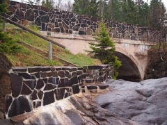 | Cascade River Wayside | site | 2003 | 03000733 |
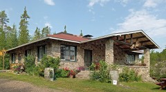 | Chik Wauk Lodge | building | 2007 | 07000599 |
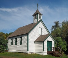 | Church of St. Francis Xavier-Catholic | building | 1986 | 86002119 |
| Clearwater Lodge | building | 1985 | 85003032 | |
| Cook County Courthouse | building | 1983 | 83000902 | |
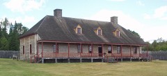 | Grand Portage National Monument | district | 1966 | 66000111 |
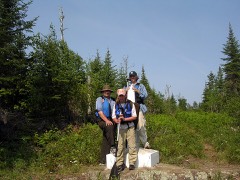 | Height of Land | site | 1974 | 74001012 |
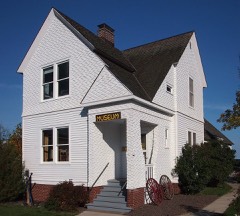 | Lightkeeper's House | building | 1978 | 78001528 |
| Naniboujou Club Lodge | building | 1982 | 82000558 | |
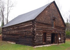 | Schroeder Lumber Company Bunkhouse | building | 1986 | 86002120 |
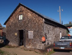 | Jim Scott Fishhouse | building | 1986 | 86002904 |
Every wildfire the federal occurrence database records inside this county: 491 of them, burning about 134,650 acres. 145 started naturally and 17 were recorded as arson. Each settlement page carries the fires within five miles of it.
| Reported cause | Fires |
|---|---|
| Recreation and ceremony | 146 |
| Natural | 145 |
| Debris and open burning | 59 |
| Missing data/not specified/undetermined | 51 |
| Equipment and vehicle use | 23 |
| Smoking | 19 |
| Power generation/transmission/distribution | 18 |
| Arson/incendiarism | 17 |
| Misuse of fire by a minor | 5 |
| Fireworks | 3 |
| Other causes | 3 |
| Railroad operations and maintenance | 2 |
The five largest, by the area the report gives. None of them was recorded as arson.
| Date | Cause | Size | Reported by | Name on the report |
|---|---|---|---|---|
| 5 May 2007 | Recreation and ceremony | 75,484 acres | Superior National Forest | HAM LAKE |
| 14 July 2006 | Natural | 31,830 acres | Superior National Forest | CAVITY LAKE |
| 10 August 1995 | Recreation and ceremony | 12,600 acres | Superior National Forest | SAG CORRIDOR |
| 14 June 1996 | Natural | 4,130 acres | Superior National Forest | SOUTH TEMPERANCE |
| 8 September 2006 | Natural | 4,104 acres | Superior National Forest | FAMINE LAKE |
| 9 September 2006 | Natural | 1,792 acres | Superior National Forest | REDEYE |
| 6 August 2005 | Natural | 1,335 acres | Superior National Forest | ALPINE LAKE |
| 20 June 1995 | Natural | 1,269 acres | Superior National Forest | WINCHELL |
Every settlement page carries the fires within five miles of it - see the settlement index below.
The NOAA Storm Events Database holds 86 reports for this county, causing 2 deaths, 3 injuries and about $1,122,000 in recorded property damage. Each settlement page carries the reports that name it.
| Kind of event | Reports |
|---|---|
| Thunderstorm Wind | 33 |
| Hail | 25 |
| Flash Flood | 17 |
| Tornado | 4 |
| Lightning | 3 |
| Flood | 3 |
| Heavy Rain | 1 |
The most serious of them, by death, then injury, then recorded damage. The accounts are quoted exactly as the forecast office filed them.
| When | Event | Place named | Harm | What the report says |
|---|---|---|---|---|
| June 2016 | Thunderstorm Wind | Marais | 1 killed, 1 hurt | A large tree trunk was snapped several feet above ground level and the tree landed on a man and his son who were camping on Duncan Lake. The tree killed the father, Craig Walz, the brother of Minnesota Representative Tim Walz, as well as seriously injuring Craig's son. The son was airlifted to a hospital in Duluth. |
| August 1996 | Lightning | Grand Marais | 1 killed, 1 hurt | no account filed |
| June 2016 | Thunderstorm Wind | Marais | 1 hurt | Cook County authorities received a report that a tree fell on a man at Clove Lake, along the Canadian border northwest of Gunflint Lake.||The man suffered injuries to his upper body and was transported by ambulance to the hospital in Grand Marais. |
| June 2008 | Flash Flood | Hovland | $900,000 | no account filed |
| July 2013 | Flash Flood | Lutsen | $100,000 | Thunderstorm heavy rain resulted in flash flooding along and near the Cascade River and Highway 61 and near Cascade State Park. Water was flowing over Highway 61 and mile marker 104. Part of the highway was washed out. Other county roads in the area were damaged. There was also some cabin and road/driveway damage at Cascade Lodge that totaled about $50,000. |
| June 2012 | Flash Flood | Taconite Harbor | $61,000 | Three to five inches of rain in less that 24 hours lead to road damage as many small streams flooded. |
| September 2025 | Lightning | Marais | $20,000 | A lightning strike near the Gunflint Trail and Soderberg Lane damaged about 2,000 feet of underground fiber optic cable causing a loss of phone and internet service to customers from that point to the end of the Gunflint Trail. Service was restored after about 14 hours. |
| July 2025 | Flash Flood | Marais | $10,000 | A stretch of Forest Road 323 was washed out for a length of 20 to 30 yards where it runs adjacent to an unnamed creek just west of Mit Lake. This led to the closure of Forest Road 323 west of Forest Road 323J until repairs could be completed. |
| August 2025 | Flash Flood | Hovland | $10,000 | Fast moving water was running over County Road 14 and scouring out the road. |
| July 2025 | Flash Flood | Hovland | $10,000 | A culvert on Trout Lake Road (Forest Road 308) between Marsh Lake and Trout Lake was washed out leading to the closure of Forest Road 308 until repairs were able to be made. |
| July 2013 | Flash Flood | Marais | $10,000 | Thunderstorm heavy rains resulted in flash flooding for parts of the Grand Marais campground due to high water from a nearby stream. |
| July 2014 | Flash Flood | Lutsen | $1,000 | Flood debris covered U. S. Highway 61. |
| May 2025 | Thunderstorm Wind | Lutsen | - | A medium to large spruce tree was down partially blocking Sawbill Trail. |
| May 2025 | Thunderstorm Wind | Lutsen | - | Several medium trees of mixed types were down across The Grade near Rice Lake Road. |
| May 2025 | Thunderstorm Wind | Hovland | - | Two large trees were down at the spotter's home. The spotter also recorded a gust of 74 mph during the storm from a personal weather station. |
| May 2025 | Thunderstorm Wind | Marais | - | Numerous spruce and poplar trees were snapped along the lake side of Highway 61. The area of damaged trees appeared to be fairly localized. |
| May 2025 | Thunderstorm Wind | Tofte | - | A video was received of extensive tree damage in Tofte Park including several large trees that were uprooted or snapped. Per the Tofte Town Board Supervisor, approximately two-thirds of the trees in Tofte Park, around 40, were lost and two of the trees fell onto the Tofte Town Hall. |
| August 2025 | Thunderstorm Wind | Lutsen | - | One large tree was uprooted as well as a couple of cedar trees snapped in half. |
| June 2024 | Flash Flood | Tofte | - | A small creek flowing between two houses was outside of its banks flowing downhill. |
| June 2024 | Flash Flood | Marais | - | Video was received showing flash flooding affecting Minnesota Highway 61 east of Lutsen in multiple locations leading to its closure. |
| July 2023 | Thunderstorm Wind | Marais | - | A few fresh trees were downed along the Cascade River. |
| September 2023 | Thunderstorm Wind | Hovland | - | Multiple large trees were down and the power was out. |
| May 2022 | Flood | Lutsen | - | Heavy rainfall led to the Poplar River becoming swollen and raging. Trees and other debris significantly damaged two covered bridges near the mouth of the river at the Lutsen Resort. The older of the two bridges was built in 1930 with the other dating from the 1950s. The resort owners have vowed to rebuild the bridges. Additionally, hundreds of trees were wiped out by the water as well. |
| May 2022 | Flash Flood | Marais | - | Water was over Cook County Road 60 and County State Aid Highway 14 with multiple culvert washouts. A No Travel Advisory was issued by the county for this area due to the water and damage. |
| May 2022 | Flash Flood | Hovland | - | A photo was received showing Moose Valley Road flooded at Carlson Creek with water flowing over the road surface. A later report indicated the Cook County Highway Department closed the road at 6:30 AM CDT. |
| July 2022 | Thunderstorm Wind | Marais | - | Multiple trees were uprooted by the storm. |
| June 2022 | Thunderstorm Wind | Lutsen | - | Many large pine trees were down with several broken halfway up. |
| October 2021 | Hail | Marais | - | A search and rescue crew in the area had to take cover near Eagle Mountain due to the large hail. |
| October 2021 | Thunderstorm Wind | Marais | - | Multiple trees were down along Ball Club Road from the storm. |
| October 2021 | Thunderstorm Wind | Marais | - | Multiple trees were downed along County Highway 57 on the north side of Devil Track Lake by the storm. |
| October 2021 | Tornado (EF2) | Hovland | - | A rare late-season strong tornado caused tree damage|across parts of the Boundary Waters Canoe Area Wilderness in |northern Cook County. The tornado appeared to begin on Alder Lake, |initially causing damage near Campsite #3 where a small swath of |trees were downed, several snapped halfway down their trunks. The |tornado then traveled north causing sporadic damage until just north |of Rocky Lake where there was a more concentrated area of downed |trees roughly 270 yards across. Sporadic tree damage continued until |reaching Clearwater Lake and crossing the lake just west of Campsite |#5, causing significant damage north of Clearwater Lake and north to |the International Border (Mountain Lake). Significant tree damage was|observed along the Border Route Trail, of which passage was made |impossible as the tornado reached its maximum width of around 500 |yards as it moved across the trail. Numerous trees were snapped near |their bases within this area of damage. The coverage of damage was |widespread with satellite imagery depicting over 80% of trees |uprooted, bent, or snapped across its path near the Border Route |Trail. The tornado then crossed the International Border and continued into Northwestern Ontario, Canada. No private property was damaged along the course of the tornado. ||The National Weather Service appreciates the public reports, photos,|and videos of this tornado damage, aerial photographs from the US |Forest Service, and satellite imagery shared by the Northern |Tornadoes Project (Western University in Canada) which all aided in |an accurate assessment of the damage. |
| June 2019 | Tornado (EFU) | Marais | - | A fishing party on Elbow Lake observed a funnel cloud and took a photo of it. They reported there was a brief period of debris being lofted into the air. The party contacted a local pilot who performed a flyover and confirmed tree damage in the woods north of Elbow Lake. This tornado occurred in an area with no roads, making it difficult to survey. |
| July 2019 | Thunderstorm Wind | Lutsen | - | A large tree was downed near the end of the Gunflint Trail. |
| July 2019 | Thunderstorm Wind | Marais | - | A large tree was knocked down approximately 5 miles north of Grand Marais along the Gunflint Trail. |
| July 2019 | Thunderstorm Wind | Marais | - | Multiple 2 to 3 inch tree branches were downed due to the winds. |
| July 2019 | Thunderstorm Wind | Lutsen | - | A tree was knocked down near Baker Lake Campground on the Grade Road. |
| June 2018 | Thunderstorm Wind | Schroeder | - | A large tree was blown down near the intersection of Highway 61 and Temperance Road. |
| September 2017 | Thunderstorm Wind | Marais | - | A few trees were blown down along Minnesota Highway 61 by mile marker 100. |
| October 2017 | Flood | Marais | - | Water covered the west bound lane on Pike Lake Road near County Road 7. |
| October 2017 | Flash Flood | Hovland | - | Water was flowing over some roads while other roads were under water. |
| July 2016 | Thunderstorm Wind | Lutsen | - | There were many trees blown down. The largest diameter trees were 16 to 20. There were some trees uprooted and sheared off. |
| July 2016 | Thunderstorm Wind | Marais | - | Three trees were blown down. One downed tree was a 2 to 3 foot diameter pine tree. |
| August 2015 | Hail | Marais | - | The hail fell for 10 minutes. |
| August 2015 | Hail | Marais | - | The largest hail was dime sized. One inch of rain fell in a few minutes. |
| July 2014 | Thunderstorm Wind | Lutsen | - | There was widespread tree damage near the end of the Gunflint Trail near Seagull Lake. Most damaged trees were blown down. |
| July 2014 | Thunderstorm Wind | Lutsen | - | There was a widespread tree blow down near the end of Gunflint Trail near Seagull Lake. |
| July 2014 | Hail | Schroeder | - | There was also ponding of water on Highway 61 in Tofte, MN. |
| May 2012 | Flash Flood | Taconite Harbor | - | Water covered US Route 61. |
| April 2011 | Hail | Lutsen | - | Penny size hail and gusty winds occurred near Seagull Lake. |
| June 2011 | Heavy Rain | Marais | - | Almost an inch of rain fell within 45 minutes. |
| June 2011 | Flash Flood | Taconite Harbor | - | Water covered State Highway 61 between County Road 6 and the Manitou River. |
| July 2011 | Flash Flood | Marais | - | Overnight rainfall of 2 to 5 inches across Cook County caused downtown Grand Marais to flood. Five inches of rain fell at Golden Eagle Lodge on the Gunflint Trail while 2.91 inches fell in Grand Marais.Most of the rain fell between 3:00 am and 6: am CDT. Cook County Road 8, also known as Devil Track Road, was flooded as were a few other county roads. |
| May 2010 | Thunderstorm Wind | Marais | - | A few large trees, as well as powerlines, were downed at the Trail Center on Poplar Lake along the Gunflint Trail. |
| October 2007 | Flood | Lutsen | - | Cook County law enforcement reported widespread road flooding from the evening of October 18 through early October 19. Portions of U.S. Highway 61 were flooded near Taconite Harbor. Several other county roads were also closed due to flooding, including county roads 1, 14, 42, 58, 60, 69, 70, and 71. |
| May 2006 | Hail | Grand Marais | - | The hail fell at Sea Gull Lake. |
| June 2006 | Hail | Tofte | - | The hail caused severe stripping of vegetation. |
| April 2004 | Thunderstorm Wind | Grand Marais | - | Numerous trees were blown down three miles north of the Gunflint Lodge. |
| June 2004 | Lightning | Grand Marais | - | A lightning strike caused a cabin to catch fire. |
| July 2003 | Hail | Grand Marais | - | The hail fell at Sea Gull Lake. |
| July 1999 | Thunderstorm Wind | Grand Marais | - | Numerous trees and power lines were blown down. The wind speed is estimated. |
The Survey's mineral resources record lists 34 workings inside this county. 1 still produces and 33 are closed or unrecorded. Each settlement page carries the workings within five miles of it.
| Commodity | Workings |
|---|---|
| Iron, Titanium, Metal | 8 |
| Iron | 6 |
| Graphite | 4 |
| Sand and Gravel, Construction | 3 |
| Cobalt | 2 |
| Gold | 2 |
| Nickel, Copper | 1 |
| Copper, Nickel | 1 |
| Silver, Gold | 1 |
| Gold, Copper, Nickel | 1 |
| Silver | 1 |
| Arsenic, Cobalt | 1 |
| Arsenic | 1 |
| Copper | 1 |
The least common of them first, because a county's hundredth gravel pit says nothing its first ten did not.
| Where | Site | Commodity | Status | Recorded |
|---|---|---|---|---|
| Blankenburg-Whiteside Prospect | Cobalt, Arsenic | Occurrence | Arsenopyrite, Chalcopyrite | |
| Cobalt Prospect | Arsenic, Cobalt | Occurrence | Arsenopyrite | |
| Green Prospect Pit | Copper | Occurrence | Pentlandite, Pyrrhotite, Chalcopyrite | |
| Gunflint Corridor East | Nickel, Copper | Occurrence | 1966 | |
| Gunflint Corridor West | Copper, Nickel | Occurrence | 1966 | |
| Mcfarland Lake Prospect | Silver, Gold | Occurrence | Gold, Silver | |
| Old Silver Mine | Silver | Past Producer | ||
| Rove Slate Area Prospect Pits | Gold, Copper, Nickel | Unknown | Cubanite, Pentlandite | |
| Susie Island Copper Veins | Copper, Silver | Past Producer | Chalcopyrite, Bornite, Pyrite, Covellite, Chalcocite | |
| Tucker-Poplar Lake Deposit | Titanium, Vanadium | Prospect | 1880 | |
| Lake Saganaga-Gold Island Prospect | Gold | Unknown | Gold | |
| Loon Lake | Cobalt | Occurrence | Chalcopyrite, Pyrite, Arsenopyrite | |
| Old Spaulding Mine | Gold | Occurrence | Gold | |
| Gunflint Gravel Pit No 1 | Sand and Gravel, Construction | Past Producer | ||
| Gunflint Gravel Pit No 2 | Sand and Gravel, Construction | Past Producer | ||
| Johnson Pit and Mill | Sand and Gravel, Construction | Producer | ||
| Graphite Pit No 1 | Graphite | Occurrence | ||
| Graphite Pit No 2 | Graphite | Occurrence | ||
| Graphite Pit No. 1 | Graphite | Unknown | Graphite | |
| Graphite Pit No. 2 | Graphite | Unknown | Graphite | |
| Titaniferous Magnetite Pit No 1 | Iron | Occurrence | ||
| Titaniferous Magnetite Pit No 2 | Iron | Occurrence | ||
| Titaniferous Magnetite Pit No 3 | Iron | Occurrence | ||
| Titaniferous Magnetite Pit No 4 | Iron | Occurrence | ||
| Titaniferous Magnetite Pit No 5 | Iron | Occurrence | ||
| Titaniferous Magnetite Prospect #6 | Iron | Occurrence | ||
| Dawkins Lake Prospect | Iron, Titanium, Metal | Unknown | Magnetite, Ilmenite | |
| Gabimichigama Lake Deposit | Iron, Titanium, Metal | Unknown | Ilmenite, Magnetite | |
| Iron Lake Deposit | Iron, Titanium, Metal | Unknown | Ilmenite, Magnetite | |
| Pillsbery Lake Prospect | Iron, Titanium, Metal | Unknown | Ilmenite, Magnetite | |
| Poplar Lake Deposit | Iron, Titanium, Metal | Unknown | Ilmenite, Magnetite | |
| Smoke Lake Deposit | Iron, Titanium, Metal | Unknown | Ilmenite, Magnetite | |
| Tucker Lake Deposit | Iron, Titanium, Metal | Unknown | Ilmenite, Magnetite | |
| Tuscarora Lake Prospect | Iron, Titanium, Metal | Unknown | Ilmenite, Magnetite |
Named settlements recorded in the Geographic Names Information System, each with the topographic sheets covering it. Villages, hamlets and abandoned places alike. Each is shown with the nearest named watercourse or landform and the survey quadrangle it falls on.
West Cook unorganized territory · 55604 · Grand Marais quadrangle
9 sheets, 1954 to 1977
East Cook unorganized territory · 55604 · On Kadunce River · Kadunce River quadrangle
10 sheets, 1954 to 1977
Grand Portage unorganized territory · 55605 · Near Mount Rose · Grand Portage quadrangle
10 sheets, 1958 to 1999
East Cook unorganized territory · 55604 · On Flute Reed River · Hovland quadrangle
11 sheets, 1958 to 1985
West Cook unorganized territory · 55604 · On Elbow Creek · Grand Marais quadrangle
9 sheets, 1954 to 1977
Grand Portage unorganized territory · 55605 · Grand Portage OE N quadrangle
9 sheets, 1959 to 1999
Grand Portage unorganized territory · 55605 · On Hollow Rock Creek · Grand Portage quadrangle
10 sheets, 1958 to 1999
Schroeder township · 55613 · On Cross River · Schroeder quadrangle
11 sheets, 1954 to 1977
Schroeder township · 55613 · On Two Island River · Schroeder quadrangle
11 sheets, 1954 to 1977
No longer a settlement
The vanished settlements of Cook County: the places named above that are no longer on the map.