Block
From the record
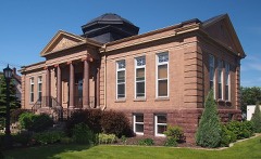
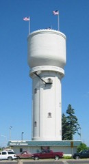
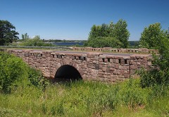
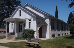
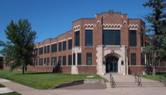
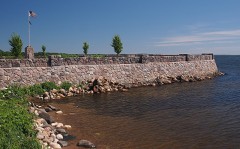
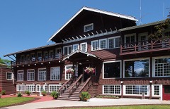
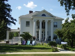
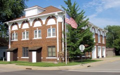
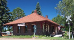
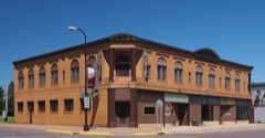
31 National Register listings published here.
Sources: the National Register database, National Park Service
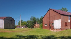
86 topographic sheets cover 44 settlements here, and 31 properties are on the National Register of Historic Places.
31 National Register listings published here.
Sources: the National Register database, National Park Service
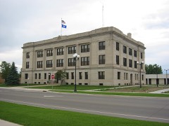
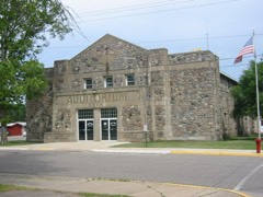
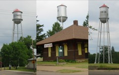
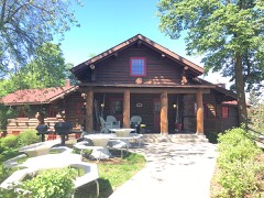
Every property in this county listed on the National Register of Historic Places, with the year it was listed and the federal nomination document.
Every wildfire the federal occurrence database records inside this county: 1,878 of them, burning about 7,046 acres. 15 started naturally and 248 were recorded as arson. Each settlement page carries the fires within five miles of it.
| Reported cause | Fires |
|---|---|
| Debris and open burning | 909 |
| Missing data/not specified/undetermined | 303 |
| Arson/incendiarism | 248 |
| Equipment and vehicle use | 200 |
| Recreation and ceremony | 106 |
| Smoking | 46 |
| Power generation/transmission/distribution | 17 |
| Natural | 15 |
| Misuse of fire by a minor | 15 |
| Railroad operations and maintenance | 12 |
| Fireworks | 4 |
| Other causes | 3 |
The five largest, by the area the report gives. Three of them were set deliberately.
| Date | Cause | Size | Reported by | Name on the report |
|---|---|---|---|---|
| 31 May 2002 | Missing data/not specified/undetermined | 1,260 acres | Minnesota Department of Natural Resources | BY PASS FIRE |
| 28 April 1997 | Debris and open burning | 325 acres | Minnesota Department of Natural Resources | not named |
| 7 May 1995 | Arson/incendiarism | 242 acres | Minnesota Department of Natural Resources | not named |
| 28 March 2015 | Missing data/not specified/undetermined | 120 acres | Minnesota Department of Natural Resources | not named |
| 22 April 1993 | Debris and open burning | 106 acres | Minnesota Department of Natural Resources | not named |
| 3 May 2000 | Debris and open burning | 105 acres | Minnesota Department of Natural Resources | not named |
| 26 March 2003 | Arson/incendiarism | 93 acres | Minnesota Department of Natural Resources | not named |
| 27 October 2006 | Arson/incendiarism | 90 acres | Minnesota Department of Natural Resources | not named |
Every settlement page carries the fires within five miles of it - see the settlement index below.
The NOAA Storm Events Database holds 609 reports for this county, causing no deaths, 21 injuries and about $16,557,500 in recorded property damage. Each settlement page carries the reports that name it.
| Kind of event | Reports |
|---|---|
| Thunderstorm Wind | 293 |
| Hail | 255 |
| Tornado | 28 |
| Flood | 12 |
| Flash Flood | 11 |
| Lightning | 8 |
| Funnel Cloud | 2 |
The most serious of them, by death, then injury, then recorded damage. The accounts are quoted exactly as the forecast office filed them.
| When | Event | Place named | Harm | What the report says |
|---|---|---|---|---|
| August 1977 | Tornado (F3) | not stated | 11 hurt, $2,500,000 | no account filed |
| July 1991 | Tornado (F3) | not stated | 3 hurt, $2,500,000 | no account filed |
| July 1999 | Thunderstorm Wind | Cross Lake | 3 hurt | no account filed |
| June 1973 | Tornado (F3) | not stated | 2 hurt, $2,500,000 | no account filed |
| June 2016 | Thunderstorm Wind | Bay Lake | 1 hurt | A large tree fell on a home. The trapped residents needed to be extricated by emergency responders. There were minor injuries. |
| June 1998 | Lightning | Baxter | 1 hurt | no account filed |
| August 1969 | Tornado (F4) | not stated | $2,500,000 | no account filed |
| July 1997 | Lightning | Brainerd | $1,500,000 | According to a deputy state fire marshall, lightning caused a fire that destroyed a landmark restaurant on Gull Lake. No one was injured. |
| June 2024 | Tornado (EF2) | Wolford | $1,000,000 | A tornado redeveloped near Wolford, from the same storm that produced the first tornado near Crosslake. Initial damage located along County Road 30, south of County Highway 11/Mississippi River, mostly trees snapped and uprooted. Tornado continued east- southeast across Rabbit Lake just north of Cuyuna and then towards Highway 210. Damage along the western shore of Rabbit Lake affected private residences with a RV flipped over, roof covering material partially removed, and numerous trees snapped which lead to secondary home damage, including several collapsed out- buildings and garages. The tornado crossed Highway 210 near mile marker 145, as evidenced by both tree damage and storm chaser footage. It then took a southeastward path across portions of western Cedar Lake, producing extensive tree damage and pockets of residential property damage to roofs and garages, including a fish house that was picked up and thrown nearly 100 yards. This is the area of low-end EF-2 damage. The tornado path then continued southeast, crossing into Aitkin County before dissipating at 1904 CDT. The tornado was only rated EF-0 once crossing into Aitkin County. No fatalities or injuries were reported. |
| September 1998 | Thunderstorm Wind | Brainerd | $1,000,000 | no account filed |
| June 2012 | Flood | Crow Wing | $634,000 | The Mississippi River at Fort Ripley rose to its 10 foot flood stage at 11:00 PM CST June 19th. The Mississippi River crested at 12.42 feet at 8:00 AM CST on June 25th. The river remained at 11.68 feet, above flood stage, through the end of June. As a result of the Mississippi River flooding, many tributaries became backed up and flooded. Parts of Crow Wing State Park were flooded, included the picnic areas, trails and the boat landing. The boat landing was reopened on July 24th. The Black Bear and Miller Lakes neighborhoods was flooded. Numerous roads and bridges were damaged across Crow Wing County. |
| June 2024 | Tornado (EF2) | Jenkins | $500,000 | Tornado developed over Upper Whitefish Lake (no tornadic damage found or reported on the northwestern shore indicating the tornado touched down on land before crossing the lake) and traveled southeast towards Pelican Lake. Extensive damage to private residences and forest along Old Whiskey Road and Ruttger Rd (referred to by locals as Tip Top Point) and across Bertha and Clamshell Lake towards the far eastern reach of Whitefish Golf Clubs holes. Damage path was the widest near Old Whiskey and Ruttger Road, around 700 yards across, with tree damage even identified on the island to the north of Old Whiskey Road. Over 80% of trees were uprooted or snapped near the base, and numerous homes showed minor to major roof damage. The worst of the roof damage was several homes which had over 50% of the roof deck uplifted and removed. Homeowners also reported a nearly hour-long storm surge of 1 to 2 feet from Upper Whitefish Lake. Minnesota State Patrol helicopter footage shows some scattered tornadic tree damage south of County Road 16 near Clear Lake before no additional damage has been found or reported. No fatalities or injuries reported. |
| July 2002 | Flash Flood | Brainerd | $250,000 | no account filed |
| July 1985 | Tornado (F0) | not stated | $250,000 | no account filed |
| June 1966 | Tornado (F4) | not stated | $250,000 | no account filed |
| June 1966 | Tornado (F4) | not stated | $250,000 | no account filed |
| August 2019 | Lightning | Jenkins | $200,000 | A house was struck by a positive bolt of lightning which caused a fire that began in the basement. Fire crews were on the scene for about 3 hours and reported a lot of smoke and water damage, all electronics destroyed, holes through the roof and floors, complete loss of the mechanical room and part of the kitchen, making the house most likely a total loss. |
| August 2000 | Thunderstorm Wind | Brainerd | $200,000 | A microburst approaching 100 mph hit Brainerd, damaging several buildings and knocking down numerous trees. |
| May 2012 | Lightning | Brainerd | $140,000 | Two homes were completely destroyed by the lightning-induced fires. |
| September 2022 | Thunderstorm Wind | (P39)Pequot Lakes | $50,000 | Some roofing material was peeled off the roof of a pole barn on the south end of Pequot Lakes. Additionally, a center-pivot irrigation system was overturned in the area along with a few downed trees. |
| March 2000 | Lightning | Brainerd | $50,000 | Lightning struck and demolished the chimney on a downtown furniture store. Large chunks of bricks crashed through the roof, causing additional damage and allowing rain to enter. |
| October 1996 | Tornado (F2) | Brainerd | $50,000 | no account filed |
| July 1985 | Tornado (F2) | not stated | $25,000 | no account filed |
| August 1977 | Tornado (F2) | not stated | $25,000 | no account filed |
| July 1974 | Tornado (F1) | not stated | $25,000 | no account filed |
| August 1971 | Tornado (F0) | not stated | $25,000 | no account filed |
| June 1996 | Thunderstorm Wind | Brainerd | $19,000 | no account filed |
| May 2011 | Thunderstorm Wind | Breezy Pt | $15,000 | Trees and power lines were blown down across most county roads between County Highway 11 and the Merrifield area. Many of the trees were healthy and about a foot in diameter. Trees fell on campers at Mission Lake. There was also damage reported to the docks at the east end of Pelican Lake. |
| June 2025 | Thunderstorm Wind | Nisswa | $10,000 | Multiple trees were damaged including one that fell on top of a residence. |
| August 2024 | Thunderstorm Wind | Pine Center | $10,000 | A barn door was pushed in and damaged by the wind and a large pine tree was down. All brush surrounding the barn that was standing about 3 to 4 feet high was flattened. |
| July 2020 | Tornado (EF0) | Pine Center | $10,000 | A supercell briefly produced a tornado in a rural area between Brainerd and Garrison. The tornado produced minor damage to one property as well as damaging several trees along its path. The tornado was estimated to be on the ground for nearly 23 minutes |before dissipating as the parent storm became outflow dominant. |
| May 2011 | Hail | Shepard | $8,000 | A citizen brought some hail stones into the Brainerd Dispatch office, which were measured to be 2.5 inches in diameter after having been saved in a freezer for approximately 6 hours. The hail originally fell near County Highways 2 and 25 in the Daggett Brook Township. The hail damaged roofs and buildings. |
| July 2013 | Thunderstorm Wind | Cross Lake | $6,000 | Thunderstorm winds knocked down at least 50 trees in the immediate Crosslake area. A large oak tree fell on a garage while another large tree fell on a motorhome. |
| July 2010 | Thunderstorm Wind | Brainerd | $6,000 | Many trees and power lines were blown down. |
| July 2010 | Thunderstorm Wind | Brainerd | $6,000 | Many large oak trees were blown down. |
| June 2025 | Thunderstorm Wind | Woodrow | $5,000 | An aspen or birch tree was blown over onto a pole barn causing some structural damage. |
| June 2025 | Thunderstorm Wind | Merrifield | $5,000 | A mature 36 inch diameter poplar tree was uprooted and caused damage to an outbuilding. |
| May 2022 | Thunderstorm Wind | Lake Hubert | $5,000 | A tree was down on a vehicle. |
| August 2013 | Thunderstorm Wind | Pequot Lakes Arpt | $5,000 | Trees were blown down at Breezy Point Resort. There was also pea to nickel size hail . Numerous windows were broken. |
| May 2011 | Hail | Shepard | $5,000 | Golf ball sized hail damaged a skylight and roofs near County Road 130 in the Daggett Brook township of southern Crow Wing County. |
| July 1995 | Thunderstorm Wind | Cross Lake | $5,000 | Numerous trees were blown down across the county. A sailboat on Gull Lake was flipped over by the winds, along with pontoons at other resorts. Store signs in Brainerd were torn off and blown two blocks. Winds in Cross Lake were measured at 60 knots (69 mph). Trees in Baxter were blown down on cars. |
| May 2011 | Thunderstorm Wind | Breezy Pt | $3,000 | A boat lift was blown across a highway in the Breezy Point area. |
| June 1973 | Tornado (F0) | not stated | $2,500 | no account filed |
| July 1971 | Tornado (F0) | not stated | $2,500 | no account filed |
| July 2010 | Thunderstorm Wind | Nisswa | $2,000 | Trees, 6-12 inches in diameter, were blown down. |
| July 2010 | Thunderstorm Wind | Ft Ripley | $1,000 | Two large oak trees were blown down. |
| July 2000 | Lightning | Brainerd | $1,000 | Lightning struck a house causing $1,000 in damage. |
| August 2010 | Thunderstorm Wind | Cross Lake | $500 | A tree was blown down on County Road 1. |
| June 1994 | Thunderstorm Wind | not stated | $500 | Power lines were blown down by strong thunderstorm winds. |
| June 1994 | Thunderstorm Wind | Brainerd | $500 | Trees and power lines were blown down in the Brainerd area. |
| April 2025 | Hail | Pequot Lakes | - | Numerous hailstones between three quarters of an inch to 1.1 inches were observed. |
| June 2025 | Thunderstorm Wind | Crosby | - | A large oak tree snapped near the base along with other smaller trees down nearby as well. |
| June 2025 | Tornado (EF1) | Lake Hubert | - | This is the second of two tornadoes that were observed and produced damage from a severe thunderstorm. The tornado developed along Moody Lane, just east of Crimson Lane, and moved northeast for about 1.5 miles before turning east-southeast near the south end of Mollie Lake. The tornado then tracked east-southeast for about 3.8 miles before turning east-northeast just after crossing Rebel Road. The tornado then continued across the Mississippi River and into Cuyuna Lakes State Park for about 5.6 miles before dissipating along the north shore of Huntington Mine Lake. Damage along the path of this tornado was almost entirely tree damage with hardwood and softwood trees snapped about 10 to 20 feet above the ground (DI 27/28, DOD 4). Extensive tree damage was observed along Sugar Bush Trail North west of Merrifield with the road completely blocked by fallen trees for a time. The maximum width of the tornado was 900 yards near the south end of Mollie Lake. |
| June 2025 | Thunderstorm Wind | Brainerd | - | A large tree was down at the spotter's location. |
| June 2025 | Thunderstorm Wind | Brainerd | - | Trees stripped of leaves, a grill was blown around a yard, and several four inch diameter branches were down. |
| June 2025 | Thunderstorm Wind | (Brd)Weiland Fld Bra | - | A measured gust of 61 mph was recorded at the KBRD Brainerd Airport ASOS station. |
| June 2025 | Thunderstorm Wind | Cross Lake | - | A dozen trees were on roadways and three trees were down on powerlines in the community of Crosslake. |
| June 2025 | Tornado (EF1) | Lake Hubert | - | First of two tornadoes from a severe thunderstorm that crossed through Cass and Crow Wing Counties. The tornado began just north of Casino, Minnesota, and crossed into Crow Wing County about 5.25 miles southwest of Lake Hubert while over Gull Lake. The tornado continued into Crow Wing County for about three-quarters of a mile moving back on shore then dissipating after crossing Sea Gull Road NW at 1643 CDT. Damage along the path was mainly limited to hardwood and softwood trees that were snapped about 10 to 20 feet up (DI 27/28, DOD 4). |
| July 2025 | Thunderstorm Wind | Emily | - | Several small trees were down at the golf course in Emily. Course had a lot of standing water as well. |
| August 2025 | Thunderstorm Wind | Garrison Miller Arpt | - | Trees were down on Turtle Lake. |
The Survey's mineral resources record lists 220 workings inside this county. 11 still produce and 209 are closed or unrecorded. Each settlement page carries the workings within five miles of it.
| Commodity | Workings |
|---|---|
| Iron | 160 |
| Manganese | 121 |
| Limestone, General | 22 |
| Sand and Gravel, Construction | 7 |
| Iron, Manganese | 2 |
| Clay | 1 |
The least common of them first, because a county's hundredth gravel pit says nothing its first ten did not.
| Where | Site | Commodity | Status | Recorded |
|---|---|---|---|---|
| Crow Wing County Clay Deposit | Clay | Occurrence | ||
| Algoma-Zeno Mine | Iron, Manganese | Past Producer | 1904, 1915 | |
| Northland Mine | Iron, Manganese | Past Producer | ||
| Anderson Pit | Sand and Gravel, Construction | Producer | ||
| East of Town Pit | Sand and Gravel, Construction | Producer | ||
| Garrison Pit | Sand and Gravel, Construction | Producer | ||
| Holtz Pit | Sand and Gravel, Construction | Producer | ||
| Portage Lake Pit & Mill | Sand and Gravel, Construction | Producer | ||
| Range Redi Mix Pit | Sand and Gravel, Construction | Producer | ||
| Ylinen Pit and Mill | Sand and Gravel, Construction | Producer | ||
| Crow Wing County Marl Beds No 1 | Limestone, General | Occurrence | ||
| Crow Wing County Marl Beds No 10 | Limestone, General | Occurrence | ||
| Crow Wing County Marl Beds No 11 | Limestone, General | Occurrence | ||
| Crow Wing County Marl Beds No 12 | Limestone, General | Occurrence | ||
| Crow Wing County Marl Beds No 13 | Limestone, General | Occurrence | ||
| Crow Wing County Marl Beds No 14 | Limestone, General | Occurrence | ||
| Crow Wing County Marl Beds No 15 | Limestone, General | Occurrence | ||
| Crow Wing County Marl Beds No 16 | Limestone, General | Occurrence | ||
| Crow Wing County Marl Beds No 17 | Limestone, General | Occurrence | ||
| Crow Wing County Marl Beds No 18 | Limestone, General | Occurrence | ||
| Crow Wing County Marl Beds No 19 | Limestone, General | Occurrence | ||
| Crow Wing County Marl Beds No 2 | Limestone, General | Occurrence | ||
| Crow Wing County Marl Beds No 20 | Limestone, General | Occurrence | ||
| Crow Wing County Marl Beds No 21 | Limestone, General | Occurrence | ||
| Crow Wing County Marl Beds No 3 | Limestone, General | Occurrence | ||
| Crow Wing County Marl Beds No 4 | Limestone, General | Occurrence | ||
| Crow Wing County Marl Beds No 5 | Limestone, General | Occurrence | ||
| Crow Wing County Marl Beds No 6 | Limestone, General | Occurrence | ||
| Crow Wing County Marl Beds No 7 | Limestone, General | Occurrence | ||
| Crow Wing County Marl Beds No 8 | Limestone, General | Occurrence | ||
| Crow Wing County Marl Beds No 9 | Limestone, General | Occurrence | ||
| Nisswa Lake Deposit | Limestone, General | Occurrence | ||
| Adams Mine | Iron, Manganese | Past Producer | ||
| Algoma Mine | Iron, Manganese | Past Producer | Hematite, Magnetite | |
| Algoma Mine | Manganese | Producer | 1920 | |
| Alstead Mine | Iron, Manganese | Past Producer | Hematite, Magnetite | |
| Alstead-North Hillcrest Mine | Manganese | Past Producer | 1955 | |
| Alsted Mine | Iron, Manganese | Past Producer | ||
| Arko Mine | Iron, Manganese | Past Producer | Hematite, Magnetite | |
| Arko Mine | Manganese | Past Producer | 1955 | |
| Armour No.2 Mine | Iron, Manganese | Past Producer | 1912 | |
| Armour Number 1 Mine | Manganese | Past Producer | 1955 | |
| Armour Number 2 Mine | Manganese | Past Producer | 1955 | |
| Aune Reserve | Iron, Manganese | Prospect | ||
| Bonnie Bell Mine | Iron, Manganese | Past Producer | ||
| Carlson-Nelson Mine | Iron, Manganese | Past Producer | Hematite, Magnetite | |
| Clearwater Lake Reserve | Iron, Manganese | Prospect | ||
| Clearwater Lake Reserve X-43 | Iron, Manganese | Past Producer | Hematite, Magnetite | |
| Colinization Reserve | Iron, Manganese | Prospect | ||
| Colonization Reserve H-41 | Iron, Manganese | Past Producer | Hematite, Magnetite | |
| Croft Mine | Manganese | Past Producer | 1934 | |
| Crosby Reserve | Iron, Manganese | Prospect | ||
| Crow Wing Reserve | Iron, Manganese | Prospect | ||
| Cuyuna North Range | Manganese, Iron | Past Producer | 1903, 1912 | |
| Dunn Reserve H-3 | Iron, Manganese | Prospect | ||
| Emily Shawmut Res East | Iron, Manganese | Prospect | ||
| Emily Shawmut Res- West | Iron, Manganese | Prospect | ||
| Emily-Shawmut Reserve P-27 | Iron, Manganese | Past Producer | Hematite, Magnetite | |
| Federal Reserve | Iron, Manganese | Prospect | ||
| Feigh Mine | Iron, Manganese | Past Producer | ||
| Ferro Mine | Iron, Manganese | Past Producer | Hematite, Magnetite | |
| Ferro Mine | Iron, Manganese | Past Producer | ||
| Ferro Mine | Manganese | Past Producer | 1943 | |
| Gloria Mine | Iron, Manganese | Past Producer | Hematite, Magnetite | |
| Gloria Mine | Manganese | Past Producer | 1920 | |
| Gloria Mine | Iron, Manganese | Past Producer | ||
| Hennen Mine | Iron, Manganese | Past Producer | ||
| Hillcrest Mine-North | Iron, Manganese | Past Producer | Hematite, Magnetite | |
| Hillcrest Mine-North | Iron, Manganese | Past Producer | ||
| Hillcrest South Mine | Iron, Manganese | Past Producer | ||
| Hopkins Mine | Iron, Manganese | Past Producer | ||
| Hunter Reserve X-35 | Iron, Manganese | Past Producer | Hematite, Magnetite | |
| Huntington Mine | Iron, Manganese | Past Producer | Hematite, Magnetite | |
| Huntington Mine | Manganese | Past Producer | 1955 | |
| Ironton | Manganese | Past Producer | 1971 | |
| Ironton Mine | Iron, Manganese | Past Producer | Hematite, Magnetite | |
| Joan Number 1 Mine | Manganese | Past Producer | 1955 | |
| Joan Number 4 Mine | Manganese | Past Producer | 1920 | |
| Kennedy Mine | Manganese | Past Producer | 1925 | |
| Kennedy Reserve Mine | Iron, Manganese | Prospect | ||
| Kona Reserve | Iron, Manganese | Prospect | ||
| Kona Reserve X-21 | Iron, Manganese | Past Producer | Hematite, Magnetite | |
| Louise Mine | Iron, Manganese | Past Producer | Hematite, Magnetite | |
| Louise Mine | Manganese | Past Producer | ||
| Mahnomen Number 1 Mine | Manganese | Past Producer | 1955 | |
| Mahnomen Number 3 Mine | Manganese | Past Producer | 1955 | |
| Mahnomen Number 4 Mine | Manganese | Past Producer | 1955 | |
| Mallen Mine | Iron, Manganese | Past Producer | Hematite, Magnetite | |
| Mallen Mine | Manganese | Past Producer | 1952 | |
| Mangan Number 1 Mine | Manganese | Past Producer | 1955 | |
| Mangan Number 2 Mine | Manganese | Past Producer | 1955 | |
| Mangan Stai Mine | Iron, Manganese | Past Producer | ||
| Manuel Mine | Iron, Manganese | Past Producer | Hematite, Magnetite | |
| Manuel Mine | Iron, Manganese | Past Producer | ||
| Maroco Mine | Manganese | Past Producer | 1955 | |
| Maroco Mine | Iron, Manganese | Past Producer | ||
| Martin Mine | Iron, Manganese | Past Producer | Hematite, Magnetite | |
| Martin Mine | Iron, Manganese | Past Producer | ||
| Mattson Rectangle Mine | Iron, Manganese | Past Producer | Hematite, Magnetite | |
| Meacham Mine | Iron, Manganese | Past Producer | ||
| Merritt Mine | Manganese | Past Producer | 1943 | |
| Merritt No 1 Mine | Iron, Manganese | Past Producer | ||
| Merritt No 2 Mine | Iron, Manganese | Past Producer | ||
| Merritt No.1 Mine | Iron, Manganese | Past Producer | Hematite, Magnetite | |
| Merritt No.2 Mine | Iron, Manganese | Past Producer | Hematite, Magnetite | |
| Milford Mine | Iron, Manganese | Past Producer | Hematite, Magnetite | |
| Milford Mine | Manganese | Past Producer | 1933 | |
| Musser Mine | Iron, Manganese | Past Producer | ||
| N W I Reserve X-47 | Iron, Manganese | Prospect | ||
| N W I Reserve X-48 | Iron, Manganese | Prospect | ||
| N W I Reserve X-53 | Iron, Manganese | Prospect | ||
| North Carlson-Nelson Mine | Iron, Manganese | Past Producer | ||
| North Yawkey Mine | Iron, Manganese | Past Producer | ||
| Northland Mine | Iron, Manganese | Past Producer | Hematite, Magnetite | |
| Omaha Mine | Iron, Manganese | Past Producer | Hematite, Magnetite | |
| Polk Reserve X-58 | Iron, Manganese | Prospect | ||
| Pontiac Mine | Iron, Manganese | Past Producer | Hematite, Magnetite | |
| Pontiac Reserve Mine | Iron, Manganese | Prospect | ||
| Portsmouth Mine | Iron, Manganese | Past Producer | ||
| Preston Reserve I-1 | Iron, Manganese | Past Producer | Hematite, Magnetite | |
| Preston Reserve I-1 | Iron, Manganese | Prospect | ||
| Rabbit Lake Mine | Iron, Manganese | Past Producer | ||
| Rowe Mine | Iron, Manganese | Past Producer | Hematite, Magnetite | |
| Rowe Mine | Iron, Manganese | Past Producer | ||
| Sagamore Mine | Iron, Manganese | Past Producer | Hematite, Magnetite | |
| Sagamore Mine | Iron, Manganese | Past Producer | ||
| Sagamore and Syracuse | Manganese | Past Producer | 1955 | |
| Section Six Mine | Manganese | Past Producer | 1951 | |
| Sisters 40 Reserve | Iron, Manganese | Prospect | ||
| Sisters 40 Reserve H-67 | Iron, Manganese | Past Producer | Hematite, Magnetite | |
| Snowshoe Mine | Iron, Manganese | Past Producer | ||
| Snyder Mine | Iron, Manganese | Past Producer | ||
| South Carlson-Nelson Mine | Iron, Manganese | Past Producer | ||
| South Hillcrest Mine | Manganese | Past Producer | 1955 | |
| South Yawkey Mine | Iron, Manganese | Past Producer | 1952 | |
| South Yawkey Mine | Iron, Manganese | Past Producer | ||
| Sultana Mine | Iron, Manganese | Past Producer | ||
| Syracuse Mine | Iron, Manganese | Past Producer | Hematite, Magnetite | |
| Syracuse Mine | Iron, Manganese | Past Producer | ||
| Syracuse Reserve St-4 | Iron, Manganese | Past Producer | ||
| Syracuse Reserve (St-4) | Manganese | Unknown | ||
| Trojan Mine | Iron, Manganese | Past Producer | ||
| Virginia Mine | Manganese | Past Producer | 1948 | |
| Walker Reserve H-29 | Iron, Manganese | Prospect | ||
| Wearne Mine | Iron, Manganese | Past Producer | 1916 | |
| West Airport Mine | Iron, Manganese | Past Producer | Hematite, Magnetite | |
| West Airport Mine | Iron, Manganese | Past Producer | ||
| Whitmarsh Reserve H-66 | Iron, Manganese | Prospect | ||
| Whitmarsh Reserve H-66 | Iron, Manganese | Past Producer | Hematite, Magnetite | |
| Willcuts Reserve H-47 | Iron, Manganese | Prospect | ||
| Willcuts Reserve H-47 | Iron, Manganese | Past Producer | Hematite, Magnetite | |
| Zeno Mine | Iron, Manganese | Producer | Hematite, Magnetite | |
| Zeno Mine | Iron, Manganese | Producer | ||
| Adams Mine | Iron | Past Producer | Hematite, Magnetite | |
| Arko Mine | Iron | Past Producer | ||
| Barrows Mine | Iron | Past Producer | Hematite, Magnetite | |
| Barrows Mine | Iron | Past Producer | ||
| Barrows Reserve H-1 | Iron | Past Producer | Hematite, Magnetite | |
| Brainerd-Cuyuna Mine | Iron | Past Producer | Hematite, Magnetite | |
| Brainerd-Cuyuna Mine | Iron | Past Producer | ||
| Croft Mine | Iron | Past Producer | Hematite, Magnetite | |
| Crosby Reserve H-50 | Iron | Past Producer | Hematite, Magnetite | |
| Crow Wing Reserve O-11 | Iron | Past Producer | Hematite, Magnetite | |
| Cuyuna Reserve | Iron | Occurrence | 1915 | |
| Cuyuna Reserve X-61 | Iron | Past Producer | Hematite, Magnetite | |
| Dunn Reserve H-3 | Iron | Past Producer | Hematite, Magnetite | |
| Erich Reserve | Iron | Prospect | ||
| Erich Reserve X-60 | Iron | Past Producer | Hematite, Magnetite | |
| Federal Reserve X-37 | Iron | Past Producer | Hematite, Magnetite | |
| Feigh Mine | Iron | Past Producer | 1919 | |
| Gunderson Reserve | Iron | Prospect | ||
| Gunderson Reserve O-34 | Iron | Past Producer | Hematite, Magnetite | |
| Hanna Iron Ore Divn | Iron | Prospect | ||
| Hillcrest Mine-South | Iron | Past Producer | 1916 | |
| Hopkins-Sultana Mine | Iron | Past Producer | Hematite, Magnetite | |
| Hunter Reserve | Iron | Prospect | ||
| Joan No.1 Mine | Iron | Past Producer | 1917 | |
| Joan No.4 Mine | Iron | Past Producer | 1917 | |
| Kennedy Mine | Iron | Past Producer | 1911 | |
| Mahnomen Mine | Iron | Past Producer | Hematite, Magnetite | |
| Mangan No.1 Mine | Iron | Past Producer | Hematite, Magnetite | |
| Maroco Mine | Iron | Past Producer | 1921 | |
| Mattson Rectangle Mine | Iron | Past Producer | Hematite, Magnetite | |
| Mattson Rectangle Mine | Iron | Past Producer | Hematite, Magnetite | |
| Meacham Mine | Iron | Past Producer | Hematite, Magnetite | |
| Musser Mine | Iron | Past Producer | 1958 | |
| N W I Reserve X-51 | Iron | Prospect | ||
| N W I Reserve X-46 | Iron | Prospect | ||
| N W I Reserve X-49 | Iron | Prospect | ||
| N W I Reserve X-50 | Iron | Prospect | ||
| N W I Reserve X-52 | Iron | Prospect | ||
| N.W.I. Reserve X-46 | Iron | Past Producer | Hematite, Magnetite | |
| N.W.I. Reserve X-47 | Iron | Past Producer | Hematite, Magnetite | |
| N.W.I. Reserve X-48 | Iron | Past Producer | Hematite, Magnetite | |
| N.W.I. Reserve X-49 | Iron | Past Producer | Hematite, Magnetite | |
| N.W.I. Reserve X-50 | Iron | Past Producer | Hematite, Magnetite | |
| N.W.I. Reserve X-51 | Iron | Past Producer | Hematite, Magnetite | |
| N.W.I. Reserve X-52 | Iron | Past Producer | Hematite, Magnetite | |
| N.W.I. Reserve X-53 | Iron | Past Producer | Hematite, Magnetite | |
| North Yawkey Mine | Iron | Past Producer | 1954 | |
| Northland Mine | Iron | Past Producer | 1941 | |
| Omaha Mine | Iron | Past Producer | ||
| Pennington Mine | Iron | Past Producer | Hematite, Magnetite | |
| Pennington Mine | Iron | Past Producer | ||
| Polk Reserve X-58 | Iron | Past Producer | Hematite, Magnetite | |
| Portsmouth Mine | Iron | Past Producer | Hematite, Magnetite | |
| Rabbit Lake Mine | Iron | Past Producer | Hematite, Magnetite | |
| Robert Mine | Iron | Past Producer | 1911 | |
| Robert Mine | Iron | Past Producer | ||
| Section 6 Mine | Iron | Past Producer | 1951 | |
| Snowshoe Mine | Iron | Past Producer | 1944 | |
| Tabert Reserve | Iron | Prospect | ||
| Tabert Reserve H-24 | Iron | Past Producer | Hematite, Magnetite | |
| Trojan Mine | Iron | Past Producer | 1942 | |
| Virginia Estension Mine | Iron | Past Producer | ||
| Virginia Extension Mine | Iron | Past Producer | 1966 | |
| Virginia Mill | Iron | Producer | ||
| Virginia Mine | Iron | Past Producer | 1948 | |
| Walker Reserve H-29 | Iron | Past Producer | Hematite, Magnetite | |
| Wearne | Iron | Past Producer |
Named settlements recorded in the Geographic Names Information System, each with the topographic sheets covering it. Villages, hamlets and abandoned places alike. Each is shown with the nearest named watercourse or landform and the survey quadrangle it falls on.
Crosby city · 56441 · On Serpent Creek · Crosby quadrangle
11 sheets, 1912 to 1985
Bay Lake township · 56444 · Near Malkerson Island · Bay Lake quadrangle
11 sheets, 1912 to 1985
Fort Ripley city · 56449 · On Nokasippi River · Fort Ripley quadrangle
13 sheets, 1948 to 1986
Irondale township · 56455 · Riverton quadrangle
14 sheets, 1915 to 1986
No longer a settlement
First Assessment unorganized territory · 56401 · Merrifield quadrangle
15 sheets, 1915 to 1986
Manhattan Beach city · 56442 · Near Berg Island · Lower Whitefish Lake quadrangle
10 sheets, 1953 to 1976
Mission township · 56441 · On Little Pine River · Trommald quadrangle
10 sheets, 1953 to 1976
St. Mathias township · 56449 · On Hay Creek · Fort Ripley quadrangle
13 sheets, 1948 to 1986
Bay Lake township · 56444 · Near Bird Island · Bay Lake quadrangle
11 sheets, 1912 to 1985
The vanished settlements of Crow Wing County: the places named above that are no longer on the map.