 Block
From the record
14 National Register listings published here, 1 of them a National Historic Landmark.
Sources: the National Register database, National Park Service
96 topographic sheets cover 50 settlements here, and 14 properties are on the National Register of Historic Places.
14 National Register listings published here, 1 of them a National Historic Landmark.
Sources: the National Register database, National Park Service
Every property in this county listed on the National Register of Historic Places, with the year it was listed and the federal nomination document.
| Photograph | Property | Type | Listed | Reference |
|---|---|---|---|---|
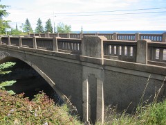 | Bridge No. 3589-Silver Creek Township | structure | 1998 | 98000686 |
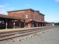 | Duluth and Iron Range Railroad Company Depot | building | 1983 | 83000910 |
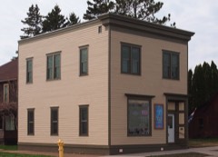 | John Dwan Office Building | building | 1992 | 92000700 |
 | EDNA G (tugboat) | structure | 1975 | 75002144 |
| Gooseberry Falls State Park CCC/WPA/Rustic Style Historic Resources | district | 1989 | 89001672 | |
| Halfway Ranger Station | district | 2011 | 11000782 | |
| Kawishiwi Lodge | district | 2021 | 100005995 | |
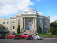 | Lake County Courthouse and Sheriff's Residence | building | 1983 | 83000912 |
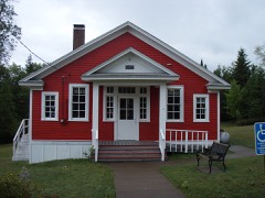 | Larsmont School | building | 1992 | 92000799 |
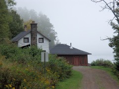 | Edward and Lisa Mattson House and Fish House | building | 1990 | 90001152 |
 | Split Rock Lighthouse | district | 1969 | 69000073 |
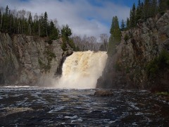 | Tettegouche Camp Historic District | district | 1989 | 88003084 |
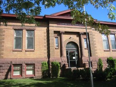 | Two Harbors Carnegie Library | building | 1986 | 86002121 |
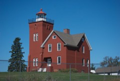 | Two Harbors Light Station | building | 1984 | 84001483 |
Every wildfire the federal occurrence database records inside this county: 769 of them, burning about 99,908 acres. 167 started naturally and 43 were recorded as arson. Each settlement page carries the fires within five miles of it.
| Reported cause | Fires |
|---|---|
| Natural | 167 |
| Recreation and ceremony | 132 |
| Debris and open burning | 112 |
| Railroad operations and maintenance | 107 |
| Missing data/not specified/undetermined | 105 |
| Equipment and vehicle use | 50 |
| Arson/incendiarism | 43 |
| Smoking | 24 |
| Power generation/transmission/distribution | 13 |
| Misuse of fire by a minor | 10 |
| Fireworks | 3 |
| Other causes | 3 |
The five largest, by the area the report gives. None of them was recorded as arson.
| Date | Cause | Size | Reported by | Name on the report |
|---|---|---|---|---|
| 18 August 2011 | Natural | 92,682 acres | Superior National Forest | PAGAMI CREEK |
| 9 June 1995 | Natural | 3,048 acres | Superior National Forest | LITTLE GABBRO |
| 13 July 2006 | Natural | 2,085 acres | Superior National Forest | TURTLE |
| 7 May 2016 | Natural | 257 acres | Minnesota Department of Natural Resources | not named |
| 26 August 2013 | Natural | 188 acres | Superior National Forest | KNIFE LAKE |
| 31 May 2002 | Natural | 150 acres | Superior National Forest | BALSAM LAKE |
| 21 October 2010 | Railroad operations and maintenance | 144 acres | Superior National Forest | FULL MOON |
| 30 May 2002 | Natural | 120 acres | Minnesota Department of Natural Resources | not named |
Every settlement page carries the fires within five miles of it - see the settlement index below.
The NOAA Storm Events Database holds 161 reports for this county, causing 4 deaths, 6 injuries and about $2,533,500 in recorded property damage. Each settlement page carries the reports that name it.
| Kind of event | Reports |
|---|---|
| Thunderstorm Wind | 71 |
| Hail | 60 |
| Flash Flood | 15 |
| Tornado | 7 |
| Lightning | 2 |
| Flood | 2 |
| Heavy Rain | 2 |
| Funnel Cloud | 2 |
The most serious of them, by death, then injury, then recorded damage. The accounts are quoted exactly as the forecast office filed them.
| When | Event | Place named | Harm | What the report says |
|---|---|---|---|---|
| July 2016 | Thunderstorm Wind | Forest Center | 2 killed, 2 hurt | Severe thunderstorm winds knocked down numerous trees near the Prairie Portage area of Basswood Lake right on and near the Canadian border. Trees were blown down near the campsite of 9 campers who were affiliated with the Boy Scouts of America. One woman (age 39) and one boy (age 13) were killed when trees fell on their tent. Two other campers were injured with non-life-threatening injuries. The campers were technically in Canada, but added this to the event record for historical purposes since the campers were so close to the US border. |
| July 2003 | Thunderstorm Wind | Isabella | 1 killed, 1 hurt | no account filed |
| June 1996 | Lightning | Ely | 1 killed | no account filed |
| July 2003 | Hail | Isabella | 1 hurt, $100,000 | no account filed |
| July 2014 | Thunderstorm Wind | Forest Center | 1 hurt | A camper was injured from a tree falling on the campsite. |
| July 2014 | Thunderstorm Wind | Forest Center | 1 hurt | A camper was injured from a tree falling on the campsite. |
| June 2012 | Flash Flood | Knife River | $1,900,000 | Six to 10 inches of rain fell overnight on the 19th and during the following day, resulting in stream and river flooding. Many driveways were washed out. The Knife River flooded Highway 61 and resulted in evacuations in the town of Knife River. Other smaller state and county roads were washed out. Water was flowing across Highway 61 on the northeast end of Two Harbors. |
| July 2013 | Lightning | Finland | $250,000 | no account filed |
| June 2012 | Flash Flood | Higen City | $191,000 | There was six inches of water over Highway 61 at the junction with Highway 1 due to the flooding of the west branch of the Baptism River. There was also significant flooding of the golf course at Beaver bay and of Rockwood Road at Silver Bay, due to flooding of the Beaver River and Palisade River, respectively. |
| June 2024 | Flood | Isabella | $30,000 | Flood waters from Weiss Creek were flowing over Minnesota Highway 1 with half the roadway washed away at the time of the survey visit around 9:30AM CST. The roadway was closed at the time of the visit. |
| April 1976 | Tornado (F1) | not stated | $25,000 | no account filed |
| June 1976 | Tornado (F1) | not stated | $25,000 | no account filed |
| September 2023 | Thunderstorm Wind | Sawbill Lndg | $5,000 | Many large trees were snapped off ten feet above the ground with trees nearby uprooted in areas with thin or wet soils. One tree limb was through the metal roof of a cabin. |
| July 2021 | Thunderstorm Wind | Two Harbors | $5,000 | The top part of a healthy pine tree was knocked over by the wind and punctured a garage roof. |
| September 1987 | Tornado (F1) | not stated | $2,500 | no account filed |
| April 2026 | Hail | Silver Creek | - | The majority of the hail was three quarters to one inch in size but some pieces were as large as 1.5 inches in diameter. |
| May 2025 | Thunderstorm Wind | Silver Bay Muni Arpt | - | Trees were reported down around the boat launch. |
| May 2025 | Thunderstorm Wind | Silver Bay Muni Arpt | - | Numerous trees were uprooted or snapped in Split Rock State Park blocking trails and taking down power lines. |
| May 2025 | Thunderstorm Wind | Silver Bay Muni Arpt | - | About ten to 15 spruce trees were snapped near the base in a video that was received. |
| May 2025 | Thunderstorm Wind | East Beaver Bay | - | Trees were reported down along and across Highway 61 between Ionas Beach and East Beaver Bay along with trees down in Silver Bay. |
| May 2025 | Thunderstorm Wind | Silver Bay | - | Photos were received of trees down in Silver Bay. |
| May 2025 | Thunderstorm Wind | Finland | - | Some trees were uprooted, some were snapped, and some trees fell in different directions. Many trees were large, estimated to be around or greater than a foot in diameter. Report was received via phone, and the caller mentioned that around the immediate Finland area, damage was sporadic with relatively minor to moderate widespread damage, but channels from approximately Little Marais to the Superior Hiking Trailhead along Little Marais Road towards Finland where there were numerous trees down. |
| June 2025 | Thunderstorm Wind | Isabella | - | A large tree was down over the roadway. |
| June 2025 | Thunderstorm Wind | Sawbill Lndg | - | Trees were down across highways 1 and 2 near the Stony River Wayside. |
| June 2024 | Tornado (EF1) | Isabella | - | Tornado damage initially appeared on the northeast shore of Tanner Lake (east of Dumbbell Lake), crossing Wanless Road (Forest Road 172) on a southeastward track. Satellite imagery depicts sporadic tree damage along the path, with a particularly impressive swath of trees that were uprooted or snapped east of East General Grade Road (Forest Road 362) measuring approximately 150 yards in width and a quarter mile in length. Damage continues to be evident for another mile or so before no additional discernible damage is evident. No fatalities or injuries were reported. Tornado rating was determined based on satellite imagery, and NWS Duluth is coordinating to learn more about any air or ground surveyed damage from our partners at the Superior National Forest which may result in a future revision in the tornado rating. |
| June 2024 | Flash Flood | Finland | - | Minnesota Highway 1 was closed northeast of Finland between White Pine Road and Riverside Drive due to flooding and washouts. |
| June 2024 | Flash Flood | Sawbill Lndg | - | Flooding was reported near the Fall Lake Campground. |
| June 2024 | Flash Flood | Little Marais | - | Flooding and debris across Minnesota Highway 61 led to multiple closures between Outer Drive in Silver Bay and Happy Acres Drive in Lutsen. |
| June 2024 | Flash Flood | Little Marais | - | Water was over Highway 61 with the road being closed as a result. |
| September 2023 | Thunderstorm Wind | Forest Center | - | A photo was received showing a large tree snapped and multiple other trees down around a campsite. |
| September 2023 | Thunderstorm Wind | Sawbill Lndg | - | Several large trees were snapped and a 24 inch diameter tree was uprooted. |
| September 2023 | Thunderstorm Wind | Forest Center | - | Numerous trees were reported down on Boga Lake in the Boundary Waters Canoe Area Wilderness. |
| September 2023 | Thunderstorm Wind | Sawbill Lndg | - | The storm blew the top off of a white pine tree and the spotters location. |
| May 2022 | Flash Flood | Finland | - | A washout was reported along Breezy Lane in Finland. |
| May 2022 | Flash Flood | Finland | - | Multiple washouts were reported along Cramer Road near and east of Finland. |
| June 2022 | Thunderstorm Wind | Sawbill Lndg | - | Numerous trees were downed in the area. |
| June 2022 | Thunderstorm Wind | Sawbill Lndg | - | Numerous trees were downed ranging from six to ten inches in diameter. |
| July 2021 | Thunderstorm Wind | Isabella | - | Trees were reported down on power lines along Mitawan Lake Road northwest of Isabella. |
| July 2019 | Thunderstorm Wind | Sawbill Lndg | - | A large tree was downed along New Tomahawk Road. |
| July 2019 | Thunderstorm Wind | Stewart | - | Power lines were knocked down north of Two Harbors along Forest Highway 15. |
| June 2018 | Thunderstorm Wind | Forest Center | - | The wind was measured by a personal weather station on Moose Lake Road. |
| May 2018 | Hail | Castle Danger | - | A spotter reported 3 minutes of dime-sized hail at Gooseberry Falls State Park. |
| July 2018 | Thunderstorm Wind | Waldo | - | Multiple trees were knocked down onto power lines along U.S. Highway 2. |
| August 2018 | Hail | Silver Creek | - | The hail was covering County Road 2 six miles north of Two Harbors. |
| August 2018 | Hail | Waldo | - | The hail damaged some vehicles. |
| June 2018 | Flash Flood | Silver Creek | - | Lake County Highway 3 was washed out between Loop Road and Fors Road. |
| June 2018 | Flash Flood | Two Harbors Muni Arp | - | Airport Road was washed out between Highway 12 and Big Rock Road. |
| June 2018 | Flash Flood | Stewart | - | Old Drummond Road was washed out at the Stewart River between Big Rock Road and Holm Road. |
| May 2018 | Thunderstorm Wind | Isabella | - | Several trees blown down by strong thunderstorm winds. |
| July 2017 | Tornado (EF1) | Forest Center | - | Environment Canada conducted a survey of the long-tracked tornado, which began and mostly occurred in Ontario before crossing into Minnesota, and rated the damage on their end as EF-2, and as EF-1 on the short distance in Minnesota before it dissipated. Satellite imagery is available to show the clear path of the tornado. The total path length was about 8.5 miles, only 0.9 miles of which occurred in Minnesota. |
| March 2016 | Hail | Sawbill Lndg | - | When delayed report received at 10:25 am hail was still on the ground. |
| August 2016 | Flash Flood | East Beaver Bay | - | Thunderstorms brought heavy rain to parts of the North Shore. There was flooding over Highway 61 between mile markers 53 and 54. |
| July 2016 | Thunderstorm Wind | Larsmont | - | A tree fell on a cabin. |
| July 2016 | Thunderstorm Wind | Sawbill Lndg | - | There were over 70 trees blown over on and near Browns Lake. |
| July 2016 | Thunderstorm Wind | Sawbill Lndg | - | There were over 70 trees blown over on and near Browns Lake. |
| July 2016 | Thunderstorm Wind | Forest Center | - | There was at least one large tree blown down at the Kawishiwi Lodge on Lake One. |
| July 2016 | Thunderstorm Wind | Finland | - | Two power lines fell on two motor homes. |
| July 2016 | Thunderstorm Wind | Finland | - | There was a power line down on County Road 6. |
| July 2016 | Thunderstorm Wind | Sawbill Lndg | - | A multiple trees snapped near its base. |
| September 2014 | Hail | Finland | - | The majority of the hailstones were pea size, but there were many nickel sized and a few half dollar sized hail. |
The Survey's mineral resources record lists 25 workings inside this county. 17 still produce and 8 are closed or unrecorded. Each settlement page carries the workings within five miles of it.
| Commodity | Workings |
|---|---|
| Sand and Gravel, Construction | 14 |
| Iron | 4 |
| Iron, Titanium, Metal | 2 |
| Copper, Nickel, Platinum, Palladium | 1 |
| Cobalt, Gold, Silver | 1 |
| PGE | 1 |
| Nickel, Copper | 1 |
| Cobalt, Silver, Gold, Platinum, Palladium | 1 |
| Copper, Nickel, Palladium, Platinum | 1 |
| Cobalt, Titanium, Gold | 1 |
| Titanium, Silica, Iron, Aluminum, Sodium, Calcium | 1 |
| Copper | 1 |
The least common of them first, because a county's hundredth gravel pit says nothing its first ten did not.
| Where | Site | Commodity | Status | Recorded |
|---|---|---|---|---|
| Birch Lake Prospect | Copper | Unknown | ||
| Lake and Cook County Anorthosite | Titanium, Silica, Iron, Aluminum, Sodium, Calcium | Occurrence | ||
| Maturi Nokomis Deposit | Copper, Nickel, Palladium, Platinum, Cobalt, Titanium, Gold | Prospect | Bornite, Chalcocite, Chalcopyrite, Covellite, Cubanite, Cuprite, Digenite, Pentlandite, Pyrite, Pyrrhotite, Sphalerite, Tenorite | |
| South Filson Creek deposit | Nickel, Copper, Cobalt, Silver, Gold, Platinum, Palladium | Prospect | 1967 | |
| Spruce Road deposit | Copper, Nickel, Platinum, Palladium, Cobalt, Gold, Silver, PGE | Prospect | 1955 | |
| Fraser Lake Deposit | Iron, Titanium, Metal | Unknown | Ilmenite, Magnetite | |
| Thomas Lake Deposit | Iron, Titanium, Metal | Unknown | Ilmenite, Magnetite | |
| E.W. Davis Works | Iron | Producer | ||
| Reserve Pellet Plant | Iron | Producer | ||
| Section 30 Mine | Iron | Past Producer | 1910 | |
| Silver Bay Plant | Iron | Producer | ||
| American John Pit | Sand and Gravel, Construction | Producer | ||
| Big Noise Pit No 1 | Sand and Gravel, Construction | Producer | ||
| Big Noise Pit No 2 | Sand and Gravel, Construction | Producer | ||
| Clark Pit | Sand and Gravel, Construction | Producer | ||
| Cramer Pit | Sand and Gravel, Construction | Producer | ||
| Drummond Pit | Sand and Gravel, Construction | Producer | ||
| Fall Lake Township Pit | Sand and Gravel, Construction | Producer | ||
| Gooseberry Pit | Sand and Gravel, Construction | Producer | ||
| Johnson Pit | Sand and Gravel, Construction | Producer | ||
| Lake County Highway Dept Pit | Sand and Gravel, Construction | Producer | ||
| Lauren Pit and Mill | Sand and Gravel, Construction | Producer | ||
| Swanstroms Pit | Sand and Gravel, Construction | Producer | ||
| Thompson Pit | Sand and Gravel, Construction | Producer | ||
| Toivonen Pit | Sand and Gravel, Construction | Producer |
Named settlements recorded in the Geographic Names Information System, each with the topographic sheets covering it. Villages, hamlets and abandoned places alike. Each is shown with the nearest named watercourse or landform and the survey quadrangle it falls on.
Beaver Bay city · 55601 · On Beaver River · Silver Bay quadrangle
11 sheets, 1954 to 1982
Silver Creek township · 55616 · On Stony Creek · Two Harbors NE quadrangle
11 sheets, 1954 to 1976
Beaver Bay township · 55601 · Near Wieland Island · Silver Bay quadrangle
11 sheets, 1954 to 1982
Crystal Bay township · 55603 · On East Branch Baptism River · Finland quadrangle
11 sheets, 1954 to 1976
Stony River township · 55607 · On Kelly Creek · Slate Lake West quadrangle
10 sheets, 1954 to 1994
Beaver Bay township · 55614 · On Crystal Creek · Illgen City quadrangle
11 sheets, 1954 to 1976
Silver Creek township · 55616 · On Kinney Creek · Mount Weber quadrangle
11 sheets, 1953 to 1982
Stony River township · 55607 · On Trappers Creek · Sawbill Landing quadrangle
12 sheets, 1954 to 1994
Lake No. 2 unorganized territory · 55616 · Two Harbors OE S quadrangle
5 sheets, 1953 to 1980
Beaver Bay township · 55614 · On East Branch Fortythree Creek · Silver Bay quadrangle
11 sheets, 1954 to 1982
Lake No. 1 unorganized territory · 55614 · On Little Marais River · Little Marais quadrangle
11 sheets, 1954 to 1976
Lake No. 1 unorganized territory · 55614 · Finland quadrangle
11 sheets, 1954 to 1976
Silver Creek township · 55616 · Near Gustafson Hill · Two Harbors NE quadrangle
11 sheets, 1954 to 1976
Stony River township · 55731 · On Jack Creek · Sawbill Landing quadrangle
12 sheets, 1954 to 1994
Silver Creek township · 55614 · On Kinney Creek · Kane Lake quadrangle
11 sheets, 1953 to 1981
Silver Bay city · 55614 · Near Beaver Island · Silver Bay quadrangle
11 sheets, 1954 to 1982
Two Harbors city · 55616 · On Skunk Creek · Two Harbors quadrangle
11 sheets, 1954 to 1992