 Block
From the record
8 National Register listings published here.
Sources: the National Register database, National Park Service
28 topographic sheets cover 15 settlements here, and 8 properties are on the National Register of Historic Places.
8 National Register listings published here.
Sources: the National Register database, National Park Service
Every property in this county listed on the National Register of Historic Places, with the year it was listed and the federal nomination document.
| Photograph | Property | Type | Listed | Reference |
|---|---|---|---|---|
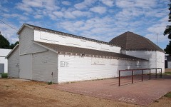 | 4-H Club Building, Murray County Fairgrounds | building | 2005 | 05001436 |
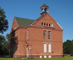 | Avoca Public School | building | 1979 | 79003715 |
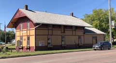 | Chicago, Milwaukee, St. Paul, and Pacific Depot | building | 1979 | 79003716 |
 | Chicago, St. Paul, Minneapolis, and Omaha Turntable | structure | 1977 | 77000758 |
 | Dinehart-Holt House | building | 1982 | 82000562 |
 | First National Bank | building | 1982 | 82000563 |
 | Lake Shetak State Park WPA/Rustic Style Group Camp | building | 1992 | 92000777 |
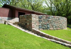 | Lake Shetek State Park WPA/Rustic Style Historic District | district | 1992 | 89001656 |
Every wildfire the federal occurrence database records inside this county: 2 of them, burning about 133 acres. None started naturally and 1 was recorded as arson. Each settlement page carries the fires within five miles of it.
| Reported cause | Fires |
|---|---|
| Arson/incendiarism | 1 |
| Debris and open burning | 1 |
The five largest, by the area the report gives. One of them was set deliberately.
| Date | Cause | Size | Reported by | Name on the report |
|---|---|---|---|---|
| 15 April 2014 | Debris and open burning | 123 acres | Minnesota Department of Natural Resources | not named |
| 25 April 2004 | Arson/incendiarism | 10 acres | Minnesota Department of Natural Resources | not named |
Every settlement page carries the fires within five miles of it - see the settlement index below.
The NOAA Storm Events Database holds 296 reports for this county, causing 1 death, 41 injuries and about $60,739,000 in recorded property damage. Each settlement page carries the reports that name it.
| Kind of event | Reports |
|---|---|
| Hail | 121 |
| Thunderstorm Wind | 97 |
| Tornado | 34 |
| Flood | 23 |
| Flash Flood | 15 |
| Lightning | 3 |
| Heavy Rain | 2 |
| Funnel Cloud | 1 |
The most serious of them, by death, then injury, then recorded damage. The accounts are quoted exactly as the forecast office filed them.
| When | Event | Place named | Harm | What the report says |
|---|---|---|---|---|
| June 1992 | Tornado (F5) | not stated | 1 killed, 35 hurt, $25,000,000 | no account filed |
| June 1992 | Tornado (F4) | not stated | 3 hurt, $25,000,000 | no account filed |
| April 1985 | Tornado (F3) | not stated | 2 hurt, $2,500,000 | no account filed |
| June 2008 | Tornado (EF1) | Lime Creek | 1 hurt, $100,000 | A tornado blew the roof off a house, collapsed a wall in the house, and shifted the house off its foundation. A woman taking shelter in a closet was injured. On the same farmstead, the tornado also destroyed two sheds and caused minor damage to another house and two outbuildings. The tornado carried some debris from the farm over a mile. The tornado also caused extensive tree damage. |
| June 1968 | Tornado (F5) | not stated | $2,500,000 | no account filed |
| June 2024 | Flood | Chandler | $2,300,000 | Rainfall amounts across Murray County from June 20-22 ranged from 4 to 8 inches. This rainfall resulted in overland flooding and major flooding along the West Fork Des Moines River. ||County-wide, 132 homes were damaged, three of which were declared destroyed. Many homes in the cities of Slayton and Fulda reported wastewater backup in their basements. Numerous roads and culverts were damaged with State Highway 30 closed at one point between Dovray and Westbrook. Preliminary assessments estimate loss to private property to be near 1 million dollars and 1.3 million dollars to public infrastructure. ||The majority of overland flooding subsided by June 23, but river flooding continued through the end of the month. For additional information on river flooding, please see other flood entries for Murray County. |
| April 2019 | Flood | Currie | $600,000 | Runoff from occasional precipitation in late March and April maintained significant flooding of agricultural and pasture lands near the Des Moines River. The Des Moines River near Avoca (gage site AVOM5) crested twice at moderate flood stage during the month. The first crest was at 2.14 feet above flood stage on April 1. The second crest occurred on April 19 at 2.53 feet above flood stage. Moderate flooding continued at the end of the month. |
| June 2004 | Flash Flood | Countywide | $500,000 | Rainfall of 2 to 6 inches over the northern and eastern parts of Murray County flooded numerous roads, and washed out some township roads. Residents in the Lake Shetek area were especially affected, with high water flooding roads to many homes. At least 50 thousand acres of cropland were flooded, with some crops washed away completely. The amount of crop damage was not known, due to the uncertainties in both crop recovery and in the ability to replant. Other lowlands were flooded, including a golf course in Slayton. |
| March 2019 | Flood | Currant Lake | $273,000 | Flooding resulted in extensive damage to public infrastructure including numerous county and township roads, culverts, and some bridges. The property damage costs include estimates for public property losses. |
| April 1985 | Tornado (F1) | not stated | $250,000 | no account filed |
| April 1985 | Tornado (F1) | not stated | $250,000 | no account filed |
| August 2019 | Tornado (EF1) | Hadley | $200,000 | The tornado formed around 2 miles west-southwest of Hadley, moving northeast through a farmstead shortly after touchdown and damaging trees and partially removing a roof from a metal outbuilding. After crossing Minnesota Highway 30, the tornado struck another farm, causing destruction of a barn, and resulting in damage to the house including blowing in a door and driving a 2x4 through the siding. The tornado reached Hadley three minutes after touchdown. Two garages were destroyed in town, along with damage to numerous trees. One final structure was grazed by the tornado just northeast of Hadley, blowing in the door and damaging the roof of a metal outbuilding. The tornado lifted around 2 miles northeast of Hadley after crossing 121st Street and damaging a power transmission pole. The average path width was 75 yards. |
| June 1997 | Thunderstorm Wind | Slayton | $200,000 | no account filed |
| September 2019 | Flood | Chandler | $100,000 | Numerous county and township roads were under water. Multiple homes were impacted by water in Slayton, Avoca and Chandler. Property damage costs are rough estimates. Flooding also resulted in crop losses across the area. Crop loss estimates provided by the United States Department of Agriculture. |
| April 2011 | Flood | Currant Lake | $100,000 | Flooding of lakes, streams, and lowlands, including some farmland, continued in the county through April. While flooding of small streams abated, lake and lowland flooding continued with very slow improvement. Several roads remained flooded. High water and groundwater levels resulting from record precipitation in the previous year was the main reason that the flooding either grew worse or improved so slowly. |
| March 1998 | Hail | Avoca | $100,000 | no account filed |
| September 2021 | Thunderstorm Wind | Chandler | $50,000 | A hoop barn was destroyed by thunderstorm winds, along with doors and roof ripped off a machine shed. Property damage costs are a rough estimate. |
| August 2019 | Tornado (EF0) | Currie | $50,000 | This brief tornado touched down around a mile south of Lake Sarah in an open corn field, leaving a discernible track. Two small outbuildings were damaged as the tornado moved to the northeast, with mainly minor damage to metal roofing panels. The tornado crossed U.S. Highway 59, turning a bit more northward in track before damaging the final farm outbuilding and lifting shortly thereafter. The average path width was 30 yards. |
| June 2014 | Flood | Currant Lake | $50,000 | Persistent moderate to heavy rain caused flooding of fields and other lowlands, including several roads, homes, and businesses. This flooding lasted for two days, and was aggravated locally by additional storms during that time. Some roads were damaged or washed out. |
| July 2010 | Thunderstorm Wind | Currie | $50,000 | Thunderstorm winds caused widespread tree damage near Lake Shetek, including up to 3 foot diameter trees blown down. Several vehicles, a dock, and a trampoline near the lake were damaged by falling trees or tree debris. Falling trees trapped 4 people in a restaurant. |
| June 2008 | Tornado (EF1) | Wirock | $50,000 | A tornado, after crossing into Murray County from Nobles County, destroyed a garage and a barn, blew down a grain bin, damaged several sheds, and caused tree damage. |
| April 2002 | Thunderstorm Wind | Slayton | $50,000 | Thunderstorm winds blew the roof off a building, damaged trees and road signs, and blew a semi trailer on its side. |
| June 1998 | Thunderstorm Wind | Fulda | $50,000 | no account filed |
| March 1998 | Tornado (F1) | Avoca | $50,000 | no account filed |
| March 1998 | Tornado (F1) | Fulda | $50,000 | no account filed |
| June 2001 | Thunderstorm Wind | Fulda | $30,000 | Thunderstorm winds lifted an anchored metal building and rolled it into a house. |
| June 2001 | Thunderstorm Wind | Slayton | $30,000 | Thunderstorm winds destroyed a granary building. |
| August 2021 | Thunderstorm Wind | Chandler | $25,000 | Portions of two barn roofs were removed by thunderstorm winds. Property damage costs are a rough estimate. |
| August 2019 | Tornado (EF0) | Currie | $25,000 | The track of this tornado followed generally eastward along 181st Street between 140th and 150th Avenues. The tornado started with a slight south of east track, flattening corn and damaging trees in a shelter belt. The tornado then began to move more eastward, striking and destroying an old barn around a quarter mile from the touchdown point. The remainder of the track was across cornfields, crossing north of 181st Street before lifting. The average path width was 40 yards. |
| September 2010 | Flash Flood | Lake Wilson | $25,000 | Heavy rain caused flash flooding in much of southern Murray County. Numerous roads were flooded, including Minnesota Highway 30 in several areas. Numerous basements were flooded, especially in Fulda. |
| April 1985 | Tornado (F0) | not stated | $25,000 | no account filed |
| May 2004 | Thunderstorm Wind | Avoca | $20,000 | Thunderstorm winds destroyed a small building. |
| May 2004 | Tornado (F0) | Hadley | $20,000 | A tornado destroyed a 48 foot grain bin. The tornado also caused widespread tree damage, including several trees blown down. |
| August 2000 | Thunderstorm Wind | Lake Wilson | $20,000 | Thunderstorm winds blew down power lines and caused tree damage. |
| June 1996 | Heavy Rain | Lake Wilson | $20,000 | no account filed |
| August 2021 | Thunderstorm Wind | Avoca | $10,000 | A machine shed was damaged by thunderstorm wind gusts. Property damage costs are a rough estimate. |
| August 2019 | Thunderstorm Wind | Chandler | $10,000 | Thunderstorm winds flipped an old shed toward the north. |
| September 2019 | Flood | Currie | $10,000 | After excessive two-day rainfall during September 10-12 (5.35 inches at Slayton), the West Fork of the Des Moines River near Avoca (gage site AVOM5) reached the third highest stage on record of 2.71 feet above flood stage on September 16. Significant agricultural land was flooded, with numerous county roads under water. |
| July 2003 | Thunderstorm Wind | Fulda | $10,000 | Thunderstorm winds caused widespread tree damage and blew down power lines. The winds also blew a porch awning off a house. |
| June 2001 | Thunderstorm Wind | Fulda | $10,000 | Thunderstorm winds blew down trees and broke windows. |
| September 2021 | Thunderstorm Wind | Lake Wilson | $5,000 | A hoop barn was damaged by thunderstorm wind gusts. Property damage costs are a rough estimate. |
| June 2020 | Thunderstorm Wind | Iona | $5,000 | Eight trees were snapped off at the trunk, with several other uprooted. A 4-wheeler was blown a couple hundred feet off the driveway. Property damage costs are rough estimates. |
| May 1998 | Lightning | Fulda | $5,000 | no account filed |
| August 2021 | Thunderstorm Wind | Chandler | $4,000 | Several large trees were snapped or uprooted by thunderstorm winds. Property damage costs are a rough estimate. |
| July 1968 | Tornado (F1) | not stated | $2,500 | no account filed |
| July 2019 | Lightning | Currie | $2,000 | Lightning struck and killed a cow. |
| June 2001 | Lightning | Slayton | $2,000 | Lightning struck a house, causing damage to the side of the house and burning off cable television wires. |
| June 2020 | Thunderstorm Wind | Fulda | $500 | Damage occurred to numerous small to moderate tree limbs. Property damage costs are rough estimates. Wind was accompanied by pea size hail. Crop damage is an estimate from insured losses. Information provided by the United States Department of Agriculture. |
| July 2024 | Flood | Currie | - | Flooding continued from June on the Des Moines River near Avoca, with declining river levels. The river fell below flood stage on the morning of July 8th. |
| July 2024 | Hail | Hadley | - | Hail varied from pea to quarter size. |
| July 2024 | Hail | Hadley | - | Quarter size hail produced considerable crop damage. Crop damage monetary losses are an estimate using data from the U.S. Department of Agriculture. |
| May 2024 | Thunderstorm Wind | Currie | - | Thunderstorms winds tore the doors off a farm outbuilding. |
| July 2024 | Thunderstorm Wind | Dovray | - | Thunderstorm wind gusts up to 60 mph were measured at a Minnesota Road Weather Information System site near Dovray. |
| June 2024 | Flood | Currie | - | The West Fork of the Des Moines River near Avoca rose above flood stage the morning of June 21st, cresting around 4.64 feet above flood stage (1429.64 feet) on June 24th. This crest is in the Major Stage. The river stayed above flood stage into July. For a more comprehensive description of flood damage, please see other entries for Murray County. |
| June 2024 | Thunderstorm Wind | Currie | - | Four power poles were damaged by thunderstorm winds and resulted in loss of power to substations and a brief power outage. |
| April 2023 | Flood | Currie | - | The West Fork of the Des Moines River near Avoca, MN rose above flood stage on the afternoon of April 12th before cresting around 0.67 feet above flood stage (1425.67 feet) on April 15th. The river then fell below flood stage on the morning of April 17th. |
| June 2023 | Thunderstorm Wind | Currie | - | Thunderstorm winds downed a large tree limb in End-O-Line Railroad Park. |
| June 2023 | Tornado (EFU) | Lake Wilson | - | A brief landspout developed around 1.5 miles west-southwest of Lake Wilson, and was seen and photographed by numerous individuals, despite its brief appearance. The touchdown occurred within an open field and caused no visible damage to determine a rating. |
| September 2023 | Hail | Currie | - | Hail varied from pea to walnut size on the south side of Lake Shetek. |
| September 2023 | Hail | Lake Wilson | - | Hail was mostly nickel to quarter size. |
The Survey's mineral resources record lists 20 workings inside this county. All of them still produce. Each settlement page carries the workings within five miles of it.
| Commodity | Workings |
|---|---|
| Sand and Gravel, Construction | 20 |
The least common of them first, because a county's hundredth gravel pit says nothing its first ten did not.
| Where | Site | Commodity | Status | Recorded |
|---|---|---|---|---|
| Anderson Pit | Sand and Gravel, Construction | Producer | ||
| Anderson Pit | Sand and Gravel, Construction | Producer | ||
| Ferguson Pit | Sand and Gravel, Construction | Producer | ||
| Freeburg Pit No 1 | Sand and Gravel, Construction | Producer | ||
| Freeburg Pit No 2 | Sand and Gravel, Construction | Producer | ||
| Ginn Pit | Sand and Gravel, Construction | Producer | ||
| Johnson Pit | Sand and Gravel, Construction | Producer | ||
| Mc Beth Pit | Sand and Gravel, Construction | Producer | ||
| Peltala Pit | Sand and Gravel, Construction | Producer | ||
| Renken Pit | Sand and Gravel, Construction | Producer | ||
| Rupp 2 | Sand and Gravel, Construction | Producer | ||
| Rupp No 1 Pit | Sand and Gravel, Construction | Producer | ||
| Rupp No 3 Pit | Sand and Gravel, Construction | Producer | ||
| Rupp No 4 Pit | Sand and Gravel, Construction | Producer | ||
| Rupp No 5 Pit | Sand and Gravel, Construction | Producer | ||
| Rupp No 6 Pit | Sand and Gravel, Construction | Producer | ||
| Rupp No 7 Pit | Sand and Gravel, Construction | Producer | ||
| Shaw Pit | Sand and Gravel, Construction | Producer | ||
| Sweetman Pit | Sand and Gravel, Construction | Producer | ||
| Toussaint Pit | Sand and Gravel, Construction | Producer |
Named settlements recorded in the Geographic Names Information System, each with the topographic sheets covering it. Villages, hamlets and abandoned places alike. Each is shown with the nearest named watercourse or landform and the survey quadrangle it falls on.
Lowville township · 56151 · Near Great Oasis Lakebed · Hadley quadrangle
11 sheets, 1953 to 1986