 Block
Currie, Minnesota
10 topographic sheets cover this place, the earliest surveyed in 1953 and the latest in 1986. It stands in Murray Township. It lies in ZIP code area 56123. It stands on Beaver Creek. The Survey maps it on the Currie quadrangle. 224 people lived here at the 2020 count. It stands 1,496 feet above sea level.
Research this city
On record in Currie
Buildings and businesses the archive holds for this place. Each opens its own page, with the source record it came from.
On the National Register 3 records
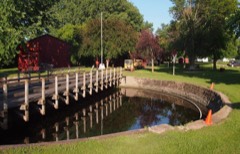


Population over time
2 figuresCurrie fell from 233 to 224 between 2010 and 2020. These are the recorded population figures Wikidata holds for this place, reached through the Geographic Names Information System number this page is keyed on rather than by name, so they belong to this place and not to another of the same name. Most are census counts, but not all are: an early figure may be a founding or settlement estimate, and an estimate published within five years of a census is left out. The change column is computed, and is left blank where more than 20 years separate a figure from the one before it, because a gap that long is not a change between two counts.
| Year | People | Change |
|---|---|---|
| 2010 | 233 | |
| 2020 | 224 | -9 (-4%) |
Topographic sheets covering this place
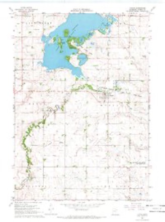
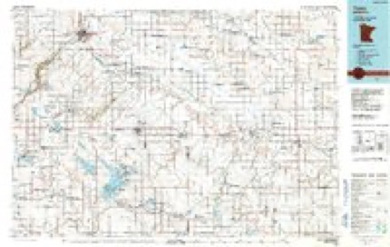
6 surveys from 10 printed sheetsMatched by testing this settlement's coordinate against the published boundary of every sheet in the United States Geological Survey's historical collection. Each opens the scanned sheet at the Survey.
- 1953 USGS New Ulm quadrangle1:250000, 3 printings
- 1957 USGS New Ulm quadrangle1:250000
- 1958 USGS New Ulm quadrangle1:250000
- 1967 USGS Currie quadrangle1:24000, 2 printings
- 1967 USGS New Ulm quadrangle1:250000
- 1986 USGS Tracy quadrangle1:100000, 2 printings




Mines and quarries near this place
7 within 5 milesRegional context, not property-specific evidence. The federal mineral resources record lists 7 workings within 5 miles of Currie: 7 producers. All of them still produce. What was taken out: Sand and Gravel, Construction. Distance is straight-line from the map coordinates, so a quarry counted here may appear on a neighbouring settlement's page as well.
| Where | Site | Commodity | Status | Recorded |
|---|---|---|---|---|
| Anderson Pit | Sand and Gravel, Construction | Producer | ||
| Johnson Pit | Sand and Gravel, Construction | Producer | ||
| Rupp No 4 Pit | Sand and Gravel, Construction | Producer | ||
| Rupp No 5 Pit | Sand and Gravel, Construction | Producer | ||
| Rupp No 6 Pit | Sand and Gravel, Construction | Producer | ||
| Rupp No 7 Pit | Sand and Gravel, Construction | Producer | ||
| Sweetman Pit | Sand and Gravel, Construction | Producer |
Storms near this place
55 since 2000Regional context, not property-specific evidence. The National Weather Service names Currie in 55 storm reports between 2000 and 2024: 18 hail, 15 flood, 13 thunderstorm wind, 4 flash flood. No death or injury is recorded in these reports. Each account below is quoted exactly as the forecast office filed it, from the NOAA Storm Events Database, and each date opens the federal record of that event.
| When | Event | Place named | Harm | What the report says |
|---|---|---|---|---|
| April 2019 | Flood | Currie | $600,000 | Runoff from occasional precipitation in late March and April maintained significant flooding of agricultural and pasture lands near the Des Moines River. The Des Moines River near Avoca (gage site AVOM5) crested twice at moderate flood stage during the month. The first crest was at 2.14 feet above flood stage on April 1. The second crest occurred on April 19 at 2.53 feet above flood stage. Moderate flooding continued at the end of the month. |
| August 2019 | Tornado (EF0) | Currie | $50,000 | This brief tornado touched down around a mile south of Lake Sarah in an open corn field, leaving a discernible track. Two small outbuildings were damaged as the tornado moved to the northeast, with mainly minor damage to metal roofing panels. The tornado crossed U.S. Highway 59, turning a bit more northward in track before damaging the final farm outbuilding and lifting shortly thereafter. The average path width was 30 yards. |
| July 2010 | Thunderstorm Wind | Currie | $50,000 | Thunderstorm winds caused widespread tree damage near Lake Shetek, including up to 3 foot diameter trees blown down. Several vehicles, a dock, and a trampoline near the lake were damaged by falling trees or tree debris. Falling trees trapped 4 people in a restaurant. |
| August 2019 | Tornado (EF0) | Currie | $25,000 | The track of this tornado followed generally eastward along 181st Street between 140th and 150th Avenues. The tornado started with a slight south of east track, flattening corn and damaging trees in a shelter belt. The tornado then began to move more eastward, striking and destroying an old barn around a quarter mile from the touchdown point. The remainder of the track was across cornfields, crossing north of 181st Street before lifting. The average path width was 40 yards. |
| September 2019 | Flood | Currie | $10,000 | After excessive two-day rainfall during September 10-12 (5.35 inches at Slayton), the West Fork of the Des Moines River near Avoca (gage site AVOM5) reached the third highest stage on record of 2.71 feet above flood stage on September 16. Significant agricultural land was flooded, with numerous county roads under water. |
| July 2019 | Lightning | Currie | $2,000 | Lightning struck and killed a cow. |
| July 2024 | Flood | Currie | - | Flooding continued from June on the Des Moines River near Avoca, with declining river levels. The river fell below flood stage on the morning of July 8th. |
| May 2024 | Thunderstorm Wind | Currie | - | Thunderstorms winds tore the doors off a farm outbuilding. |
| June 2024 | Flood | Currie | - | The West Fork of the Des Moines River near Avoca rose above flood stage the morning of June 21st, cresting around 4.64 feet above flood stage (1429.64 feet) on June 24th. This crest is in the Major Stage. The river stayed above flood stage into July. For a more comprehensive description of flood damage, please see other entries for Murray County. |
| June 2024 | Thunderstorm Wind | Currie | - | Four power poles were damaged by thunderstorm winds and resulted in loss of power to substations and a brief power outage. |
| April 2023 | Flood | Currie | - | The West Fork of the Des Moines River near Avoca, MN rose above flood stage on the afternoon of April 12th before cresting around 0.67 feet above flood stage (1425.67 feet) on April 15th. The river then fell below flood stage on the morning of April 17th. |
| June 2023 | Thunderstorm Wind | Currie | - | Thunderstorm winds downed a large tree limb in End-O-Line Railroad Park. |
| September 2023 | Hail | Currie | - | Hail varied from pea to walnut size on the south side of Lake Shetek. |
| May 2022 | Hail | Currie | - | Hail varied between dime- and nickel-sized. |
| June 2022 | Thunderstorm Wind | Currie | - | A large tree was split in half by thunderstorm wind gusts near Lake Shetek. |
| March 2020 | Flood | Currie | - | The West Fork of the Des Moines River near Avoca (gage site AVOM5) rose above flood stage on March 4, and crested 1.71 feet above flood stage on March 6. A significant amount of agricultural land was flooded. |
| June 2019 | Flood | Currie | - | A continuation of flooding from May, the West Des Moines River near Avoca (gage site AVOM5) began the month at 0.87 feet above flood stage. Significant amounts of agricultural land remained flooded, and further impeded spring planting. |
| May 2019 | Flood | Currie | - | The Des Moines River near Avoca (gage site AVOM5) reached a peak of 0.97 feet above flood stage on May 31. The main impact was inundation of agricultural land and additional delays to spring planting in the flood plain. Minor flooding continued at the end of the month. |
| March 2019 | Flood | Currie | - | Snow melt and heavy rainfall (measured 1.50 inches at Tracy and 1.15 inches at Windom) resulted in significant flooding of agricultural lands. County Roads 6 and 44 were inundated with flood water for several days. The Des Moines River near Avoca (gage site AVOM5) reached the second highest stage on record cresting 3.56 feet above flood stage on March 16. The river remained in moderate flood stage at the end of the month. |
| May 2019 | Flood | Currie | - | This is a continuation of flooding from April. The Des Moines River near Avoca (gage site AVOM5) had an early month crest at 1.04 feet above flood stage on May 1, before falling below flood stage on May 13. Significant agricultural flooding persisted, with no opportunity for spring planting throughout the flood plain. |
| June 2018 | Flood | Currie | - | A week of periodic heavy rainfall ending June 26 resulted in a widespread 4 to 8 inches of rainfall, much of which occurred on June 20 and 24. Weekly rainfall totals included 7.30 inches at Lake Wilson and 5.60 inches at Windom. Moderate flooding occurred with significant amounts of crop and pasture land inundated, as well as numerous township and county roads, as the Des Moines River near Avoca (gage site AVOM5) crested 3.9 feet above flood stage on June 27. The river remained in moderate flood stage at the end of the month. |
| July 2018 | Flood | Currie | - | U.S Highway 59 remained closed around 191st Street with significant water over the roadway. Numerous basements in Currie and Slayton were flooded and city streets remained impassable due to standing water. |
| July 2018 | Flood | Currie | - | Numerous county and township roads, including county highway 6 and 44 were inundated for almost a week. Significant amounts of crop and pasture land near the Des Moines River were severely impacted by major flooding as river levels climbed to 5.2 feet above flood stage near Avoca (gage site AVOM5) on July 5. |
| July 2018 | Flash Flood | Currie | - | Torrential rainfall produced widespread flooding of basements around Lake Shetek as water levels of the lake rapidly rose above shore. 8.61 inches of rain was measured at Lake Shetek in just a few hours with over 7 inches in just a two hour period. Around 70 children were evacuated from a Bible camp as water inundated the campground. |
| July 2018 | Flash Flood | Currie | - | U.S. Highway 59 closed at the Lake Shetek turnoff as well as one mile north due to water over roadway. 8.61 inches of rainfall was reported at Lake Shetek. No travel advisory was issued for Murray county. |
| September 2018 | Flood | Currie | - | Heavy rainfall on September 18-20 brought a widespread 2 to 4 inches of rainfall resulting in minor flooding of agricultural land. The Des Moines River near Avoca (gage site AVOM5) crested 0.7 feet above flood stage at 0500LST on September 25. |
| October 2018 | Flood | Currie | - | Low-lying crop and pasture land was inundated as levels on the Des Moines River near Avoca (gage site AVOM5) crested 0.5 feet above flood stage on October 13. |
| June 2018 | Flash Flood | Currie | - | Slow moving thunderstorms dumped an estimated 2 to 4 inches rainfall in a couple of hours. Roads near the intersection of 141st St. and 170th Ave. were inundated by a couple feet of flowing water from a nearby creek. |
| June 2018 | Flash Flood | Currie | - | An estimated 2 to 4 inches of rainfall over two hours resulted in water over Highway 59 north of Slayton. |
| September 2016 | Thunderstorm Wind | Currie | - | Thunderstorm winds caused tree damage and created huge waves on Lake Sarah. |
| September 2016 | Thunderstorm Wind | Currie | - | Thunderstorm winds caused tree damage, including a few trees blown down at a campground. |
| July 2016 | Heavy Rain | Currie | - | Rainfall of 5.60 inches was measured. |
| June 2015 | Thunderstorm Wind | Currie | - | Thunderstorm winds tossed playground equipment. |
| May 2012 | Hail | Currie | - | Large hail was accompanied by heavy rain. |
| June 2010 | Thunderstorm Wind | Currie | - | Thunderstorm winds caused tree damage, including up to 8 inch diameter branches blown down. |
| July 2010 | Thunderstorm Wind | Currie | - | Thunderstorm winds caused tree damage, and were accompanied by heavy rain. |
| July 2010 | Thunderstorm Wind | Currie | - | Thunderstorm winds caused tree damage, including several branches blown down. |
| September 2010 | Hail | Currie | - | Hail was accompanied by rainfall of 1.5 inches. |
| July 2009 | Thunderstorm Wind | Currie | - | Thunderstorm winds, along with hail, caused an unknown amount of tree and crop damage. |
| July 2009 | Hail | Currie | - | Hail, accompanied by damaging winds, caused an unknown amount of tree and crop damage. |
| June 2006 | Hail | Currie | - | Large hail caused an unknown amount of crop damage. |
| October 2023 | Hail | Currie | - | no account filed |
| October 2023 | Hail | Currie | - | no account filed |
| October 2023 | Hail | Currie | - | no account filed |
| August 2021 | Funnel Cloud | Currie | - | no account filed |
| August 2021 | Hail | Currie | - | no account filed |
| August 2013 | Hail | Currie | - | no account filed |
| May 2012 | Hail | Currie | - | no account filed |
| August 2012 | Hail | Currie | - | no account filed |
| June 2007 | Hail | Currie | - | no account filed |
| June 2006 | Hail | Currie | - | no account filed |
| June 2006 | Hail | Currie | - | no account filed |
| June 2006 | Hail | Currie | - | no account filed |
| June 2004 | Hail | Currie | - | no account filed |
| August 2000 | Thunderstorm Wind | Currie | - | no account filed |
Nearest settlements
The eight closest, with where each one stands in the county. Distances are straight-line, computed from the Geographic Names Information System coordinates.
Elsewhere
Matched on this settlement's Geographic Names Information System number rather than its name, so it cannot be a different place of the same name in another state.
| Wikipedia article on Currie | An encyclopaedic summary. Its text is share-alike, so it is linked here rather than copied. |
| Wikidata item Q2232221 | The structured record the population and elevation above come from. Public domain (CC0). |
Provenance
This settlement is recorded in the Geographic Names Information System as feature 642557. The sheet list is computed by point-in-boundary test against the United States Geological Survey's historical topographic inventory. Both are works of the United States government and carry no copyright under 17 U.S.C. 105.
Mines and quarries. USGS Mineral Resources Data System (MRDS) https://mrdata.usgs.gov/mrds/ A work of the United States government, no copyright under 17 U.S.C. 105.
Storms. NOAA National Centers for Environmental Information, Storm Events Database https://www.ncei.noaa.gov/stormevents/ A work of the United States government, no copyright under 17 U.S.C. 105. Narratives are quoted verbatim from the National Weather Service report and are not edited or summarised.