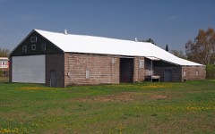
Block
From the record
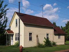
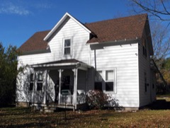
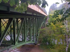
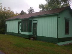
22 National Register listings published here, 1 of them a National Historic Landmark.
Sources: the National Register database, National Park Service
68 topographic sheets cover 32 settlements here, and 22 properties are on the National Register of Historic Places.
22 National Register listings published here, 1 of them a National Historic Landmark.
Sources: the National Register database, National Park Service
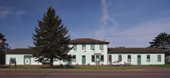
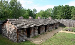
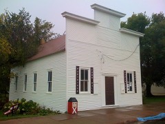
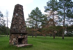
Every property in this county listed on the National Register of Historic Places, with the year it was listed and the federal nomination document.
Every wildfire the federal occurrence database records inside this county: 2,191 of them, burning about 14,265 acres. 26 started naturally and 369 were recorded as arson. Each settlement page carries the fires within five miles of it.
| Reported cause | Fires |
|---|---|
| Debris and open burning | 820 |
| Arson/incendiarism | 369 |
| Equipment and vehicle use | 322 |
| Missing data/not specified/undetermined | 291 |
| Railroad operations and maintenance | 145 |
| Recreation and ceremony | 97 |
| Smoking | 75 |
| Natural | 26 |
| Fireworks | 12 |
| Misuse of fire by a minor | 12 |
| Other causes | 11 |
| Power generation/transmission/distribution | 11 |
The five largest, by the area the report gives. Two of them were set deliberately.
| Date | Cause | Size | Reported by | Name on the report |
|---|---|---|---|---|
| 18 October 2000 | Debris and open burning | 1,350 acres | Saint Croix National Scenic River | ST CROIX |
| 3 April 2004 | Railroad operations and maintenance | 835 acres | Minnesota Department of Natural Resources | 107 COMPLEX |
| 3 April 2004 | Railroad operations and maintenance | 358 acres | Minnesota Department of Natural Resources | 107 COMPLEX |
| 3 April 2004 | Railroad operations and maintenance | 298 acres | Minnesota Department of Natural Resources | 107 COMPLEX |
| 1 April 2000 | Debris and open burning | 275 acres | Minnesota Department of Natural Resources | not named |
| 3 April 2004 | Arson/incendiarism | 250 acres | Minnesota Department of Natural Resources | not named |
| 3 April 2004 | Railroad operations and maintenance | 244 acres | Minnesota Department of Natural Resources | 107 COMPLEX |
| 21 May 1995 | Arson/incendiarism | 216 acres | Minnesota Department of Natural Resources | not named |
Every settlement page carries the fires within five miles of it - see the settlement index below.
The NOAA Storm Events Database holds 373 reports for this county, causing 1 death, 3 injuries and about $1,122,300 in recorded property damage. Each settlement page carries the reports that name it.
| Kind of event | Reports |
|---|---|
| Hail | 189 |
| Thunderstorm Wind | 147 |
| Flash Flood | 19 |
| Tornado | 13 |
| Flood | 2 |
| Lightning | 2 |
| Heavy Rain | 1 |
The most serious of them, by death, then injury, then recorded damage. The accounts are quoted exactly as the forecast office filed them.
| When | Event | Place named | Harm | What the report says |
|---|---|---|---|---|
| August 2013 | Lightning | Sturgeon Lake | 1 killed | The Pine County Sheriff reported that a male was struck by lightning about 4 miles east-southeast of Sturgeon Lake, MN on Alder Loop in a development called Hogan's Acres. The individual passed away from his injuries after being taken by ambulance to Mercy Hospital in Moose Lake, MN. The investigation showed that the 53 year old male victim was standing in a large puddle of water near a tree when the tree and victim were struck by lightning. |
| June 2010 | Tornado (EF2) | Rock Creek | 2 hurt, $283,000 | The severe storm that produced the tornado tracked northeast along the Saint Croix River Valley on the Minnesota-Wisconsin state border. Although the tornado crossed through mostly recreational land, residents between Rush City and Rock Creek in MN, as well as Grantsburg to Yellow Lake in WI were impacted. The maximum path width was a quarter mile, or 400 yards, with an average path width of 400 to 600 ft. The tornado exited Pine County at around 1955 CST, continuing on in Burnett County, WI, where it lifted at 2001 CST, about 3.5 miles northwest of Grantsburg, WI. The total path length was about 6.5 miles. ||The worst of the damage occurred in far southeast Pine County and was evidence of a strong EF2 tornado with estimated winds of 110-135 mph. This rating was based on the total destruction of a strapped down mobile home and the extensive uprooting/snapping of trees where the tornado crossed Minnesota State Highway 70. Two people in a mobile home were injured. Multiple homes sustained significant damage. |
| April 1986 | Thunderstorm Wind | not stated | 1 hurt | no account filed |
| July 2011 | Thunderstorm Wind | Pine City | $500,000 | Numerous trees were blown down across Pine City and to the east. The Markville area and St. Croix State Park were hit the hardest. In Markville most trees were blown down, eleven homes received minor damage, two homes were rendered unlivable, and a a pole barn was destroyed. In a large portion of St. Croix State Park there was 75 to 100 percent tree damage. There were no visitors at the park at the time due to a state government shutdown. |
| August 2005 | Thunderstorm Wind | Sturgeon Lake | $200,000 | There was major wind damage at Sturgeon Lake. At least four homes were heavily damaged. One garage was blown down the street. Numerous trees were uprooted. |
| May 2022 | Thunderstorm Wind | Pokegama | $25,000 | Several large trees were down with one landing on a camper and another that was 16 to 18 inches in diameter that fell onto a house causing significant damage to the roof on the north side of Pokegama Lake. |
| July 1986 | Tornado (F0) | not stated | $25,000 | no account filed |
| July 1970 | Tornado (F2) | not stated | $25,000 | no account filed |
| July 2011 | Thunderstorm Wind | Cloverdale | $20,000 | The second story of a house was rotated. There was also damage to an outbuilding roof and many large trees were blown down. |
| May 2022 | Thunderstorm Wind | Cloverdale | $15,000 | A 28 foot camper was lifted off its foundation and destroyed. Many trees were also snapped due to the strong winds. |
| August 1995 | Thunderstorm Wind | Sand Lake | $10,000 | Thunderstorm winds knocked down trees and power lines. Cars, barns, and homes were damaged by falling trees. |
| May 2022 | Thunderstorm Wind | Bruno | $5,000 | Photos were received showing numerous large trees uprooted and causing damage to outbuildings. |
| August 2020 | Lightning | Beroun | $5,000 | Lightning struck a trailer home causing damage to the home. |
| August 2010 | Thunderstorm Wind | Pokegama | $2,000 | Power lines were blown down in the Grasston area. |
| August 2010 | Thunderstorm Wind | Pine City | $2,000 | Trees were blown down in Grasston Township. |
| August 2010 | Thunderstorm Wind | Pine City | $2,000 | Power lines were blown down. |
| August 2010 | Thunderstorm Wind | Hinckley | $2,000 | Power lines were blown down. |
| August 2010 | Thunderstorm Wind | Pine City | $500 | A tree was blown down on State Highway 70 near the intersection of Pine County Road 1. |
| August 2010 | Thunderstorm Wind | Pine City | $500 | A large tree was blown down at the intersection of Knob Road and Rolling Hills Road. |
| June 1968 | Tornado (F0) | not stated | $250 | no account filed |
| June 1994 | Tornado (F0) | Hinckley | $50 | A tornado touched down briefly downing several trees. |
| July 2025 | Hail | Finlayson | - | Hail was mainly dime to quarter size with the largest hail stones being 1.5 inches in diameter. |
| June 2024 | Thunderstorm Wind | Groningen | - | Several 18 to 20 inch in diameter aspen trees down. About half of them had roots showing and the other half were broken some place half way or lower on the trunk. There were a few trees that had about the top third or higher of the trunk broken off. All of the damage limbs or trunks were on the north side of the tree base. |
| August 2023 | Thunderstorm Wind | Rock Creek | - | A tree six to eight inches in diameter fell during the storm and crushed a canvas tent. |
| August 2023 | Thunderstorm Wind | Pine City | - | Tree branches four to six inches in diameter were down and the power was flickering off and on. |
| May 2022 | Thunderstorm Wind | Pine City | - | Multiple trees were reported down in the Pine City area. |
| May 2022 | Thunderstorm Wind | Hinckley | - | Wind damage and downed trees at the Holiday gas station in Hinckley. This was near the start of the tornado. |
| May 2022 | Thunderstorm Wind | Hinckley | - | Trees were down just north of Hinckley on I-35. |
| May 2022 | Thunderstorm Wind | Sandstone | - | A photo was received showing numerous uprooted trees and several downed power lines. |
| May 2022 | Thunderstorm Wind | Hinckley | - | Widespread trees and power lines down in Hinckley. |
| May 2022 | Thunderstorm Wind | Beroun | - | Multiple trees were reported down near Beroun. |
| May 2022 | Thunderstorm Wind | Sturgeon Lake | - | A photo was received showing tipped over metal patio chairs and table. |
| May 2022 | Tornado (EF1) | Hinckley | - | Damage sustained to a fast food restaurant in Hinckley, including broken windows, a damaged rooftop HVAC unit, and evidence of metal flashing damage, is believed to be the beginning of a tornado that then tracked across Interstate 35 in a north-northwest direction, crossing the railroad tracks near 7th St NE. The majority of the damage was trees uprooted with several snapped along the way. Aerial imagery provided by the Pine County Sheriffs Department shows fairly weak but convergent tree fall between I-35 and near Highway 61 and Owl Drive between a distinct intensification where the treefall becomes much more extensive and a metal roof section was lifted off a local business. The tornado then tracked across Highway 61 and traversed north causing mainly tree damage with at least one home losing some roof shingles. The end of the tornado path is estimated due to the track moving into a much less wooded wetland area. NWS Duluth sincerely appreciates the drone imagery provided by the Pine County Sheriffs Office to aid in the assessment of this storm damage. Peak winds were estimated to be 95 mph. |
| May 2022 | Thunderstorm Wind | Groningen | - | A 15 inch diameter tree was snapped about halfway up. |
| May 2022 | Thunderstorm Wind | Beroun | - | A large tree was down across Blueberry Island road and needed to be removed by the county public works department. |
| July 2022 | Tornado (EF1) | Nickerson | - | A tornado was confirmed via both a radar tornadic debris signature and a comparison of satellite imagery before and after the storm. The rating was estimated by satellite observed damage to trees along the path. The maximum winds were estimated to be 100 mph. |
| July 2022 | Thunderstorm Wind | Finlayson | - | A cluster of trees were snapped at the base along with a spruce tree being uprooted. |
| July 2022 | Thunderstorm Wind | Finlayson | - | A couple of large spruce trees were downed. |
| July 2022 | Thunderstorm Wind | Askov | - | A portion of Interstate 35 was blocked by a large downed tree. |
| July 2022 | Thunderstorm Wind | Cloverdale | - | A portion of Minnesota Highway 38 was blocked by a downed tree. |
| June 2022 | Thunderstorm Wind | Pine City Muni Arpt | - | Several large trees were downed onto cars. |
| June 2022 | Thunderstorm Wind | Rock Creek | - | A large aspen tree was downed across a road. |
| August 2020 | Thunderstorm Wind | Sturgeon Lake | - | A few trees were downed near the Moose Lake Golf Course during the storm. |
| August 2020 | Thunderstorm Wind | Sturgeon Lake | - | A few trees were down by the Moose Lake Golf Club on Sand Lake. |
| August 2020 | Hail | Pokegama | - | Large hail led to several broken windows, damaged siding on a home and shredded a garden at a home in addition to other assorted damage on the property. |
| August 2020 | Hail | Pokegama | - | The size of the hail was measured from damage to a vehicle. That hailstones were likely larger as hail was found two and a half hours after the storm. |
| August 2020 | Thunderstorm Wind | Pine City | - | A tree limb 8 to 12 inches in diameter was downed across a driveway. |
| August 2020 | Thunderstorm Wind | Finlayson | - | Multiple trees were downed in Finlayson by the storm. The trees were mostly dead birch and tamarack, but a few live popple trees were uprooted as well. |
| August 2020 | Thunderstorm Wind | Sandstone | - | Several 3 to 5 inch diameter trees were broken by the storm. |
| August 2020 | Thunderstorm Wind | Sandstone | - | A ten inch diameter tree was broken by the storm. |
| August 2020 | Thunderstorm Wind | Sturgeon Lake | - | Multiple trees were down in Sturgeon Lake. |
| August 2020 | Thunderstorm Wind | Kerrick | - | A tree fell onto a cabin with lots of additional tree damage around the property as well. |
| August 2020 | Thunderstorm Wind | Groningen | - | Part of a metal roof was peeled off a house by the strong winds with additional damage to a barn near the intersection of Groningen Road and Fox Road. |
| August 2020 | Thunderstorm Wind | Groningen | - | A tree was blown down and blocking a driveway. |
| August 2020 | Thunderstorm Wind | Rutledge | - | Trees were falling along Minnesota 61 as the spotter was driving between Willow River and Rutledge. |
| August 2020 | Thunderstorm Wind | Duquette | - | A tree was downed onto a power line. |
| July 2019 | Thunderstorm Wind | Rock Creek | - | A 14-inch tree fell due to the winds and damaged a garage, vehicle and a light pole. |
| July 2019 | Hail | West Rock | - | Crops were flattened by the large hail. |
| July 2019 | Hail | Rock Creek | - | Hail stones punched through a steel garage roof and sheetrock ceiling and damaged a vehicle. |
| July 2019 | Hail | Rock Creek | - | Golf ball to tennis ball-sized hail broke windows on the north side of a home. |
The Survey's mineral resources record lists 7 workings inside this county. 3 still produce and 4 are closed or unrecorded. Each settlement page carries the workings within five miles of it.
| Commodity | Workings |
|---|---|
| Sand and Gravel, Construction | 4 |
| Peat | 1 |
| Silica | 1 |
| Uranium | 1 |
The least common of them first, because a county's hundredth gravel pit says nothing its first ten did not.
| Where | Site | Commodity | Status | Recorded |
|---|---|---|---|---|
| Holtgren Sand Pit | Silica | Past Producer | ||
| Pine County Peat Deposits | Peat | Past Producer | ||
| Uranium Prospect | Uranium | Occurrence | ||
| Hopkins Pit and Mill | Sand and Gravel, Construction | Producer | ||
| Rock Creek Pit and Mill | Sand and Gravel, Construction | Producer | ||
| Sikkink Pit and Mill | Sand and Gravel, Construction | Past Producer | ||
| Simmons Pit | Sand and Gravel, Construction | Producer |
Named settlements recorded in the Geographic Names Information System, each with the topographic sheets covering it. Villages, hamlets and abandoned places alike. Each is shown with the nearest named watercourse or landform and the survey quadrangle it falls on.
Finlayson township · 55735 · On Wolf Creek · Sandstone North quadrangle
7 sheets, 1953 to 1981
Hinckley city · 55037 · On North Branch Grindstone River · Hinckley quadrangle
8 sheets, 1953 to 1991
Hinckley city · 55037 · On North Branch Grindstone River · Hinckley quadrangle
8 sheets, 1953 to 1991
Ogema township · 55037 · On Crooked Creek · Monson Lake quadrangle
12 sheets, 1950 to 1985
Sandstone city · 55072 · On Wolf Creek · Sandstone North quadrangle
7 sheets, 1953 to 1981
Willow River city · 55795 · On Willow River · Willow River quadrangle
7 sheets, 1953 to 1981